
Sleeping Beauty Trail
View Photos
Sleeping Beauty Trail
Difficulty Rating:
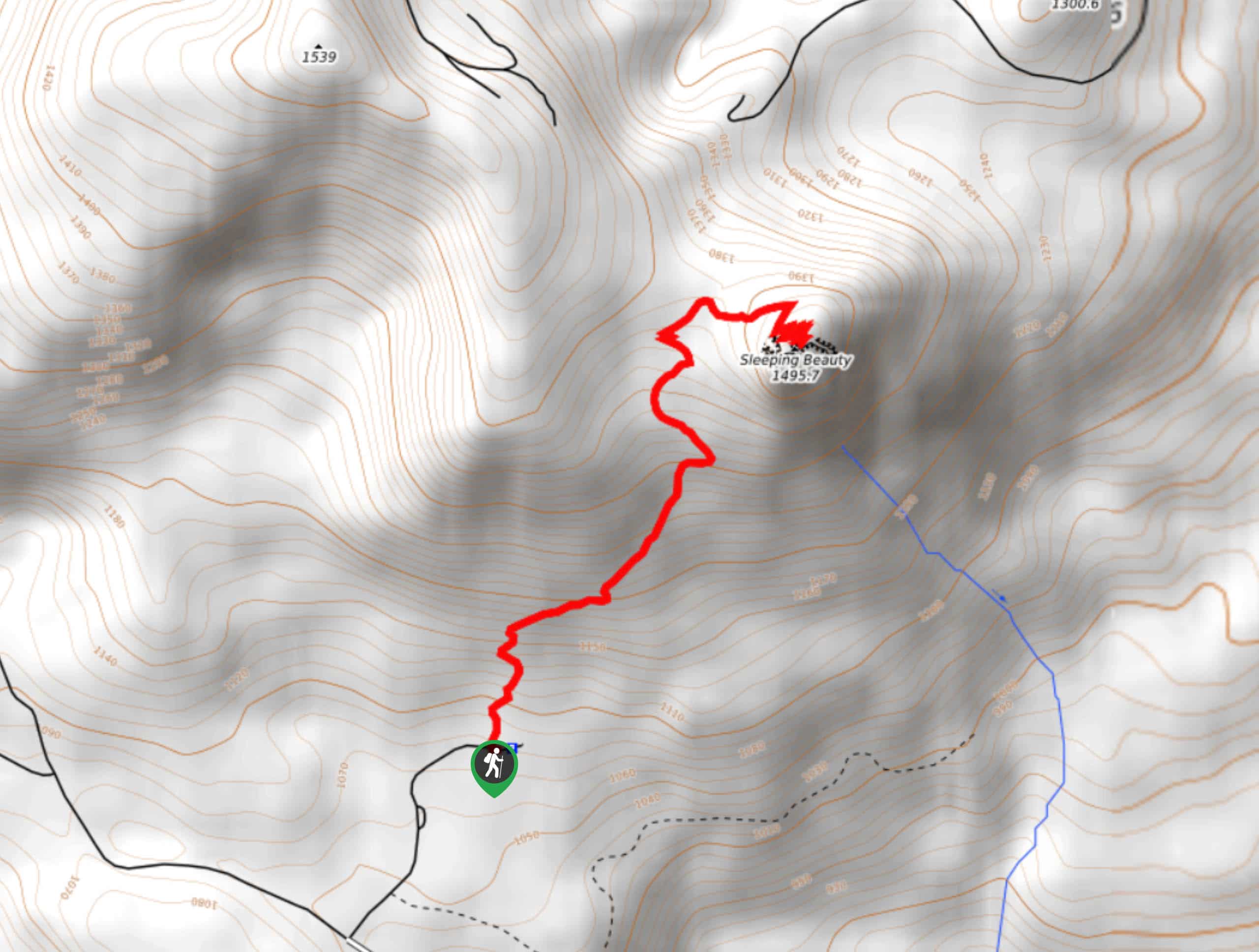
Head up Sleeping Beauty Trail for a peek of the beauty of this corner of the Gifford Pinchot National Forest. This trail is only 2.4mi long, but it’s quite steep and a bit narrow in sections. It’s not the best choice for small children but it’s suitable for most skill levels. On a clear day, the view is awesome!
Getting there
The trailhead for Sleeping Beauty Trail is on Forest Road 40.

About
| Backcountry Campground | No |
| When to do | May-November |
| Pets allowed | Yes - On Leash |
| Family friendly | Older Children only |
| Route Signage | Average |
| Crowd Levels | High |
| Route Type | Out and back |
Sleeping Beauty Trail
Elevation Graph
Weather
Sleeping Beauty Trail Description
This short but steep hike will get your legs working en route to the summit of Sleeping Beauty. With fabulous views over the Gifford Pinchot National Forest, this is a great hike if you want to work hard instead of work long.
Users note that to find the trailhead, you will need to stay right at the fork on 8810 and look for a sign for the trail. If you end up on a dirt road, you missed the required right turn.
Beginning from the trailhead, the trail starts with a warm-up climb before steepening, heading almost straight up before a few narrow switchbacks help you out. It’s a bit of a grind, but you’ll be on the final switchbacks to the top in no time. Take a moment to relax and enjoy the view before retracing your steps to the trailhead.
Similar hikes to the Sleeping Beauty Trail hike

Ptarmigan Trail
Ptarmigan Trail is a 4.2mi moderate trail near the base of Mount Saint Helens. This trail is suitable…

Boundary West Trail
Boundary West Trail is a hike near Mount Saint Helens that doesn’t see much traffic, making it a nice pick…

Silver Creek Trail
Silver Creek Trail is a moderate hike in the Gifford Pinchot National Forest that is suitable for most skill levels.…
Comments