Lower Falls Creek Trail
View Photos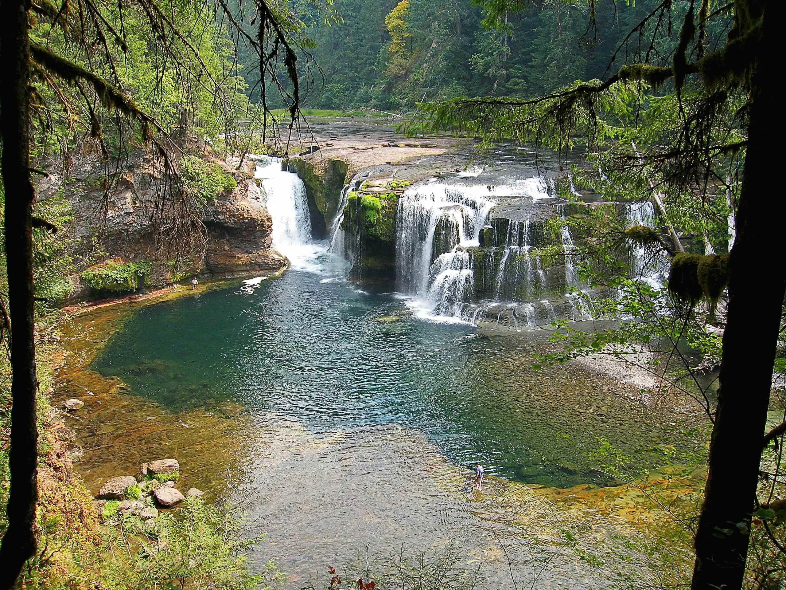
Lower Falls Creek Trail
Difficulty Rating:
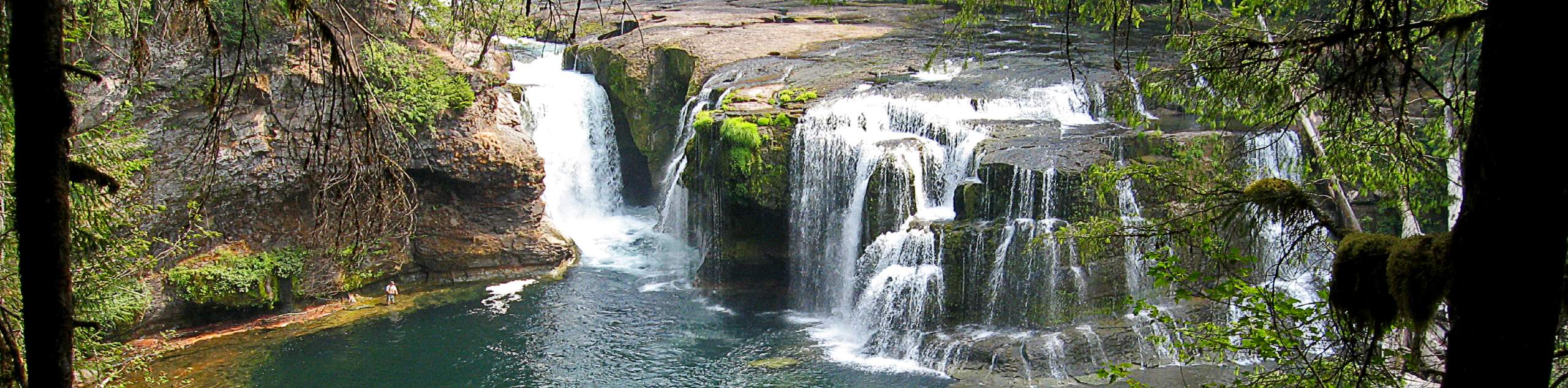
The Falls Creek Falls are a beautiful set of waterfalls in a bright green corner of the Gifford Pinchot National Forest, falling over a dramatic cascade and then trickling down through the moss-laden rocks that line the creek. Despite its beauty, this spot isn’t as busy as other waterfalls in the forest, so this is a fabulous pick for a warm weekend when other falls trails could be crowded.
The hike to the falls on Lower Falls Creek Trail is moderately difficult, requiring 3.2mi of hiking roundtrip. The elevation gain is fairly mild overall, making this a good pick for active families. Bring a packed lunch and settle in at the falls to enjoy the scenery for a while.
This trail is great after heavy rains or when the fall colors are at their best.
Getting there
The trailhead for Lower Falls Creek Trail is at the end of Forest Road 3062-057.

About
| Backcountry Campground | No |
| When to do | March-November |
| Pets allowed | Yes - On Leash |
| Family friendly | Yes |
| Route Signage | Average |
| Crowd Levels | High |
| Route Type | Out and back |
Lower Falls Creek Trail
Elevation Graph
Weather
Lower Falls Creek Trail Description
Lower Falls Creek Trail is a fantastic little hike that requires relatively little effort for the pleasure of seeing a triple waterfall cascading through the verdant forest. This hike doesn’t get as busy as other waterfalls in the area, so try it on a hot summer weekend when other routes might be congested. While we love this hike in the spring when the water is flowing at full force, it’s also a very pretty trip in the fall when the trees are going golden and red.
This hike has a nice area that’s good for picnics or other miscellaneous relaxing near the falls, so bring a blanket, some snacks, some cards, or whatever else you need to kick back for a while.
Begin from the trailhead. Taking Falls Creek Trail. At the first T-intersection, turn right. Left takes you onto Falls Creek Trail 152, but you want to stay on the easier Falls Creek Trail 152A.
You’ll gain gentle elevation as you follow along Falls Creek, a very cute stream that tumbles over the green rocks. Continue through the forest and then cross the creek to a cable suspension bridge. The view of the falls from the bridge is great, and you can look down into the rocky gorge below.
You might want to hold hands for small children on the bridge as it can be prone to bouncing a bit with foot traffic.
There’s a creek crossing before the falls that can be a bit tough in the earlier spring. Navigate it carefully. A mile and a half into the hike, you’ll arrive at the base of the falls. Take a seat and take in the view. It’s a bit cool and misty down here, but it feels perfect on a hot day.
When you’re ready, you’ll return to the trailhead on the same route you used to reach the falls.
Hiking Route Highlights
Falls Creek Falls
The impressive triple waterfall of Falls Creek Falls is a beautiful destination. This waterfall flows throughout the year unlike others in the area, making it a worthwhile visit in all seasons. The falls can be reached on a fairly easy trail, requiring about a mile and a half of hiking to reach them.
Frequently Asked Questions
Do I need a pass for Lower Falls Creek Trail?
You’ll need a Northwest Forest Pass for this hike.
Can you swim in Falls Creek Falls?
We do not recommend it. There isn’t a good, safe swimming area near the falls.
Is the hike to Falls Creek Falls kid-friendly?
Yes, this is a family-friendly hike.
Insider Hints
Finding the trailhead for this hike can be tough. We recommend downloading your GPS track to help you get where you need to go.
Visit the nearby Carson Hot Springs if you want a soak after your hike.
Similar hikes to the Lower Falls Creek Trail hike

Ptarmigan Trail
Ptarmigan Trail is a 4.2mi moderate trail near the base of Mount Saint Helens. This trail is suitable…

Boundary West Trail
Boundary West Trail is a hike near Mount Saint Helens that doesn’t see much traffic, making it a nice pick…

Silver Creek Trail
Silver Creek Trail is a moderate hike in the Gifford Pinchot National Forest that is suitable for most skill levels.…
Comments