Silver Star Mountain via Grouse Vista Trail
View Photos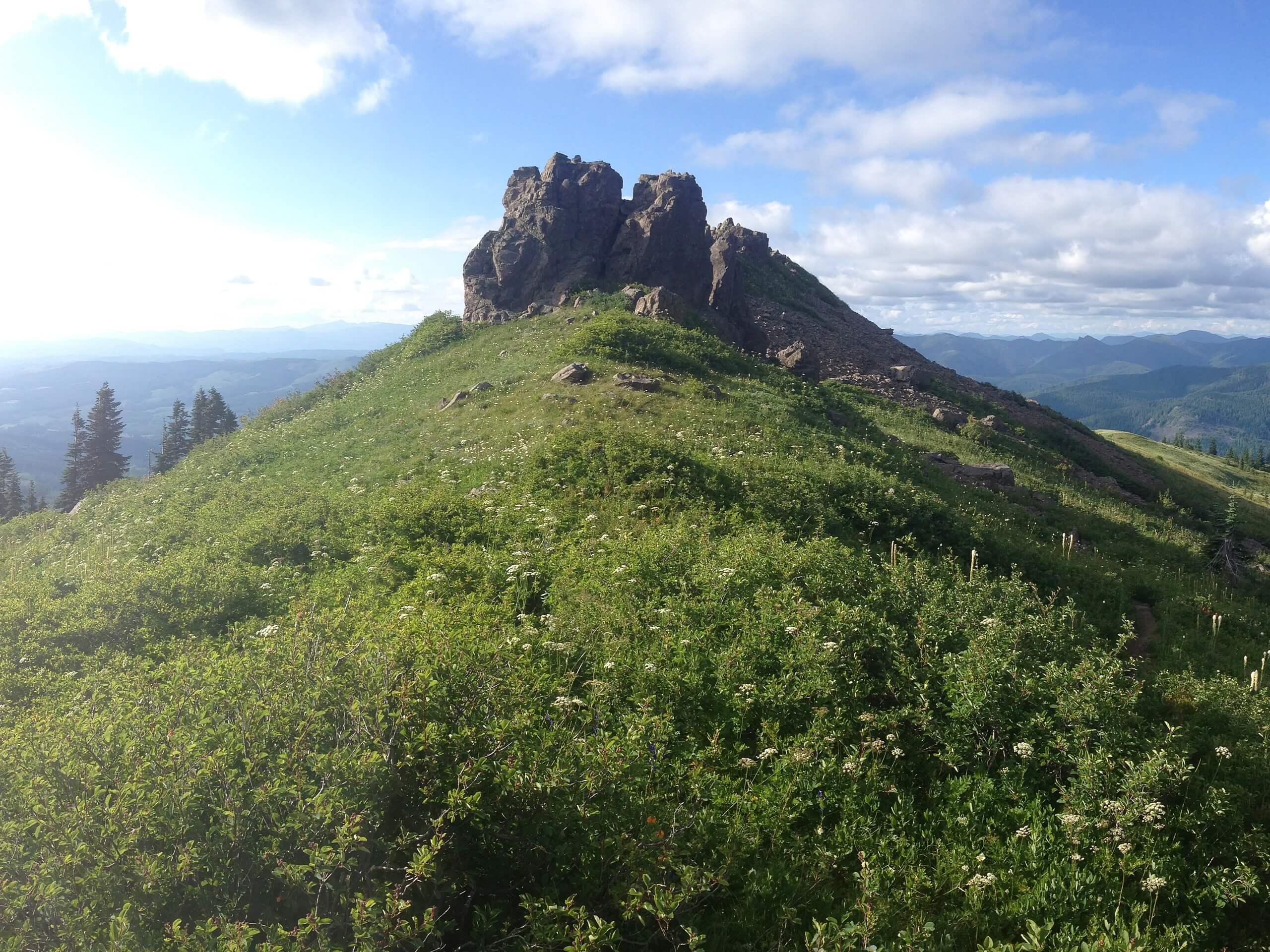
Silver Star Mountain via Grouse Vista Trail
Difficulty Rating:
The view from the top of Silver Star Mountain is definitely one of the better ones in the area, if not maybe the best. It’s also one of the best places to appreciate the widespread blooms of wildflowers in Southwest Washington, making a late spring or early summer visit ideal. Bring a camera and be prepared for a wonderful summit.
This hike is 6.3mi long and is rated as hard. While there aren’t any technical challenges, you’ll gain a respectable amount of elevation on a rocky trail. Some sections can get a bit wet and washed out, so come prepared for a bit of an adventure.
Note that this approach does not follow Silver Star Mountain Trail. This route is better for those who don’t have high-clearance vehicles as the road to the Silver Star Mountain Trail is one of the worst in the state.
Getting there
The trailhead for Silver Star Mountain via Grouse Vista Trail is on L-1200 Road.

About
| Backcountry Campground | No |
| When to do | Year-round |
| Pets allowed | Yes - On Leash |
| Family friendly | Older Children only |
| Route Signage | Good |
| Crowd Levels | High |
| Route Type | Out and back |
Silver Star Mountain via Grouse Vista Trail
Elevation Graph
Weather
Silver Star Mountain via Grouse Vista Trail Description
Silver Star Mountain offers stunning views of surrounding Southwest Washington all the way to the Pacific, making it a truly camera-worthy spot. In the spring and early summer, the wildflowers are simply amazing. This hike is guaranteed to please and might become a go-to if you live in the area.
This guide follows the approach on Grouse Vista Trail, which runs up the southern side of the mountain. Silver Star Mountain Trail is a more popular trail, but the road required to reach it is one of the worst in the state. If you’d prefer to skip the potholes, this approach is recommended.
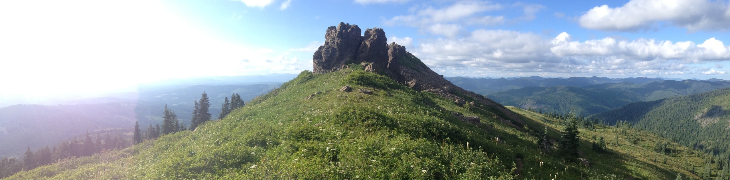
This trail requires more elevation gain than the Silver Star Mountain Trail, but it’s shorter than many of the other loops you can take to the top. It’s also generally hikeable earlier and later in the season thanks to its southern exposure. We like the close-up view of Pyramid Rock this route gives, as well as the generally lighter crowds.
Make sure you bring a windbreaker for the often gusty summit. Additionally, sections of this trail are subject to getting soaked in wet conditions, so waterproof boots are recommended if you’re visiting after a heavy rain.
Begin from the trailhead near the road. You’ll take Tarbell Trail, staying right at the first split onto Grouse Vista Trail. Cross into the national forest and then pass right underneath Pyramid Rock.
You’ll soon merge into Silver Star Trail. Shortly after, there’s a set of junctions with Indian Pits Trail and Sturgeon Rock Trail. Proceed straight through both.
At the T-junction, go right and then stay right again. This takes you to the final summit approach. Make a sharp left to proceed up the last few steps, getting your final reward. Look out over the numerous peaks of the Cascades, the major mountains of Rainier, Adams, Hood, and Jefferson, and the ocean far to the west.
When you’re ready, you’ll retrace your steps back to the trailhead.
Hiking Route Highlights
Mount Adams
12281ft Mount Adams is the second-highest mountain in Washington State. Originally named Pahto or Klickitat, it rises above the Cascade Range in the southern portion of Washington. Although Mount Adams has not erupted in over 1,000 years, it’s still considered to be potentially active. The mountain was named for President John Adams.
Mount Rainier
The tallest mountain in the state is a dominant part of your view from the lava flows near Takh Takh Meadows. This 14,409-foot stratovolcano is an iconic sight and is clearly visible from your perch on this trail. Mount Rainier is the tallest mountain in Washington State and is called Tahoma by Indigenous peoples.
Frequently Asked Questions
Do I need a pass for Silver Star Mountain?
You’ll need a Discover Pass for this hike.
Is the road to Silver Star Mountain safe?
The road to the Silver Star Trailhead is nearly impassable. We recommend using this route for your ascent of Silver Star Mountain instead.
Is Silver Star Mountain in the national forest?
Slider Star Mountain is in Gifford Pinchot National Forest. The trailhead for Grouse Vista Trail is not, but you’ll pass into the forest in the first half of your hike.
Insider Hints
You can make a longer loop of this hike by exploring the interconnecting trails.
Poles and sturdy boots can help with the rockiness of this route.
Similar hikes to the Silver Star Mountain via Grouse Vista Trail hike

Ptarmigan Trail
Ptarmigan Trail is a 4.2mi moderate trail near the base of Mount Saint Helens. This trail is suitable…

Lakes Trail #211 Loop
The Lakes Trail #211 Loop is used as both a full-day hike and for backpacking trips. This trail isn’t for…

Boundary West Trail
Boundary West Trail is a hike near Mount Saint Helens that doesn’t see much traffic, making it a nice pick…
Comments