Mount Adams South Climb
View Photos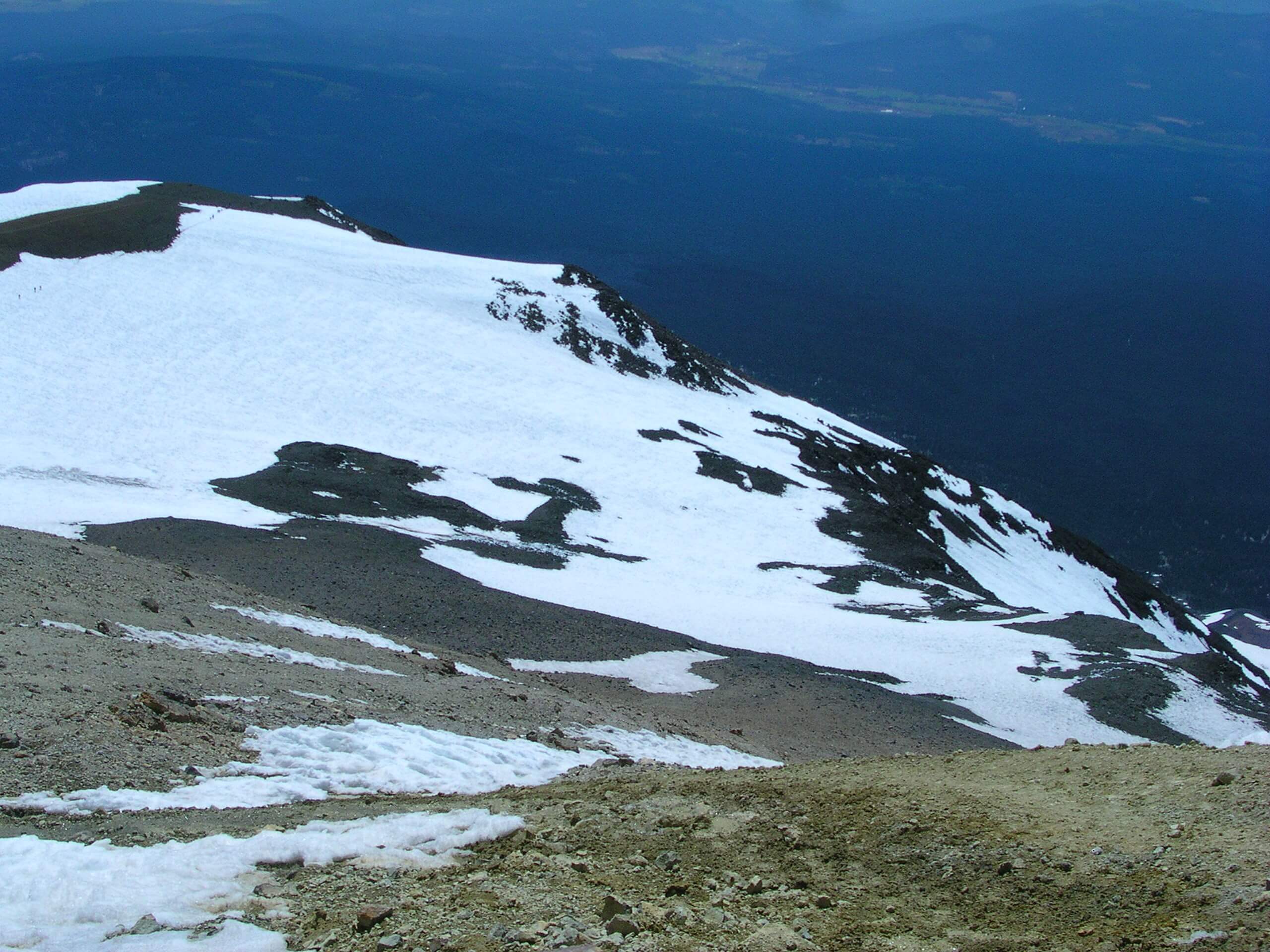
Mount Adams South Climb
Difficulty Rating:
The Mount Adams South Climb is the least technical approach, leading you to the summit over the course of 10.9mi and over 6700ft of elevation gain. While this is the least challenging way up Mount Adams, it’s still best taken on by experienced adventurers with the proper gear: ice axes, crampons, mountaineering boots, and supplies to sleep overnight at Lunch Counter if they’re attempting the hike over two days instead of one. While this hike can be done in a day, doing it over two allows you to attempt the summit in the morning when the snow is firm.
Dogs are allowed on this trail but very likely won’t be able to summit with you, so we recommend leaving them at home if you intend to make a summit attempt.
Getting there
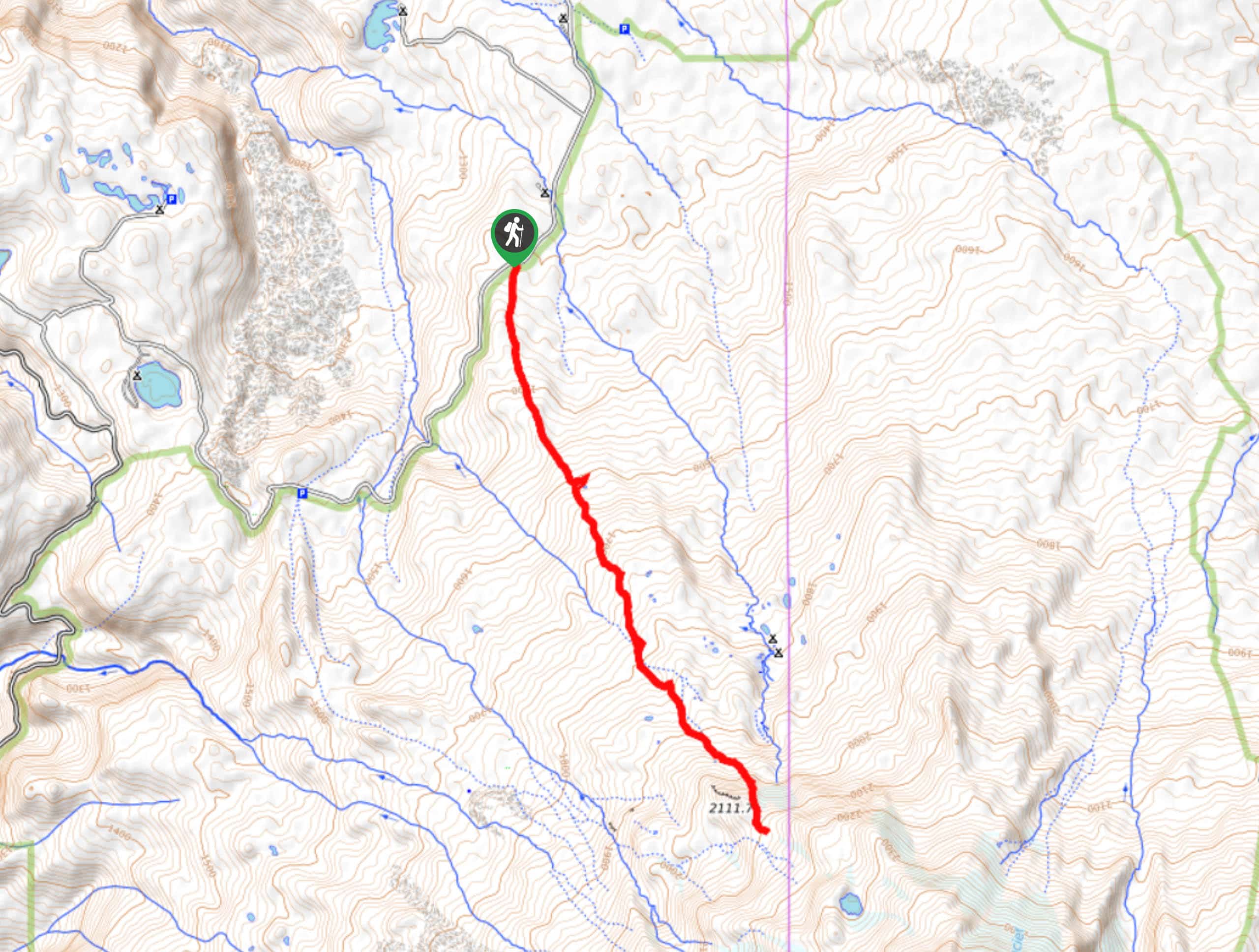
The trailhead for the Mount Adams South Climb is on Forest Road 8040 at the old Cold Springs Camp area.

About
| Backcountry Campground | Lunch Counter Backcountry |
| When to do | May-September |
| Pets allowed | No |
| Family friendly | No |
| Route Signage | Poor |
| Crowd Levels | High |
| Route Type | Out and back |
Mount Adams South Climb
Elevation Graph
Weather
Mount Adams South Climb Description
If you want the easiest route up Mount Adams, the South Climb is it. Not that this trail is easy, but it’s the least technically demanding ascent. That being said, you’ll still want to be comfortable using crampons and an ice axe, navigating across snowfields, and potentially camping on the mountain for a night. The reward is a view from the second-tallest mountain in the state.
This ascent can be done in a day, but it would be an arduous day. Splitting it up over two days also allows you to make your summit push in the morning when the snow is firm. Most people camp at the Lunch Counter.
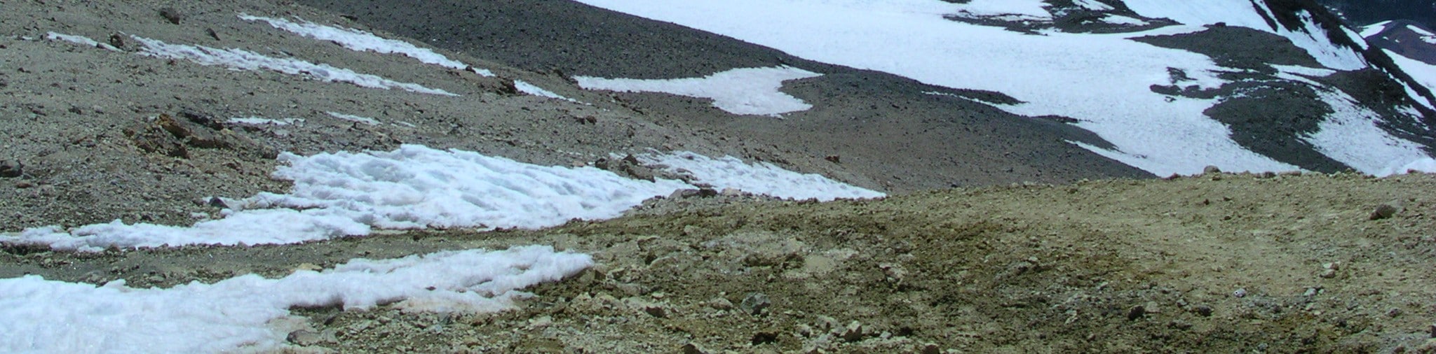
You’ll start at South Climb Trailhead, hiking up an old road bed. The first mile offers no shade, much like most of the hike. Continue past Morrison Creek, a good spot to top up your water.
The footing becomes very rocky after the creek. Make your way along carefully and begin to climb the ridgeline ahead. The elevation gain here is aggressive and you’ll likely need to navigate snowfields. At the Lunch Counter, either set up camp or just take a breather.
Past the Lunch Counter, you’ll climb to Pikers Peak. Be prepared for an aggressive climb to this false summit that can be made more difficult by high winds. You can take a break on the peak if it’s not too windy.
From Piper’s Peak, you’ll make your way up to the summit cone of Mount Adams. The air noticeably thins out as you gain elevation, so take your ascent only as fast as you safely can. From the top, gaze out over Mount Hood, Mount Jefferson, Mount Rainier, and Mount St. Helens. On a clear day, the views are sublime.
From here, you’ll descend the same way you came up.
Hiking Route Highlights
Mount Adams
12281ft Mount Adams is the second-highest mountain in Washington State. Originally named Pahto or Klickitat, it rises above the Cascade Range in the southern portion of the state. Although Mount Adams has not erupted in over 1,000 years, it’s still considered to be potentially active. The mountain was named for President John Adams.
Frequently Asked Questions
How long does it take to climb Mount Adams?
The South Climb can be done in around 10-12 hours, but most hikers split it up over two days.
Has anyone ever died on Mount Adams?
Two individuals have died on the mountain in the last 5 years. It’s a climb worthy of your preparation and care.
Can you climb Mount Adams without crampons?
While hikers have climbed Mount Adams in microspikes before, we don’t recommend coming under-prepared as the snowfields can be difficult to cross without crampons in certain conditions.
Insider Hints
Bring lots of water and refill where you can. This trail is unshaded for lots of the climb.
You’ll need a Cascade Volcano Pass from May 1-September 30 if you’ll be climbing above 7000ft. You can buy one at the Mount Adams Ranger Station or the Cowlitz Valley Ranger Station.
If you’re not going above 7000ft, you’ll just need a Northwest Forest Pass and Wilderness Permit.
Similar hikes to the Mount Adams South Climb hike

Lakes Trail #211 Loop
The Lakes Trail #211 Loop is used as both a full-day hike and for backpacking trips. This trail isn’t for…

Boundary West Trail
Boundary West Trail is a hike near Mount Saint Helens that doesn’t see much traffic, making it a nice pick…
High Camp Trail
High Camp Trail is a 7.8mi hike that takes you to a camp on the base of Mount…
Comments