Ape Caves Trail
View Photos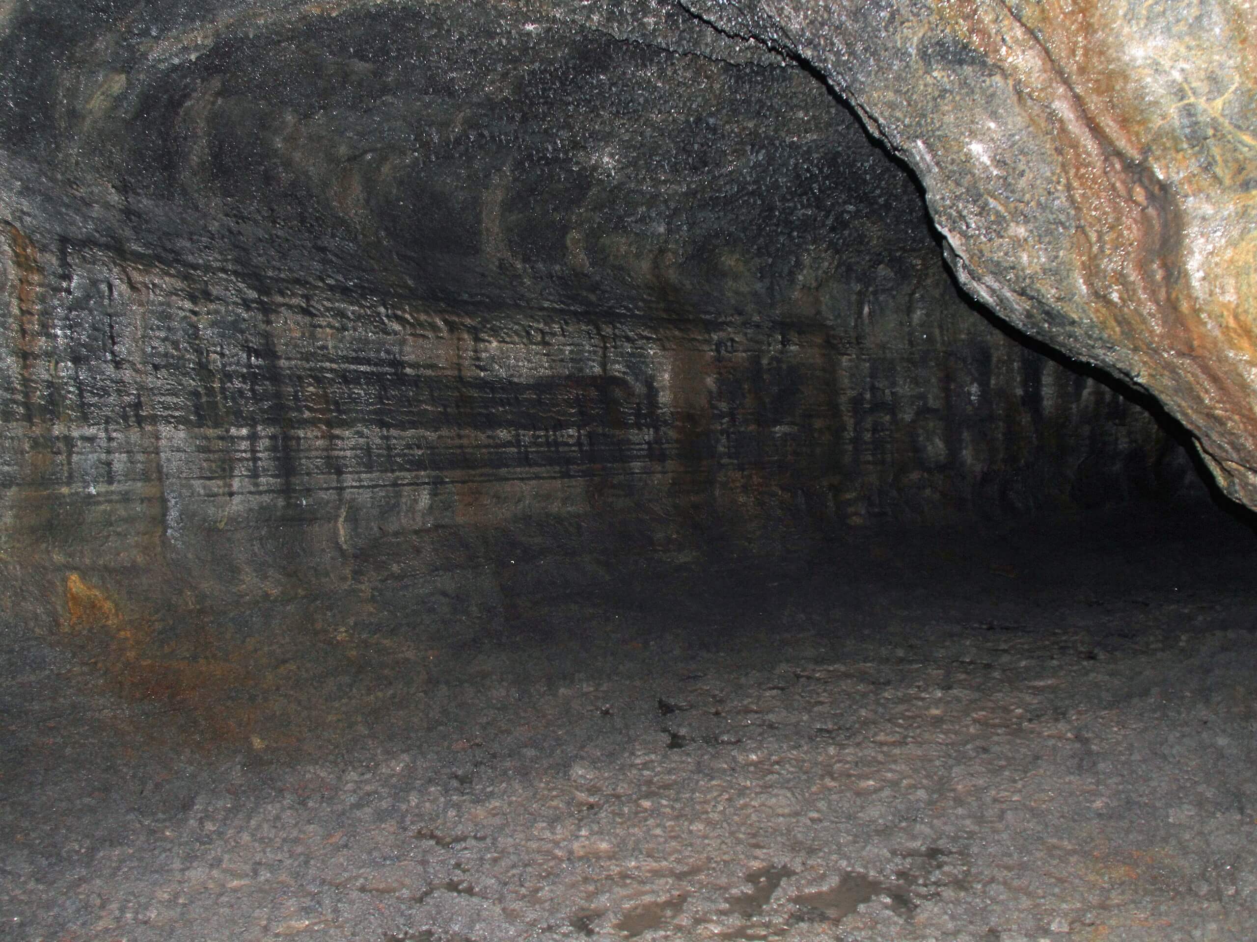
Ape Caves Trail
Difficulty Rating:
The Ape Caves Trail takes you into a lava tube discovered in 1951. The tubes were created by an eruption of nearby Mount St. Helens. At 2.5mi long, this trail is the longest continuous lava tube in the continental United States and the third-longest lava tube in North America. Nearly 200,000 people hike through the tube each year, making this a very popular spot to explore. The hike itself is quite easy and is suitable for all ages, although those who are claustrophobic may want to evaluate whether this is the right trail for them.
The caves are open between April and October and reservations are required to visit the cave. You’ll need one reservation per vehicle. Make your reservation on the official site.
This guide describes the route through the Lower Cave. The Upper Cave requires about 2 more hours and a bit of scrambling to complete.
Getting there
The trailhead for the Ape Cave Trail is near the end of Forest Road 8303 in the parking lot.

About
| Backcountry Campground | No |
| When to do | April-October |
| Pets allowed | No |
| Family friendly | Yes |
| Route Signage | Average |
| Crowd Levels | High |
| Route Type | Out and back |
Ape Caves Trail
Elevation Graph
Weather
Ape Cave Trail Description
The Ape Cave Trail is one for the books. These two lava tunnels (the Upper and the Lower) are fascinating underground passageways created by Mount St. Helens long ago. Discovered in 1951, 170,000 visitors now explore them each year.
The GPS track associated with this guide follows the Lower Trail. This is the easier of the two, with mostly level footing and no scrambling around rocks required. The Upper Trail can be accessed by visitors as well, but you should be prepared to climb over rocks and deal with a bit more elevation gain. The Lower Trail is better suited to families and the Upper Trail is great for more adventurous and physically capable visitors.
No matter which trail you do (or if you do both), make sure you bring 2-3 light sources and spare batteries. The caves are very, very dark and you won’t be able to navigate through without your own light.
The caves are a constant 42°F and it can be quite damp, so bring warm layers with a waterproof shell. We also recommend waterproof boots for the puddles on the cave floor. If you want to hike through the upper tunnel as well, you may wish to have gloves for the scrambling.
The caves are open between April and October and reservations are required to hike the caves. You’ll need to make one reservation per car. Reservations are $2 and prices are subject to change.
Please don’t touch the walls of the cave. It disrupts a slime that is essential to the cave ecosystem. Additionally, the USDA requires that you wear footwear never worn in another cave inhabited by bats and that you wear clean clothes to the cave and wash them after. This helps to prevent the spread of a deadly fungus that can affect bat populations across the country. You should never enter a cave with gear or clothing that has been in another cave without decontamination.
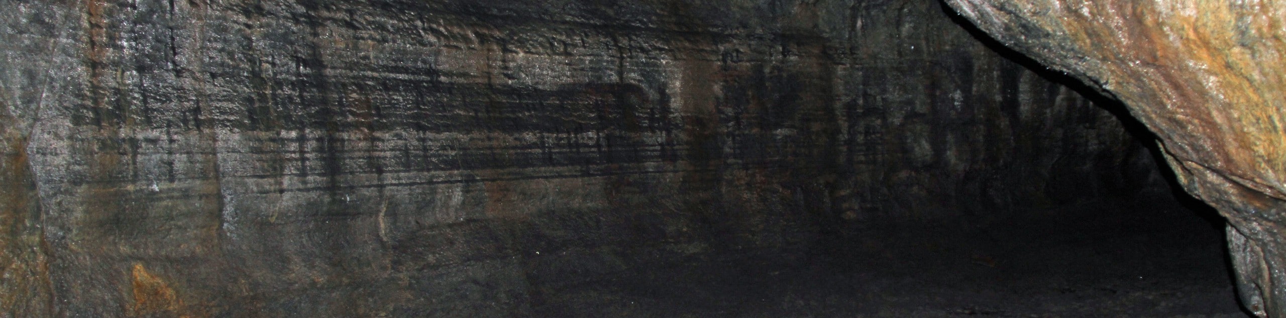
The Lower entrance is near the parking lot. You’ll walk down a set of stairs underneath the forest floor, entering an eerie world of rock. It’s very, very dark in the caves. Walk through the tunnel, which is very easy to follow as long as you’ve got light. The cave is full of strange corners and interesting rock shapes. You’ll be walking through the caves on your own time, so linger wherever you please.
The entrance to the other tunnel is at the end of the Lower Trail. You can either return back through the lower tunnel for the easiest experience or go back through the upper tunnel if you’re wanting more of a challenge and a new experience.
Hiking Route Highlights
Ape Cave
The cold, pitch-black lava tubes of Ape Cave Interpretive Site are the third-longest lava tubes in North America. They were discovered in 1951 and named by a Scout Troop. Now, the caves are popular with visitors from near and far, drawing hikers into their pitch-black, dripping depths.
Frequently Asked Questions
Why do they call it Ape Cave?
Ape Cave was named by a Scout Troop in honor of their sponsor, the St. Helens Apes. The sponsor’s name may have come from an old name for foresters in the area, “brush apes,” or from the legend of Bigfoot.
How long does it take to walk through Ape Caves?
The Lower Trail takes about an hour and the Upper Trail takes about 2 hours, but you’ll be walking at your own pace so your timing may differ.
How much light do I need for Ape Caves?
We recommend everyone bring 2-3 flashlights or headlamps. Phone lights are not sufficient. In the summer, you can rent lanterns from the information building.
Insider Hints
You’ll need a Northwest Forest Pass to access this hike.
This trail isn’t a good choice for those who deal with claustrophobia or a fear of the dark, especially the upper tunnel.
Bring spare batteries for your light sources.
Similar hikes to the Ape Caves Trail hike

Ptarmigan Trail
Ptarmigan Trail is a 4.2mi moderate trail near the base of Mount Saint Helens. This trail is suitable…

Boundary West Trail
Boundary West Trail is a hike near Mount Saint Helens that doesn’t see much traffic, making it a nice pick…

Silver Creek Trail
Silver Creek Trail is a moderate hike in the Gifford Pinchot National Forest that is suitable for most skill levels.…
Comments