Hamilton Mountain Trail
View Photos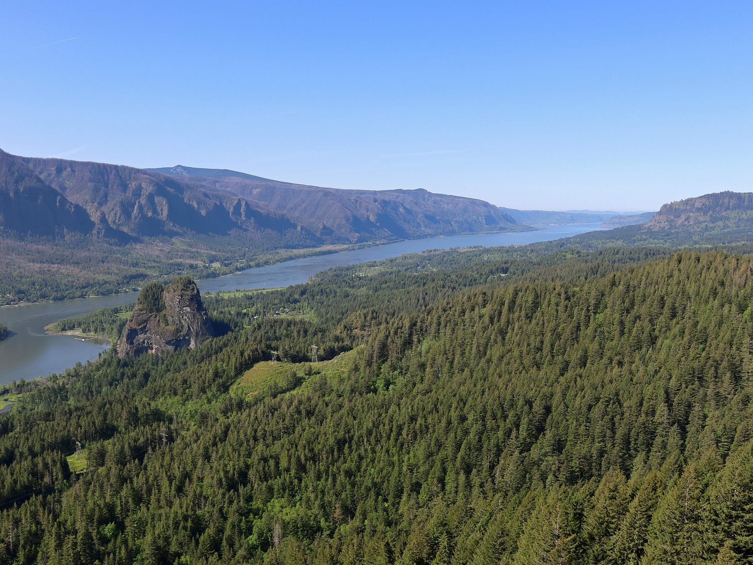
Hamilton Mountain Trail
Difficulty Rating:
The hike to Hamilton Mountain is a gorgeous trip that captures the best of the Columbia Gorge. Admire snow-capped peaks, changing foliage through the seasons, the river down below, and multiple waterfalls, including Rodney Falls. This is a hard hike, but it’s worth the extra bit of work for beginners. This out and back approach is shorter than the Hamilton Falls and Rodney Falls loop, but it’s a bit harder on the knees.
While the trail is generally very well-maintained, poles might be helpful for the elevation gain, especially on the way down. Expect heavy traffic on this hike.
Getting there
The trailhead for the Hamilton Mountain Trail is on the access road for the Beacon Rock State Park Campground off Evergreen Highway.

About
| Backcountry Campground | No |
| When to do | Year-round |
| Pets allowed | Yes - On Leash |
| Family friendly | Older Children only |
| Route Signage | Good |
| Crowd Levels | High |
| Route Type | Out and back |
Hamilton Mountain Trail
Elevation Graph
Weather
Hamilton Mountain Trail Description
The natural beauty of Beacon Rock State Park never fails to impress, and the hike up Hamilton Mountain is an ideal way to take it all in. This hike also brings you to Rodney Falls, which is a great midpoint rest or a good turnaround point for hikers not wanting to complete the entire hike.
This fantastic hike follows a well-maintained trail lined by wildflowers, old-growth fir trees, and strawberries in the late summer. You can either do it as an out and back or a loop, but our guide reflects the slightly shorter and more direct out and back route. The loop, while longer, is a bit easier on the knees.
You’ll begin from the trailhead, taking the obvious path. It’s wide and well-kept, leading you past ancient trees as you warm up.
About a mile into the hike, listen for the waterfalls. There’s a steep spur trail that leads down to Hardy Falls if you want to take a look.
Further on you’ll find the spur trail to Rodney Falls, which is undoubtedly more impressive. You’ll see the upper falls from the viewpoint on the spur trail and the lower falls once you’re back on the main trail.
Expect the grade to increase after the falls. There are stairs in the trail to help you out. You’ll come to a junction signed “Hamilton Mountain, More Difficult” and “Hardy Creek Trail, Difficult”. We’re going “more difficult” here.
Hike through the switchbacks to the top of Hamilton Mountain. The views of the Cascades are fantastic here, but heading about three-quarters of a mile northwest on the loop trail takes you to a ridge with an even better view.
The ridge is your turnaround point. Retrace your steps back to the trailhead.
Hiking Route Highlights
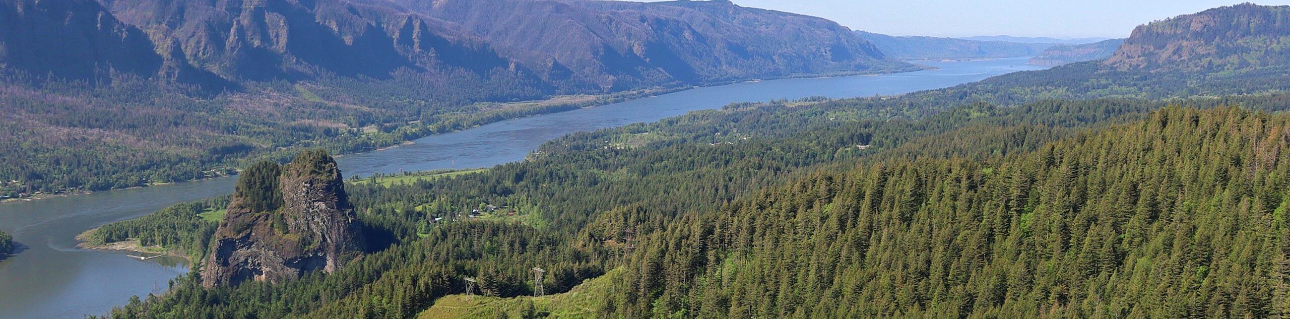
Columbia River Gorge
The view from Hamilton Mountain features the Columbia River Gorge, where the river slices through the mountains. You can see a wide swath of the gorge from the mountain, looking across the blue flowing water to the tree-clad mountains in both directions. You can also enjoy a great view of the Cascades.
Frequently Asked Questions
How tall is Hamilton Mountain?
Hamilton Mountain is 2400ft tall.
Can you swim in Beacon Rock State Park?
The water in this area is not sampled for E.coli. You can swim but the water quality is not guaranteed.
Insider Hints
Remember your Discover Pass for this hike.
Similar hikes to the Hamilton Mountain Trail hike

Ptarmigan Trail
Ptarmigan Trail is a 4.2mi moderate trail near the base of Mount Saint Helens. This trail is suitable…

Boundary West Trail
Boundary West Trail is a hike near Mount Saint Helens that doesn’t see much traffic, making it a nice pick…

Silver Creek Trail
Silver Creek Trail is a moderate hike in the Gifford Pinchot National Forest that is suitable for most skill levels.…
Comments