Windy Ridge Trail
by Emily Poisel, CC-BY 2.0Image tones and noise levels adjusted; image resized
Windy Ridge Trail
Difficulty Rating:
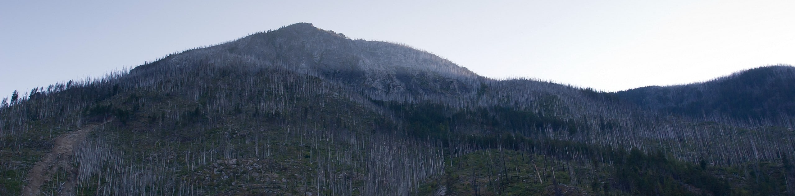
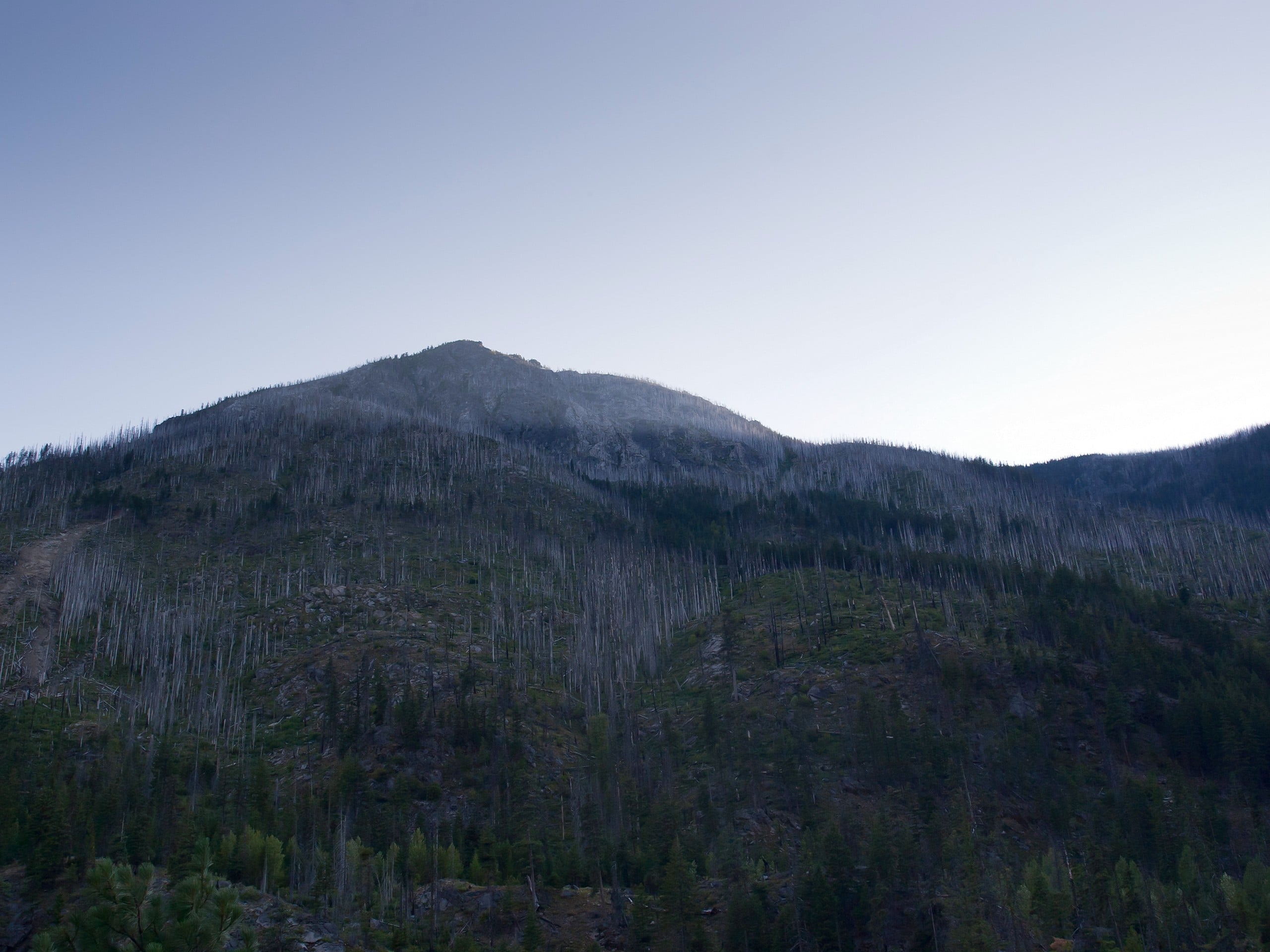
Windy Ridge Trail is true to its name, but it could also be called Windy Scenic Trail. This trail is an easy trip suitable for all skill levels. While you’ll need the windbreaker, the views are worth it. Our section of this route is only 0.6mi long and takes you up to the Harmony Lake Viewpoint. You can go all the way across the ridge to the Smith Creek Trail, which is about a 15.0mi hike in total.
The drive to this hike is spectacular, too. You’ll have some excellent views from the car windows, so enjoy the journey as well as the destination.
This route sees moderate traffic. The footing can be a bit rough, with the trail consisting of rocky gravel. Additionally, note that the road to this trail is not always accessible when it’s snowy out. Plan this hike for the summer months.
Getting there
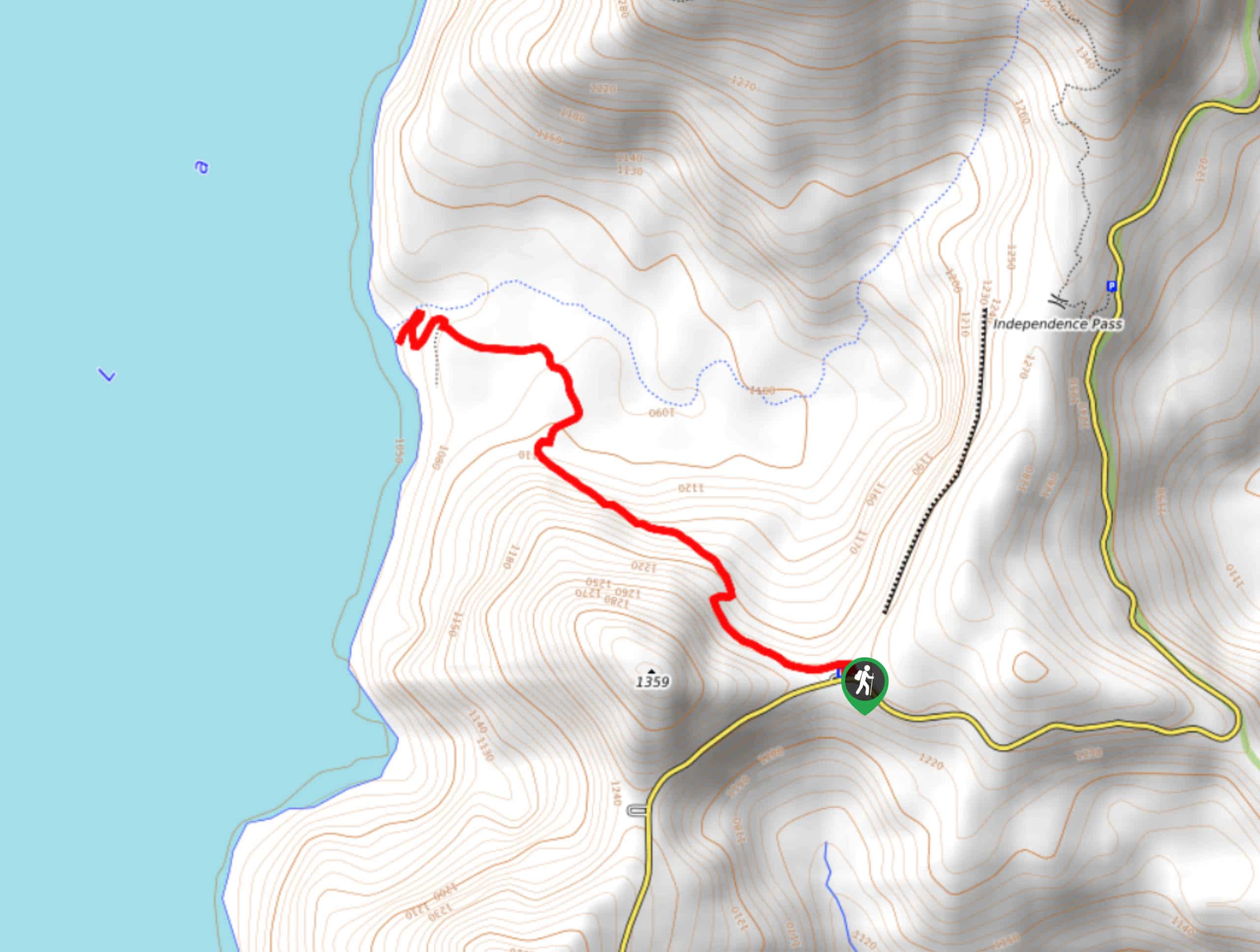
The trailhead for the Windy Ridge Trail is at the Windy Ridge Interpretive Site off Spirit Lake-Iron Creek Road.

About
| Backcountry Campground | No |
| When to do | May-October |
| Pets allowed | No |
| Family friendly | Yes |
| Route Signage | Average |
| Crowd Levels | Moderate |
| Route Type | Out and back |
Windy Ridge Trail
Elevation Graph
Weather
Windy Ridge Trail Description
Windy Ridge Trail is a treat, with great views of Mount Saint Helens and the surrounding forest and mountains. The drive to the trail is also spectacular, so the views start before you’ve even reached the trailhead. There’s an interpretive site in the parking area for this hike that you can stop into to learn more about the area before heading out on your adventure.
This route guide covers the first 0.6 miles of the Windy Ridge Trail, ending just past the Harmony Lake Viewpoint. You can go further, hiking to the end of the Windy Ridge Trail at the Smith Creek junction. This trip is still quite easy, clocking in at a very modest 15.0mi.
The name doesn’t lie- you’ll want to be dressed warmly for this hike, preferably with a windbreaker as your top layer. The wind howls here, often making it feel colder than it actually is outside. If you hike the ridge on a still day, consider yourself lucky!
The road to the trailhead isn’t always open in the wintertime, so we recommend planning this hike for the summer months and checking on the status of the road if you want to visit in the wintertime.
Begin from the trailhead, which is past the interpretive site (a worthwhile stop before you start hiking). There are Ranger Talks here every hour on the half hour during summer weekends.
Begin at the trailhead, heading up the stairs to the ridge. After the stairs, the footing is a bit rocky, but the trail is very easy to follow. There’s a moderate climb along the stairs to get atop the ridge, and then it’s smooth sailing as you stroll along the ridgeline.
Snap a photo from the viewpoint, admire Mount Saint Helens, and then decide if you want to keep traversing the ridge or not. It’s an easy hike with lots to see, so we recommend continuing as far as you like. When you’re ready, turn back and simply retrace your steps.
Hiking Route Highlights
Mount Saint Helens
The highlight of this hike is the view of Mount Saint Helens. Mount Saint Helens is an active volcano, last erupting in May of 1980, taking 57 lives and destroying 200 homes. The volcano is8363ft feet high. Previously the summit was at 9677ft, but it was shortened in a lateral eruption triggered by an earthquake. Mount Saint Helens was originally named Lawetlat’la by the Cowlitz people.
Frequently Asked Questions
Do I need a pass for Windy Ridge?
Yes, you’ll need a Northwest Forest Pass for this hike.
Is Windy Ridge hard?
This hike is rated as moderate. There’s a long set of switchbacking stairs to climb, but you can take your time if needed.
Insider Hints
Plan to stop by the Ranger Talks if you’re here in the summer.
The parking lot doesn’t tend to fill, so don’t worry about getting here too early.
Similar hikes to the Windy Ridge Trail hike
Harmony Trail
Harmony Trail is a wonderful easy hike in the Gifford Pinchot National Forest that takes you to the shore of…
Big Creek Falls Trail
Big Creek Falls Trail takes you through a beautiful forest to three waterfalls, one of which is clearly visible. This…

Curly Creek Falls via Lewis River Trail
Curly Creek Falls can be reached on an easy 0.8mi section of the Lewis River Trail suitable for…
Comments