Wind Mountain Trail
View Photos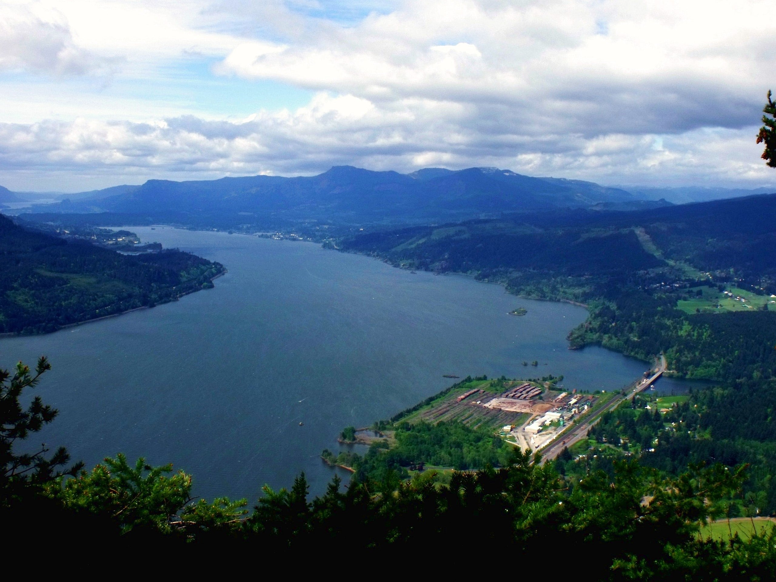
Wind Mountain Trail
Difficulty Rating:
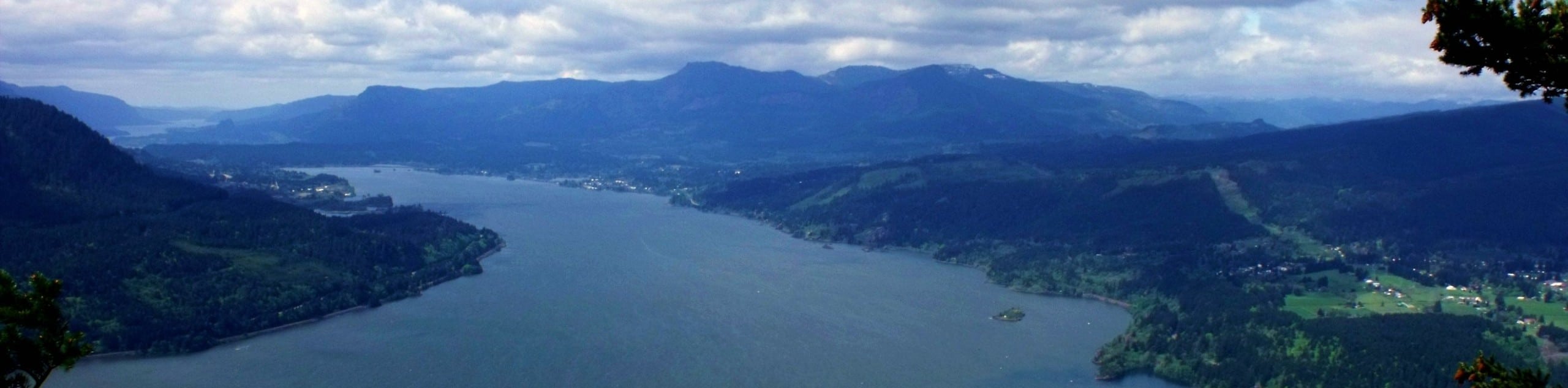
Wind Mountain Trail is a 24.0mi moderate hike that gives you a great vantage point over the Columbia River Gorge. This summit is about as easy to bag as it gets, and it’s a fun hike for all ages and skill levels. Be prepared for a bit of a steep climb, but it doesn’t last very long. You’ll enjoy a view of Table Mountain, Mount Defiance, and more.
Bring poles if you’re worried about your footing, as this trail can get slick if it’s rained recently. Otherwise, this trail is generally in good condition and easy to follow. Take a moment to read the interpretive sign near the top that tells you about the mountain’s history.
Getting there
The trailhead for the Wind Mountain Trail is at the end of Girl Scout Road.

About
| Backcountry Campground | No |
| When to do | May-October |
| Pets allowed | Yes - On Leash |
| Family friendly | Yes |
| Route Signage | Average |
| Crowd Levels | High |
| Route Type | Out and back |
Wind Mountain Trail
Elevation Graph
Weather
Wind Mountain Trail Description
Wind Mountain gives you great views without making you work too hard for them. It’s a great hike for families and beginners, taking you to a mountaintop with views over the Columbia River Gorge over the span of a few short miles.
While this trail is generally well-kept and easy to follow, it can get slippery if it’s wet out. On the flip side, the trail can be very dusty if it’s been dry, which can be slippery as well. Watch your footing if you’re hiking in either condition. Some hikers may prefer to bring poles on this hike, but they’re not a must-have for this trail.
From the parking lot, walk down the gravel road to the trailhead on your right. The wide switchbacks will take you across a talus slope before the trail evens out as you hike through the forest. The canopy high above you, you might be treated to birdsong as you go.
About a quarter of a mile past the entrance to the forest, watch for a sign that explains the cultural and historical significance of the mountain, then continue on a bit further to the summit. From the top, look out to Dog Mountain, Mitchell Point, Table Mountain, Greenleaf Peak, and Mount Defiance, which is the tallest mountain in the gorge. If you’ve scored a clear day, you can see Mount Saint Helens.
After you’ve enjoyed the views, retrace your steps to the parking area.
Insider Hints
Home Valley Beach is near the mountain if you want to enjoy the river once you’re done hiking.
There tends to be plenty of parking for this hike, so no need to race out in the morning.
Similar hikes to the Wind Mountain Trail hike

Ptarmigan Trail
Ptarmigan Trail is a 4.2mi moderate trail near the base of Mount Saint Helens. This trail is suitable…

Boundary West Trail
Boundary West Trail is a hike near Mount Saint Helens that doesn’t see much traffic, making it a nice pick…

Silver Creek Trail
Silver Creek Trail is a moderate hike in the Gifford Pinchot National Forest that is suitable for most skill levels.…
Comments