
Killen Creek Trail
View Photos
Killen Creek Trail
Difficulty Rating:
Killen Creek Trail is a 5.8mi out and back trail in Gifford Pinchot National Forest. This trail is 5.7mi long and moderately difficult. The incline is never too steep, but it never stops. Enjoy gorgeous wildflowers in the early summer and nice mountain views on this moderately trafficked route. This trail is also good for backpacking trips.
Getting there
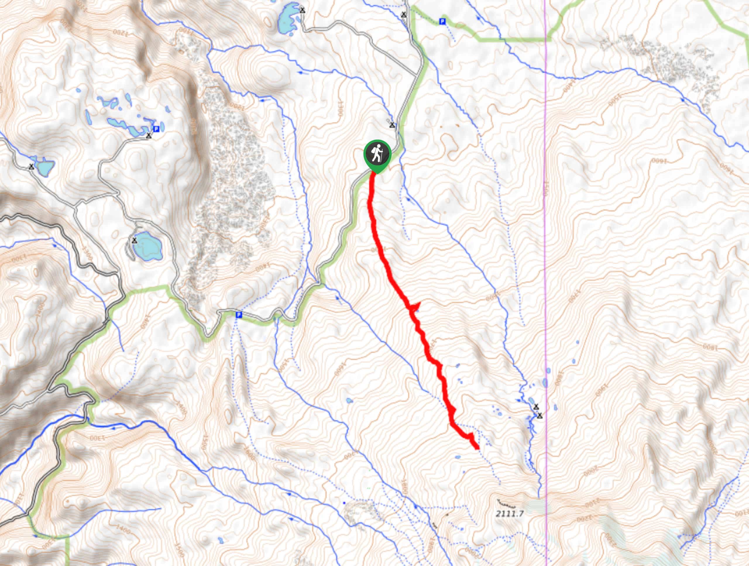
The trailhead for Killen Creek Trail is on Midway Loop Road.

About
| Backcountry Campground | Killen Creek Campground |
| When to do | June-October |
| Pets allowed | Yes - On Leash |
| Family friendly | Yes |
| Route Signage | Average |
| Crowd Levels | Moderate |
| Route Type | Out and back |
Killen Creek Trail
Elevation Graph
Weather
Killen Creek Trail Description
Killen Creek Trail is a popular pick for backpackers in the area, and its connection to the PCT means you might run into some thru-hikers as you go. This trail is known for its wildflowers in the early summer and nice views of Mount Adams. This can be used for both day trips and for backpacking trips.
This trail is moderately difficult. The incline isn’t ever too steep, but it’s very consistent. You’ll be heading up and not stopping. Let the meadows and streams take your mind off the climb if you need.
Begin from the trailhead. The route heads roughly south, climbing through flower-filled meadows and through forests. It’s a scenic route. There are no junctions to consider until the end of the trail, so navigation is about as simple as it gets. Pass a pond on your left before the climb picks up a bit. Cross the East Fork Adams Creek and complete the final steps to the end of the trail, which is at the junction with the PCT. From here, turn around and retrace your steps.
Similar hikes to the Killen Creek Trail hike

Ptarmigan Trail
Ptarmigan Trail is a 4.2mi moderate trail near the base of Mount Saint Helens. This trail is suitable…

Boundary West Trail
Boundary West Trail is a hike near Mount Saint Helens that doesn’t see much traffic, making it a nice pick…

Silver Creek Trail
Silver Creek Trail is a moderate hike in the Gifford Pinchot National Forest that is suitable for most skill levels.…
Comments