
Trail of Two Forests
View Photos
Trail of Two Forests
Difficulty Rating:
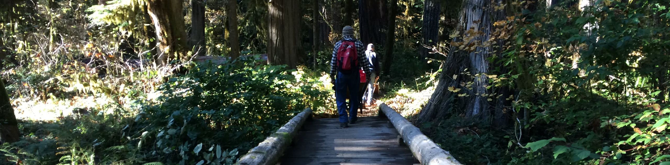
Trail of Two Forests is a very short, easy hike in Gifford Pinchot National Forest. This hike is only about a third of a mile long, but it packs lots to see into that short distance. Check out the interpretive signs and informational placards, climb through a lava tube, and examine a tree hollowed out by lava. This trail is family-friendly.
Getting there
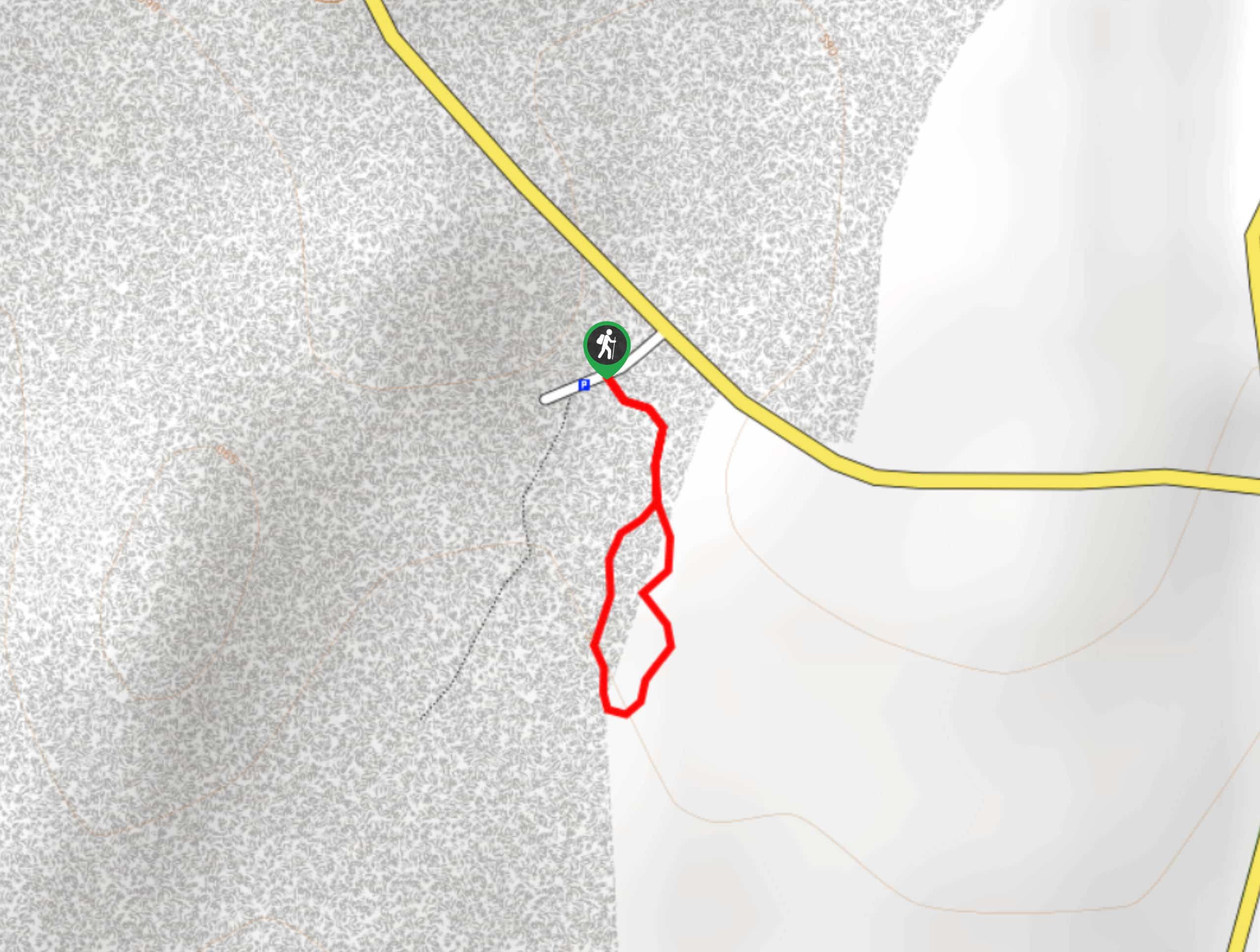
The trailhead for the Trail of Two Forests is on an access road off Forest Road 8303.

About
| Backcountry Campground | No |
| When to do | March-November |
| Pets allowed | Yes - On Leash |
| Family friendly | Yes |
| Route Signage | Good |
| Crowd Levels | Moderate |
| Route Type | Loop |
Trail of Two Forests
Elevation Graph
Weather
Trail of Two Forests Description
The quick interpretive Trail of Two Forests is a fun stop for families and older hikers alike. A boardwalk takes you past informational interpretive signage into a forest affected by the 1980 eruption of Mount Saint Helens. You can observe a lava tunnel and even climb down a ladder to walk through it and check out a tree hollowed out in the middle by lava.
This trail is stroller-friendly and easy enough for all skill levels. If you want to check out the lava tube from the inside, you’ll need to be able to climb up and down a short ladder. Note that there are two trails that depart from the access road, and the one that leads to the bathroom ends shortly thereafter. You’ll want the one on your left.
The loop is very easy to follow and there are no junctions. Go either way you prefer and explore until you reach the parking area again.
Similar hikes to the Trail of Two Forests hike
Harmony Trail
Harmony Trail is a wonderful easy hike in the Gifford Pinchot National Forest that takes you to the shore of…
Big Creek Falls Trail
Big Creek Falls Trail takes you through a beautiful forest to three waterfalls, one of which is clearly visible. This…
Curly Creek Falls via Lewis River Trail
Curly Creek Falls can be reached on an easy 0.8mi section of the Lewis River Trail suitable for…
Comments