
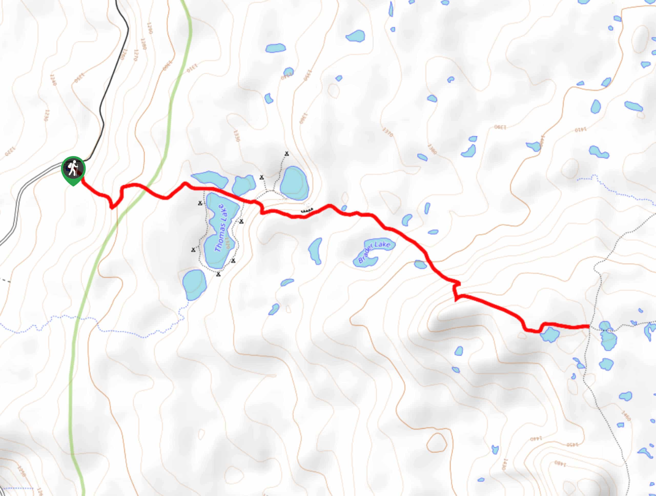
Thomas Lake Trail
View Photos
Thomas Lake Trail
Difficulty Rating:
Thomas Lake is a fantastic spot for a weekend getaway, offering nice backcountry camping spots all around the lakeshore and an easy trail in. This hike is 3.8mi long and rated as easy, making it a good choice for all skill levels. This guide covers the entire distance of the trail, but if you just want to get to Thomas Lake and back, it’s less than half as long.
Note that the mosquitoes on this hike can be truly incessant in the early-mid summertime. Try visiting in August when they tend to be less bothersome and bring a very potent spray. A hike in the fall eliminates this issue and offers great foliage color.
Getting there
The trailhead for the Thomas Lake Trail is at the end of Forest Road 65.

About
| Backcountry Campground | Thomas Lake Backcountry |
| When to do | May-October |
| Pets allowed | Yes - On Leash |
| Family friendly | Yes |
| Route Signage | Average |
| Crowd Levels | High |
| Route Type | Out and back |
Thomas Lake Trail
Elevation Graph
Weather
Thomas Lake Trail Description
Thomas Lake is a relaxing, beautiful spot with lots of backcountry camping to enjoy. It’s great for a day hike too, with an easy trail suitable for beginners. Note that if you want to camp, you’ll need to pick a designated spot with a numbered post.
This hike is plagued by mosquitoes in early and mid-summer. Bring a potent spray. We recommend visiting in August for summer trips and October for fall trips when the bugs are less bothersome and the foliage starts to turn red and golden.
Begin from the trailhead. The route meanders uphill before trailing through a couple of lazy switchbacks. Thomas Lake, Heather Lake, and Dee Lake will appear ahead. This guide covers the entire Thomas Lake Trail to its end where it reaches a T-junction, passing Naha Lake, Brader Lake, and Eunice Lake (which also has camping). You can hike the whole trail or just stop at Thomas Lake depending on your plans. To return, retrace your steps.
Similar hikes to the Thomas Lake Trail hike

Ptarmigan Trail
Ptarmigan Trail is a 4.2mi moderate trail near the base of Mount Saint Helens. This trail is suitable…

Silver Creek Trail
Silver Creek Trail is a moderate hike in the Gifford Pinchot National Forest that is suitable for most skill levels.…
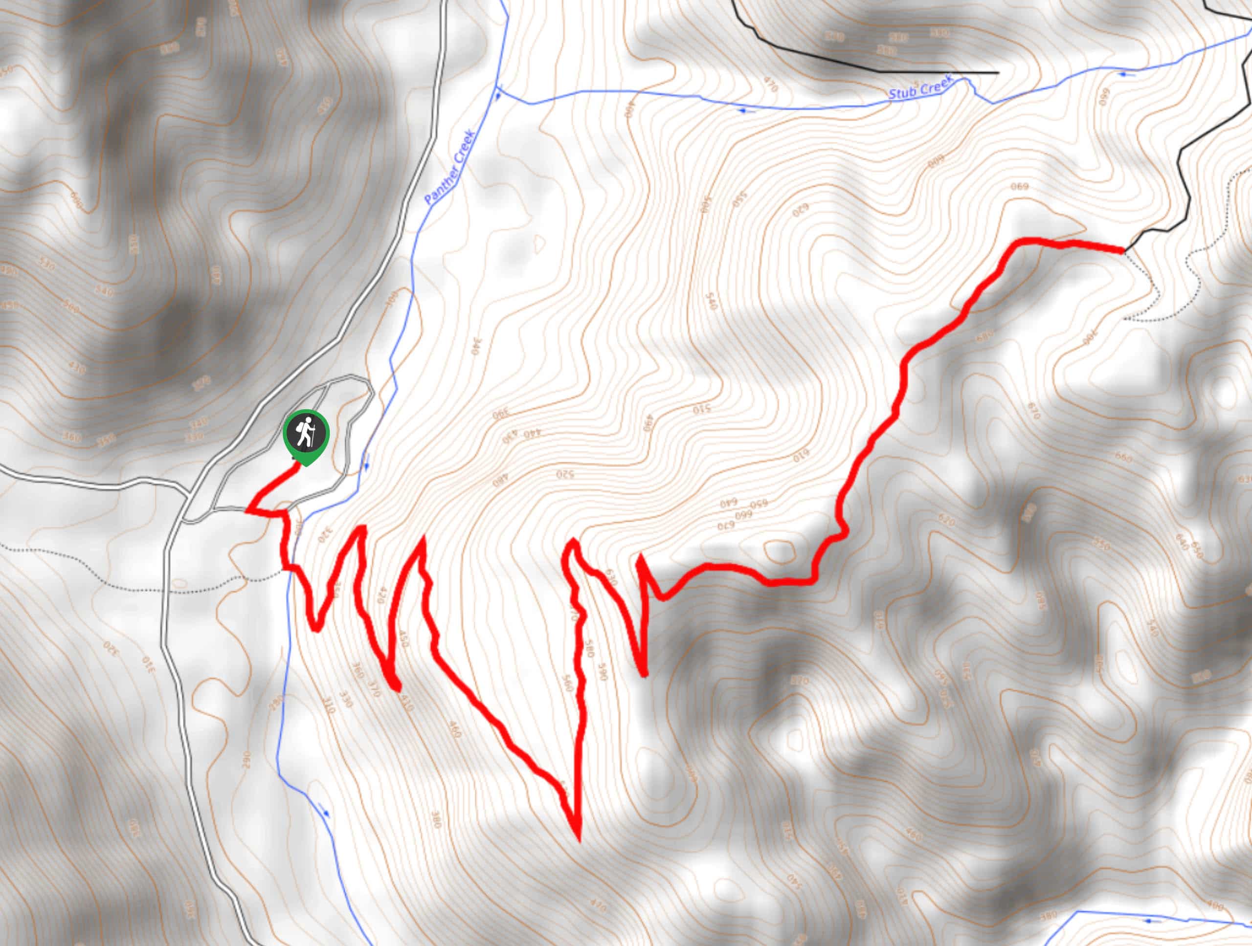
Pacific Crest Trail from Panther Creek
This route guide takes you from Panther Creek Campground to the Pacific Crest Trail, offering an easy connector for those…
Comments