
Merrill Lake Campground Loop
View Photos
Merrill Lake Campground Loop
Difficulty Rating:
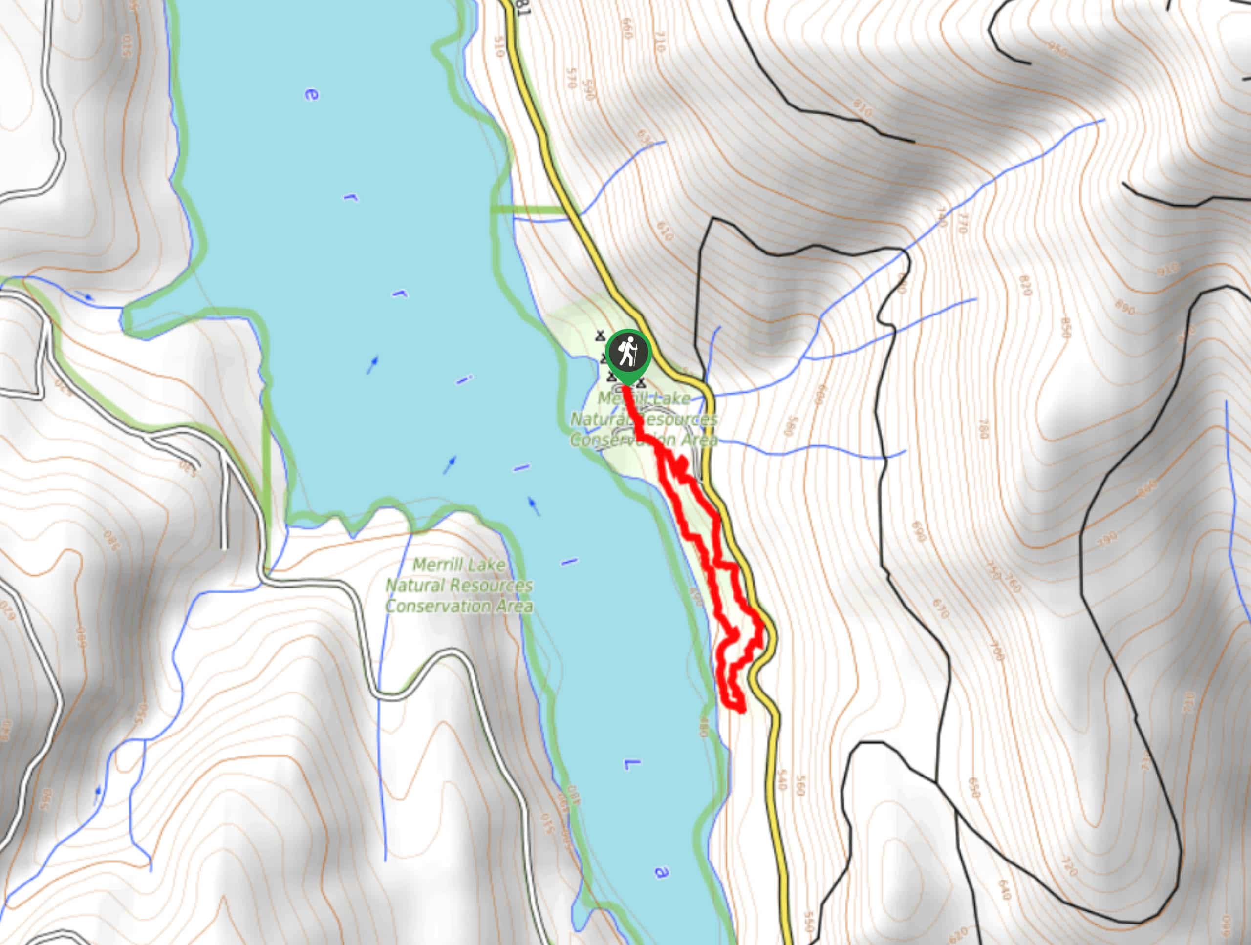
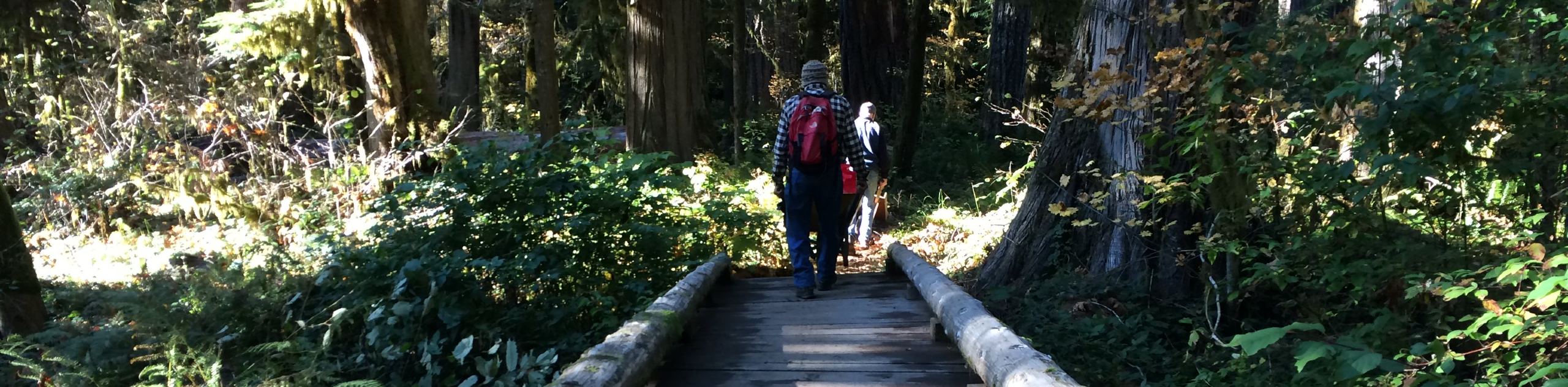
Staying at Merrill Lake Campground? Set out on the casual Merrill Lake Campground Loop, a 1.0mi stroll that leads you through the campground, along the lakeshore, and back. This walk is essentially flat and is suitable for all ages and skill levels. Bring some paddleboards or a picnic if you want to spend more time enjoying the lake.
Getting there
The trailhead for the Merrill Lake Campground Loop is in the campground in the parking loop.

About
| Backcountry Campground | Merrill Lake Campground |
| When to do | March-November |
| Pets allowed | Yes - On Leash |
| Family friendly | Yes |
| Route Signage | Average |
| Crowd Levels | Low |
| Route Type | Loop |
Merrill Lake Campground Loop
Elevation Graph
Weather
Merrill Lake Campground Loop Description
If you’re staying at the Merrill Lake Campground, this short and sweet loop is the ideal way to enjoy the lake and get a few steps in. Those not staying at the campground can make use of the day use parking and spend the afternoon walking, paddleboarding, picnicking, or swimming.
The walk begins from the parking loop near the camping sites. You’ll walk south past the restrooms and past the day use parking. The trail forks near the water and you can decide which way to go. Staying left will give you the closest lake views on the return trip and staying right will start your hike with the lake nearby.
There are no intersecting trails to worry about, so whichever way you choose to go, relax and enjoy your walk. The loop turns back around about a half-mile in, and then you’ll follow the same trail back to the starting point.
Similar hikes to the Merrill Lake Campground Loop hike
Harmony Trail
Harmony Trail is a wonderful easy hike in the Gifford Pinchot National Forest that takes you to the shore of…
Big Creek Falls Trail
Big Creek Falls Trail takes you through a beautiful forest to three waterfalls, one of which is clearly visible. This…
Curly Creek Falls via Lewis River Trail
Curly Creek Falls can be reached on an easy 0.8mi section of the Lewis River Trail suitable for…
Comments