Sunrise Peak Trail
View Photos
Sunrise Peak Trail
Difficulty Rating:
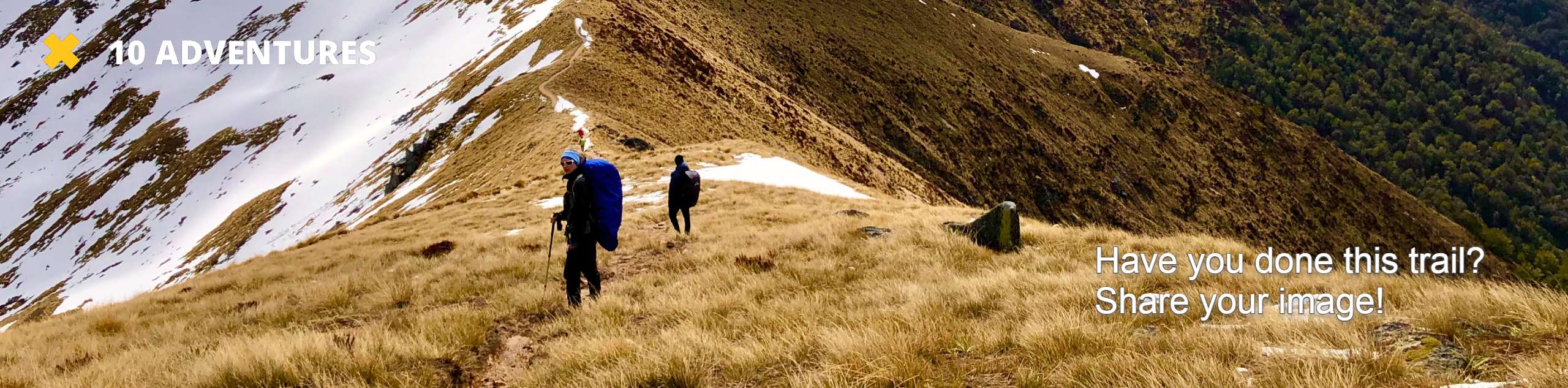
Sunrise Peak Trail is a spectacular hike with panoramic views that start before you’ve even reached the top. We do recommend trying to do this hike for sunrise if you’re willing to wake up early, as the view is spectacular when awash in color. This 3.5mi hike is rated as moderate.
This trail is shared by dirtbikers, most of whom are courteous and careful. You’ll want to be cautious on the narrow route, which can be quite dusty.
Getting there
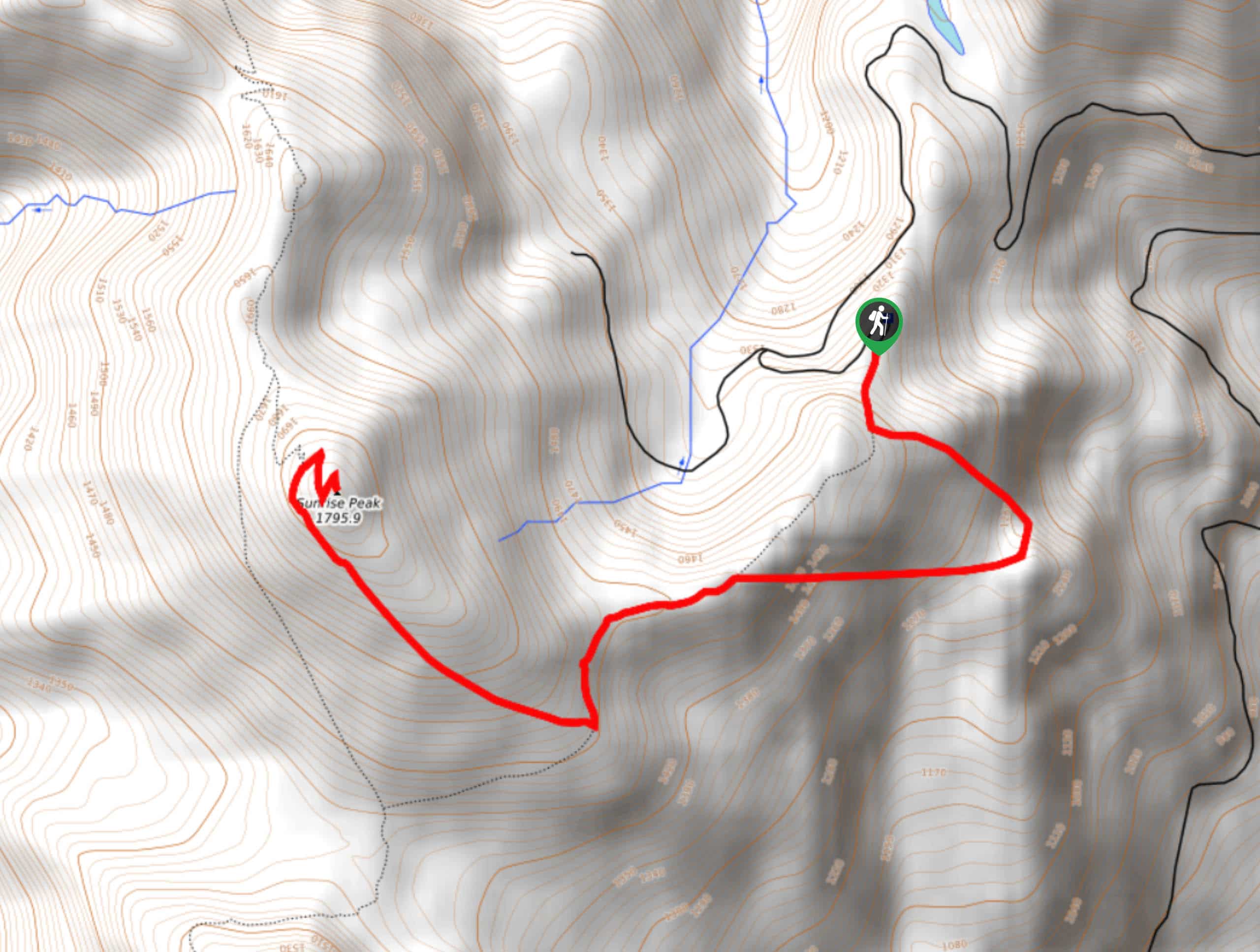
The trailhead for the Sunrise Peak Trail is on National Forest Road 2324-053.

About
| Backcountry Campground | No |
| When to do | June-October |
| Pets allowed | Yes - On Leash |
| Family friendly | Yes |
| Route Signage | Average |
| Crowd Levels | Moderate |
| Route Type | Out and back |
Sunrise Peak Trail
Elevation Graph
Weather
Sunrise Peak Trail Description
Sunrise Peak is well worth every step, offering 360-degree views of the Gifford Pinchot National Forest. The views start before you’ve summitted, making this an enjoyable hike through and through. We especially enjoy it in wildflower season.
This trail is used by dirtbikers, most of whom are careful and courteous. That being said, parts of the trail are quite narrow and dusty, so be cautious as you go. Additionally, the road to the trailhead is in rough condition in spots. Drive slowly.
Beginning from the trailhead, take Sunrise Trail #262 as it leads you uphill. At the first junction, stay right. You’ll hike just underneath the ridge, wrapping around the summit to a few short switchbacks that lead you to the top. After admiring the views, retrace your steps back to the trailhead.
Similar hikes to the Sunrise Peak Trail hike

Ptarmigan Trail
Ptarmigan Trail is a 4.2mi moderate trail near the base of Mount Saint Helens. This trail is suitable…

Boundary West Trail
Boundary West Trail is a hike near Mount Saint Helens that doesn’t see much traffic, making it a nice pick…

Silver Creek Trail
Silver Creek Trail is a moderate hike in the Gifford Pinchot National Forest that is suitable for most skill levels.…
Comments