Coyote Wall Loop Trail
View Photos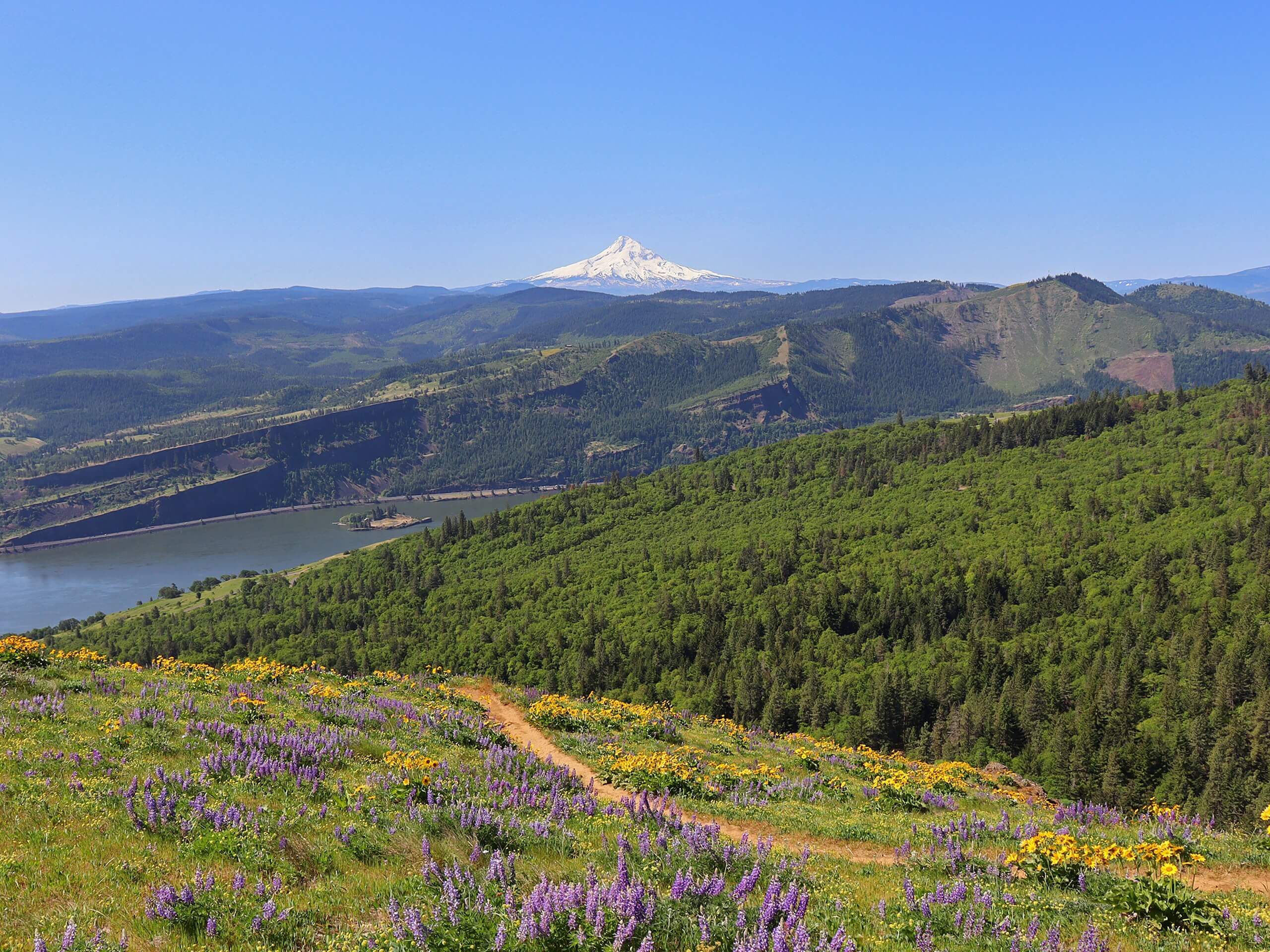
Coyote Wall Loop Trail
Difficulty Rating:
The Coyote Wall Loop Trail is a fun, customizable hike in the Columbia River Gorge. The trail followed by this route guide is 6.8mi long and rated as moderately difficult, but you can use the labyrinth of interconnecting trails on the wall to make your loop shorter, longer, easier, or more challenging. You can swing by Little Maui Falls and enjoy great views of the river just below you. While parts of this loop are family-friendly, know that if you plan to hike the western side of the wall you’ll deal with steeper, rockier terrain.
Some sections of this trail are a bit steep, so we recommend bringing poles. Additionally, if you’re unfamiliar with the Coyote Wall trails, we definitely recommend downloading your GPS track ahead of time. It can be somewhat easy to get off the trail.
Getting there
The trailhead for the Coyote Wall Loop Trail is on Old Highway 8.

About
| Backcountry Campground | No |
| When to do | Year-round |
| Pets allowed | Yes - On Leash |
| Family friendly | Yes |
| Route Signage | Average |
| Crowd Levels | High |
| Route Type | Loop |
Coyote Wall Loop Trail
Elevation Graph
Weather
Coyote Wall Loop Trail Description
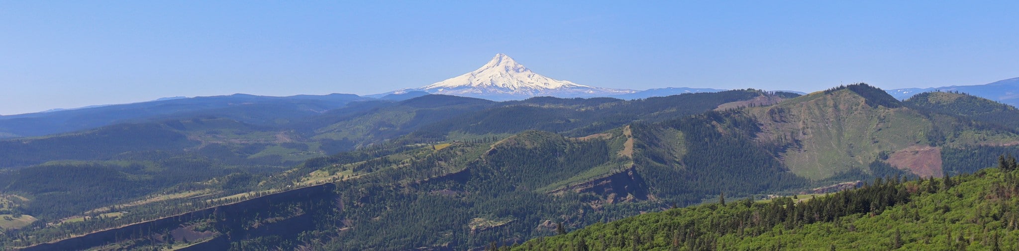
The Coyote Wall offers beautiful views of the Columbia River Gorge, spanning from the blue river just below you across to the mountains on the other side of the river. You’ll be able to see Mount Hood in all its glory and admire miles and miles of the sparkling water. In addition, your hike takes you past Little Maui Falls.
This trail can be completed all year and also offers the opportunity to lengthen or shorten your hike. Although this isn’t an easy trail, it can be made a bit easier by taking a shorter loop or made more difficult by making a longer loop. Download a GPS track and a map to help you plan your adventure.
Parts of this hike are quite steep, so we recommend poles and sturdy boots. Generally, the west side of the wall is rockier and steeper and the east side is a bit more forgiving. This guide covers a bit of both. Kids may struggle on certain parts of the route, so consider shortening your loop if you’ve got the whole family in tow.
A final note: there is poison oak along Labyrinth Trail. This guide stays a bit west of Labyrinth, but if you go wandering, stay out of the bushes.
Beginning from the parking area, hike alongside Locke Lake on Old Highway 8 towards the wall. The trail splits off from Old Highway 8 to your left, leading you up to the base of the loop. We recommend tackling the tougher west side first, which takes you up the wall. This provides for an easier descent on the knees that will allow you to actually enjoy the view as you go.
Go left, taking Old Ranch Road #4426. Stay left to switchback up the wall. It’s quite steep on your left side, so take care on loose, rocky sections.
Continue your way up the wall, staying left on Coyote Wall Trail #4428. This will lead you all the way up the wall. Once you hit Atwood Road, turn back and retrace your steps to where Old Ranch Road #4426 splits off to the left (it connects in two places, and you want the second).
Cross the stream onto Little Maui Trail and then turn right to weave down the wall beside the stream. Check out Little Maui Falls and then bear right at the Labyrinth Connector. This will take you back to the bottom of the loop where you’ll turn left to return to the parking area.
Hiking Route Highlights
Columbia River Gorge
The view from the Coyote Wall features the Columbia River Gorge, where the river slices through the mountains. You’ll have a particularly good view of Mount Hood on this part of the river. Between the mountains and the blue of the river, it’s a gorgeous spot.
Frequently Asked Questions
Do I need a pass for the Coyote Wall?
No pass or permit is required for this hike.
Can you bike on the Coyote Wall?
The trails on the wall are shared by hikers and mountain bikers.
When is the Coyote Wall open?
The wall is open year-round.
Insider Hints
Similar hikes to the Coyote Wall Loop Trail hike

Ptarmigan Trail
Ptarmigan Trail is a 4.2mi moderate trail near the base of Mount Saint Helens. This trail is suitable…

Boundary West Trail
Boundary West Trail is a hike near Mount Saint Helens that doesn’t see much traffic, making it a nice pick…

Silver Creek Trail
Silver Creek Trail is a moderate hike in the Gifford Pinchot National Forest that is suitable for most skill levels.…
Comments