Lewis River Falls Trail
View Photos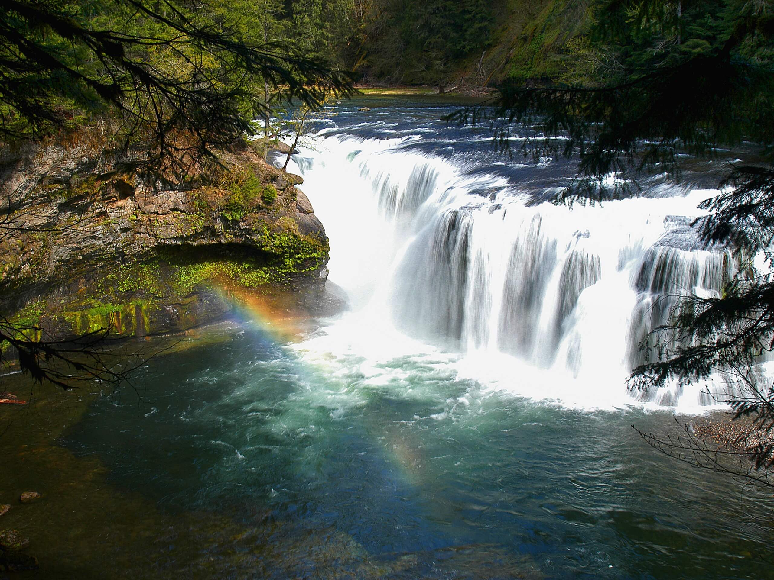
Lewis River Falls Trail
Difficulty Rating:
Lewis River Falls Trail is a delightful hike in every way. The trail is in great condition, the scenery is immaculate, and despite the heavy traffic, visiting on a weekday or early morning/late afternoon can score you some solitude. There are also multiple access points for this route to shorten or lengthen it. This guide covers the 8.6mi from the Crab Creek Trailhead to the Upper Lewis River Falls, which is a moderate trip.
You can start from the Lower Falls Campground to shorten your trip a bit if desired. You can also hike further to Taitnapum Falls.
Getting there
The trailhead for the Lewis River Falls Trail is on Lewis River Road in a parking area.

About
| Backcountry Campground | Lewis Falls Campground |
| When to do | April-November |
| Pets allowed | Yes - On Leash |
| Family friendly | Yes |
| Route Signage | Average |
| Crowd Levels | High |
| Route Type | Out and back |
Lewis River Falls Trail
Elevation Graph
Weather
Lewis River Falls Trail Description
The Lewis River Falls Trail is a splendid hike, taking you to multiple waterfalls through a mushroom-studded forest. It’s a bit like stepping into a storybook- the mossy forest, the interesting plants, the old-growth trees, the many mushrooms, and the misty waterfalls make for a very special hike. This is definitely a must-do if you’re in the area. If you can manage to hike it after a rainy day, you’ll get the best version of the falls possible.
The trail has various access points, so you can customize your trip a bit depending on your desired distance. This section goes from the Crab Creek Trailhead to the Upper Lewis River Falls. You can start from the campground at the lower falls to shorten it or you can hike further to the Taitnapum Falls if you want more distance and more views.
This hike is moderately difficult but should be within the comfort zone of most beginners and families. If you want a shorter trip, start at the campground instead. There are no falls between the Crab Creek Trailhead and the campground that you’ll miss.
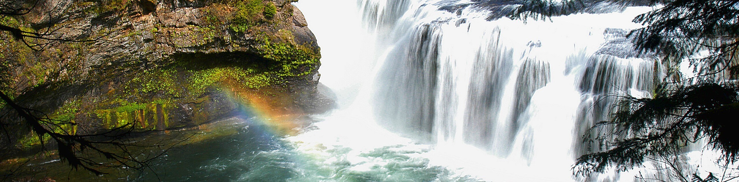
Beginning from the trailhead, follow the riverside path north. It’s an easy cruise to the Lower Lewis Falls beside the campground. These falls are 43ft high and 200ft across with a churning pool of water on the left side.
Continue on. After a mile and a half through the forest, you’ll find the Middle Lewis River Falls. The viewpoints here aren’t as numerous, but you can enjoy the sights nonetheless before continuing on. Note that if you want to add on a side trip to Copper Creek Falls, look for the short switchbacking trail on your right just before the middle falls.
Hiking upstream once more, you’ll soon reach Upper Lewis River Falls. It’s stellar! You’ll see the 58ft high falls, which are 175ft across. Stay a while here, soaking up the sigh of this impressive feature.
Our route has you turn back here and retrace your steps to the trailhead. Should you want to continue, Taitnapum Falls is just a short jaunt up the same path.
Hiking Route Highlights
Lewis River Falls
The three Lewis River waterfalls are truly a spectacle to behold. The Lower Lewis River Falls is 43ft high and 200ft across, truly not done justice in photos. The Middle Lewis River Falls is 32ft tall, and the Upper Lewis River Falls is 58ft tall and 175ft across. Together, they make for a sublime hiking experience.
Frequently Asked Questions
Can you swim in Lewis River Falls?
The safest place to swim is at the base of the lower falls, but exercise caution whenever swimming near a waterfall.
What pass do you need for Lewis River Falls?
Anyone parking in the Lewis River Recreation Area needs a permit, which can be reserved ahead of time. You will also need a Northwest Forest Pass.
How hard is the Lewis River Falls hike?
The hike is moderate. There are different access points for the trail that can be used to shorten the hike, or you can go further along the Lewis River Trail for a more challenging hike.
Insider Hints
Reserve your parking permit ahead to avoid disappointment on the day of your visit.
Hike this trail in the spring for the most impressive experience at the falls.
Similar hikes to the Lewis River Falls Trail hike

Ptarmigan Trail
Ptarmigan Trail is a 4.2mi moderate trail near the base of Mount Saint Helens. This trail is suitable…

Boundary West Trail
Boundary West Trail is a hike near Mount Saint Helens that doesn’t see much traffic, making it a nice pick…

Silver Creek Trail
Silver Creek Trail is a moderate hike in the Gifford Pinchot National Forest that is suitable for most skill levels.…
Comments