
Council Bluff Trail
View Photos
Council Bluff Trail
Difficulty Rating:
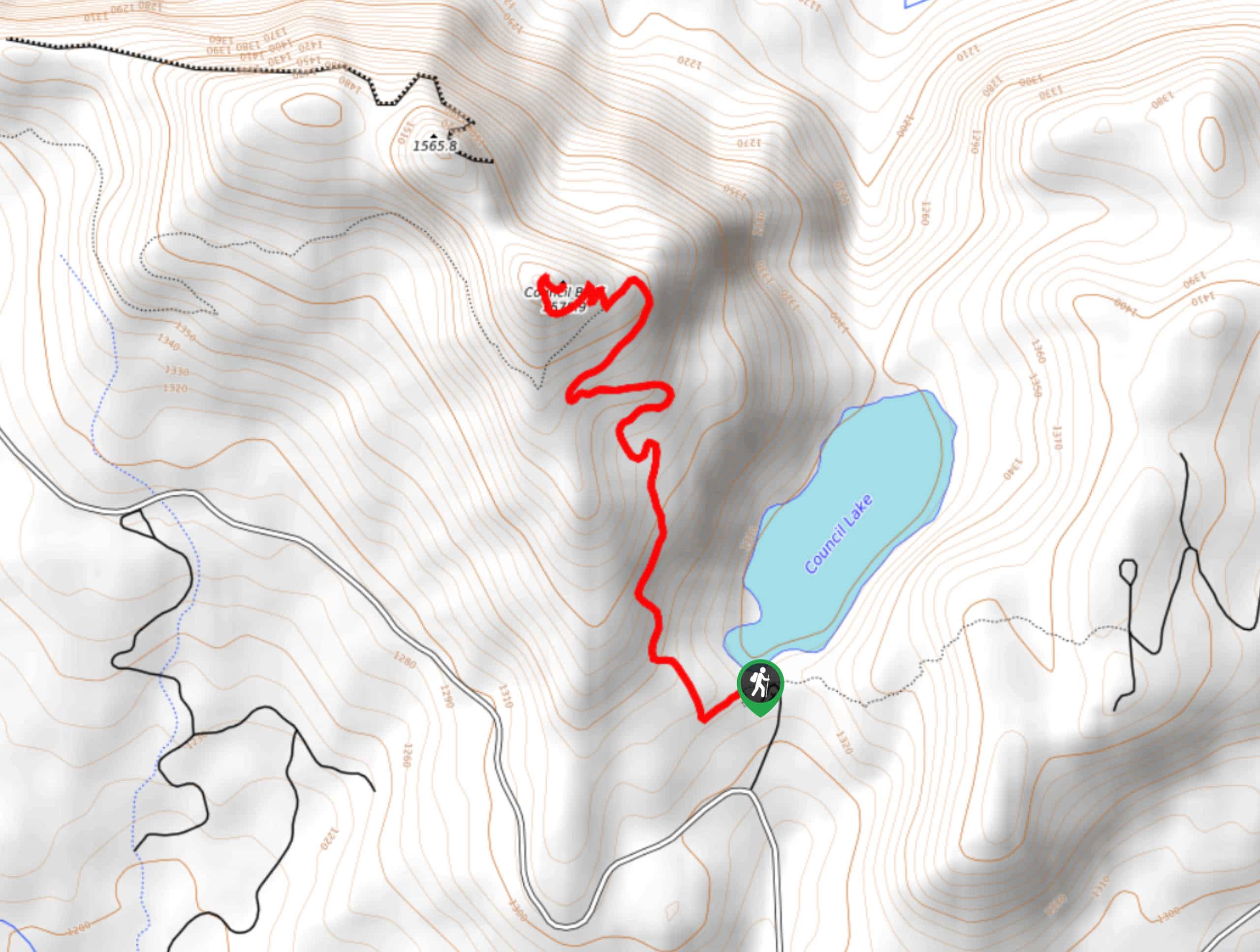
Council Bluff Trail is a 2.9mi out and back hike that starts from the Council Bluff Campground and takes you up to a viewpoint over Council Lake. This hike is fairly short, but there are some confusing, unmarked junctions that make a downloaded GPS route very helpful. Expect light traffic on this hike.
Getting there
The trailhead for the Council Bluff Trail is in the back of Council Bluff Campground.

About
| Backcountry Campground | Council Lake Campground |
| When to do | April-November |
| Pets allowed | Yes - On Leash |
| Family friendly | Yes |
| Route Signage | Poor |
| Crowd Levels | Low |
| Route Type | Out and back |
Council Bluff Trail
Elevation Graph
Weather
Council Bluff Trail Description
Council Bluff Trail is a good hike if you’re staying at the nearby campground or if you want a 2 hour or so adventure. It’s quick in and out and provides a nice view over Council Lake and the surrounding forest and mountains.
This trail isn’t very well marked, so we recommend downloading your GPS route. The mosquitoes tend to be persistent, so bring a potent spray. Additionally, it tends to be rocky and a bit loose. Poles and sturdy boots are recommended.
Begin from the back end of the campground. The trail isn’t marked, so take a peek at your GPS. You’ll climb next to the ridge, hiking roughly north before taking four wide switchback turns prior to the final switchbacks to the summit. From the top, you’ll retrace your steps down the same route.
Similar hikes to the Council Bluff Trail hike

Ptarmigan Trail
Ptarmigan Trail is a 4.2mi moderate trail near the base of Mount Saint Helens. This trail is suitable…

Boundary West Trail
Boundary West Trail is a hike near Mount Saint Helens that doesn’t see much traffic, making it a nice pick…

Silver Creek Trail
Silver Creek Trail is a moderate hike in the Gifford Pinchot National Forest that is suitable for most skill levels.…
Comments