hikes in Phoenix
Phoenix Hikes
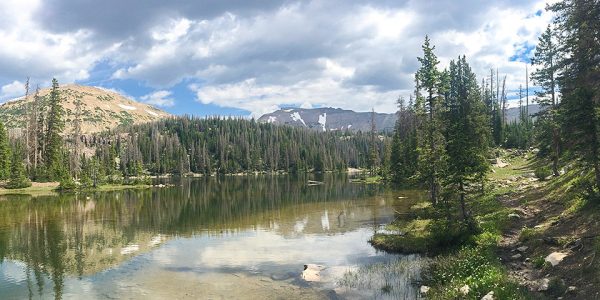
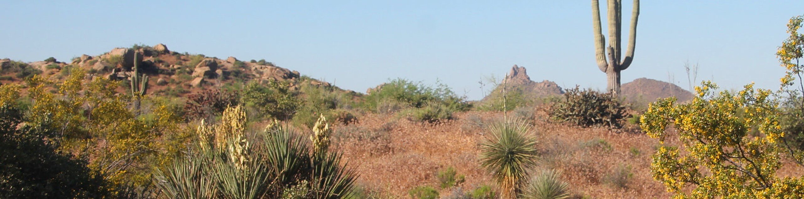
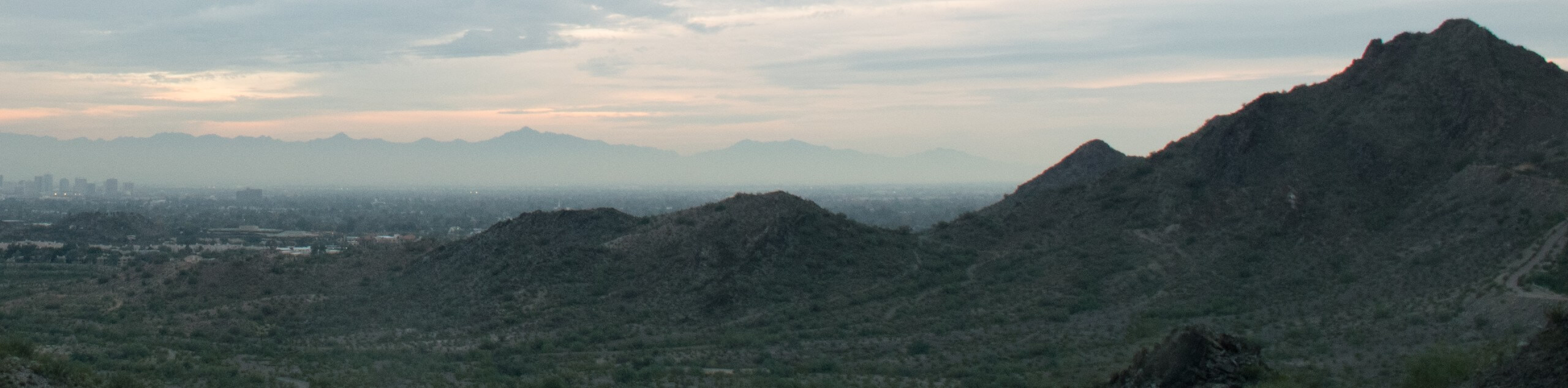
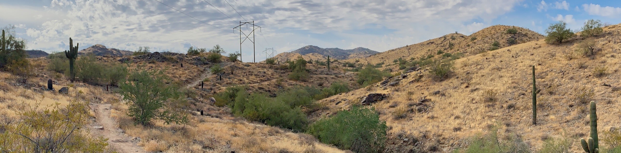
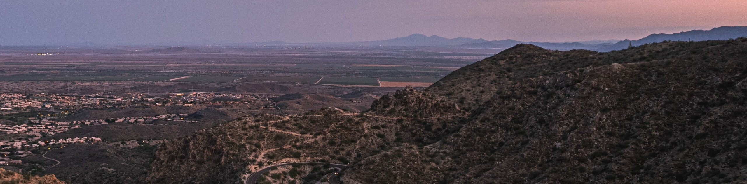
Phoenix hikes are an amazing way to explore the stunning Arizona landscape and will make you realize that Phoenix is so much more than its dynamic urban center. Right within city limits, nature reserves and protected areas provide outdoor adventurers with a jaw-dropping selection of trails to explore. Put aside what you know about this desert center and re-imagine it as a mecca for hikers and mountain bikers. There are countless Phoenix hikes that are ready and waiting to be explored!
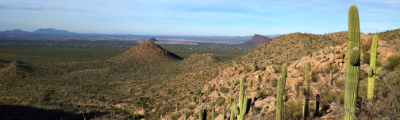
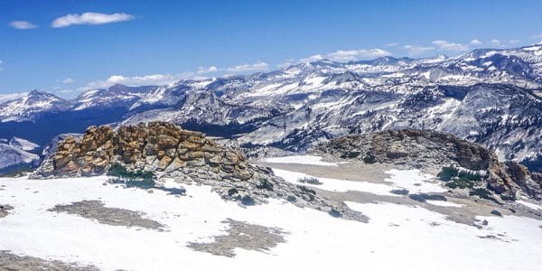
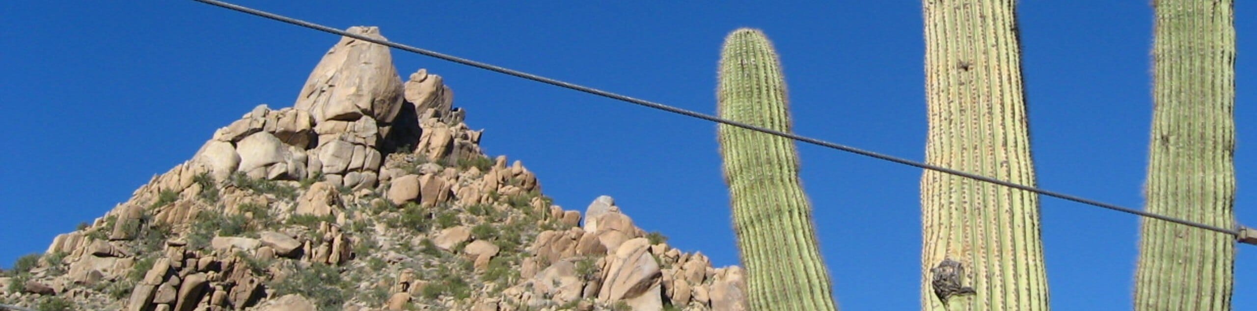
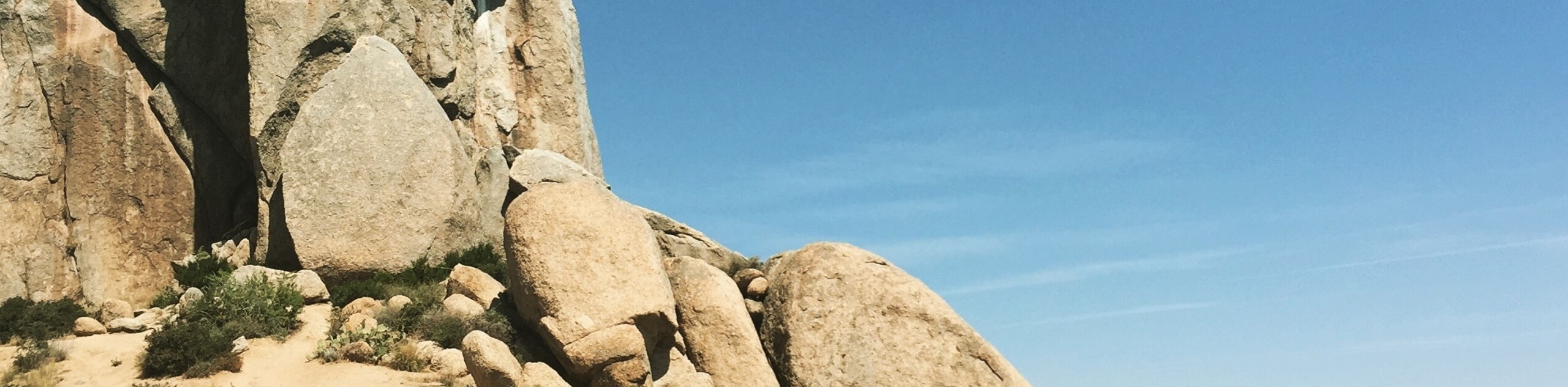
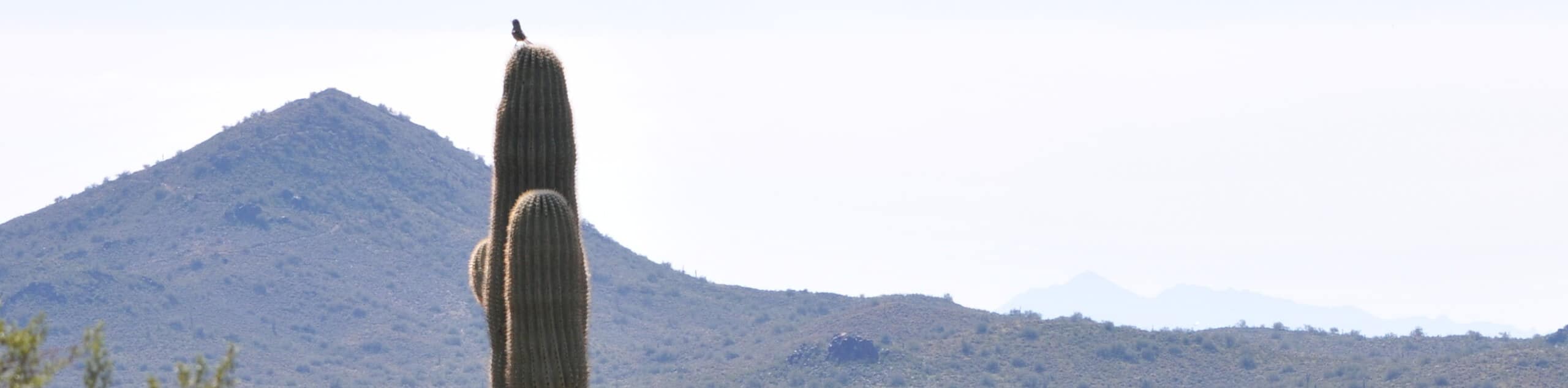
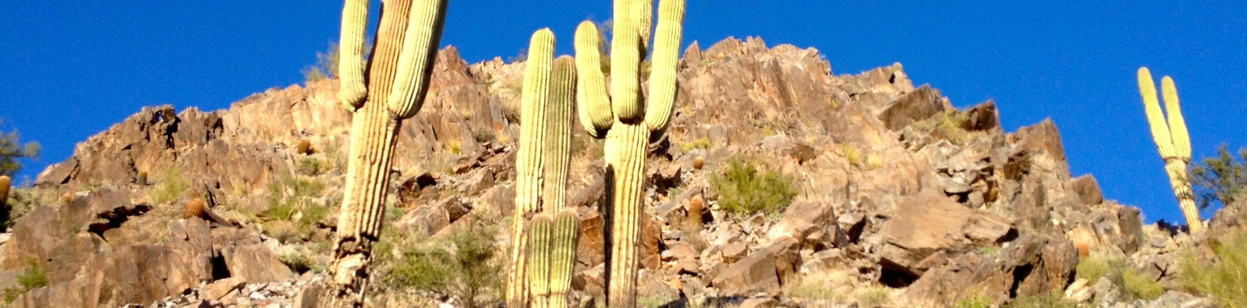
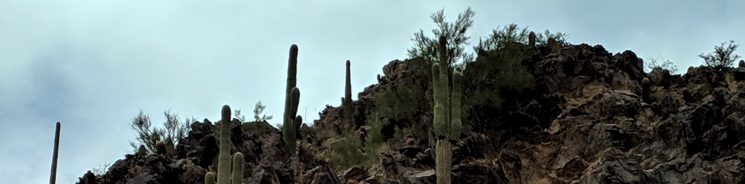
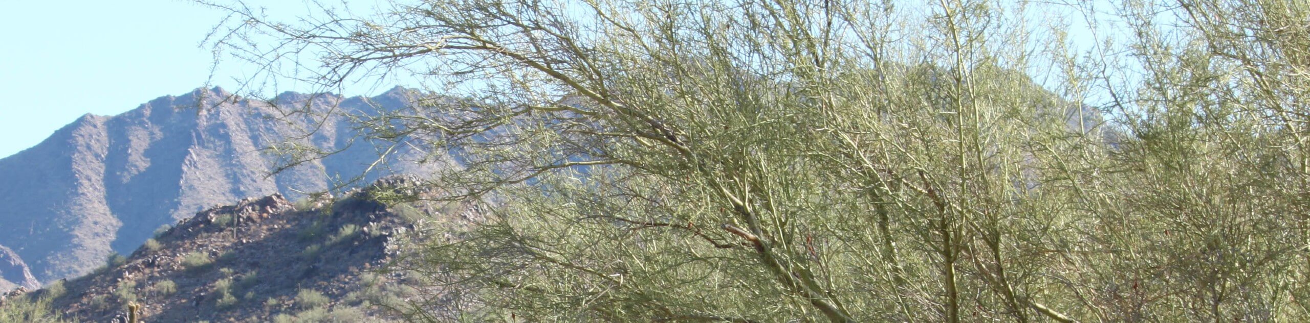
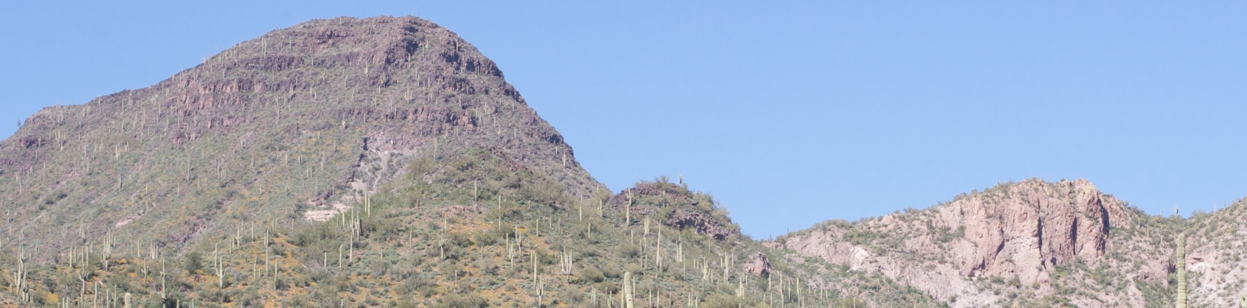
Flanked by the McDowell Mountains, White Tank Mountains, and the Superstition Mountains, there are peaks over 2500ft to climb without ever leaving city limits. Phoenix hikes offer every bit of the one-of-a-kind Sonoran Desert scenery you’d desire, with mighty saguaros, prickly teddy bear cholla, caves, petroglyphs, barrel cactus, wildlife, and more to experience as you hike.
Whether you’re scaling Camelback Mountain, listening to a Taiko drum atop Piestewa Peak, or taking a sunset stroll through Papago Park, you’ll find that these rugged, edgy desert trails can become some of the most fascinating to explore. Read on to discover some of the most popular Phoenix hikes.
20 Best Hikes in Phoenix
Ready to start exploring? We’re making it easy to get going with 20 of our favorite Phoenix hikes. Our list includes short, easy trails, challenging summits, and everything in between. Work your way through as many as you can on the weekends or make the most of your downtime while visiting the city–you’ll want to keep exploring once you first discover the draw of the desert.
Our 20 best hikes in Phoenix are chosen to show off the highlights of Phoenix’s landscape. While starting with these Phoenix hikes is a great way to get acquainted with the area's hiking scene, remember that we’ve got plenty more route guides to keep you adventuring!
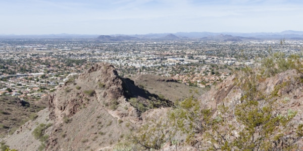
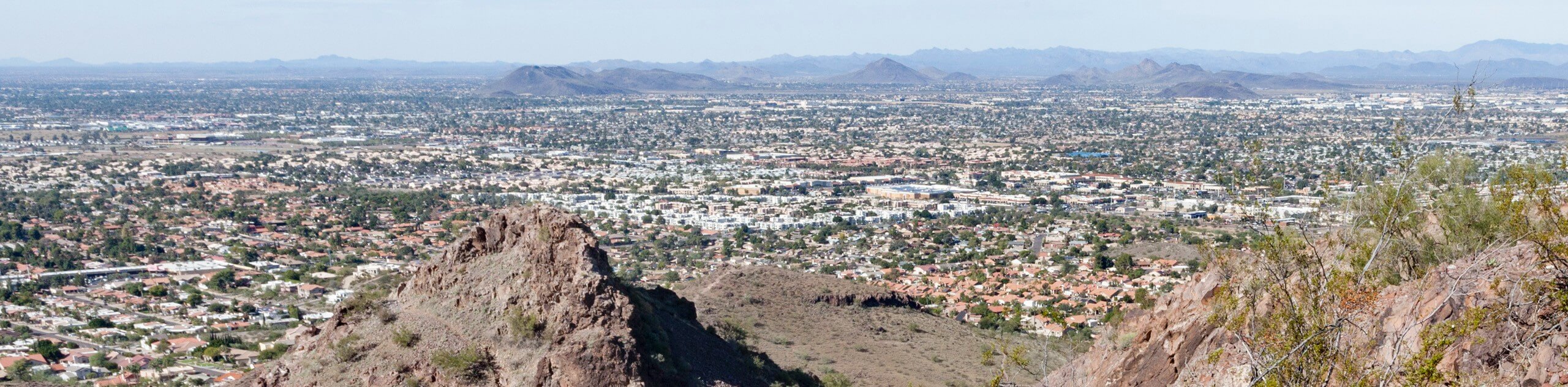
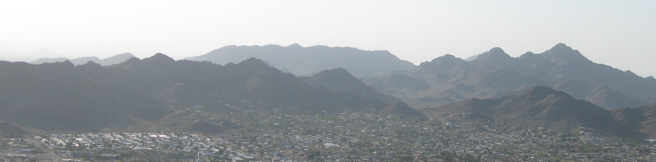
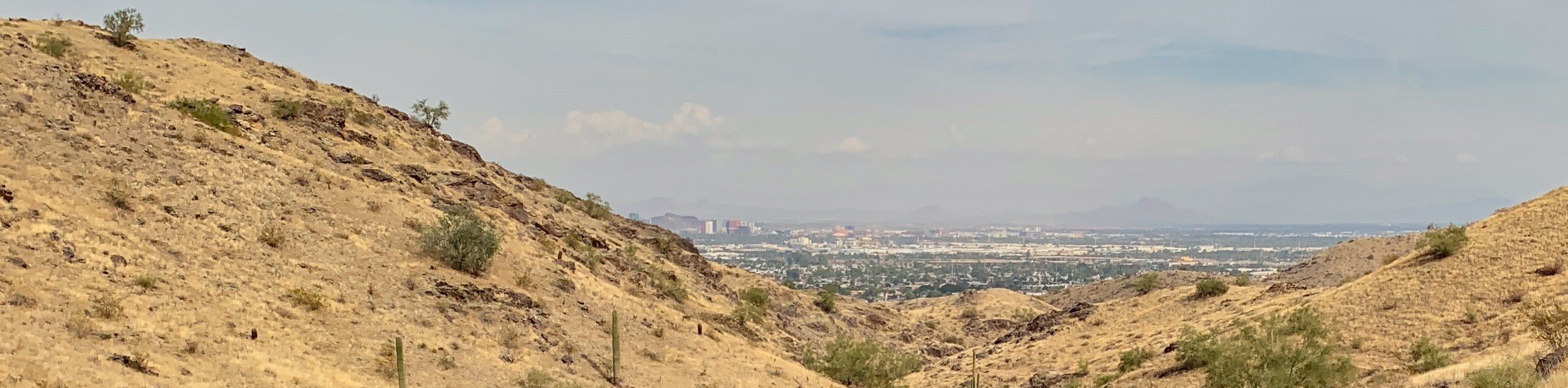
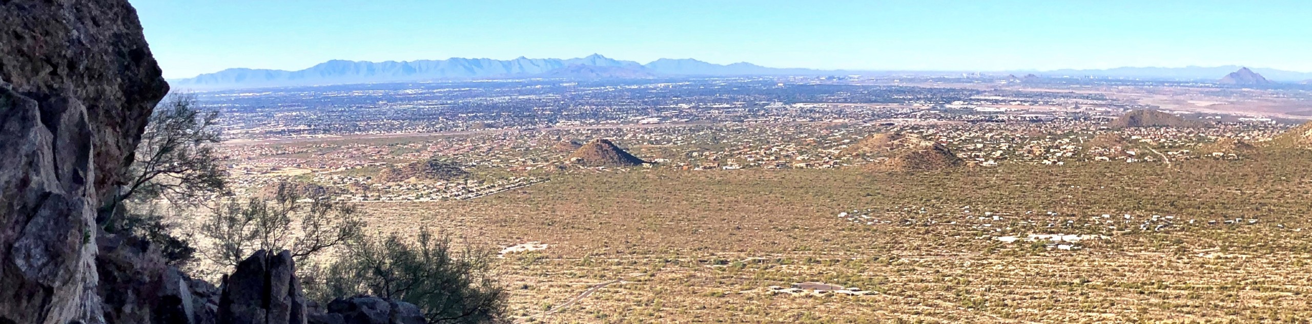
Camelback Mountain, named for its resemblance to a camel laying down, is the tallest mountain in the Phoenix area. Clearly visible from its dominating spot on the skyline, it beckons hikers with its sloping summit. Camelback Mountain offers excellent views of the city and the surrounding mountains since it’s the tallest mountain in the area. It’s a tough hike, but a rite of passage indeed!
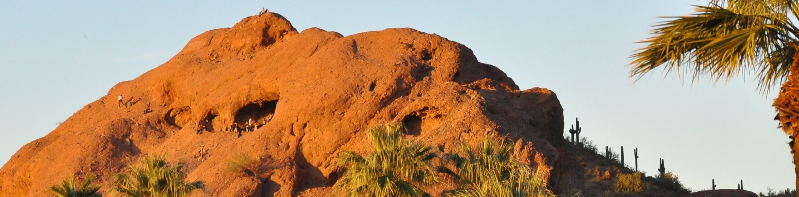
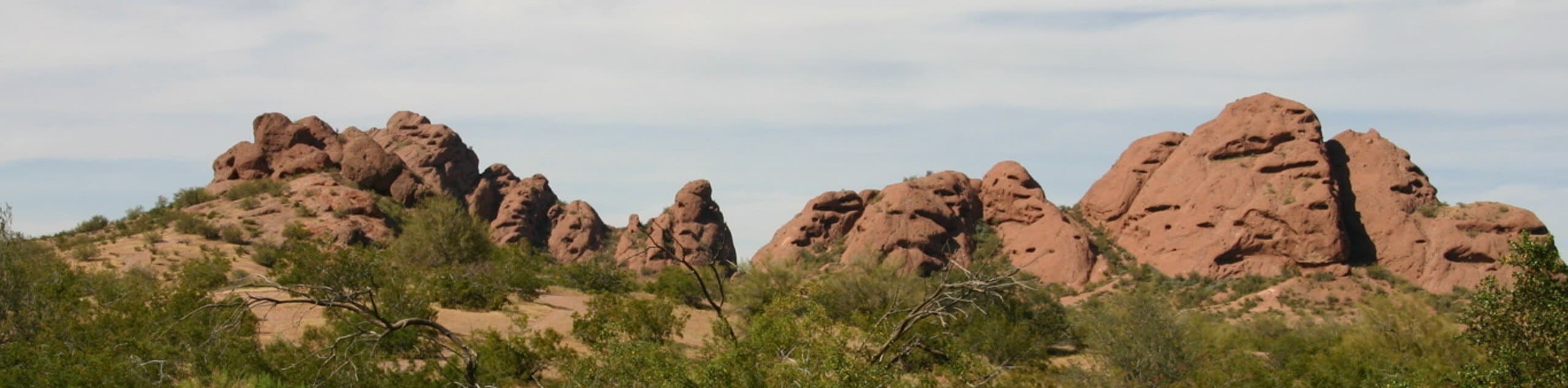
These days, Papago Park is a recreational and hiking area, a golf course, and an access point for the Phoenix Zoo and the Desert Botanical Gardens. In years past, it was a Native reservation, a fish hatchery in the Depression, a POW camp, and a VA hospital. It’s not only a historical part of the city, but a beautiful one, with big red hills eroded like Swiss cheese. There are caves to explore and views of the city to enjoy. This trail loops the golf course–fore!!
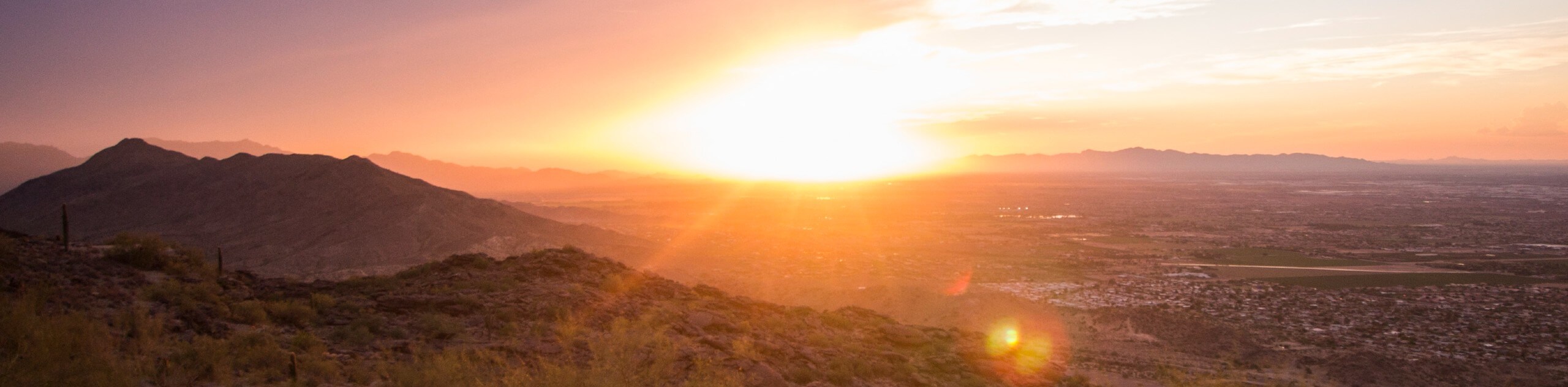
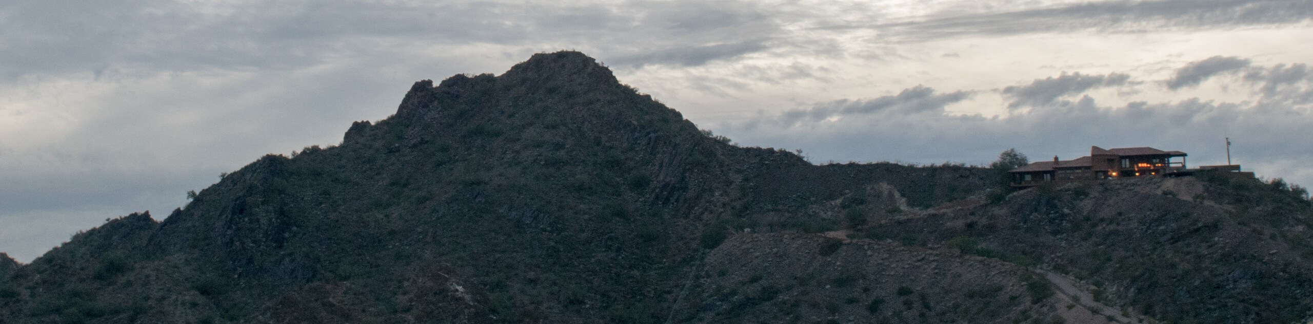
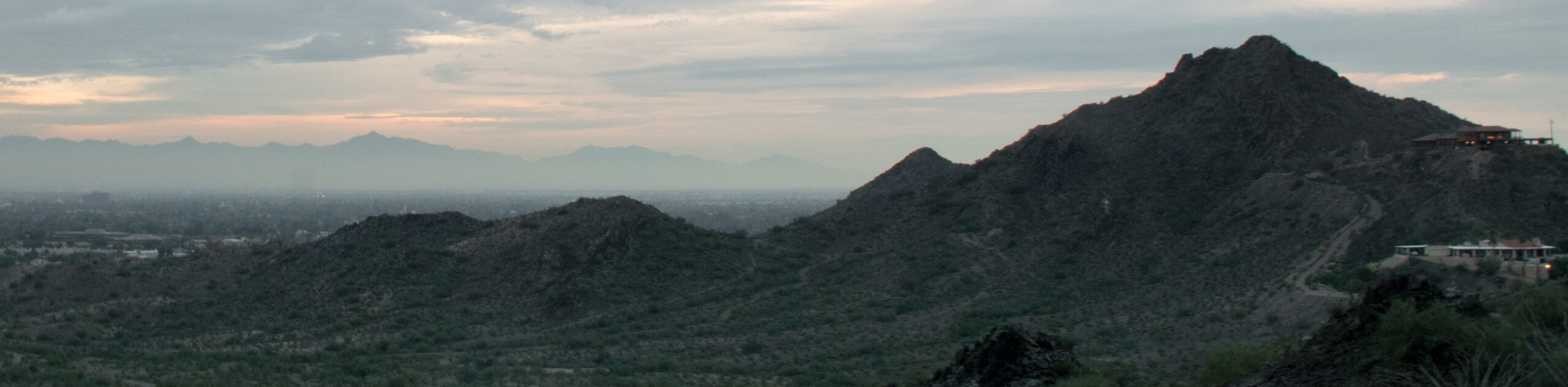
North Mountain rises above the Phoenix area, offering a gorgeous summit with expansive views of the city and the Phoenix Mountain Preserve to the southwest. The views are really special at sunset when the mountains over the city are silhouetted in orange and yellow. This hike is fairly short, and most of the trail is actually paved, but it’s still steep enough to feel like a workout.
Piestewa Peak is one of the defining mountains of Phoenix’s skyline, rising 2608ft to claim the title of the second-tallest mountain in the city. Part of the Phoenix Mountain Preserve, the hiking trails on this mountain provide locals and visitors with the chance to challenge themselves in exchange for incredible views of the city and the mountains that surround it. This trail both reaches the summit and loops around the base of the mountain.
Lookout Mountain is an isolated peak in the Phoenix Mountain Preserve. The mountain offers an excellent view of the other peaks of the preserve, which are just south of it, and the city and its suburbs sprawling in all directions. The hike to the top of Lookout Mountain is a short one, but it’s no-nonsense, requiring a bit of light scrambling over rocky sections. It’s a good pick for beginners who want to try out a more adventurous trail that’s still forgiving.
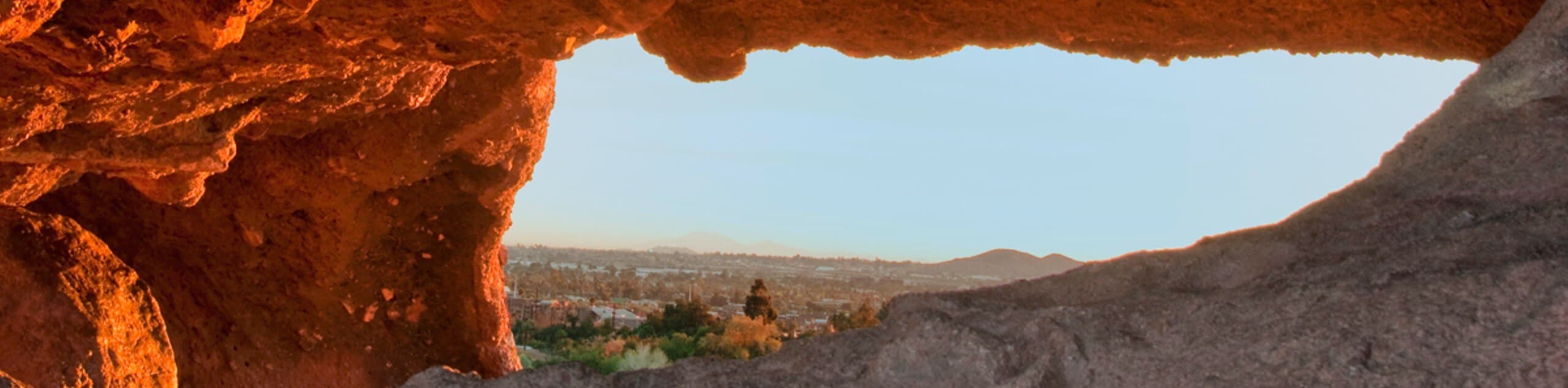
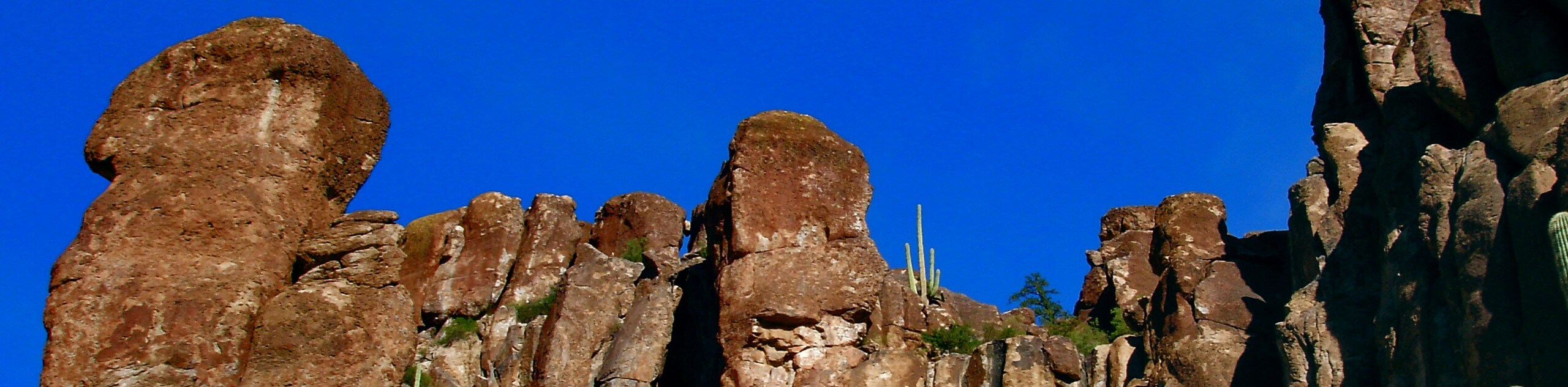
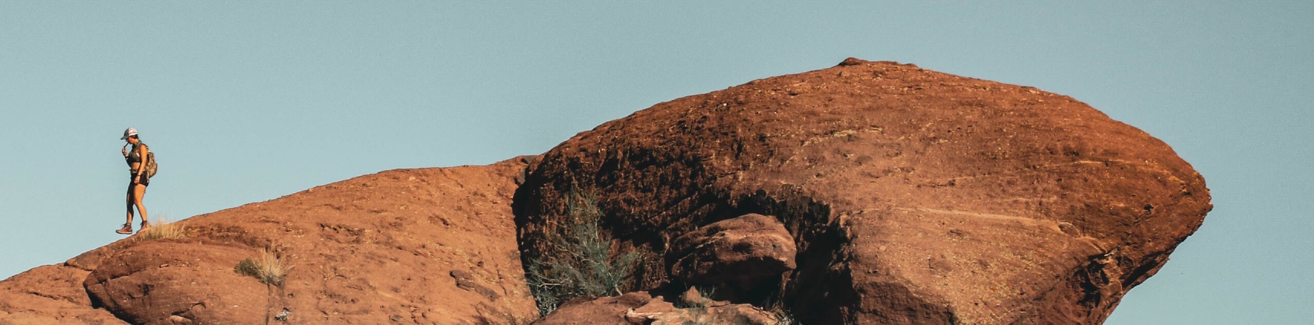
The Hole in the Rock in Papago Park is one of the city’s most popular hiking trails. This short, simple Phoenix hike leads you up a red sandstone butte with a hole in it large enough to sit in. This hole is one of several in this very unique landscape, where erosion in the sandstone creates a spongelike appearance on the rocks.
The hike to Dobbins Lookout is an awesome adventure. It’s just hard enough to challenge more experienced hikers, but it’s still accessible for strong beginners thanks to its non-rocky path (relative to the usual in Phoenix) and lack of technicality. The view from the lookout is a treat, and it won’t take too long to reach it. You can also check out petroglyphs on this amazing Phoenix hike.
Mormon Trail is one of the main routes in South Mountain Park. This busy trail can be used to reach Acer Summit, or it can be used to create loop hikes with the several intersecting routes along the way. The trail isn’t technical, but it offers unique rocky desert terrain flanked by saguaros. Look for petroglyphs on the sides of this trail.
The Deem Hills Recreation Area is a fabulous park serving residents of North Phoenix. The park boasts playgrounds, a dog park, ramadas, and picnic areas. It’s a perfect place to relax on a warm afternoon. The hiking trails in this park are great, especially the Circumference Trail to Ridgeline Loop. This route climbs to the highest point in the park. While it’s not that high in the mountain world, the views are excellent.
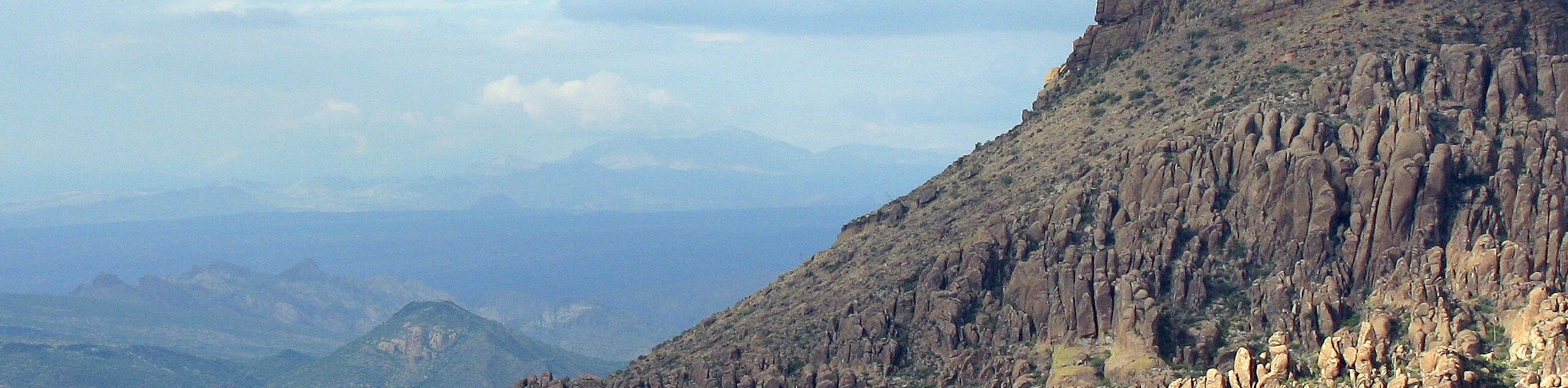
Aravaipa Canyon Trail is a unique route that travels along the floor of a gorgeous cliff-bound gorge southeast of Phoenix. This hike passes through a wide, wooded area into the gorge, the rocks changing from volcanic to conglomerate. There are cacti, trees, and wildlife to see along the way. This is a special trail that usually feels quite secluded.
The Brown’s Ranch Perimeter Loop is a fantastic adventure through the McDowell Sonoran Preserve. This loop makes use of several different trails over 14.0mi. You can see Balanced Rock and the Amphitheater on this hike. The saguaros, the mountains, and the rock formations make for great scenery, and the trail’s packed sand/gravelly footing is easy to cruise over.
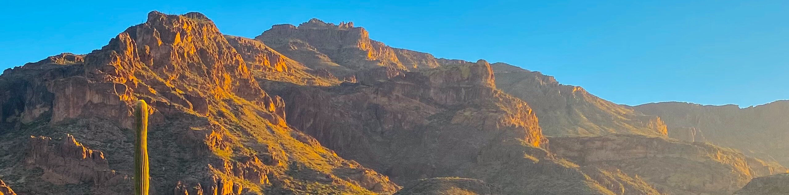
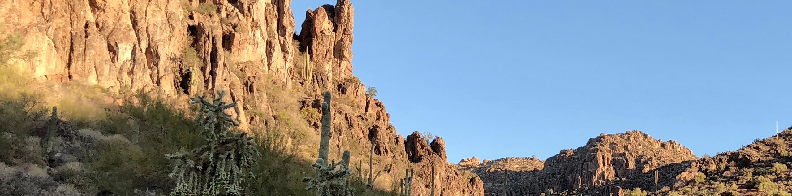
The Hieroglyphic Trail is a fascinating hike that leads you up towards the base of the mighty Superstition Mountains into a canyon where petroglyphs decorate the basalt boulders and walls. These images were left here over 1,500 years ago when the Hohokam tribe lived in this area. Along with the petroglyphs, this hike shows off the towering Superstition Mountains above you and the Gold Canyon and Gila River Plain below. In the spring, it’s lined by wildflowers.
The hike to Bluff Springs and Cave via Peralta Trail is a bit of an under-appreciated gem. This hike in the Superstition Wilderness doesn’t have the hype surrounding it that other trails do, but users consistently rate it high and appreciate it for its beautiful views. This route shows off a gorgeous slice of the desert mountains, dotted with saguaros and fascinating rock formations sculpted by erosion.
The hike to Canyon Lake Marina via Peralta Trail is an ideal adventure for backpackers seeking a two day and one night trip. Beginning from the Peralta Trailhead at the far southern border of the Tonto National Forest near Phoenix, this hike traverses the rugged, gorgeous desert mountains to the lake, tucked away in the hills.
This hike is a very easy adventure that anyone of any age can enjoy. The Papago Park Butte Loop wraps around two buttes, which look like something out of an aquarium with their Swiss cheese hotels and smooth exterior. The trail is clear, easy to follow, and lined with unique desert plants and cacti.
Pinnacle Peak Trail is a great hike that’s enjoyed by hikers, runners, and climbers bound for the climbing routes on Pinnacle Peak. This route might deceive you a bit with its name–it’s not as hard as it sounds. You won’t be climbing up a peak, but you will be enjoying Pinnacle Peak and the summit next to it as you hike. Being just south of the McDowell Sonoran Preserve, you can see the mountains in the preserve from this trail.
Tom's Thumb Trail is a hard hike in the McDowell Sonoran Preserve, one of the best natural areas near Scottsdale. This hike climbs up past East End Peak to a viewpoint over the McDowell Mountains and the city of Phoenix spread out below. The view is a treat and the hike is relatively short, so if you’re a fast hiker, the bang for your buck is definitely there.
Western Vista Trail via Dixie Mountain Loop is a moderate hike in the Union Hills area of Phoenix. This route is moderately difficult, and we’d consider it suitable for strong beginners and older children. The hike climbs up through the hills near the base of Dixie Mountain, ending atop the hill immediately to the west of Dixie. You’ll enjoy a great view of the low peaks and the city beside you.
Telegraph Pass Trail is a hike that’s easy to reach and very popular. This moderate trail is used by hikers, dog walkers, and joggers. It’s suitable for families, but with a great view of the city from the top, it’s rewarding for all levels. Some of the trail is on concrete footing, then you’ll hike over packed dirt, so you can check this one off your list in your sneakers.
Freedom Trail is the route that wraps around Piestewa Peak’s base in its entirety. It’s sometimes called the Circumference Trail in contrast to the trail to the summit, which is called Summit Trail. This trail is much easier than the trek to the summit, so it’s a good pick for hikers who don’t feel ready to climb the whole mountain but who still want to appreciate the scenery of this peak and this part of the Phoenix Mountain Preserve.
Scroll down to see the full list of hiking trails in Phoenix.
When is the Best Time to Hike in Phoenix
To state the obvious, it gets extremely hot in Phoenix. The summer months (May through September) aren’t just unpleasant to hike in, they’re downright dangerous due to the risk of dehydration and heatstroke. Temperatures frequently exceed 110°F (41°C), making it generally unsafe to be wandering out on the trails.
Keep in mind that Arizona experiences summer monsoons, which are heavy, brief rainstorms that can bring lightning and flash flooding. Monsoons tend to come in the afternoons, so if you plan to hike in the summer despite the heat, getting an early start is even more important.
Spring and fall are somewhat milder, but you can still easily expect daytime temperatures to hover between 77°C to 86°F (25°C to 30°C) in March, April, October, and November. Should you be hiking in these months, make sure you bring lots of water, turn back when your water is halfway done, and wear sun protection. Begin your hike early in the morning or early in the evening to avoid the heat of the day.
Winter is the best time to hike in Phoenix. In January, February, and December, temperatures rise to a much more manageable 68°C to 71°F (20°C to 22°C) daytime high. While hotter days can still occur, you’re at a much lower risk of heat-related issues on the trail in the winter.
Other Outdoor Activities in Phoenix
While the trails are excellent, hiking is certainly not the only way to explore Phoenix! This region boasts plenty of space for other outdoor activities.
Adventurers on two wheels can take advantage of the many mountain bike trails. Those with four-legged friends can explore horse and dog-friendly trails. Campers can set up their tents in sites near the city, and birders and animal lovers will be spoiled with the fascinating variety of species that call the desert home.
How to Plan a Trip to Phoenix
Planning a trip to Phoenix is pleasantly less high-pressure than planning trips to some of Arizona’s other outdoor destinations. You won’t find long lines of cars vying for trailhead parking here, nor will you be strapped for places to stay.
Phoenix has a good selection of accommodation options, from hotels in each corner of the city to short and long-term vacation rentals. Renting a car will make getting around the city as easy as possible, especially since Phoenix lacks a well-developed transit system. Trailhead parking is normally easy to find, save for the busiest weekends.
Some of the parks and recreation areas near Phoenix charge modest day-use fees, but most of the routes are free to hike.
Arizona Adventure Tours
Some of us love trip planning and some of us just… don’t. Take the stress out of your trip with an expert-planned adventure tour, letting you let go and focus on the fun stuff. Check out some incredible adventure tours in Arizona.
Frequently Asked Questions About Phoenix
What is Phoenix known for?
The Desert Botanical Gardens, hot air balloons, Papago Park, Chase Field, sports games, golfing, and vacationers.
Why is Phoenix so popular?
Phoenix balances an affordable cost of living, job opportunities, and recreation in a way that makes it very attractive to many.
What is the population of Phoenix?
As of 2021, the population of Phoenix was approaching 1.7 million.
Does it get really hot in Phoenix?
Yes, extremely hot. The summers in Phoenix are some of the hottest in any major city in the United States.
Explore other great hiking regions in the United States
Or check out our full range of tour destinations in the United States.
Read MoreThe best hikes in Phoenix

01. Camelback Mountain via Echo Canyon and Cholla Trail
Difficulty
Camelback Mountain is Phoenix’s most dominant peak, begging to be climbed as it rises above… Read More

02. Papago Park Golf Course Loop
Difficulty
Papago Park is a popular recreation area just minutes from downtown Phoenix, and the adjacent… Read More

03. North Mountain National Trail
Difficulty
North Mountain Trail leads you to the top of 2060ft North Mountain in… Read More

04. Piestewa Peak and Freedom Loop Hike
Difficulty
Piestewa Peak is the second-tallest mountain in Phoenix after Camelback. From the top of this… Read More
05. Lookout Mountain Summit Trail
Difficulty
Lookout Mountain is an isolated peak in the Phoenix Mountain Preserve, located north of the… Read More
06. Hole in the Rock Trail
Difficulty
The Hole in the Rock is one of the most popular hikes in Phoenix, especially… Read More

07. Piestewa Peak Summit Trail
Difficulty
Piestewa Peak is the second-tallest mountain in Phoenix after Camelback Mountain. From the top of… Read More
08. Dobbins Lookout via Holbert Trail
Difficulty
Dobbins Lookout via Holbert Trail is a 4.0mi hike on South Mountain in… Read More

09. Acer Summit via Mormon Trail
Difficulty
Acer Summit via Mormon Trail is a 2.4mi hike on South Mountain in… Read More

10. Circumference Trail to Ridgeline Loop
Difficulty
The Circumference Trail to Ridgeline Loop is a 3.8mi hike in the Deem… Read More
Yes, there are more than 10
Phoenix is so beautiful that we can not give you only 10 hikes. So here is a list of bonus hikes in Phoenix that you should take a look at as well
11. Aravaipa Canyon Trail
Difficulty
The Aravaipa Canyon Trail is a 9.5mi hike in the Aravaipa Canyon Wilderness… Read More
12. Brown's Ranch Perimeter Loop
Difficulty
The Brown's Ranch Perimeter Loop travels through the McDowell Sonoran Preserve, looping around Granite Mountain… Read More
13. Upper Ranch and Brown's Ranch Road Trail
Difficulty
The Upper Ranch and Brown's Ranch Road Trail travels through the McDowell Sonoran Preserve, looping… Read More
14. Hieroglyphic Trail
Difficulty
The Hieroglyphic Trail is a 2.8mi hike at the base of Arizona’s Superstition… Read More
15. Bluff Springs and Cave via Peralta Trail
Difficulty
Bluff Springs and Cave via Peralta Trail is an adventurous 5.3mi loop hike… Read More
16. Canyon Lake Marina via Peralta Trail
Difficulty
Canyon Lake Marina via Peralta Trail is a point-to-point hike that begins in the far… Read More

17. Papago Park Butte Loop
Difficulty
Papago Park is a popular recreation area just minutes from downtown Phoenix. The park was… Read More
18. Pinnacle Peak Trail
Difficulty
Pinnacle Peak Trail might be a little bit of a misnomer, but bear with us.… Read More

19. Camelback Mountain Hike
Difficulty
Camelback Mountain is Phoenix’s most dominant peak, instantly recognizable on the city’s skyline, resembling a… Read More

20. Tom's Thumb Trail
Difficulty
Tom's Thumb Trail is a fabulous 4.0mi out and back hike in the… Read More
21. Tom's Thumb Trail to Lookout
Difficulty
Tom's Thumb Trail to Lookout is a beautiful 5.0mi out and back hike… Read More

22. Western Vista Trail via Dixie Mountain Loop
Difficulty
Western Vista Trail via Dixie Mountain Loop is a 3.8mi out and back… Read More

23. Telegraph Pass Trail
Difficulty
Telegraph Pass Trail is a 2.2mi hike in Phoenix’s South Mountain Preserve that… Read More

24. Dreamy Draw to Piestewa Peak
Difficulty
Dreamy Draw to Piestewa Peak is a hard 6.0mi hike in the Phoenix… Read More
25. Apache Wash Loop Trail
Difficulty
Apache Wash Loop Trail is an easy 2.8mi hike north of Phoenix, Arizona.… Read More

26. Apache Wash Trail
Difficulty
The Apache Wash Trail is an easy 6.5mi hike north of Phoenix, Arizona.… Read More

27. Shaw Butte Trail
Difficulty
The Shaw Butte Trail is a heavily trafficked out and back trail in the Phoenix… Read More

28. Shaw Butte Loop
Difficulty
The Shaw Butte Loop is a heavily trafficked loop trail in Phoenix Mountain Preserve. This… Read More

29. Trail 101 to North Mountain National Trail
Difficulty
This hiking route guide leads you up North Mountain on Trail 101 and North Mountain… Read More

30. Dixie Mountain Two Summit Loop
Difficulty
The Dixie Mountain Two Summit Loop is a mi moderate hike in Phoenix’s… Read More

31. Dixie Mountain Loop
Difficulty
The Dixie Mountain Loop is a 4.6mi moderate hike in Phoenix’s Sonoran Desert… Read More
32. North Mountain Trail
Difficulty
North Mountain Trail leads you to the top of 2060ft North Mountain in… Read More

33. Quartz Ridge Trail
Difficulty
The Quartz Ridge Trail traverses a scenic ridge in the Phoenix Mountain Preserve, showing off… Read More
34. Quartz Ridge and LV Yates Loop
Difficulty
The Quartz Ridge and LV Yates Loop travels over Quartz Ridge and through a canyon… Read More

35. Holbert Trail
Difficulty
The Holbert Trail is an awesome hike in Phoenix’s South Mountain Preserve. This trail boasts… Read More
36. Freedom Trail
Difficulty
The Freedom Trail encircles the entire base of Piestewa Peak. This route is 3.6mi Read More
37. Phoenix Mountain Preserve Loop
Difficulty
This loop hike leads you through an easier, flatter section of the Phoenix Mountain Preserve.… Read More

38. Geronimo Trail
Difficulty
Geronimo Trail is a 4.8mi trail in Phoenix’s South Mountain Preserve. This hike… Read More

39. Telegraph Pass to Pyramid Trail
Difficulty
Telegraph Pass to Pyramid Trail is a point-to-point hike in Phoenix’s South Mountain Preserve. This… Read More

40. Pyramid Trail
Difficulty
Pyramid Trail is a hike in Phoenix’s South Mountain Preserve. This 6-mile out and back… Read More

41. Mormon Trail to National Trail Circuit
Difficulty
This hike uses two main trails in Phoenix’s South Mountain Preserve, the Mormon Trail and… Read More
42. Javelina Canyon and Ridgeline Loop
Difficulty
The Javelina Canyon and Ridgeline Loop makes use of two popular trails in the South… Read More

43. North Mountain Park East Loop
Difficulty
The North Mountain Park East Loop is an easy, relaxing loop hike through a small… Read More

44. Pima Wash Trail to West Loop
Difficulty
The Pima Wash Trail to West Loop is a laid-back trail in Phoenix’s South Mountain… Read More

45. Midlife Crisis and National Loop
Difficulty
This hike uses two main trails in Phoenix’s South Mountain Preserve, the National Trail and… Read More
46. Big Butte Loop
Difficulty
Papago Park is a popular recreation area just minutes from downtown Phoenix. The park was… Read More
47. Voaz Loop
Difficulty
The Voaz Loop is a hike in Phoenix Mountain Preserve that offers gorgeous Sonoran Desert… Read More
48. 304 and Voaz Loop
Difficulty
The 304 and Voaz Loop is a hike in Phoenix Mountain Preserve that offers fantastic… Read More

49. Lookout Mountain via Trail 308
Difficulty
This route guide follows Trail 308 to the top of Lookout Mountain, a 2027ft Read More

50. Piestewa Nature Trail and 304 Loop
Difficulty
The Piestewa Nature Trail and 304 Loop is a hike in Phoenix Mountain Preserve that… Read More

51. Trail 308 Loop
Difficulty
This trail is a moderate, short hike in the Phoenix Mountain Preserve near Lookout Mountain.… Read More

52. Charles M. Christiansen Trail
Difficulty
The Charles M. Christiansen Trail is a moderately difficult route in the Phoenix Mountain Preserve… Read More

53. Pima East Loop
Difficulty
The Pima East Loop is an easy hike in Phoenix’s South Mountain Preserve. While this… Read More

54. Dixie Peak Trail
Difficulty
Dixie Peak Trail is a hike in the Phoenix Mountain Preserve that offers great views… Read More

55. National to Hidden Valley to Mormon Loop
Difficulty
This hike uses some of the main trails in Phoenix’s South Mountain Preserve, the Mormon… Read More

56. Hawk's Nest and Dixie Mountain Loop
Difficulty
The Hawk's Nest and Dixie Mountain Loop is a 5.6mi moderate hike in… Read More
57. Shaw Butte and Charles M. Christiansen Loop
Difficulty
The Shaw Butte and Charles M. Christiansen Loop is a heavily trafficked trail in the… Read More

58. Marcos de Niza and Pima Loop
Difficulty
This hike in the South Mountain Preserve is short, but it packs in some good… Read More
59. Ruth Hamilton Trail
Difficulty
Ruth Hamilton Trail is a 3.1mi moderately difficult hike in the Phoenix Mountain… Read More

60. Shaw Butte via Shaw Butte Trailhead
Difficulty
Shaw Butte via Shaw Butte Trailhead is the most direct route to the top of… Read More

61. Warpaint Loop
Difficulty
This hike is an easy wander through the flat areas in front of the hills… Read More

62. Marcos de Niza Trail
Difficulty
The Marcos de Niza Trail is a 1.8mi out and back hike in… Read More

63. Phoenix Mountain Nature Trail 304
Difficulty
The Phoenix Mountain Nature Trail 304 is a 1.4mi easy hike in the… Read More

64. Desert Classic Trail
Difficulty
The Desert Classic Trail is an 8.8mi trail that stretches across the South… Read More

65. National Trail Out and Back Hike
Difficulty
The National Trail Out and Back hike leads you from the Pima Canyon Trailhead to… Read More

66. Shadow Mountain Trail
Difficulty
The Shadow Mountain Trail leads you around the portion of the Phoenix Mountain Preserve that… Read More
67. Bursera and Gila Trail Loop
Difficulty
The Bursera and Gila Trail Loop is a hike in a quieter corner of Phoenix’s… Read More
68. Beverly Canyon Loop
Difficulty
The Beverly Canyon Loop is a moderately difficult hike in Phoenix’s South Mountain Preserve. This… Read More

69. Beverly Canyon Trail
Difficulty
The Beverly Canyon Trail is a moderately difficult hike in Phoenix’s South Mountain Preserve. This… Read More

70. Phoenix Mountain Nature Loop
Difficulty
This hike explores an arm of the Phoenix Mountain Preserve near The Pointe. It’s an… Read More
71. Deems Hill Ridgeline
Difficulty
The Deems Hill Ridgeline hike is a 3.6mi lightly to moderately trafficked hike… Read More

72. Pima Wash and Beverly Canyon Loop
Difficulty
The Pima Wash and Beverly Canyon Loop is an easy hike in Phoenix’s South Mountain… Read More

73. Ridgeback Overlook Hike
Difficulty
The Ridgeback Overlook is a moderately trafficked, moderately difficult hike in Phoenix, Arizona. This hike… Read More
74. Sidewinder and Ocotillo Loop
Difficulty
The Sidewinder and Ocotillo Loop is a heavily trafficked 5.2mi loop hike in… Read More
75. Lost Ranch Ruins to Lost Ranch Mines Loop
Difficulty
The Lost Ranch Ruins to Lost Ranch Mines Loop is a heavily trafficked 4.9mi Read More

76. Kiwanis Trail to Las Lomitas Trail Loop
Difficulty
The Kiwanis Trail to Las Lomitas Trail Loop is a hike that explores the center… Read More

77. T-Bone Ridgeline Hike
Difficulty
The T-Bone Ridgeline Hike is a 2.1mi moderately difficult hike in the South… Read More

78. L.V. Yates Loop
Difficulty
The L.V. Yates Loop is an easy 2.8mi loop hike in the Phoenix… Read More

79. Pyramid Peak Loop
Difficulty
This trail is most often used by mountain bikers and dirt bikers, but hikers are… Read More

80. Bursera Trail
Difficulty
The Bursera Trail is a hike in Phoenix’s South Mountain Preserve. This route is 7.0mi Read More

81. Desert Tortoise Trail
Difficulty
The Desert Tortoise Trail is a pretty hike near Dixie Mountain in the Phoenix Sonoran… Read More

82. Perl Charles and Voaz Loop
Difficulty
The Perl Charles and Voaz Loop is a 4.3mi moderately difficult hike that… Read More

83. Perl Charles Memorial Trail
Difficulty
The Perl Charles Memorial Trail is one of the main routes in the Piestewa Peak… Read More

84. Corona de Loma Trail
Difficulty
The Corona de Loma Trail is a hike in Phoenix’s South Mountain Preserve. This route… Read More

85. Old Man Corona Loop
Difficulty
The Old Man Corona Loop is a hard hike in Phoenix’s South Mountain Preserve. This… Read More

86. Mohave Trail
Difficulty
The Mohave Trail is a moderate hike that leads up through the hills in the… Read More

87. Maxine Lakin Nature Trail
Difficulty
The Maxine Lakin Nature Trail is a moderate hike that leads up through the hills… Read More
88. Camelback Mountain via Cholla Trail
Difficulty
Camelback Mountain is Phoenix’s most dominant peak, named for its resemblance to a camel laying… Read More

89. Lost Dog Trail
Difficulty
This hike is a 4.2mi out and back adventure that leads you through… Read More

90. Lost Dog Wash to Ringtail Loop
Difficulty
The Lost Dog Wash and Ringtail Loop is a 4.4mi moderately difficult trail… Read More
91. Tom's Thumb via Gateway Trail
Difficulty
Tom’s Thumb via Gateway Trail is an alternative route to the top of Tom’s Thumb… Read More
92. Granite Mountain Loop
Difficulty
The Granite Mountain Loop does as it says, looping Granite Mountain in the McDowell Sonoran… Read More

93. Peralta Canyon Trail to Robber's Roost
Difficulty
This hike adds an extension onto the typical adventure through Peralta Canyon, taking you to… Read More
94. Papago Buttes Out and Back
Difficulty
If you’re visiting Papago Park, try this out and back hike to the park’s recognizable… Read More
95. Wind Cave Trail
Difficulty
The Wind Cave Trail is likely the most-hiked route in Usery Mountain Regional Park near… Read More
96. Lone Tree via Peralta Canyon Trail
Difficulty
This hike adds an extension onto the typical adventure through Peralta Canyon, taking you to… Read More
97. Weaver's Needle via Peralta Canyon Trail
Difficulty
This hike leads you to Weaver’s Needle, a giant column of stone perched above Peralta… Read More

98. Arrowhead Point and Cholla Loop
Difficulty
This hike follows two main trails to loop through the Thunderbird Conservation Park in the… Read More

99. Cholla Loop
Difficulty
The Cholla Loop is one of the three main trails in Phoenix’s Thunderbird Conservation Area,… Read More
100. Skull Mesa Trail
Difficulty
The Skull Mesa Trail is an 11.3mi hike in the Spur Cross Ranch… Read More

101. Superstition Peak 5057 via Hieroglyphic Trail
Difficulty
This hike leads you to the top of Peak 5057 in Arizona’s Superstition Mountains. You’ll… Read More

102. Union Peak Loop
Difficulty
The Union Peak Loop is an easy trail in the Phoenix Sonoran Desert Preserve that… Read More

103. Scarlett Canyon Hike
Difficulty
Scarlett Canyon is a route in Phoenix that shows off a small canyon in a… Read More

104. Alta Trail
Difficulty
The Alta Trail is a route in Phoenix’s South Mountain Preserve that climbs atop a… Read More

105. Alta and Bajada Loop
Difficulty
The Alta Trail and Bajada Trail Loop is a route in Phoenix’s South Mountain Preserve… Read More

106. Valle Verde Loop
Difficulty
This route is a loop hike in the Sonoran Desert Preserve that shows off Dixie… Read More

107. Ma-Ha-Tauk Trail
Difficulty
The Ma-Ha-Tauk Trail is a moderate hike in Phoenix’s South Mountain Preserve. This route doesn’t… Read More
108. Piestewa Peak Circumference Hike
Difficulty
The Piestewa Peak Circumference hike encircles the base of Piestewa Peak and the base of… Read More

109. Trail 306 via Trail 100
Difficulty
Trail 306 and Trail 100 lead you through the Phoenix Mountain Preserve near North Mountain.… Read More

110. Coach Whip Hike
Difficulty
The Coach Whip hike is a route in the Thunderbird Conservation Park in Glendale. The… Read More

111. Coach Whip Mini Loop
Difficulty
The Coach Whip Mini Loop is a short, easy hike in the Thunderbird Conservation Park… Read More

112. Ma-Ha-Tauk and Crosscut Loop
Difficulty
The Ma-Ha-Tauk and Crosscut Loop is a moderate hike in Phoenix’s South Mountain Preserve. With… Read More

113. Two Bit and Rattle Saddle Loop
Difficulty
The Two Bit and Rattle Saddle Trail is a moderately challenging hike in the Phoenix’s… Read More

114. Palisade to Basalt Loop
Difficulty
The Palisade to Basalt Loop is a short, easy trail in the Deem Hills Recreation… Read More
Are we missing your favourite hike?
Tell us! If you've got photos, a GPS track and know the hike, we'd love to share your favourite hike with the rest of the 10Adventures community.