
Shaw Butte Trail
View Photos
Shaw Butte Trail
Difficulty Rating:
The Shaw Butte Trail is a heavily trafficked out and back trail in the Phoenix Mountain Preserve that leads to the top of–you guessed it–Shaw Butte for a great view of the surrounding mountains and the city. The trail is moderately difficult and suitable for most skill levels. Dogs are welcome as long as they’re kept on leash and active families should have no problems completing this route.
Getting there
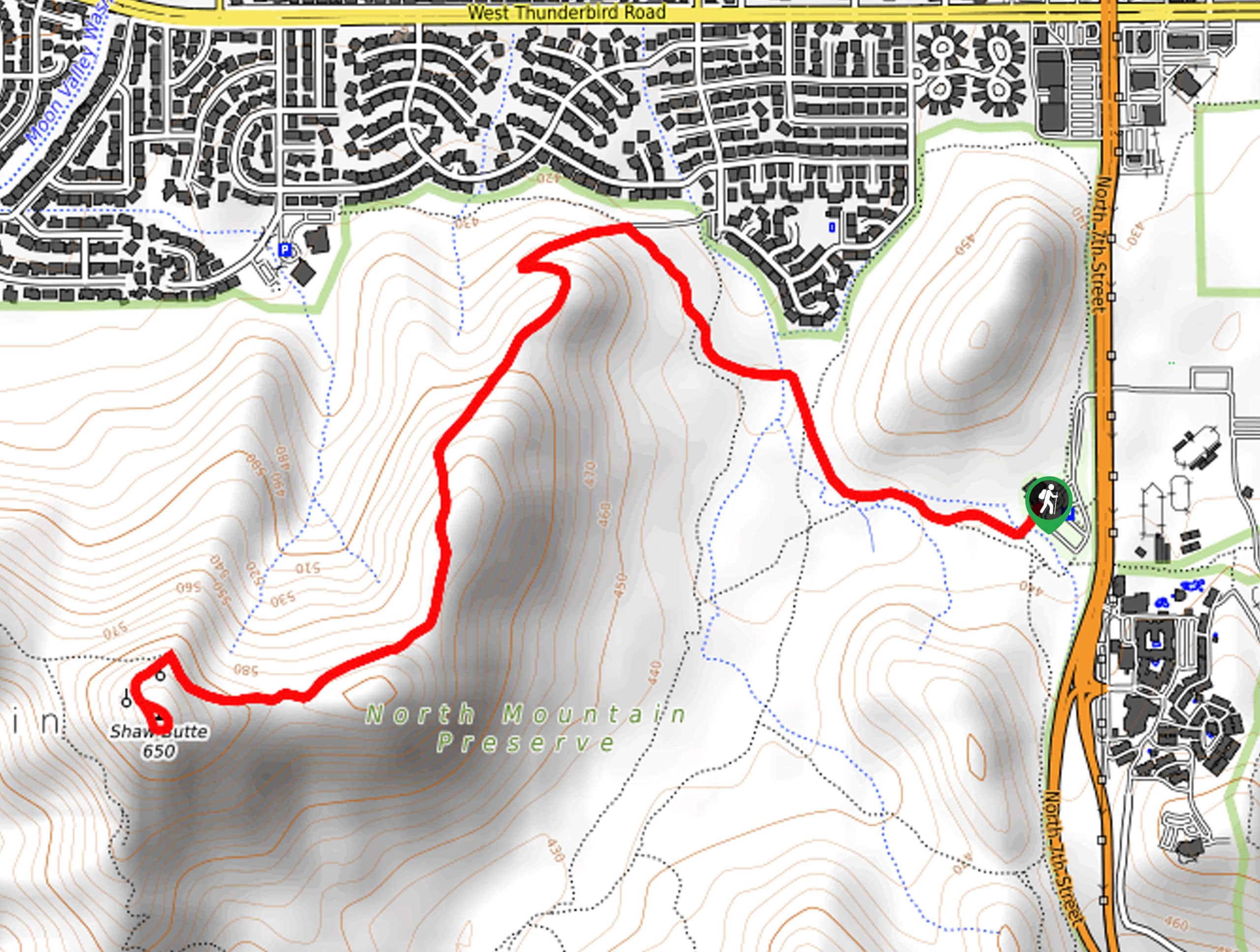
The trailhead for Shaw Butte Trail is near the North Mountain Visitor Center on Visitor Center Access Road.

About
| Backcountry Campground | No |
| When to do | October-May |
| Pets allowed | Yes - On Leash |
| Family friendly | Yes |
| Route Signage | Average |
| Crowd Levels | High |
| Route Type | Out and back |
Shaw Butte Trail
Elevation Graph
Weather
Shaw Butte Trail Description
Shaw Butte Trail is a route in the Phoenix Mountain Preserve that begins near the North Mountain Visitor Center and leads you up Shaw Butte for an excellent view of nearby North Mountain. This hike is moderately difficult, and it’s generally suitable for strong beginners and active families. This route is the best way to enjoy the view of North Mountain, and active hikers can even add on an ascent of North Mountain before calling it a day.
This hike is dog-friendly as long as furry friends are kept on leash. Remember to bring lots of water with you and consider wearing sun protection. Avoid hiking during the heat of the day if temperatures are forecast to be high.
From the trailhead next to the visitor center, follow the signage for Shaw Butte Trail. You’ll hike along a flat stretch of trail towards the butte, bearing left at the fork onto the trail that leads uphill. You’ll crest the ridge that leads to the top of the butte and follow it up to the summit. Look out at North Mountain to the southeast, then retrace your steps back to the trailhead.
Similar hikes to the Shaw Butte Trail hike

Palisade to Basalt Loop
The Palisade to Basalt Loop is a short, easy trail in the Deem Hills Recreation Area. This hike is 1.4mi

Two Bit and Rattle Saddle Loop
The Two Bit and Rattle Saddle Trail is a moderately challenging hike in the Phoenix’s Mountain Preserve near Piestewa Peak.…

Ma-Ha-Tauk and Crosscut Loop
The Ma-Ha-Tauk and Crosscut Loop is a moderate hike in Phoenix’s South Mountain Preserve. With pleasant views and not much…
Comments