Wind Cave Trail
View Photos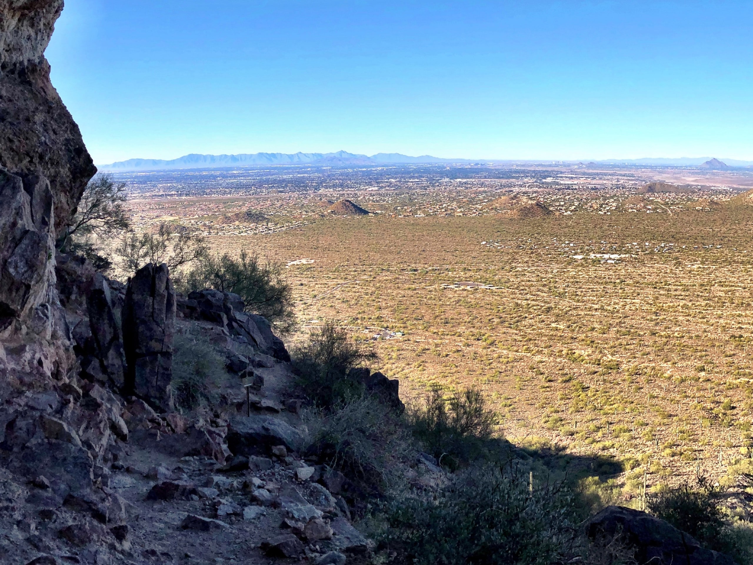
Wind Cave Trail
Difficulty Rating:
The Wind Cave Trail is likely the most-hiked route in Usery Mountain Regional Park near Phoenix. This route is 2.9mi long and rated as moderate. There are lots of natural stairs required to get into the cave that might make it too hard of a hike for small children or hikers with limited mobility, but otherwise, this route is easy enough for most users to complete.
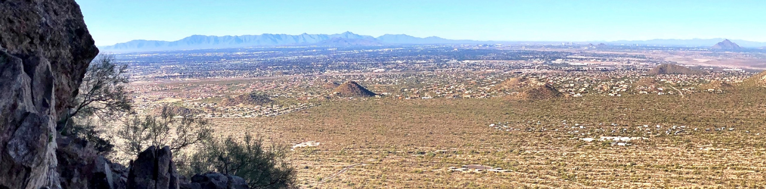
This route climbs up through the desert towards a cut-out in the mountain, more like half a subway tunnel than a cave, but nonetheless fun to explore, sit in, and admire the view from. With some pleasant shade and view of the Fountain Hills fountain, you could definitely spend a while up here. Expect heavy traffic on this very popular trail.
Getting there
The trailhead for the Wind Cave Trail is on N Wind Cave Drive.

About
| Backcountry Campground | No |
| When to do | October-May |
| Pets allowed | Yes - On Leash |
| Family friendly | Older Children only |
| Route Signage | Good |
| Crowd Levels | High |
| Route Type | Out and back |
Wind Cave Trail
Elevation Graph
Weather
Wind Cave Trail Description
The Wind Cave Trail is one of the most popular trails in Usery Mountain Regional Park. Actually, it might be the most popular trail in the park! Arizona is full of caves thanks to the effects of water and wind erosion. This cave is perched on the side of one of the arms of Pass Mountain, and its vantage point over the desert below is what makes it so popular.
With some shade from the sun, lots of room to sit, and a view like this one, it’s pretty clear why this hike sees as much traffic as it does. It’s also generally easy enough for most skill levels. Expect a lot of natural stairs to climb, but no technical challenges.
As with all hikes in the Sonoran Desert, you need to come prepared to hike this route. Bring lots of water, preferably more than you think you need. Wear sun protection like a hat and sunscreen. Time your hike outside of the heat of the day and try to hike in the cooler winter months if you have the choice. There’s no water on this trail and no shade until you get up to the cave.
The route begins nice and flat, departing from the trailhead through a saguaro-dotted desert. There are no junctions on this hike, so as long as you follow the established trail, you can put your navigation aside and just enjoy the view.
Continue hiking towards the mountain ahead, taking a moment to admire the plant life near the trail. There are quite a few wildflowers out here in the blooming season and the saguaros are plentiful.
You’ll come up on rocky stretches at times, but most of the footing is easy to navigate. As the grade increases, you’ll begin climbing rock stairs. The stairs aren’t super even, so watch your step.
Make your way through a long collection of switchbacks. After the final turn, you’ll traverse to your right across the mountain face towards the cave. There are a few final stairs to help you into the cave and, voila! You made it!
Take in the expansive view. If you managed to time your hike just right, you’ll be here for the sunset, which is an absolute treat. Admire the desert below, explore the cave (which is quite large), snap photos, and then prepare for the return trip.
To get back to the trailhead, simply retrace your steps on the same route.
Hiking Route Highlights
Wind Cave
The highlight of this hike is its namesake, the Wind Cave. There are countless caves in the desert mountains of Arizona, whittled out of the sandstone and other layers by the gradual effects of water and wind. This cave is a bit more oblong than most, but that lends to its popularity as it offers plenty of room to sit in. The Wind Cave is in Pass Mountain in the Usery Mountain Regional Park. It’s become one of the most popular hiking destinations in this part of Arizona.
Frequently Asked Questions
What mountain is Wind Cave on?
The Wind Cave is on Pass Mountain.
Is Wind Cave Trail hard?
We consider this hike to be moderately hard. The elevation gain required isn’t beginner-friendly, but you don’t have to be an experienced hiker to complete the route.
Insider Hints
Poles could be helpful if you have knee problems.
Try to make it to the cave for sunset if you can!
Similar hikes to the Wind Cave Trail hike

Palisade to Basalt Loop
The Palisade to Basalt Loop is a short, easy trail in the Deem Hills Recreation Area. This hike is 1.4mi

Two Bit and Rattle Saddle Loop
The Two Bit and Rattle Saddle Trail is a moderately challenging hike in the Phoenix’s Mountain Preserve near Piestewa Peak.…

Ma-Ha-Tauk and Crosscut Loop
The Ma-Ha-Tauk and Crosscut Loop is a moderate hike in Phoenix’s South Mountain Preserve. With pleasant views and not much…
Comments