
Arrowhead Point and Cholla Loop
View Photos
Arrowhead Point and Cholla Loop
Difficulty Rating:
This hike follows two main trails to loop through the Thunderbird Conservation Park in the far northern reaches of the Phoenix metro area. You’ll enjoy a sightline over the city that’s better than what you might expect from this little park. The hike is moderately difficult and should take less than 3 hours for most users to complete. Expect moderate traffic.
Getting there
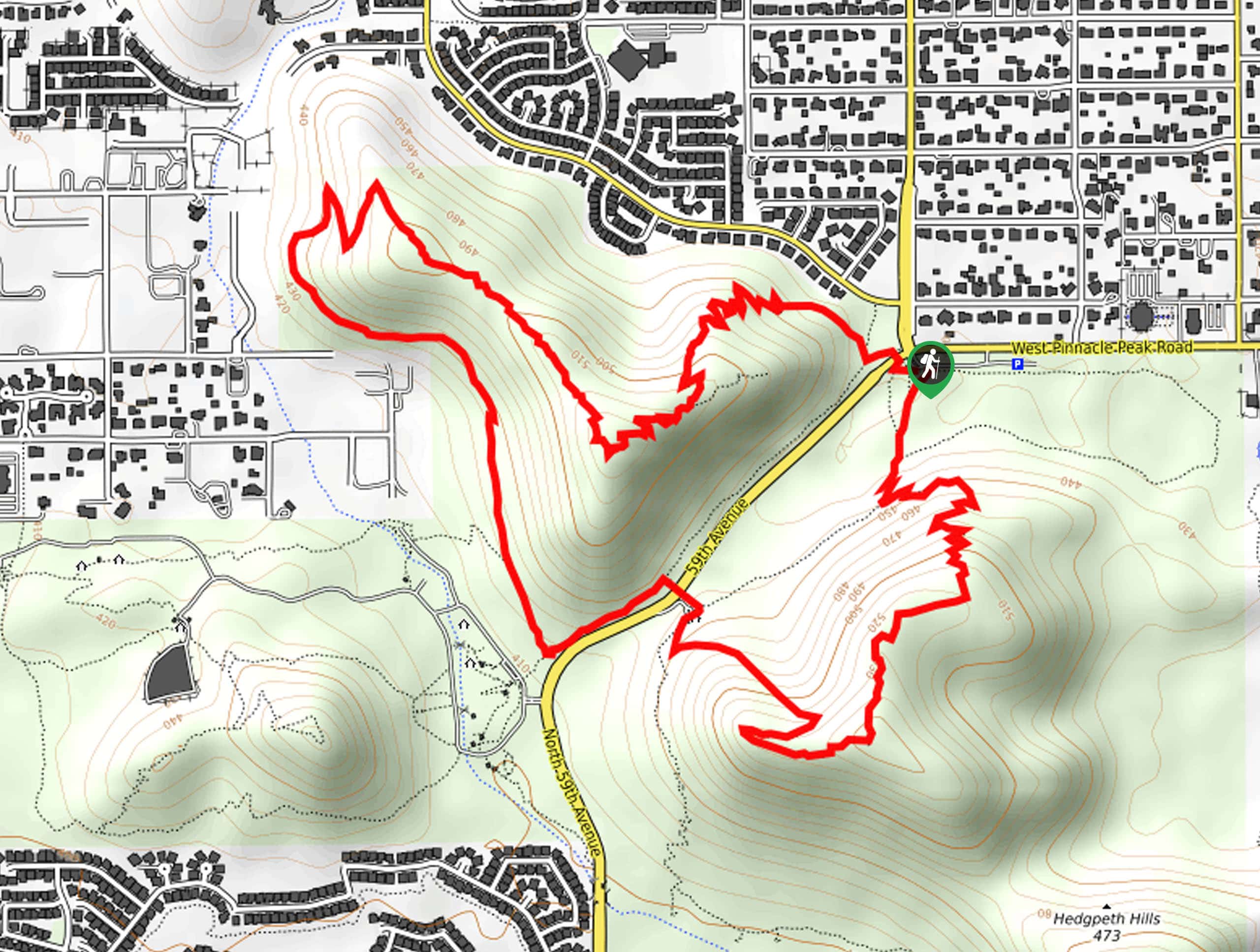
The trailhead for this hike is off W Pinnacle Peak Road.

About
| Backcountry Campground | No |
| When to do | October-May |
| Pets allowed | Yes - On Leash |
| Family friendly | Yes |
| Route Signage | Average |
| Crowd Levels | Moderate |
| Route Type | Loop |
Arrowhead Point and Cholla Loop
Elevation Graph
Weather
Arrowhead Point and Cholla Loop Description
This hike uses two trails in Thunderbird Conservation Park to make a loop that climbs two hills. This hike might look somewhat unassuming but the view from the top of the trail is actually quite lovely, making this a fun one for weekend mornings when you want a short hike with a solid reward. Try this hike during sunset if you can!
This route might be challenging for total beginners, little kids, and hikers with mobility challenges. Make sure you bring water with you and avoid hiking during the hottest part of the day. Expect well-maintained trails.
From the trailhead, take H1 Trail to H3 Trail, which switchbacks up the ridge. Follow the ridge down the other side, continue along the base of the hill, and then bear left at the road. Take a right to get onto H2 Trail and climb up the other hill. Once again, follow the trail across the ridge and back down the other side, where you’ll arrive back at the trailhead.
Similar hikes to the Arrowhead Point and Cholla Loop hike

Palisade to Basalt Loop
The Palisade to Basalt Loop is a short, easy trail in the Deem Hills Recreation Area. This hike is 1.4mi

Two Bit and Rattle Saddle Loop
The Two Bit and Rattle Saddle Trail is a moderately challenging hike in the Phoenix’s Mountain Preserve near Piestewa Peak.…

Ma-Ha-Tauk and Crosscut Loop
The Ma-Ha-Tauk and Crosscut Loop is a moderate hike in Phoenix’s South Mountain Preserve. With pleasant views and not much…
Comments