
Lost Dog Trail
View Photos
Lost Dog Trail
Difficulty Rating:
This hike is a 4.2mi out and back adventure that leads you through the scenic Sonoran Desert near Scottsdale. Enjoy an area filled with unique desert plants, making this a great hike to pick if it’s rained recently or it’s blooming season. The hike is rated as moderate but it leans to the easy side of moderate, so all ages and skill levels should be able to enjoy it. Expect heavy traffic on this trail.
Getting there
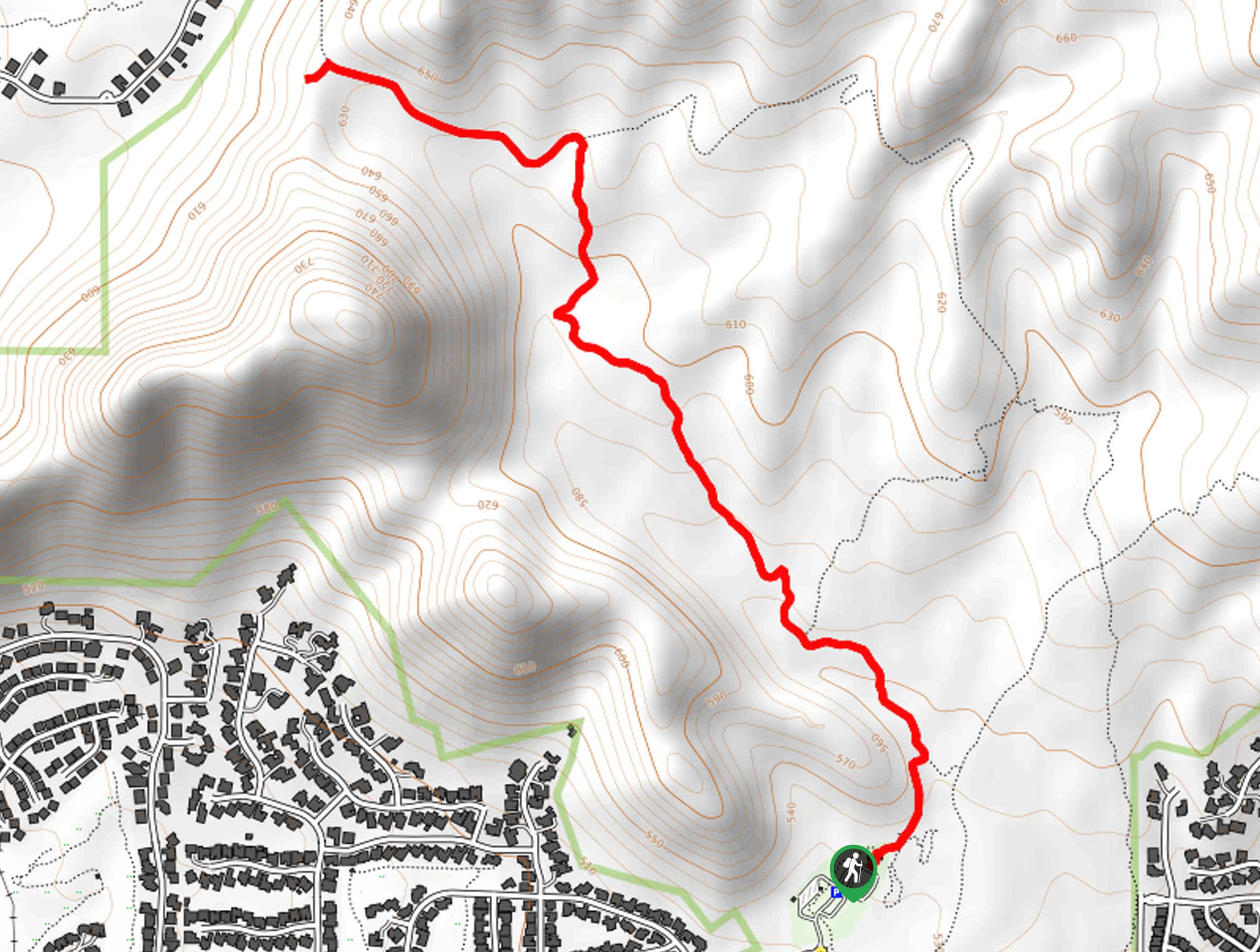
The trailhead for this hike is at the end of N 124th Street.

About
| Backcountry Campground | No |
| When to do | October-May |
| Pets allowed | Yes - On Leash |
| Family friendly | Yes |
| Route Signage | Average |
| Crowd Levels | High |
| Route Type | Out and back |
Lost Dog Trail
Elevation Graph
Weather
Lost Dog Trail Description
The Lost Dog Trail is a route in the McDowell Sonoran Preserve that travels through a particularly pretty part of the Sonoran Desert. The sides of the trail feature a wide range of desert plants and the views are great. The trail also boasts an approachable difficulty level. It does get busy, so try to visit during the week if you’re able to.
This route doesn’t offer any shade, so prepare for the weather with water, sun protection, and an early start time if possible.
From the end of the road, there is an old OHV trail that climbs up to the north, which you’ll follow. Half a mile in, the trail will turn west and cross several washes. You’ll follow the line of the ridge on your left. Hike to the T-junction in Lost Dog Wash and go left. The outbound hike ends at the next junction, from where you’ll turn around and retrace your steps.
Similar hikes to the Lost Dog Trail hike

Palisade to Basalt Loop
The Palisade to Basalt Loop is a short, easy trail in the Deem Hills Recreation Area. This hike is 1.4mi

Two Bit and Rattle Saddle Loop
The Two Bit and Rattle Saddle Trail is a moderately challenging hike in the Phoenix’s Mountain Preserve near Piestewa Peak.…

Ma-Ha-Tauk and Crosscut Loop
The Ma-Ha-Tauk and Crosscut Loop is a moderate hike in Phoenix’s South Mountain Preserve. With pleasant views and not much…
Comments