
Lost Dog Wash to Ringtail Loop
View Photos
Lost Dog Wash to Ringtail Loop
Difficulty Rating:
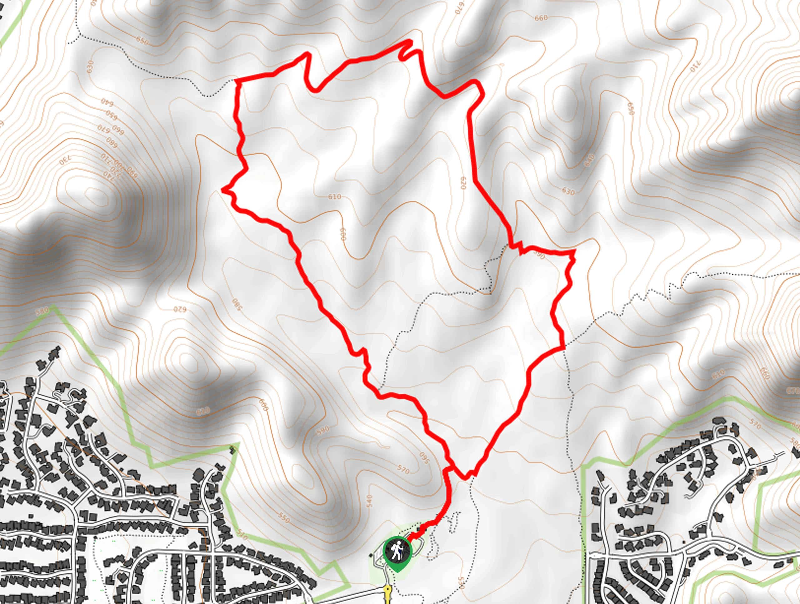
The Lost Dog Wash and Ringtail Loop is a 4.4mi moderately difficult trail in the McDowell Sonoran Preserve that is good for all skill levels. This hike really shows off the plants and wildlife of the desert on a trail that travels along a ridge adorned with most of the plant species this area is known for. If you can hike it after rain you’ll be especially impressed. Expect heavy traffic.
Getting there
The trailhead for Lost Dog Wash to Ringtail Loop is at the end of N 124th Street.

About
| Backcountry Campground | No |
| When to do | October-May |
| Pets allowed | Yes - On Leash |
| Family friendly | Yes |
| Route Signage | Average |
| Crowd Levels | High |
| Route Type | Loop |
Lost Dog Wash to Ringtail Loop
Elevation Graph
Weather
Lost Dog Wash to Ringtail Loop Description
The Lost Dog Wash to Ringtail Loop is a delightful hike after it rains or in the blooming season when the incredible variety of desert plants along the trail can shine. This is a great hike for its views, its approachable difficulty level, and its just-right length. It does get busy, so try hiking during the week if you have the time.
From the end of the road, there is an old OHV trail that climbs up to the north, which you’ll follow.
Half a mile in, the trail will turn west and cross several washes. Across the washes, the route turns north again. You’ll climb up a low ridge with nice valley views before heading down the other side.
Hike to the T-junction in Lost Dog Wash and go right. Climb through a series of washes towards the ridge. From the base of the loop, head back down to the trailhead.
Similar hikes to the Lost Dog Wash to Ringtail Loop hike

Palisade to Basalt Loop
The Palisade to Basalt Loop is a short, easy trail in the Deem Hills Recreation Area. This hike is 1.4mi

Two Bit and Rattle Saddle Loop
The Two Bit and Rattle Saddle Trail is a moderately challenging hike in the Phoenix’s Mountain Preserve near Piestewa Peak.…

Ma-Ha-Tauk and Crosscut Loop
The Ma-Ha-Tauk and Crosscut Loop is a moderate hike in Phoenix’s South Mountain Preserve. With pleasant views and not much…
Comments