Piestewa Peak Summit Trail
View Photos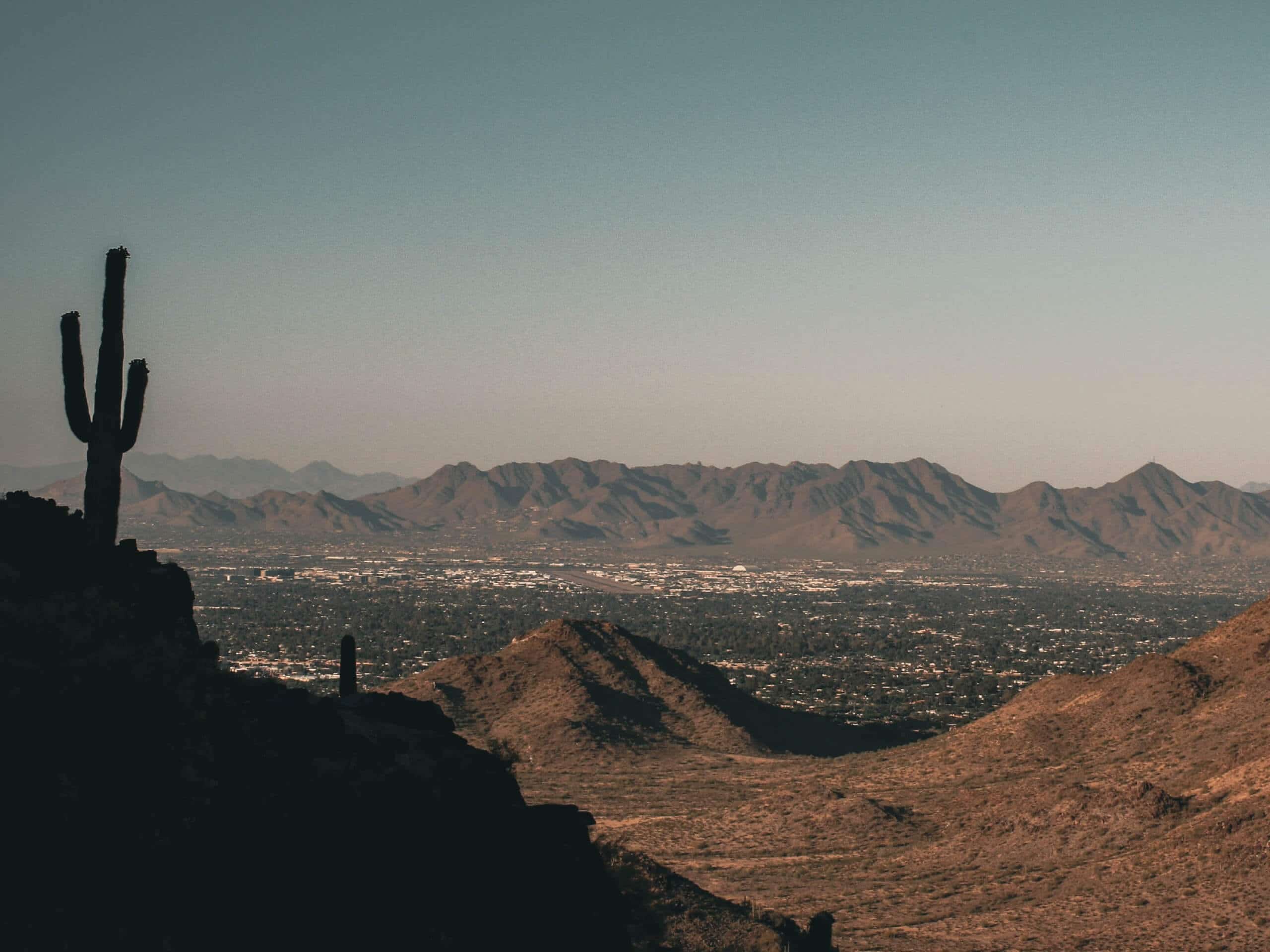
Piestewa Peak Summit Trail
Difficulty Rating:
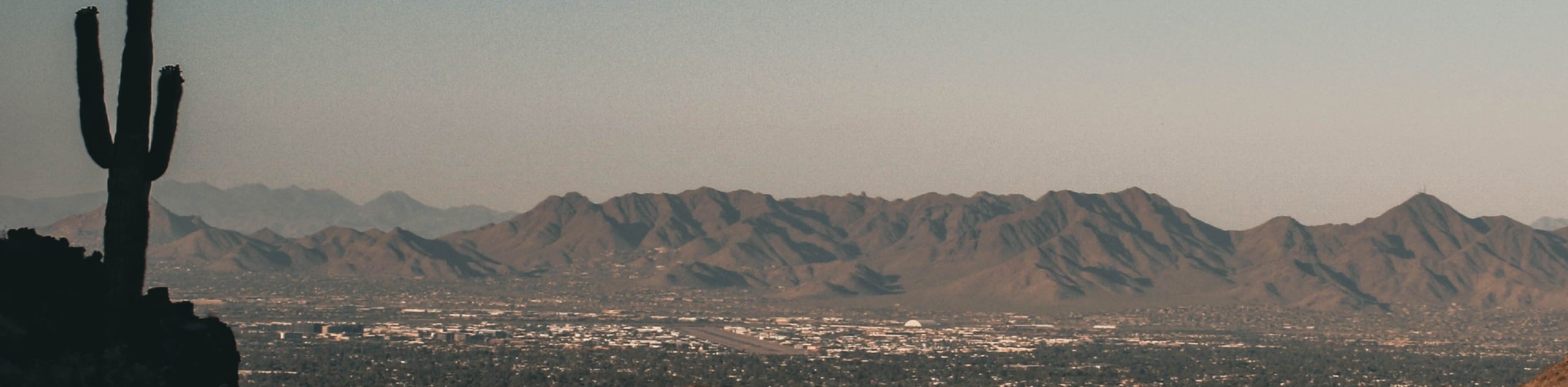
Piestewa Peak is the second-tallest mountain in Phoenix after Camelback Mountain. From the top of this peak, you’ll have a jaw-dropping, panoramic view of the city below and the mountains that surround it. This route guide follows the trail to the summit and then returns, but you can also add on the Freedom Loop if you want a longer adventure, which encircles the base of the mountain. You’ll do best on this hike if you embrace a sense of community, since this is a very popular hike.
There’s some interesting history behind the name of this mountain, which used to go by two different names. To prepare for this hike, get an early start, stay out of the heat, bring water, and leave dogs and children at home. Expect a tough but beautiful adventure.
Getting there
The trailhead for the Piestewa Peak Summit Trail is on E Piestewa Peak Drive.

About
| Backcountry Campground | No |
| When to do | October-May |
| Pets allowed | No |
| Family friendly | No |
| Route Signage | Good |
| Crowd Levels | High |
| Route Type | Out and back |
Piestewa Peak Summit Trail
Elevation Graph
Weather
Piestewa Peak Summit Trail Description
Piestewa Peak is one of the defining mountains of Phoenix’s skyline, rising 2608ft up above the landscape. After Camelback, this mountain claims the title of the second-tallest peak in the Phoenix area. Part of the Phoenix Mountain Preserve, the hiking trails on this mountain provide locals and visitors with the chance to challenge themselves in exchange for wide-reaching views of the city and the mountains that surround it.
Piestewa Peak was originally named Vianom Do’ag by the Tohono O’odham tribe. This name meant “Iron Mountain.” When settlers came, they disregarded the existing name and began calling it Squaw Peak, coming from a derogatory term for Native women. The government renamed the mountain in 2003, choosing Piestewa Peak in honor of Lori Ann Piestewa, an Arizona woman who was killed in action while fighting in Iraq that year. She was the first Native American woman to die in combat in the United States Military.
Taiko drummer and Japanese folk artist Ken Koshio plays drums and the flute atop the mountain in the mornings to honor Lori Ann Piestewa. If you manage to catch one of his sessions, you’ll enjoy a little bit of mountain magic.
The two main trails on Piestewa Peak are the Summit Trail and Freedom Trail. This route guide follows just the Summit Trail, which is what you’ll want if you’re aiming to get to the top and back without any extra distance. Should you be a fan of extra distance, the Freedom Trail loops around the base of the mountain. We have a route guide that covers both in one hike.
Although this route is short, don’t be fooled! Expect a strenuous hike. You’ll gain over 1,200 feet of elevation on your way to the top. Because of how strenuous and rocky this route is, dogs are not allowed on the trail and it’s not a good fit for kids.
The trail begins from the parking area. Note that the parking closes at 7 PM, but the trail remains open until 11 PM. You can leave between 7 PM and 11 PM, but you can’t enter after 7 PM. The parking lot tends to fill, so you might have to park at one of the other lots in the park and walk over or wait for someone to leave.
From the trailhead, hike to the junction. Stay left to take the trail to the summit. You’ll soon hit switchbacks with stairs, which continue to the next junction, where you’ll stay right. The route steepens as you approach the top, and the stairs dissolve away to a dirt and rock trail. There’s a bit of an easy scramble required to make it to the summit, and you’ll climb one more set of narrow stairs.
At the top, take in the impressive views of the Valley of the Sun and the mountains in the distance. From here, descend down to the trailhead the same way you came up.
Hiking Route Highlights
Phoenix Mountain Preserve
The Piestewa Peak Summit Trail is part of the Phoenix Mountains Preserve, an urban park system that includes the impressive Camelback Mountain, Piestewa Peak, Shaw Butte, Dreamy Draw Mountain, and more. The preserve also encompasses parks and preserves, so it serves to maintain the unique desert mountains and landscapes of Phoenix for residents and visitors to enjoy.
Frequently Asked Questions
Is Piestewa Peak harder than Camelback?
Both hikes have similar elevation gain, but the trails up Camelback are longer and a touch more technical, so we’d consider that the more difficult hike.
Can kids hike Piestewa Peak?
Unless your kids are exceptionally active and experienced with hiking, we don’t recommend bringing them on this hike.
Can you drive up Piestewa Peak?
No, there is no vehicle access beyond the trailhead parking lot.
Insider Hints
This trail is closed from 11 AM until 5 PM on days with excessive heat warnings.
Bring lots of water! You can fill your bottle at the trailhead.
Similar hikes to the Piestewa Peak Summit Trail hike

Two Bit and Rattle Saddle Loop
The Two Bit and Rattle Saddle Trail is a moderately challenging hike in the Phoenix’s Mountain Preserve near Piestewa Peak.…

Ma-Ha-Tauk and Crosscut Loop
The Ma-Ha-Tauk and Crosscut Loop is a moderate hike in Phoenix’s South Mountain Preserve. With pleasant views and not much…
Coach Whip Hike
The Coach Whip hike is a route in the Thunderbird Conservation Park in Glendale. The park mostly draws residents who…
Comments