Circumference Trail to Ridgeline Loop
View Photos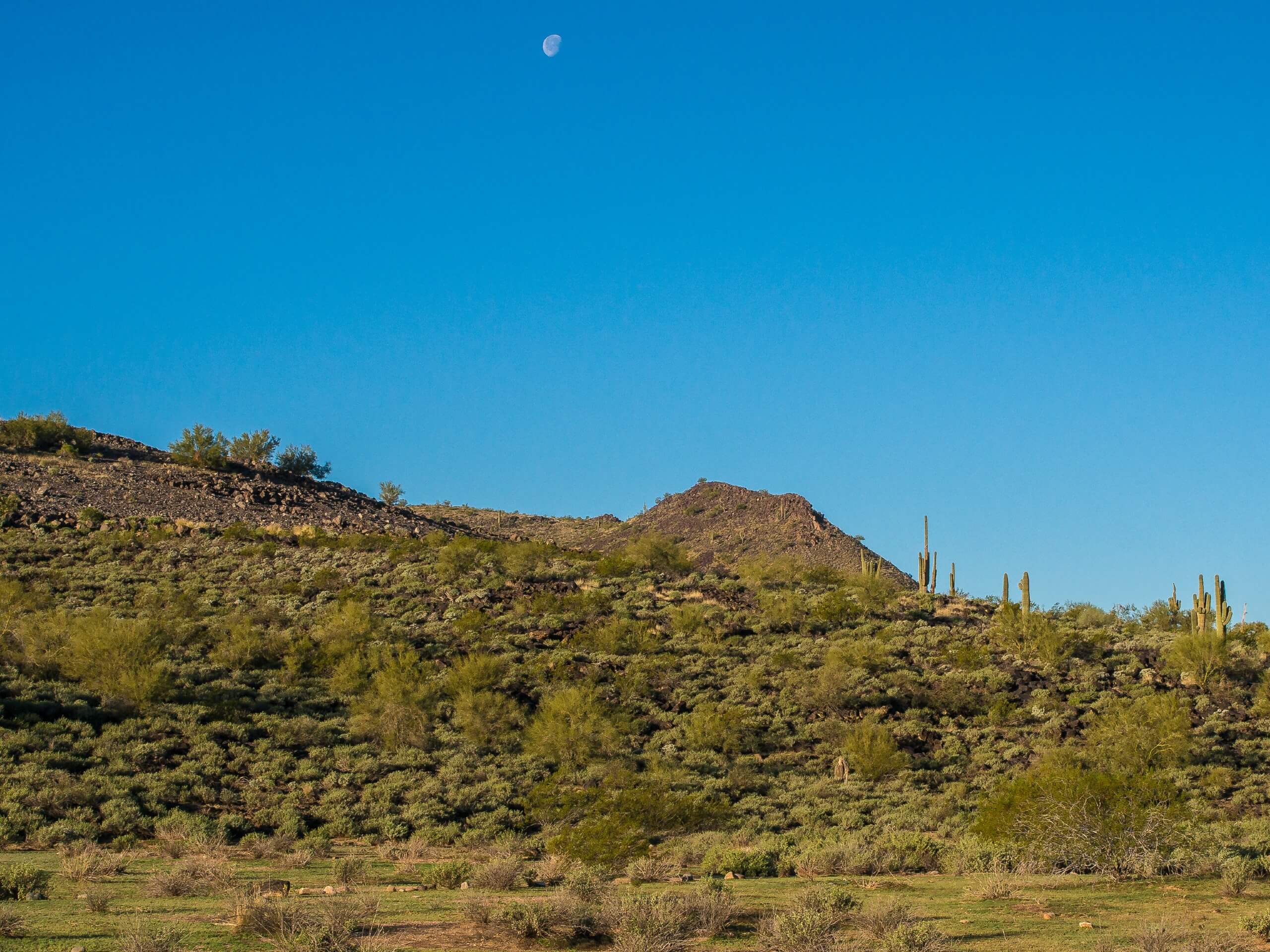
Circumference Trail to Ridgeline Loop
Difficulty Rating:
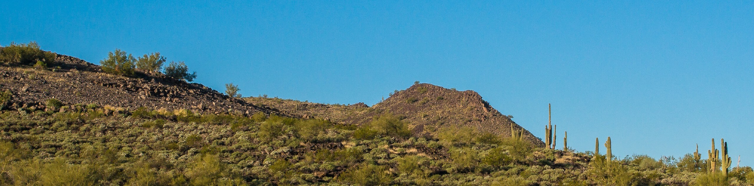
The Circumference Trail to Ridgeline Loop is a 3.8mi hike in the Deem Hills Recreation Area in North Phoenix. Before mentioning the hike, this entire recreation area is an excellent spot to spend a nice afternoon. There is a playground, dog park, picnic areas, ramadas, and hiking trails to enjoy here. This hike is one that you can’t judge by the cover. It doesn’t look like it’ll be that impressive with its minimal elevation, but the view from the top is wonderful, especially at sunset.
This hike is suitable for most skill levels and ages. Be prepared for the heat and try to time your hike outside of the heat of the day. Finally, consider bringing a picnic to enjoy in the park after your hike.
Getting there
The trailhead for the Circumference Trail to Ridgeline Loop is in the parking area for Deem Hills Park.

About
| Backcountry Campground | No |
| When to do | October-May |
| Pets allowed | Yes - On Leash |
| Family friendly | Yes |
| Route Signage | Good |
| Crowd Levels | High |
| Route Type | Loop |
Circumference Trail to Ridgeline Loop
Elevation Graph
Weather
Circumference Trail to Ridgeline Loop Description
The Deem Hills Recreation Area is a fabulous park serving residents of North Phoenix. The park boasts playgrounds, a dog park, ramadas, and picnic areas. It’s a perfect place to relax on a warm afternoon. The hiking trails in this park are great, especially the Circumference Trail to Ridgeline Loop.
This route climbs to the highest point in the park. While it’s not that high in the mountain world, the views are excellent. From an unassuming beginning comes a view of the northern reaches of the metro area, punctuated by low peaks. It’s especially beautiful at sunrise and sunset.
This loop is fairly easy to follow but there are two places where GPS guidance may help–one at a 4-way junction and one where the trail cuts through back to the park, but both spots can be effectively navigated on their own if you know what to look for. Read on!
As with all hikes in the Phoenix area, you’ll want to avoid this one in the hotter months and prepare for heat even in the middle of winter. Bring lots of water, wear sun protection, and time your hike so you’re not on the trail in the middle of the day. Should you choose to bring your dogs with you, make sure they have water, too.
From the trailhead parking area, you can see the trails heading up the hill behind the park, where there are likely to be families and dogs playing in the grass. This route begins on the Circumference Trail, which is to your right as you look at the hill. You could hike this loop the other way, but it demands a more strenuous climb.
Take the Circumference Trail, hiking along the dirt path to the right of the dog park. Follow the signage, turning briefly north (left) at the cut-through to the trail. The route follows the base of the mountain through a dry landscape defined by black volcanic rock and shrubs.
There are a few gentle undulations along this stretch of trail, but it’s mostly relaxed. About 0.7mi in, the trail steepens. At 0.9mi, stay left through the junctions to get onto the Ridgeline Trail, which is where the grade increases again. You’ll traverse northwest along a steadily climbing trail. In the spring, there are pretty wildflowers along Ridgeline.
At the highpoint of the Ridgeline Trail, you’ll reach the small summit. Despite its modest height, the view of the surrounding low mountains and city suburbs is great. The peaks resemble rolling waves.
Continue along the ridge and begin descending the switchbacks. At the last turn, you’ll see signage indicating the end of the Ridgeline Trail. Go left here to take the Circumference Trail (which is confirmed by signage a few steps later). This portion of the hike is sandier and less rocky. Gradually make your way around the base of the mountain, descending to the dog park.
This is where your adventure comes to a close.
Hiking Route Highlights
Deem Hills Recreation Area
The Deem Hills Recreation Area comprises nearly 1,000 acres of the Sonoran Desert in the northern reaches of the Phoenix metro area. This park is known for its unique basalt formations and views of the Phoenix Mountains. The recreation area is outfitted with a dog park, playground, picnic areas, ramadas, and hiking trails. The tallest of the trails is the Ridgeline Trail, which climbs the highest point in the Deem Hills.
Frequently Asked Questions
Is the Circumference Trail to Ridgeline Loop easy to follow?
This route is clear and well-defined and generally well-marked. We consider it easy to follow.
Do you have to pay to hike in Deem Hills?
No, there is no fee required for this trail.
How much parking is there at Deem Hills?
There tends to be lots of parking for those who want to come. Users don’t report struggling to find spots.
Insider Hints
Bring a picnic for after your hike!
Although dogs are allowed off-leash in the dog park, they must be on-leash while hiking with you.
Watch for mountain bikes on the north and west portions of this hike.
Similar hikes to the Circumference Trail to Ridgeline Loop hike

Palisade to Basalt Loop
The Palisade to Basalt Loop is a short, easy trail in the Deem Hills Recreation Area. This hike is 1.4mi

Two Bit and Rattle Saddle Loop
The Two Bit and Rattle Saddle Trail is a moderately challenging hike in the Phoenix’s Mountain Preserve near Piestewa Peak.…

Ma-Ha-Tauk and Crosscut Loop
The Ma-Ha-Tauk and Crosscut Loop is a moderate hike in Phoenix’s South Mountain Preserve. With pleasant views and not much…
Comments