Canyon Lake Marina via Peralta Trail
View Photos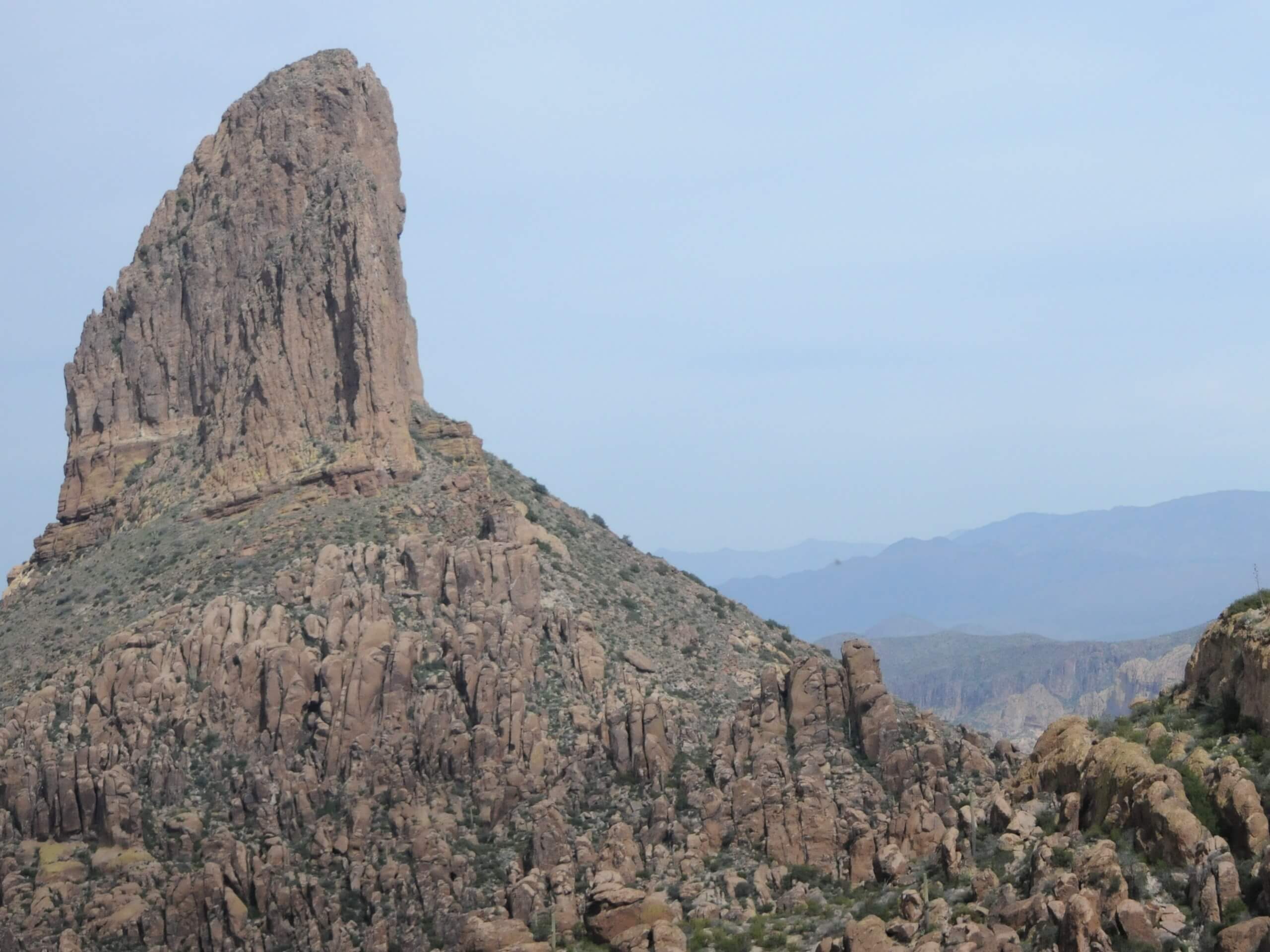
Canyon Lake Marina via Peralta Trail
Difficulty Rating:
Canyon Lake Marina via Peralta Trail is a point-to-point hike that begins in the far southern reaches of Tonto National Forest northeast of Phoenix and ends at the welcoming blue lakeshore. This hike is too long to do as an out and back hike (unless you really want to punish your legs), so book a night at the Canyon Lake Campground near the end of the trail to make a weekend out of it.
This hike crosses rugged terrain that isn’t always very well-marked. Bring a GPS and prepare to be out in the desert sun all day with lots and lots of water, food, and sturdy boots.
Getting there
The trailhead for the Canyon Lake Marina via Peralta Trail is at the end of E Peralta Road.

About
| Backcountry Campground | Canyon Lake |
| When to do | October-May |
| Pets allowed | Yes - On Leash |
| Family friendly | No |
| Route Signage | Poor |
| Crowd Levels | Low |
| Route Type | One Way |
Canyon Lake Marina via Peralta Trail
Elevation Graph
Weather
Canyon Lake Marina via Peralta Trail Description
The hike to Canyon Lake Marina via Peralta Trail is an ideal adventure for backpackers seeking a two day and one night trip. Beginning from the Peralta Trailhead at the far southern border of the Tonto National Forest near Phoenix, this hike traverses the rugged, gorgeous desert mountains to the lake, tucked away in the hills.
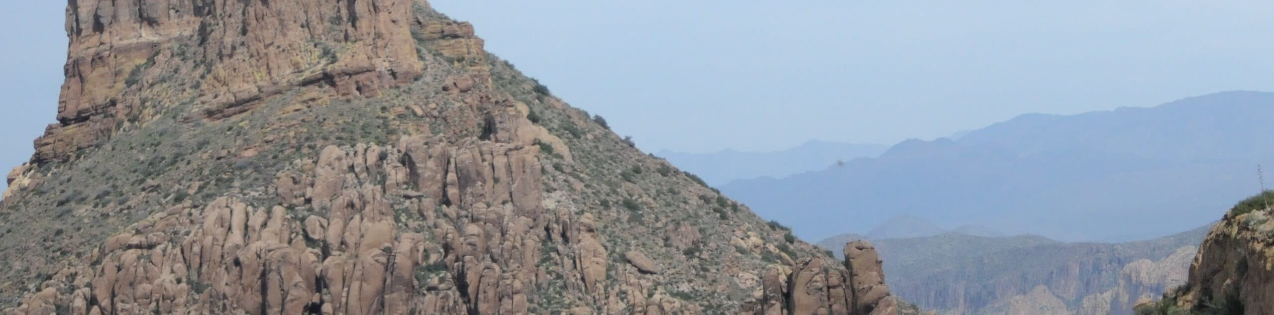
This route shows off a gorgeous slice of the desert mountains, dotted with saguaros and fascinating rock formations sculpted by erosion. With a view of the surrounding mountains and interesting terrain underfoot, it’s a perfect immersion into this part of the world.
The hike shows off a few distinct highlights. The region you hike through is dotted with saguaros and dramatic rock formations chiseled by erosion. Discover an amazing view of Weavers Needle along the way, and pass underneath Superstition Mountain and Malapais Mountain.
At the lake, there is a campground and a restaurant on the shore. It’s quite a lovely place to spend a night after a big hike through the desert. Make sure you arrange your campsite ahead of time to avoid disappointment in the busy season.
There will be some challenges to navigate on this route. The trail is not marked well in many places. You’ll cross a river multiple times and have to pick up the trail on the other bank. Speaking of the river, avoid this hike after heavy rains when it may be too high to safely cross.
Download your GPS track ahead of time to make sure you’re heading in the right direction. Bring lots of water and wear sun protection.
From the Peralta Trailhead, the route follows the canyon floor on Peralta Canyon Trail. Follow the canyon to its end, where the route climbs up to your right through a set of switchbacks. This is a steep climb, and poles might come in handy.
Stay left at the junction and finish the last few turns to continue through the upper canyon. You’ll pass Weavers Needle on your right. Snap a photo of this popular landmark and then continue on. Pass underneath Palomino Mountain on your left and Black Top Mesa on your right.
At the north end of Palomino Mountain, stay left and then right. Hike past Yellow Peak and Red Hills, passing through Boulder Canyon on Boulder Trail. Battleship Mountain will go by on your right.
Near the end of the hike you’ll need to put your tired legs to work to climb up from the canyon floor to crest the ridge that leads you to the lake. The view of the lake will open up and you’ll end off with a descent to the trail’s end at the road.
You’ll be at the marina. The campground is to your right and the restaurant is straight ahead.
Hiking Route Highlights
Weavers Needle
Weavers Needle is a 1,000-foot high distinctive column peak in the Superstition Mountains. The peak can be seen from all directions around it and is one of the most obvious and dominating features of this part of the Sonoran Desert. There are several different hikes that give you a view of Weavers Needle, including from Peralta Trail.
Frequently Asked Questions
Do you need a permit at the Peralta Trailhead?
This route does fall within the Tonto National Forest, so you’ll need a pass to hike here.
Which river flows into Canyon Lake?
The primary inflow and outflow of Canyon Lake is the Salt River.
Insider Hints
Learn more about the lake, the activities at the lake, and the requirements for camping with the USDA Forest Service.
Similar hikes to the Canyon Lake Marina via Peralta Trail hike

Palisade to Basalt Loop
The Palisade to Basalt Loop is a short, easy trail in the Deem Hills Recreation Area. This hike is 1.4mi

Two Bit and Rattle Saddle Loop
The Two Bit and Rattle Saddle Trail is a moderately challenging hike in the Phoenix’s Mountain Preserve near Piestewa Peak.…

Ma-Ha-Tauk and Crosscut Loop
The Ma-Ha-Tauk and Crosscut Loop is a moderate hike in Phoenix’s South Mountain Preserve. With pleasant views and not much…
Comments