Bluff Springs and Cave via Peralta Trail
View Photos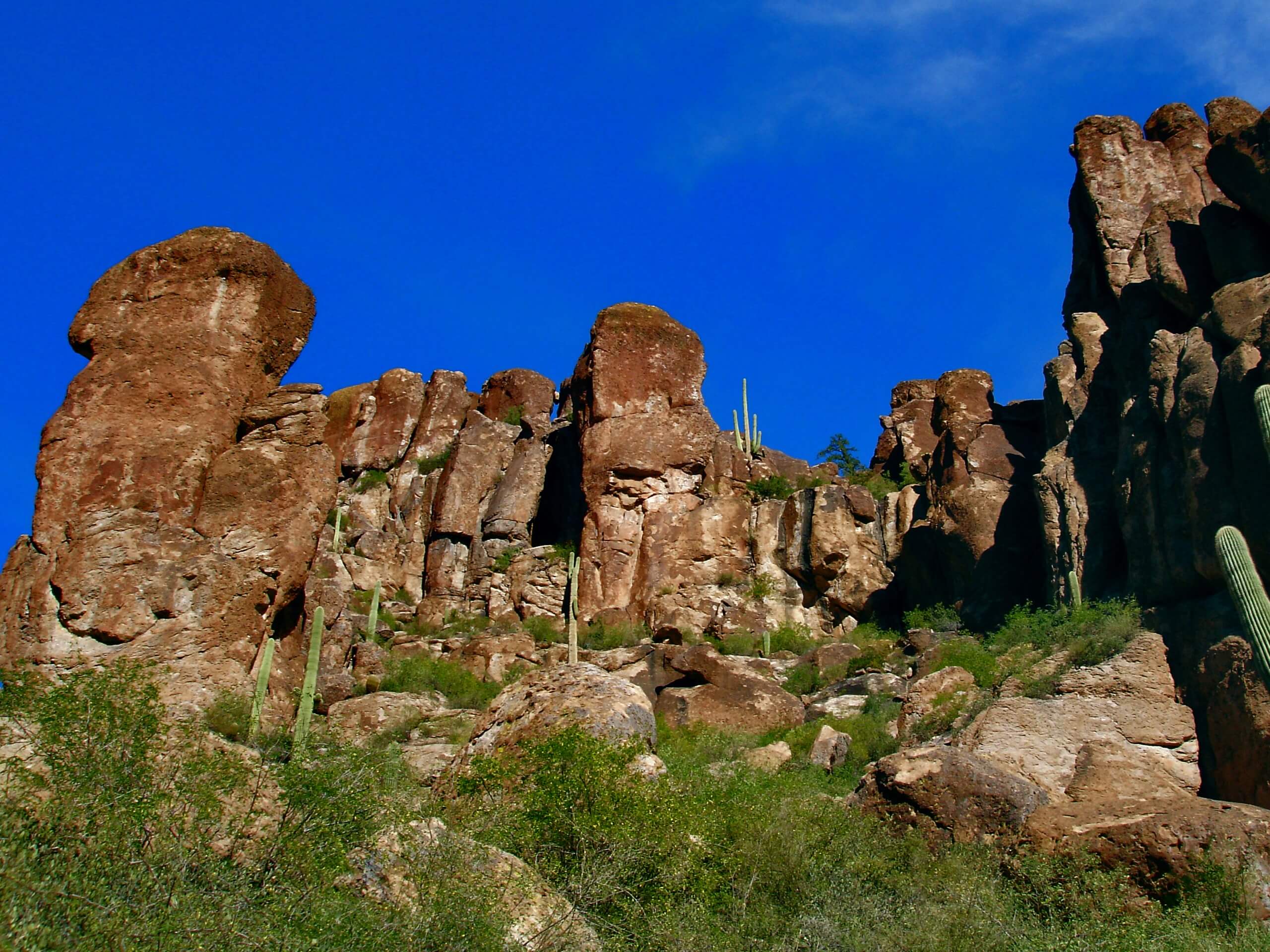
Bluff Springs and Cave via Peralta Trail
Difficulty Rating:
Bluff Springs and Cave via Peralta Trail is an adventurous 5.3mi loop hike in the Superstition Wilderness near Phoenix. This hike is diverse, interesting, and rewarding. You’ll need to do some route-finding thanks to its lack of signage, but you’ll find a cave, fantastic desert mountain scenery, and a perfect view of Weavers Needle. It’s definitely worth the navigational work you might need to do.
We like this loop best going clockwise since there are boulders on the return trip that are easier to navigate this way. Kids should be able to complete this trail, but little ones might struggle with the light technicality of the trail. Bigger, adventurous kids have successfully done the hike. Get this one done before the heat of the day!
Getting there
The trailhead for the Bluff Springs and Cave via Peralta Trail is at the end of E Peralta Road.

About
| Backcountry Campground | No |
| When to do | October-May |
| Pets allowed | Yes - On Leash |
| Family friendly | Older Children only |
| Route Signage | Poor |
| Crowd Levels | Moderate |
| Route Type | Loop |
Bluff Springs and Cave via Peralta Trail
Elevation Graph
Weather
Bluff Springs and Cave via Peralta Trail Description
The hike to Bluff Springs and Cave via Peralta Trail is a bit of an under-appreciated gem. This hike in the Superstition Wilderness doesn’t have the hype surrounding it that other trails do, but users consistently rate it high and appreciate it for its beautiful views.
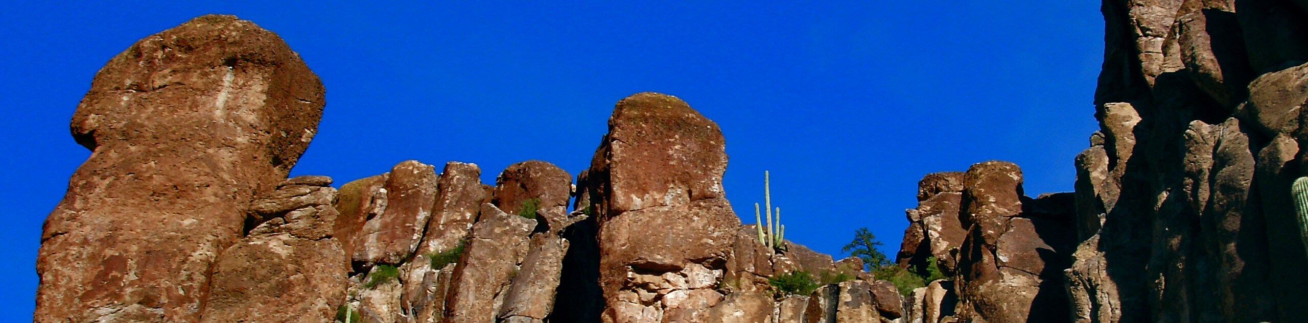
This route shows off a gorgeous slice of the desert mountains, dotted with saguaros and fascinating rock formations sculpted by erosion. With a view of the surrounding mountains and interesting terrain underfoot, it’s a perfect immersion into this part of the world.
The hike shows off a few distinct highlights. The region you hike through is lined with saguaros and dramatic rock formations chiseled by erosion. You’ll find a fascinating cave on the trail, then you’ll earn an amazing head-on view of Weavers Needle at the midpoint. The views are awesome!
There will be some challenges to navigate on this route, though. The trail is not marked well at all and multiple sections traverse smooth rock with no real discernible trail. There are some big boulders to climb up and over as well. It’s not a good hike for very young hikers, those with mobility challenges, or hikers unable to make use of offline navigation or GPS tracking.
Download your GPS track ahead of time to make sure you’re heading in the right direction.
This hike is a loop that can be done either way, but we prefer a clockwise approach. Beginning from the trailhead, take Peralta Trail on your left. This route mostly follows the floor of the canyon. The views down here aren’t quite as good as on the return trip, but this approach leaves the best for last.
Follow the trail up a set of switchbacks to the Fremont Saddle. Go right here to a junction. The lookout for Weavers Needle is here, and it’s excellent.
You’ll take a right at the junction to follow Bluff Springs Trail back towards the trailhead. Take your time and enjoy the amazing views from this higher vantage point.
Descend back down to the trailhead by following this trail as it gradually turns south.
Hiking Route Highlights
Weavers Needle
Weavers Needle is a 1000ft high distinctive column peak in the Superstition Mountains. The peak can be seen from all directions around it and is one of the most obvious and dominating features of this part of the Sonoran Desert. There are several different hikes that give you a view of Weavers Needle, including the hike on Bluff Springs and Peralta Trails.
Frequently Asked Questions
Do you need a permit at the Peralta Trailhead?
This route does fall within the Tonto National Forest, so you’ll need a pass to hike here.
Where is Weavers Needle?
Weavers Needle is located in the far south end of Tonto National Forest east of Apache Junction, Arizona.
Insider Hints
Don’t hike this route in the hot afternoons! You’ll need lots of water and sun protection on this route.
This is a gorgeous hike at sunrise if you’re able to make it early enough.
Dogs are allowed on this trail, but they might struggle with the climbing required on this route.
Similar hikes to the Bluff Springs and Cave via Peralta Trail hike

Two Bit and Rattle Saddle Loop
The Two Bit and Rattle Saddle Trail is a moderately challenging hike in the Phoenix’s Mountain Preserve near Piestewa Peak.…

Ma-Ha-Tauk and Crosscut Loop
The Ma-Ha-Tauk and Crosscut Loop is a moderate hike in Phoenix’s South Mountain Preserve. With pleasant views and not much…
Coach Whip Hike
The Coach Whip hike is a route in the Thunderbird Conservation Park in Glendale. The park mostly draws residents who…
Comments