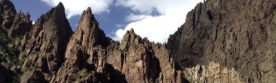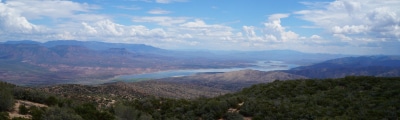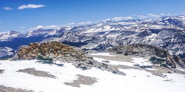
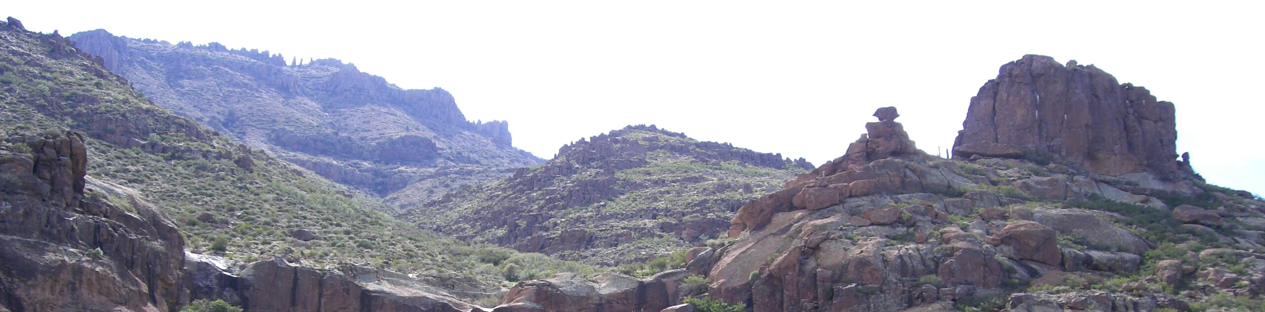
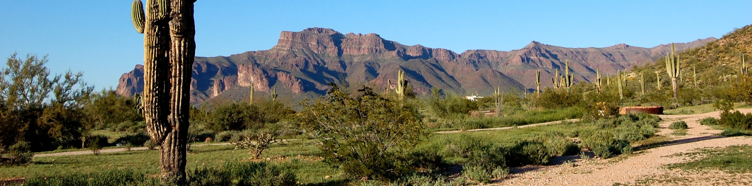
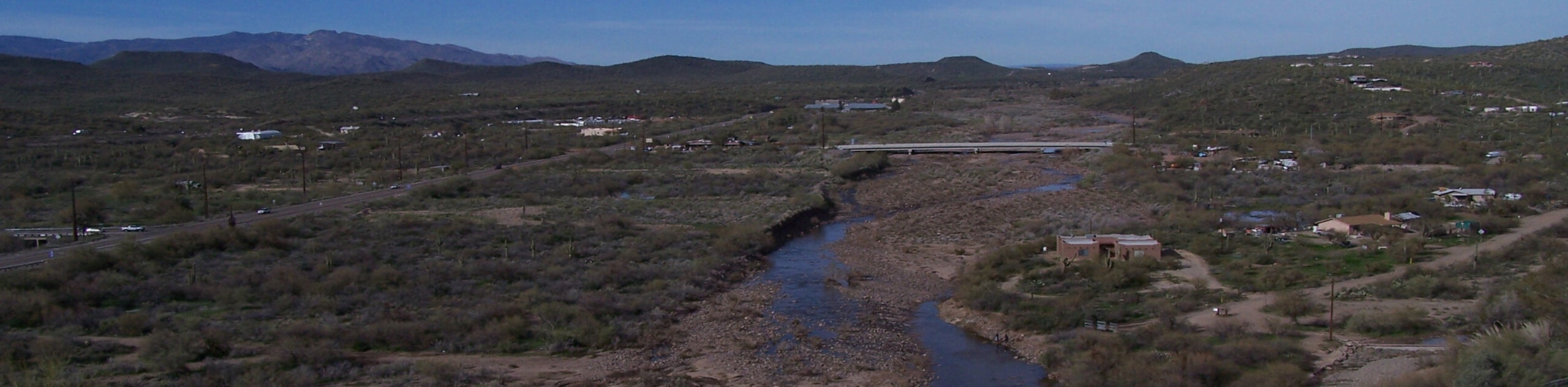
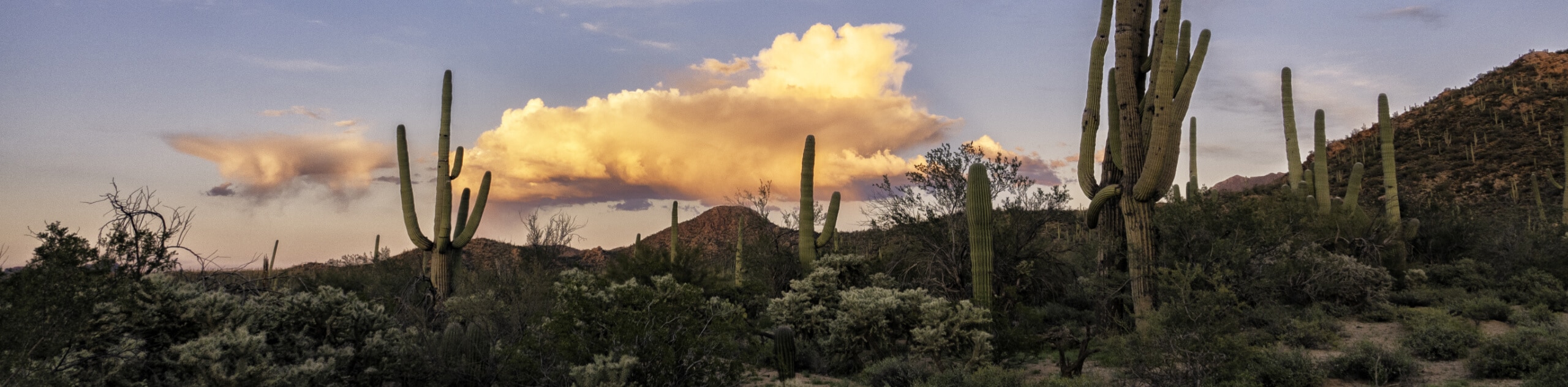
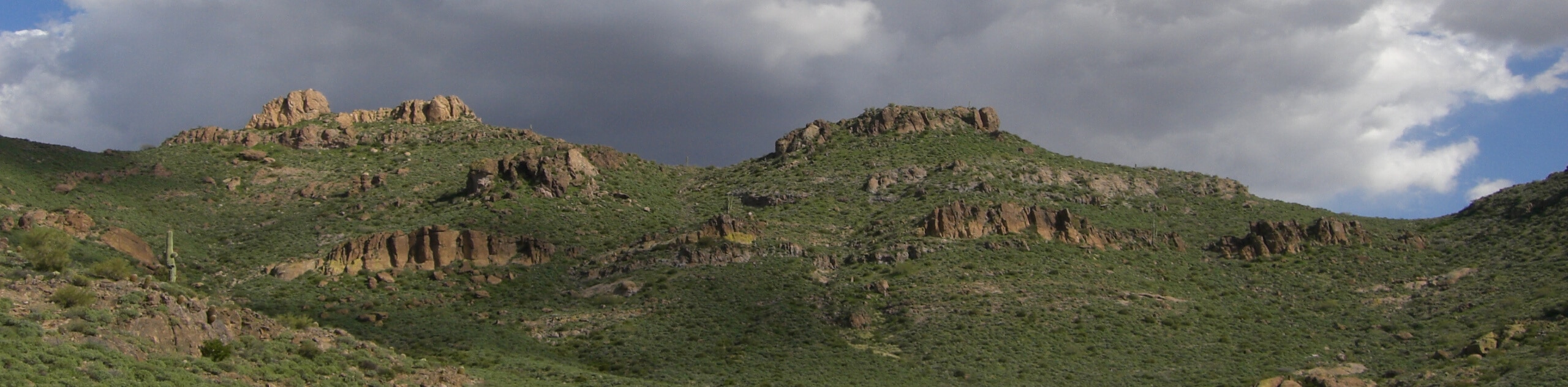
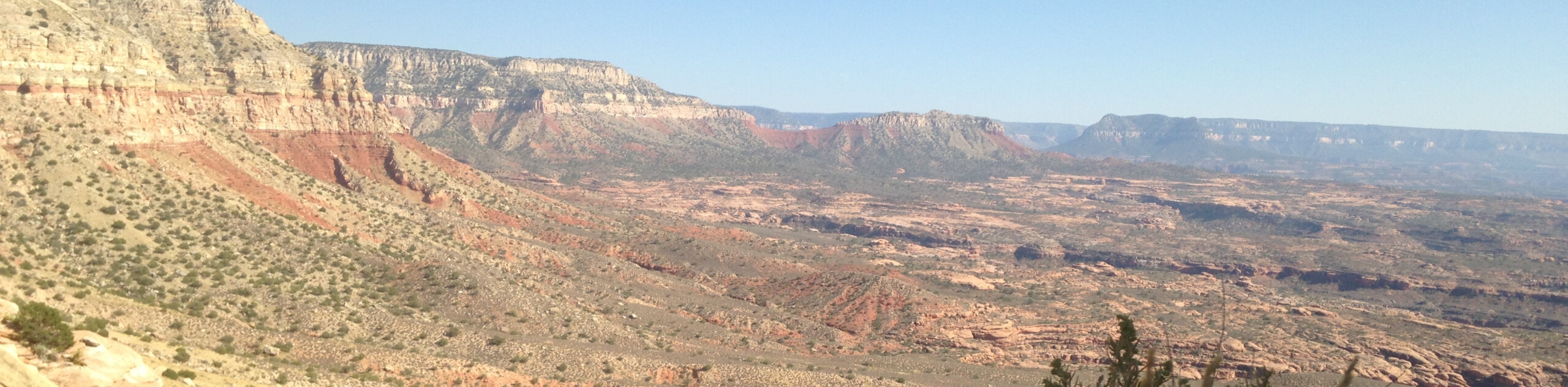
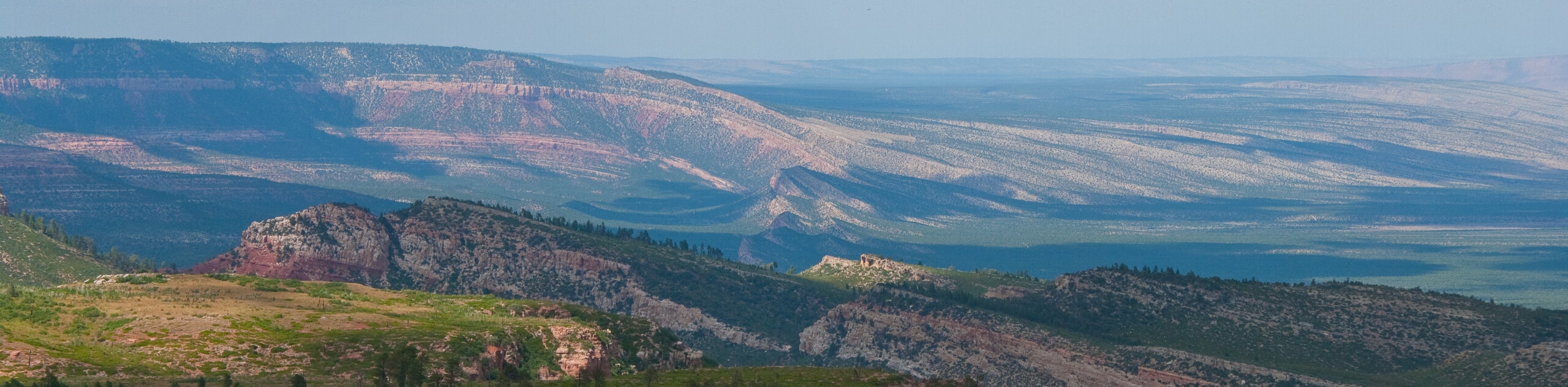
hikes in Tonto National Forest
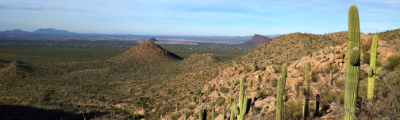
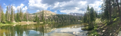
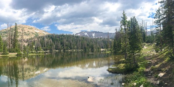
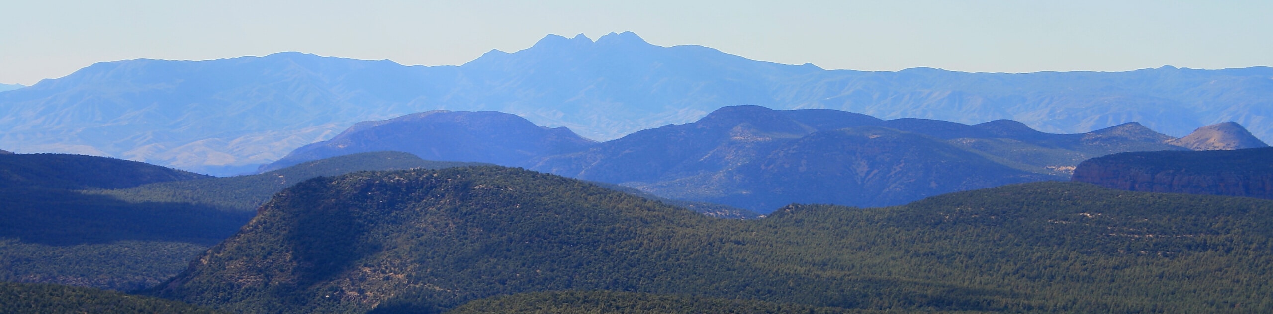
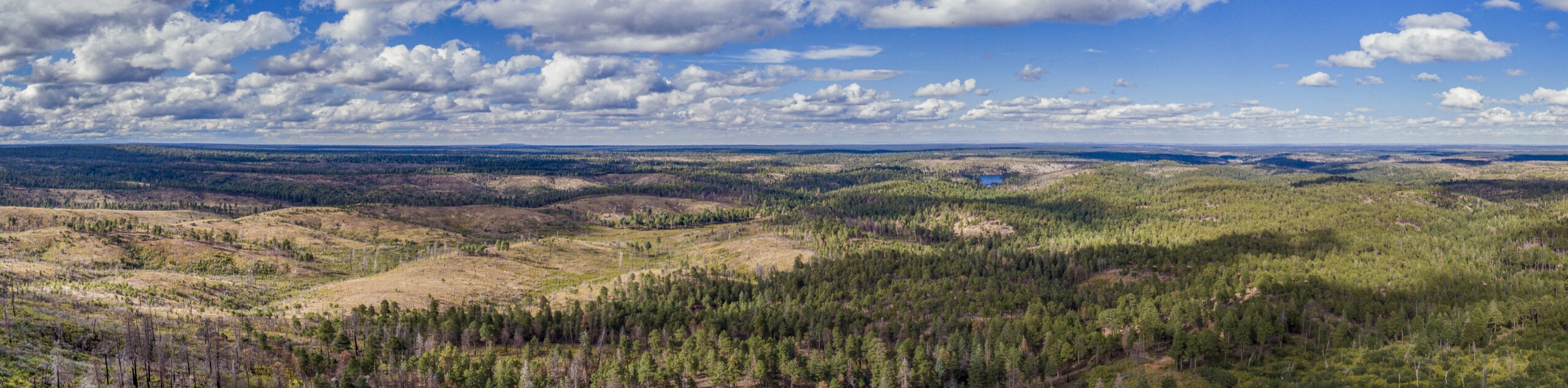
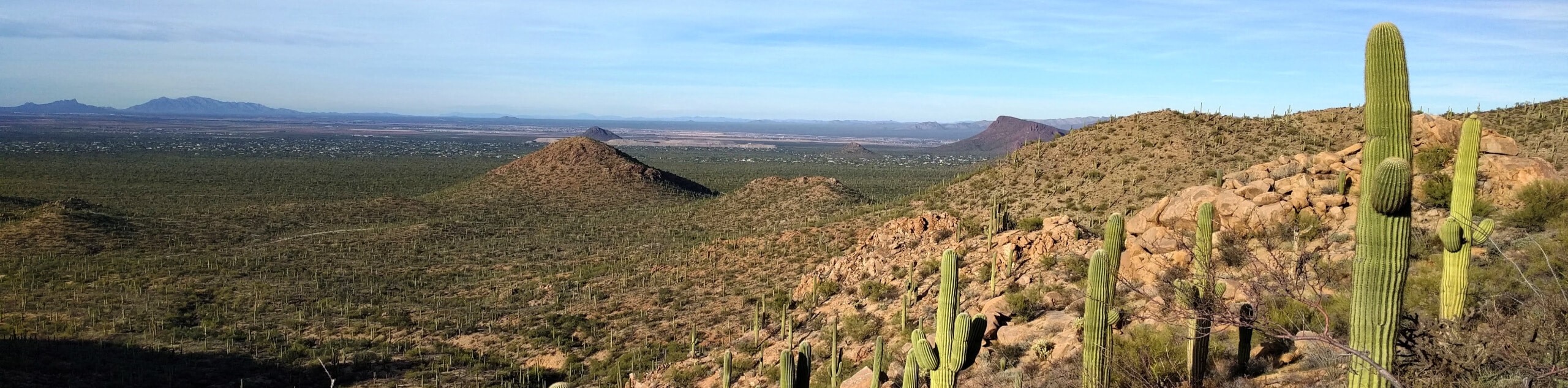
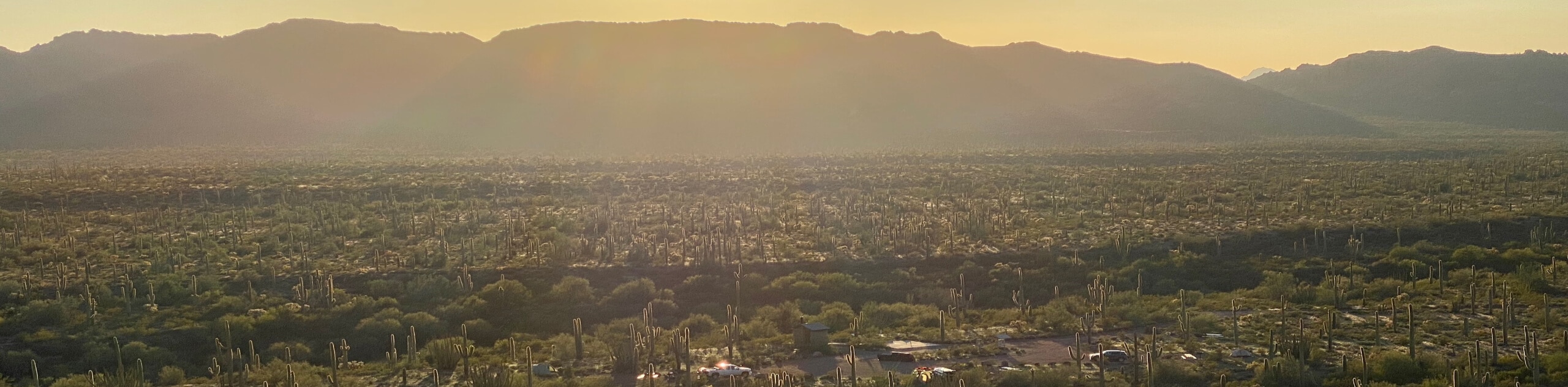
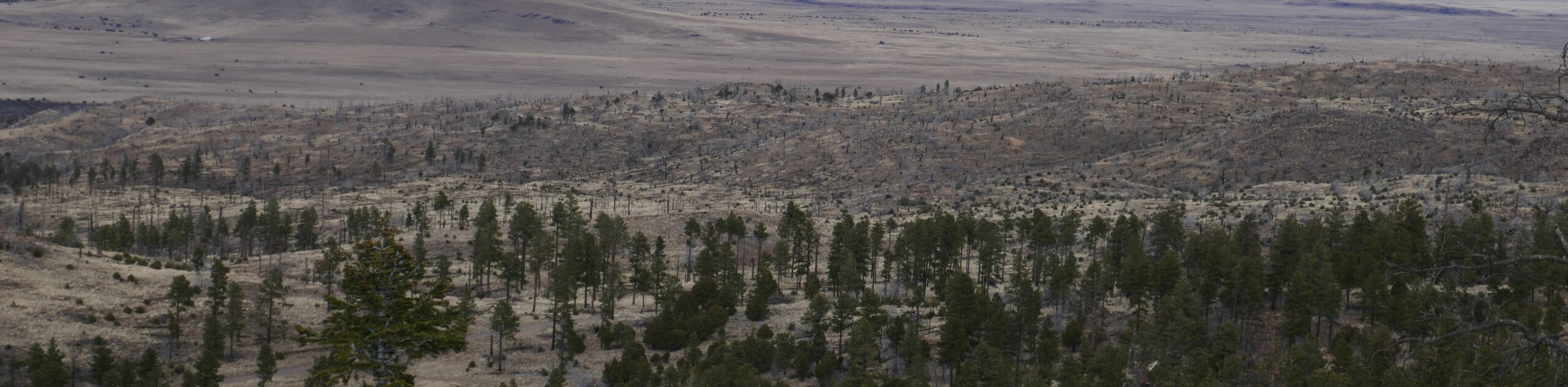
There are so many gorgeous trails in the Tonto National Forest, choosing which ones to explore first is no easy task. Thankfully, choosing the best hikes in this amazing part of the Grand Canyon State is easier than ever with our wide-ranging collection of route guides. From relaxed beginner-friendly strolls to epic mountain-scaling climbs, there’s something for every level in the Tonto National Forest. With scenery that oscillates from cacti-studded desert to lush pine forest, you’ll just want to keep hiking, and hiking, and hiking.
The trails in the Tonto National Forest can be used by hikers, mountain bikers, horseback riders, families, those with dogs, and backpackers. With proximity to Phoenix in some parts of the forest, it’s a top destination for hikers in the city, but the more far-flung trails will speak to the lovers of the remote wilderness, too.
15 Must-Do Hikes in the Tonto National Forest
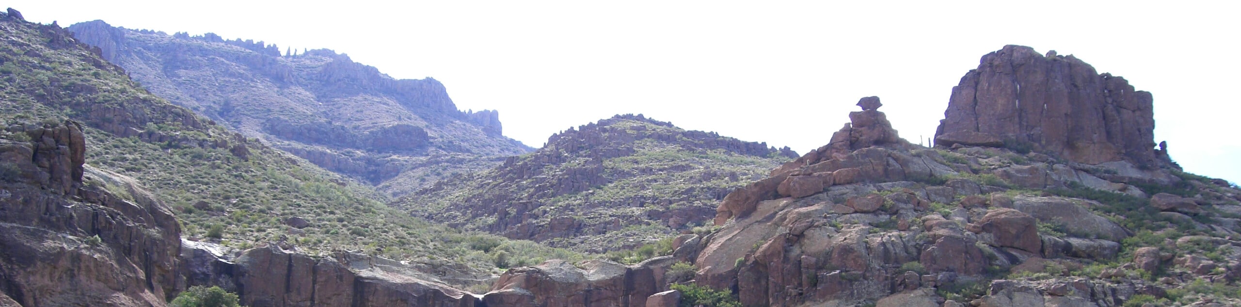
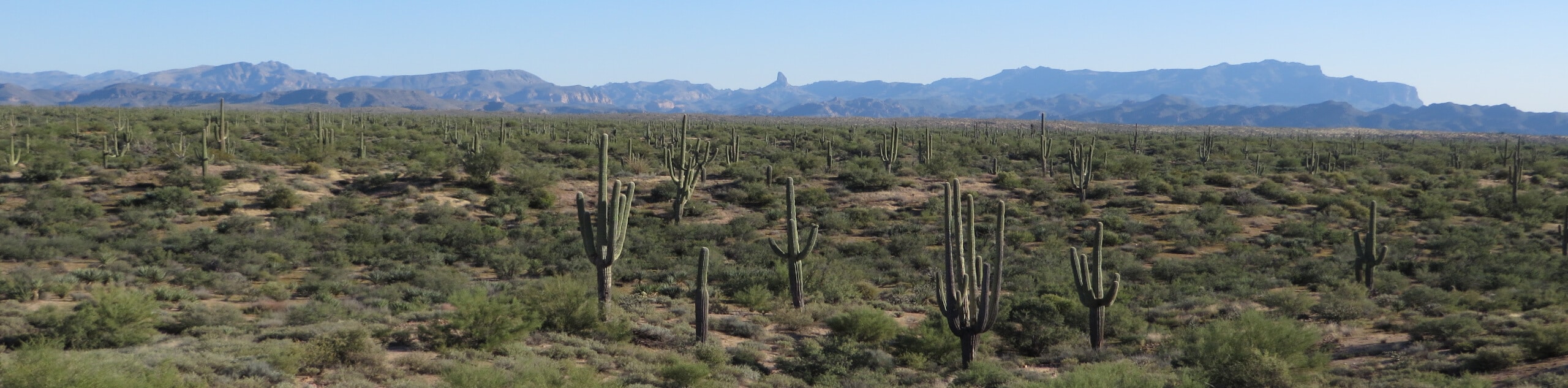
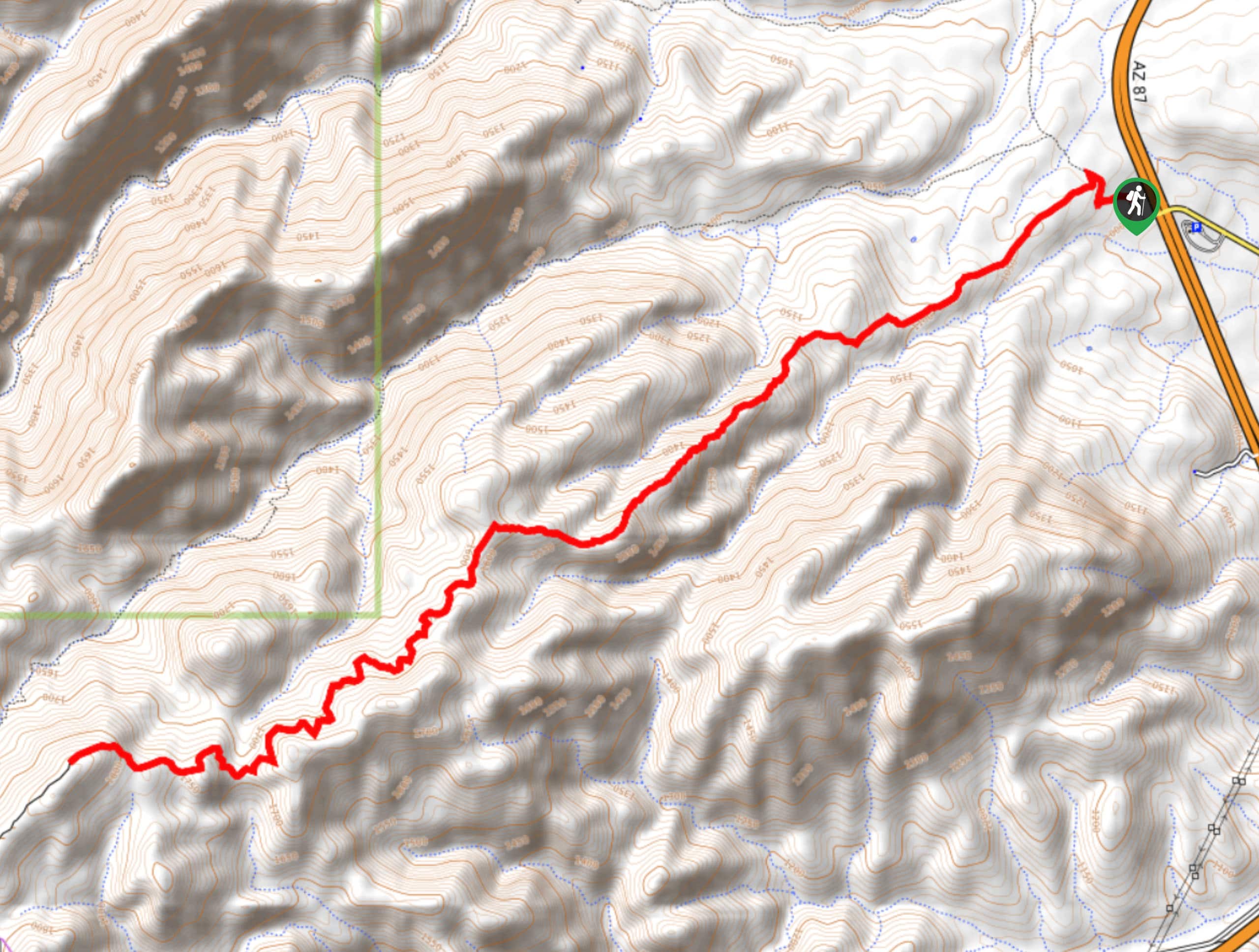
As you plan your adventures in the Tonto National Forest, start with these 15 hikes. Of course, we’ve got over 100 routes in this region that you can follow, so this is only the start! These hikes are some of our favorite in the forest and show off the unique desert beauty of this area, from saguaro-lined trails to hidden swimming holes.
Since the Tonto National Forest is so big, we recommend taking a good look to track down all the trails in whatever part you’ll be visiting. Some corners are lushly forested, some are dry and cholla-filled, but all of them capture the unique, changing landscape of Arizona. Let’s get started!
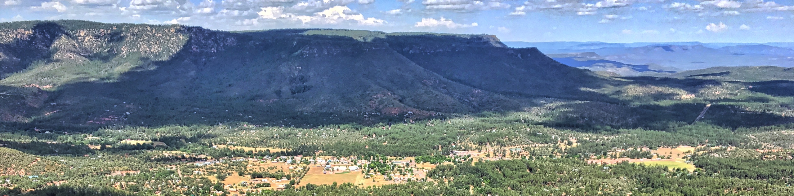
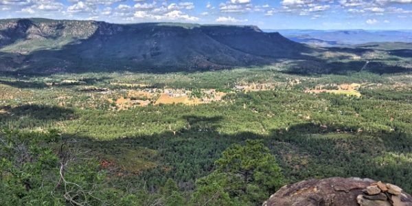
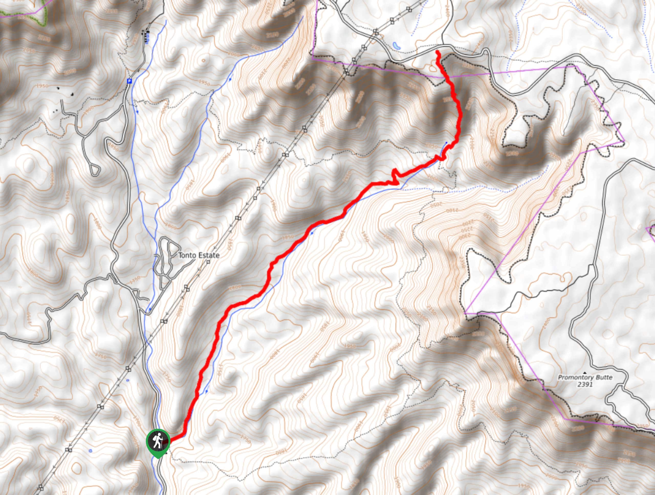
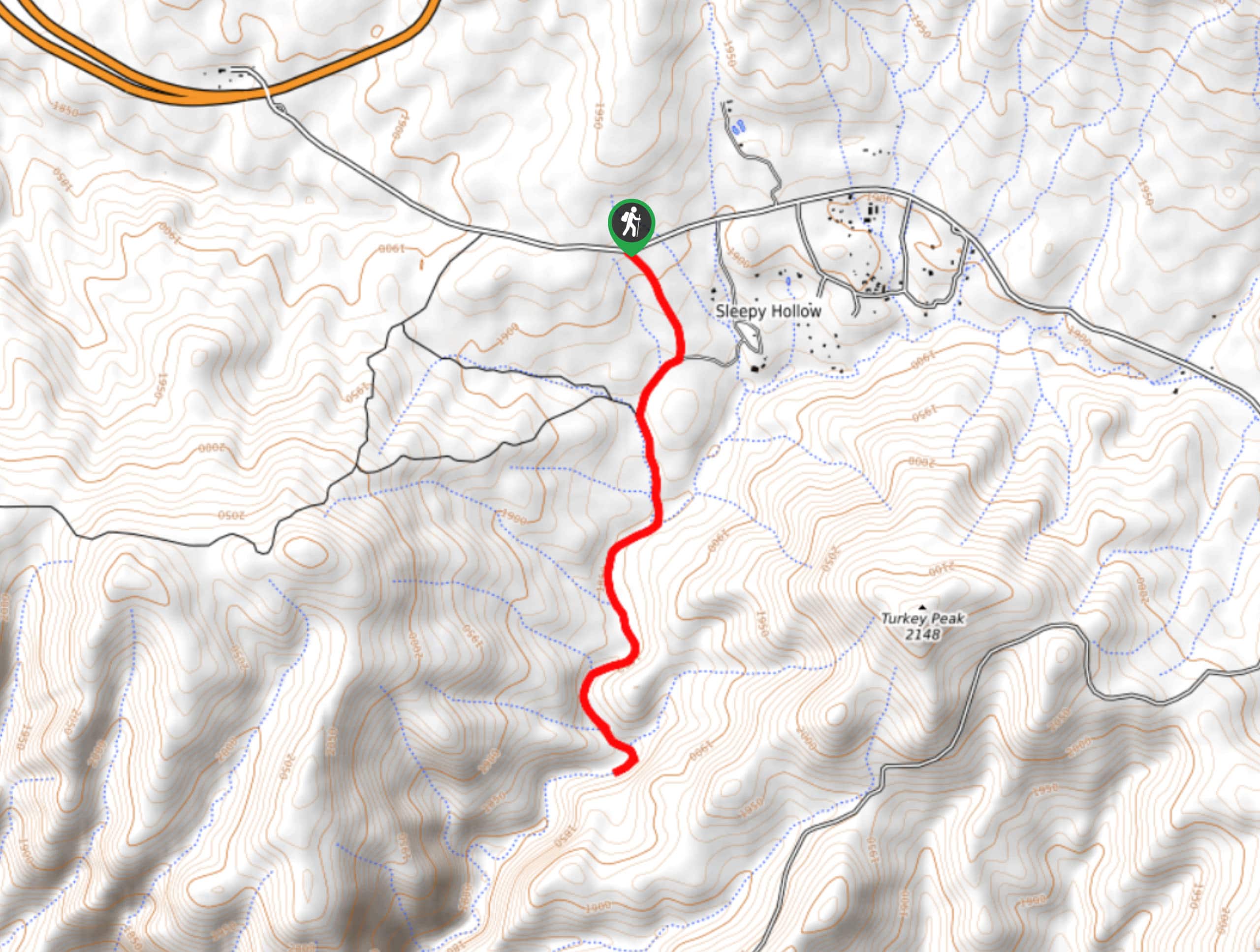
- Water Wheel Falls - Water Wheel Falls is a hike near Payson that has become increasingly popular because of its excellent swimming opportunities. The trail was named for an old water wheel you can see from the trailhead, and the route follows the East Verde River to a gorge used by cliff jumpers and a short waterfall into a wonderful swimming hole.
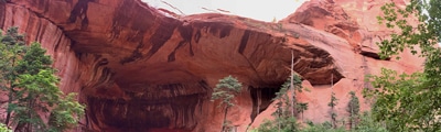
- Wave Cave Trail - You probably didn’t think you could surf in Arizona, did you? The Wave Cave is a unique cave where a “wave” of rock protrudes out into the cave opening. It’s one of the many fascinating rock formations and caves that make Arizona’s landscape so fun to explore. The hike to the cave is moderate, with a few short, steep sections.
- Box Canyon Trail - When the temperatures start to soar, you need a chilled-out afternoon in a refreshing swimming hole. The Box Canyon Trail is a quick 0.8mi hike that leads you down into a box canyon with a swimming hole in it. The red granite walls are gorgeous and the water feels perfect when the sun is shining.
- Verde Hot Springs - The Verde Hot Springs hike takes you along an easy trail to a hot spring at an abandoned resort. Perched along the Verde River, the pools were constructed in the 1920s when this area was a tourist attraction. A fire in the 1960s destroyed the resort, but the foundation and pools survived. Abandoned ever since, the pools are open for public use and offer a unique spot to get a soak in.
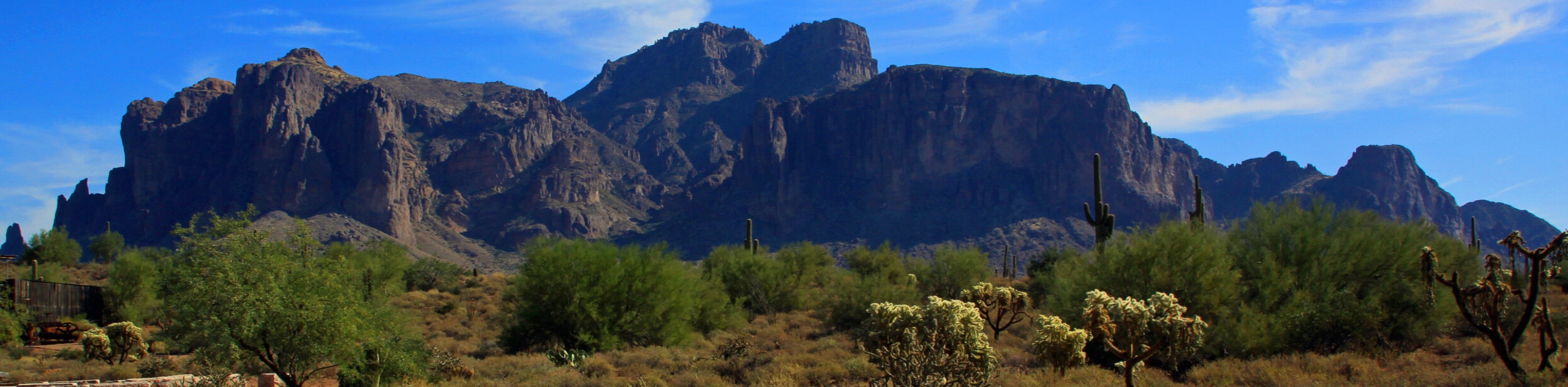
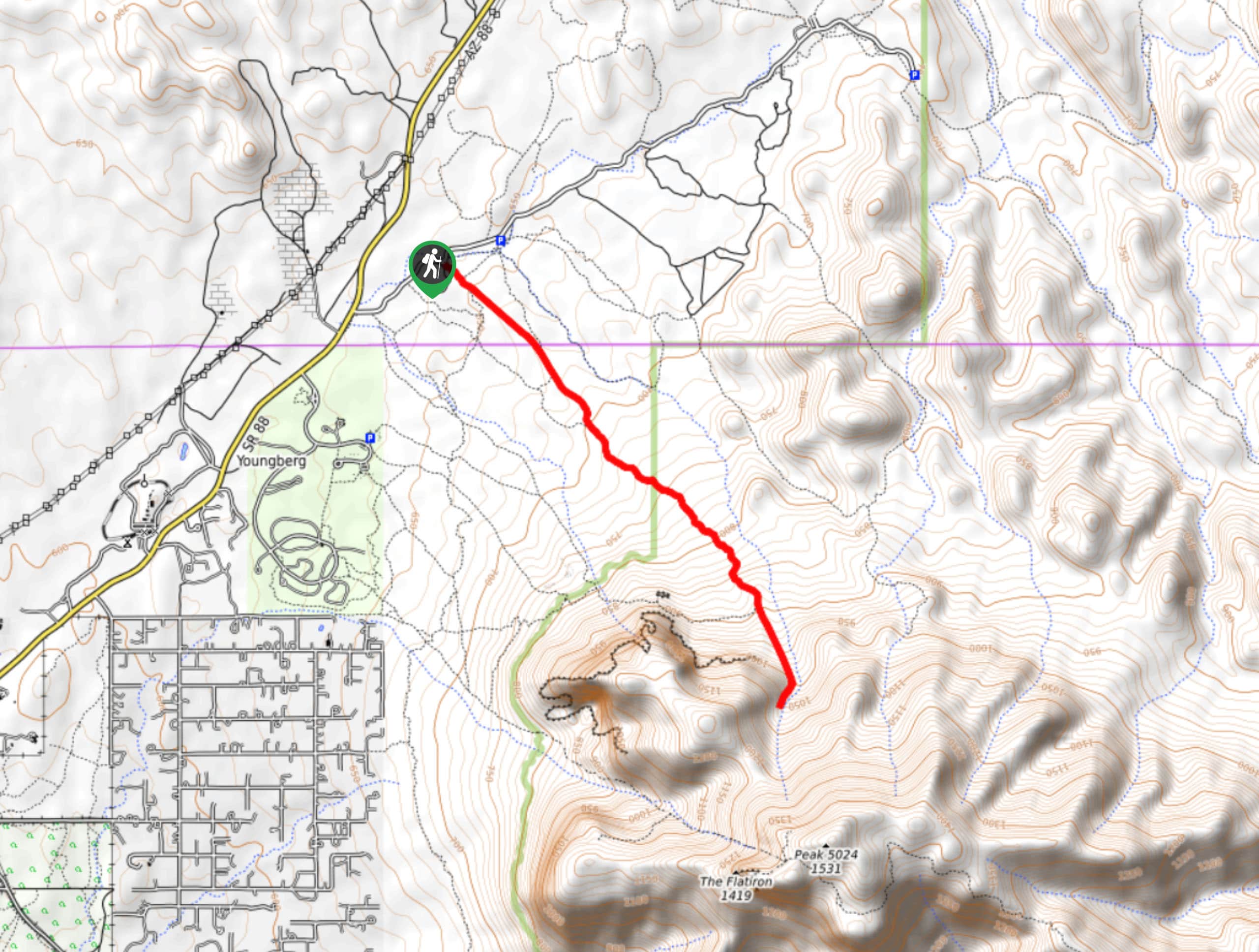
- Treasure Trail and Siphon Draw Loop - The Treasure Trail and Siphon Draw Loop is a 3.0mi hike with amazing desert scenery. This route takes you through a dramatic basin lined by low granite mountains, and you can also use the trail to climb The Flatiron. Even if you want to stay on the easier paths, this is a hike with incredible scenery. It offers a lot without being too difficult or demanding.
- Horton Creek Trail - Horton Creek Trail is a 8.6mi popular hike enjoyed by everyone from families to solo hikers to those with dogs. The trail follows along Horton Creek, taking you past waterfalls, small pools, and through trees. This is a very relaxing hike, and despite the elevation gain and distance, it feels fairly gradual until a bigger climb at the end of the trail, which can be skipped in favor of an easier trip.
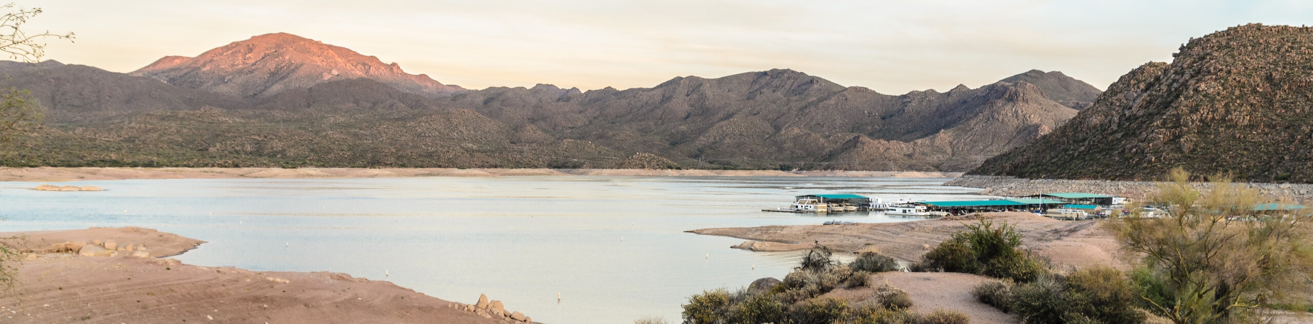
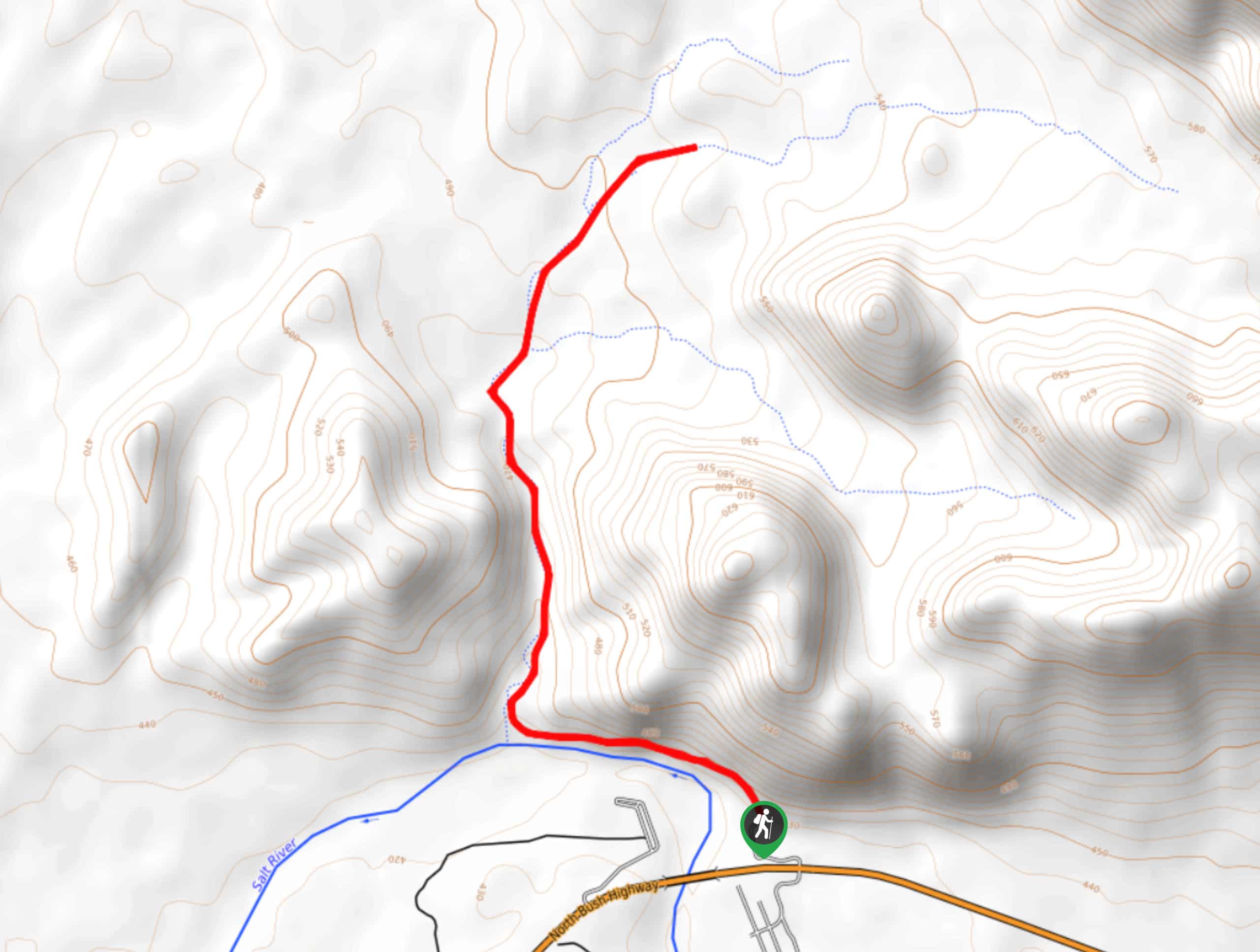
- Butcher Jones Trail - Butcher Jones Trail leads you through the Sonoran Desert to the shores of Saguaro Lake and the Salt River. This is an absolute oasis in the middle of the desert and an excellent place to spot wildlife like bighorn sheep, javelinas, and bald eagles. If you’re exceptionally lucky, you could even spot the wild horses of the Lower Salt River while travelling through the area.
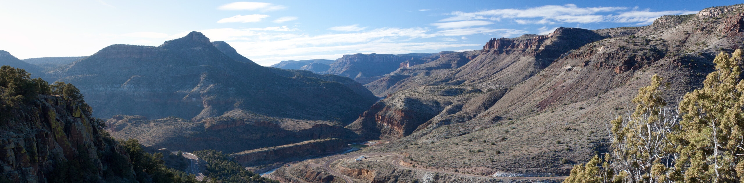
- Bob Bear Trail - Bob Bear Trail (formerly known as Fossil Springs Trail) is one of the most popular day hikes in the Tonto National Forest. This trail leads you along a canyonside route with amazing views of the Verde Valley, down through a treed-in trek, and to Fossil Springs. These springs flow over a short waterfall into a swimming hole. It’s a beautiful site that’s ideal on hot, sunny days.
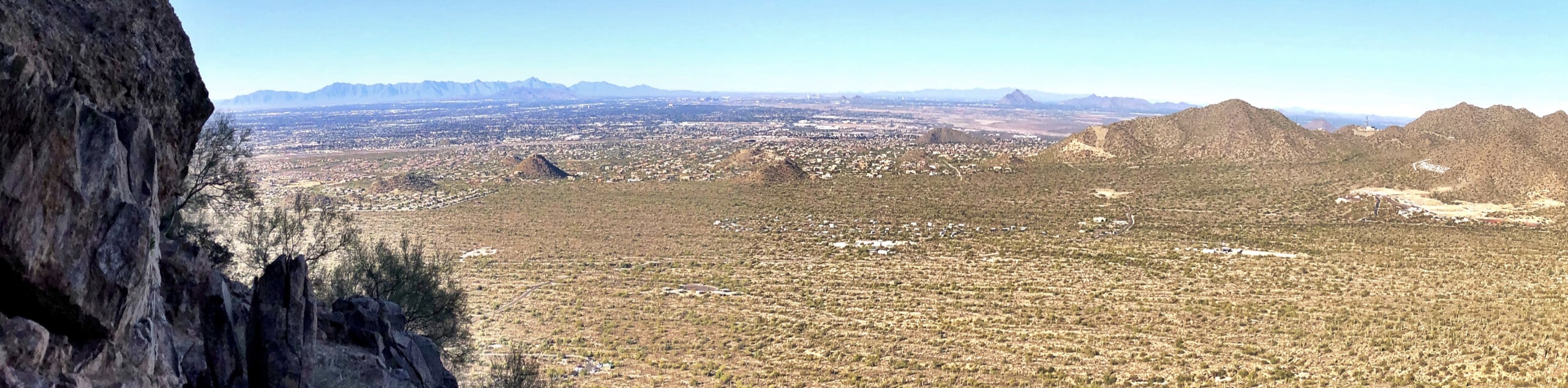
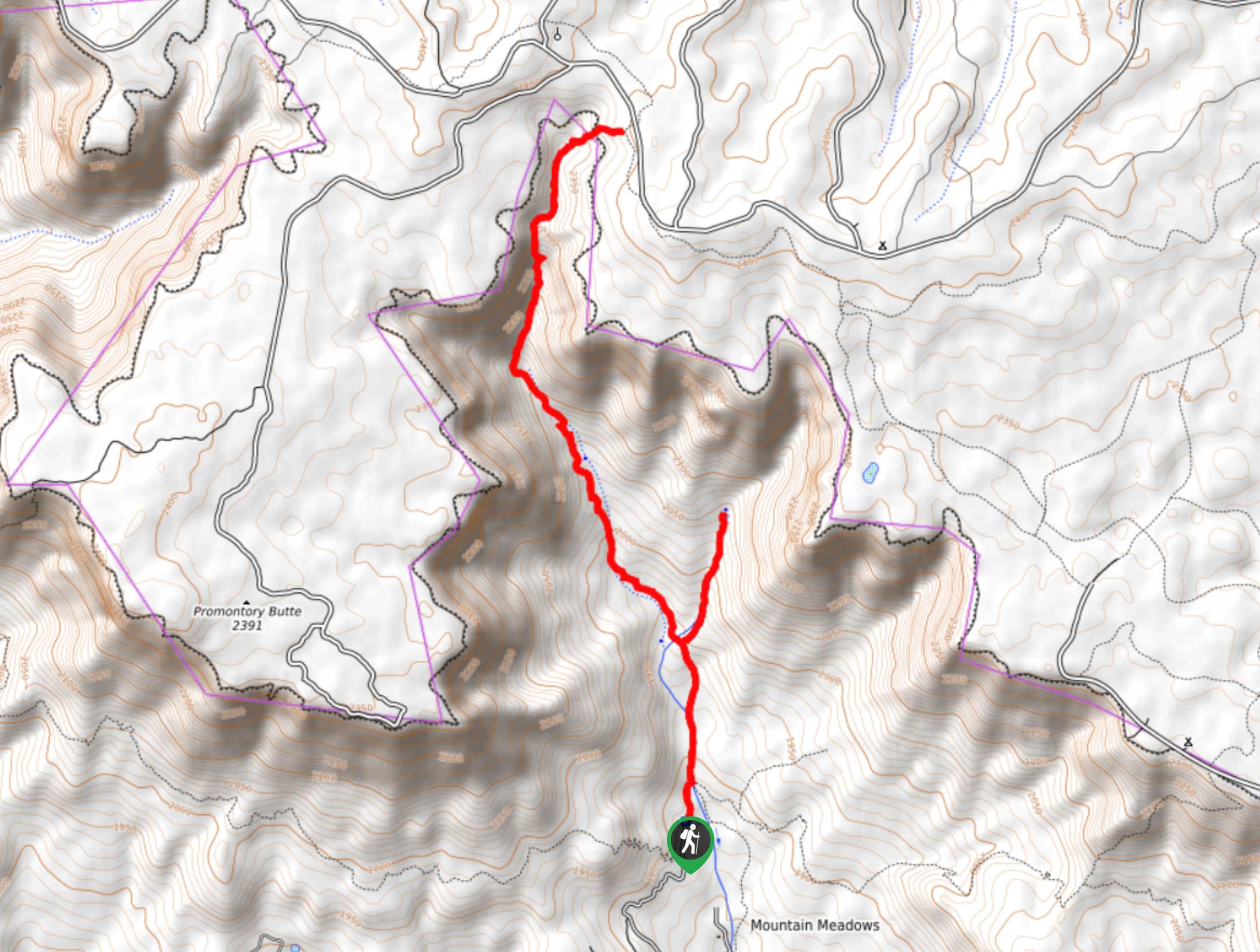
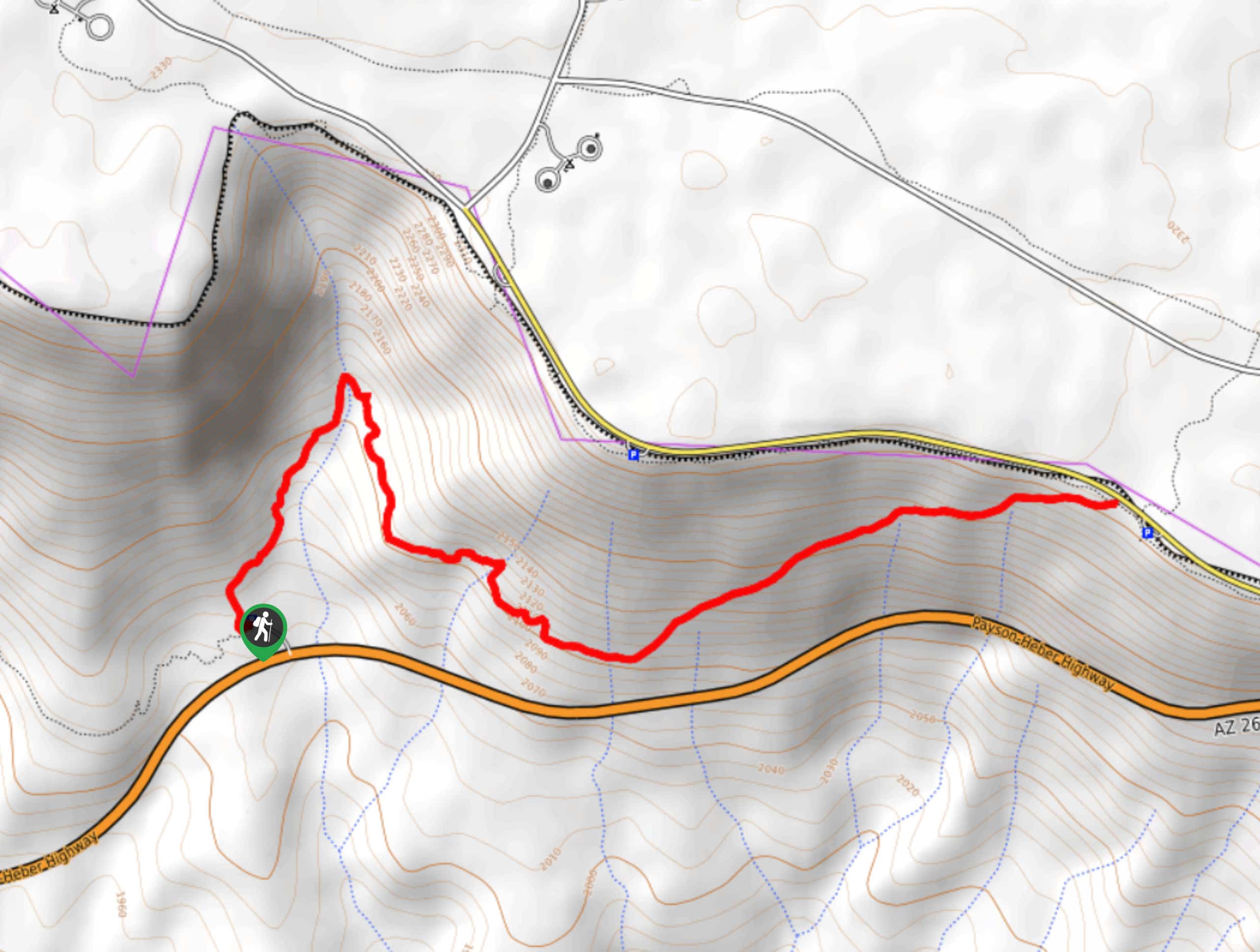
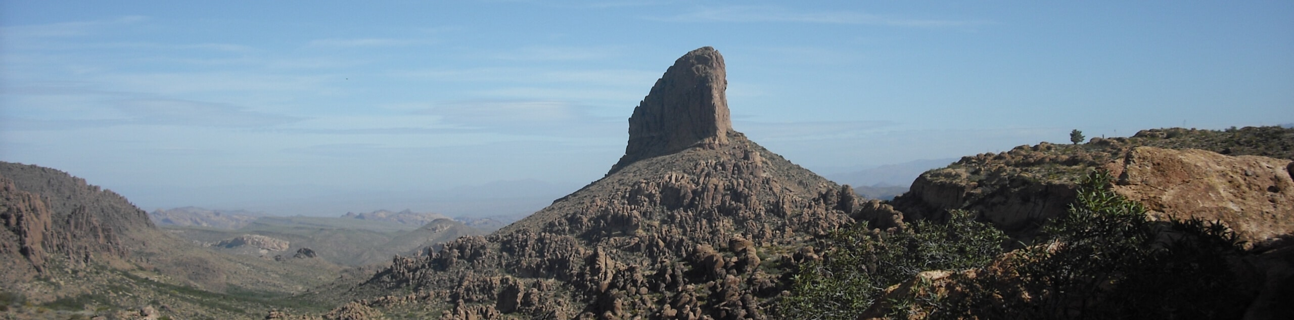
- Picketpost Mountain Trail - Picketpost Mountain Trail is a 4.2mi hike that leads you up a dramatic, isolated butte. Previously used as a battleground in efforts by Geroge Stoneman to seize this land from the Yavapai, the butte is now an area for campers and hikers to appreciate Arizona’s rugged scenery. At the top, make sure you bring a little note or treat to place in the mailbox. You can also read the notes from previous hikers.
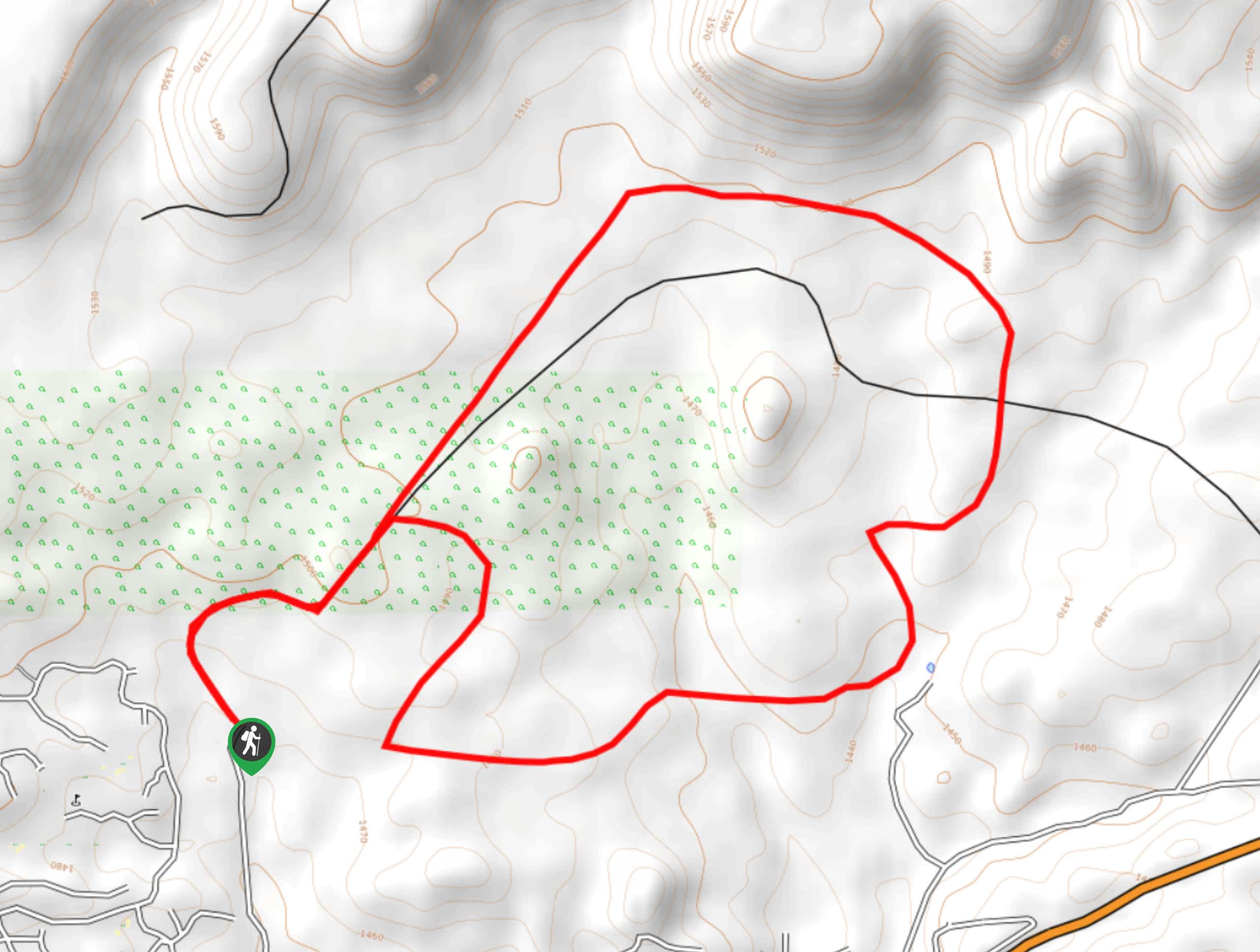
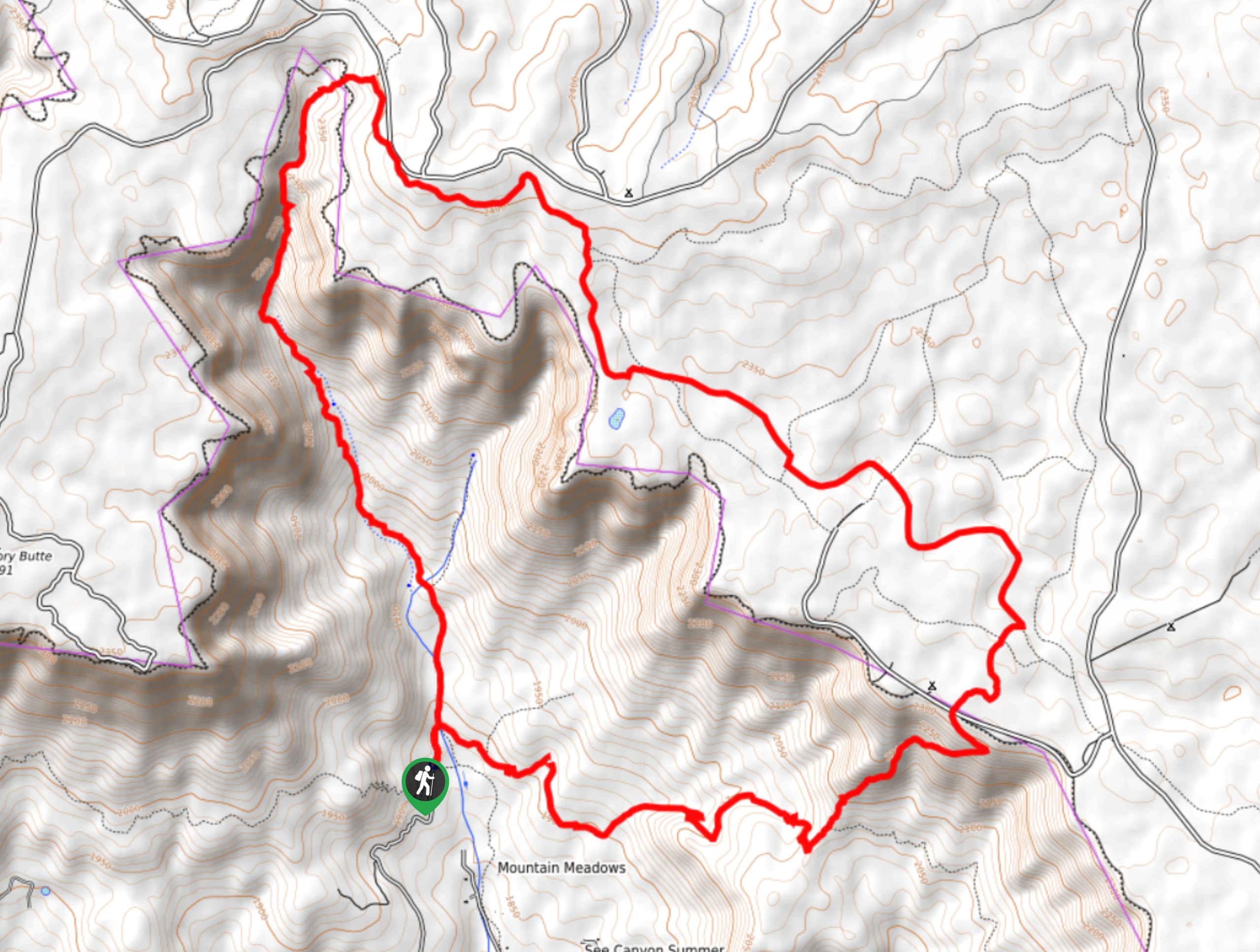
- Bulldog Saddle and Pass Mountain - The Bulldog Saddle and Pass Mountain Trail Loop is a fun hike that starts right from the city limits of Apache Junction. The hike takes you all the way around Peak 3004 and beside Pass Mountain. The views are awesome and the hike will get your legs working without being overly strenuous. This is a good pick if you want to feel like you’re in the mountains without having to actually climb one.
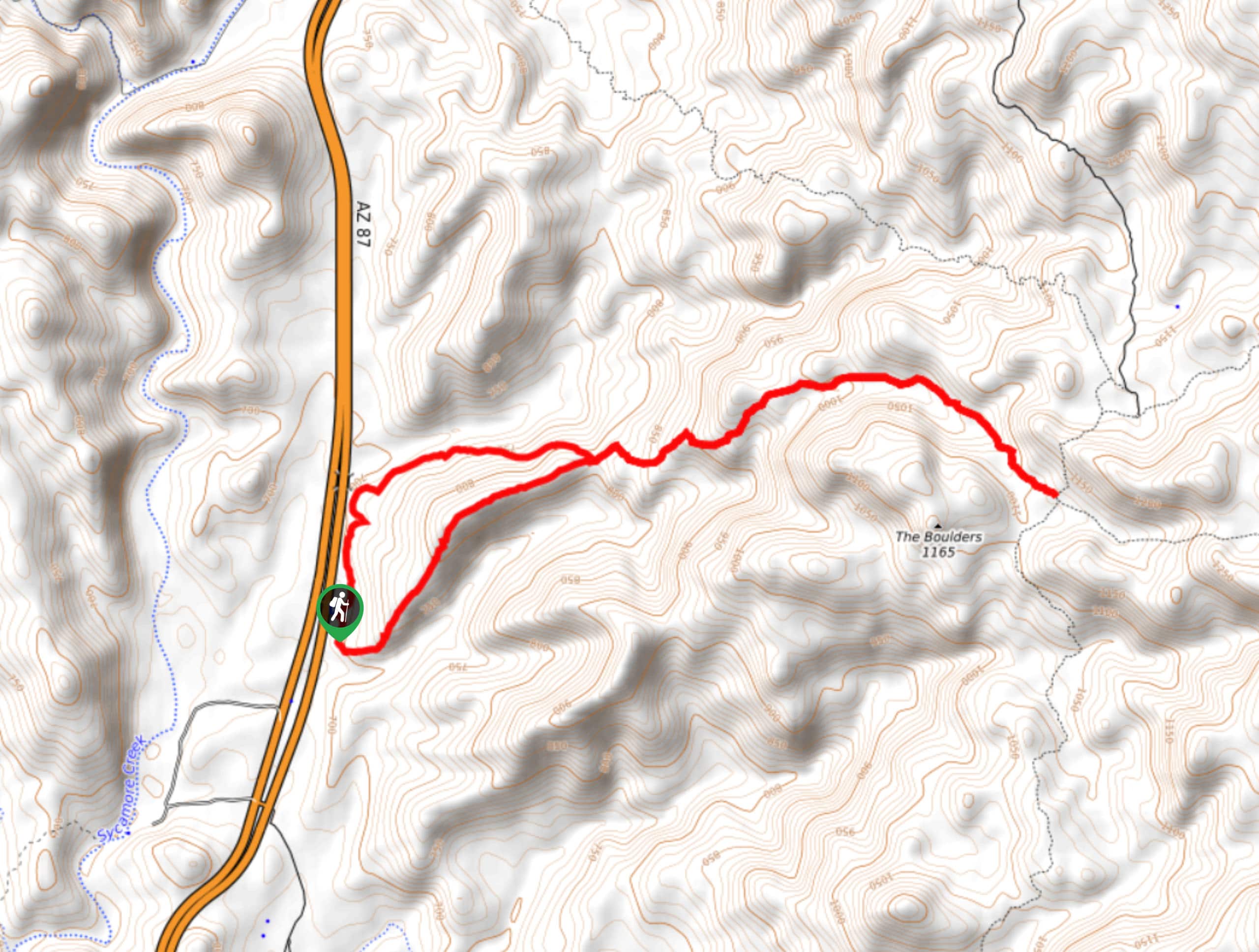
- Hawes Trail System Loop - The Hawes Trail System is a well-developed mountain biking and hiking route collection near the Salt River. This loop makes use of several trails in the system to put together a hike with awesome desert and river scenery. You can even check out an old mine shaft from the region’s past mining days.
- Blue Wash Trail - Blue Wash Trail is a scenic 2.8mi just north of Phoenix. This route leads you through a wash to Camp Creek Falls. With rugged canyon scenery, a few viewpoints, and the flowing water to follow as you near the falls (depending on the time of year), this is an enjoyable hike for all skill levels. This trail is also popular with horseback riders.
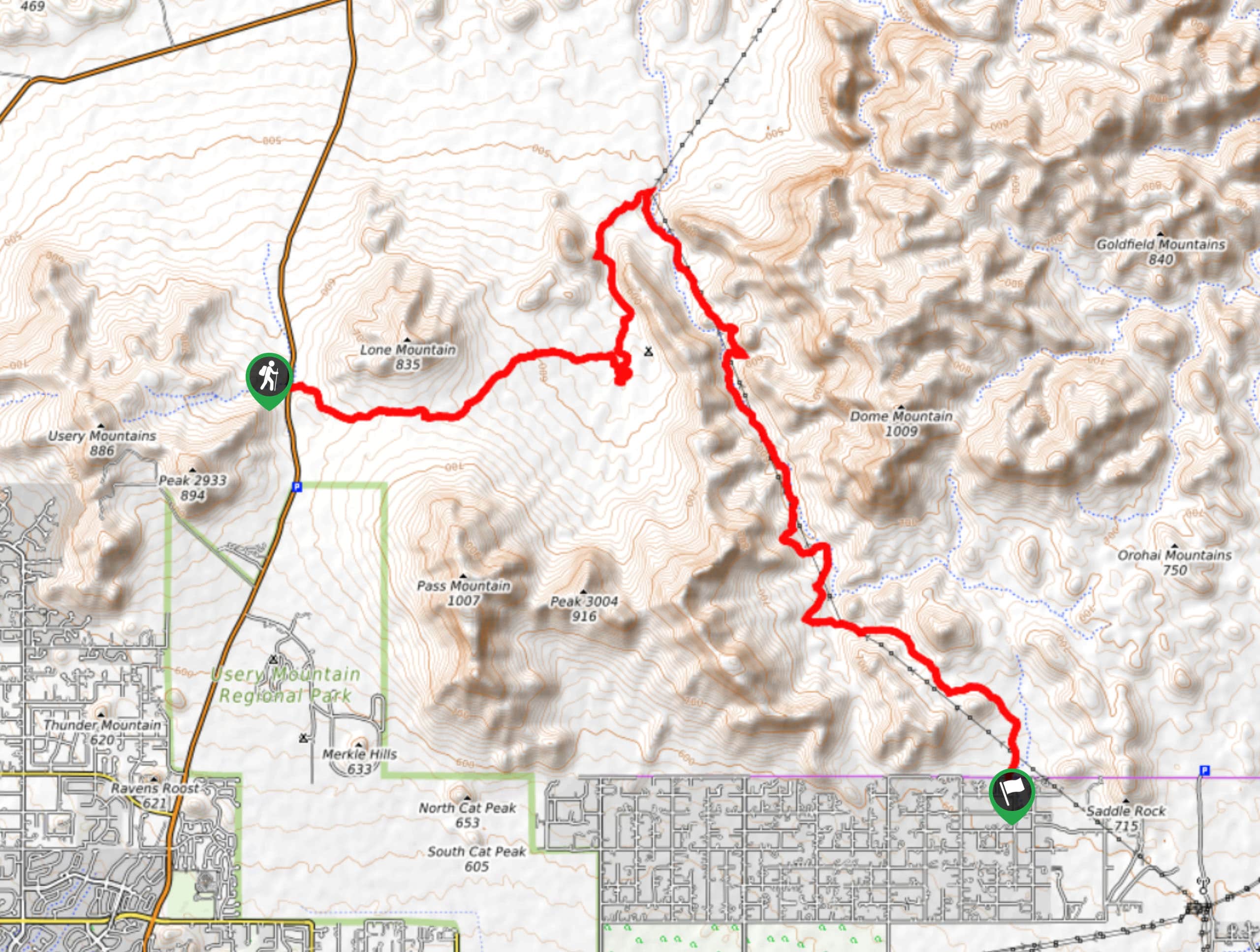
- Lone Mountain - Lone Mountain, also known as EJ Peak by locals, is a 2,800-foot mountain in the Usery Range just outside of Phoenix. The trail up the mountain and back is only 2.3mi roundtrip, making this one of the easier summits you can bag. From the top, enjoy a fantastic view of Pass Mountain, Brown’s Peaks, McDowell Peak, and the rest of the Goldfield and Usery Mountains in the distance.
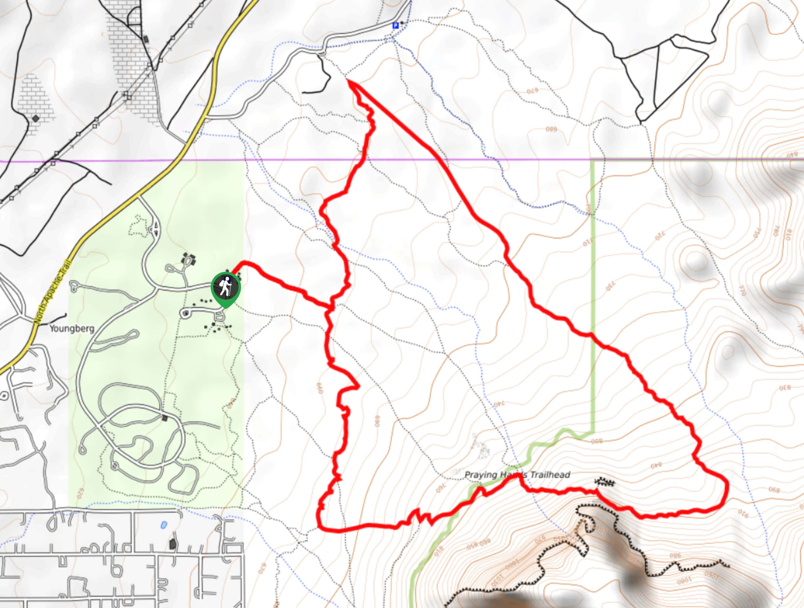
- Praying Hands to Slot Rock - Want to check out two of the coolest rock formations in the Tonto National Forest in one hike? The Praying Hands to Slot Rock hike is an awesome trek that shows off just how otherworldly the scenery of the Arizona desert can be. You’ll start at Praying Hands, a rock formation that--you guessed it--looks just like praying hands. You’ll then hike to Slot Rock, another neat formation with natural windows and narrow slots.
- Massacre Falls - As the legends of the Superstition Wilderness say, a rich Mexican family came to this area to mine gold in the 1840s. Cornered and killed by the Apache, Massacre Falls and Massacre Falls Trail got their names from this bloody past. Don’t let the moniker deter you, though. This is a great waterfall hike with lots of pleasant scenery and not as much violence these days.
Scroll down to see even more hiking trails in the Tonto National Forest.
When is the Best Time to Hike in the Tonto National Forest
The best time to hike in the Tonto National Forest depends on the part of the forest you’re in. If you’re closer to Phoenix or exploring lower elevation desert trails, you’ll want to avoid the scorching summer months. Visiting between mid-October and late May will keep you out of the brutal heat. Note that this region experiences a monsoon season in the summertime that can make hiking dangerous due to flash flooding. As a rule of thumb, raincheck your hike if a monsoon is on the way.
If you’re in higher elevation areas, you’ll often be able to hike year-round. Some mountaintops get snow in the winter that can make hiking difficult, but for the most part, a light jacket should suffice to make your winter explorations in the forest viable. No matter where you are in the forest, the summer will likely still get very hot, so if you’re not used to the Arizona heat, we recommend avoiding July and August at least.
Other Outdoor Activities in the Tonto National Forest
While the trails are excellent, hiking is certainly not the only way to explore the Tonto National Forest! There’s lots that can be done outside out here.
Adventurers on two wheels can take advantage of the many mountain bike and dirt bike paths. Those with four-legged friends can explore horse and dog-friendly trails. Campers can set up their tents in sites both backcountry and front-country. Photographers can capture the rugged beauty of the desert and the unique wildlife that calls it home, and those who love off-roading will find exciting trails to cruise.
How to Plan a Trip to the Tonto National Forest
The Tonto National Forest is an easy enough region to plan a trip to, with only a bit of advance planning necessary to make sure your trip goes off without a hitch.
Since the forest is so large, you’ll want to pick a home base or two. The Phoenix area enjoys easy access to a large part of the forest, particularly the northern and northeastern suburbs. If you want to stay out of the city, there are lots of routes accessible from Payson, Goldfield, Roosevelt, and other small towns northeast of Phoenix. State parks and towns within the Tonto National Forest often offer camping opportunities. If you’ll be booking campsites in the busy season (generally April-May and October-November), book as soon as you know your plans to ensure you get the spots you need.
Most of the trails in the Tonto National Forest require a pass. Check with the USDA to see what kind of pass best suits your travel plans. Day passes can be purchased at many gas stations throughout the forest.
Arizona Adventure Tours
From deserts to epic canyons and from red rock mountains to creek-lined forests, Arizona’s got some of the most impressive and diverse scenery in the United States. Want to see it with the help of an expert guide or take a self-guided tour? Check out our adventure tours in Arizona.
Frequently Asked Questions About the Tonto National Forest
Is the Tonto National Forest worth visiting?
The Tonto National Forest is definitely worth it, especially for those who want to hike, bike, or otherwise explore somewhere that feels rugged and off the beaten path. With a diverse range of scenery to see, you can appreciate the desert beauty near Phoenix or head up into the mountains to check out grand forests.
What is the best month to visit the Tonto National Forest?
We like to visit the forest in the spring (April and May) when the wildflowers are starting to bloom and the weather isn’t too hot yet.
Why is it called the Tonto National Forest?
The forest contains the Tonto Basin, which is where the name came from.
Can you have a fire in the Tonto National Forest?
This area is extremely prone to wildfires, so many campsites restrict fire activity. Check with your specific destinations and don’t start any fires unless you can confirm they’re permitted.
Can you camp anywhere in the Tonto National Forest?
While you can’t quite camp anywhere, there are lots of camping areas in the forest you can take advantage of.
Explore other great hiking regions in the United States
Or check out our full range of tour destinations in the United States.
Read MoreThe best hikes in Tonto National Forest
01. Water Wheel Falls Hike
Difficulty
Water Wheel Falls is a hike in the Tonto National Forest near Payson that has… Read More
02. Wave Cave Trail
Difficulty
You probably didn’t think you could surf in Arizona, did you? The Wave Cave is… Read More
03. Box Canyon Trail
Difficulty
When the temperatures start to soar, you need a chilled-out afternoon in a refreshing swimming… Read More
04. Verde Hot Springs Hike
Difficulty
The Verde Hot Springs hike takes you along an easy trail to a hot spring… Read More
05. Treasure Trail and Siphon Draw Loop
Difficulty
The Treasure Trail and Siphon Draw Loop is a 3.0mi hike in Tonto… Read More
06. Horton Creek Trail
Difficulty
Horton Creek Trail is a 8.6mi route in the Tonto National Forest that… Read More
07. Butcher Jones Trail
Difficulty
Butcher Jones Trail leads you through the Sonoran Desert to the shores of Saguaro Lake… Read More
08. Bob Bear Trail
Difficulty
Bob Bear Trail (formerly known as Fossil Springs Trail, not to be confused with Fossil… Read More
09. Picketpost Mountain Trail
Difficulty
Picketpost Mountain Trail is a 4.2mi out and back hike that leads you… Read More
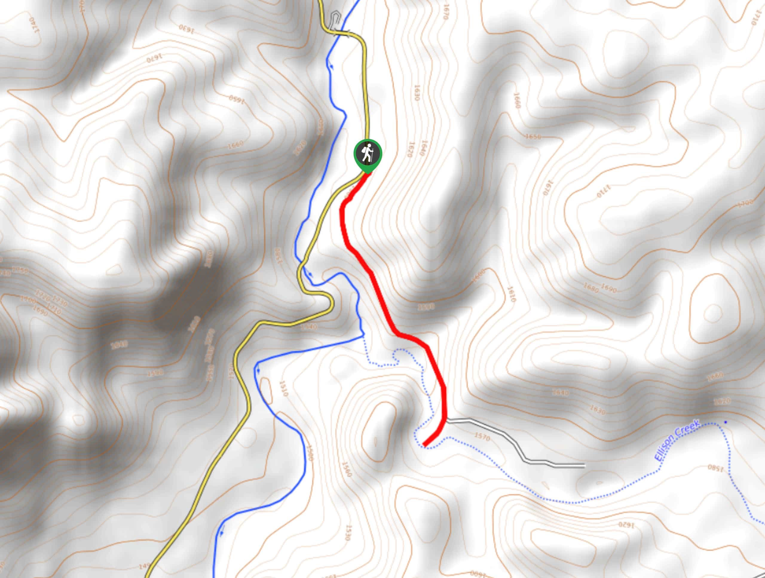
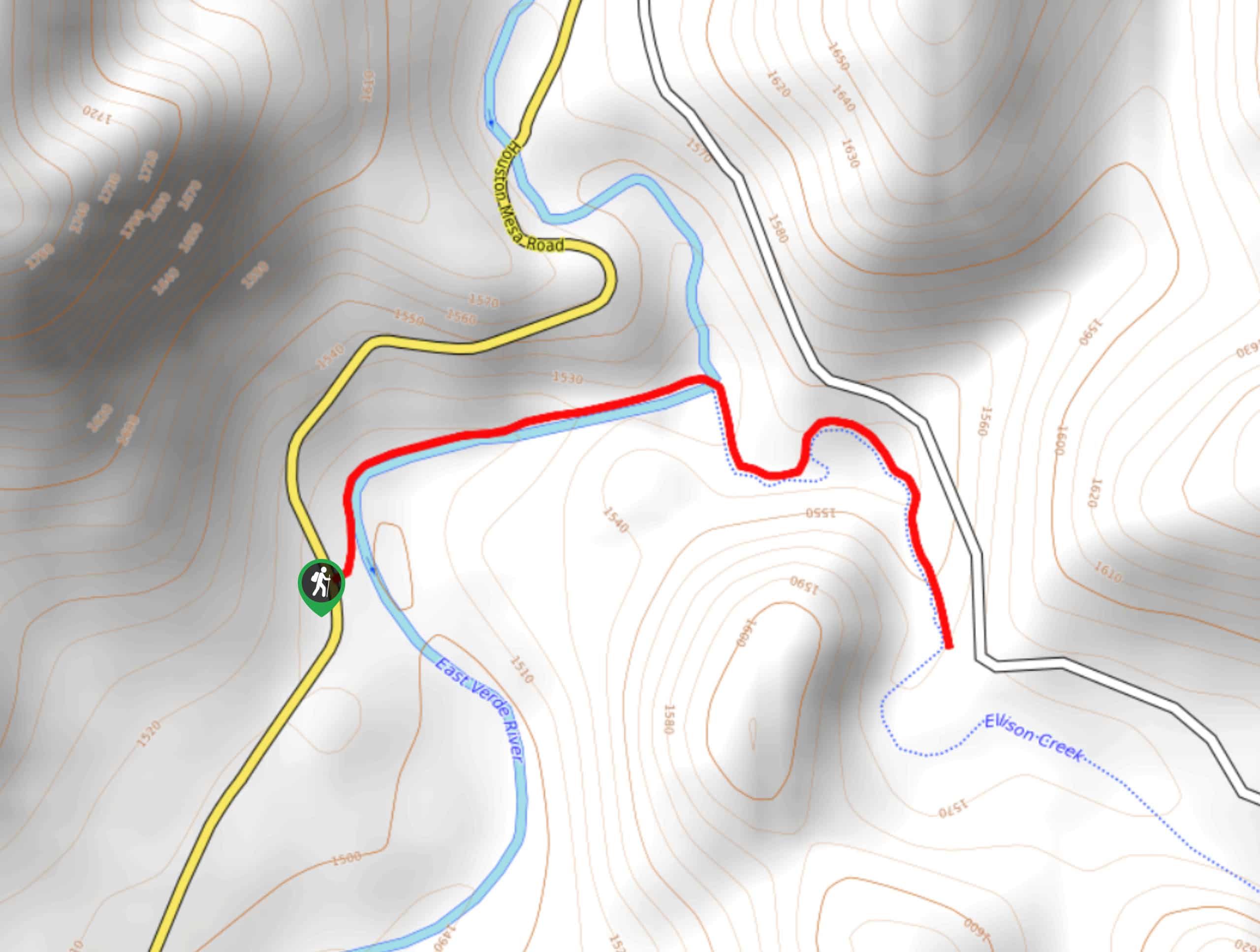
10. Ellison Creek Cascades Hike
Difficulty
The Ellison Creek Cascades are waterfalls in the Tonto National Forest near Payson that have… Read More
Yes, there are more than 10
Tonto National Forest is so beautiful that we can not give you only 10 hikes. So here is a list of bonus hikes in Tonto National Forest that you should take a look at as well
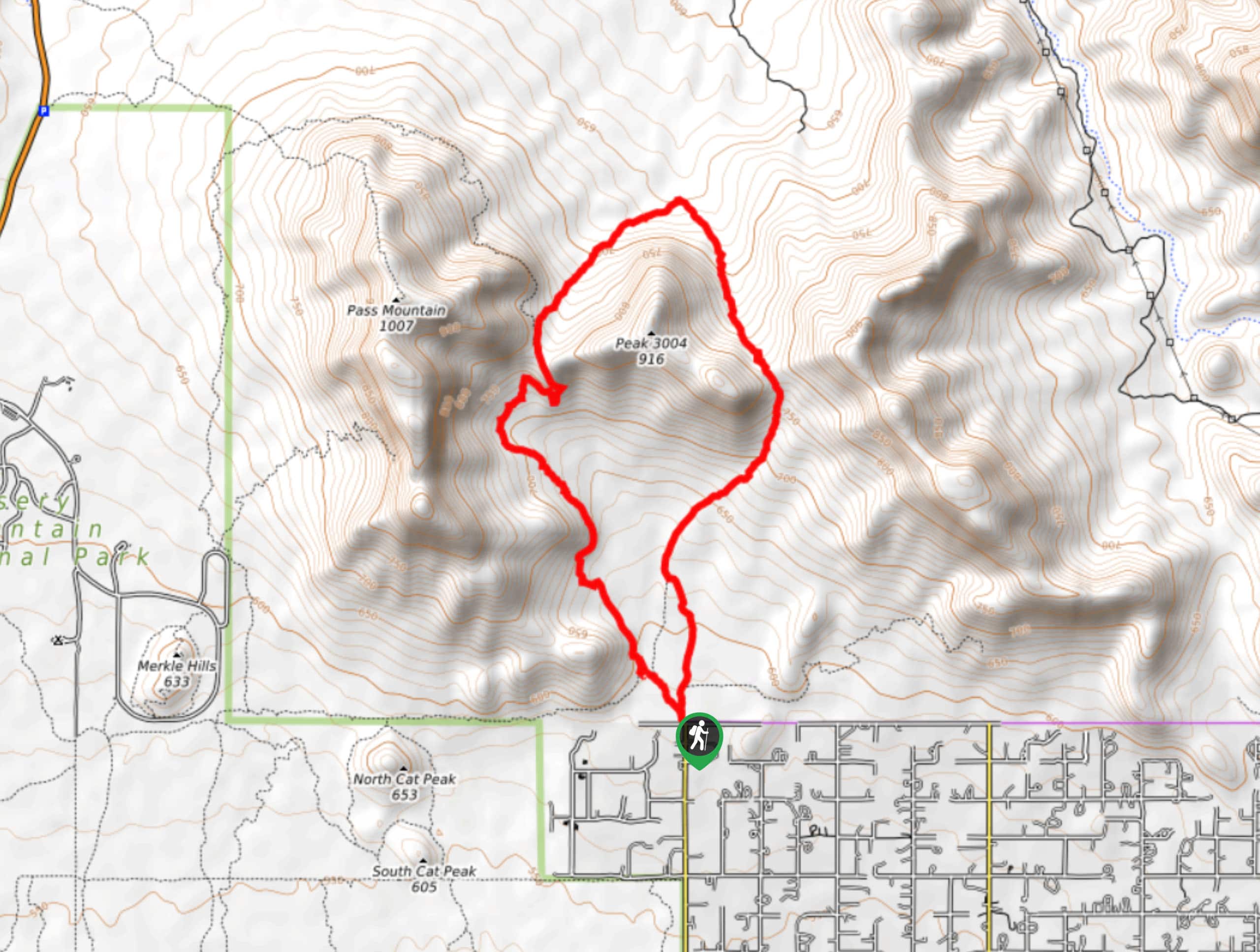
11. Bulldog Saddle and Pass Mountain Trail Loop
Difficulty
The Bulldog Saddle and Pass Mountain Trail Loop is a fun hike that starts right… Read More
12. Treasure Loop Trail
Difficulty
The Treasure Loop Trail leads you through an area once defined by Arizona’s gold rush.… Read More
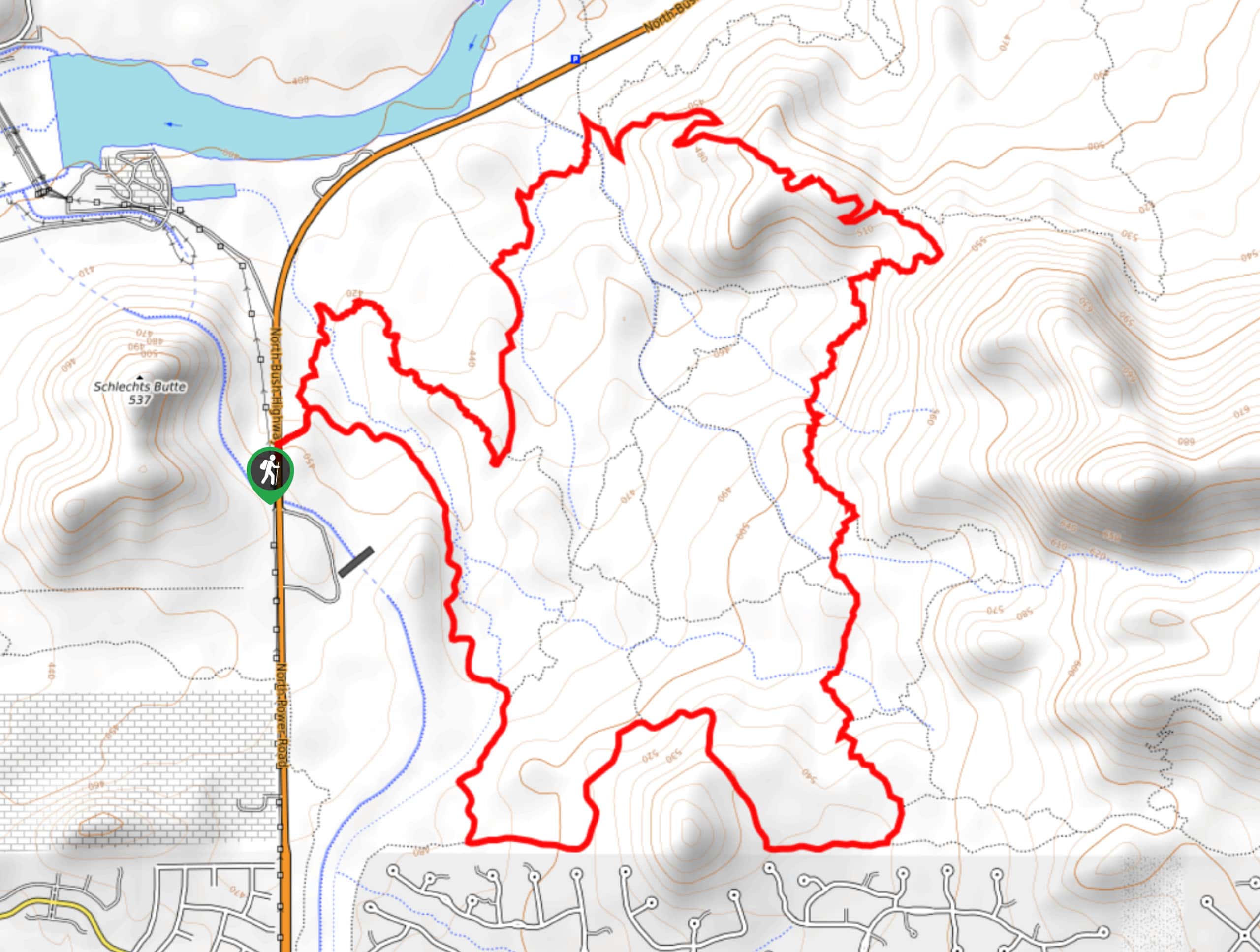
13. Hawes Trail System Loop
Difficulty
The Hawes Trail System is a well-developed mountain biking and hiking route collection near the… Read More
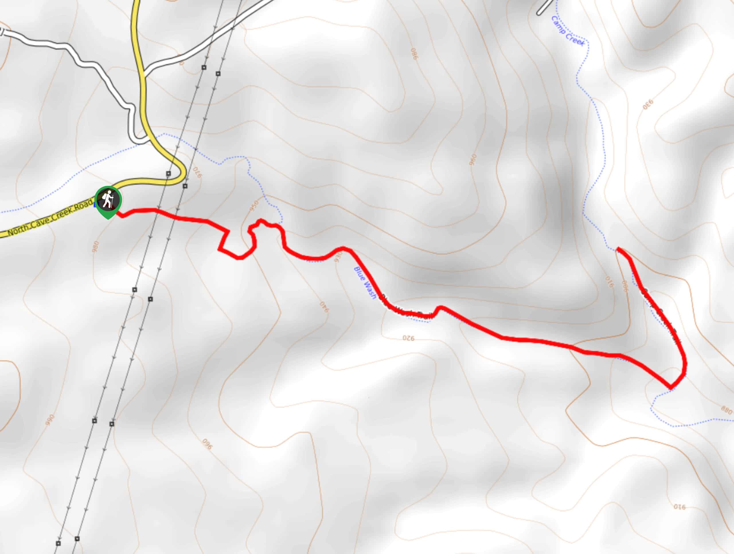
14. Blue Wash Trail
Difficulty
Blue Wash Trail is a scenic 2.8mi hike in the Tonto National Forest… Read More
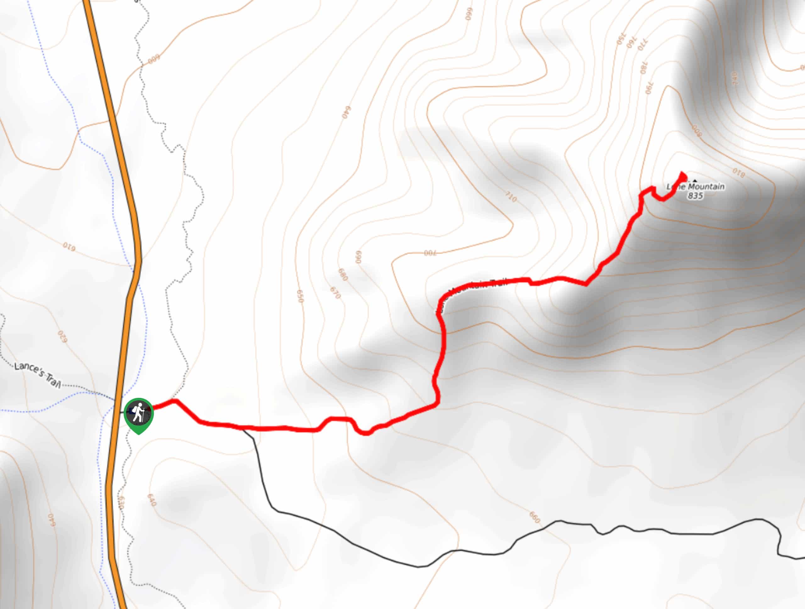
15. Lone Mountain Hike
Difficulty
Lone Mountain, also known as EJ Peak by locals, is a 2800ft mountain… Read More
16. Horton Creek, Highline, and Derrick Loop
Difficulty
The Horton Creek, Highline, and Derick Loop makes use of three lovely trails to create… Read More
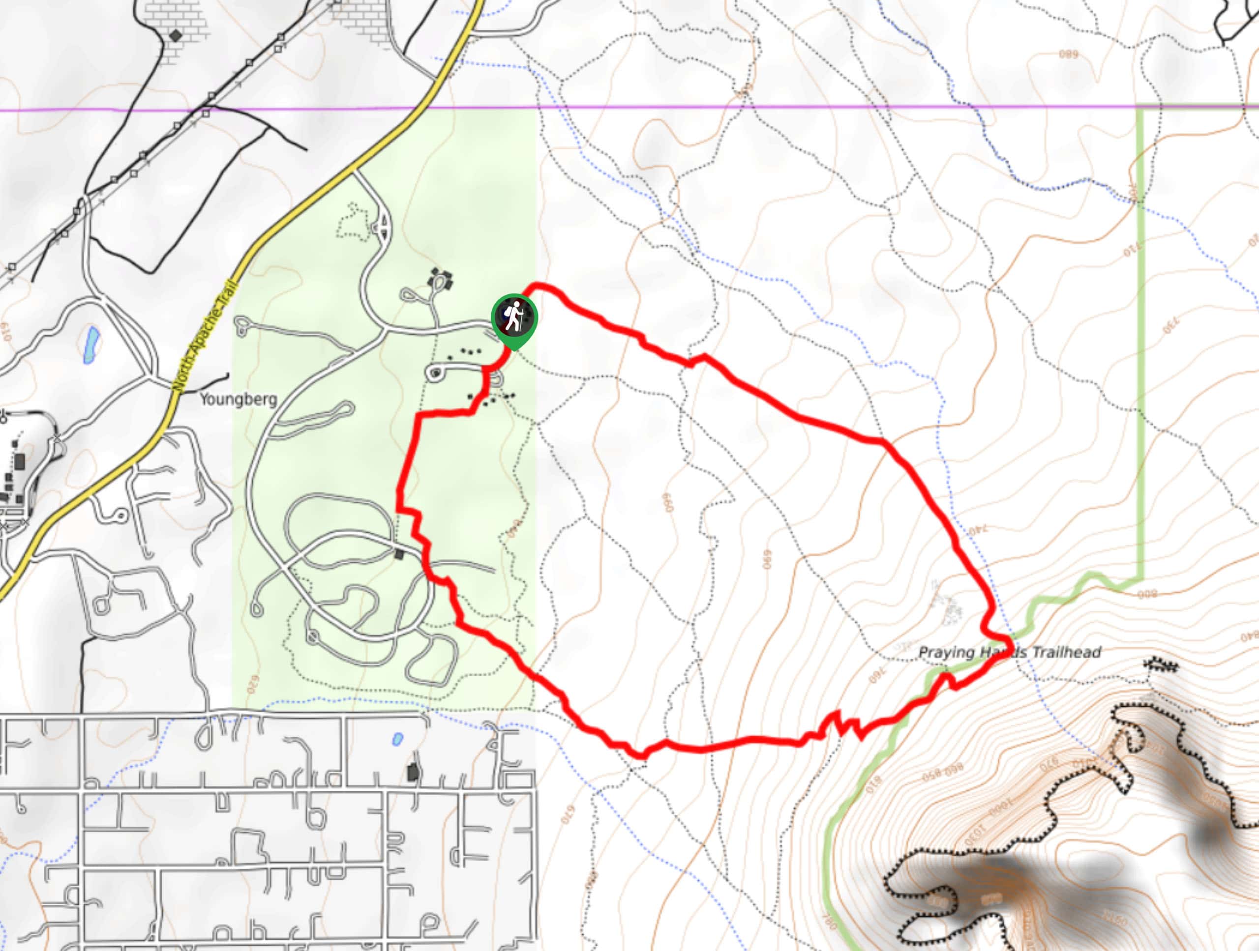
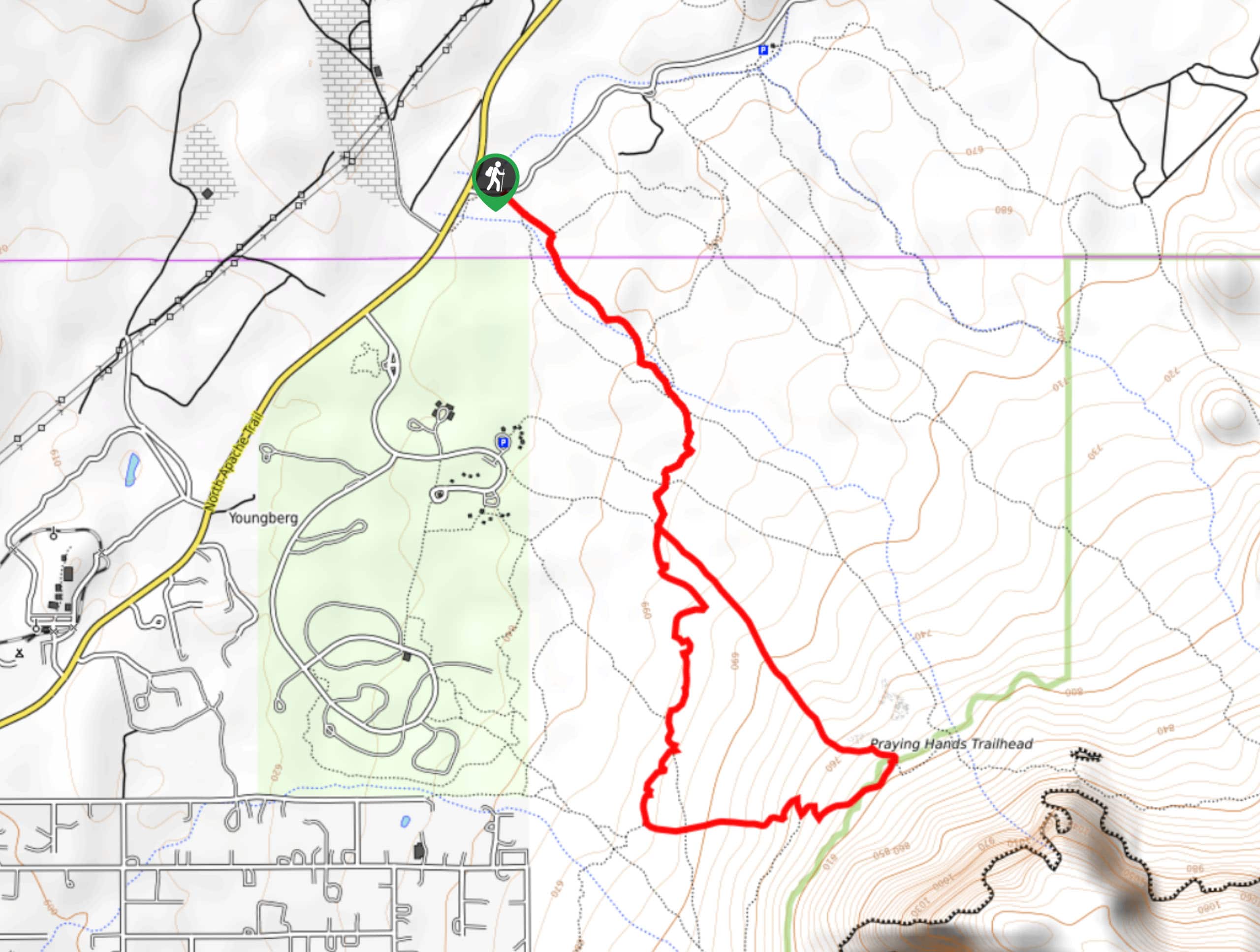
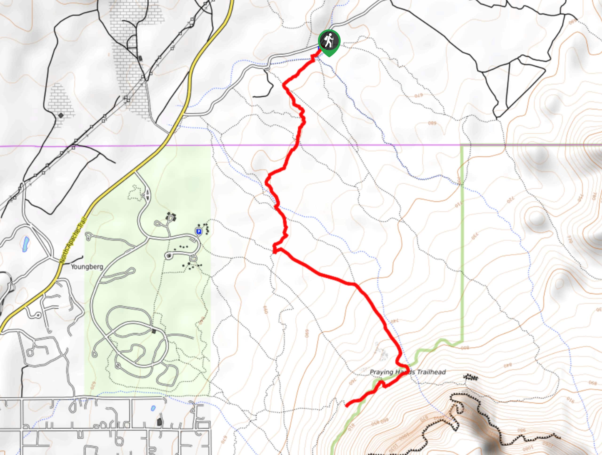
17. Praying Hands to Slot Rock Hike
Difficulty
Want to check out two of the coolest rock formations in the Tonto National Forest… Read More
18. Massacre Falls Trail
Difficulty
As the legends of the Superstition Wilderness say, a rich Mexican family came to this… Read More
19. Hawes Ridge Loop
Difficulty
The Hawes Trail System is a well-planned and maintained mountain biking and hiking route network… Read More
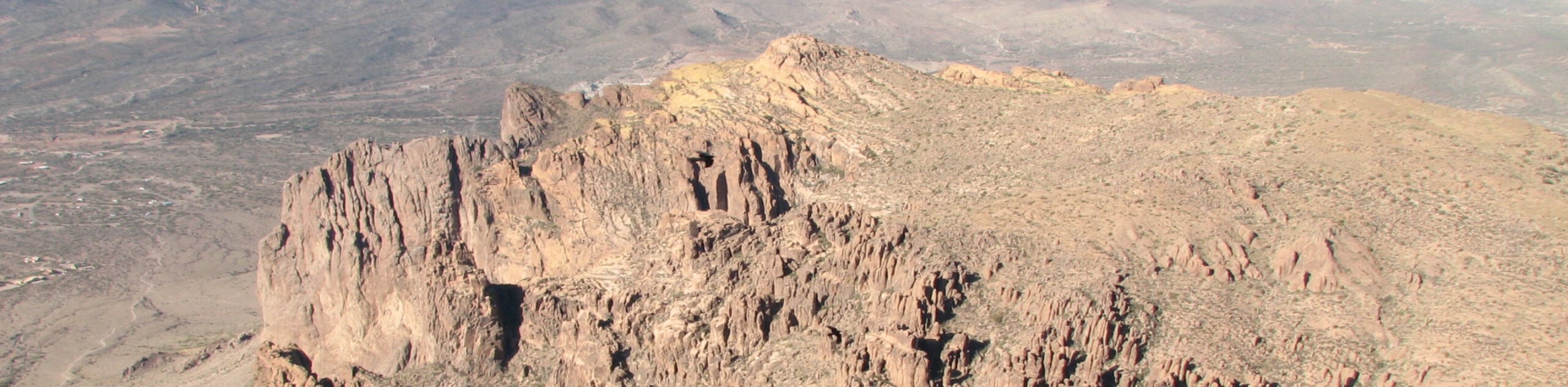
20. The Flatiron via Siphon Draw Loop
Difficulty
The Flatiron via Siphon Draw Loop is a 5.5mi hike in Tonto National… Read More
21. Pine Loop Trail
Difficulty
The Pine Loop Trail is a laidback 1.7mi loop hike near Pine, Arizona… Read More
22. Icehouse Canyon Trail
Difficulty
The Icehouse Canyon Trail #198 is an incredible hike that we’d venture to call an… Read More
23. Cypress Trail to Boulders Trail Loop
Difficulty
The network of trails right outside of Payon makes adventure easy for those in town,… Read More
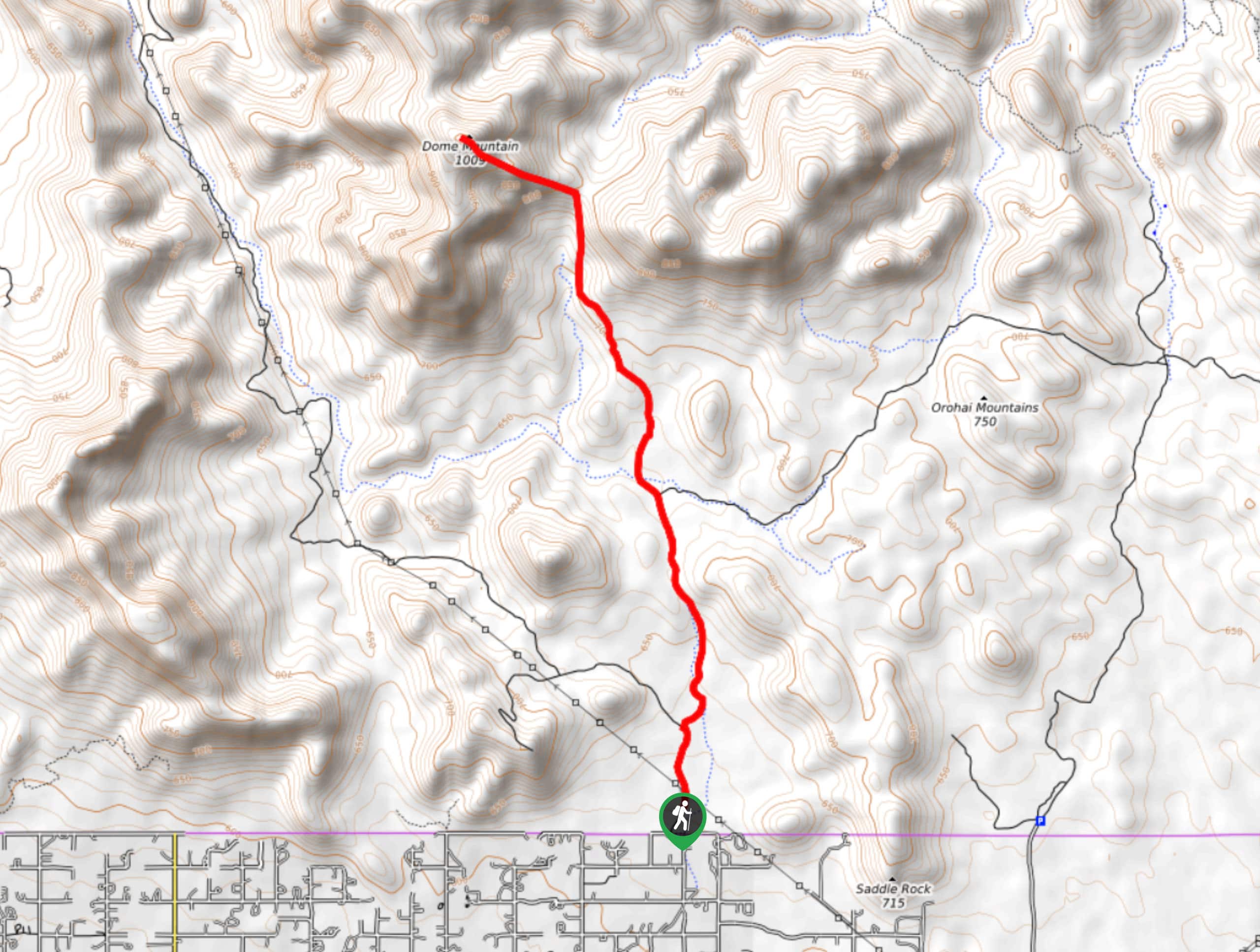
24. Dome Mountain Hike
Difficulty
Dome Mountain sits just north of Apache Junction, Arizona. The 6.2mi roundtrip hike… Read More
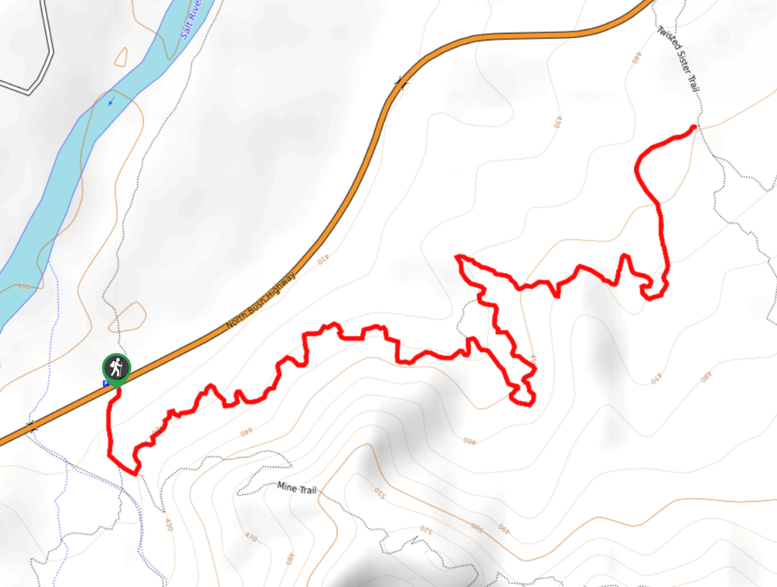
25. Saguaro Trail
Difficulty
The Saguaro Trail undulates up over a hill near the Salt River in the Tonto… Read More
26. Barnhardt Waterfall Trail
Difficulty
The Barnhardt Waterfall Trail is a 6.0mi hike in the Tonto National Forest… Read More
27. Barnhardt Trail
Difficulty
The Barnhardt Trail is a 12.0mi hike in the Tonto National Forest that… Read More
28. Deer Creek Loop Trail
Difficulty
The Deer Creek Loop is a challenging day hike or backpacking route with 18.3mi Read More
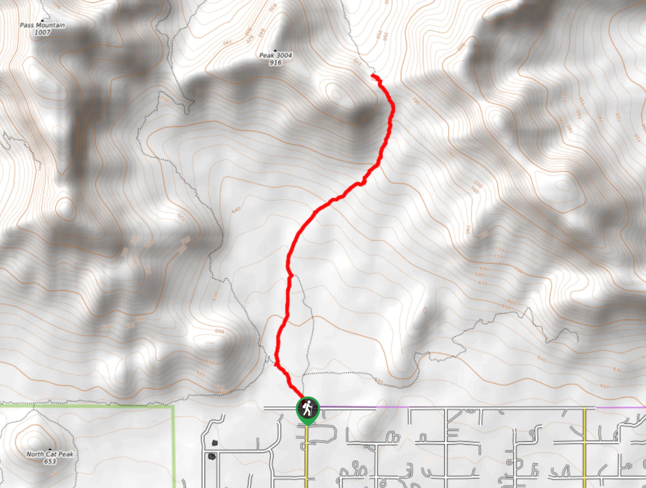
29. Pass Mountain Hike
Difficulty
Pass Mountain is a hike that toes the line of climbing. Hikers don’t call it… Read More
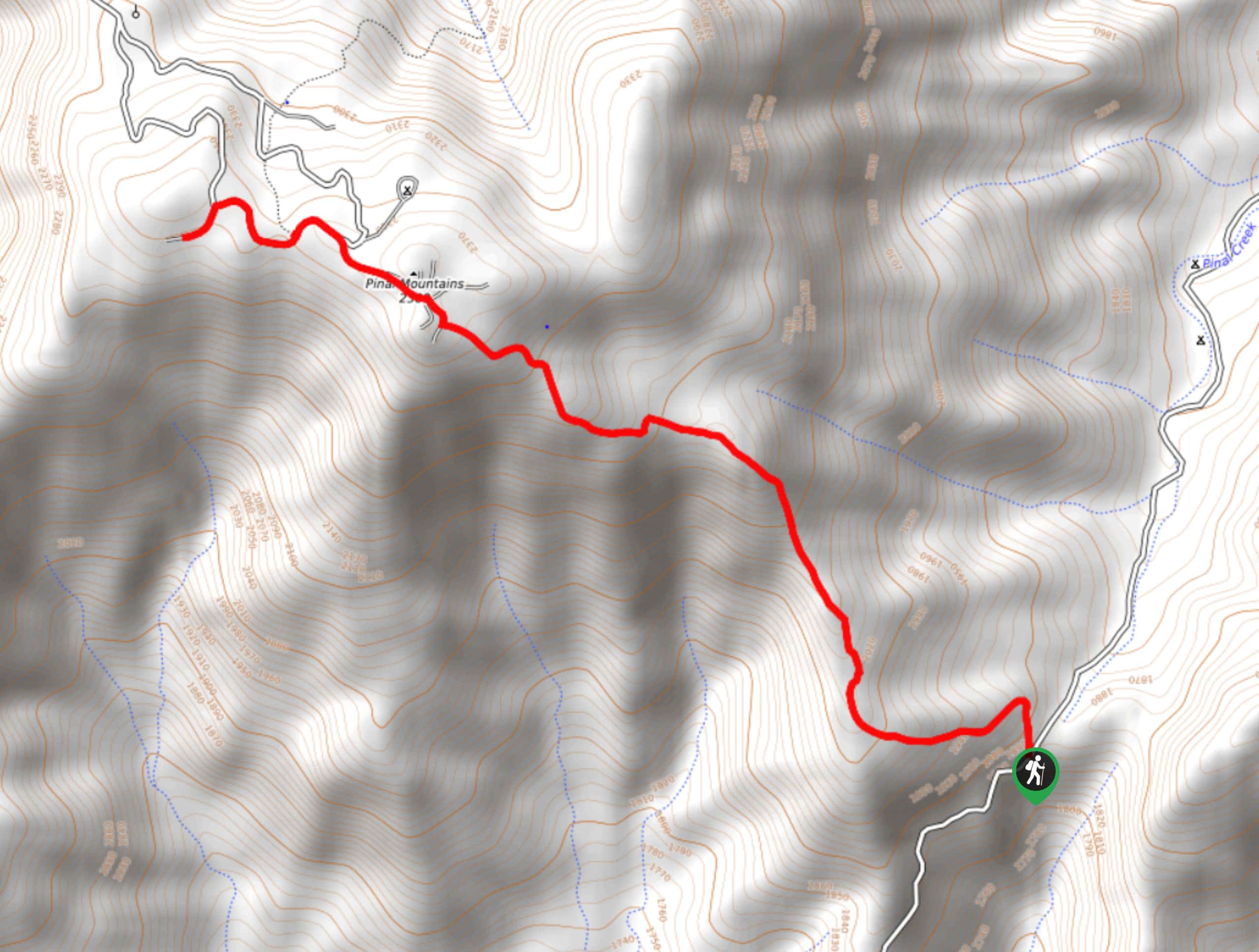
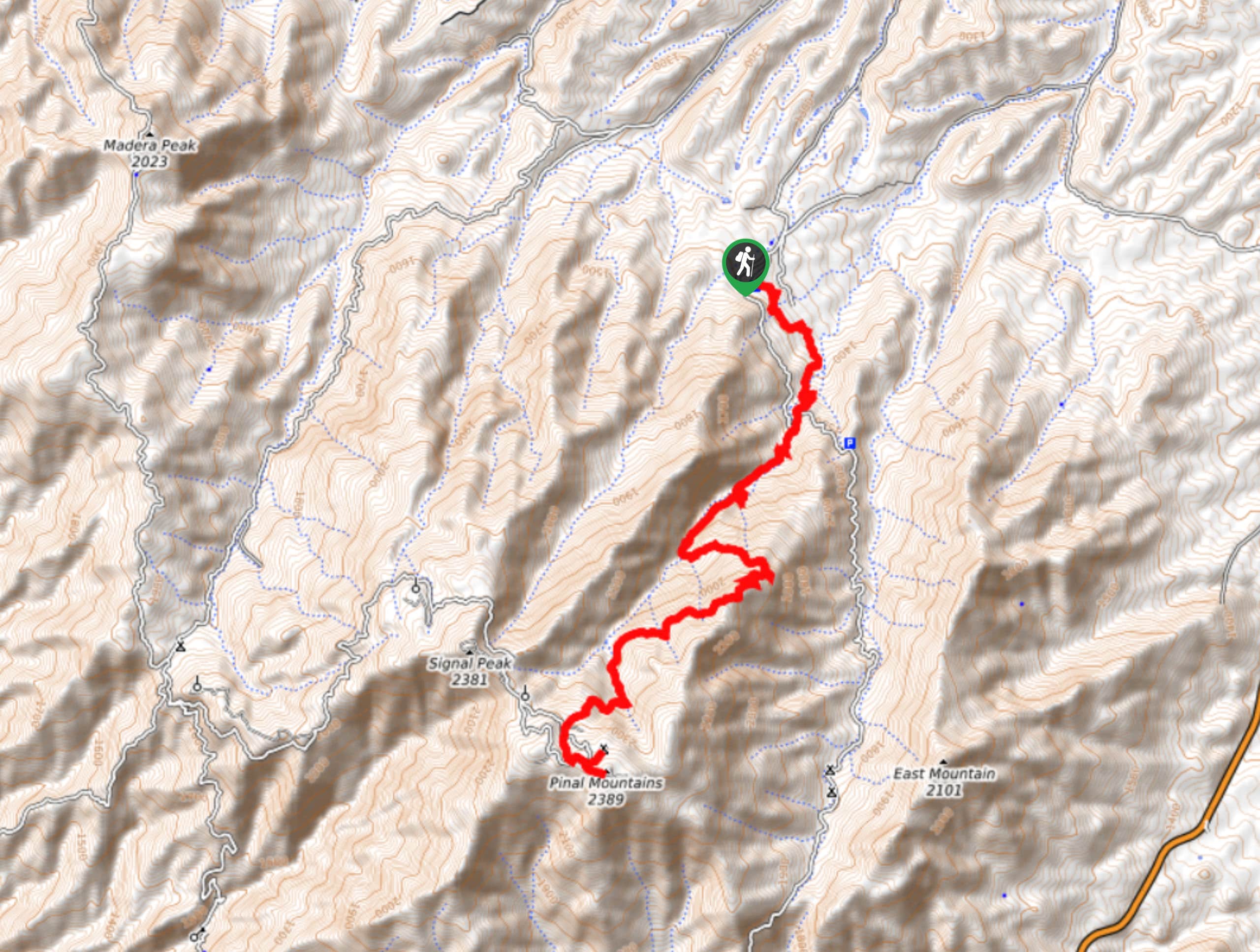
30. Pinal Peak via Pioneer Pass
Difficulty
Pinal Peak via Pioneer Pass is a 4.8mi out and back hike in… Read More
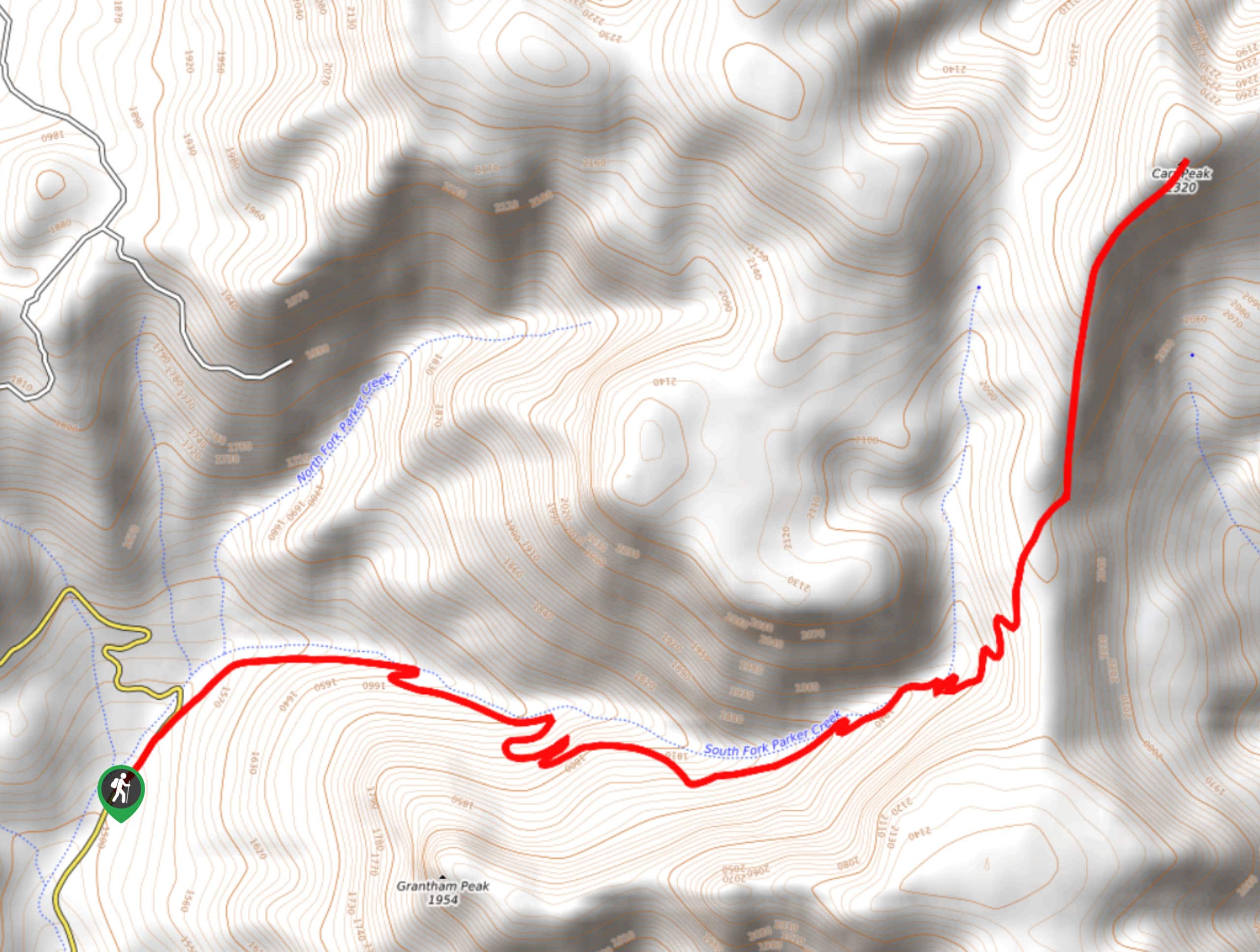
31. Parker Creek Trail
Difficulty
Parker Creek Trail is a 6.4mi hike in the Tonto National Forest that… Read More
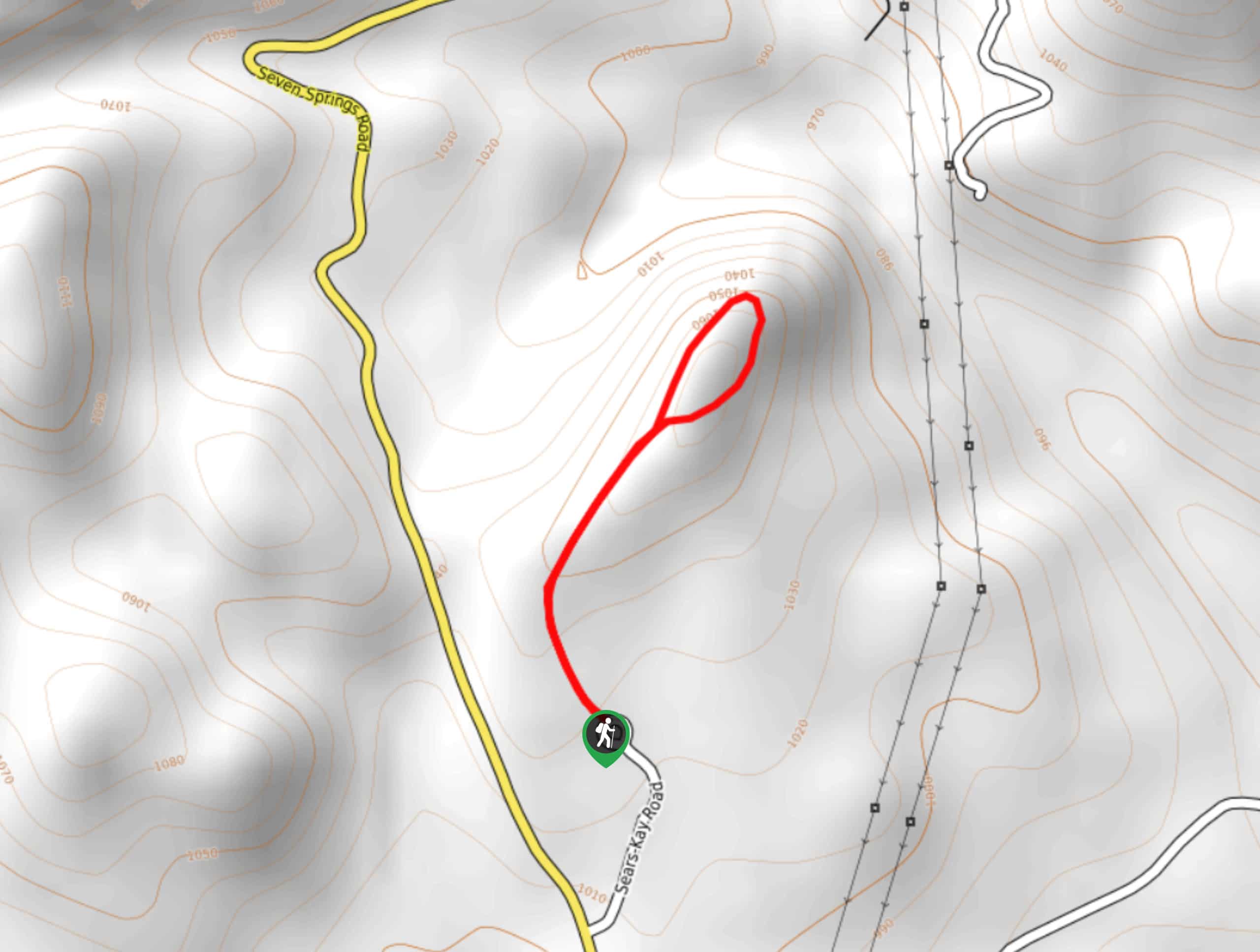
32. Sears Kay Ruins Trail
Difficulty
The Sears Kay Ruins Trail is an interesting hike suitable for all skill levels and… Read More
33. Palo Verde Trail
Difficulty
The Palo Verde Trail hugs the shores of Bartlett Lake with SB Mountain looming overhead.… Read More
34. Gordon Creek Falls Trail
Difficulty
Gordon Creek Falls Trail is an enjoyable hike packed with cliff views and flowing water.… Read More
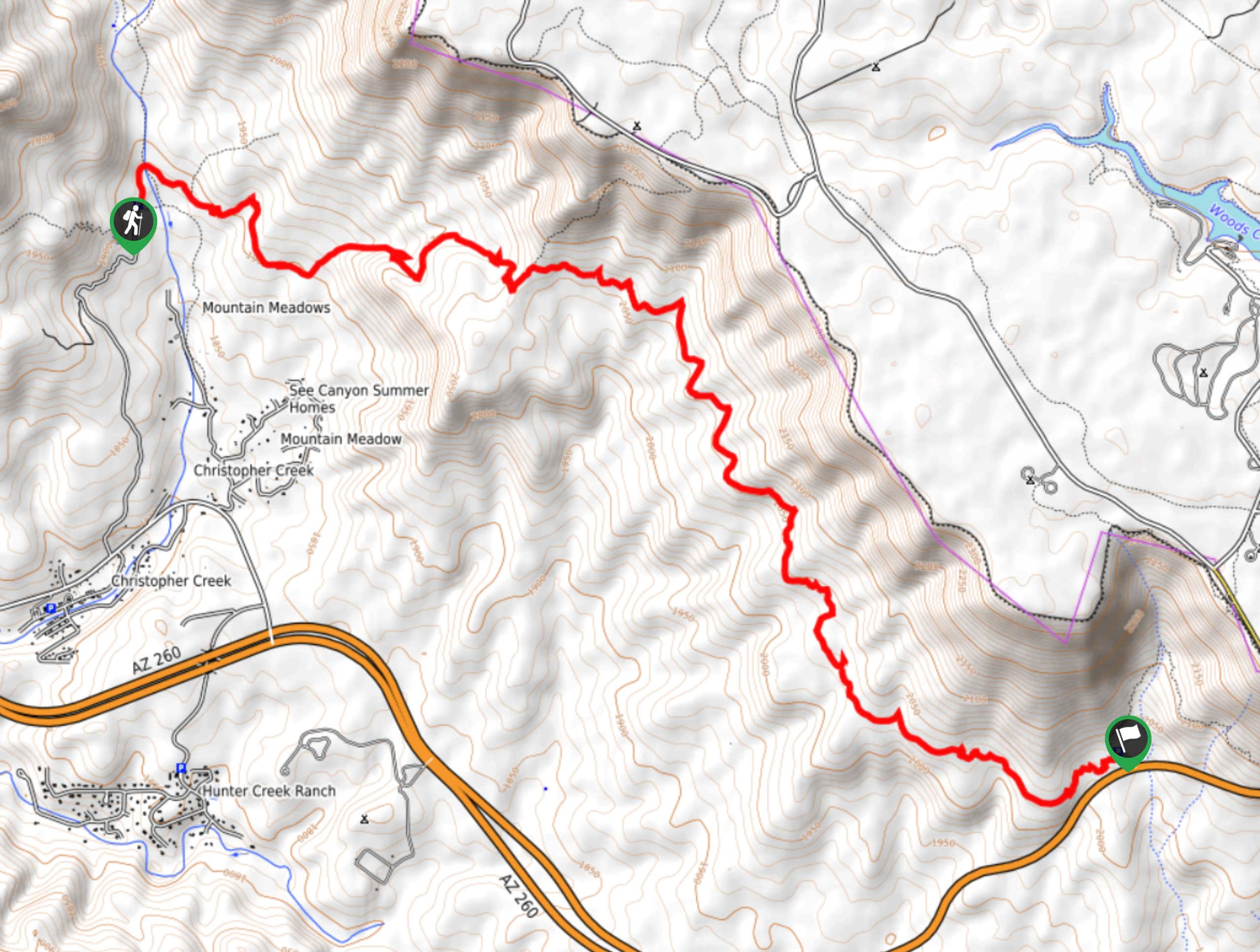
35. See Canyon Trail
Difficulty
See Canyon Trail is a 7.6mi hard hike in the Tonto National Forest… Read More
36. Red Rock Spring Trail
Difficulty
The Red Rock Spring Trail is a 2.0mi adventure in the Tonto National… Read More
37. Houston Loop Trail
Difficulty
Enjoy the forested wilderness right on the fringes of Payson on the Houston Loop Trail,… Read More

38. Apache Tears Mine Hike
Difficulty
Hike out to an old mine with lots of obsidian still stashed to find on… Read More
39. New River Trail
Difficulty
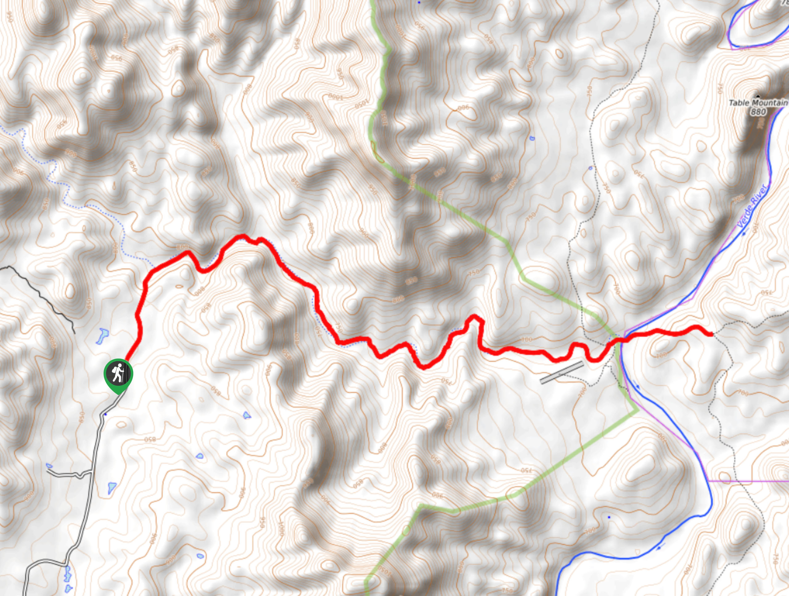
Stroll underneath Table Mountain, North Mountain, and Red Mountain on the New River Trail, a… Read More
40. Mount Ord Trail
Difficulty
Mount Ord Trail is a 14.4mi hike in the Tonto National Forest that… Read More

41. Cave Creek and Skunk Creek Loop
Difficulty
The Cave Creek and Skunk Creek Loop is an interesting trail with, frankly, mixed reviews.… Read More
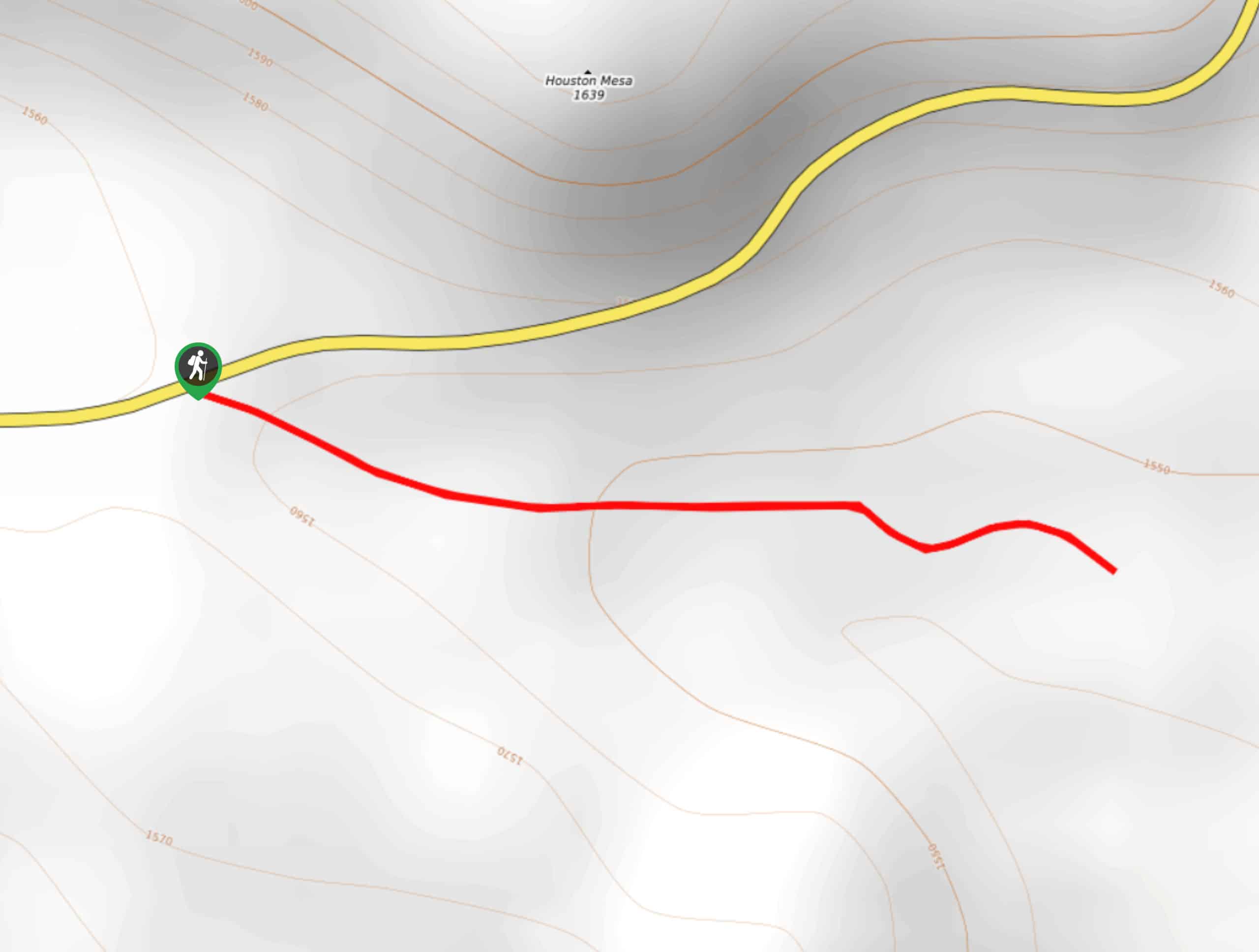
42. Houston Mesa Interpretive Trail
Difficulty
The Houston Mesa Interpretive Trail is a very quick trip near Houston Mesa that is… Read More
43. Prospector’s View Trail
Difficulty
Prospector’s View Trail is a simple, easy hike in Lost Dutchman’s State Park that is… Read More
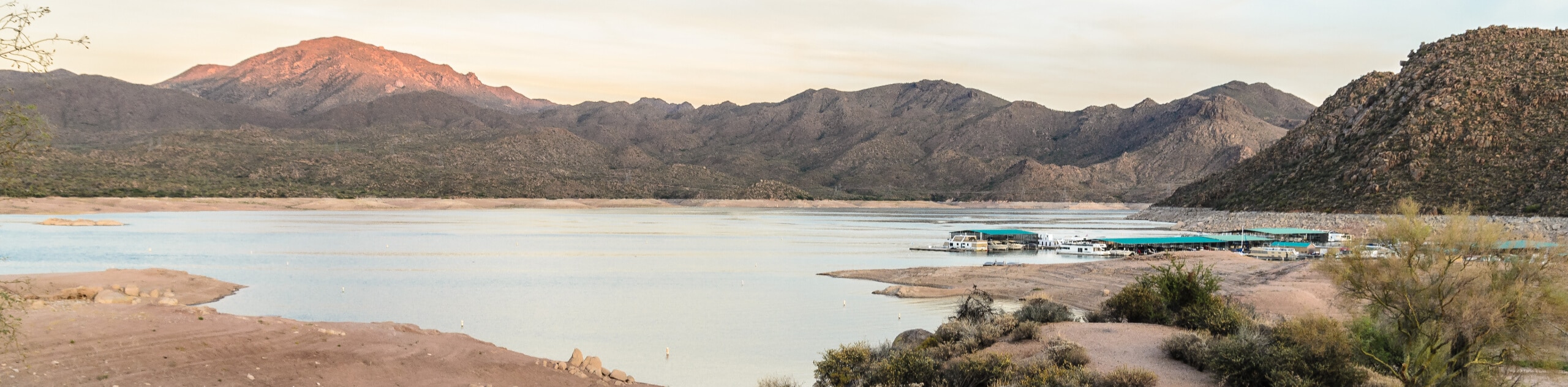
44. Bartlett Reservoir Trail
Difficulty
The Bartlett Reservoir Trail hugs the shores of Bartlett Lake with SB Mountain looming overhead.… Read More
45. Pine Creek and Ballantine Loop
Difficulty
The Pine Creek and Ballantine Loop is a hike north of Mesa in the Tonto… Read More
46. Picketpost Loop Trail
Difficulty
Picketpost Loop Trail is an 8.6mi loop hike that leads you around a… Read More
47. Military Sinkhole Trail
Difficulty
The Military Sinkhole Trail is a very scenic route in the Tonto National Forest that… Read More
48. Sixshooter Canyon Trail
Difficulty
The Sixshooter Canyon Trail is an incredible hike that we’d venture to call an underrated… Read More
49. Pine Strawberry Trail
Difficulty
The Pine Strawberry Trail is a. 8.3mi point-to-point trail that starts in southeastern… Read More
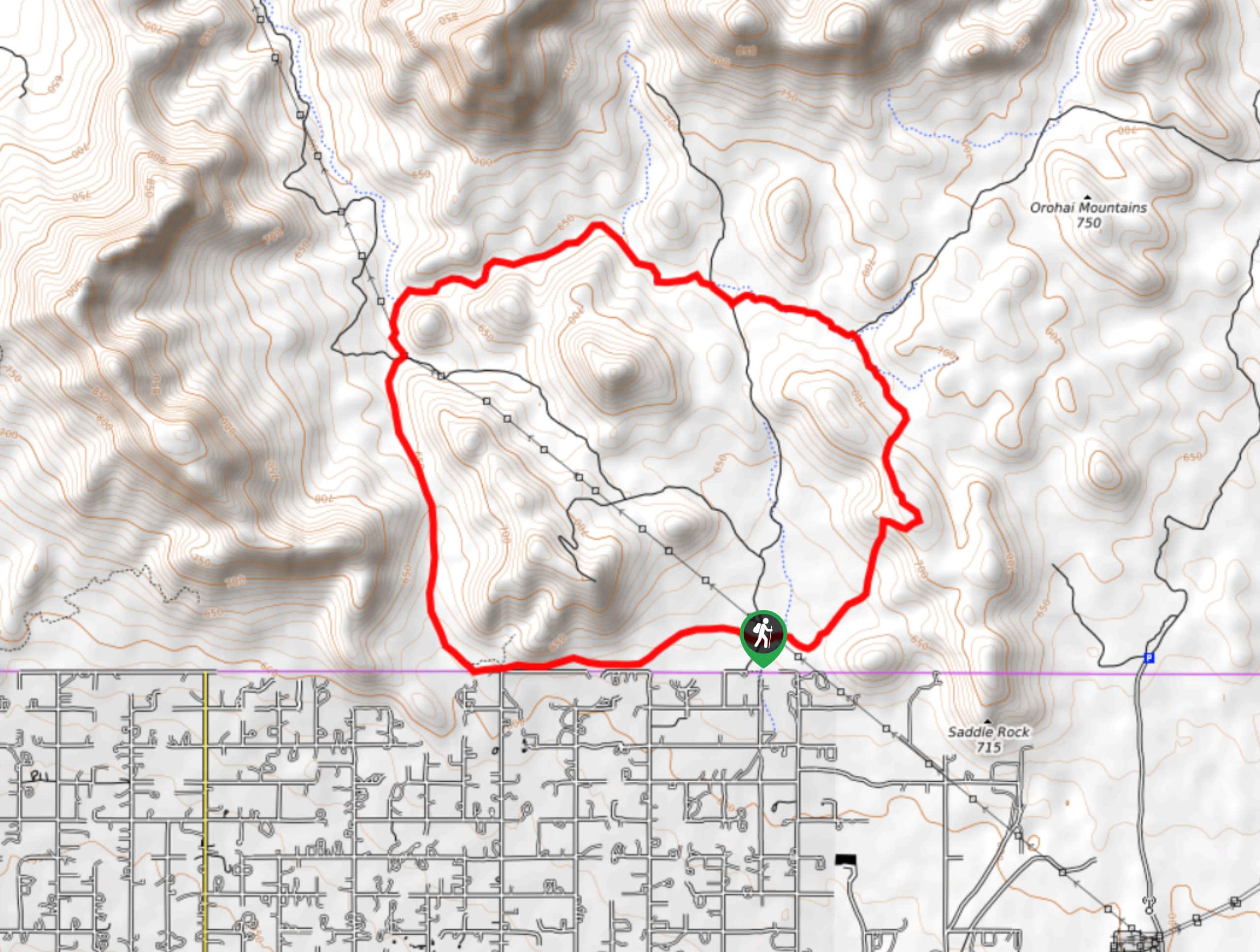
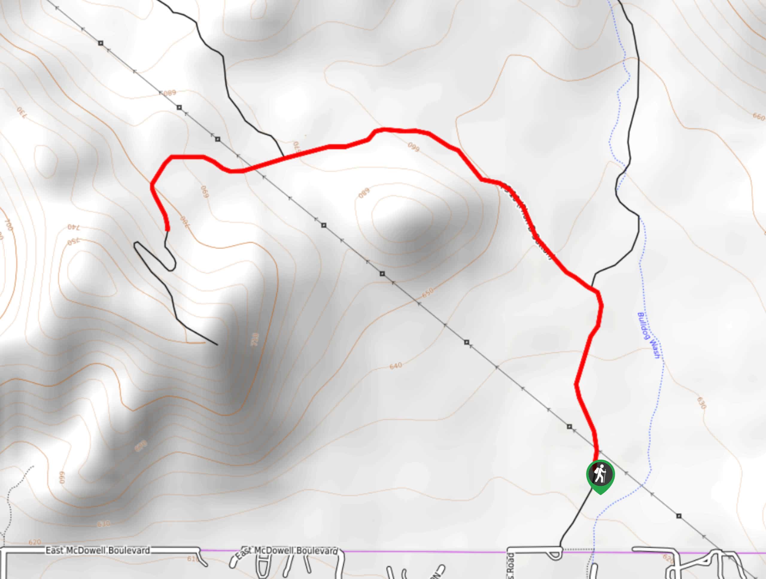
50. Bulldog Canyon Hike
Difficulty
The Bulldog Canyon hike is a fun trail that starts right from the city limits… Read More
51. Pueblo Canyon Trail
Difficulty
Pueblo Canyon Trail leads you to one of the best-kept unprotected ruin sites in the… Read More

52. Willow Springs Loop
Difficulty
The Willow Springs Loop is a 4.3mi loop hike in the Tonto National… Read More
53. Tunnel via Arizona Trail
Difficulty
As far as caves go, this one is pretty impressive. This hike leads you along… Read More
54. Babe Haught Trail
Difficulty
Babe Haught Trail is one you can do again and again. This short, sweaty trail… Read More
55. Flume Road Trail
Difficulty
If you’re on the hunt for a waterfall hike (chasing waterfalls, if you will), try… Read More
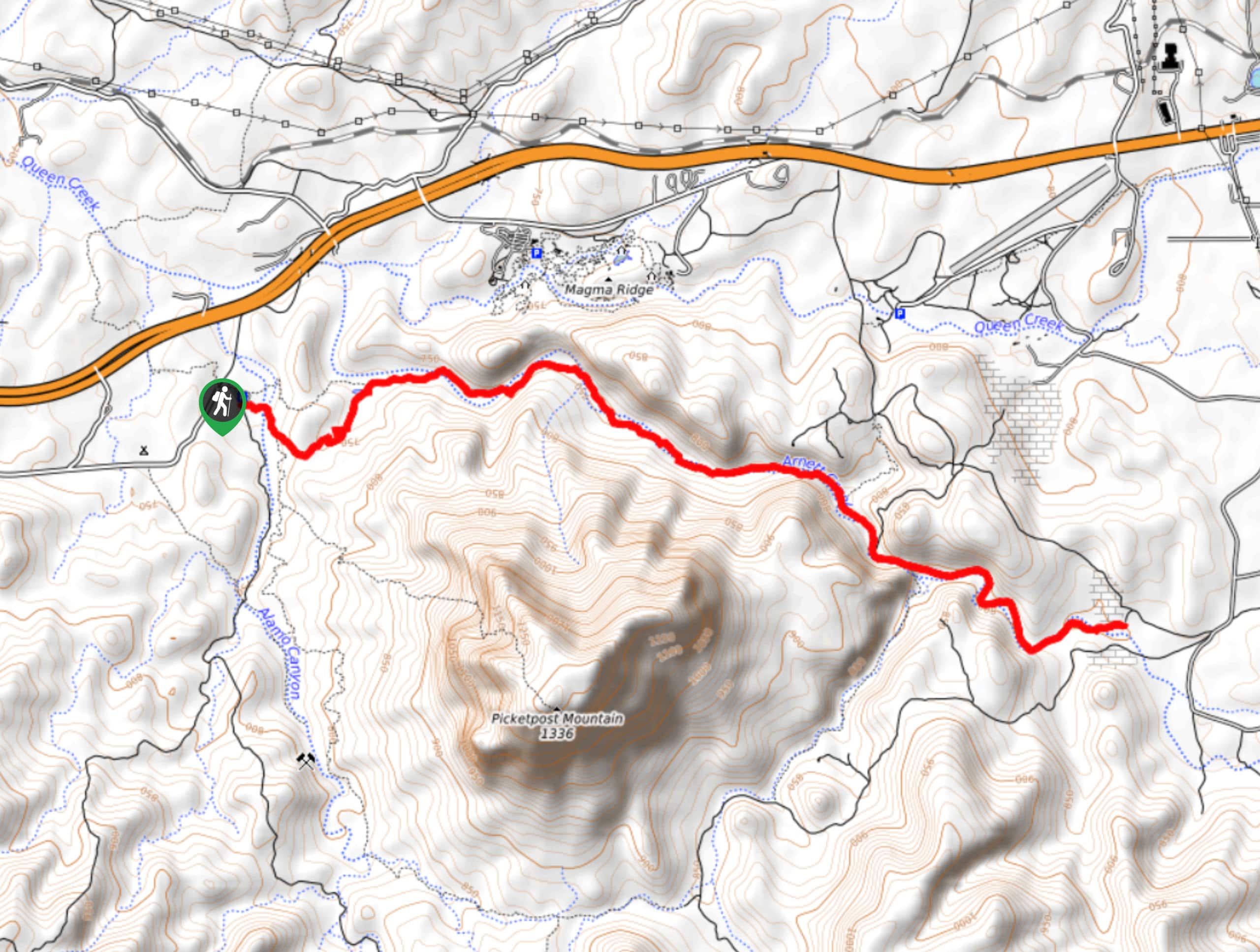
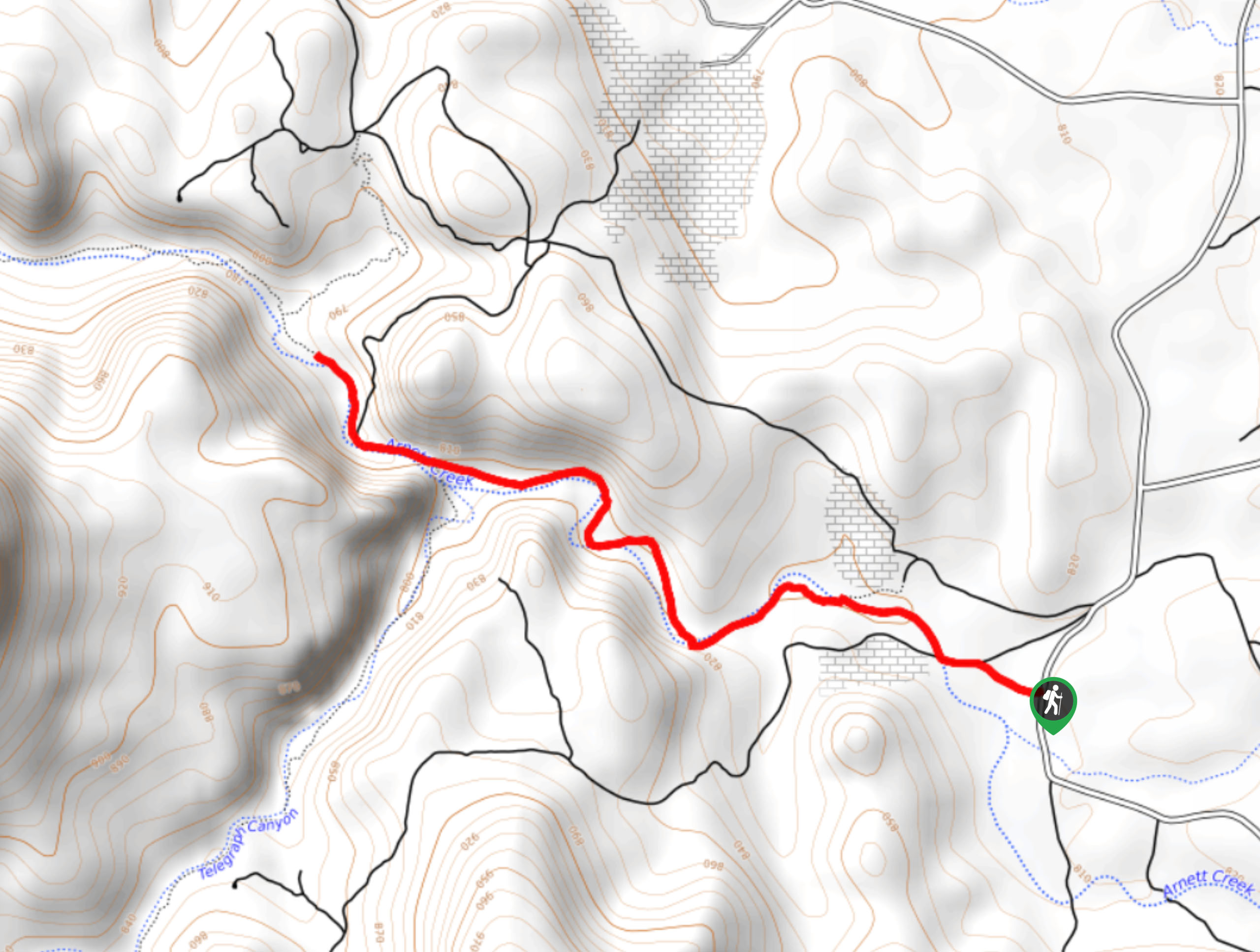
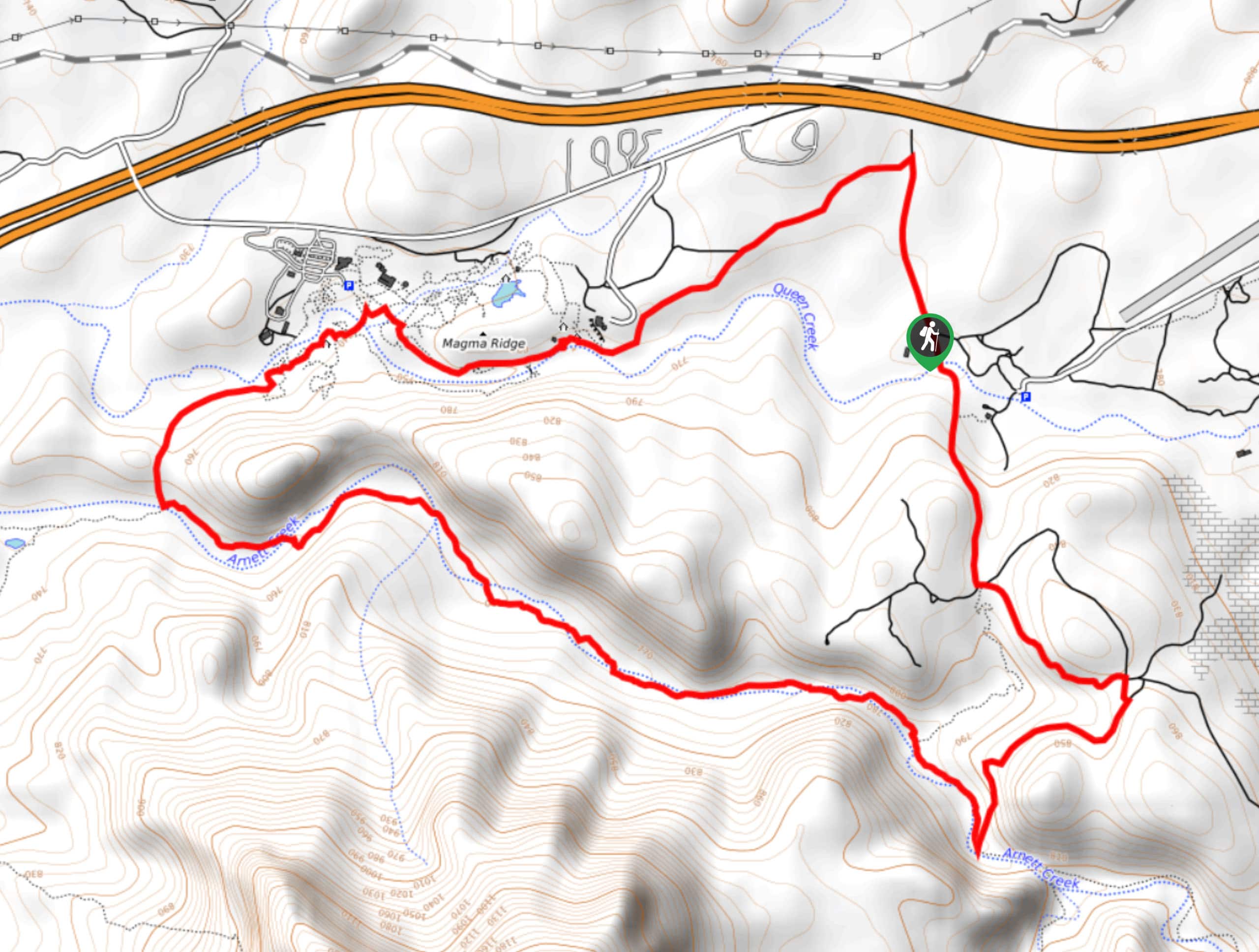
56. Arnett Canyon Trail Segment
Difficulty
The Arnett Canyon Trail is a beautiful spot to hike, horseback ride, or bike in… Read More
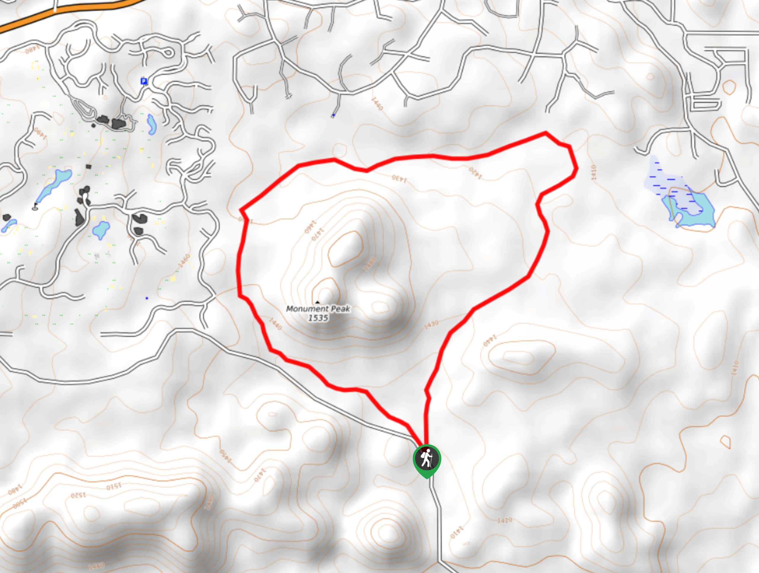
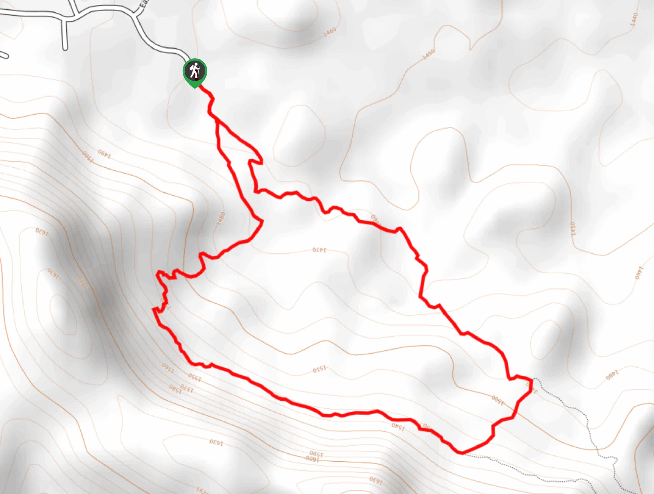
57. Monument Peak Loop
Difficulty
The Monument Peak Loop is a 3.4mi easy hike near Payson that circles… Read More
58. Wild Horse Trail
Difficulty
Wild Horse Trail is a 7.0mi easy out and back trail near Apache… Read More
59. Blue Point to the Oven Hike
Difficulty
The Blue Point to the Oven hike is a 4.0mi trek in the… Read More
60. Weavers Needle Vista Hike
Difficulty
The Weavers Needle Vista hike is a beautiful loop trail with a popular viewpoint over… Read More
61. Arnett Canyon from E Arnett Road
Difficulty
The Arnett Canyon Trail is a beautiful spot to hike, horseback ride, or bike in… Read More
62. Pine Creek Loop
Difficulty
The Pine Creek Loop is a hike north of Mesa in the Tonto National Forest… Read More
63. Drew Trail via Highline Trail
Difficulty
Drew Trail via Highline Trail is a moderate 13.2mi hike that leads you… Read More
64. Horse Tale Trail
Difficulty
The Hawes Trail System offers trail runners, hikers, and mountain bikers a place to get… Read More
65. Red Creek Trail
Difficulty
Red Creek Trail is a 9.7mi route in the Tonto National Forest that… Read More
66. Black Cross Butte Hike
Difficulty
The Black Cross Butte hike is a challenging trip in the Tonto National Forest that… Read More
67. See Canyon and Drew Trail Loop
Difficulty
The See Canyon and Drew Trail Loop is an 11.4mi moderate hike in… Read More
68. Bulldog Saddle Trail
Difficulty
The Bulldog Saddle Trail is a fun, quick hike that starts right from the city… Read More
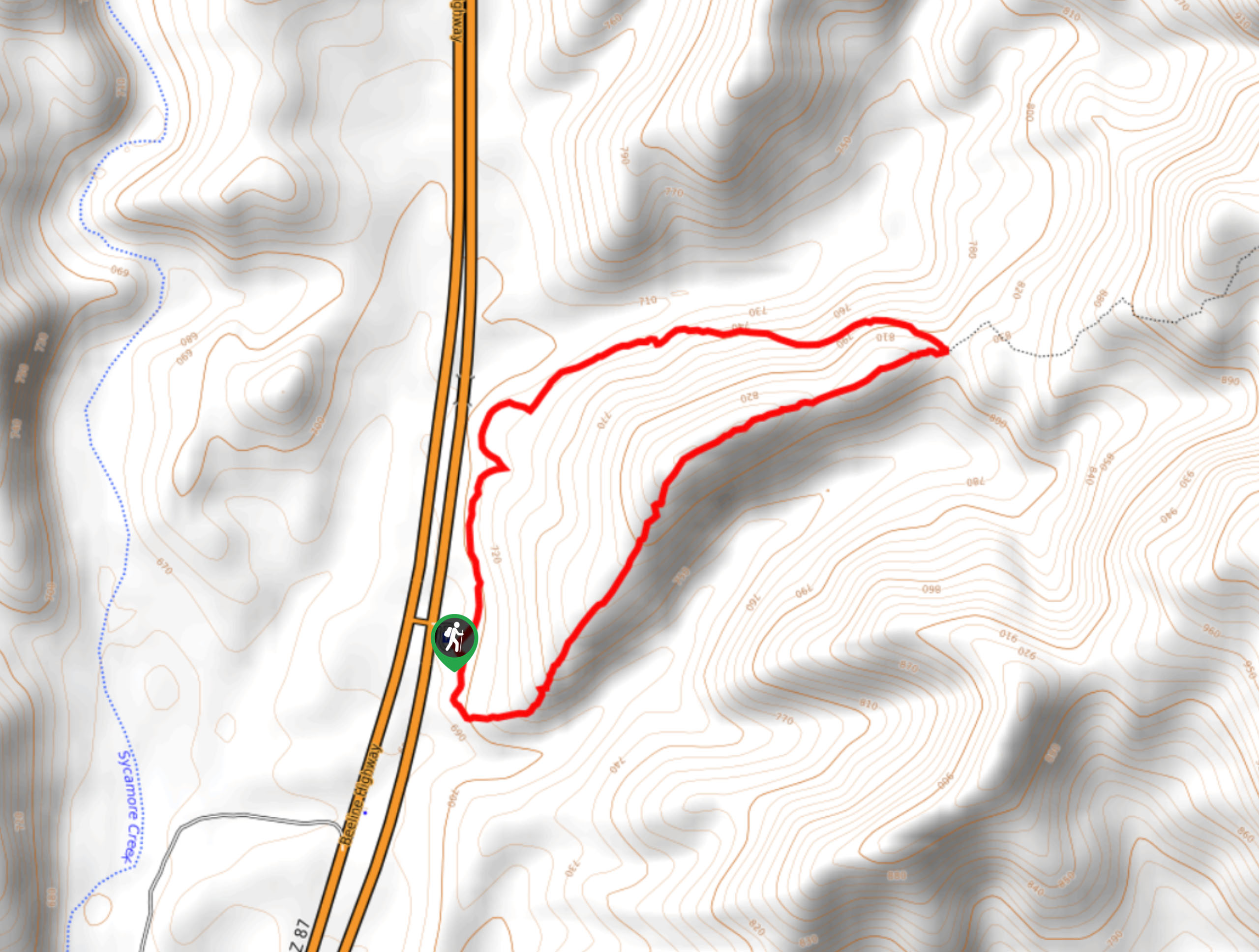
69. Twisted Sister to Saguaro Trail
Difficulty
Twisted Sister to Saguaro Trail is a 3.1mi moderate point-to-point trail near Apache… Read More
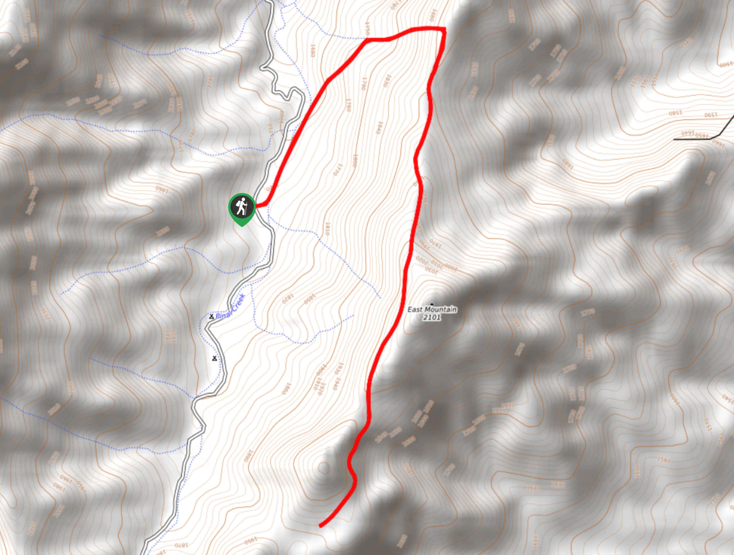
70. East Mountain Trail
Difficulty
East Mountain Trail is a 7.0mi moderate hike near Globe that’s popular for… Read More
71. Bearfoot Trail
Difficulty
The Bearfoot Trail is a long, relaxed hike that starts near Strawberry and travels down… Read More
72. Arizona Trail to North Happy Camp Road Loop
Difficulty
The Arizona Trail to North Happy Camp Road Loop is a 7.9mi loop… Read More
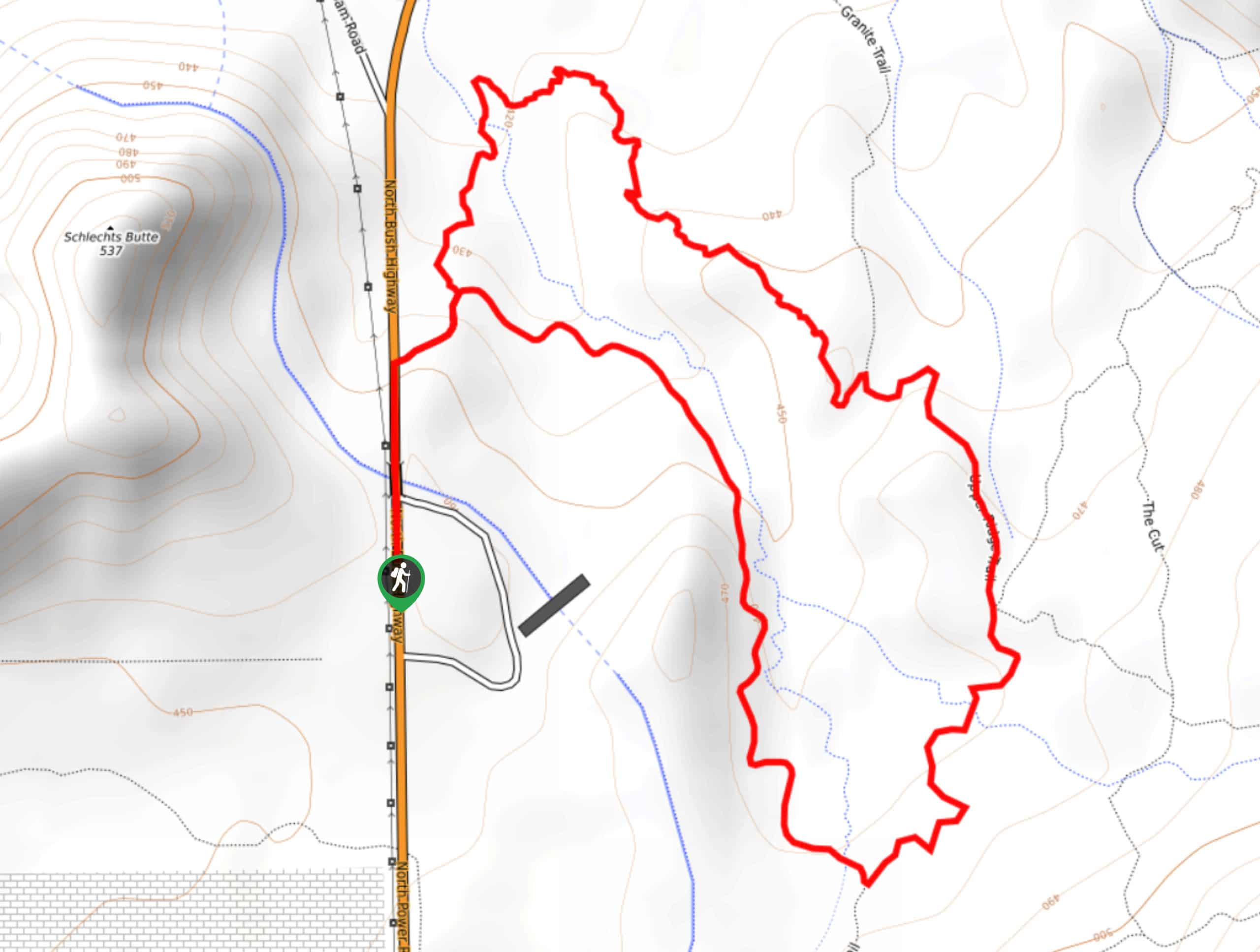
73. Saguaro, Ridge, and Granite Trail Loop
Difficulty
The Hawes Trail System is a well-developed mountain biking and hiking route collection near the… Read More
74. Massacre Grounds and Wind Gap Trail
Difficulty
The Massacre Grounds and Wind Gap Trail leads you through an area once defined by… Read More
75. Pass Mountain Saddle Hike
Difficulty
Pass Mountain Saddle is a much, much easier hike than the full ascent of Pass… Read More
76. See Spring Trail
Difficulty
See Spring Trail is a moderate 2.4mi hike in the Tonto National Forest… Read More
77. Wind Gap Trail
Difficulty
The Wind Gap Trail leads you through an area once defined by Arizona’s gold rush.… Read More
78. Hawes Trail to Granite Trail Loop
Difficulty
The Hawes Trail System is a well-developed mountain biking and hiking route collection near the… Read More
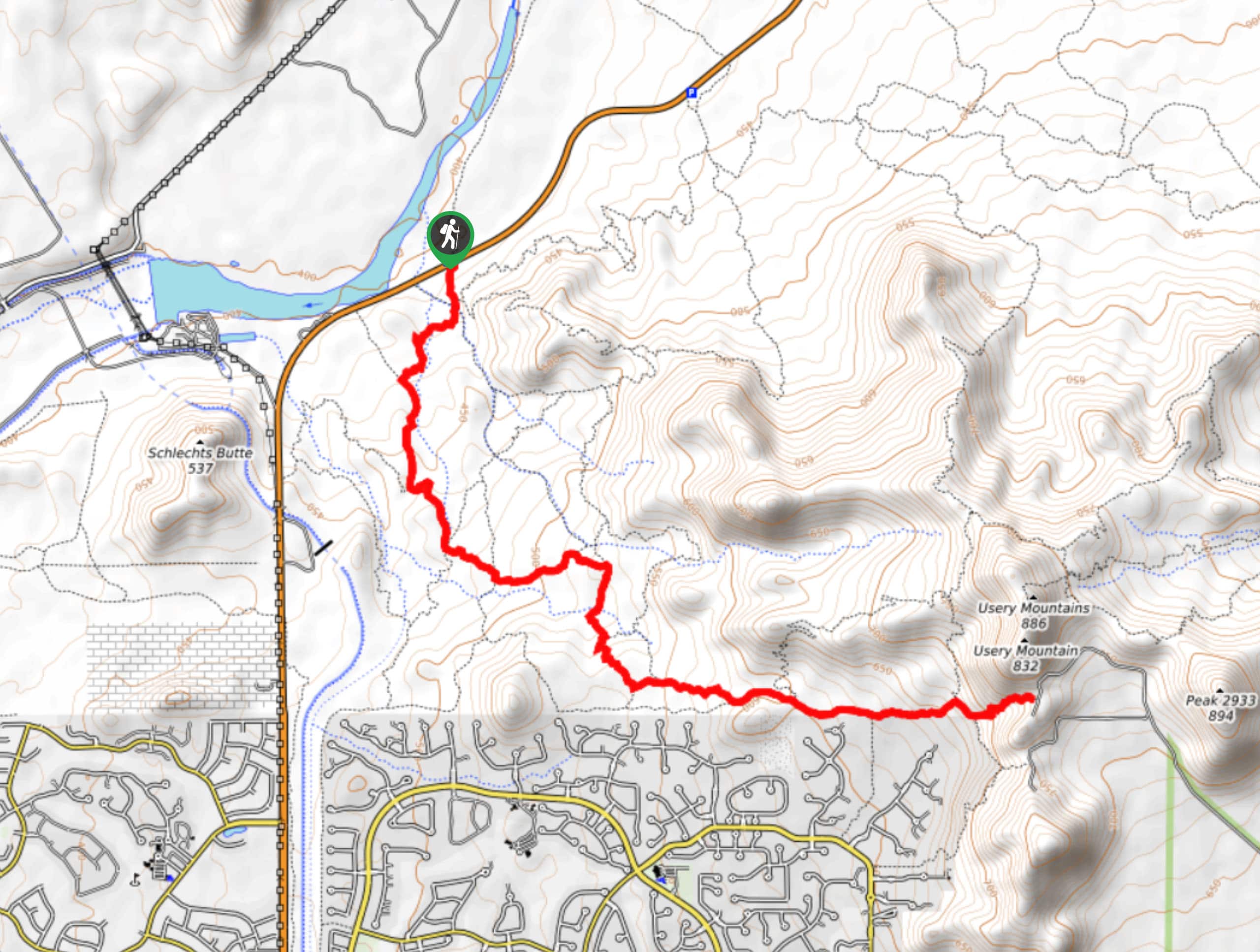
79. Usery Mountain Hike
Difficulty
The Usery Mountain hike is a fun, scenic adventure in the Tonto National Forest that… Read More
80. Derrick Trail
Difficulty
The Derrick Trail is a 5.7mi route near Payson that can be used… Read More
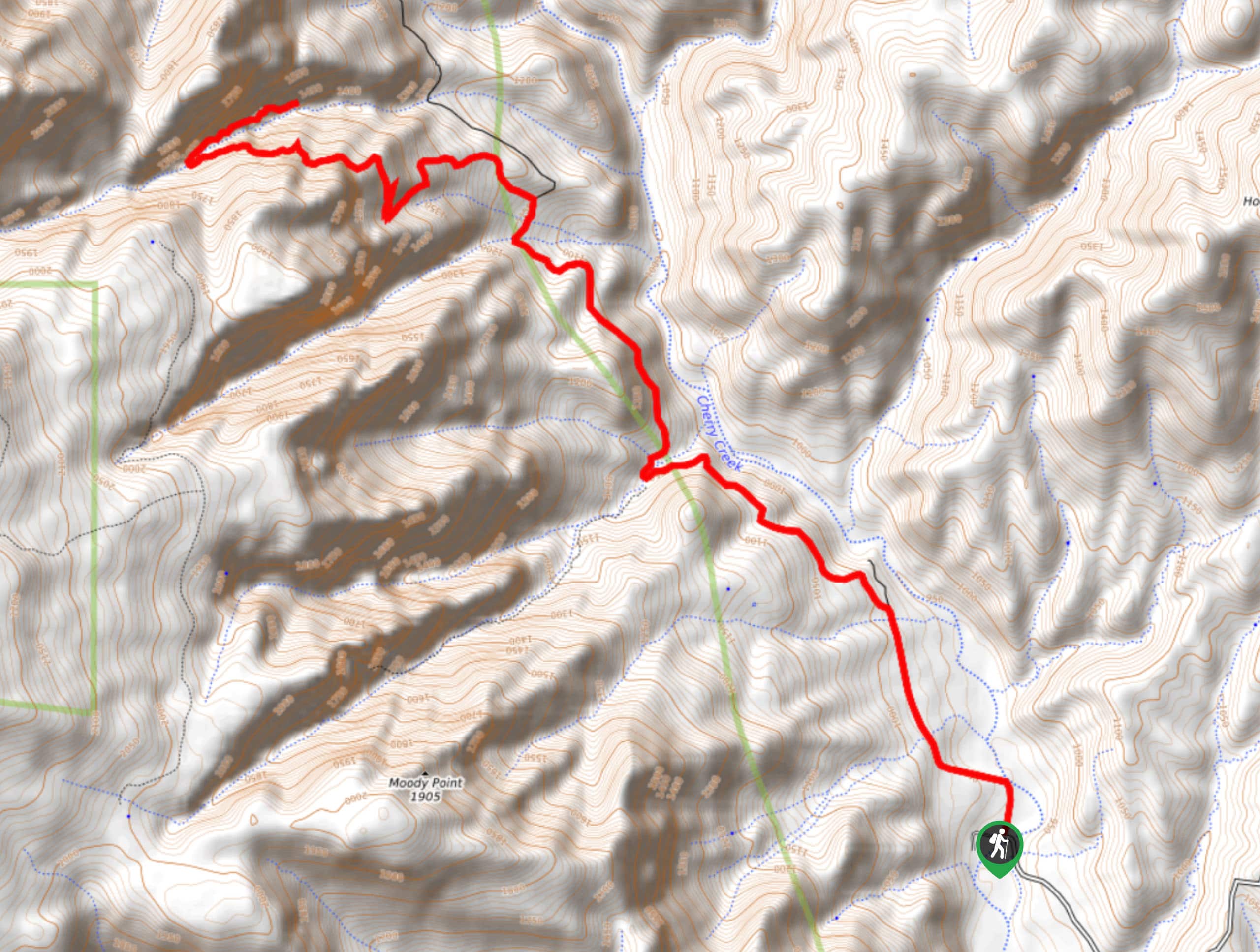
81. Y Bar and Barnhardt Trail Loop
Difficulty
The Y Bar and Barnhardt Trail Loop is a 15.7mi loop hike in… Read More
82. Cypress-Stewart Ridge Extended Loop
Difficulty
The Cypress-Stewart Ridge Extended Loop is a 5.2mi adventure near Payson with divers,e… Read More
83. Highline and Pine Loop
Difficulty
The Highline and Pine Loop is a quick hike near Pine, Arizona. This route is… Read More
84. Triple Arch Trail
Difficulty
If you’re after classic Arizona desert scenery, the Triple Arch trail is such a treat.… Read More
85. Alamo Canyon via Picketpost and Arizona Trail
Difficulty
Alamo Canyon via Picketpost and Arizona Trail is a 5.2mi out and back… Read More
86. Jacob’s Crosscut and Prospector’s Loop
Difficulty
The Jacob’s Crosscut and Prospector’s Loop is a 5.4mi hike near Goldfield, Arizona.… Read More
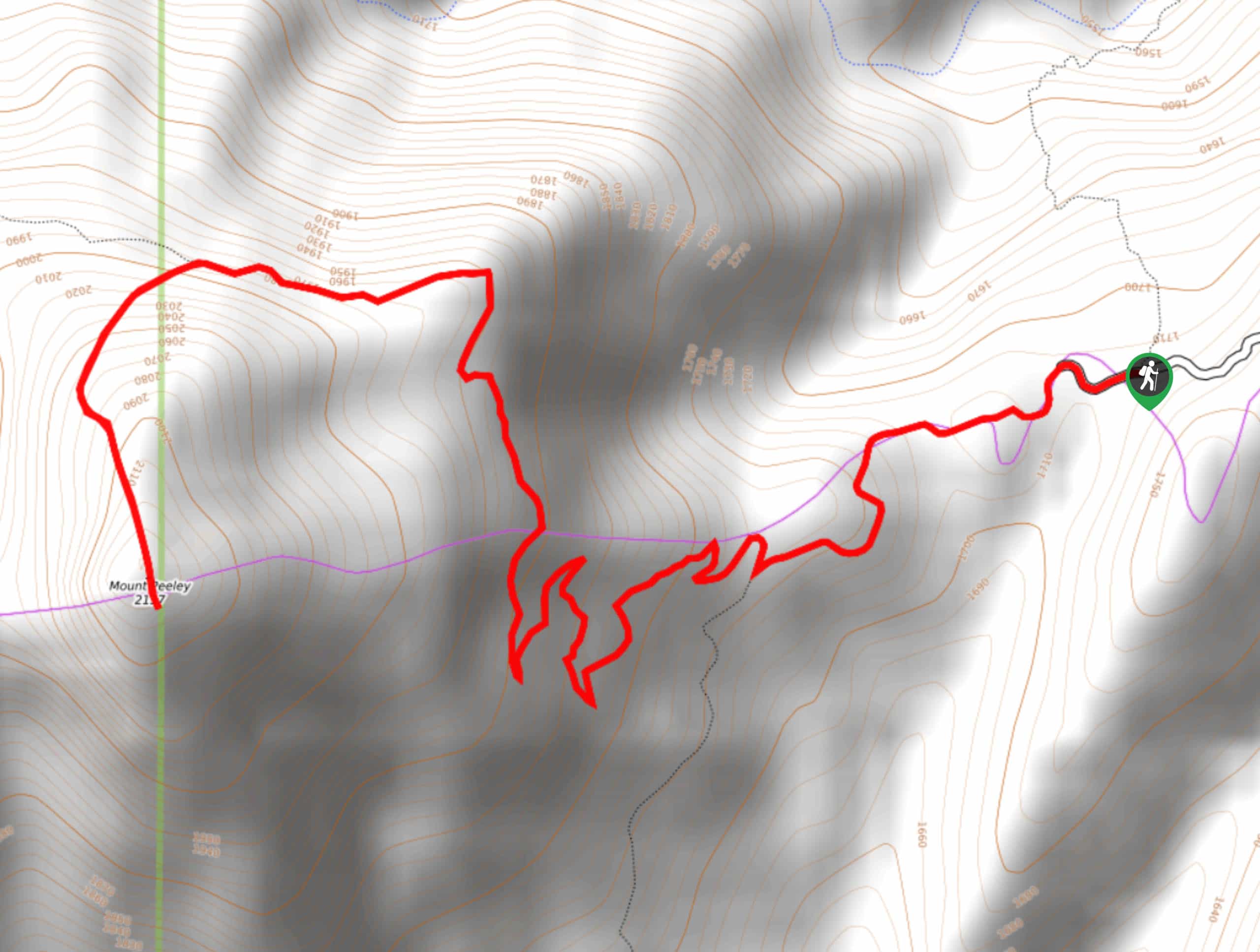
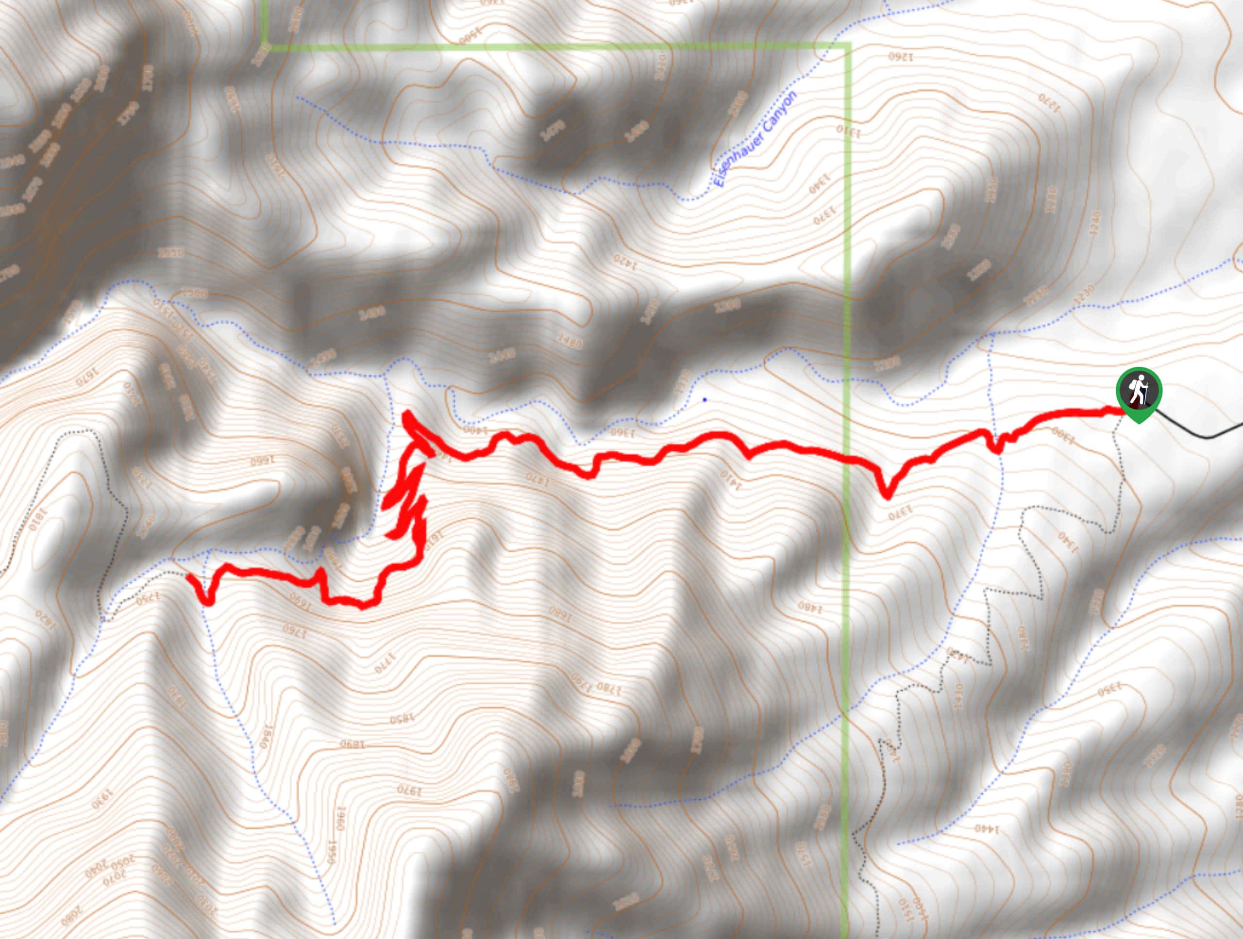
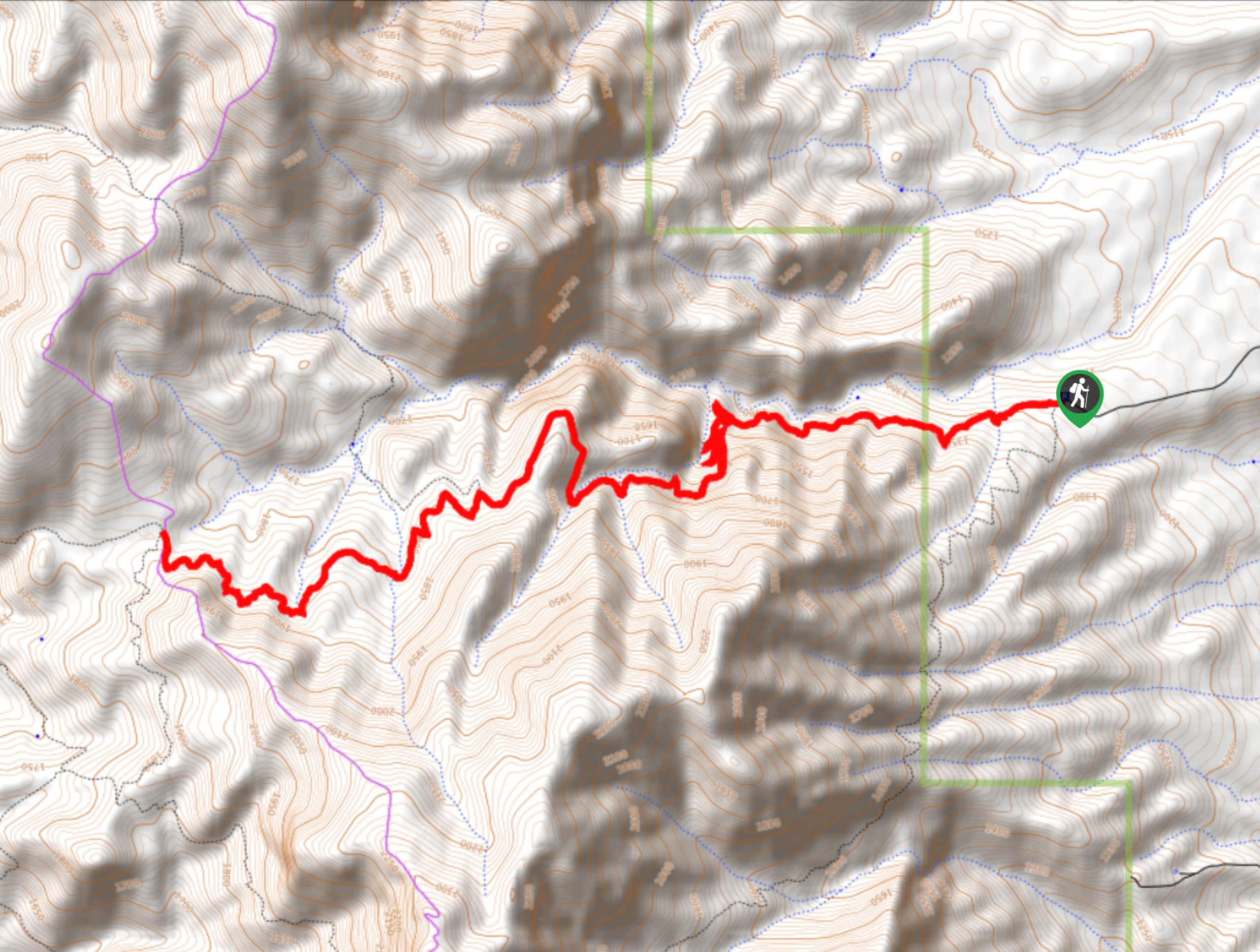
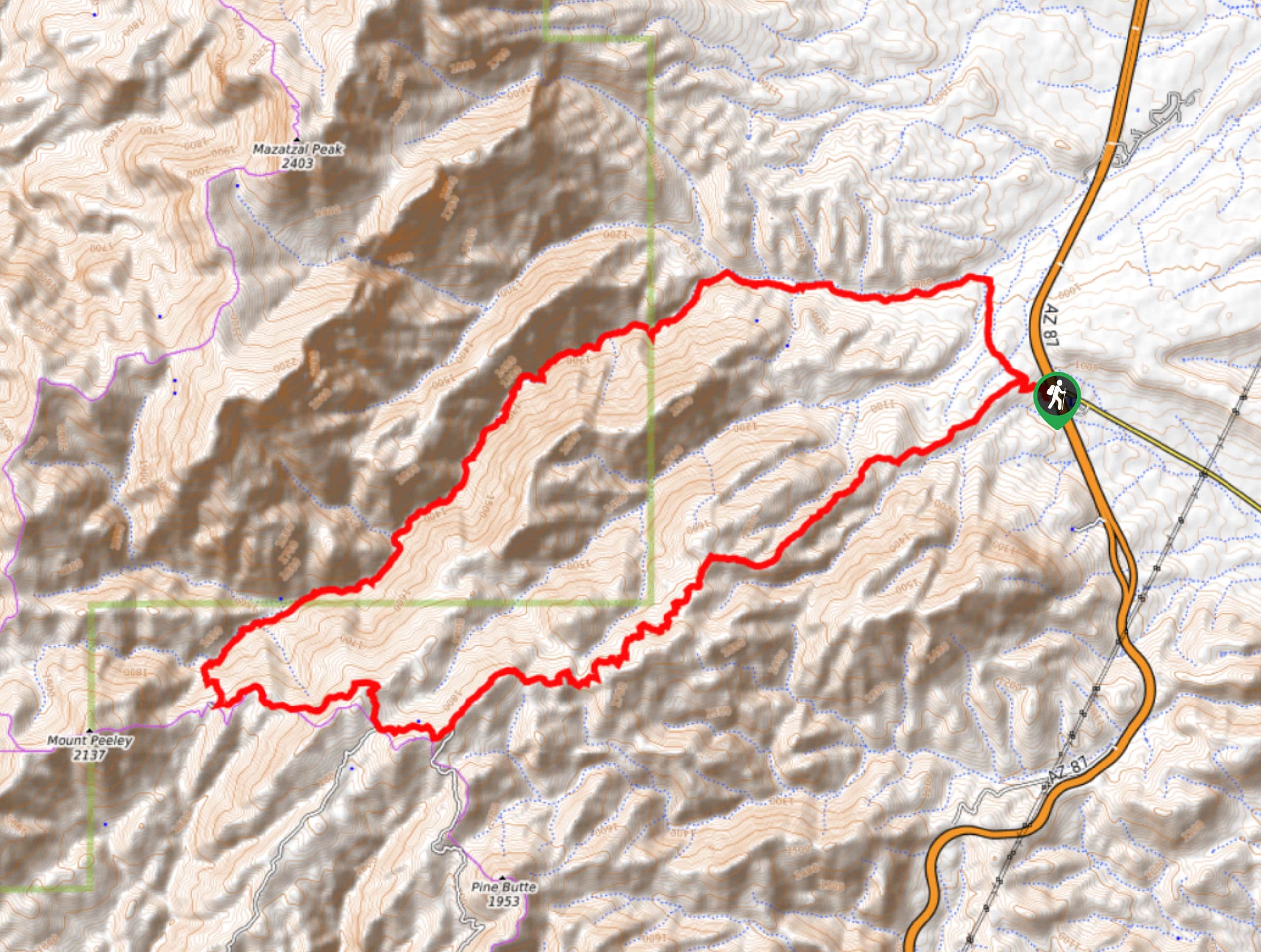
87. Mount Peeley Trail
Difficulty
Mount Peeley Trail is a 5.0mi out and back trail near Payson that… Read More
88. Granite and Hawes Trail
Difficulty
The Hawes Trail System is a well-developed mountain biking and hiking route collection near the… Read More
89. Massacre Grounds Loop
Difficulty
The Massacre Grounds Loop leads you through an area once defined by Arizona’s gold rush.… Read More
90. Gold Ridge Trail
Difficulty
The Gold Ridge Trail is a bit of a hidden gem. This route in the… Read More
91. Willow Springs Lollipop
Difficulty
The Willow Springs Lollipop is a 6.7mi loop hike in the Tonto National… Read More
92. Oak Spring Trail
Difficulty
The Oak Spring Trail is a 7.5mi loop hike in the Tonto National… Read More
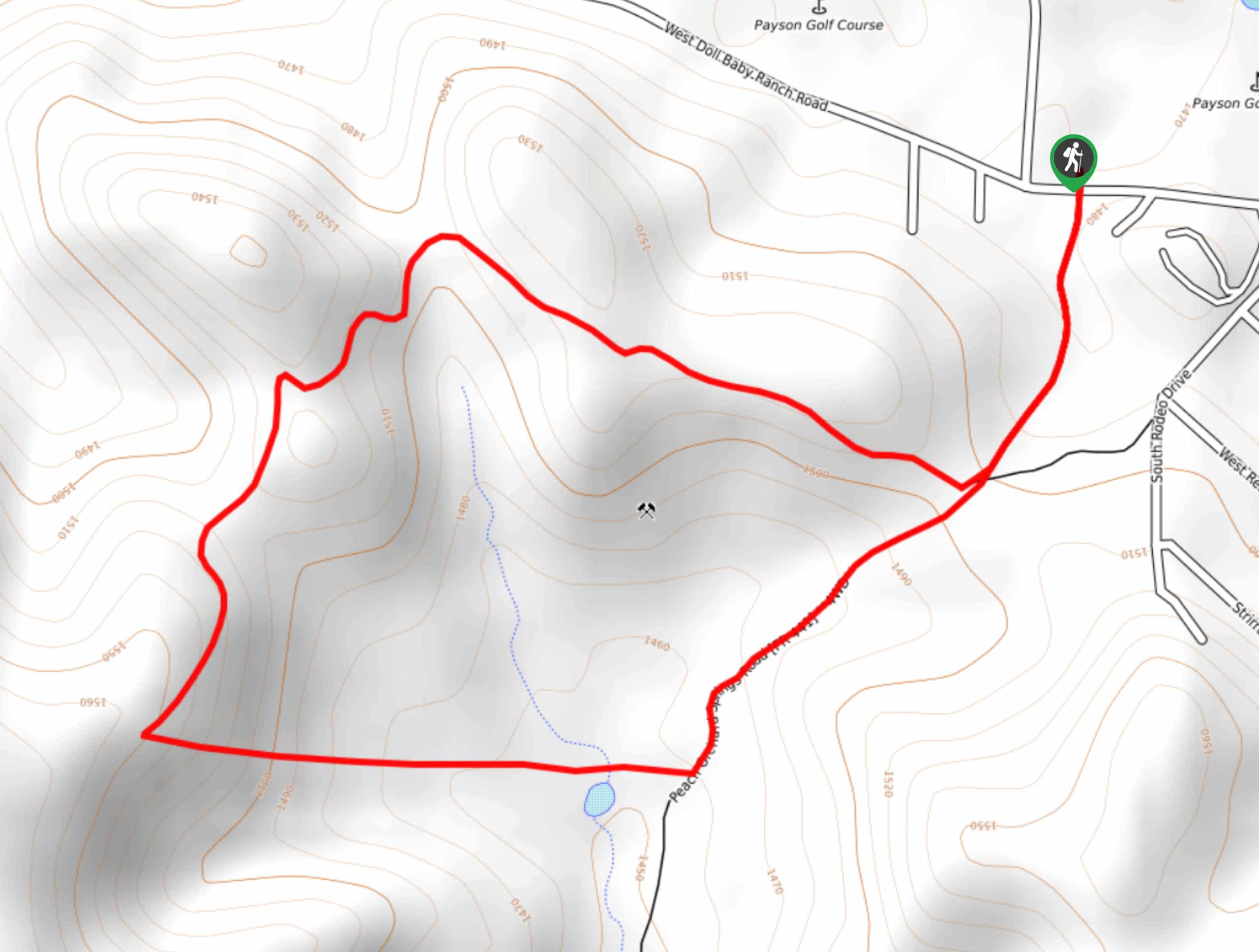
93. Peach Orchard Trail
Difficulty
The Peach Orchard Trail is a 2.7mi loop trail in Payson that offers… Read More
94. Wolverine Pass Hike
Difficulty
Wolverine Pass is a good hike for days when you want a real adventure. The… Read More

95. Willow Springs Basin Tank via Bulldog Canyon
Difficulty
The Willow Springs Basin Tank via Bulldog Canyon is a 6.0mi loop hike… Read More
96. Phon D Sutton Peak Loop
Difficulty
The Phon D Sutton Peak Loop is a 4.2mi easy hike near Apache… Read More
97. 200 Trail
Difficulty
200 Trail is a 2.6mi hike near Payson that is rated as easy,… Read More
98. Highline Trail #31
Difficulty
The Highline Trail #31 is a 7.7mipoint-to-point hike in the Tonto National Forest… Read More
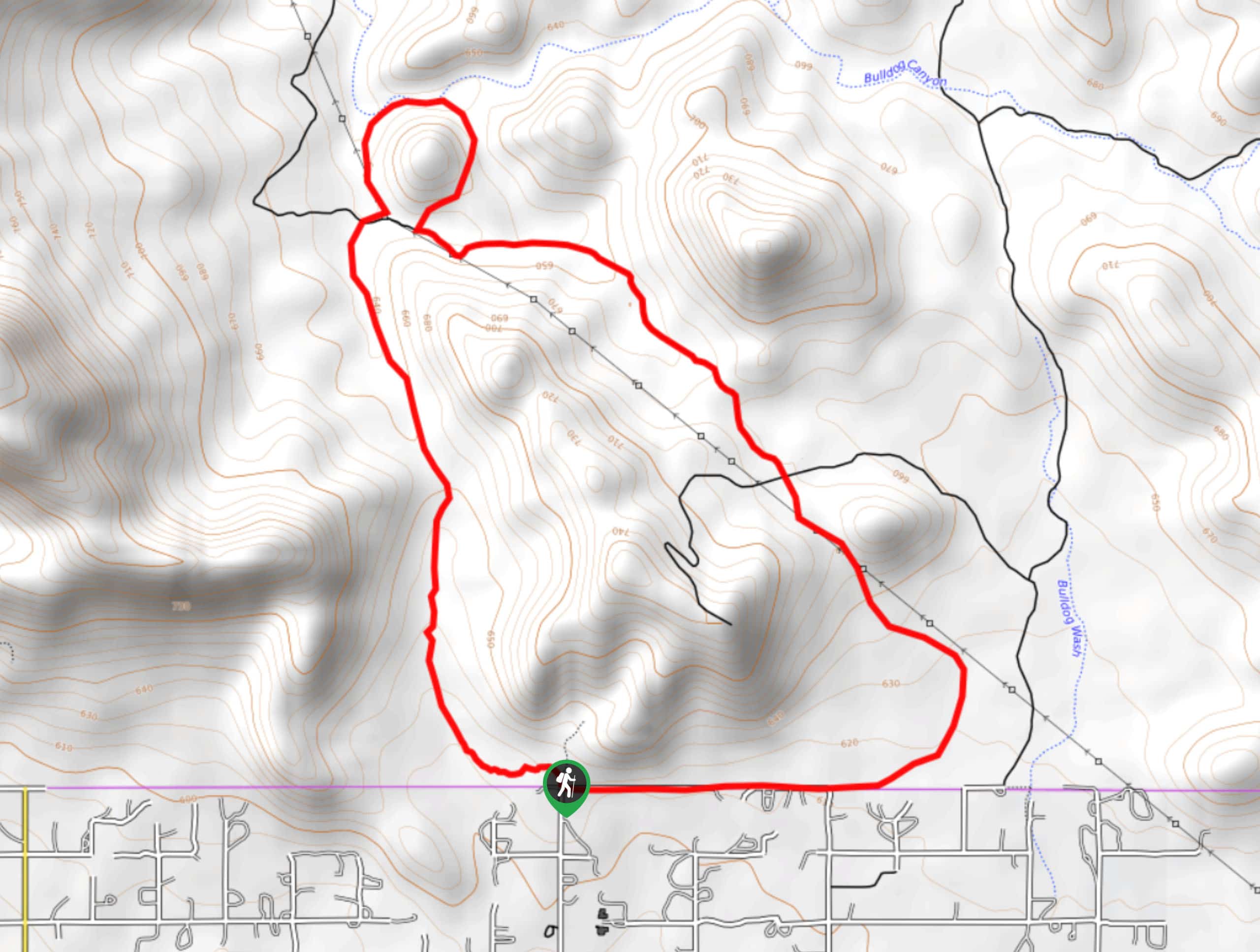
99. Bulldog Canyon Short Hike
Difficulty
The Bulldog Canyon short hike is a smaller part of a longer canyon trail that… Read More
100. Little Saddle Mountain Trail
Difficulty
Little Saddle Mountain is an 8.0mi hike in the Tonto National Forest between… Read More
101. Saddle Mountain to Mormon Grove
Difficulty
Saddle Mountain to Mormon Grove is a 9.8mi point-to-point trail near Sunflower. This… Read More
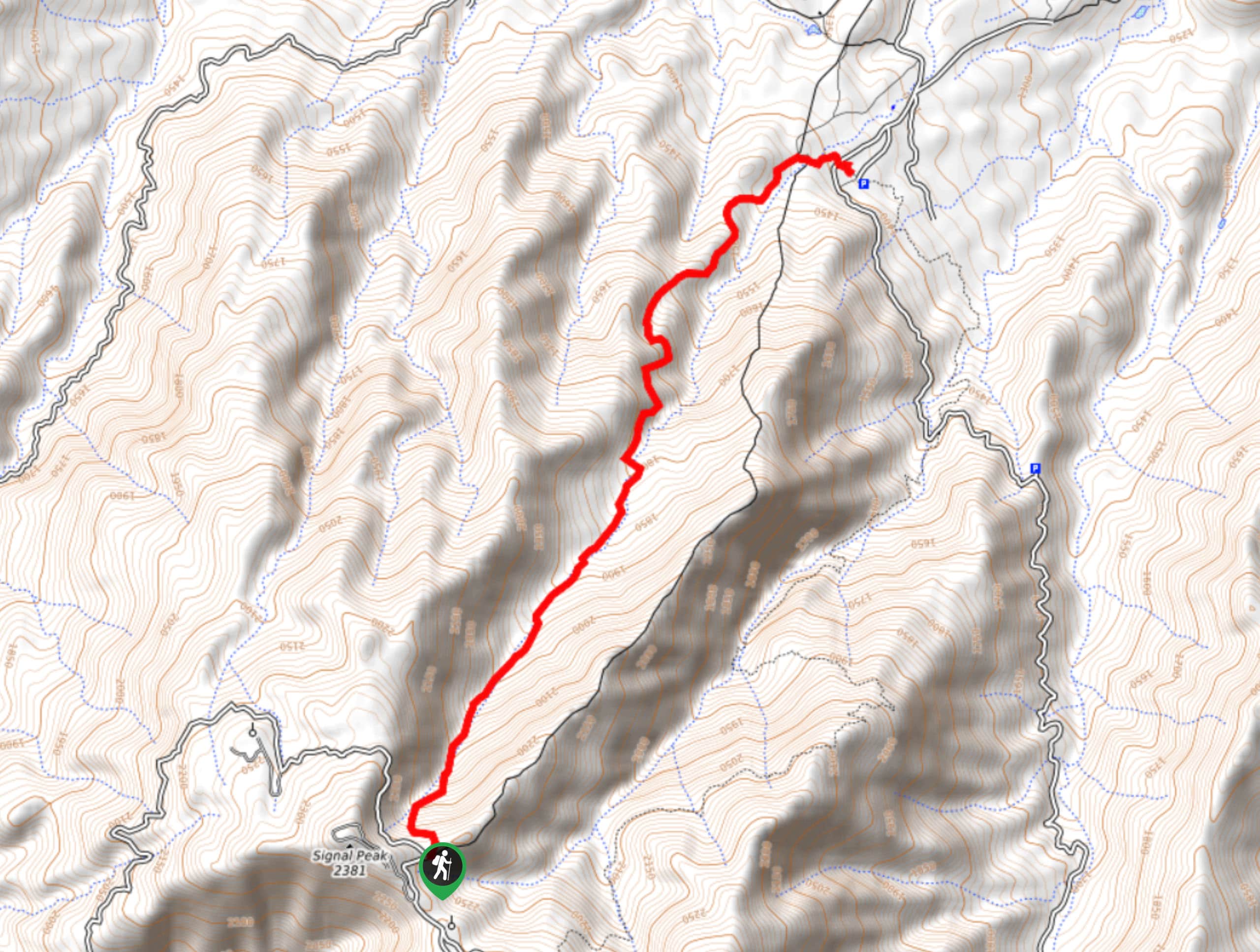
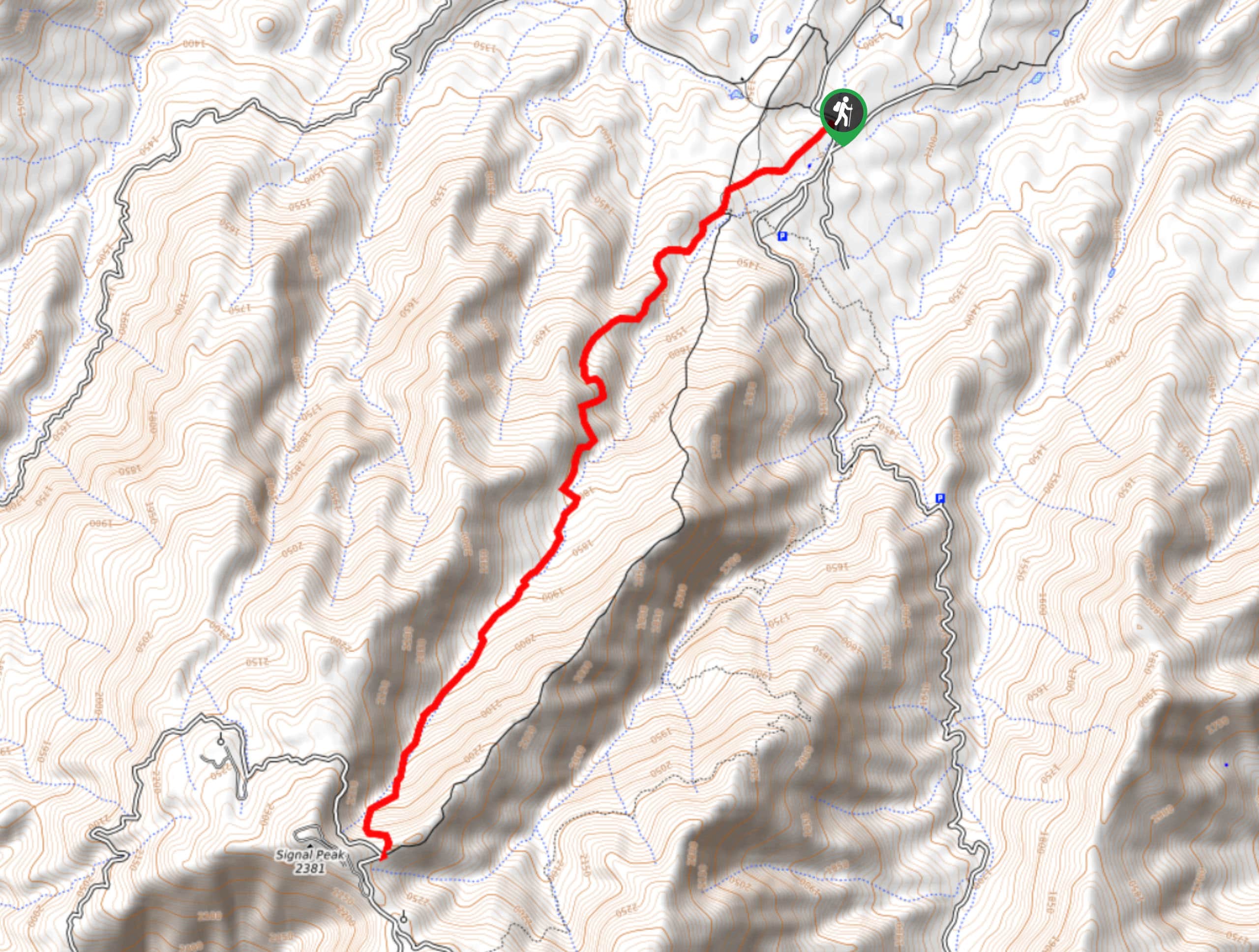
102. Icehouse Canyon via Signal Peak
Difficulty
The Icehouse Canyon Trail from Signal Peak is an ideal guide to use if you’ve… Read More
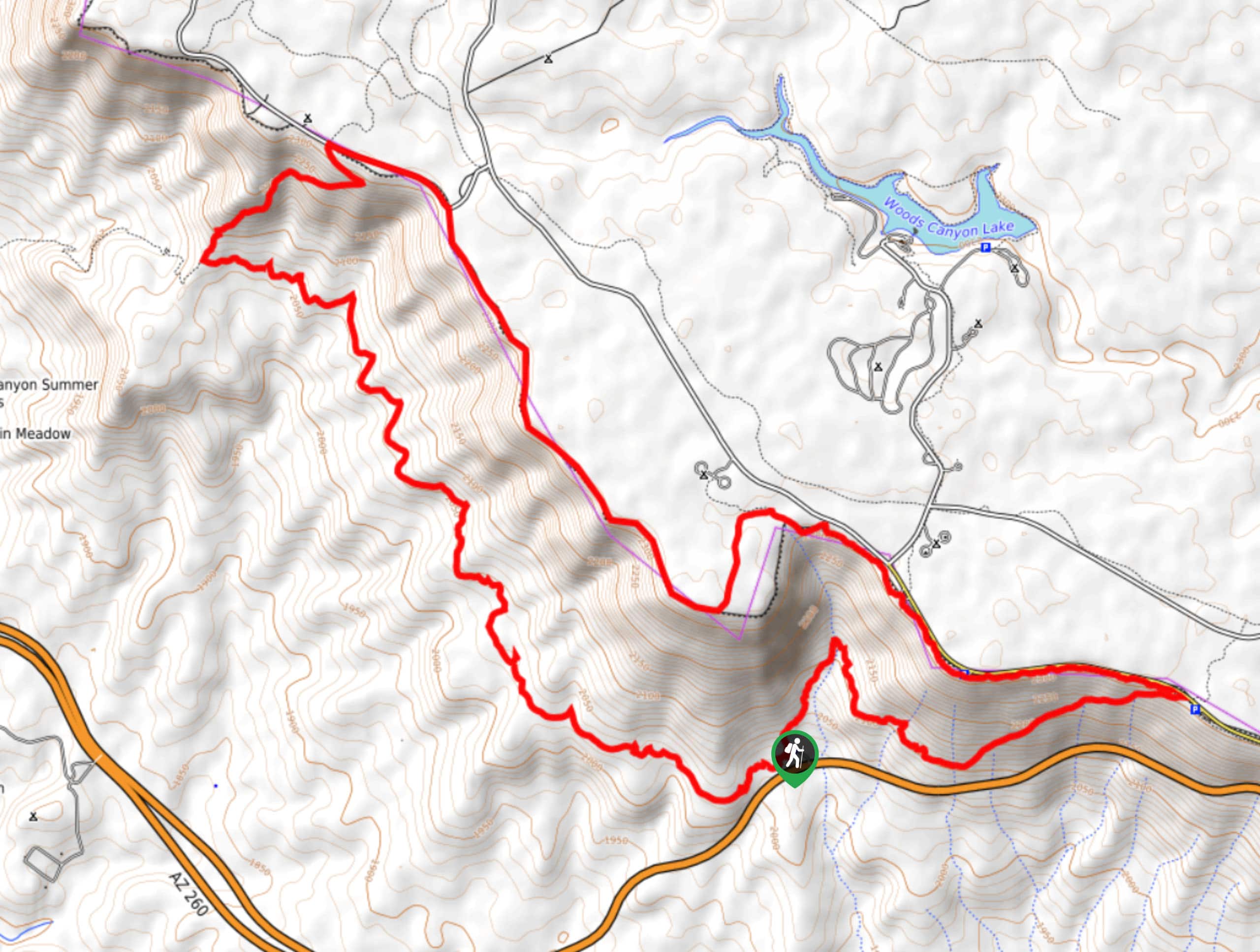
103. Military Sinkhole, Rim Lakes, and Highline Loop
Difficulty
The Military Sinkhole, Rim Lakes, and Highline Loop is a very scenic route in the… Read More
104. Massacre Falls via Dutchman’s Trailhead
Difficulty
As the legends of the Superstition Wilderness say, a rich Mexican family came to this… Read More
105. Meridian Trailhead to Idaho Road Trailhead
Difficulty
The route from Meridian Trailhead to Idaho Road Trailhead is a local favorite for its… Read More
106. South Fork Deer Creek Trail
Difficulty
The South Fork Deer Creek Trail is an adventurous, hard 11.5mi hike in… Read More
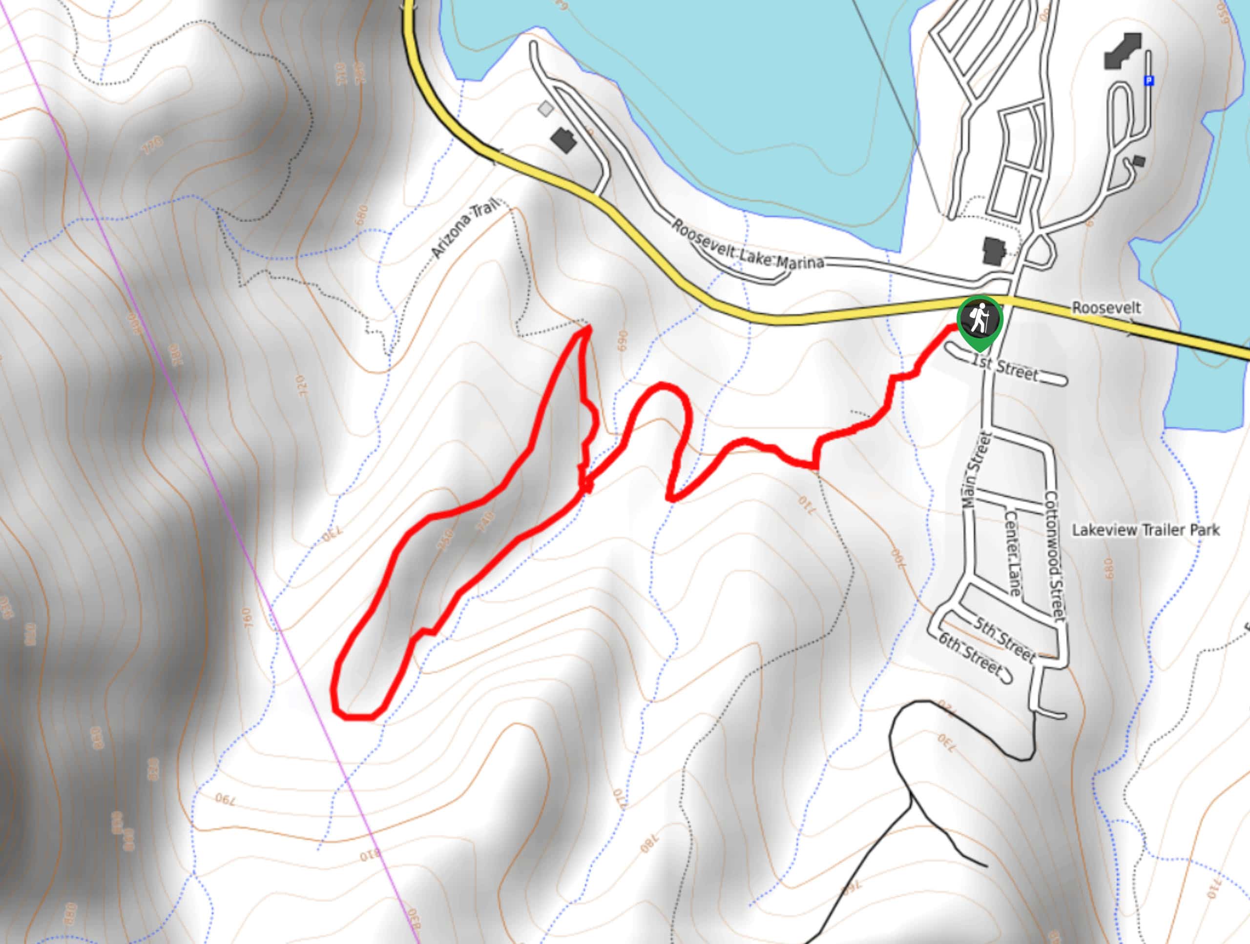
107. Roosevelt Cemetery and Arizona Trail Short Loop
Difficulty
The Roosevelt Cemetery sits on the shores of Theodore Roosevelt Lake, where 75 people were… Read More
108. Perlite Road to Arnett Creek Loop
Difficulty
The Perlite Road to Arnett Creek Loop takes you through a section of the Boyce… Read More
109. Pine Canyon Trail Loop
Difficulty
The Pine Canyon Trail Loop in Pine, Arizona is a quick 2.7mi loop… Read More
110. Bronco Trail
Difficulty
The Bronco Trail is a 7.9mi out and back route used for hiking… Read More
111. Jacob’s Crosscut Trail
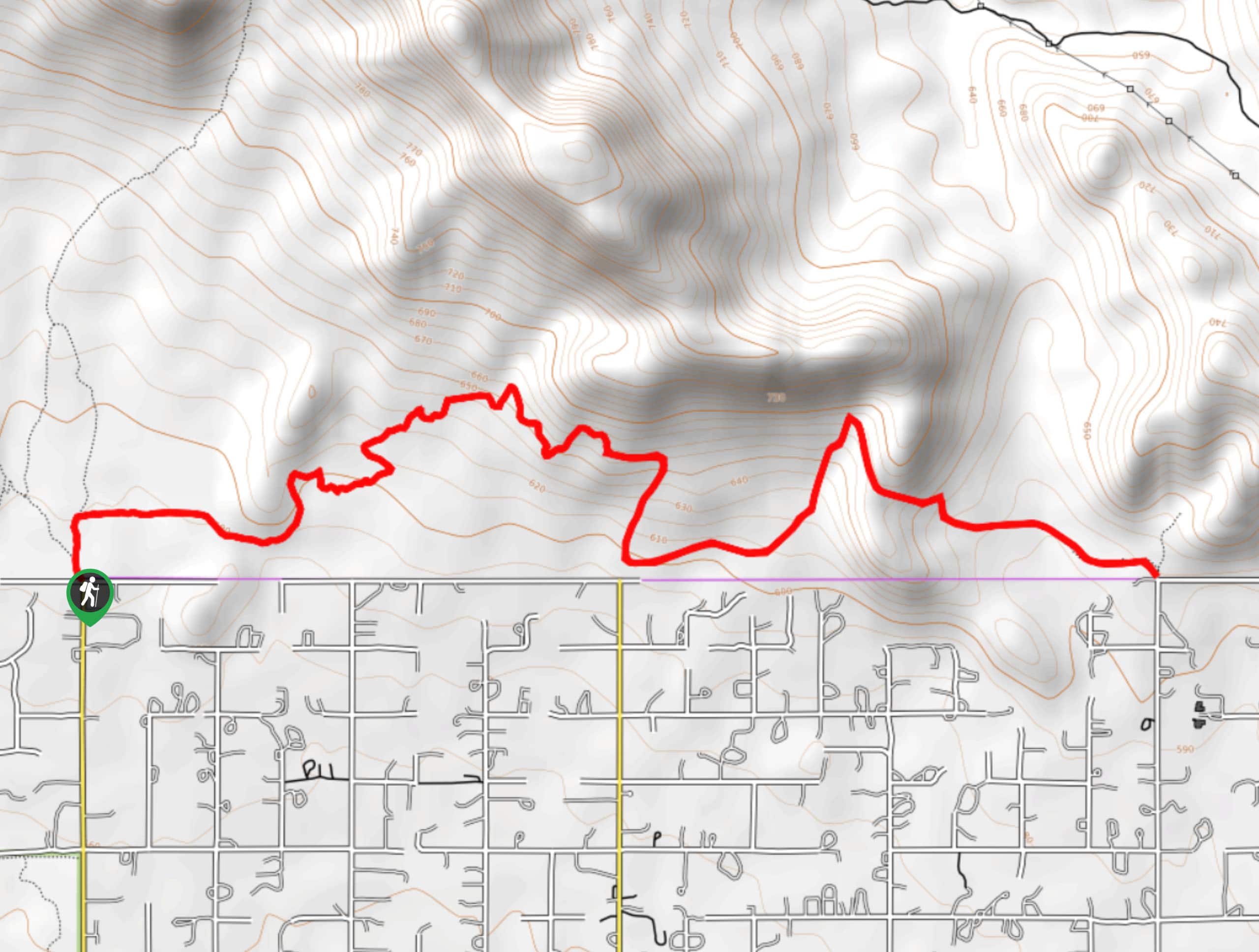
Difficulty
Jacob’s Crosscut Trail is an important route in the network of trails in Lost Dutchman… Read More
Are we missing your favourite hike?
Tell us! If you've got photos, a GPS track and know the hike, we'd love to share your favourite hike with the rest of the 10Adventures community.