
Y Bar and Barnhardt Trail Loop
View Photos
Y Bar and Barnhardt Trail Loop
Difficulty Rating:
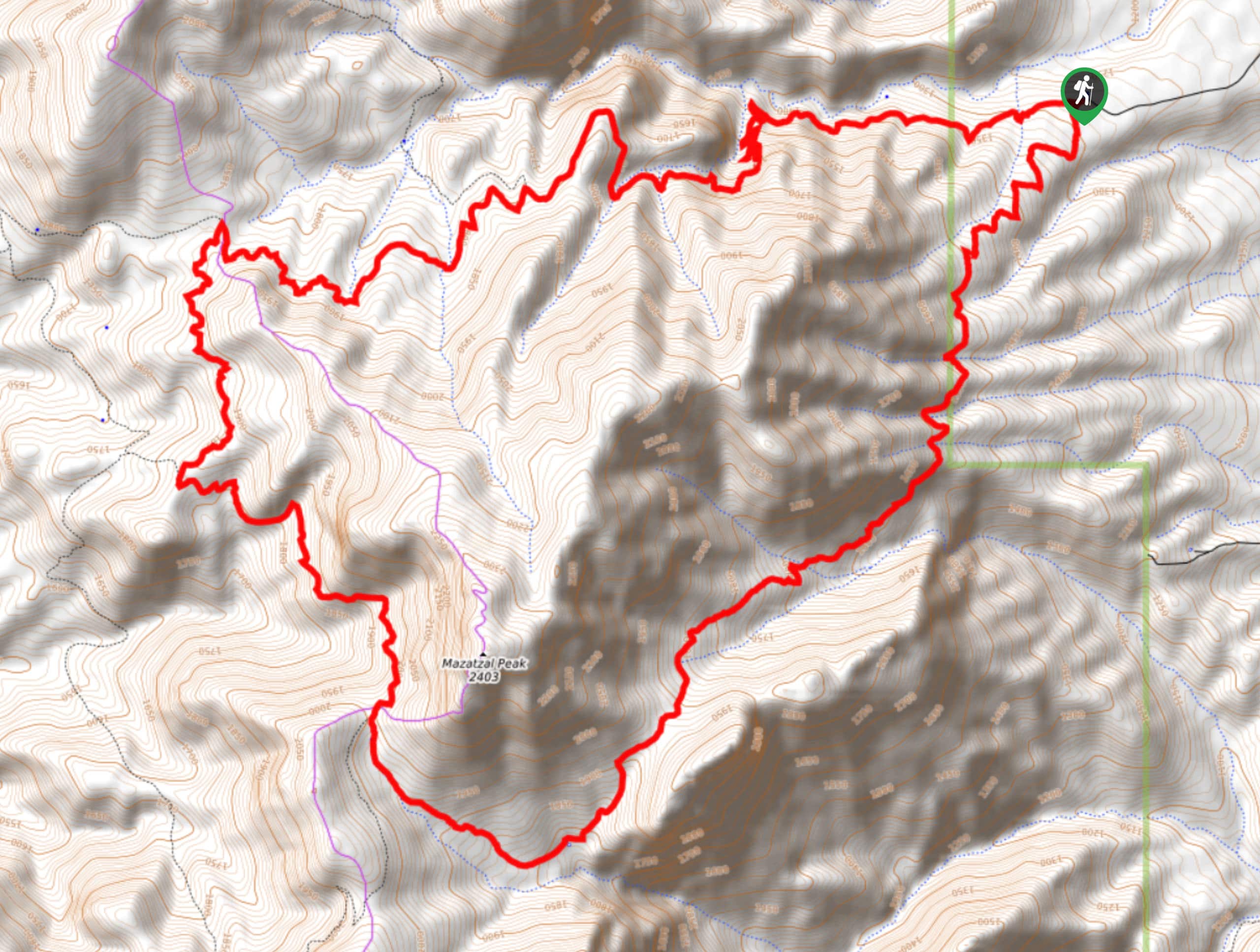
The Y Bar and Barnhardt Trail Loop is a 15.7mi loop hike in the Tonto National Forest. This route can be used as a longer day trip or you can take advantage of the camping sites along the way to backpack it. One side of this loop is very rocky, so sturdy boots are a must. While it’s a bit of a longer trek, the elevation gain is nicely spread out, making it a less demanding route than you might think. Expect moderate traffic.
Getting there
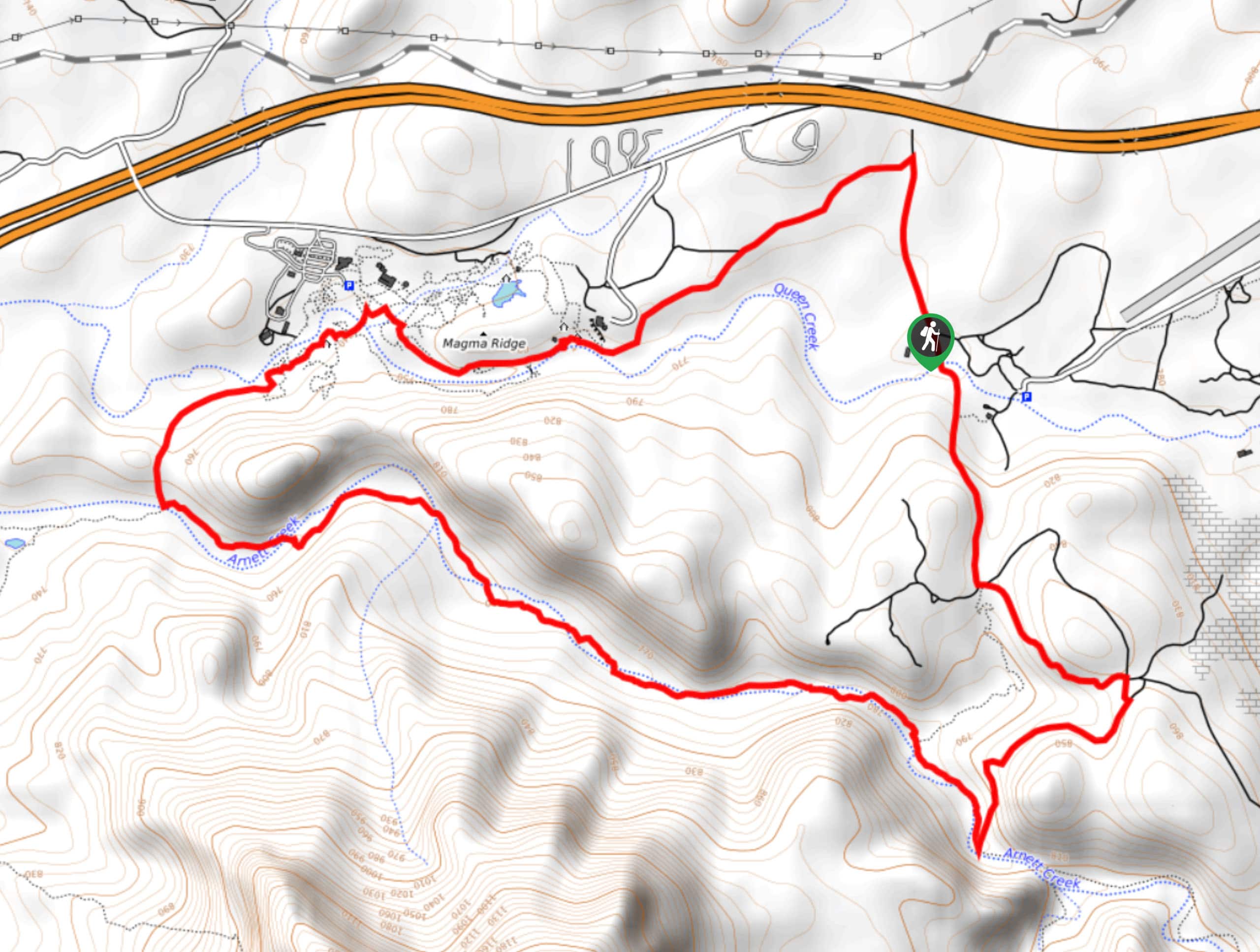
The trailhead for the Y Bar and Barnhardt Trail Loop is at the end of Barnhardt Road.

About
| Backcountry Campground | Various backcountry sites |
| When to do | October-May |
| Pets allowed | Yes - On Leash |
| Family friendly | No |
| Route Signage | Average |
| Crowd Levels | Moderate |
| Route Type | Loop |
Y Bar and Barnhardt Trail Loop
Elevation Graph
Weather
Y Bar and Barnhardt Trail Loop Description
The Y Bar and Barnhardt Trail Loop is a gorgeous loop that takes you all the way around Mazatzal Peak for awesome views of a remote-feeling part of the Tonto National Forest. This loop can be done in a day thanks to its spread-out elevation profile, or you can make use of the dispersed camping sites on the route to make this a backpacking adventure.
The Y Bar side of the route is extremely rocky, and the rocks seem to be perfectly ankle-rolling sized. Wear sturdy boots, but also consider starting your loop on the Barnhardt side in case you decide it’s too rocky for you- some users report preferring the Barnhardt side as an out and back because of the rocky terrain.
From the trailhead, keep left onto the Barnhardt Trail. You’ll take a set of even switchbacks up between the creek valleys before starting a traverse across the washes on the side of the peak. Make a longer gradual climb through the canyon to hike underneath Mazatzal Peak, continuing through the manzanitas along the backside of the loop. Stay right three times as you loop around to the Y Bar Trail, which involves some steep descents down switchbacks and consideration of the aforementioned rocks.
This route will deliver you back to the trailhead.
Similar hikes to the Y Bar and Barnhardt Trail Loop hike
Jacob’s Crosscut Trail
Jacob’s Crosscut Trail is an important route in the network of trails in Lost Dutchman State Park. This route is…
Bronco Trail
The Bronco Trail is a 7.9mi out and back route used for hiking and horseback riding. This trail…
Perlite Road to Arnett Creek Loop
The Perlite Road to Arnett Creek Loop takes you through a section of the Boyce Thompson Arboretum grounds and through…
Comments