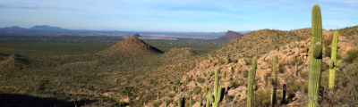
hikes in Kootenai National Forest
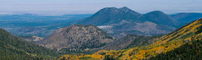
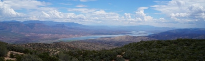
Encompassing over 2.3 million acres of land and over 1,500mil of hiking routes, the Kootenai National Forest is a hiker’s paradise. Located in northwestern Montana, the protected area encroaches into Idaho’s panhandle, with 3% of the national forest situated in the Gem State. Just to the west of the famed Glacier National Park, along the US-Canadian border, the Kootenai National Forest bounds the rugged Rockies, including mountains in the Whitefish, Purcell, Bitterroot, Salish, and Cabinet ranges.
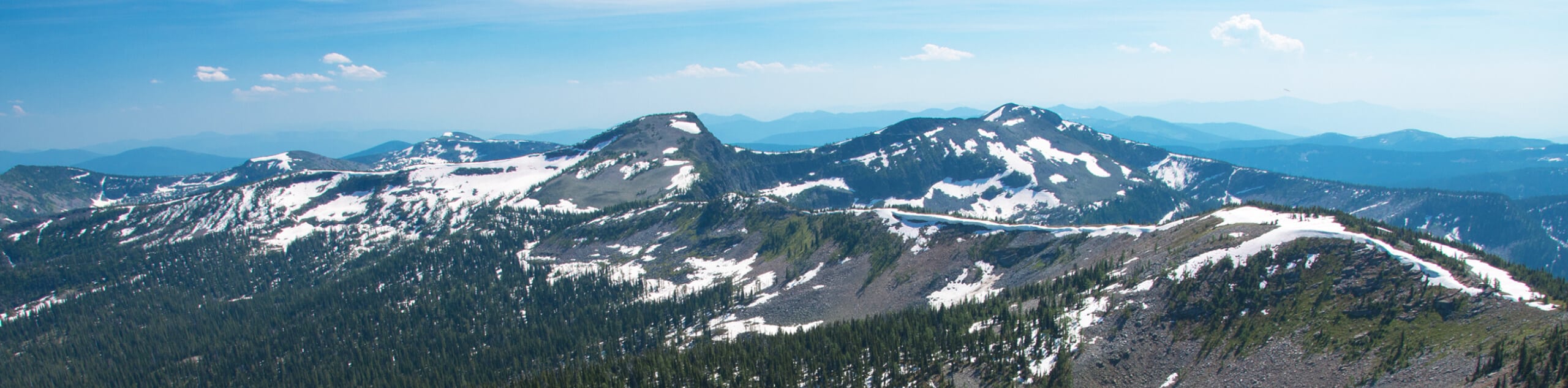
Explore the landscape characterized by soaring crests, valleys carved by wild waterways, timbered foothills, montane meadows, and idyllic alpine lakes. While there are countless recreation opportunities to satiate your thirst for adventure, hiking is indisputably the best way to explore the pristine wilderness of the Kootenai National Forest. Wander through a grove of ancient giant red cedars, frolic through wildflower-strewn meadows, or ascend the craggy flanks of the Rocky Mountains.
Exhibiting topographic range and floral diversity, wildlife viewing opportunities are also abundant. The wooded backcountry houses black bears, grizzlies, elk, big horned sheep, wolves, and cougars. With over 205 species of birds and an array of waterfowl and fish, fishing and game are also popular pastimes in the forest. While the possibilities are boundless, we argue that hiking and backpacking are the best way to appreciate the majesty and beauty of the Kootenai National Forest.
10 Amazing Hiking Routes in the Kootenai National Forest
While arduous ascents into the Rocky Mountains are ubiquitous in the Kootenai National Forest, there is also a substantial repertoire of family-friendly hikes. Lower altitude routes are great for the whole family, and high elevation climbs appeal to those seeking an adrenaline rush. Because there is such an extensive repertoire of trails in the forest, we took it upon ourselves to create a list of the top routes—happy hiking!
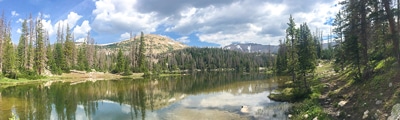
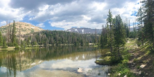
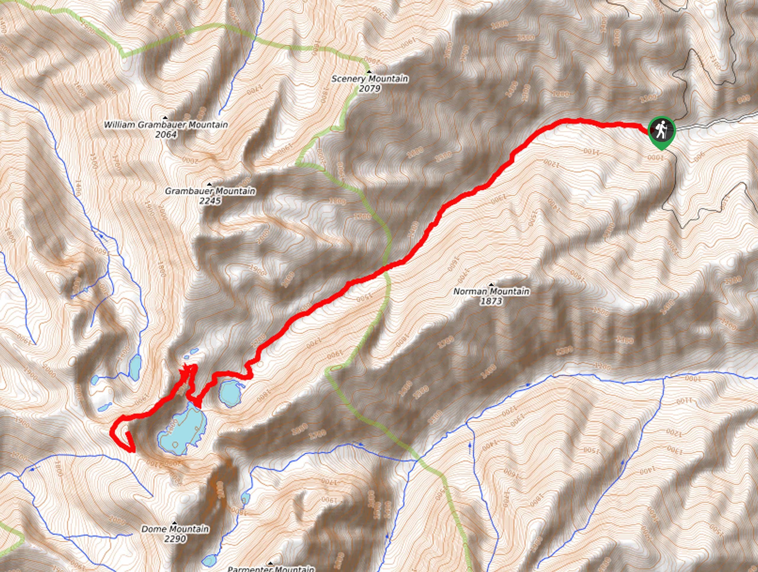
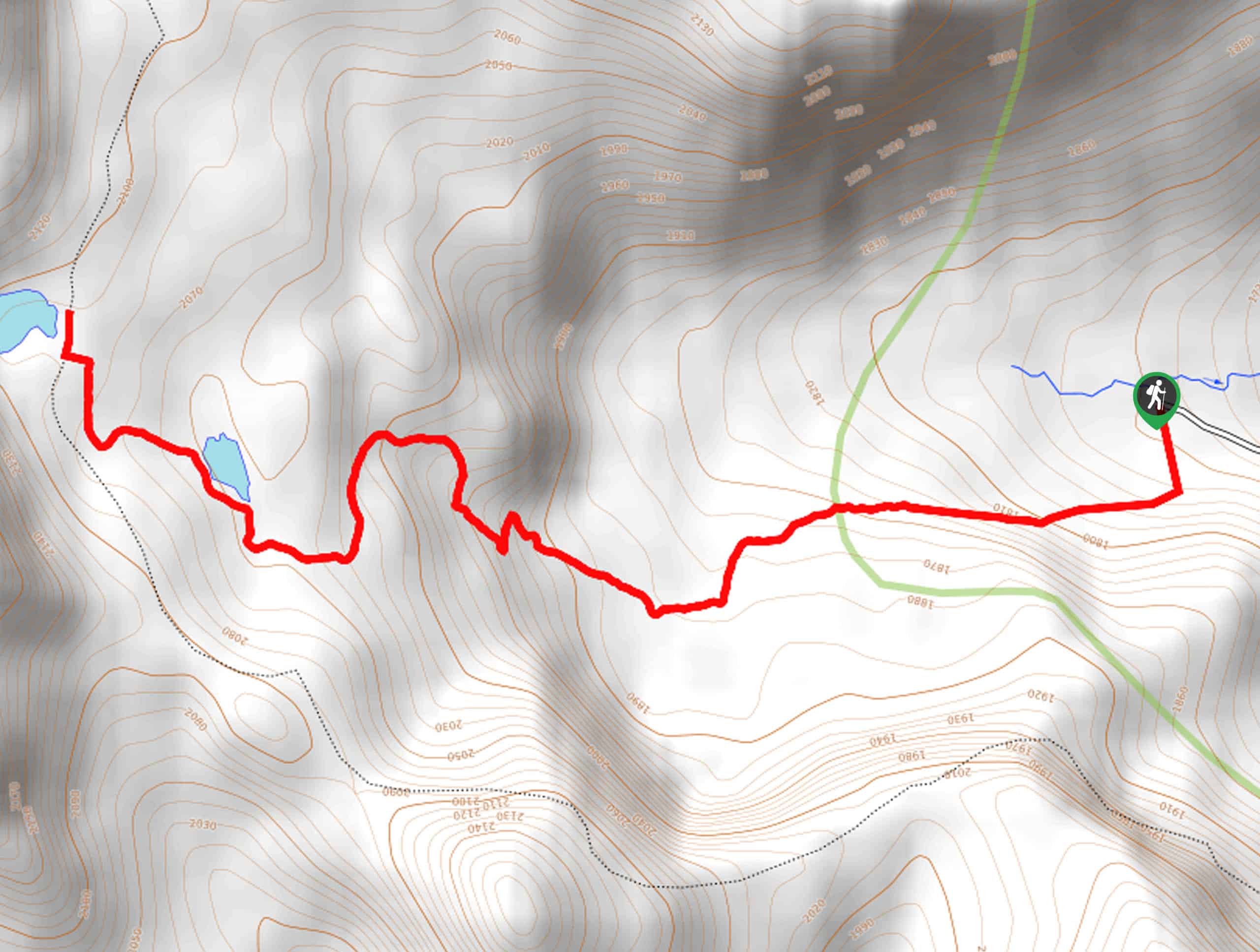
- Cedar Lakes Trail - Explore northern Montana’s unspoiled backcountry and discover two idyllic lakes on the Cedar Lakes Trail. This scenic expedition demands a modest effort, but the gorgeous woodlands, sweeping mountain views, and refreshing alpine pools are well worth the sweat.
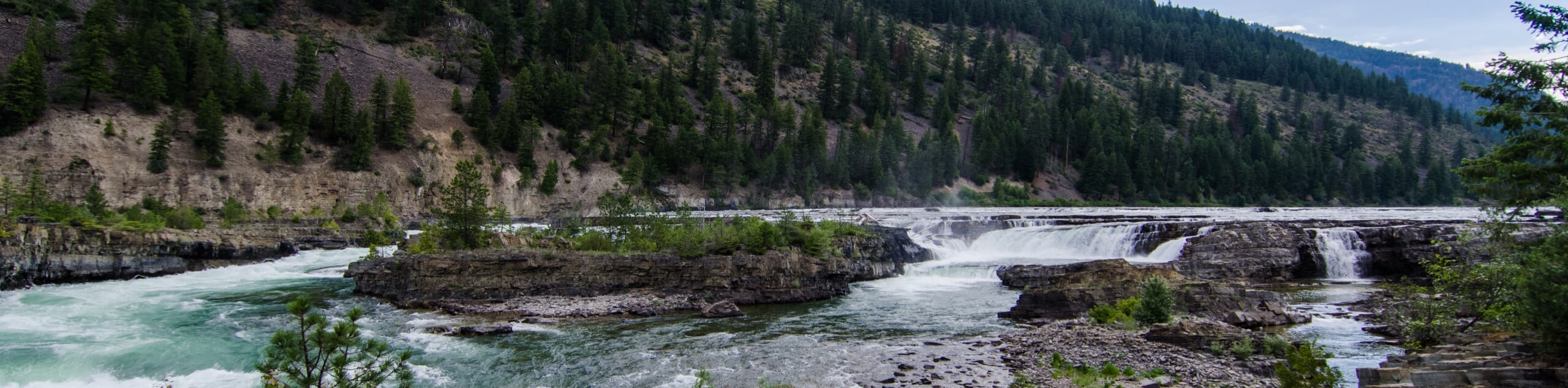
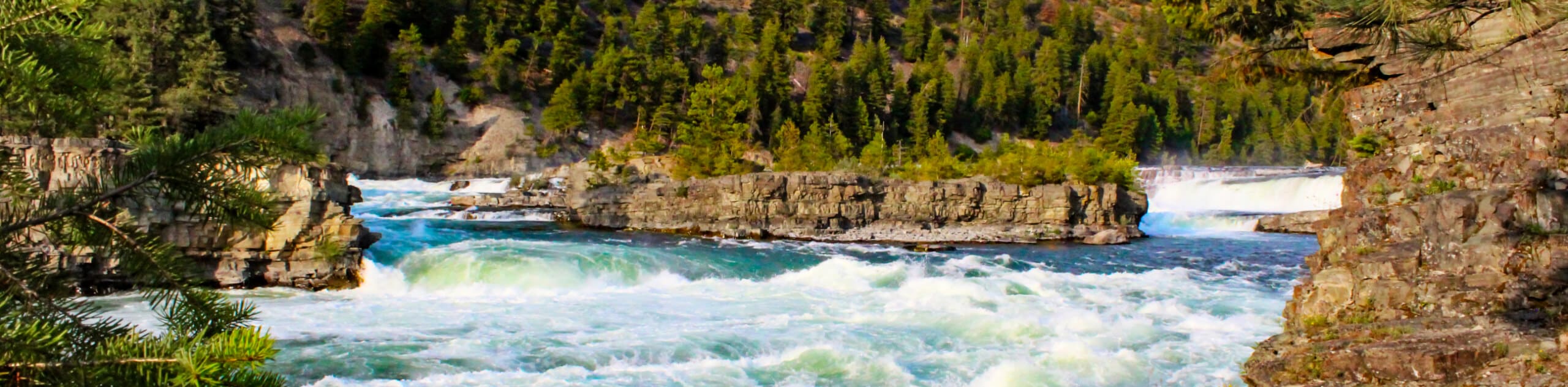
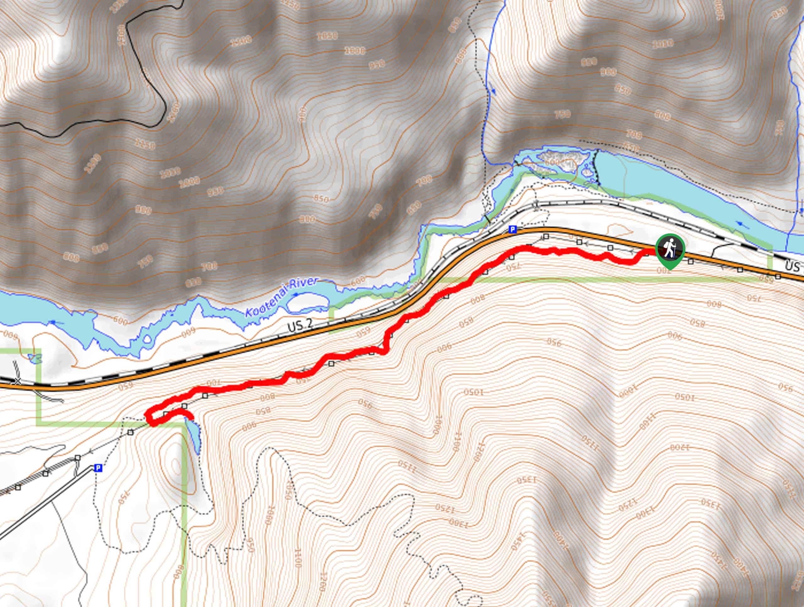
- Kootenai Falls and Swinging Bridge Trail - The Kootenai Falls and Swinging Bridge Trail is a family-friendly adventure near Troy that offers spellbinding views of the famed Kootenai Falls that cascade 56ft through sandstone and shale-layered gorge. While the falls are quite a sight to behold, the Kootenai Swinging Bridge is the cherry on top!
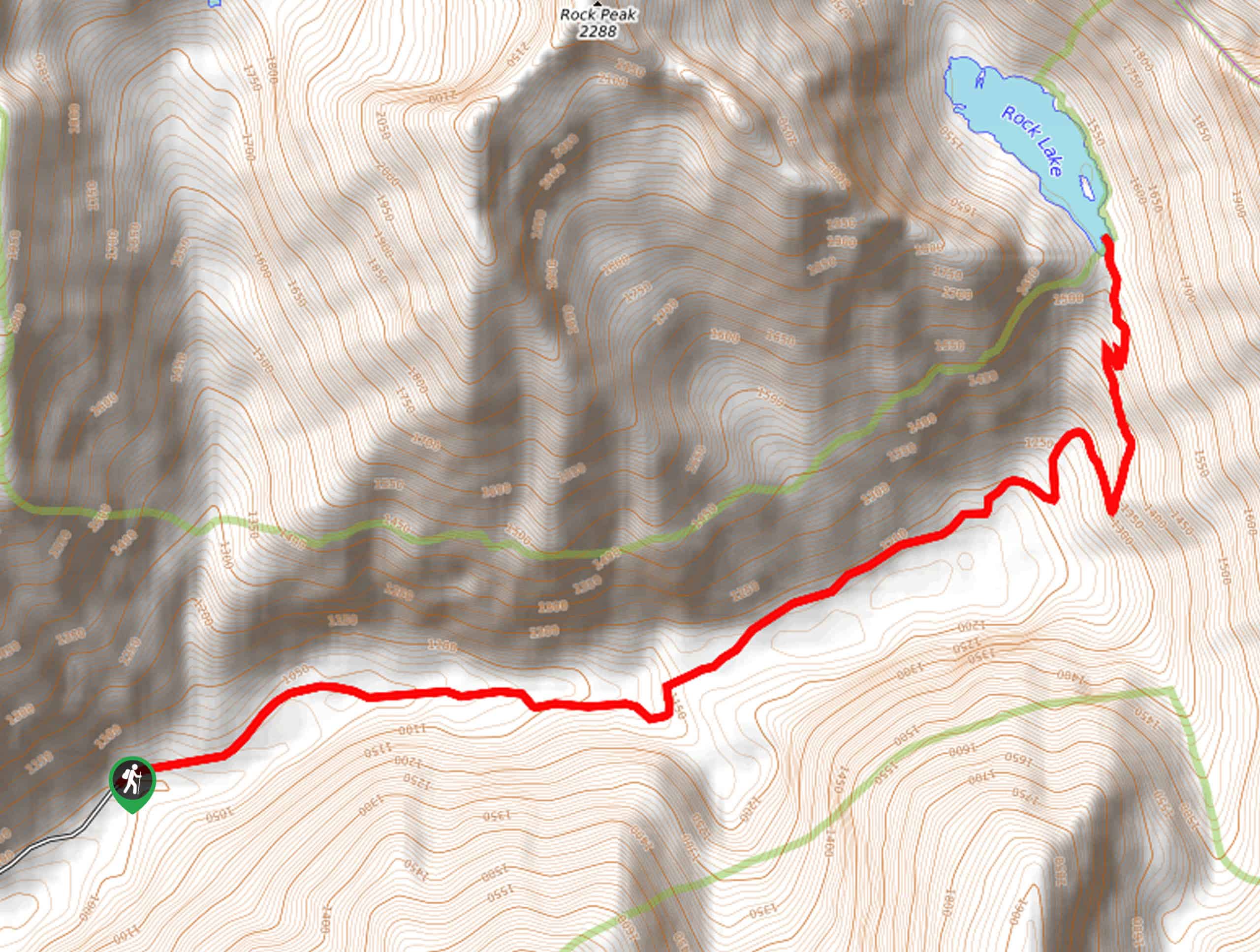
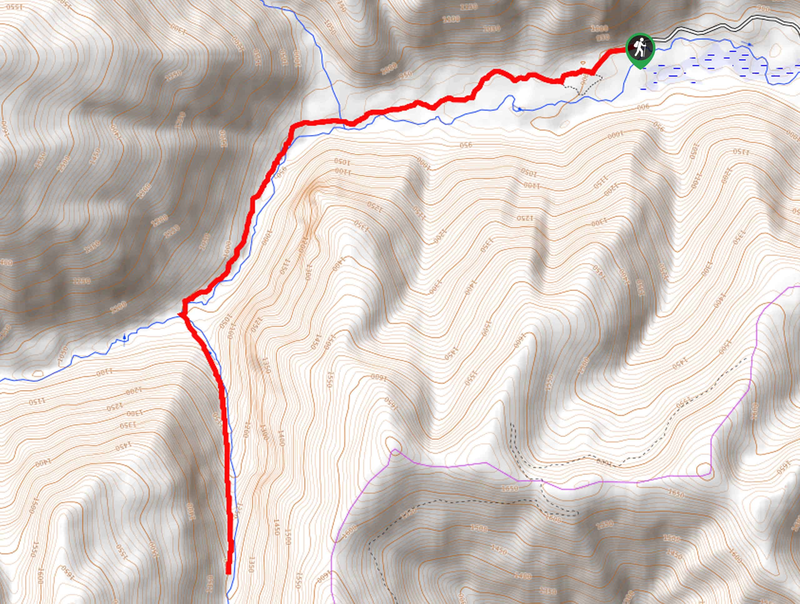
- Rock Lake Trail - Hike to a hidden alpine pool nestled amongst the crags of the Cabinet Mountains on the Rock Lake Trail. This scenic route travels through timbered valleys, past tumbling waterfalls, and the historic Heidelberg Mine. Ideal for intermediate adventurers and families with older children, your heart rate will be up without over-exhausting yourself.
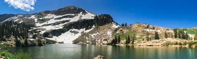
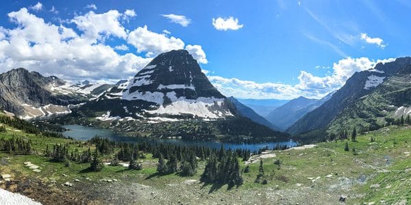
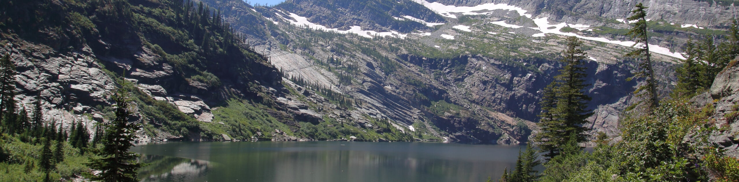
- Leigh Lake Hike - Immerse yourself amongst the craggy peaks of the Cabinet Mountains and enjoy wildlife sightings as you tackle the Leigh Lake Hike. This demanding day-hike exhibits a variety of flora and fauna in addition to a scenic waterfall, a breathtaking alpine lake, and mesmerizing mountain views.
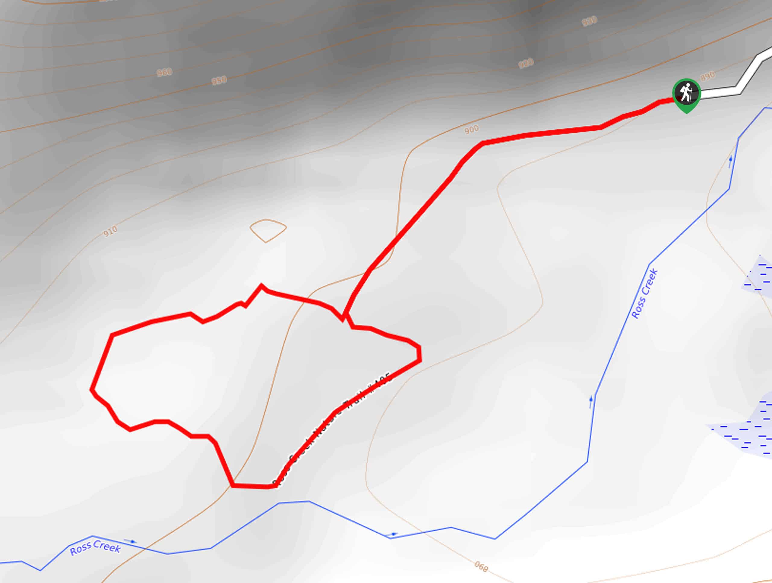
- Ross Creek Cedars Trail - Enjoy a peaceful stroll through an enchanting forest on the Ross Creek Cedars Trail. Wander through a corridor of towering giant ancient cedars and alongside a meandering creek. This family-friendly trail is not only scenic, but it is informative as it is lined with interpretive signs detailing the history and ecology of the area.
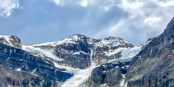
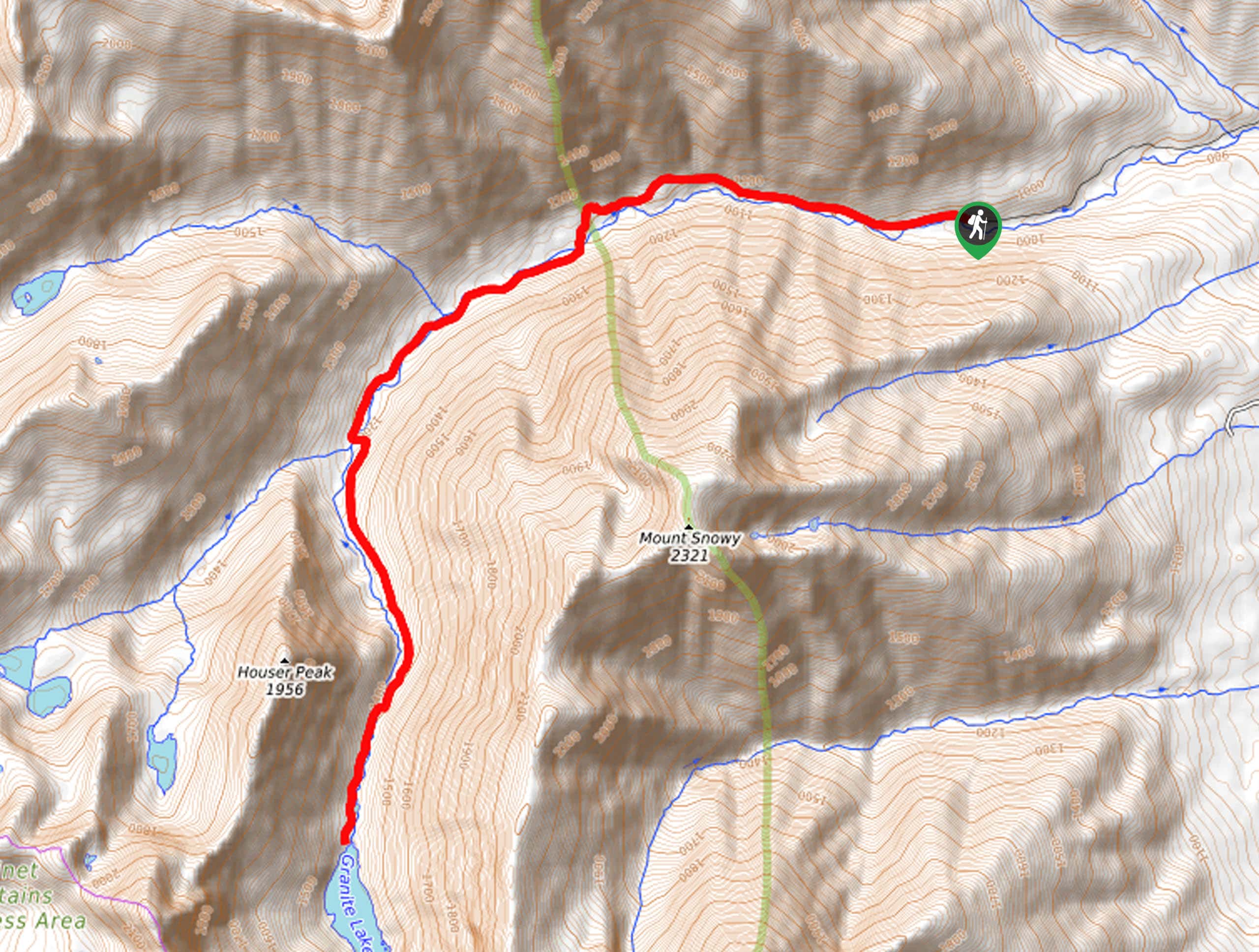
- Granite Lake Hike - Enjoy marvelous views of the Cabinet Mountains from an alpine lakeshore on the Granite Lake Hike. This arduous ascent explores a gorgeous mountain cirque adorned with the only glacial pool in the range. Although the glacier is not within view, a dramatic waterfall fed by Blackwell Glacier cascades down the flanks of Snowshoe Peak.
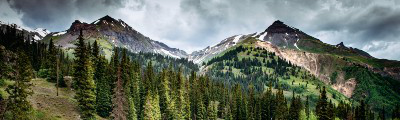
- Sky Lakes and Hanging Valley Loop Trail - The Sky Lakes and Hanging Valley Loop Trail is a challenging day-hike or epic overnight expedition in the Kootenai National Forest. Sweeping mountain views await you after an arduous climb alongside a meandering creek, through montane meadows, and up loose scree.
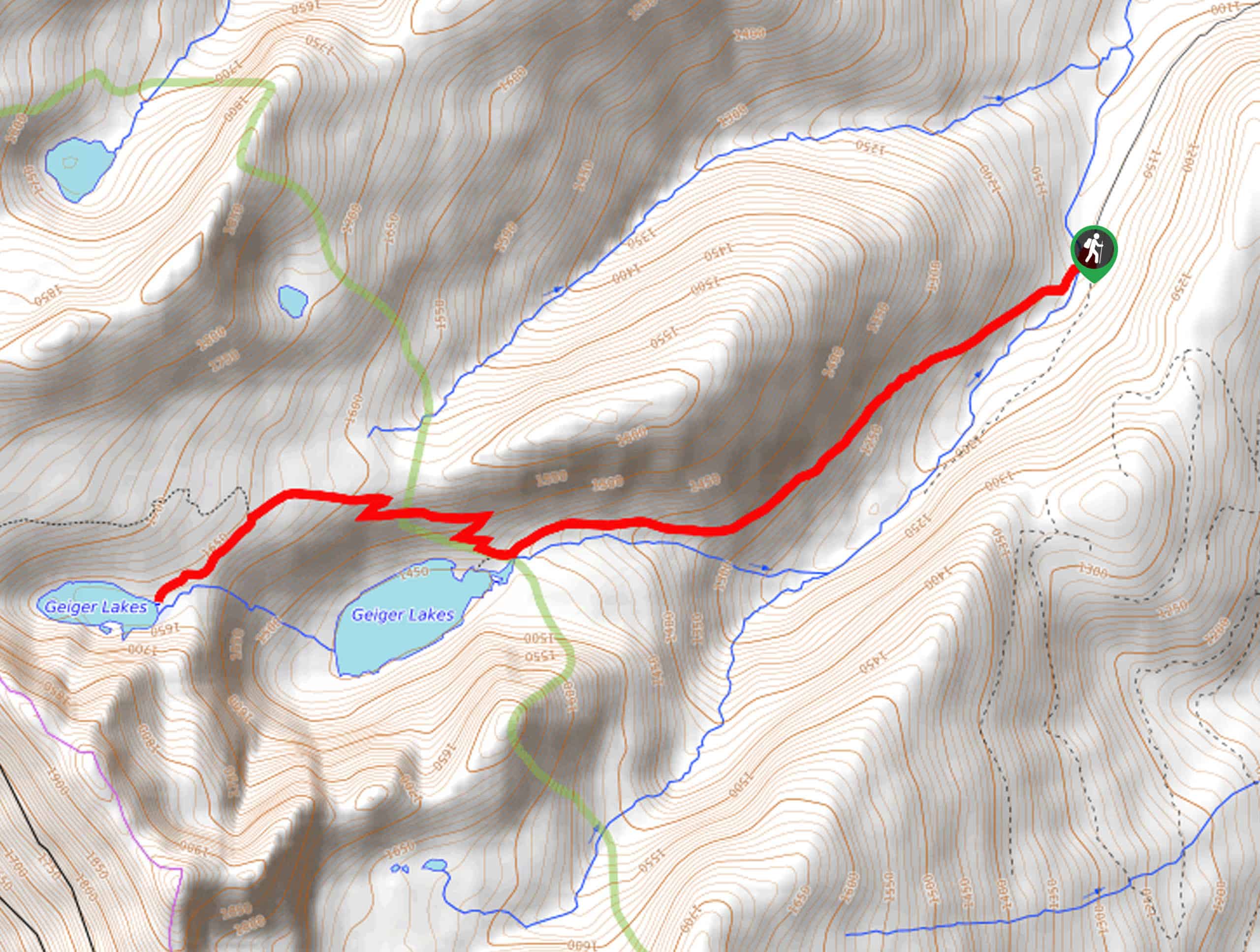
- Geiger Lakes via Lost Buck Pass Trail - Hike to a hidden paradise in the Cabinet Mountains on the Geiger Lakes via Lost Buck Pass Trail. Explore the pristine alpine environment and take a plunge in the rejuvenating alpine pools flanked by the craggy ridges anchored by Carney Peak.
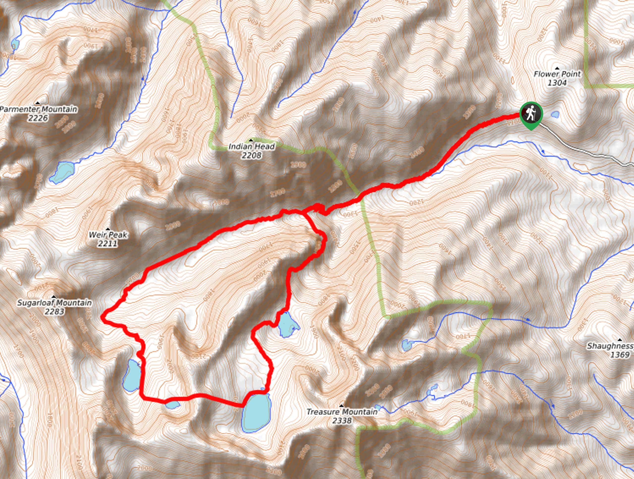
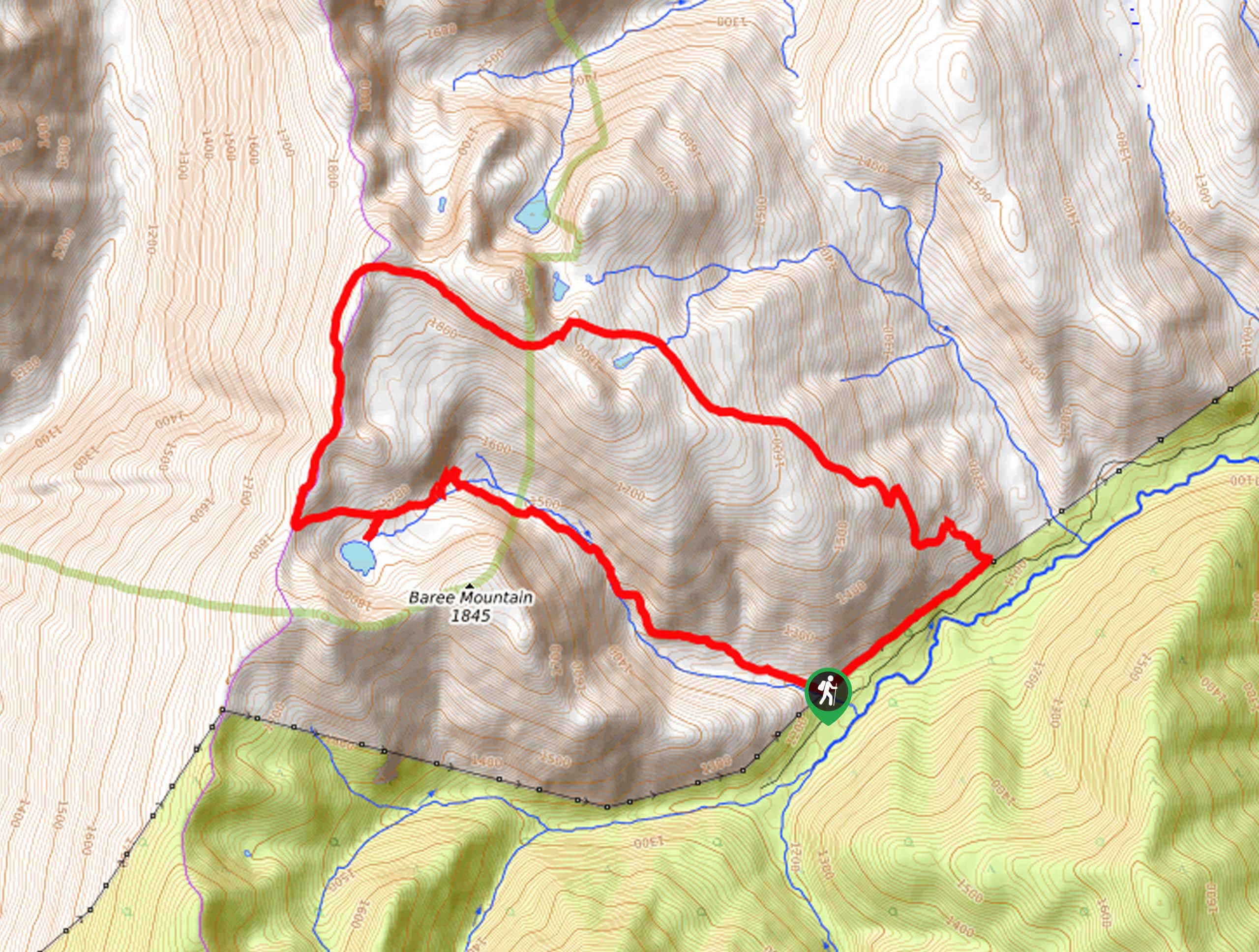
- Bear and Baree Lakes Loop Trail - The Bear and Baree Lakes Loop Trail is another quintessential adventure into the Cabinet Mountains. This heart-pumping climb into the alpine exhibits a variety of rich flora and wildlife and breathtaking mountain views. We love this high-country hike, and you will, too, if you don’t mind breaking a sweat.
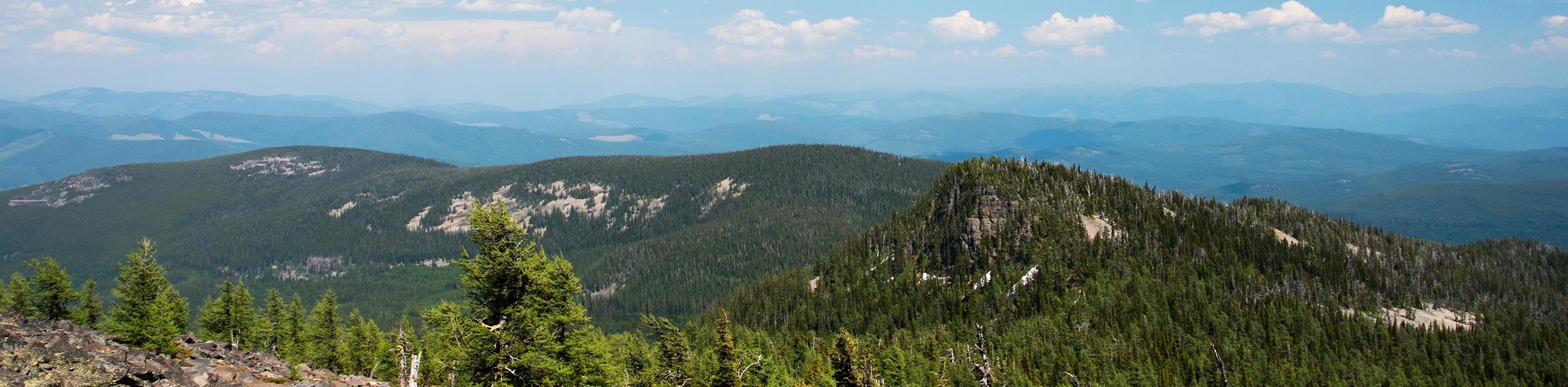
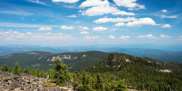
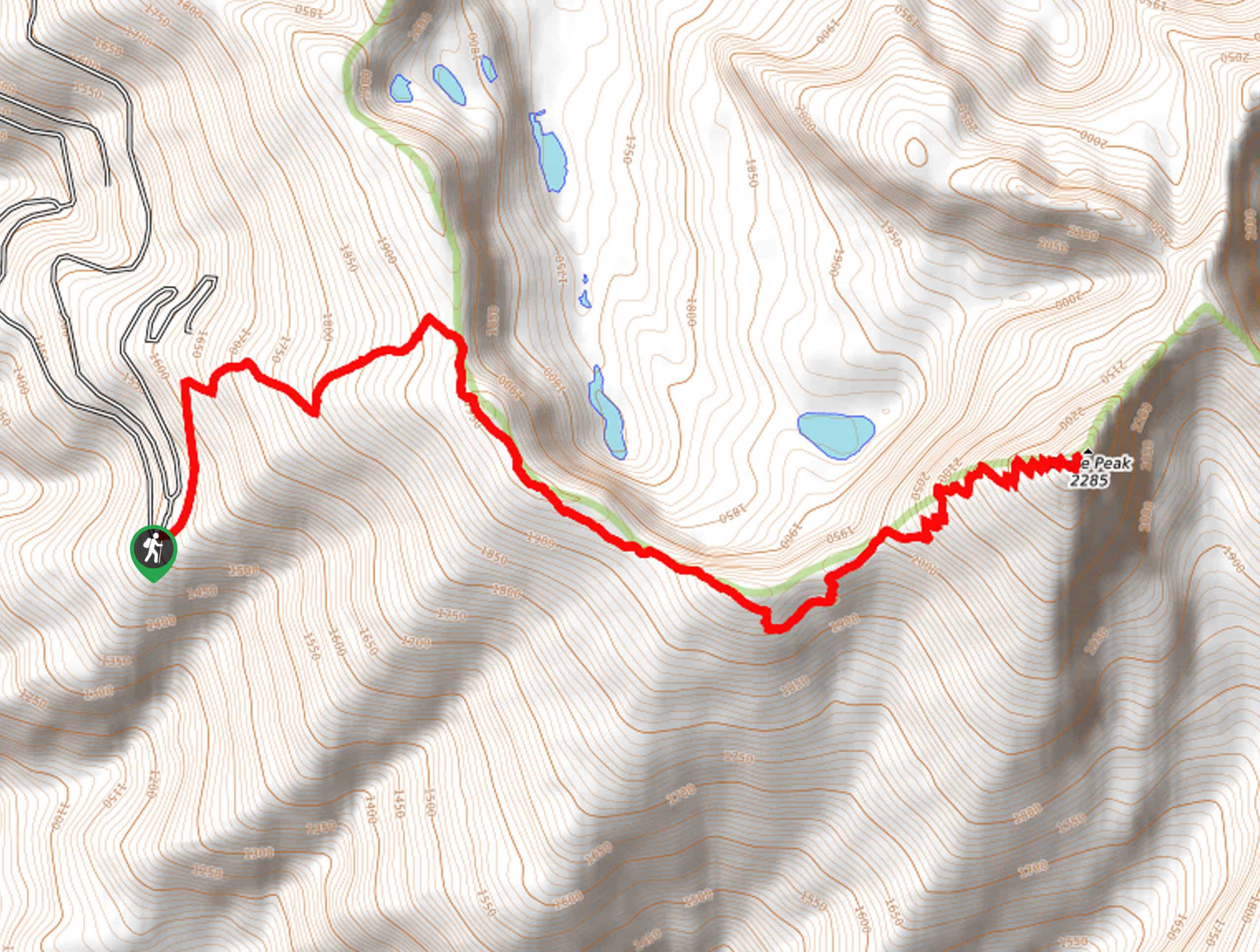
- Star Peak Lookout Hike - Hike above the clouds to a historic lookout tower on the Star Peak Lookout Hike. This relentless ascent is exhausting, demanding the navigation of countless switchbacks up to the summit where you will be rewarded with 360-degree views of the mountainous landscape.
When is the Best Time to Visit the Kootenai National Forest?
Situated in the famed Rocky Mountains, the hiking season on the Kootenai National Forest is fleeting. As a rule of thumb, most trails are accessible from May-October, though it is important to note that high altitude treks are usually not cleared or free of snow until July, and even then, there might remain a dusting. Lower altitude trails are open in the early spring into the fall—though May and June tend to boast quite a lot of precipitation. When camping, backpacking or hiking, August and September are the safest months to visit—bearing in mind that weather at high altitudes can change on a dime.
Other Outdoor Activities in the Kootenai National Forest
Boasting an extensive collection of backcountry routes, hiking is not the only recreational opportunity in the Kootenai National Forest. Instead, this swathe of unspoiled wilderness offers countless ways to explore the great outdoors. In the summer months, mountain biking, horseback riding, and camping are popular ways to discover the outdoors. The soaring crests that rise from the landscape attract intrepid and seasoned climbers and peak baggers into the high country, and fishermen take to the lakes for some fishing. Water recreation is also abundant in the warmer months, including swimming, boating, paddling, and rafting down the untamed rivers.
While winter pursuits are finite, there are a few ways to escape into the wilds. Many low-altitude trails transform into exquisite tracks for snowshoers and cross-country skiers itching to avoid the unavoidable cabin fever in the snowy months. Winter exploration also includes alpine skiing at Turner Mountain, snowmobiling, and ice fishing.
Frequently Asked Questions About the Kootenai National Forest
Can you camp anywhere in the Kootenai National Forest?
Dispersed camping is permitted in the Kootenai National Forest unless otherwise signposted. Contact one of the National Forest Service offices for more information.
How big is the Kootenai National Forest?
The Kootenai National Forest encompasses 2.2million acres of land in Northwest Montana and Northeast Idaho.
Can you hunt in the Kootenai National Forest?
Yes, hunting and fishing are permitted in the Kootenai National Forest; refer to Montana Fish and Game for regulations and seasons.
Where is the Kootenai National Forest?
The Kootenai National Forest is located in Northwest Montana and Northeast Idaho.
Are there bears in the Kootenai National Forest?
Yes, there are black bears and grizzly bears in the Kootenai National Forest. Respect any warning signs, know the procedure in the case of an encounter, and carry bear spray.
Epic Adventure Tours in Montana
Although we have yet to curate a tour specific to the Kootenai National Forest, we here at 10Adventures have a few amazing adventure tours in Montana! Note we are constantly working to add more exciting expeditions, so check back and find your perfect holiday.
Find Other Amazing Hiking Regions in Montana
Read MoreThe best hikes in Kootenai National Forest
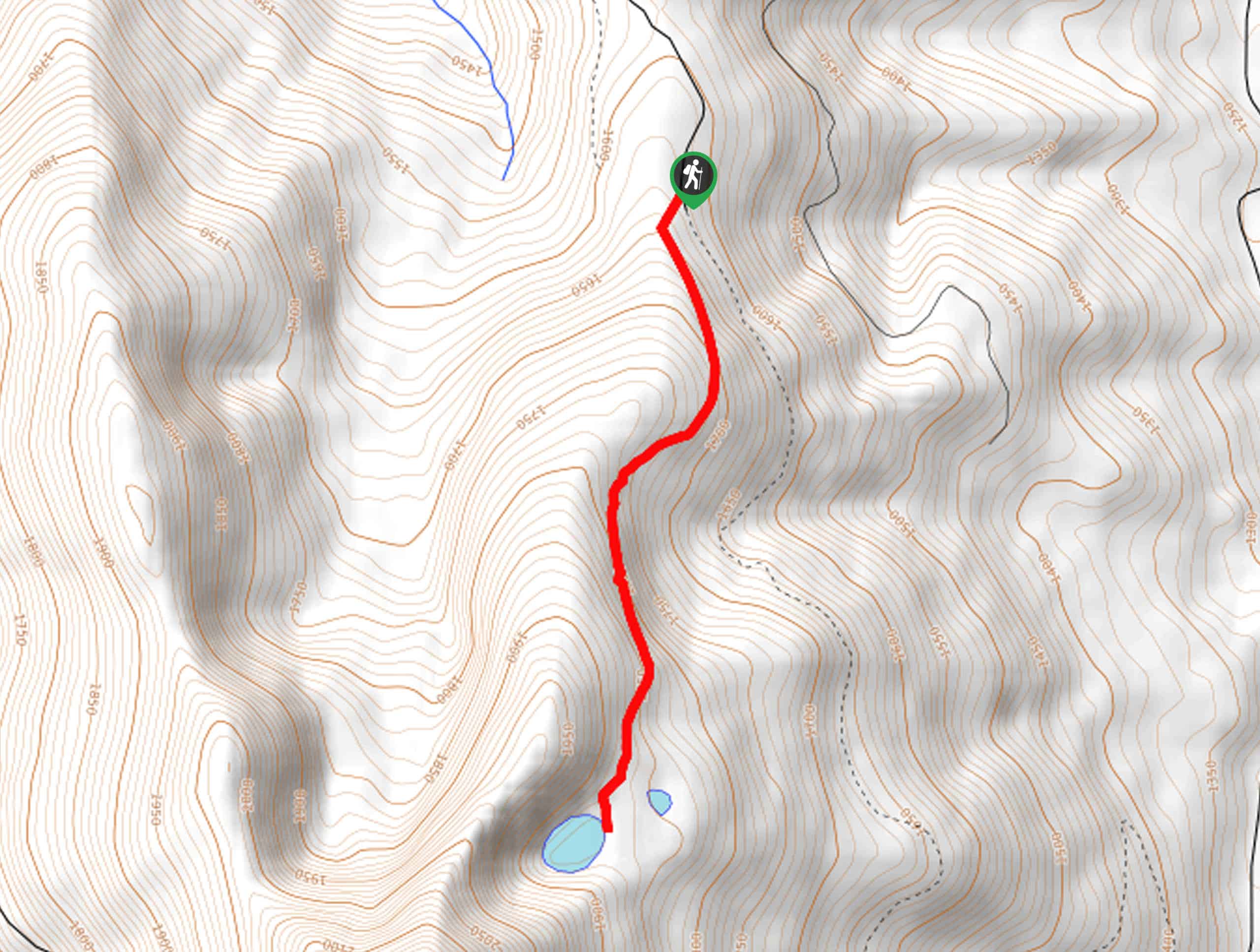
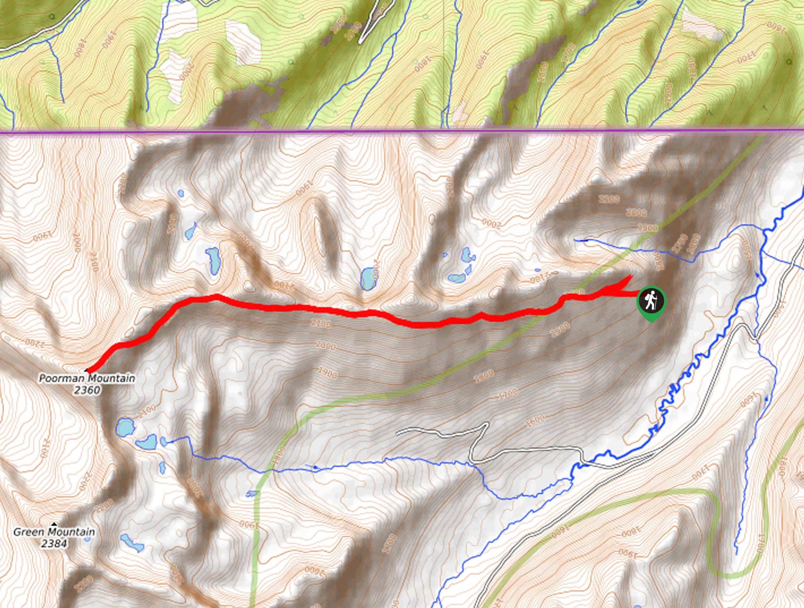
01. Cedar Lakes Trail
Difficulty
The Cedar Lakes Trail is a long and involved adventure in the Kootenai National Forest… Read More
02. Kootenai Falls and Swinging Bridge Trail
Difficulty
The Kootenai Falls and Swinging Bridge Trail is a family-friendly adventure in the Kootenai National… Read More
03. Rock Lake Trail
Difficulty
The Rock Lake Trail is a phenomenal adventure into Montana’s Cabinet Mountains that explores the… Read More
04. Leigh Lake Hike
Difficulty
The Leigh Lake Hike is a dynamic and demanding day-hike in the Kootenai National Forest.… Read More
05. Ross Creek Cedars Trail
Difficulty
The Ross Creek Cedars Trail is a pleasant hike in the Kootenai National Forest that… Read More
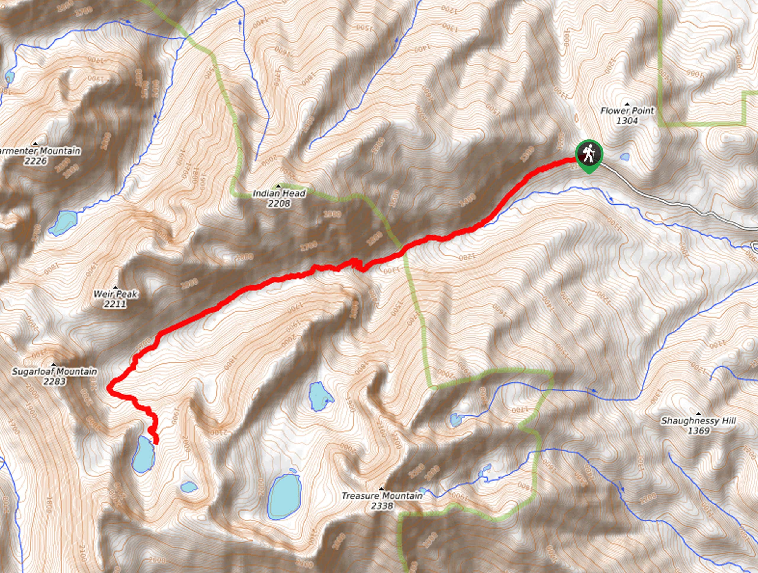
06. Granite Lake Hike
Difficulty
Visit the last remaining glacier-fed pool in the Cabinet Mountains on the Granite Lake Hike.… Read More
07. Sky Lakes and Hanging Valley Loop Trail
Difficulty
Immerse yourself in Montana’s Cabinet Mountains and discover a hidden alpine oasis on the Sky… Read More
08. Geiger Lakes via Lost Buck Pass Trail
Difficulty
The Geiger Lakes via Lost Buck Pass Trail is a demanding and dynamic day-hike in… Read More
09. Bear and Baree Lakes Loop Trail
Difficulty
Sweeping views of the Cabinet Mountains, crystalline alpine lakes, and enchanting woodlands await you on… Read More
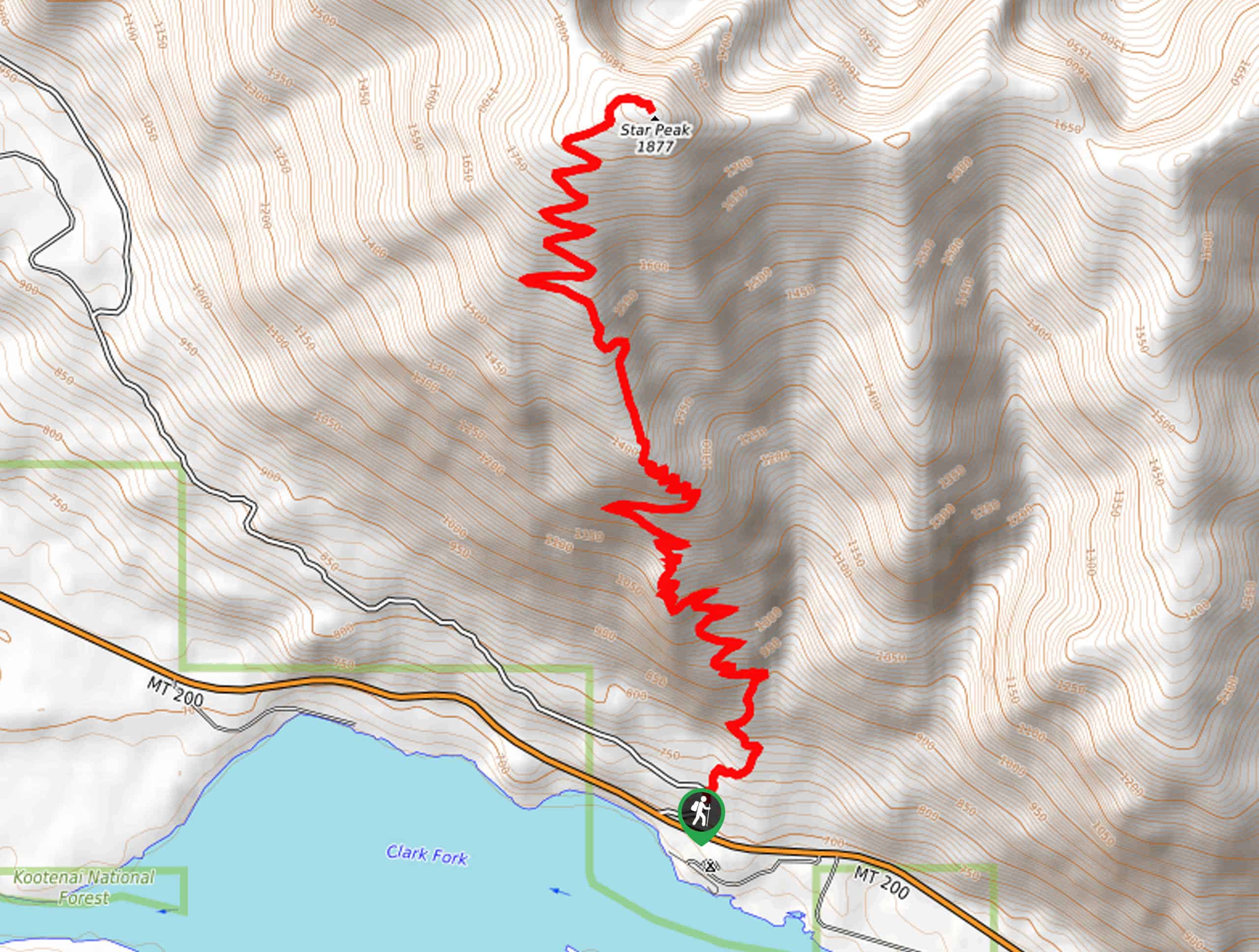
10. Star Peak Lookout Hike
Difficulty
Hike up to the historic lookout tower above the clouds on the Star Peak Lookout… Read More
Yes, there are more than 10
Kootenai National Forest is so beautiful that we can not give you only 10 hikes. So here is a list of bonus hikes in Kootenai National Forest that you should take a look at as well
11. Kootenai Falls Trail
Difficulty
The Kootenai Falls Trail is a fun family adventure in the Kootenai National Forest that… Read More
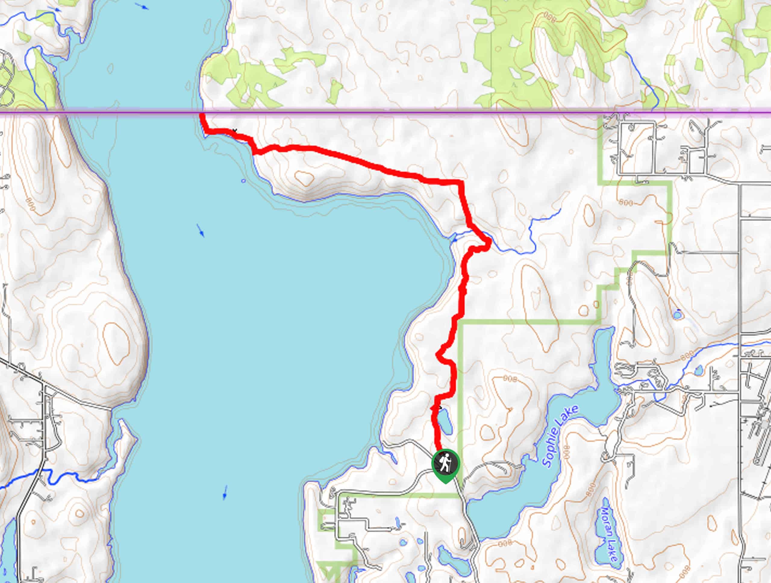
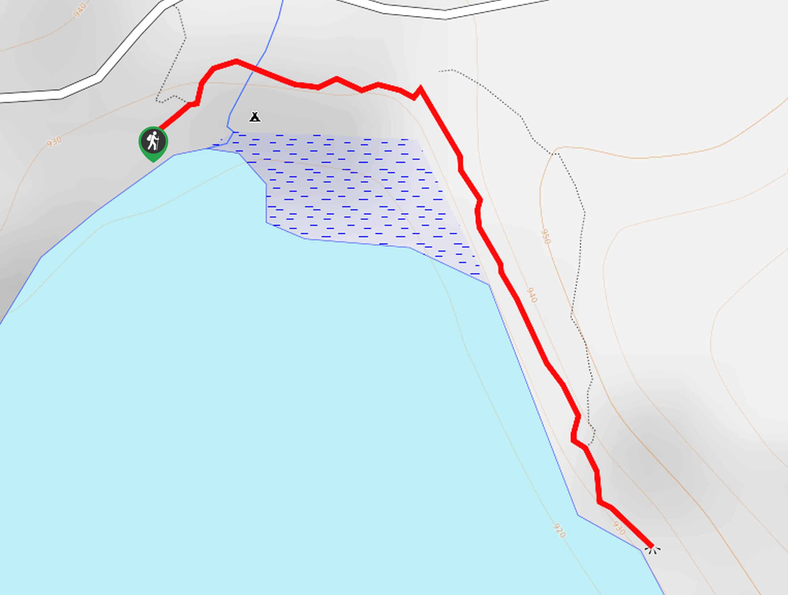
12. Swisher Lake to Gateway Boat Camp Hike
Difficulty
Explore northern Montana and come within 0.2mi of the Canadian Border on the… Read More
13. South Fork Ross Creek Trail
Difficulty
The South Fork Ross Creek Trail is a pleasant trail that explores an enchanting grove… Read More
14. Henry Lake Trail
Difficulty
Discover a hidden oasis in northern Montana on the Henry Lake Trail. This family-friendly expedition… Read More
15. Little Spar Lake Trail
Difficulty
Hiking the Little Spar Lake Trail is an unforgettable experience. This high-country hike travels through… Read More
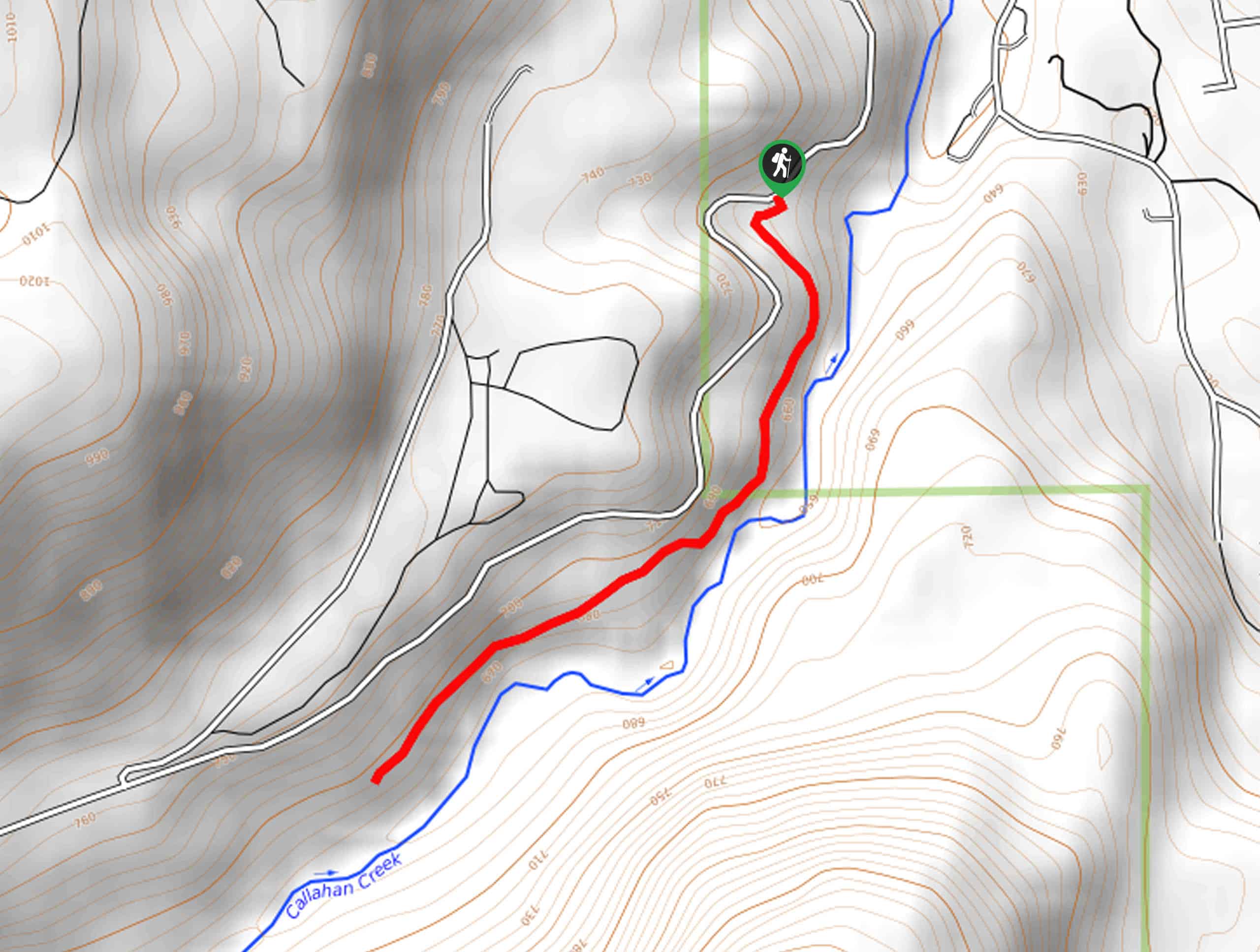
16. Callahan Creek and Historic Railway Trail
Difficulty
Hiking the Callahan Creek and Historic Railway Trail is easy-going and impressively scenic. Steep in… Read More
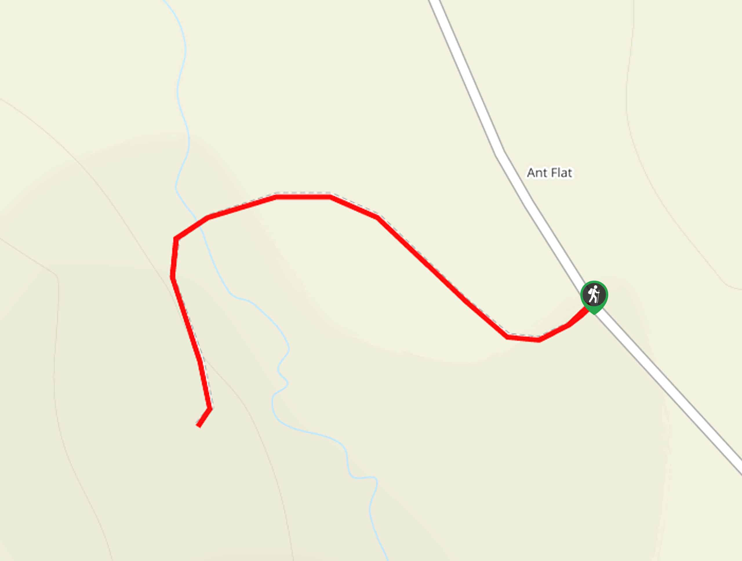
17. Ant Flat Historical Site Nature Trail
Difficulty
Seeking a family-friendly adventure near Eureka? The Ant Flat Historical Site Nature Trail is a… Read More
18. Rainbow Lake Trail
Difficulty
Sweeping views of the Wigwam Drainage, Galton Range, and the Ten Lakes Basin await you… Read More
19. Murphy Lake Hike
Difficulty
The Murphy Lake Hike is a family-friendly adventure in the Kootenai National Forest that explores… Read More
20. Flower Creek Trail
Difficulty
The Flower Creek Trail is an arduous day hike, but let us tell you, the… Read More
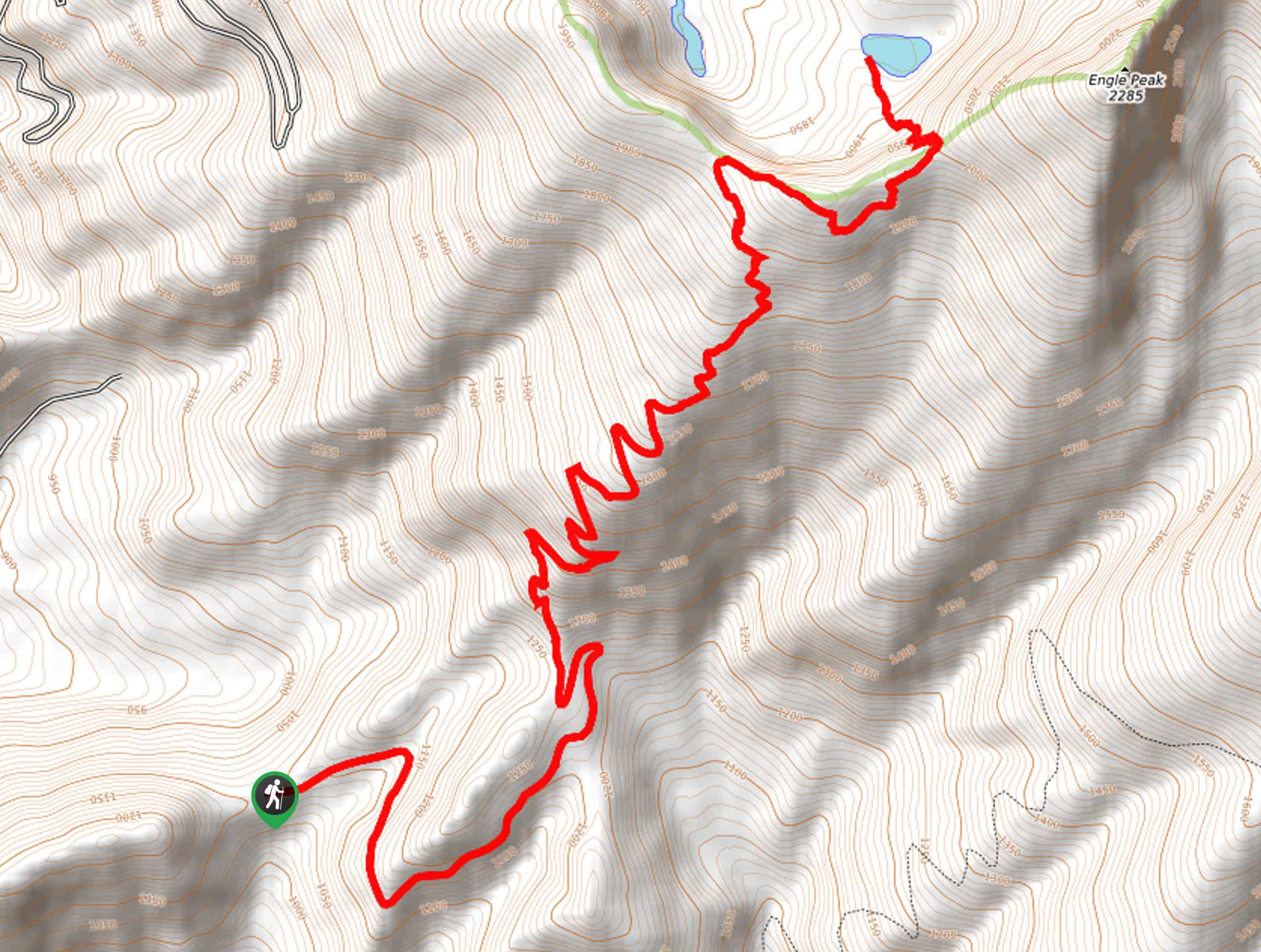
21. Engle Lake Trail
Difficulty
Spellbinding alpine scenery awaits you on the Engle Lake Trail. This scenic and steep high-country… Read More
22. Bluebird Lake via Highline Trail
Difficulty
The Bluebird Lake via Highline Trail is a marvelous adventure in the Kootenai National Forest… Read More
23. Engle Peak Hike
Difficulty
The Engle Peak Hike is an arduous ascent up to the summit of a famed… Read More
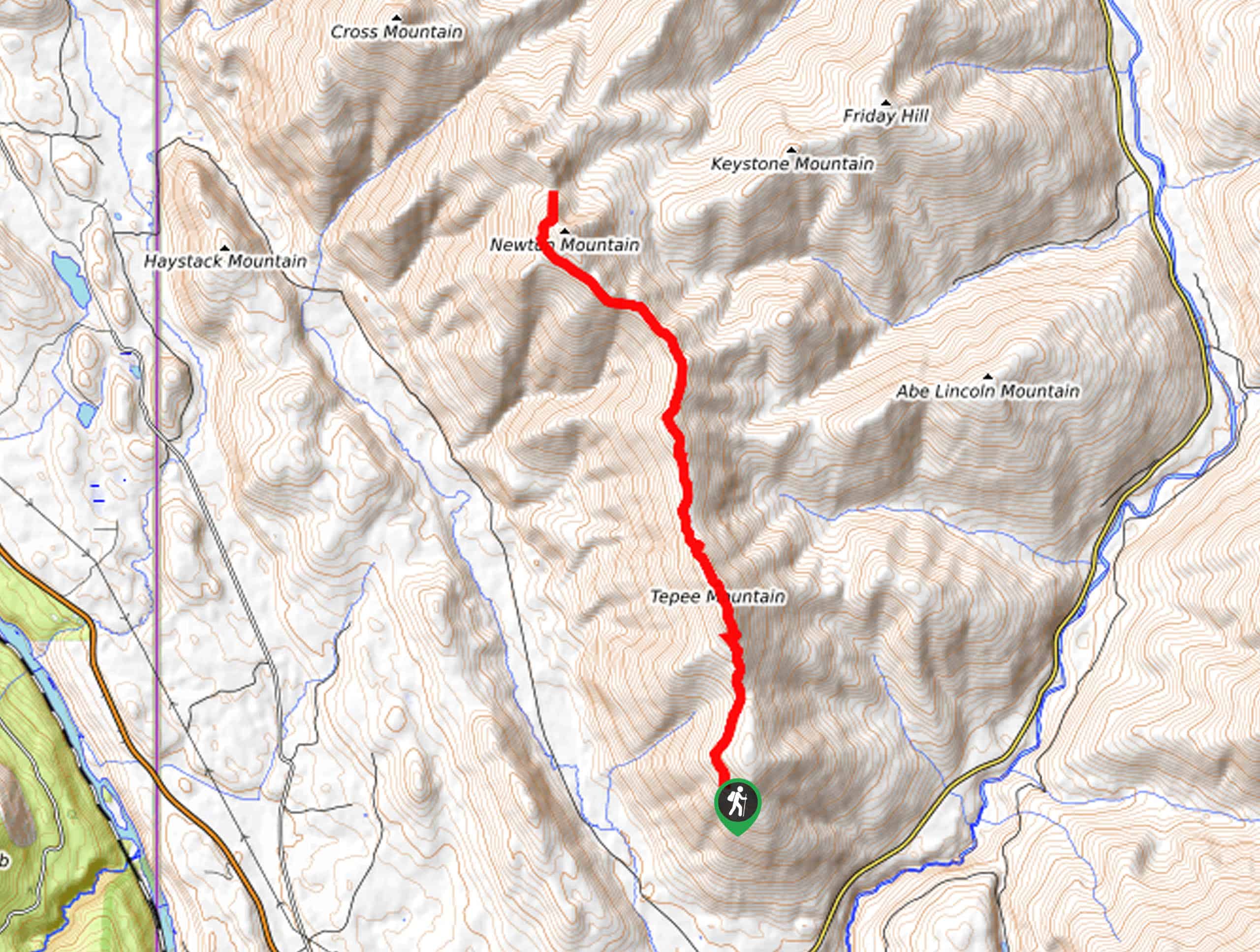
24. Teepee Mountain Trail
Difficulty
Sweeping mountain views await you on the Teepee Mountain Trail. This gorgeous high-country hike demands… Read More
25. Shannon Lake Hike
Difficulty
Discover an idyllic lake in the Kootenai National Forest on the Shannon Lake Hike. This… Read More
26. Bighorn Trail #42
Difficulty
The Bighorn Trail #42 is an exciting expedition that explores the riverbanks of the Kootenai… Read More
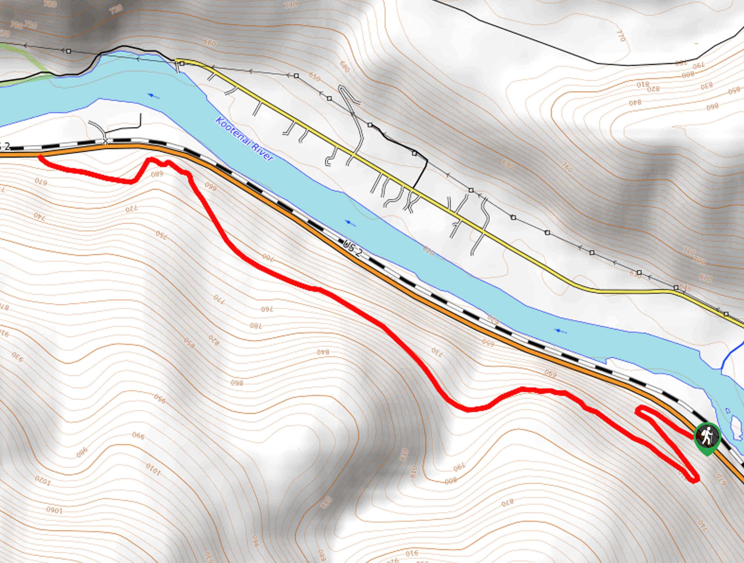
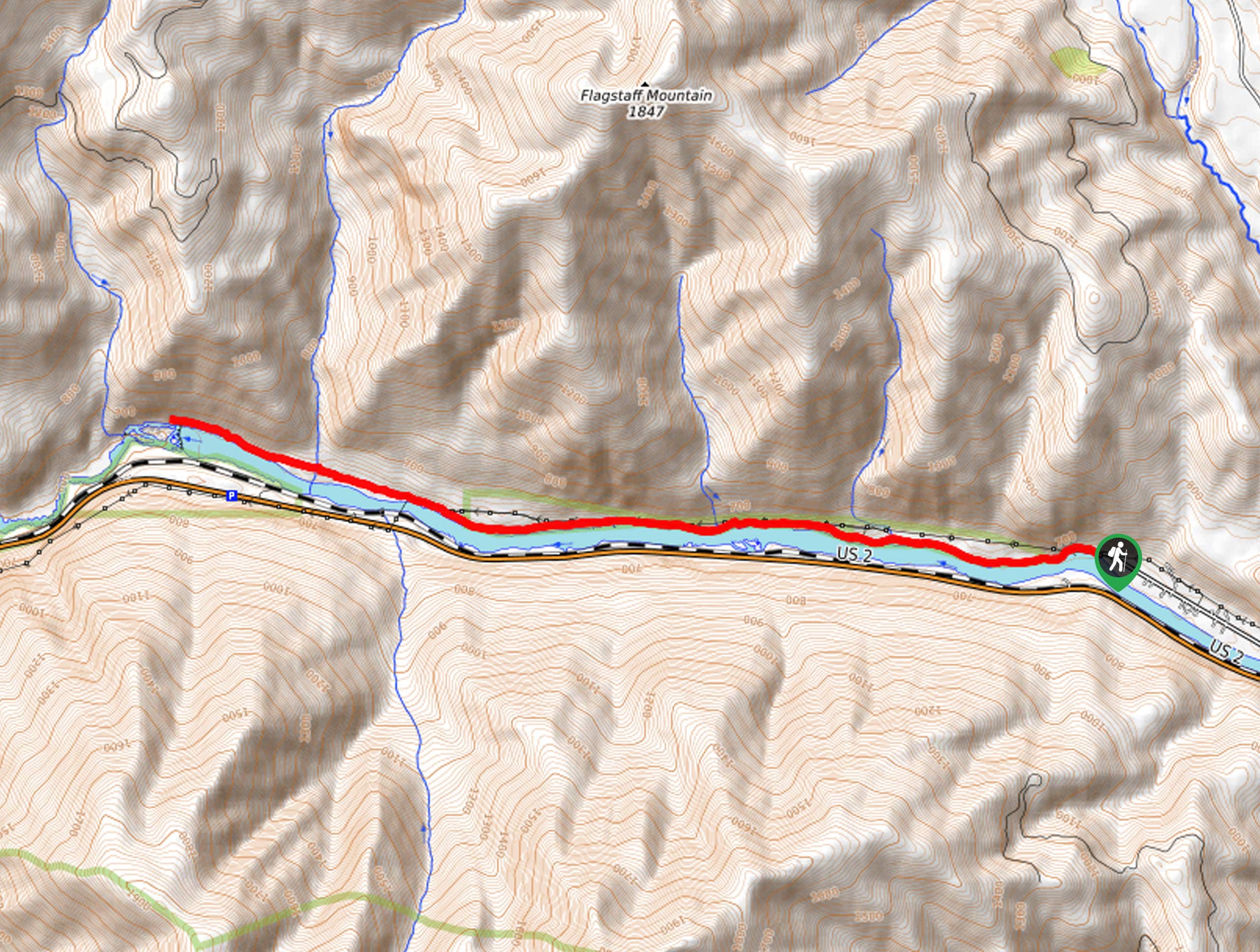
27. Historic Highway 2 East Trail
Difficulty
The Historic Highway 2 East Trail is a moderate day adventure for intermediate hikers and… Read More
28. Bramlet Lake Hike
Difficulty
Sweeping mountain views await you from the shoreline of Bramlet Lake. The Bramlet Lake Hike… Read More
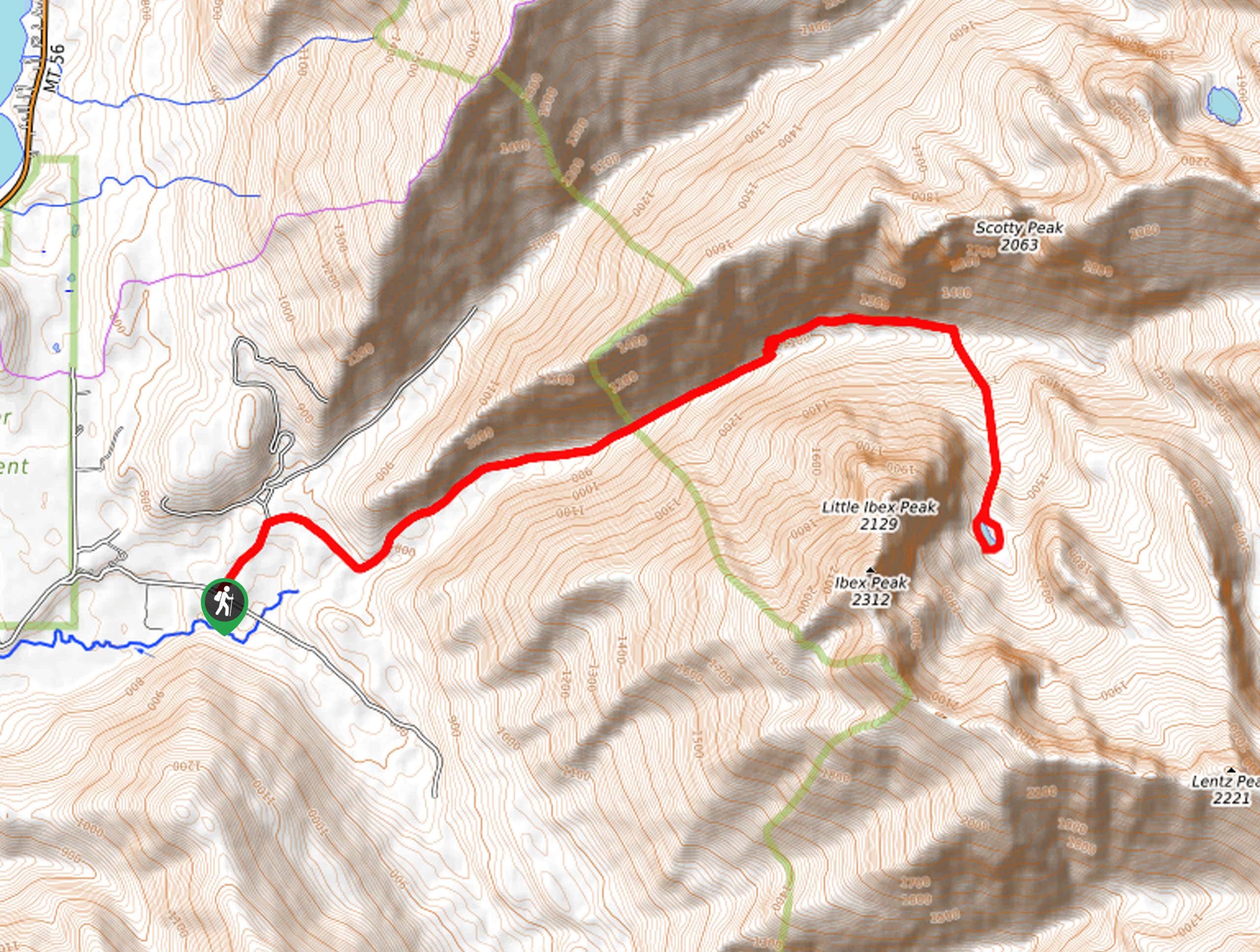
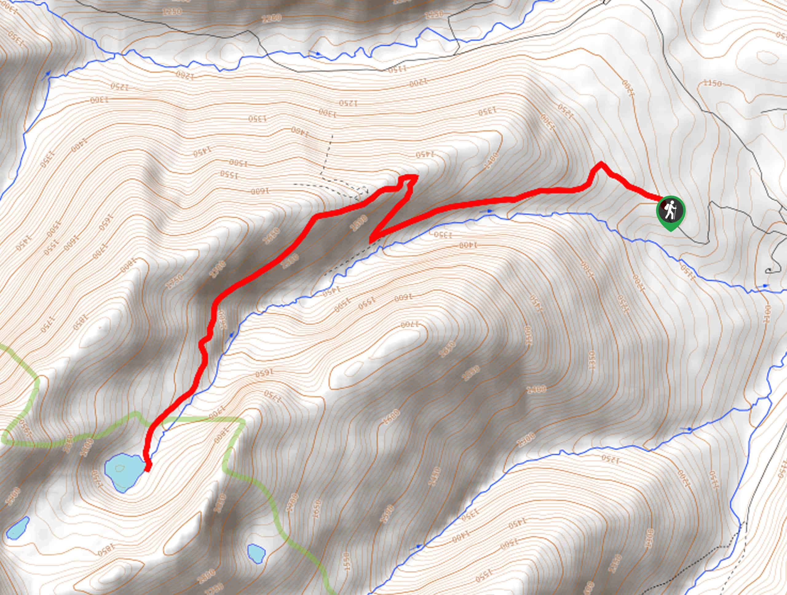
29. Little Ibex Lake Hike
Difficulty
The Little Ibex Lake Hike is an arduous day hike to one of the highest… Read More
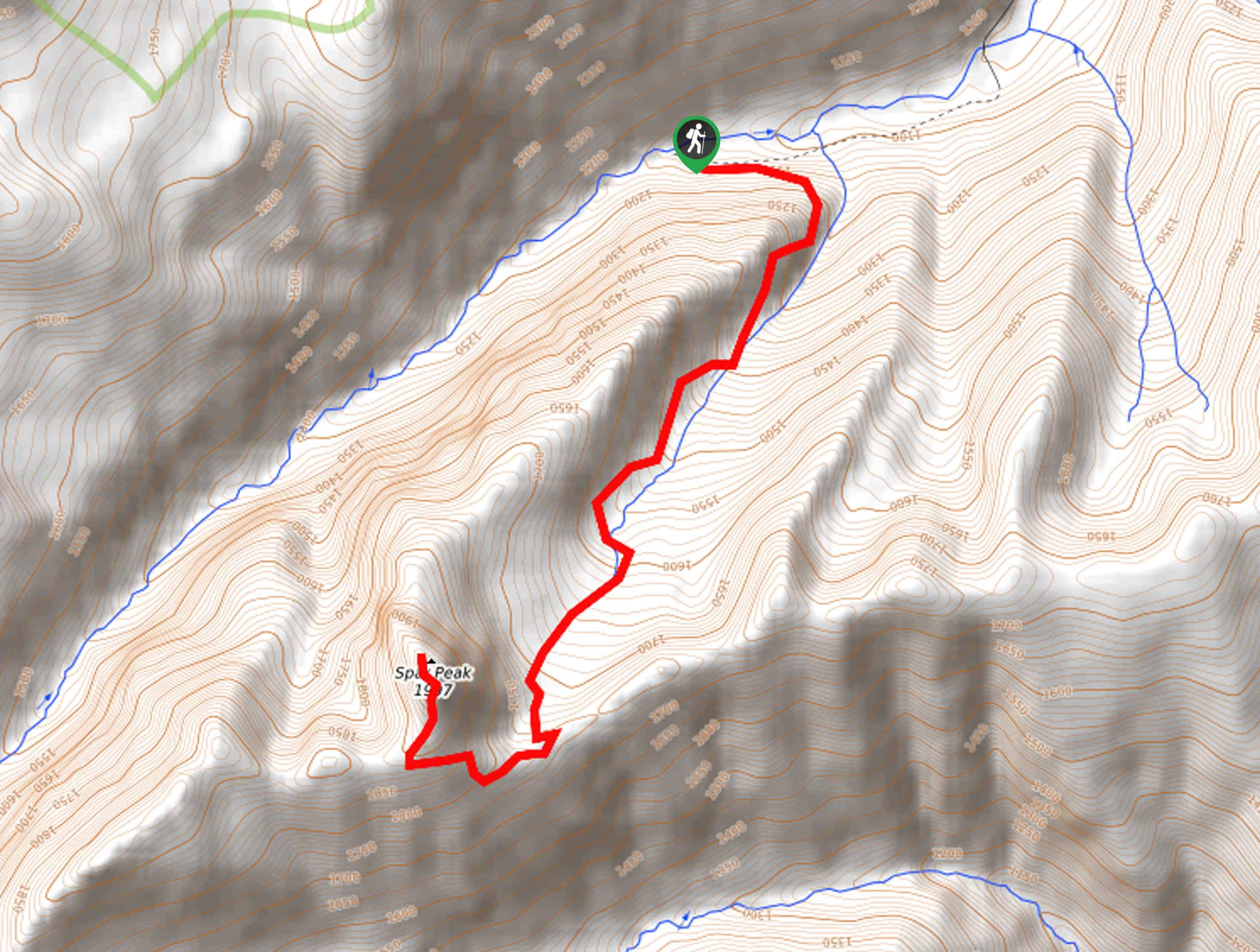
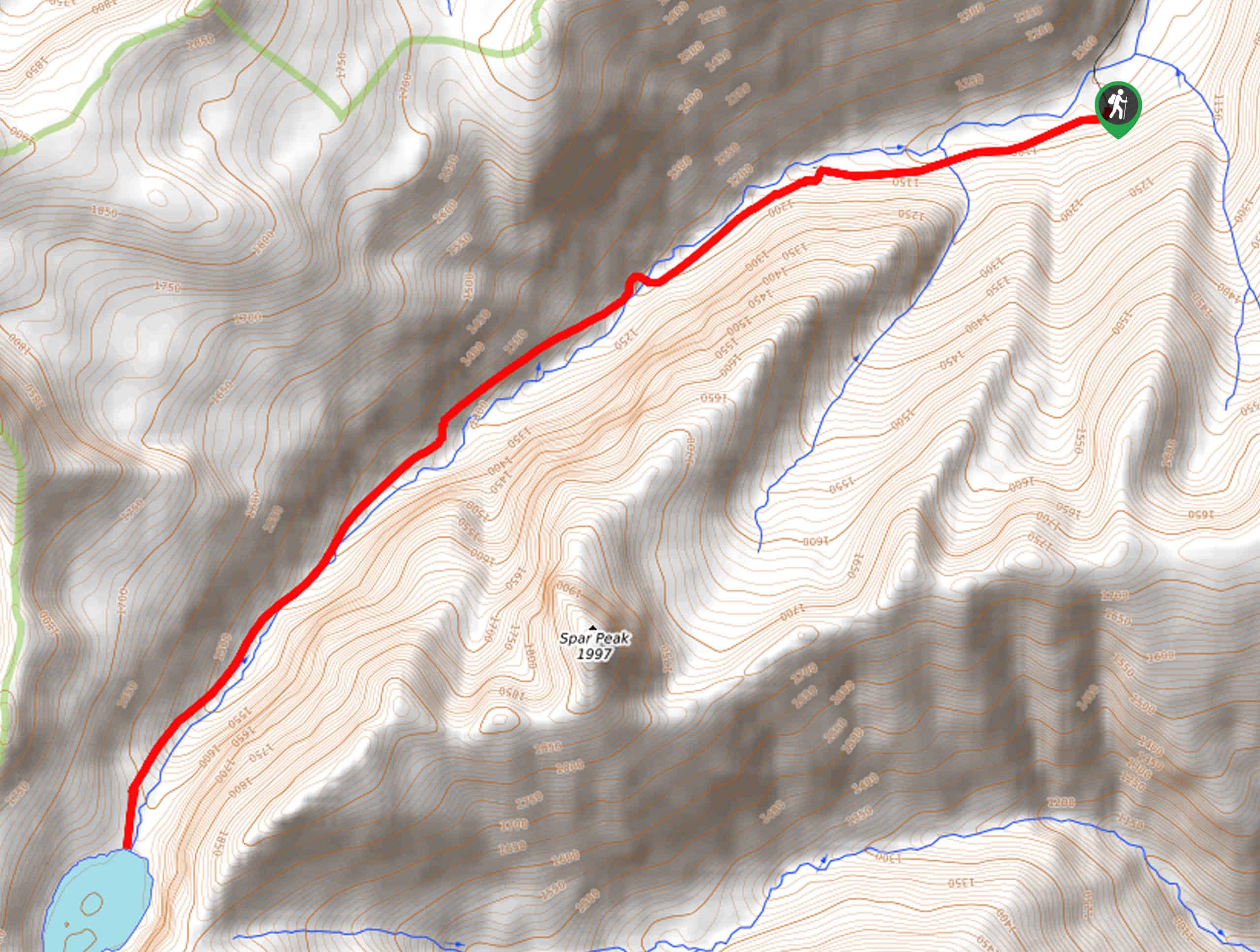
30. Spar Peak Trail
Difficulty
The panoramic views of the Cabinet Mountains from atop Spar Peak are a sight to… Read More
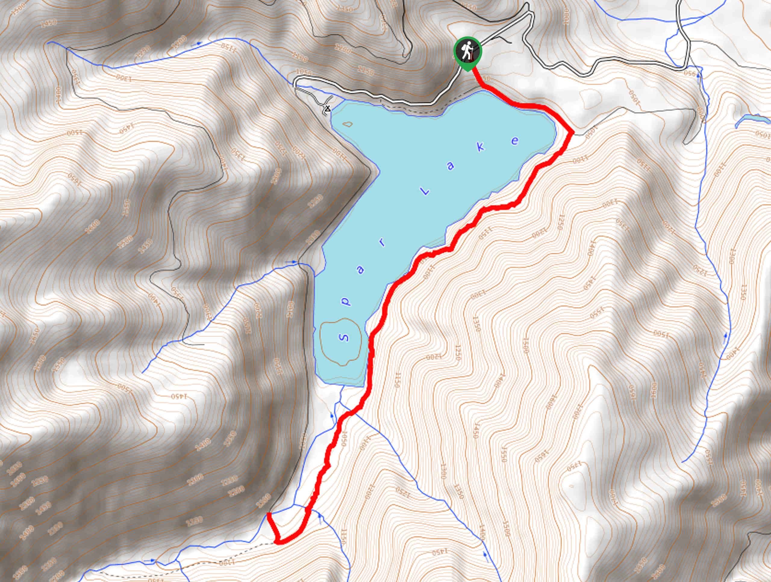
31. Big Spar Lake Hike
Difficulty
Get outside and reconnect with nature on the Big Spar Lake Hike. This family-friendly adventure… Read More
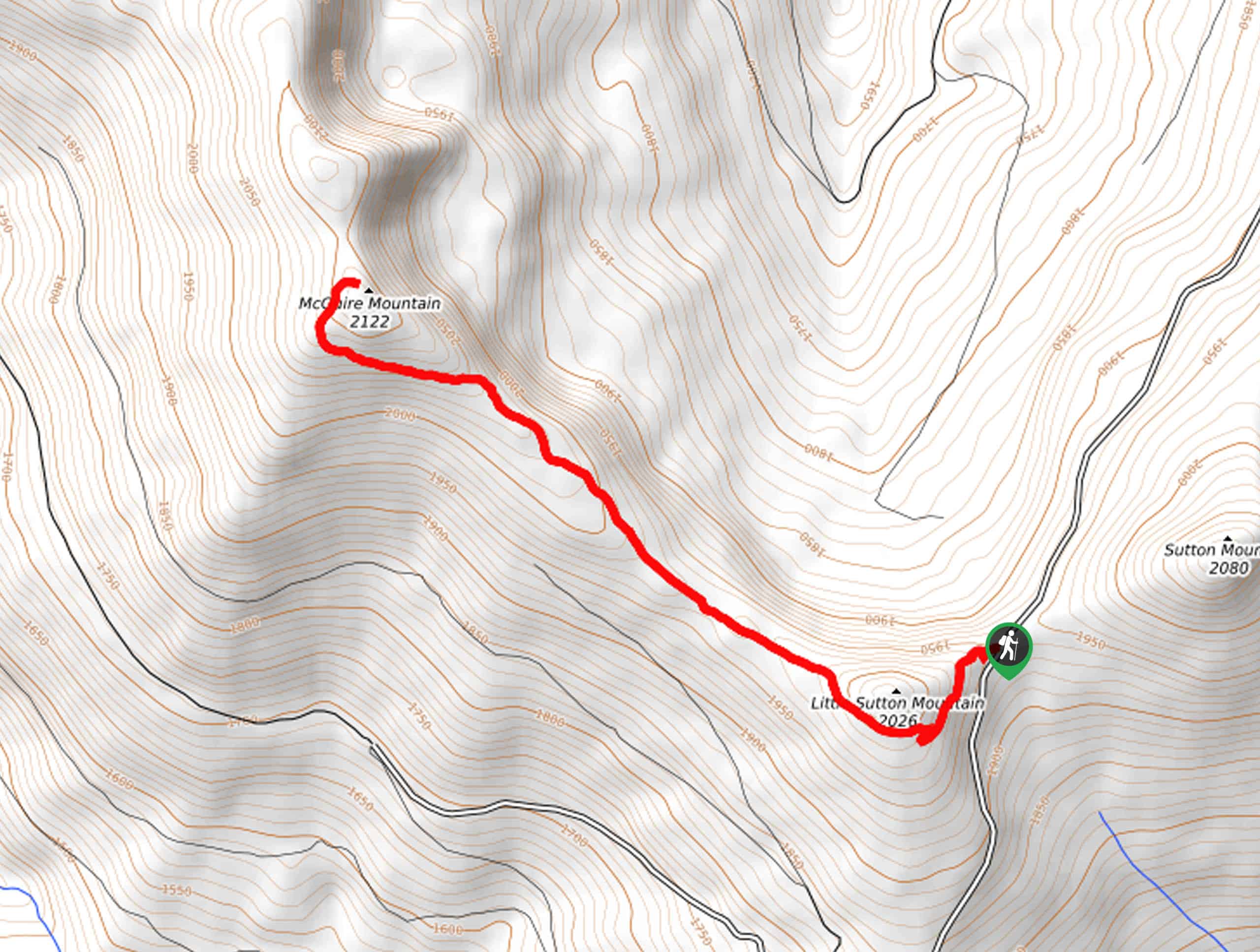
32. McGuire Mountain Trail
Difficulty
The McGuire Mountain Trail is an excellent adventure that is worth adding to your hiking… Read More
33. Northwest Peak Trail
Difficulty
Located in the far northwestern corner of Montana in the Kootenai National Forest, the Northwest… Read More
Are we missing your favourite hike?
Tell us! If you've got photos, a GPS track and know the hike, we'd love to share your favourite hike with the rest of the 10Adventures community.