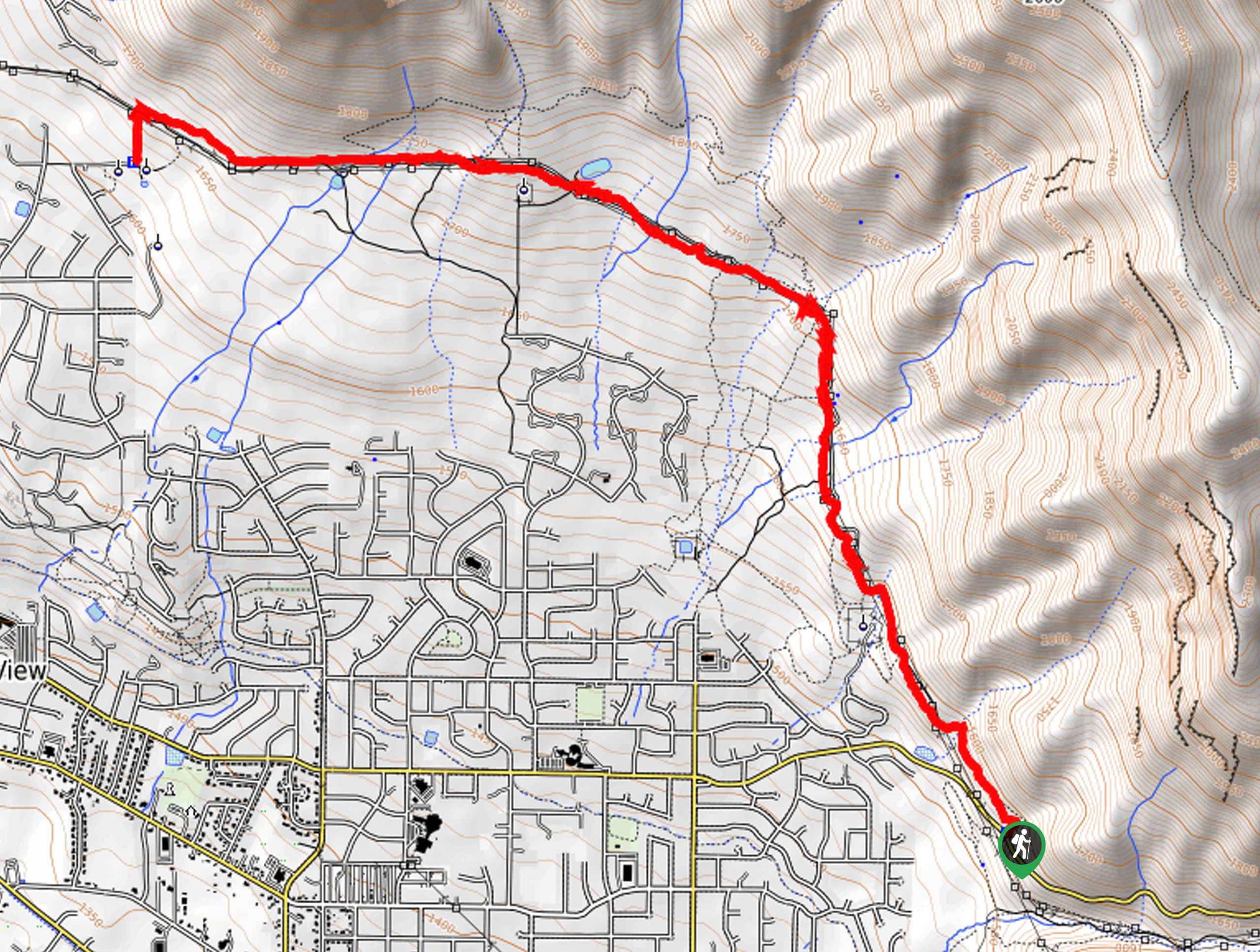
hikes in Salt Lake City
Salt Lake City Hikes
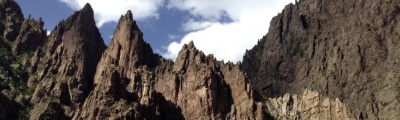
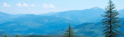
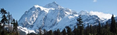
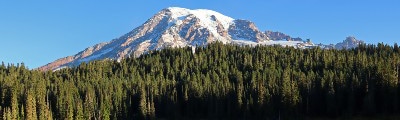
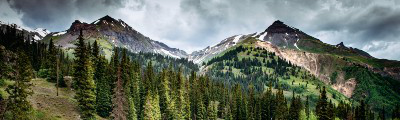
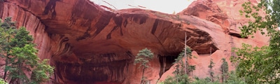
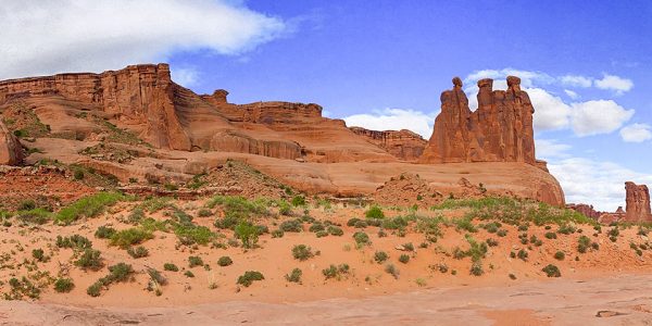
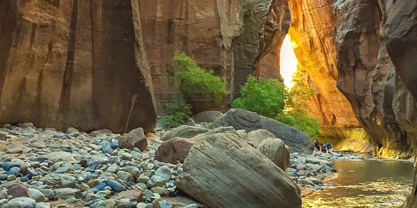
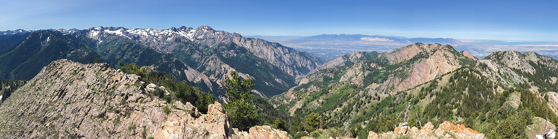
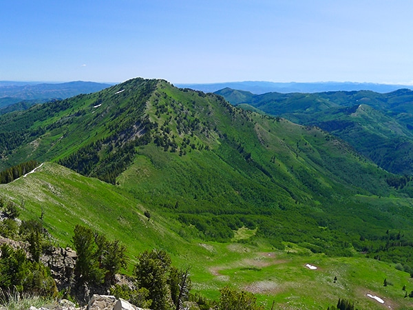
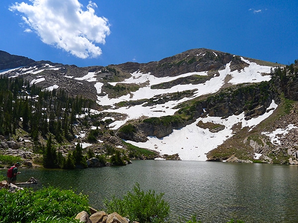
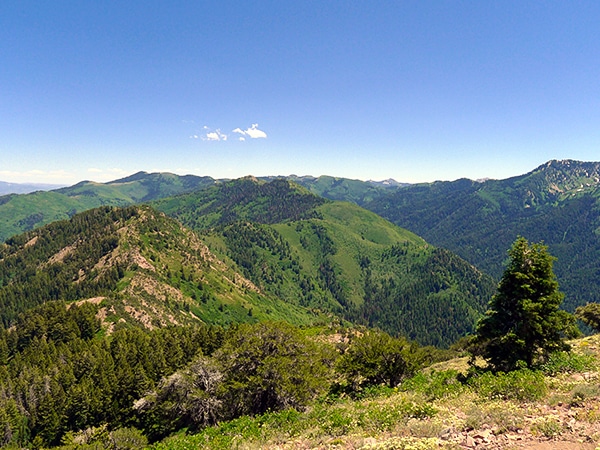
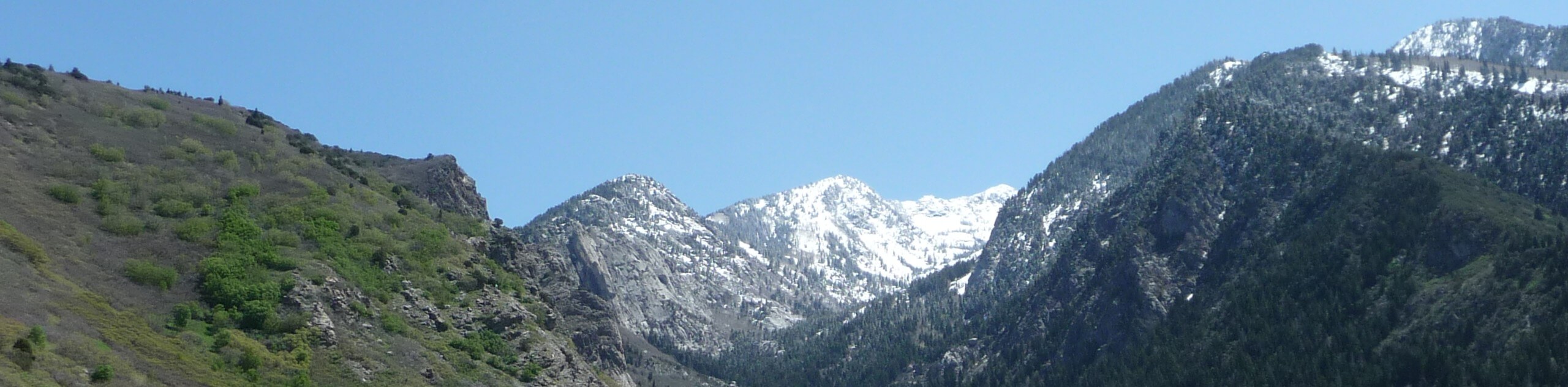
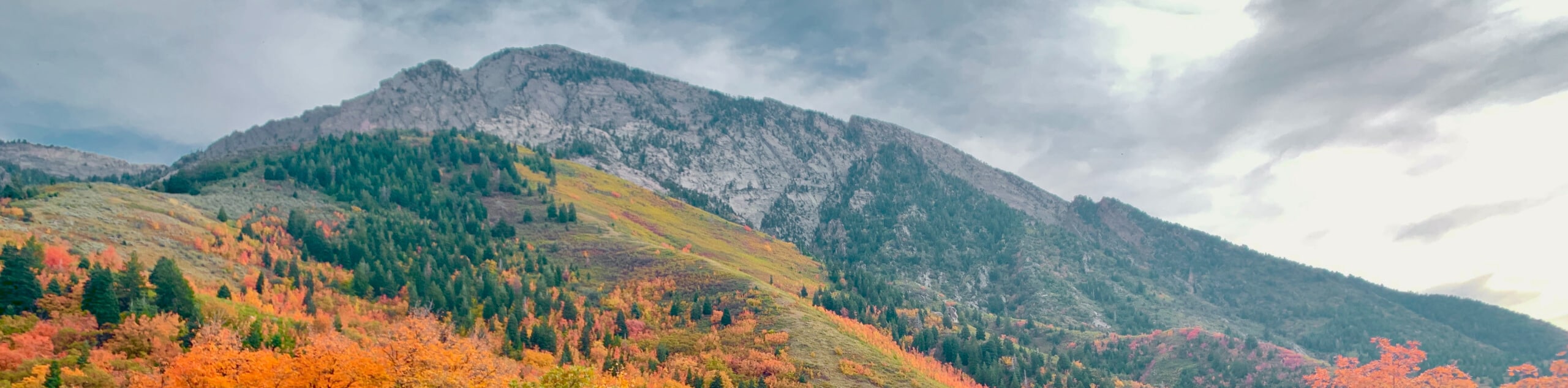
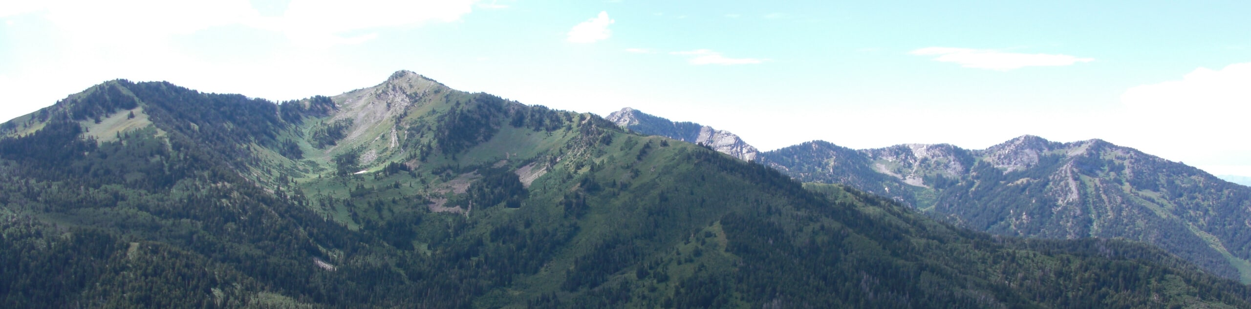
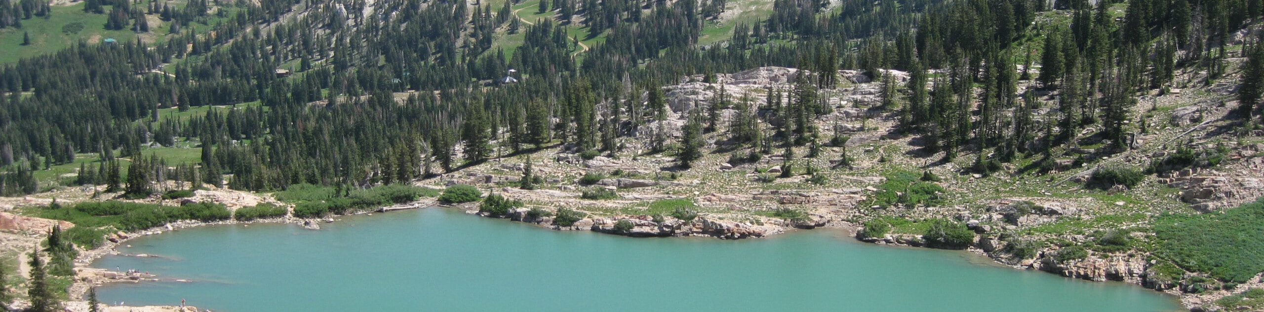
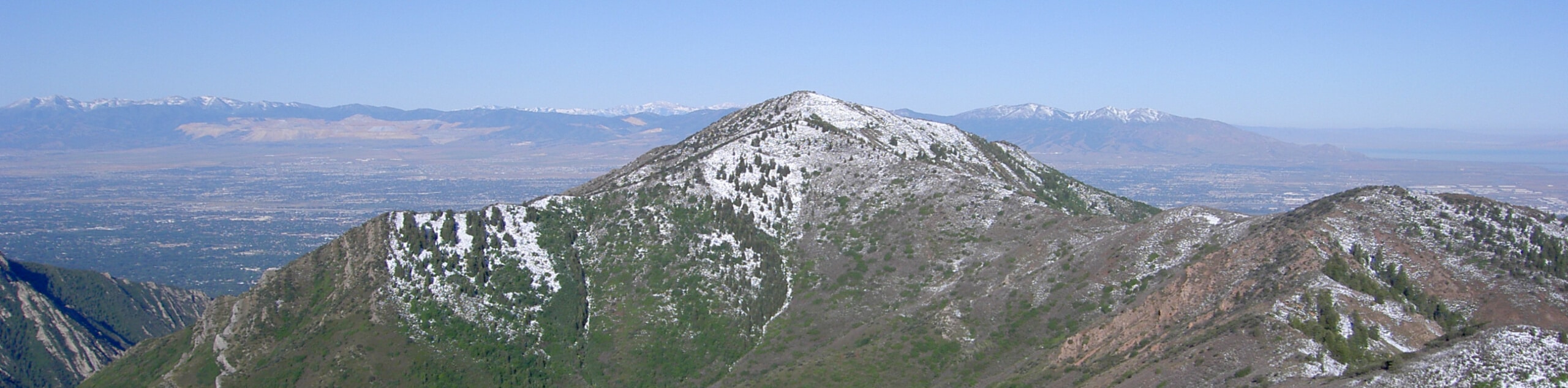
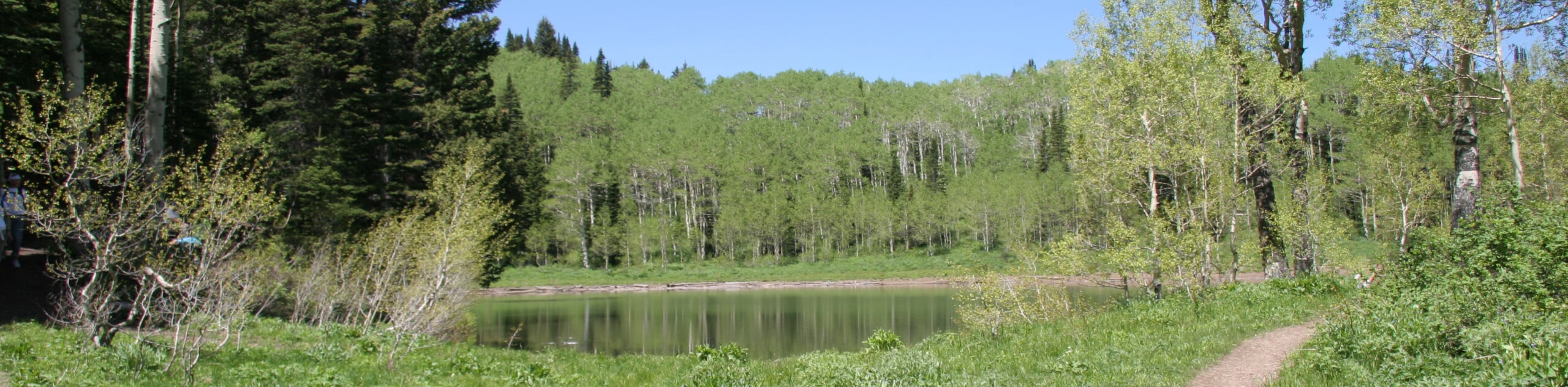
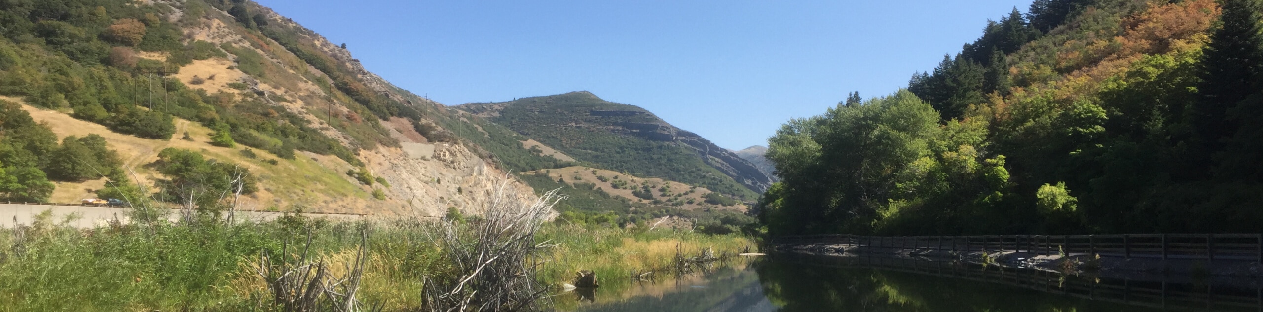
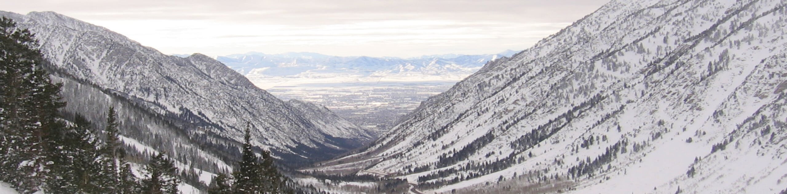
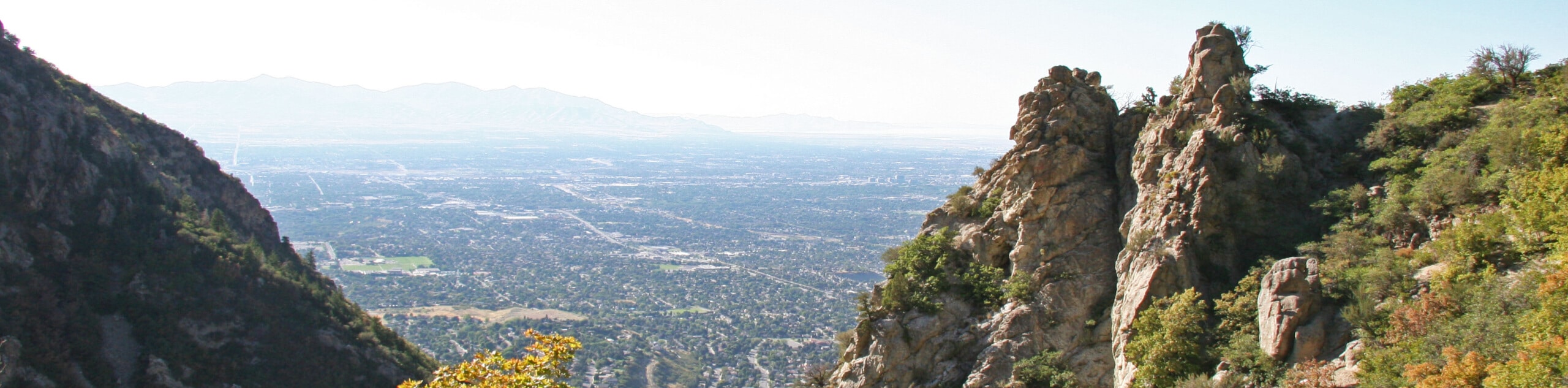
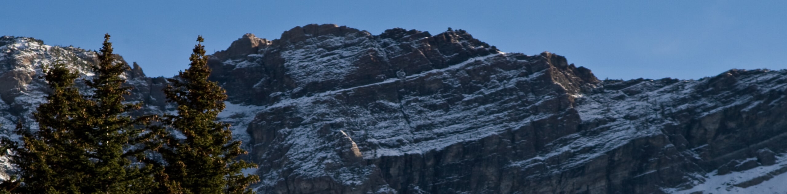
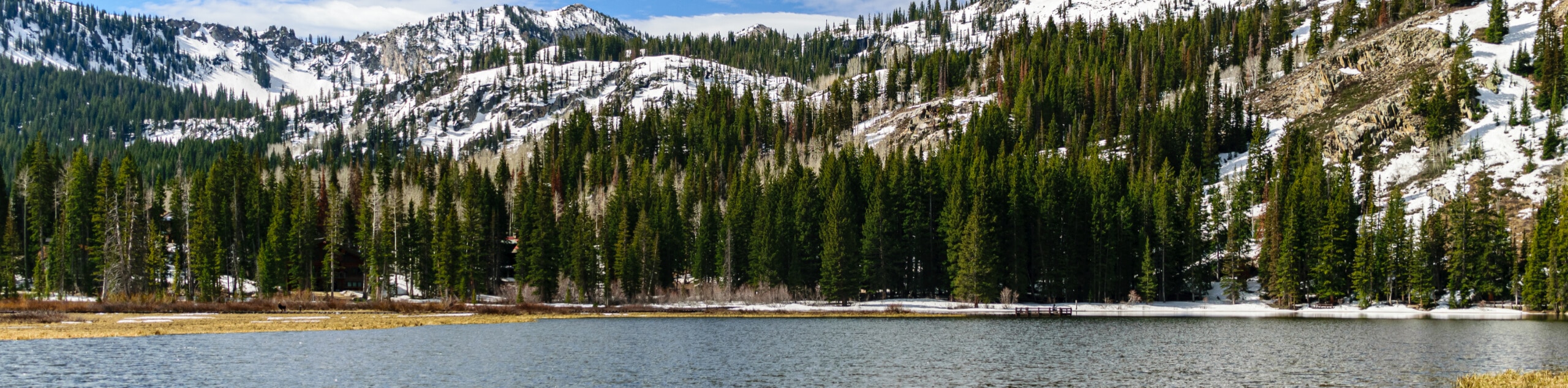
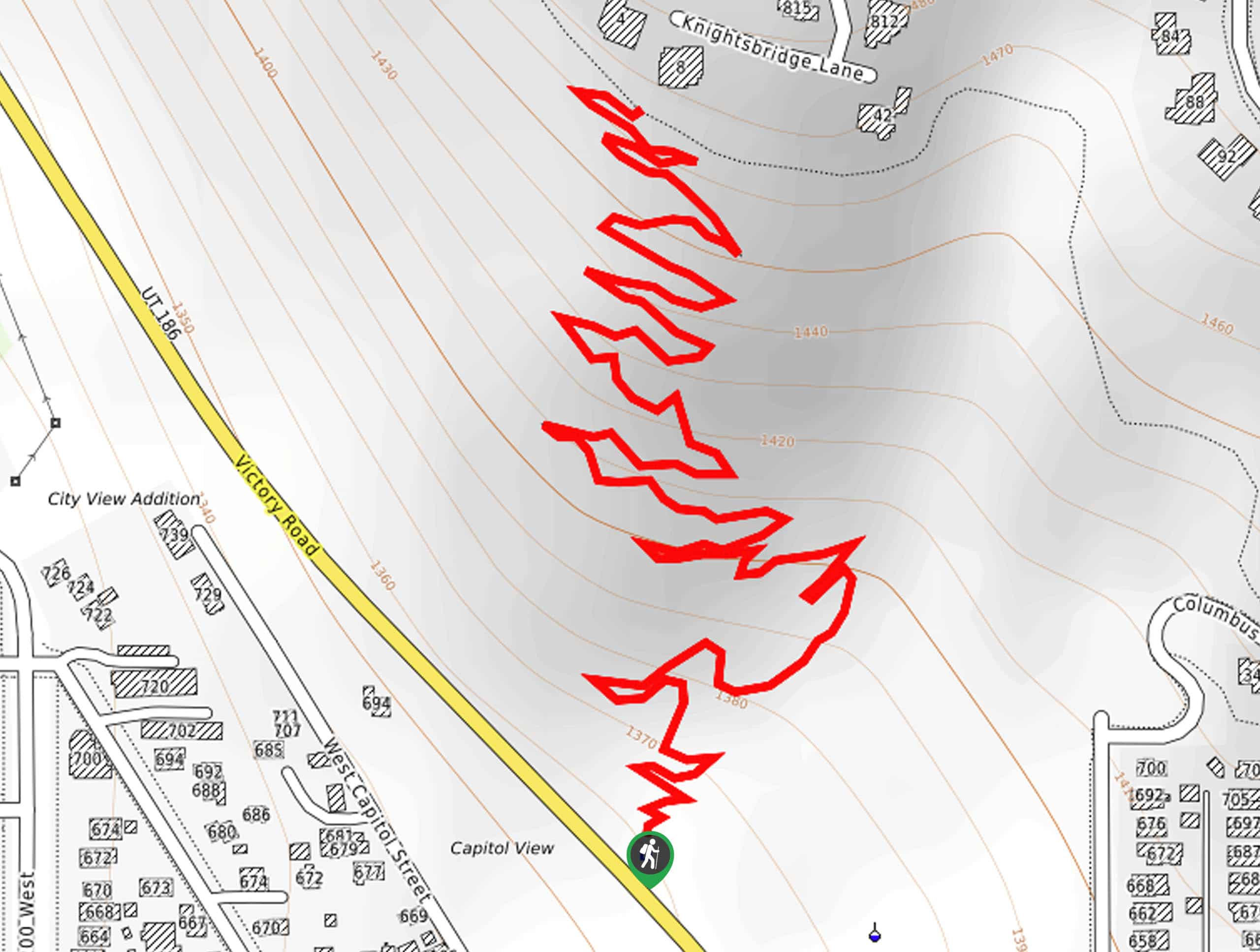
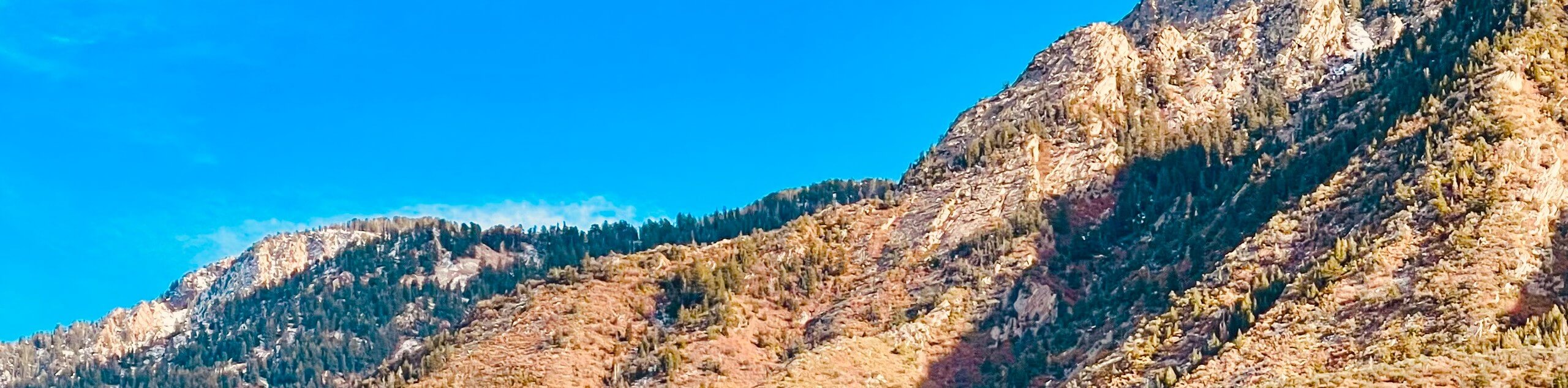
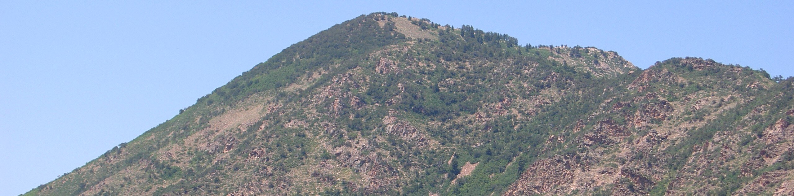
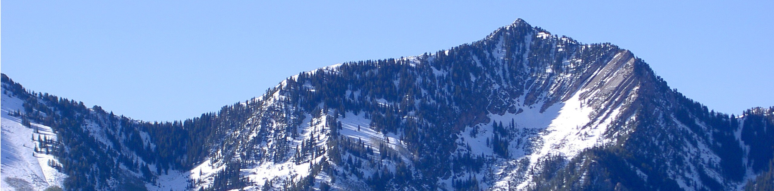
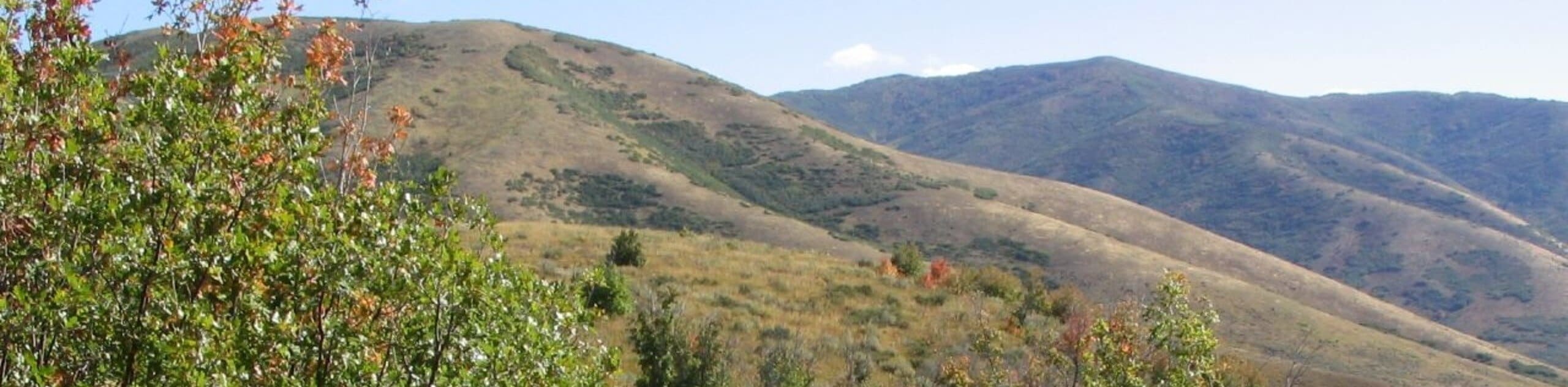
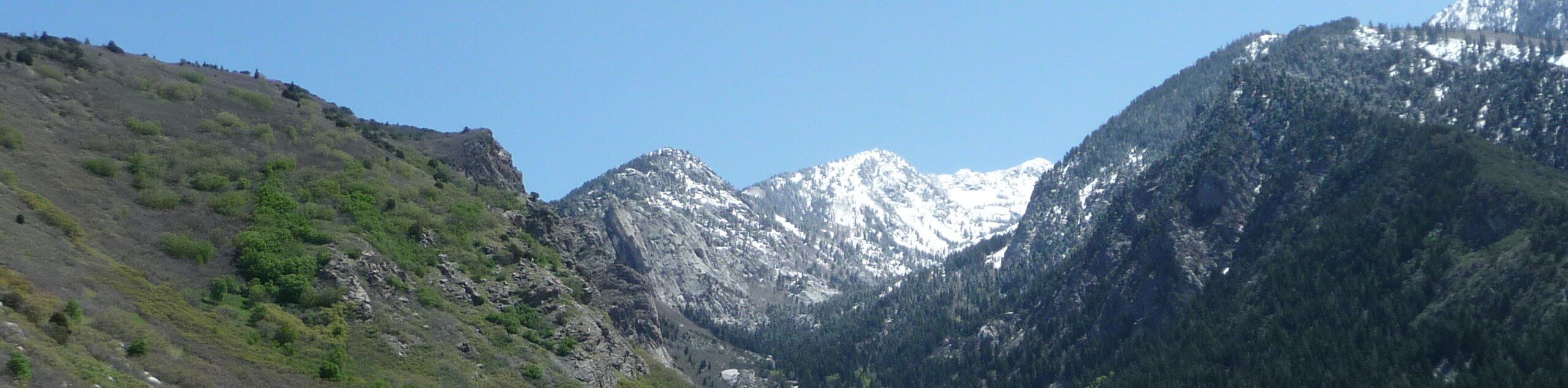
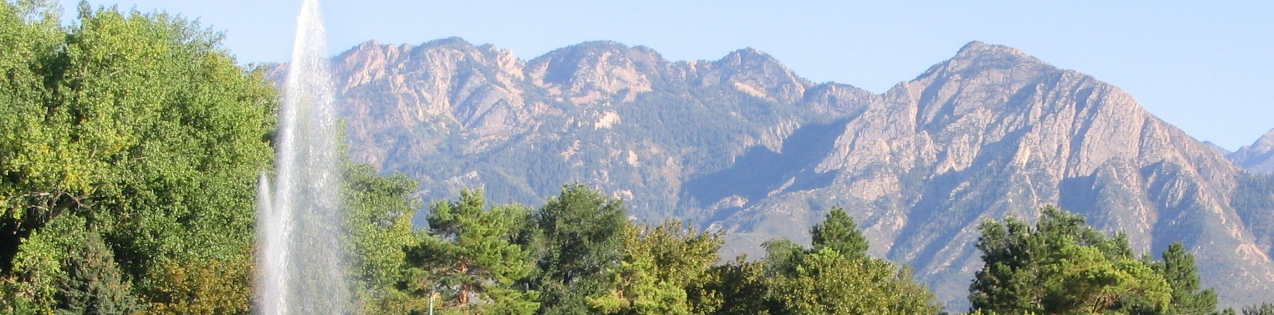
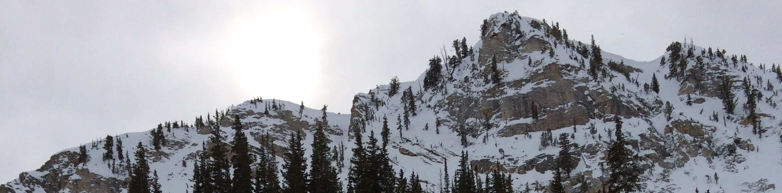
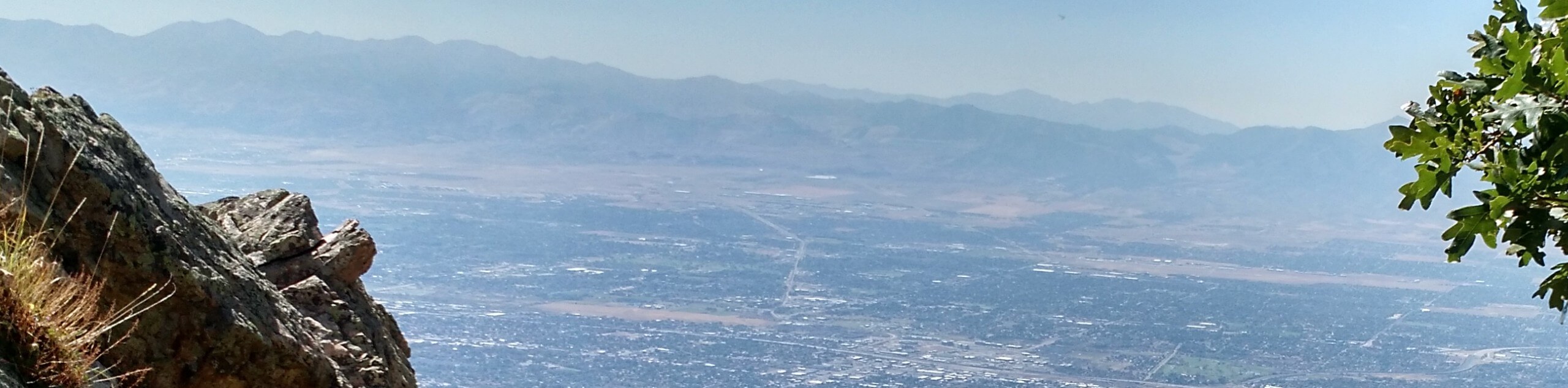
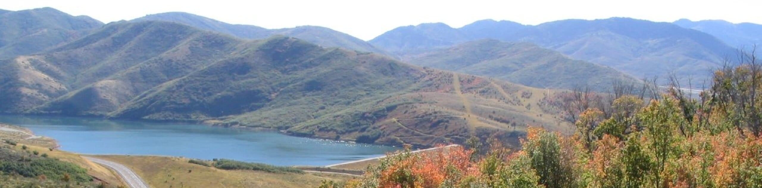
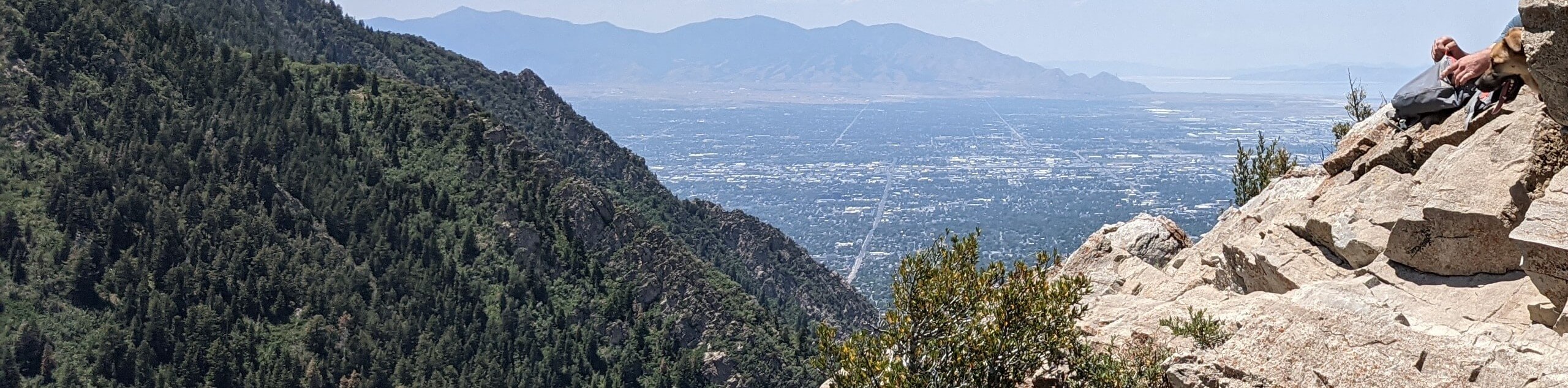
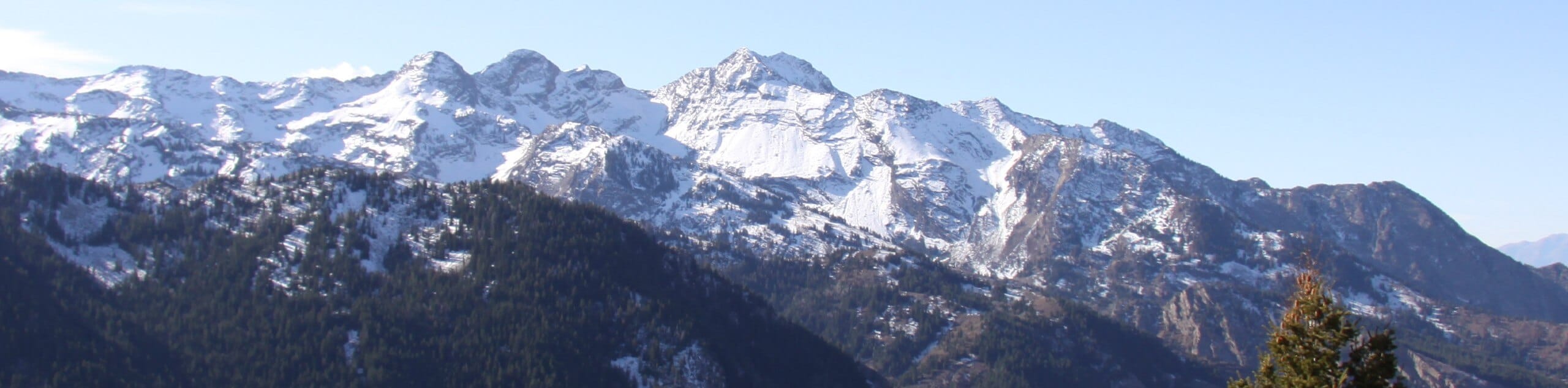
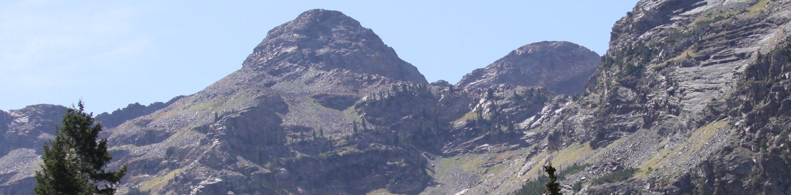
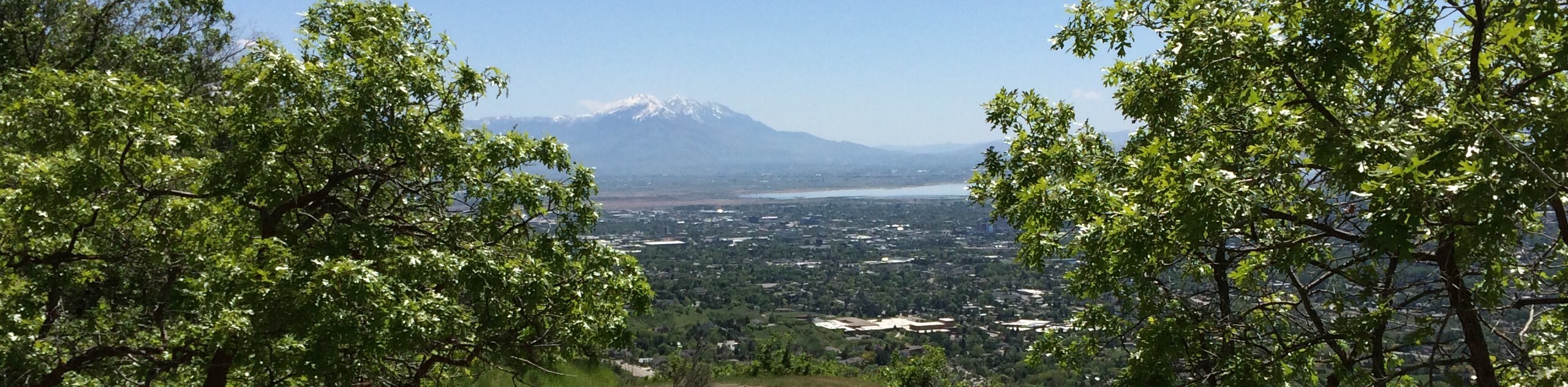
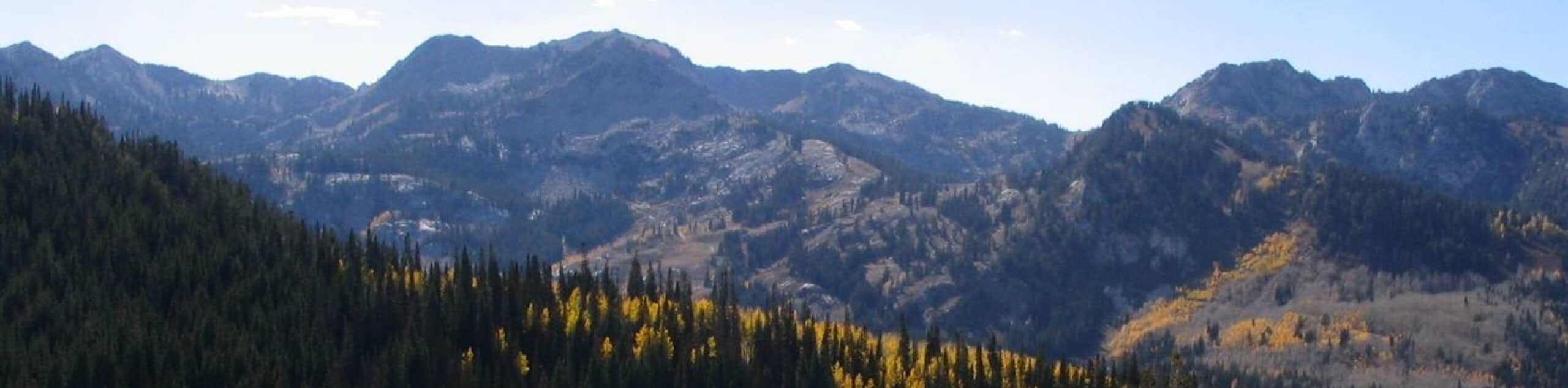
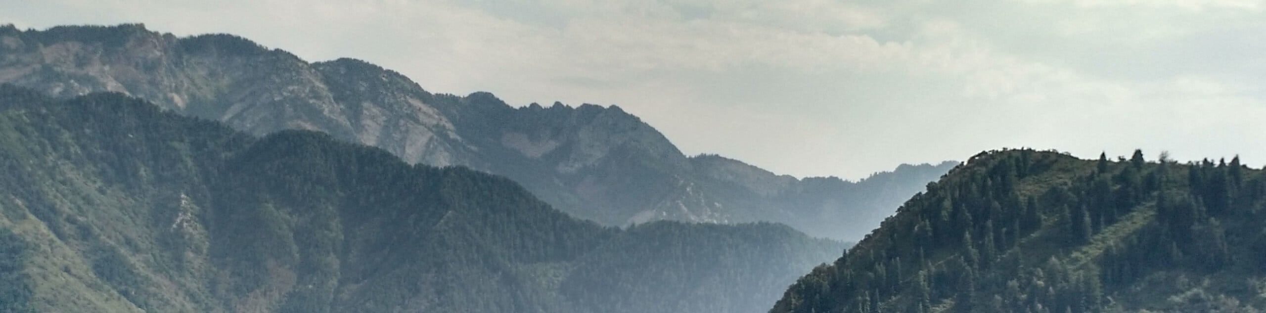
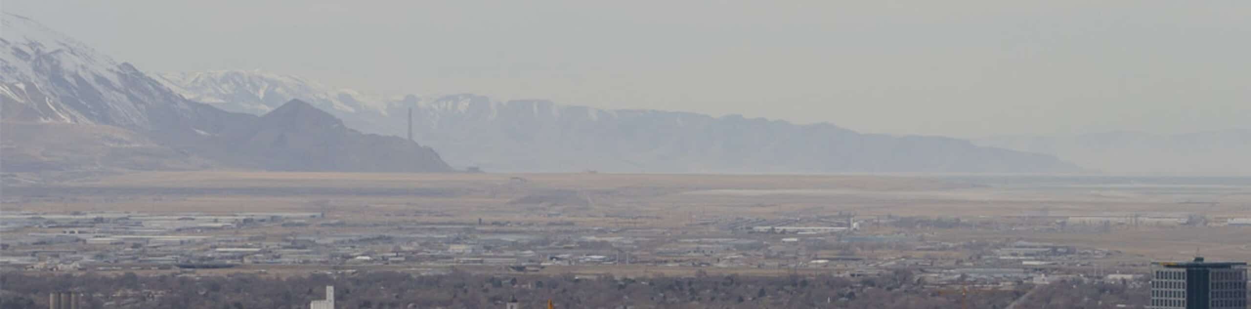
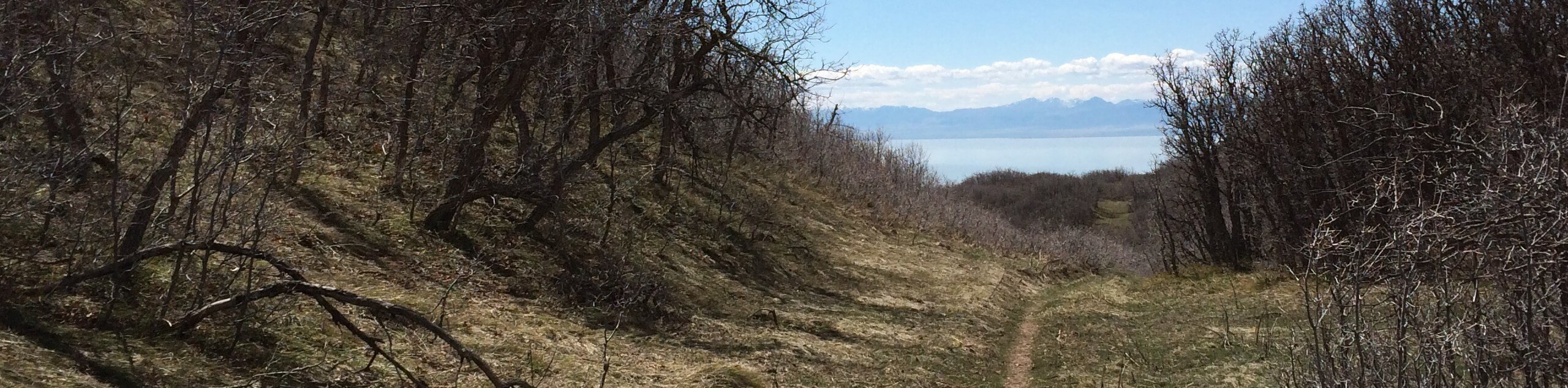
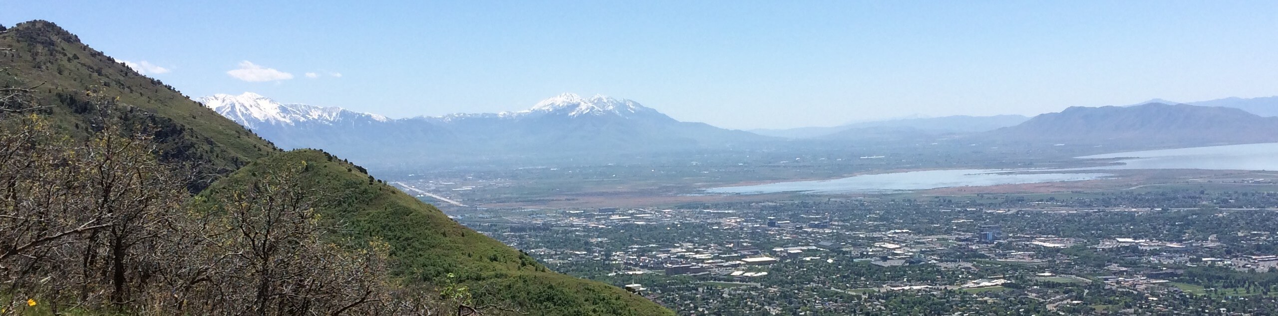
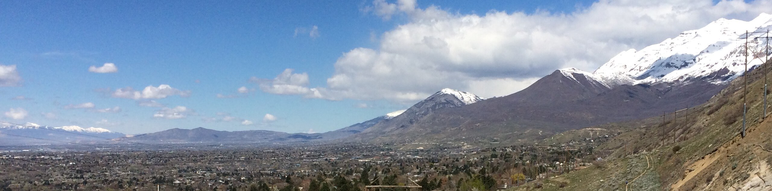
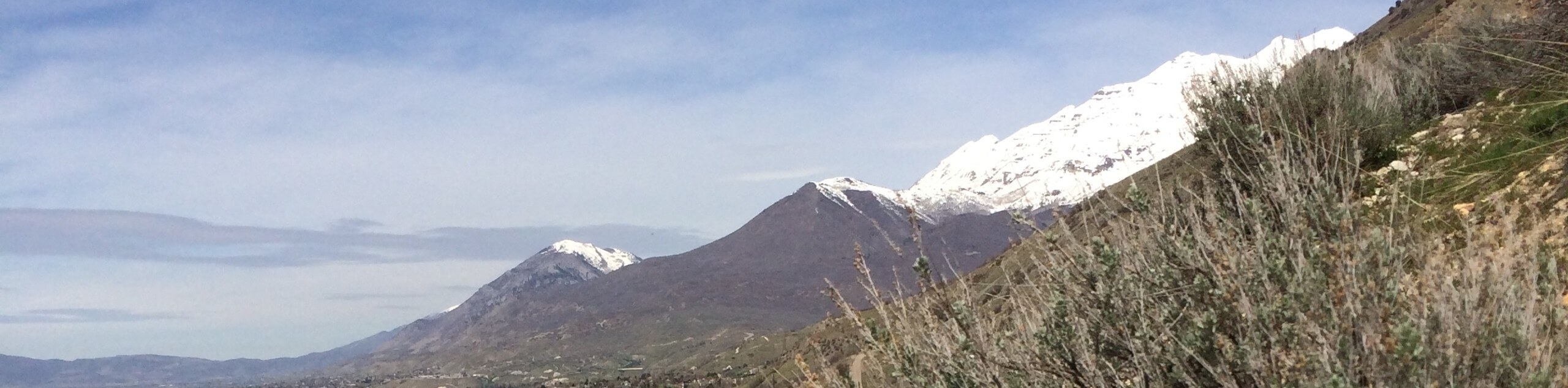
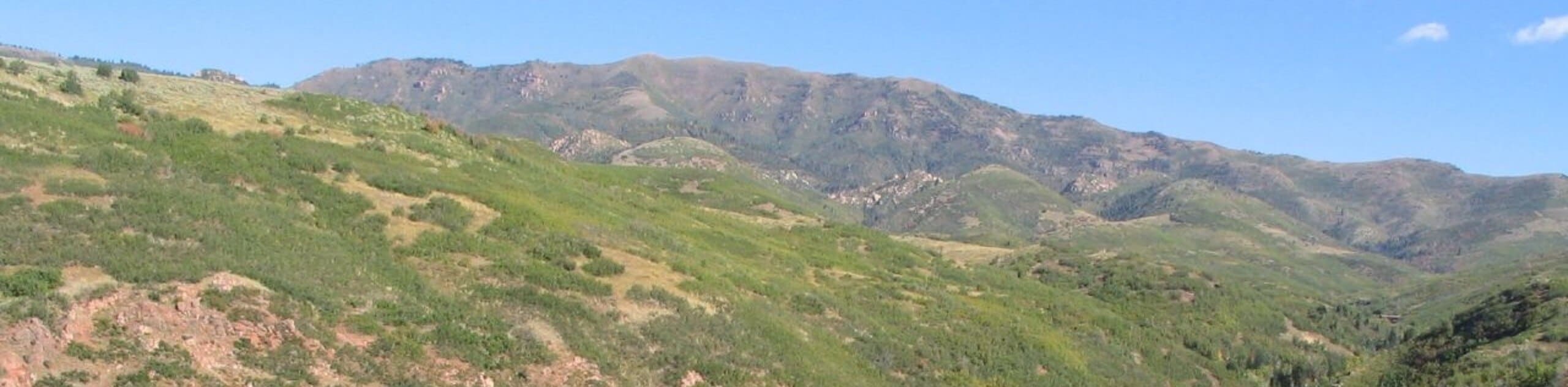
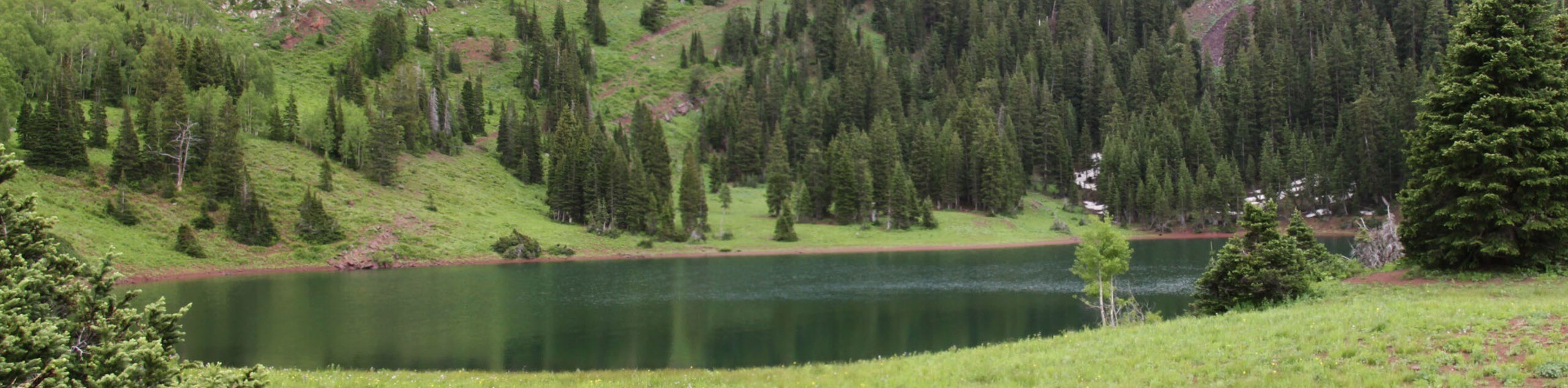
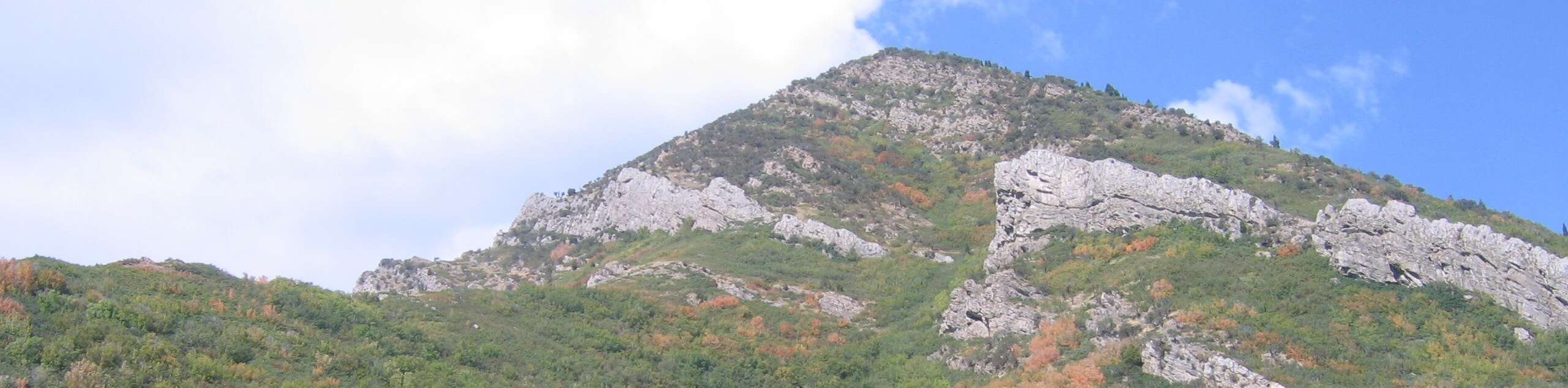
Salt Lake City hikes are an incredible outdoor adventure that provide access to some of the most picturesque terrain Utah has to offer. Right on the doorstep of the Wasatch Mountains, Salt Lake City is the ideal jumping-off point for some truly fantastic hikes. This fascinating, beautiful corner of Utah is known for its impressive craggy peaks, and particularly for the brilliant skiing opportunities in the winter months. However, come to Salt Lake City in summer, when the skies are blue and the mountains call to all avid hikers. If you are after an unforgettable outdoor experience, Salt Lake City hikes have all that you could ask for!
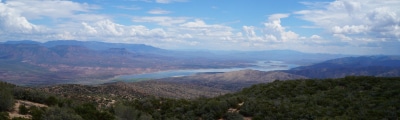
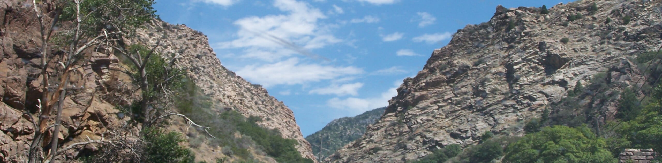
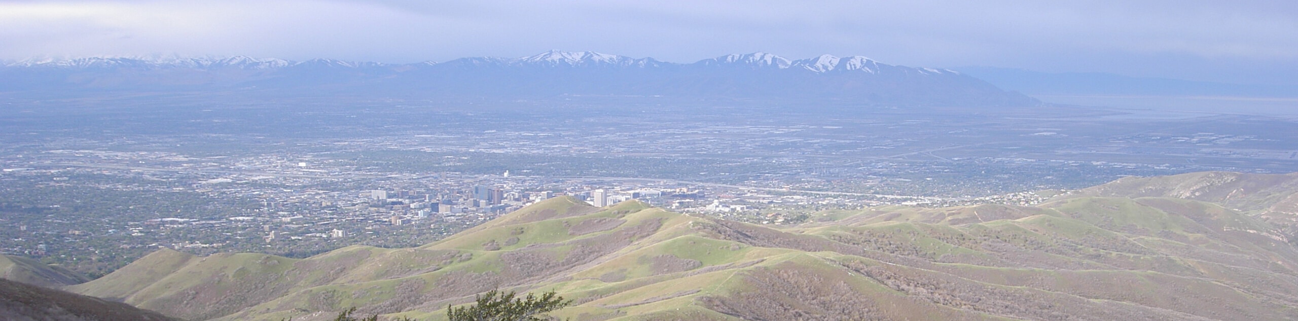
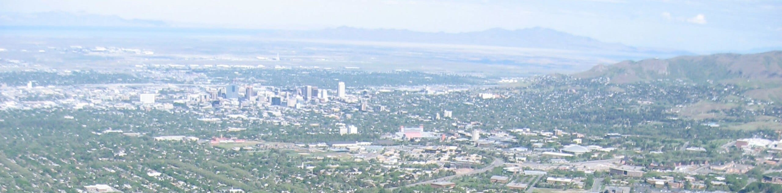
As the locals will tell you, Salt Lake City’s proximity to some beautiful natural spots is what makes it a wonderful place to live and visit. With trails that begin right where the city ends, and stunning wilderness areas just a short drive away, this is a fantastic place to experience the beauty of the great outdoors. With dramatic canyons, picturesque streams and lakes, and imposing mountain peaks, there’s no shortage of wonderful Salt Lake City hikes just waiting to be discovered.
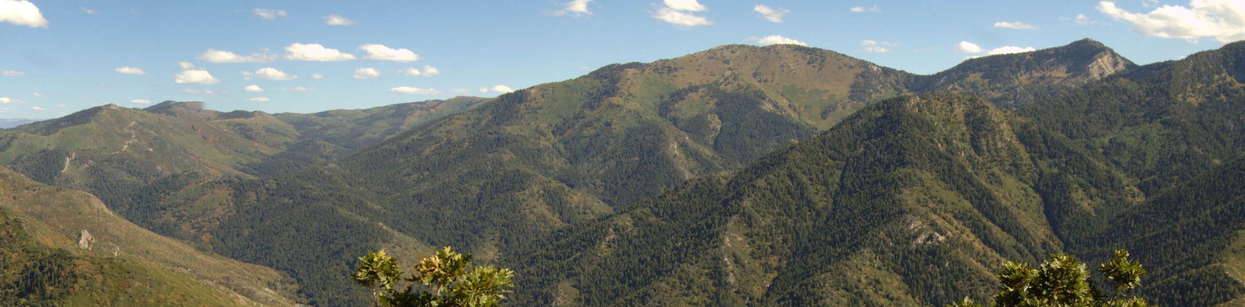
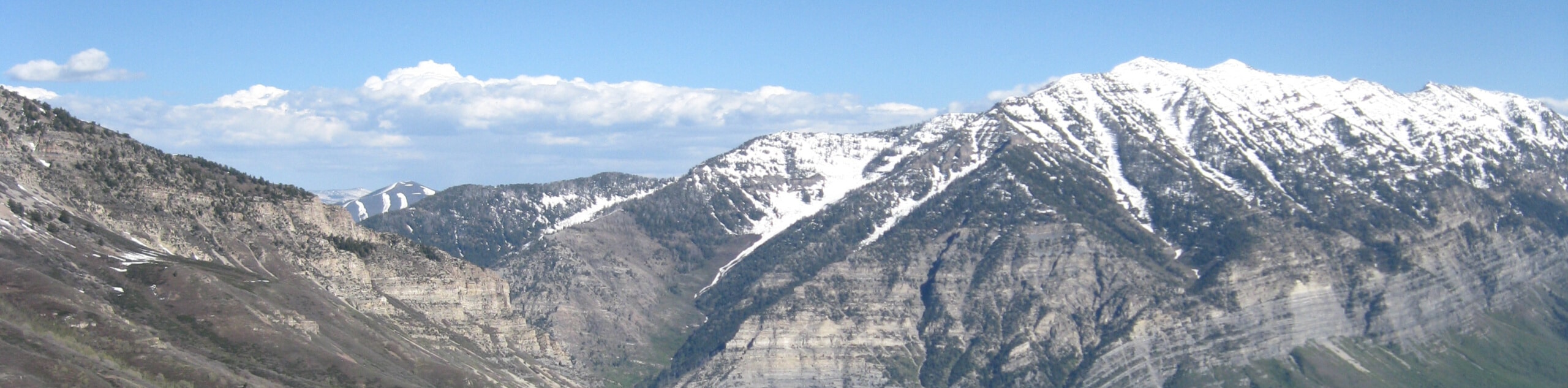
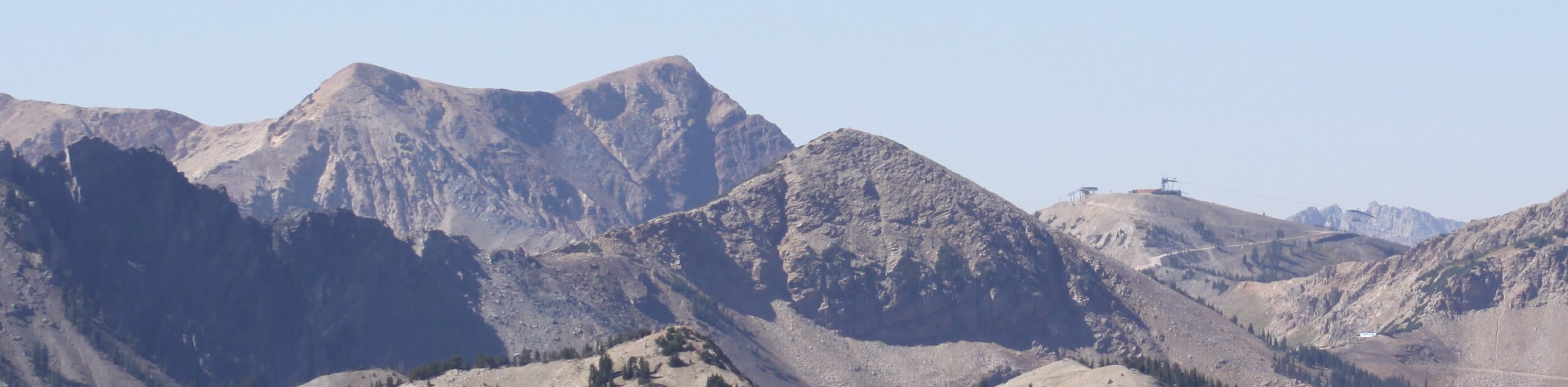
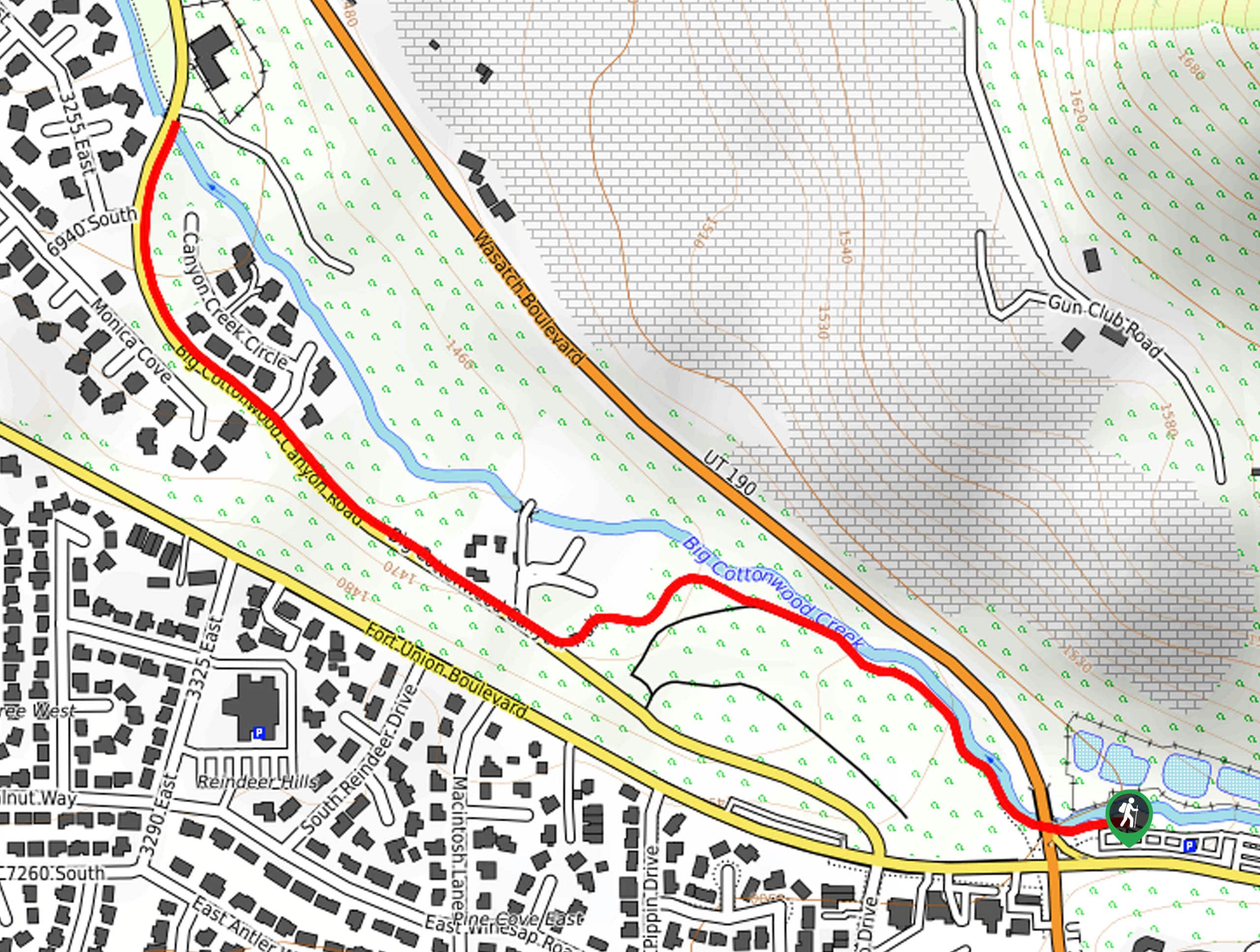
The Wasatch Mountains are particularly known for their canyons, and many of the trails listed here will take you close to Big Cottonwood Canyon, Little Cottonwood Canyon, or Mill Creek Canyon. The Salt Lake City hikes that pass through this terrain are a thrilling experience, with plenty of diversity to keep you entertained on the trail, and some really epic views.
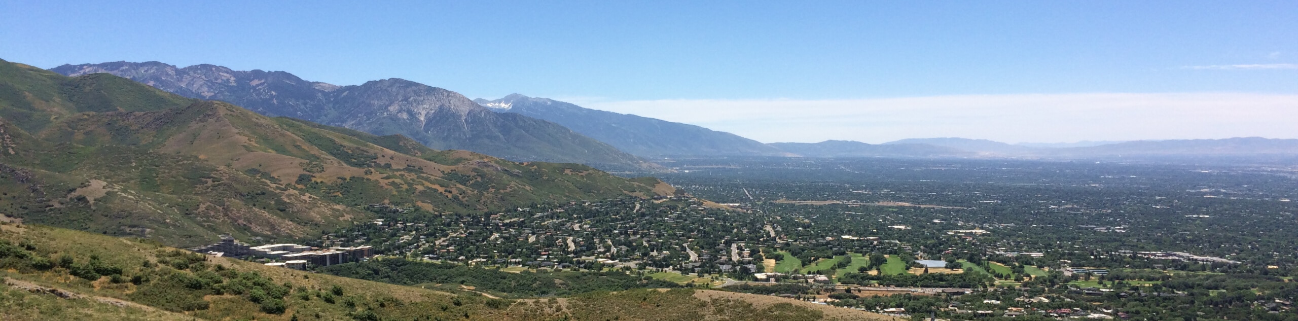
Salt Lake City offers year-round adventures, with fantastic hiking and backpacking in the summer months, and superior skiing in the winter. To give you a little inspiration for your next trip, we’ve put together a guide to our favorite Salt Lake City hikes, together with some top tips on how to enjoy your trip. Sit back, relax, and start dreaming of your next adventure!
Types Of Hiking In Salt Lake City
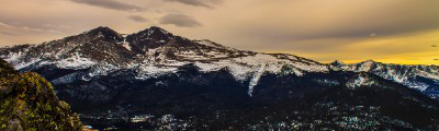
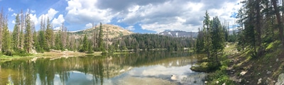
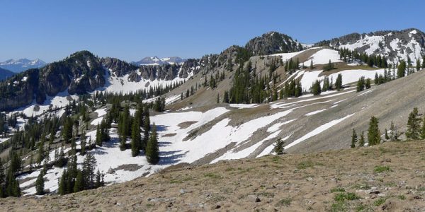
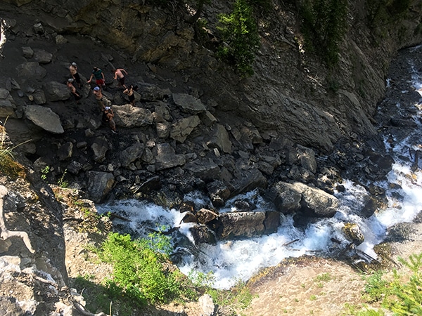
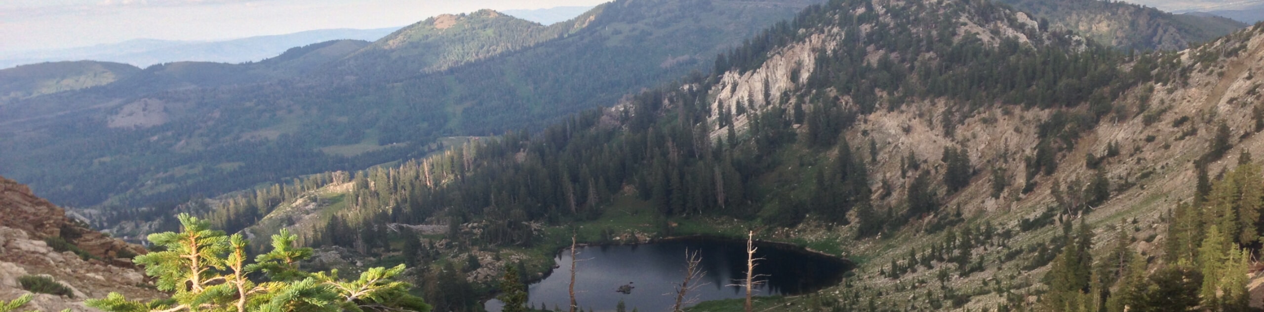
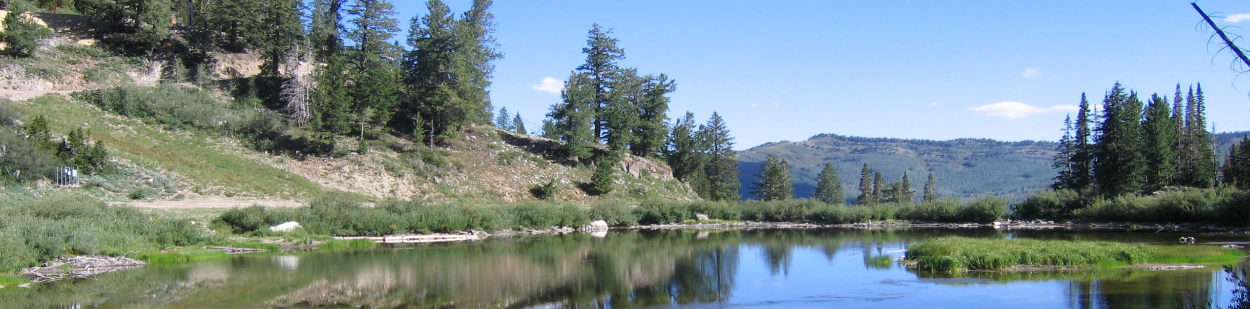
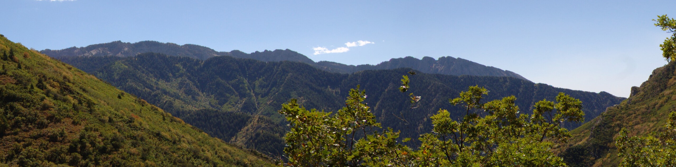
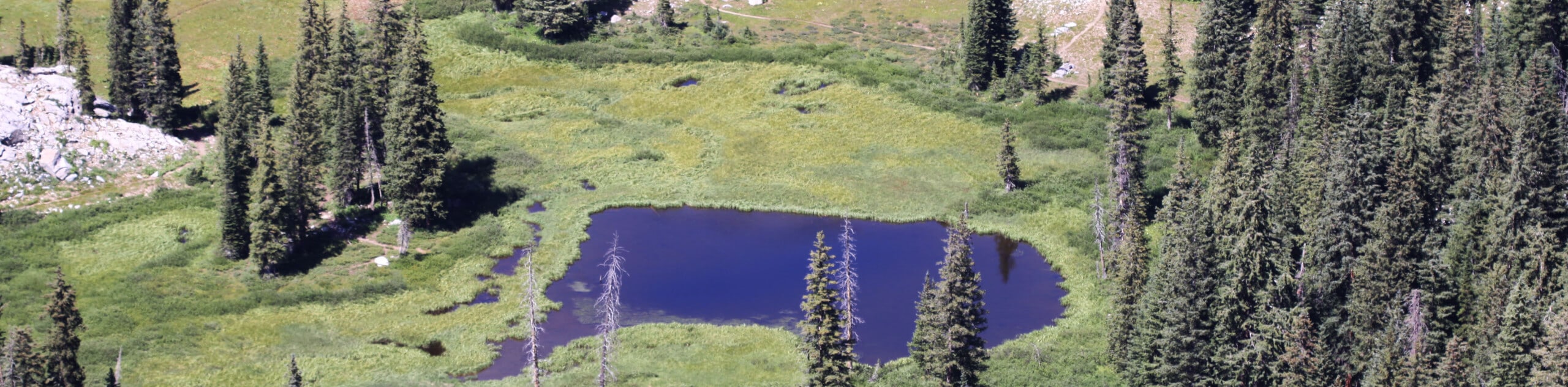
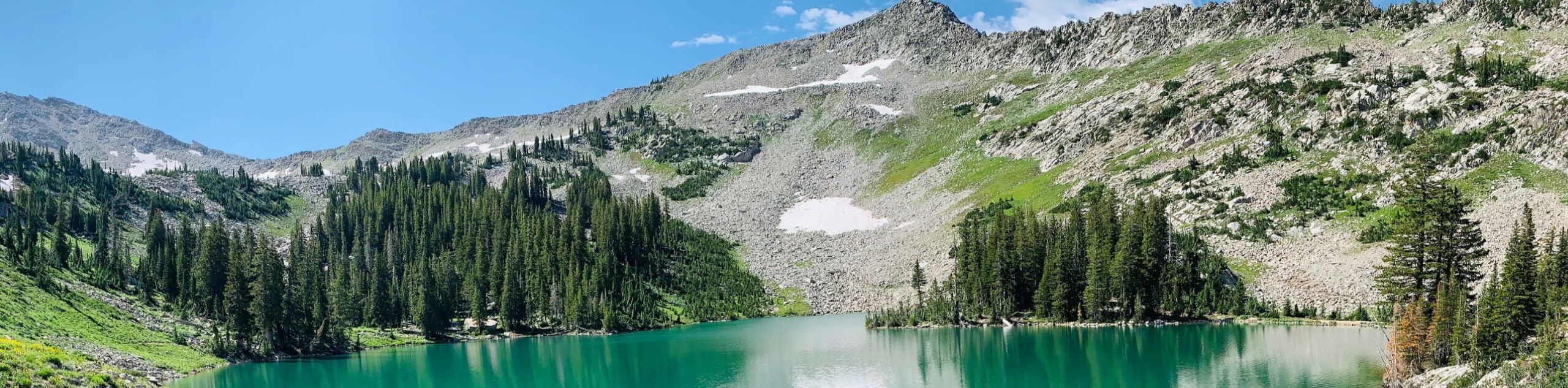
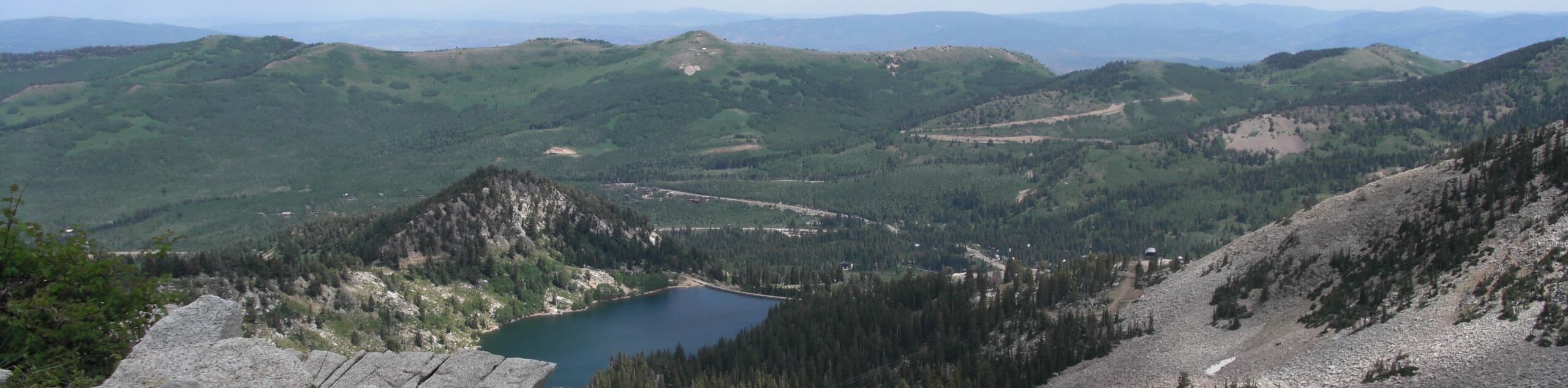
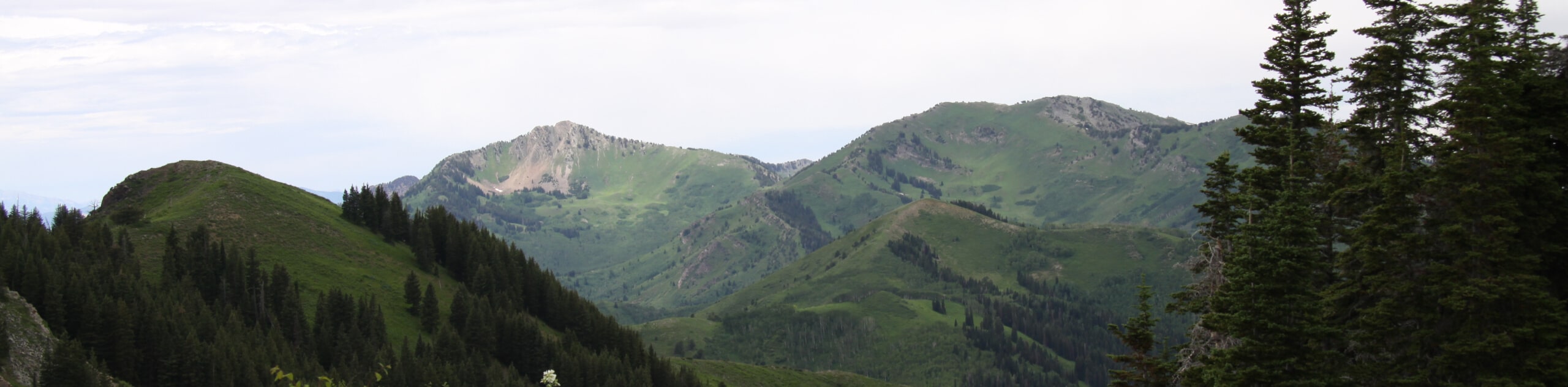
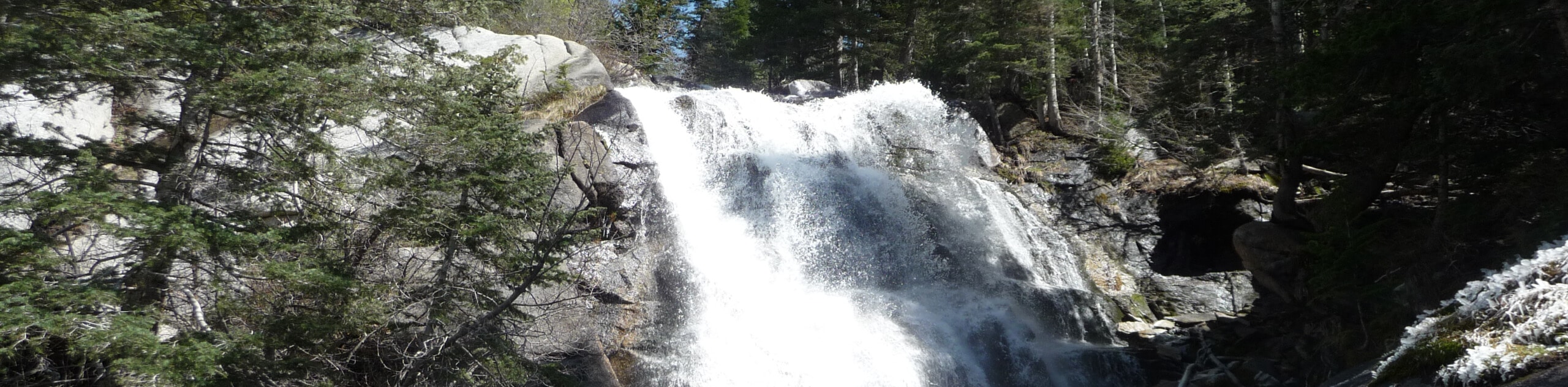
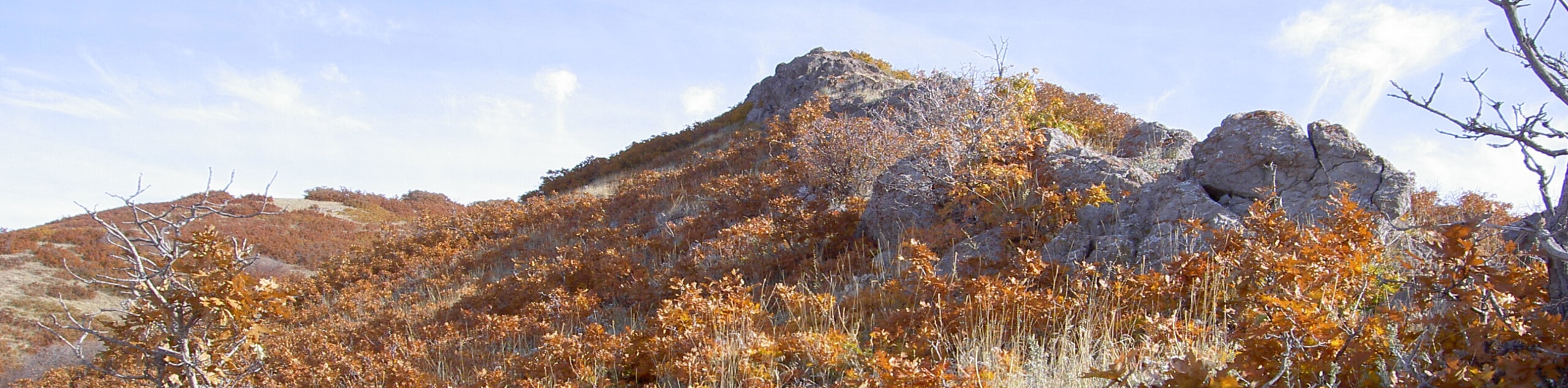
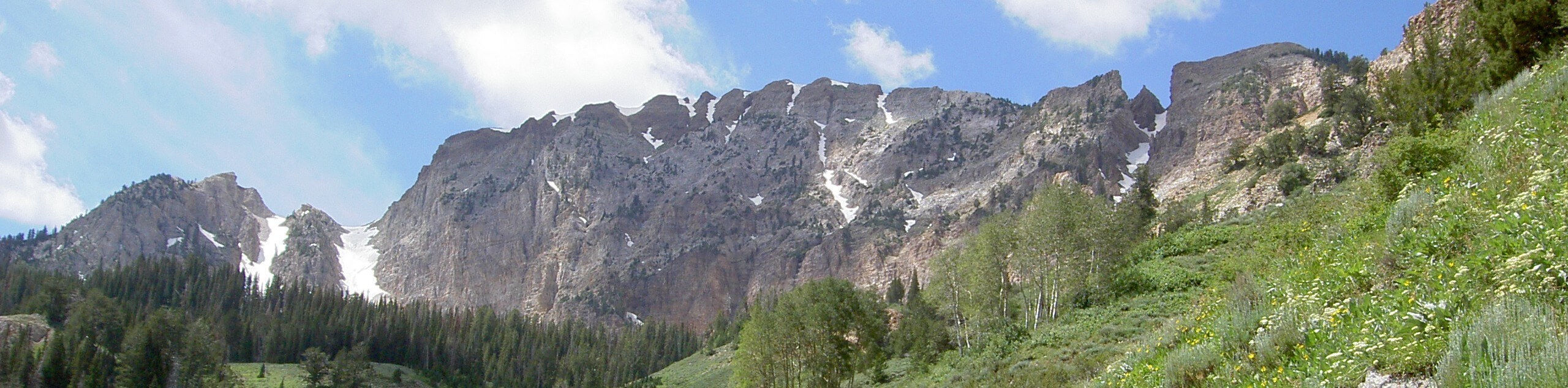
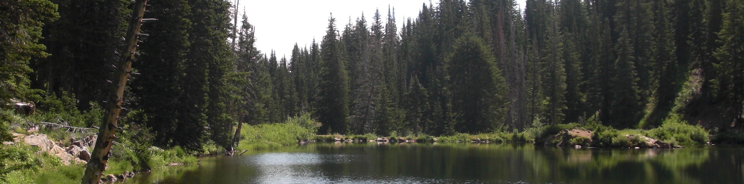
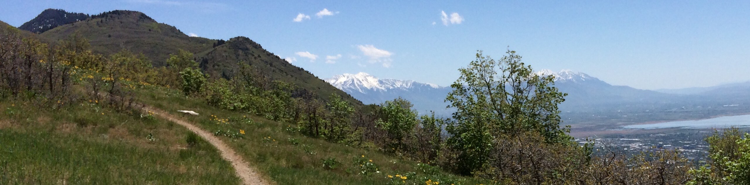
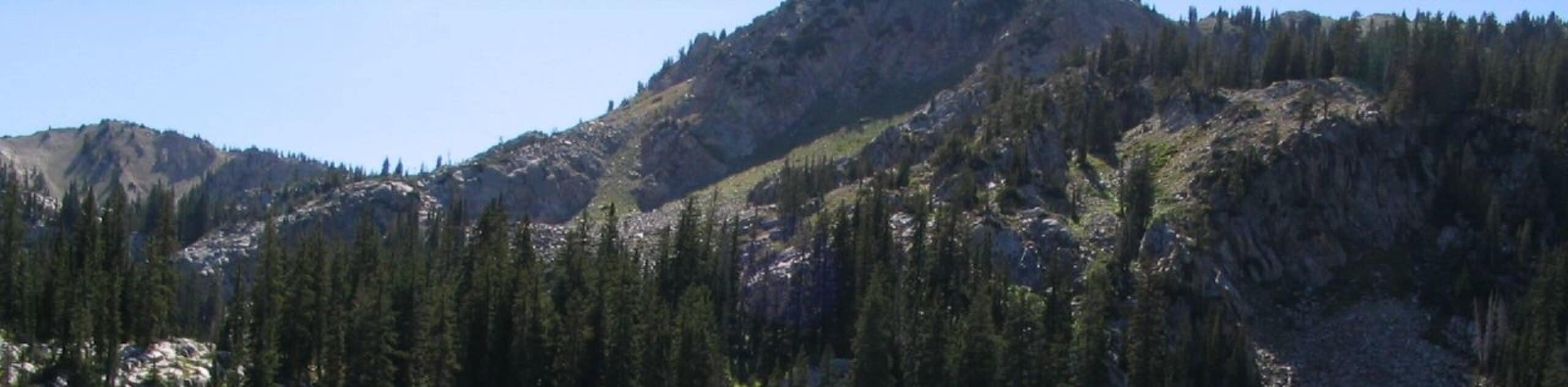
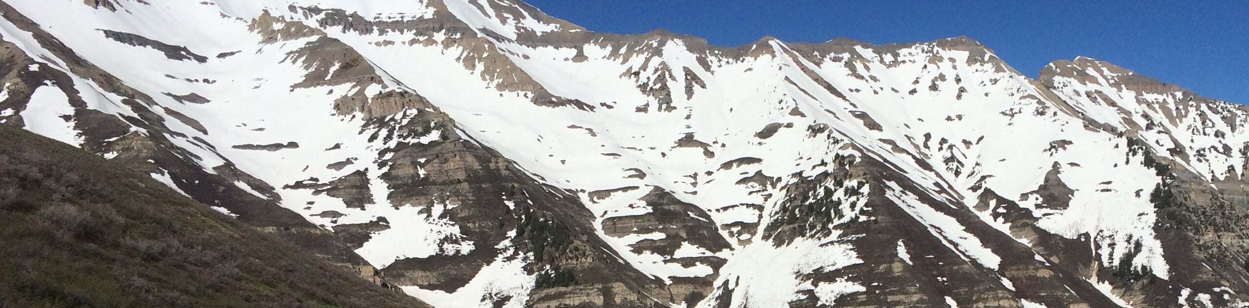
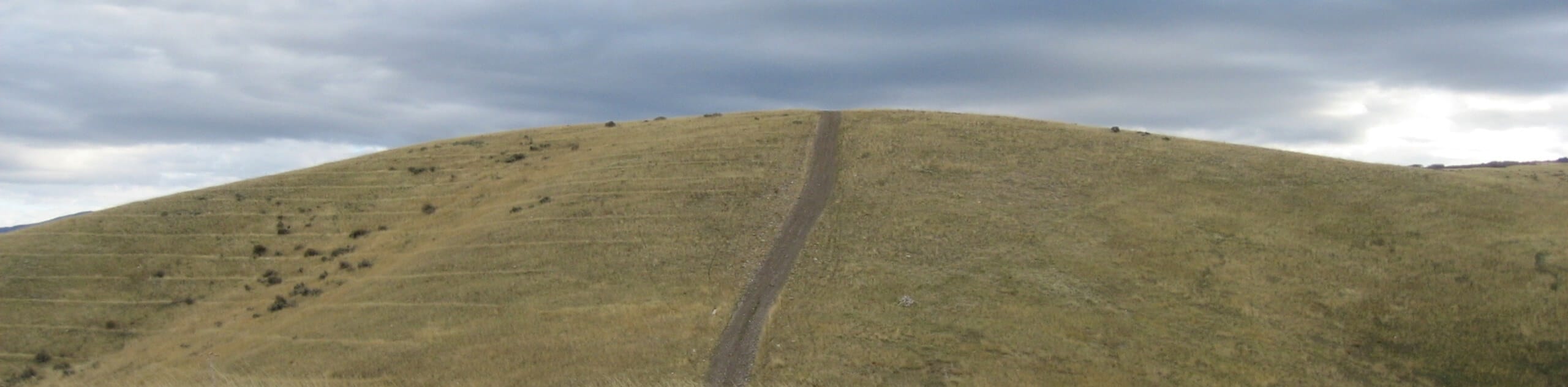
Salt Lake City offers a whole host of wonderful hiking opportunities, with trails to suit all levels of ability and experience. The Wasatch Mountains offer some satisfying challenges for serious hikers, with trails that rise steeply up to towering summits. You’ll need plenty of energy to tackle some of these longer hikes, but there are rewards in abundance once you reach the top. On the other hand, if you’re looking for something a little easier, or travelling with family, you’ll find plenty of lower elevation trails with lots of interesting sights to keep younger hikers happy. With cascading waterfalls and pristine mountain lakes, there are lots of places to cool off on hot days, and plenty of beautiful picnic areas where you can relax and enjoy the view!
Easy Hikes In Salt Lake City
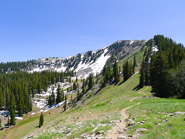
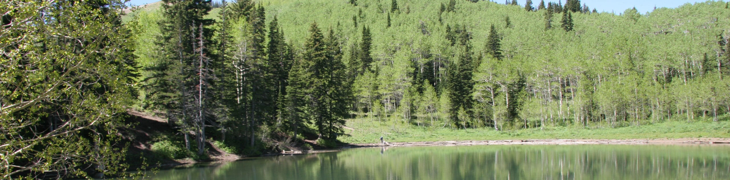
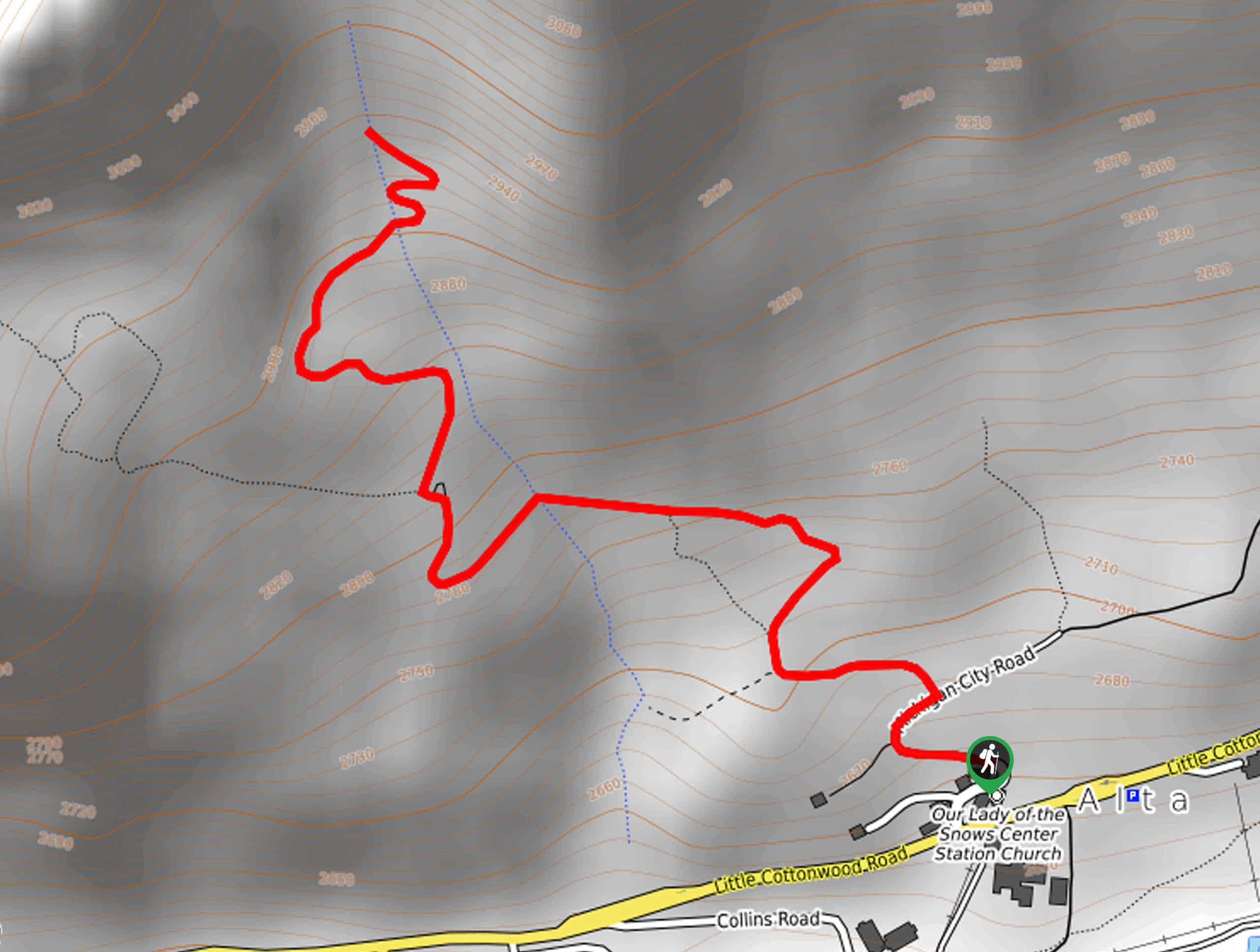
Cecret Lake Hike: This easy hike makes the most of the Alta ski lift access road to get you high into the alpine without having to expend much energy. Right from the start of the trail you’ll enjoy wonderful views, passing through alpine meadows until you come to a beautiful, serene lake. This is a wonderful place for a picnic and a tranquil moment amidst the magnificent scenery.
Family Hikes In Salt Lake City
Donut Falls Hike: The route to Donut Falls, deep in the heart of Big Cottonwood Canyon, is a classic family hike in Salt Lake City. It’s a short climb with spectacular views, and kids will love the sights and sounds of the huge cascading waterfall. Don’t forget to bring a change of socks as you may get wet feet on this fun, family hike!
Day Hikes In Salt Lake City
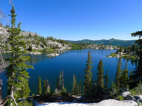
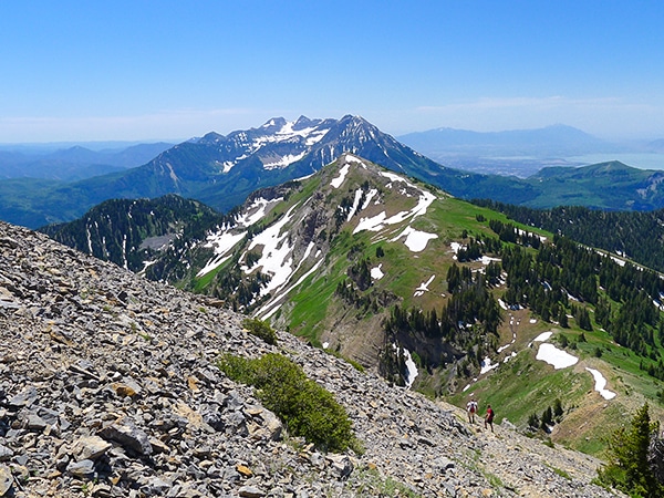
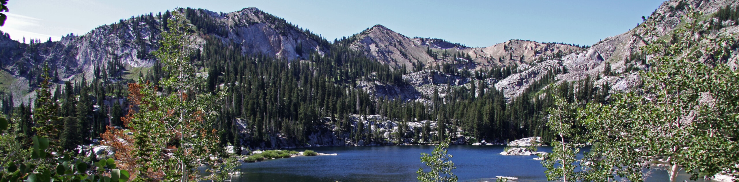
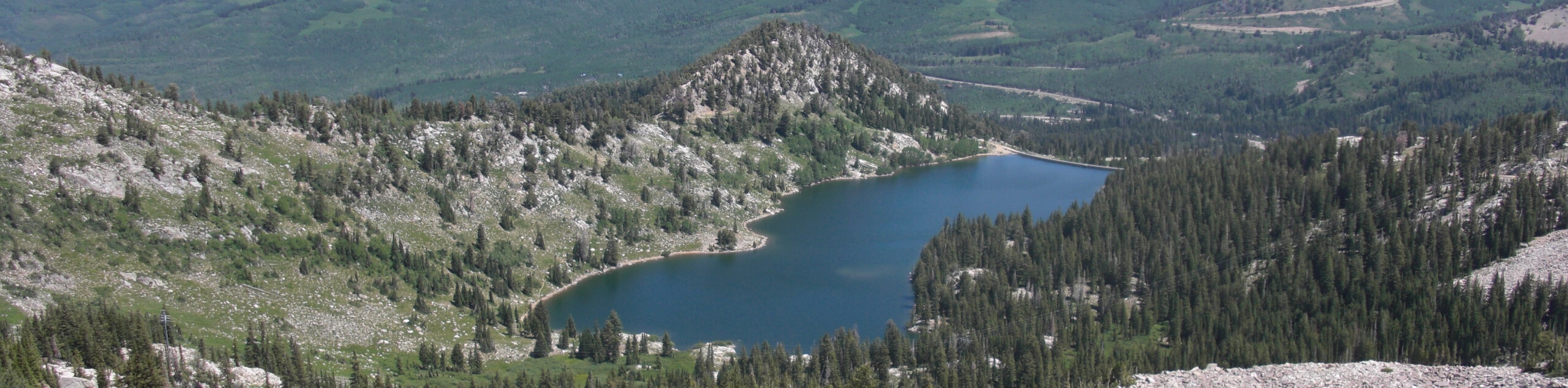
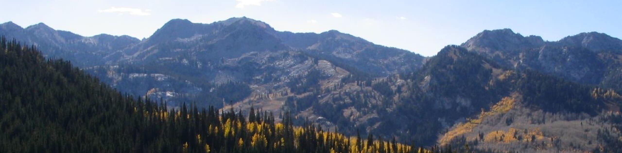
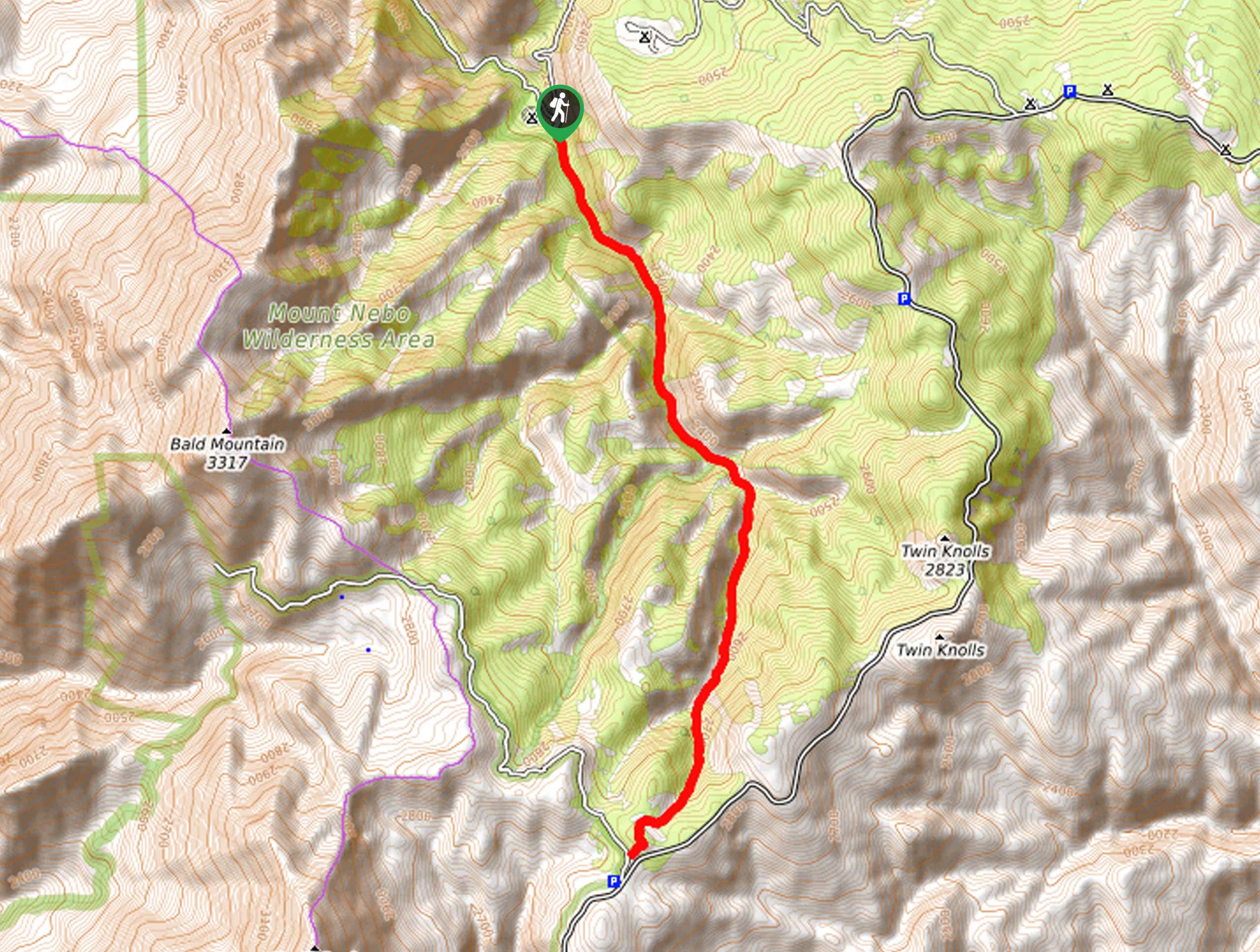
Red Pine Lake and Pfeifferhorn Ridge Hike: The route up to Red Pine Lake and further on to the Pfeifferhorn Ridge is one of the best day hikes in Salt Lake City, offering a magnificent panorama over the surrounding peaks. You’ll need to use your hands and there is some scrambling required at different points along the trail, but this is a really fun route for experienced, confident hikers.
Challenging Hikes In Salt Lake City
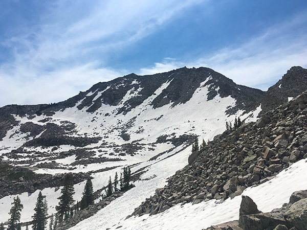
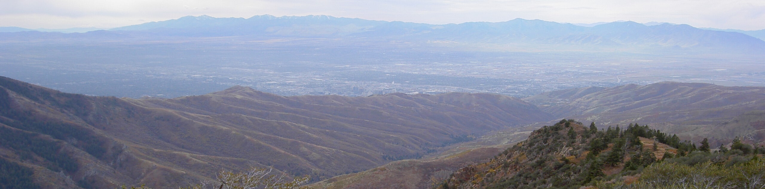
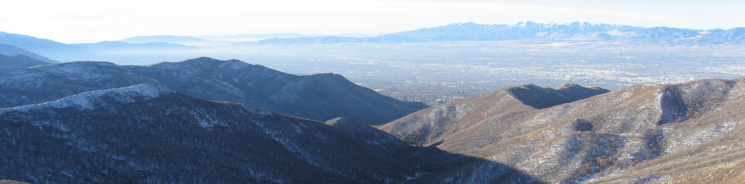
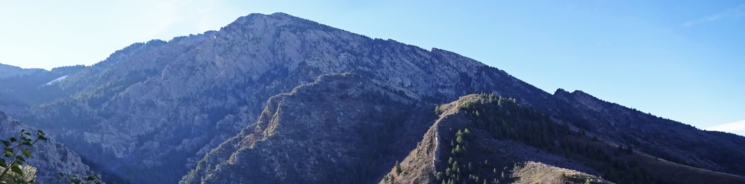
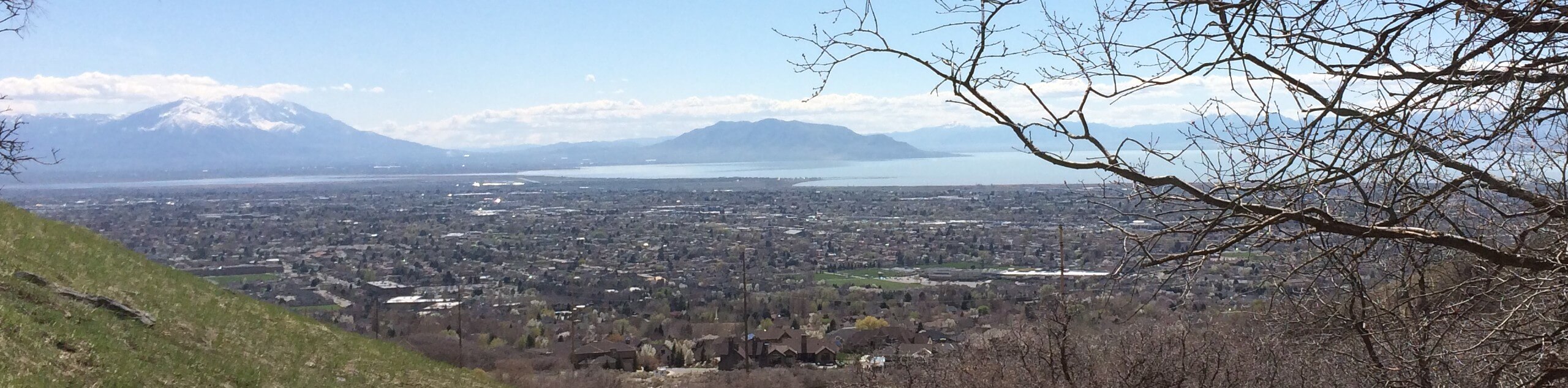
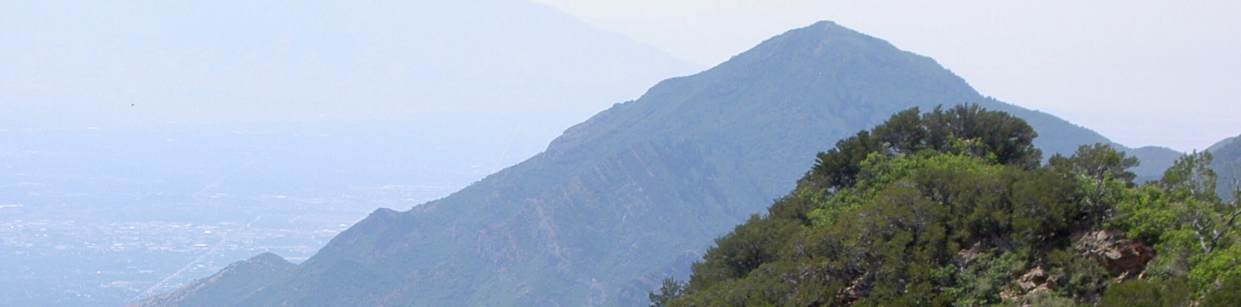
Box Elder Peak Hike: Hikers beware! This route up to Box Elder Peak is not for the faint of heart, with a steep, long climb all the way to the summit. However, if you’ve got the energy, the views from the top are simply sensational. You’ll see the Pfeifferhorn Ridge, Mount Timpanogos, and all the surrounding peaks, with views down as far as Salt Lake. This is an unmissable adventure if you’re a keen hiker.
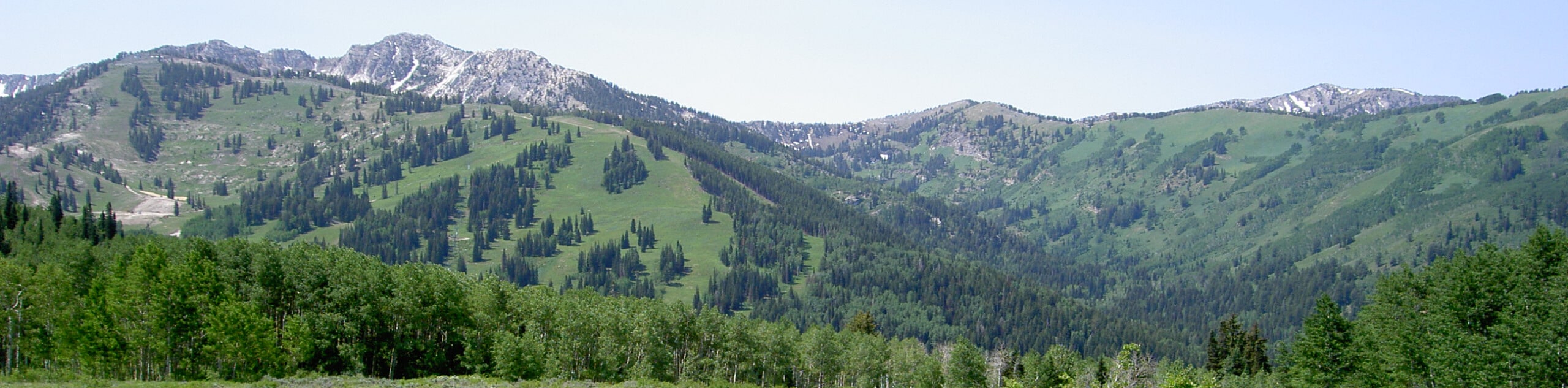
Best Hikes In Salt Lake City
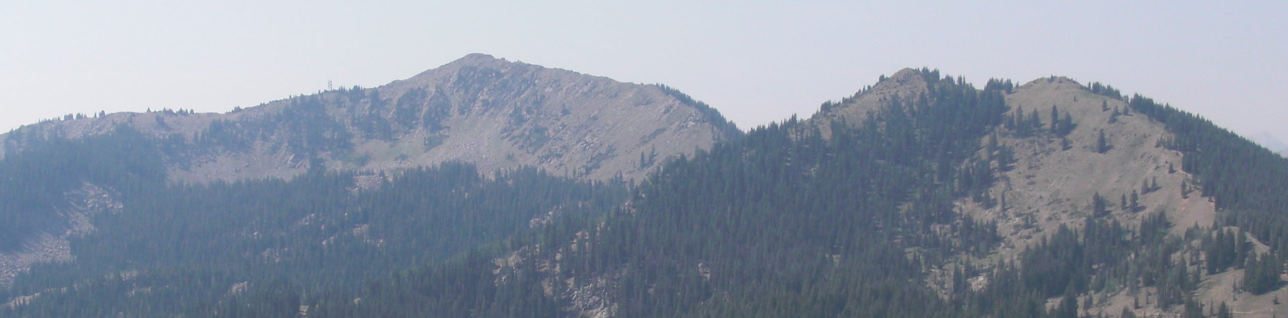
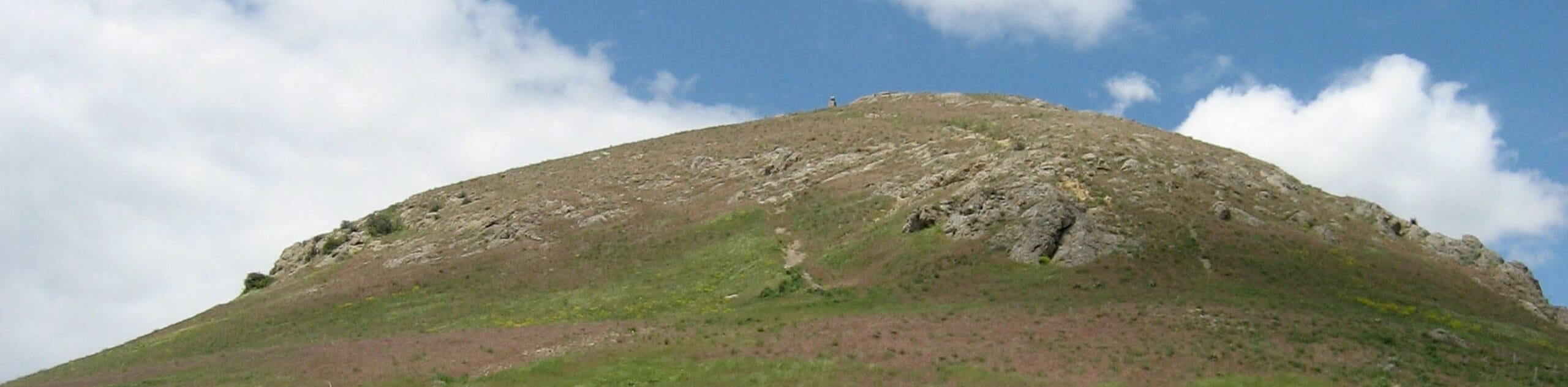
Clayton Peak Hike: The short, steep hike up to Clayton Peak is a surprisingly manageable route that offers some incredible views. As the ascent is relatively short, you’ll have plenty of time to enjoy the panorama from the summit, taking in the Wasatch Mountains, the Uintas, Mount Timpanogos and Box Elder. This is one of the best hikes in Salt Lake City if you want a short hiker that’s big on views.
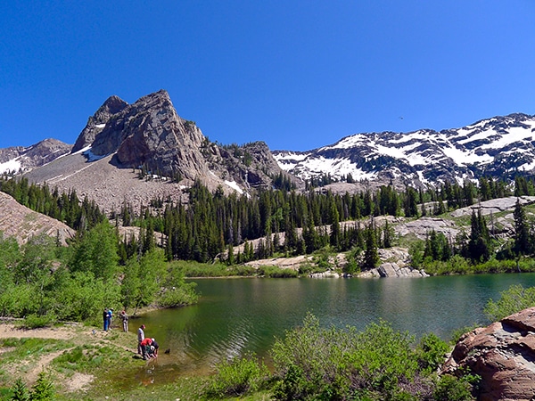
Silver Lake Hike: Relatively few hikers make the journey to Silver Lake, but this quiet trail offers many delights. The trail is well maintained and easy to follow and the easy switchbacks mean that you’ll barely notice the elevation gain. This lake itself is beautiful, surrounded by imposing gray cliffs that create an incredible ambience. Cool off in the crisp waters of the lake, or take a picnic and simply admire the view.
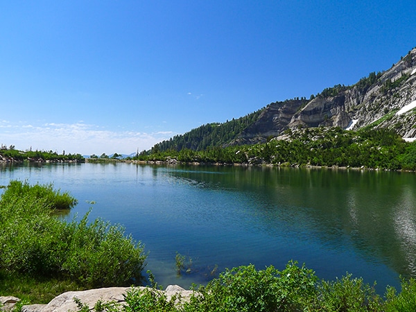
Sunset Peak Hike: The route up to Sunset Peak passes by four stunning alpine lakes: Dog Lake, Lake Mary, Lake Martha and Lake Catherine. The views along the way are lovely, with plenty of places to stop and enjoy the water and the scenery. However, once you ascend Sunset Peak things move up a level, with a magnificent outlook into both the Little and Big Cottonwood Canyons, and a wonderful mountain panorama.
Mount Raymond Hike: The route up to the summit of Mount Raymond requires some relatively significant elevation gain over a short period, meaning that many hikers don’t include it on their Salt Lake City itinerary. We think this is a huge mistake as the Mount Raymond hike is an incredible trek with unique views into the heart of the Wasatch. Enjoy the solitary summit and the majesty of these grand peaks.
Lake Blanche Hike: Lake Blanche is the destination for an extremely popular hike in Salt Lake City, and it’s not hard to see why. The climb to the lake is steep, and will definitely get your legs working, but the views as you near the top are magnificent. This exceptionally pretty alpine lake is the perfect place for a picnic, where you can get your breath back after the stiff climb.
Mount Aire Hike: This fun trail offers plenty of variation and wonderful scenery, passing through forests and wildflower meadows before finally emerging at the summit. With few switchbacks, this trail is steep and fairly arduous, but if you’re looking for a good workout, it’s a great choice. The views from the top extend into the rolling foothills of the Wasatch, and all the way to Mount Raymond and Gobbler’s Knob.
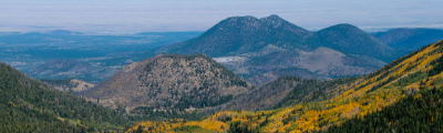
When Is The Best Time To Hike In Salt Lake City?
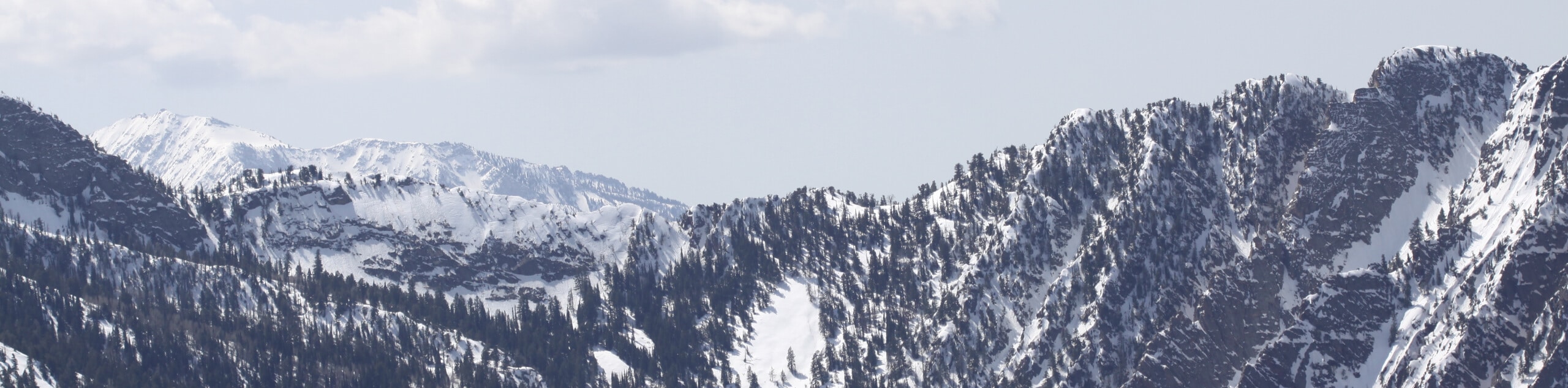
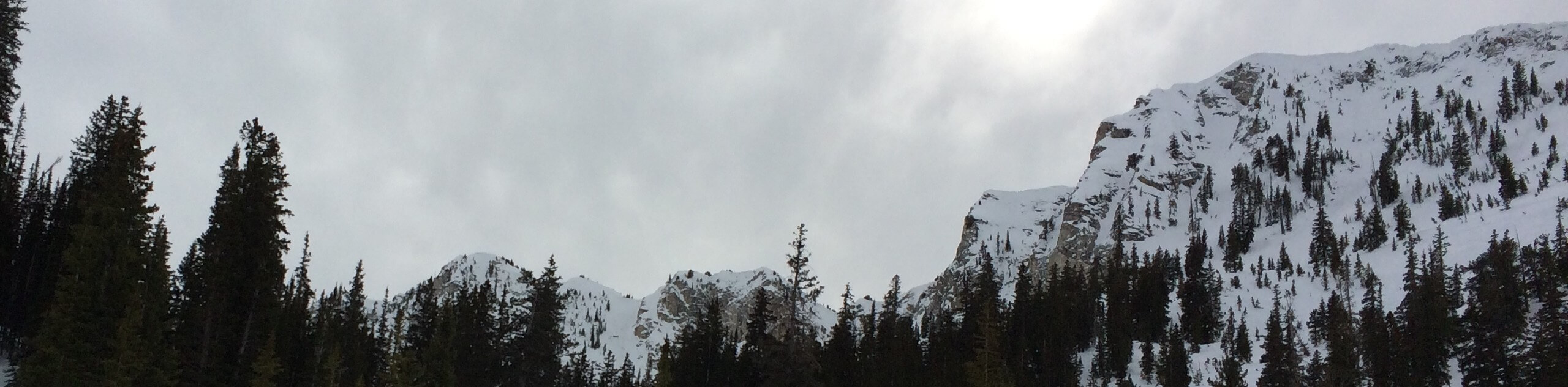
The hiking season in Salt Lake City runs from May to October, although snow can linger on high ground well into May, and you may see early flurries in October. The summer months can be very hot, with temperatures rising to an average high of 32 degrees Celsius. The spring months are cooler, but you will find the trails very muddy at this time of year, due to the high rainfall and large volume of snowmelt. As a result, we think the best time to hike in Salt Lake City is September, when you can expect cool, comfortable temperatures for hiking, and there are far fewer hikers out on the trails. What’s more, at this time of year the turning leaves create some fabulous photo opportunities! In winter, snows render many trails inaccessible, but you’ll still have the chance to go snowshoeing, skiing or snowboarding.
Other Outdoor Activities In Salt Lake City
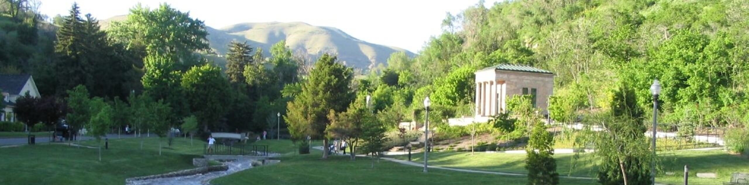
Although hiking is undoubtedly popular with visitors and locals alike, there are plenty of other wonderful outdoor activities in Salt Lake City! With endless miles of beautiful hiking trails, this is a great place for a backpacking trip, getting out into the wild for some backcountry camping. What’s more, you can also enjoy rock climbing, mountain biking, horseback riding, and road biking, all in beautiful countryside just a stone’s throw from the city. Salt Lake City also has a stellar reputation as a winter sports destination, and when the snows hit expect to enjoy both downhill and cross country skiing, snowboarding and snowshoeing.
How To Plan A Trip To Salt Lake City
If you’re thinking of making Salt Lake City your next hiking destination, we’ve got all the information you’ll need to make your trip a success. Check out our comprehensive guide to planning a trip to Salt Lake City, complete with recommendations for where to stay, what to do, and insider tips to maximize your time in this part of Utah. If you need even more inspiration, or want to go even further afield, take a look at our list of all the top hikes in Utah. Whichever trail you choose, we’re sure you won’t be disappointed!
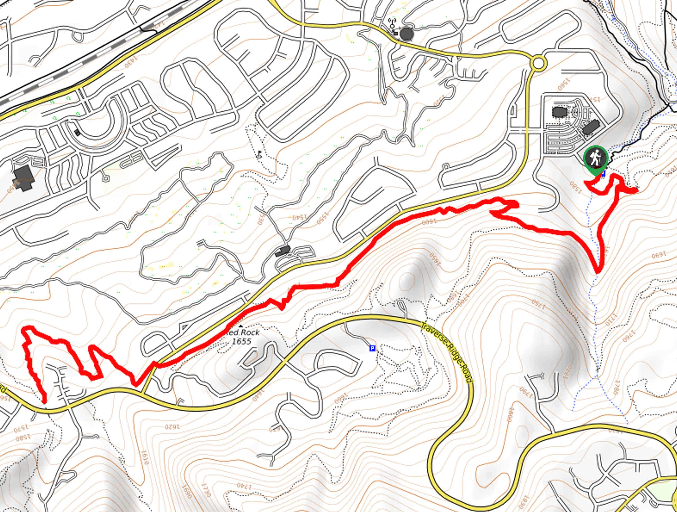
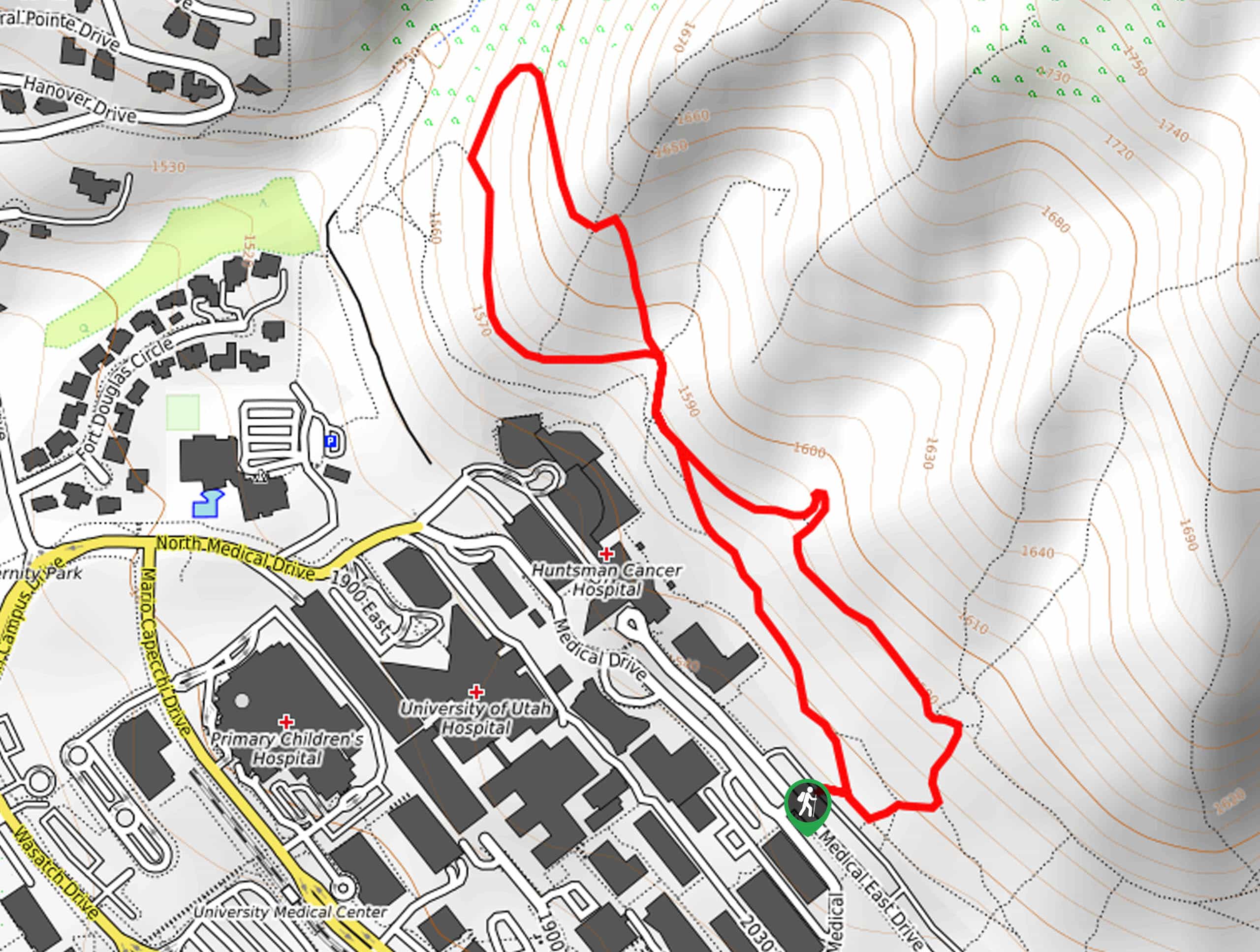
Read MoreThe best hikes in Salt Lake City
01. Clayton Peak
Difficulty
The steep hike up to Clayton Peak yields unbelievably stunning views. One of the easier… Read More
02. Sunset Peak
Difficulty
If you are all about lakes, hiking up past Dog Lake, Lake Mary, Lake Martha… Read More
03. Red Pine Lake & Pfeifferhorn Ridge
Difficulty
The beautiful hike up to Red Pine Lake can easily be extended to grant truly… Read More
04. Mt. Raymond
Difficulty
Hiking Mt. Raymond is an incredible trek granting incredible views into the heart of the… Read More
05. Box Elder Peak
Difficulty
One of the classic summit trails, the brutal hike up to Box Elder Peak involves… Read More
06. Lake Blanche Trail
Difficulty
The popular hike up to Lake Blanche is a hotspot for the hikers of Salt… Read More
07. Silver Lake
Difficulty
A stunning alpine lake that few people walk to due to the 3.0mi… Read More
08. Cecret Lake Trail
Difficulty
Using the access road for Alta ski lift maintenance, you are swept to high elevation… Read More
09. Mt. Aire
Difficulty
Just outside of the heart of the Wasatch, the desert-like Mt. Aire is a great… Read More
10. Donut Falls
Difficulty
The classic family hike in Big Cottonwood Canyon, the short climb up to Donut Falls… Read More
Yes, there are more than 10
Salt Lake City is so beautiful that we can not give you only 10 hikes. So here is a list of bonus hikes in Salt Lake City that you should take a look at as well
11. Upper Bells Canyon Trail
Difficulty
The Upper Bells Canyon Trail is a challenging route in the Lone Peak Wilderness Area… Read More
12. Mount Olympus Trail
Difficulty
Not to be confused with Mount Olympus in Washington or Mount Olympus in Greece, the… Read More
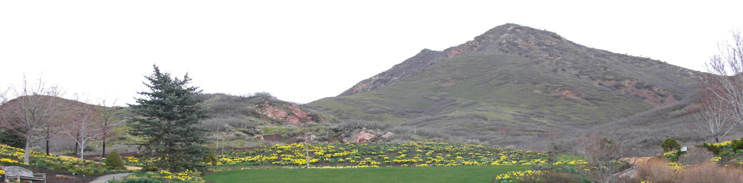
13. Red Butte Garden Small Loop
Difficulty
The Red Butte Garden Small Loop is a wonderful hike for the whole family. This… Read More
14. The Lake Mary Trail
Difficulty
The Lake Mary Trail is an absolutely gorgeous hike in the Uinta-Wasatch-Cache National Forest. Home… Read More
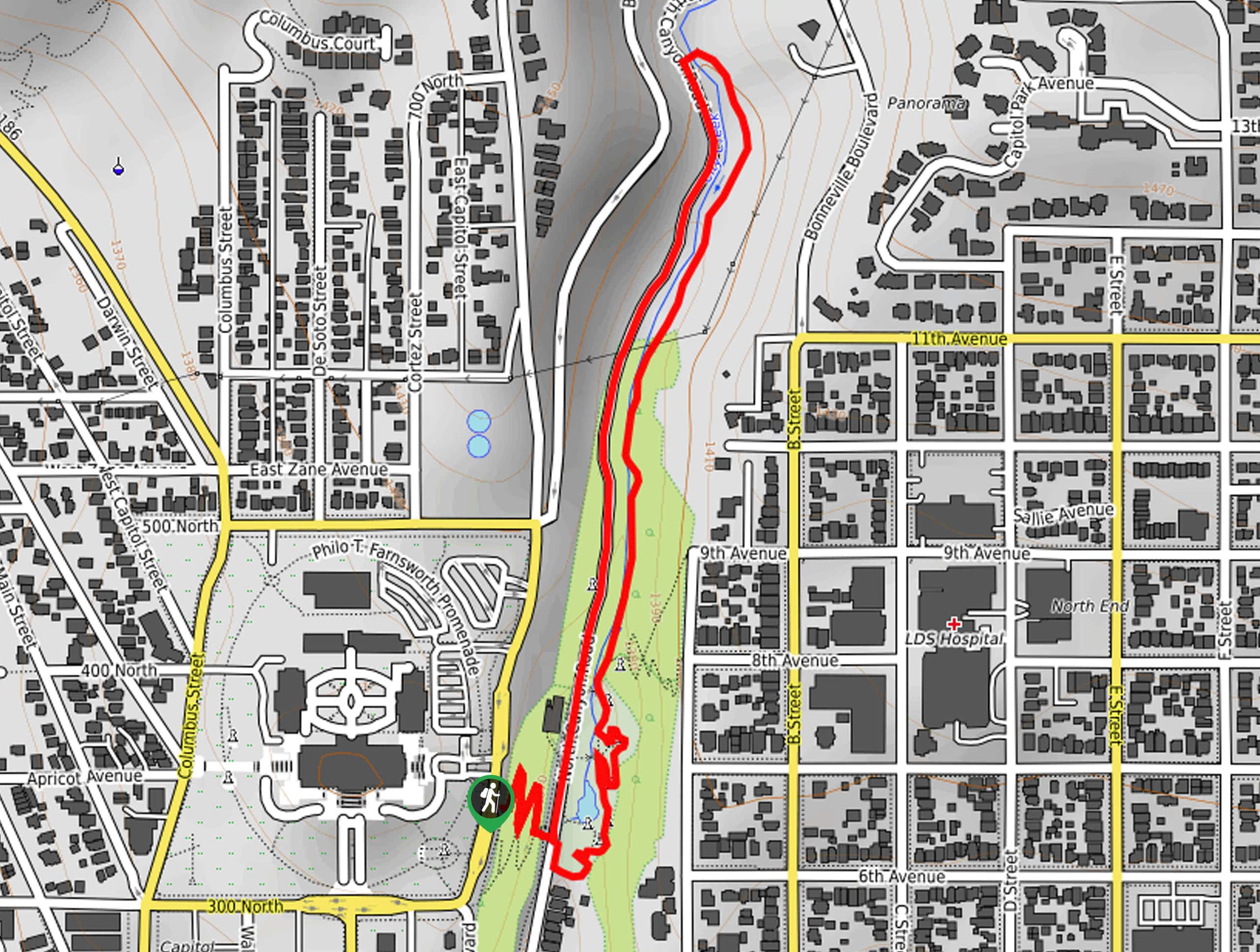
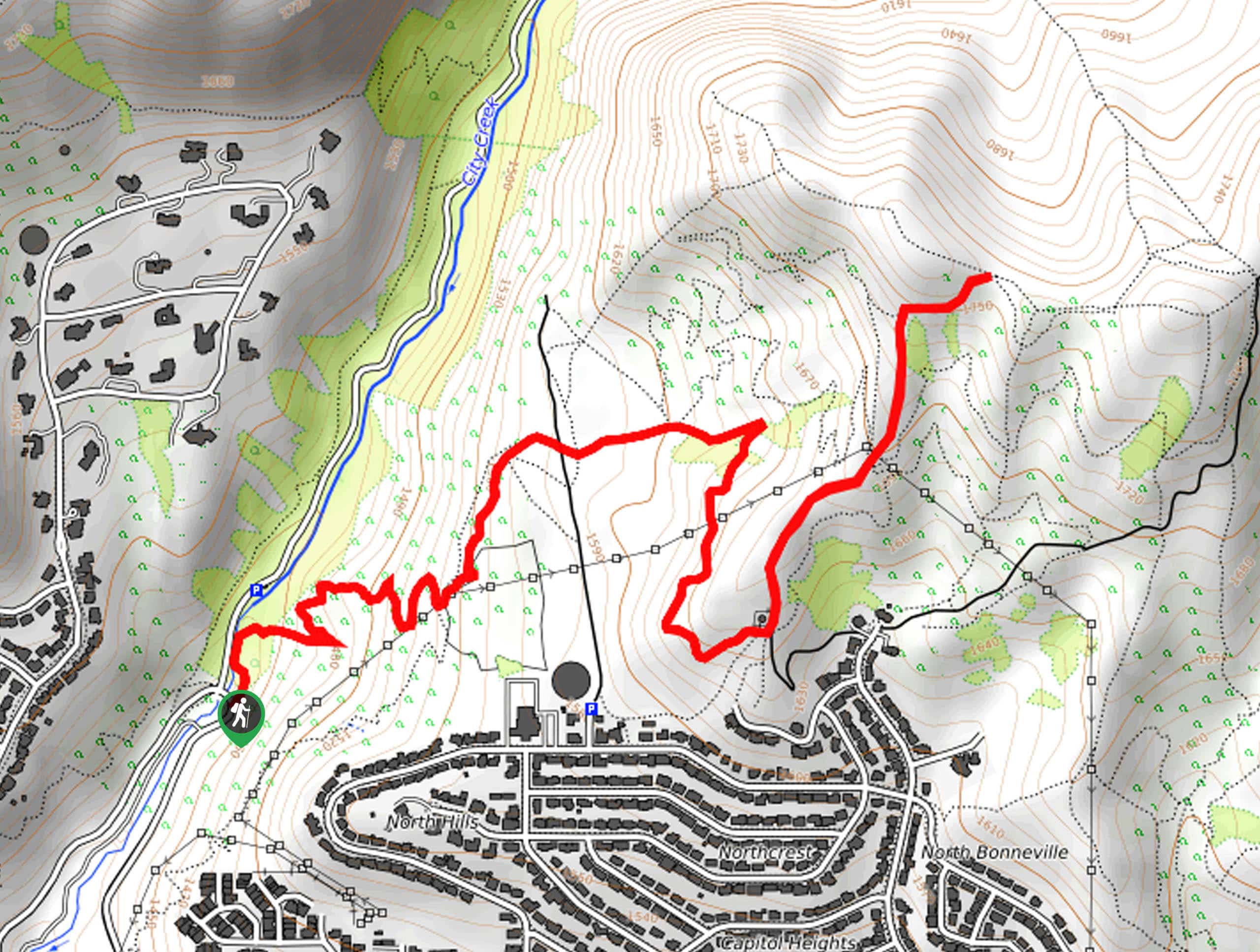
15. City Creek Canyon Trail
Difficulty
The City Creek Canyon Trail is a beautiful hike just north of downtown Salt Lake… Read More
16. Gobblers Knob via Alexander Basin
Difficulty
The Gobblers Knob via Alexander Basin trail is a steep hike to the summit of… Read More
17. Ensign Peak Overlook Trail
Difficulty
The Ensign Peak Overlook Trail is a lovely, dog-friendly hike just north of downtown Salt… Read More
18. Lake Catherine via Brighton Lakes Trail
Difficulty
The hike to Lake Catherine via the Brighton Lakes Trail is a gorgeous, moderately challenging… Read More
19. Jack’s Mountain
Difficulty
Jack’s Mountain Trail is a short but steep hike in memoriam of Jack Edwards, a… Read More
20. Cecret Lake Trail
Difficulty
With mountain views, gorgeous wildflowers and a pristine alpine lake, the Cecret Lake Trail is… Read More
21. The Living Room Lookout Trail
Difficulty
The Living Room Lookout Trail is a short, moderately challenging out-and-back hike to an incredible… Read More
22. Lake Solitude Trail
Difficulty
The Lake Solitude Trail is a relatively easy hike through a beautiful, lush area of… Read More
23. Grandeur Peak Trail- West Face
Difficulty
The hike up Grandeur Peak via the West Face is a challenging route for experienced… Read More
24. Grandeur Peak East Trail from Church Fork
Difficulty
The Grandeur Peak East Trail is a fantastic route for experienced hikers. This trail is… Read More
25. Grandeur Peak Loop
Difficulty
The Grandeur Peak Loop is a fantastic challenge for experienced adventurers. With over 4000ft Read More
26. Liberty Park Loop
Difficulty
The Liberty Park Loop is a lovely stroll through the beautiful and historic Liberty Park… Read More
27. Dog Lake via The Brighton Lakes Trail
Difficulty
The hike to Dog Lake via the Brighton Lakes Trail is a gorgeous, family-friendly hike… Read More
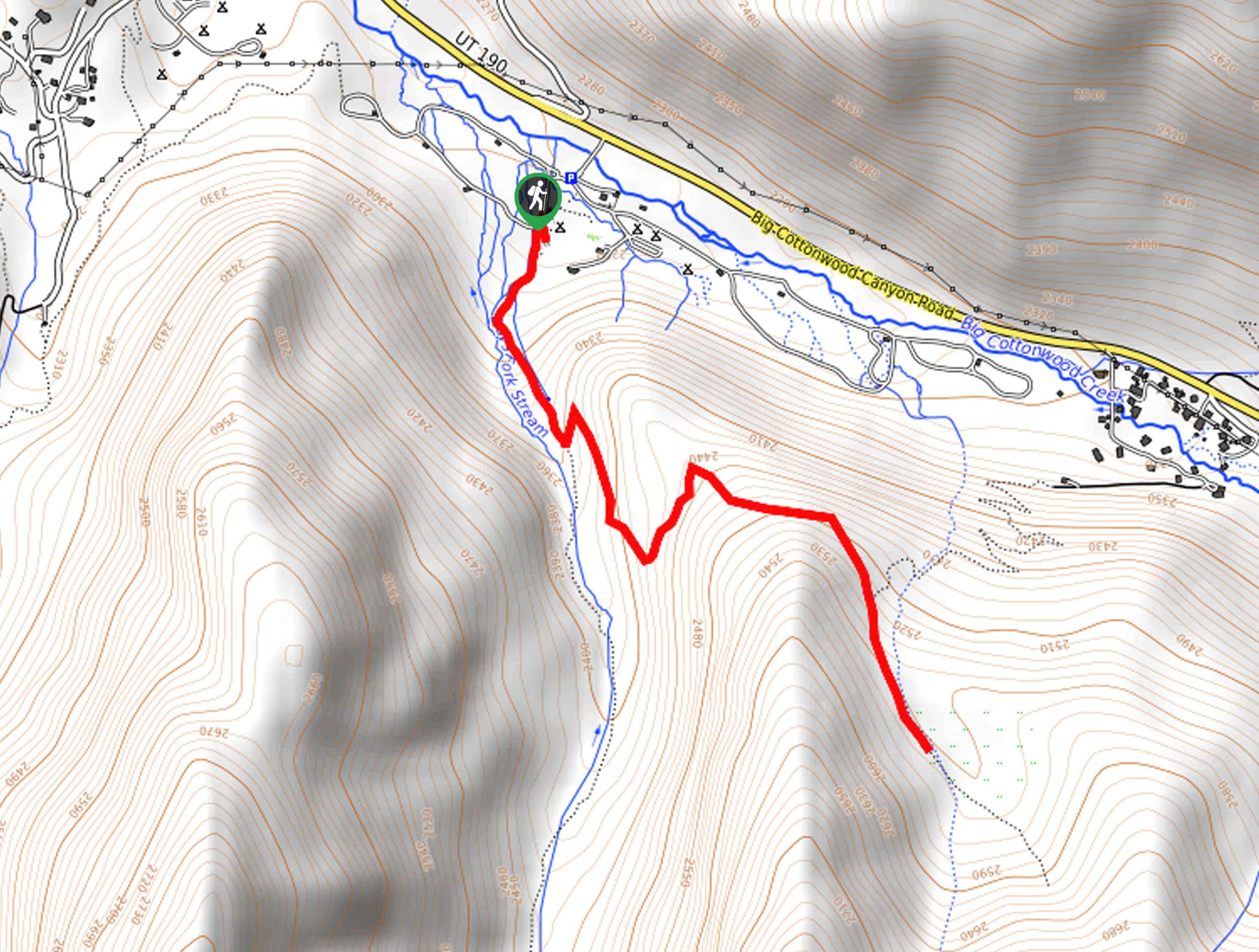
28. Dog Lake via the Mill D North Fork Trail
Difficulty
The hike to Dog Lake via the Mill D North Fork Trail is a gorgeous… Read More
29. Dog Lake via The Big Water Trail
Difficulty
Dog Lake via the Big Water Trail is a fantastic hike for dogs and their… Read More
30. Memory Grove Trail
Difficulty
The hike around Memory Grove Park is a beautiful, well-maintained path that makes a great… Read More
31. Red Butte Canyon Overlook Trail
Difficulty
The Red Butte Canyon Overlook Trail is a short hike just east of the University… Read More
32. Bonneville Shoreline Trail: Provo Canyon Section
Difficulty
The Bonneville Shoreline Trail: Provo Canyon Section is a lovely route with fantastic views of… Read More

33. Bonneville Shoreline Trail: Emigration Canyon Road to City Creek
Difficulty
The Bonneville Shoreline Trail: Emigration Canyon Road to City Creek is a gorgeous route shared… Read More
34. Willow Lake Trail
Difficulty
The Willow Lake Trail is a family-friendly hiking route in the beautiful Uinta-Wasatch-Cache National Forest… Read More
35. Neffs Canyon Trail
Difficulty
Neffs Canyon Trail is a beautiful hike in the Uinta-Wasatch-Cache National Forest. This trail is… Read More
36. Neff’s Canyon Loop
Difficulty
Neff’s Canyon Loop is a fantastic little hike on the edge of Holladay, Utah. This… Read More
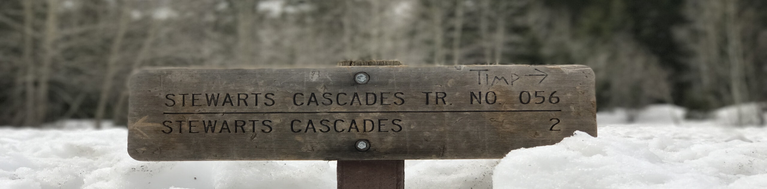
37. Stewart Cascade Trail #056
Difficulty
The Stewart Cascade Trail #056 is a gorgeous hike just outside of Aspen Grove, Utah.… Read More
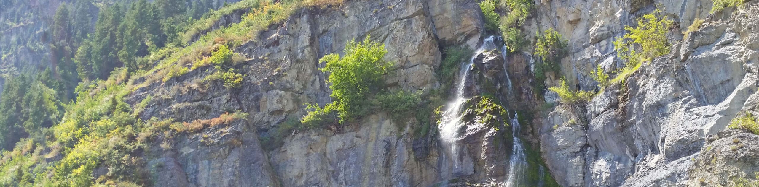
38. Stewart Falls Sundance Trail
Difficulty
The Stewart Falls Sundance Trail is a scenic hike just outside of Aspen Grove, Utah.… Read More
39. Lake Blanche Trail
Difficulty
The Lake Blanche Trail is a popular hiking route in the Twin Peaks Wilderness Area… Read More
40. White Pine Lake Trail
Difficulty
The White Pine Lake Trail is a popular hike in the Lone Peak Wilderness Area,… Read More
41. Snowbird Tram, Cecret Lake via Albion Basin
Difficulty
The Snowbird Tram, Cecret Lake Trail via Albion Basin is a gorgeous hike in the… Read More
42. Red Pine Lake Trail
Difficulty
The Red Pine Lake Trail is a gorgeous hike in the Lone Peak Wilderness Area,… Read More
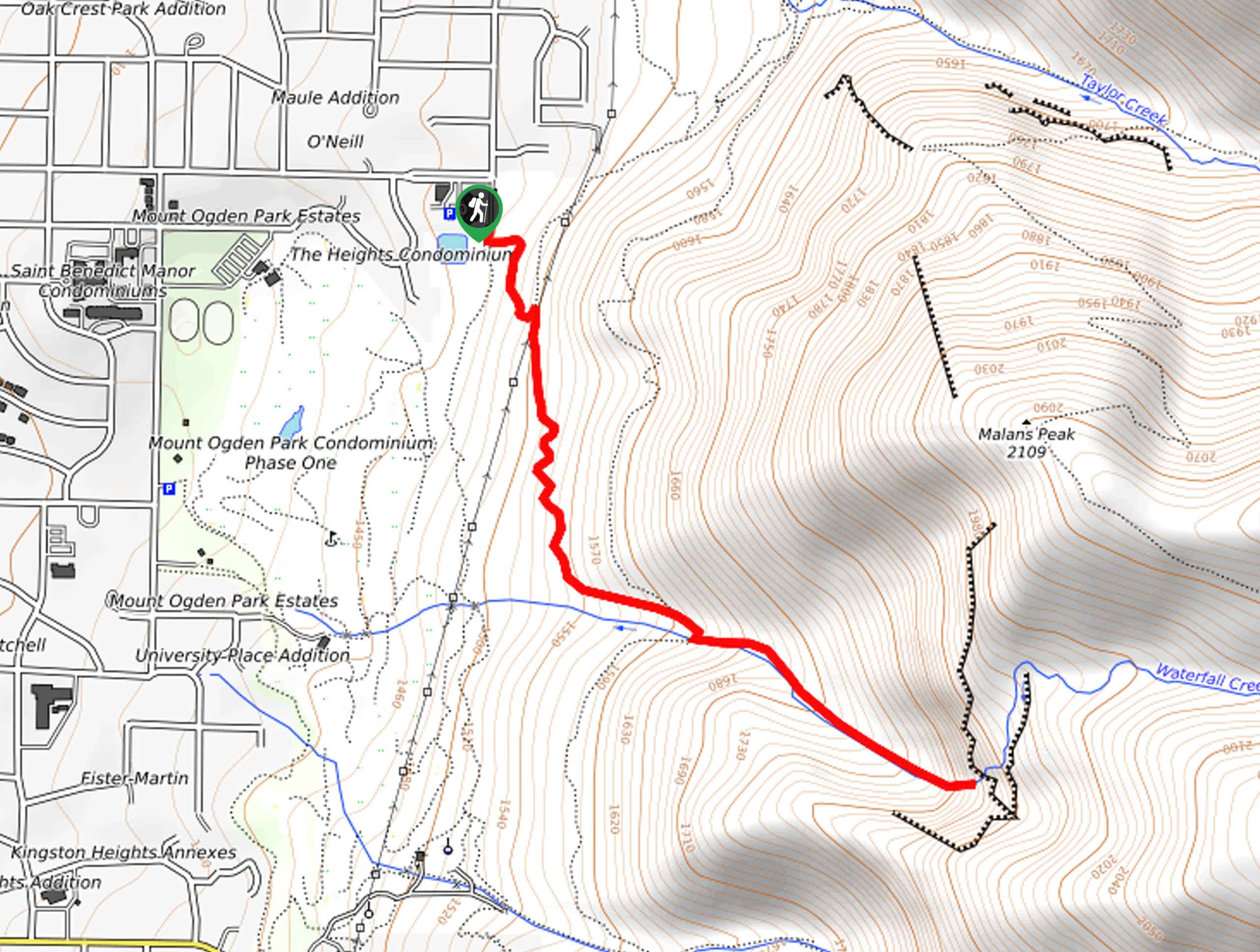
43. The Waterfall Canyon Trail
Difficulty
The Waterfall Canyon Trail is a gorgeous hike just east of Salt Lake City. This… Read More
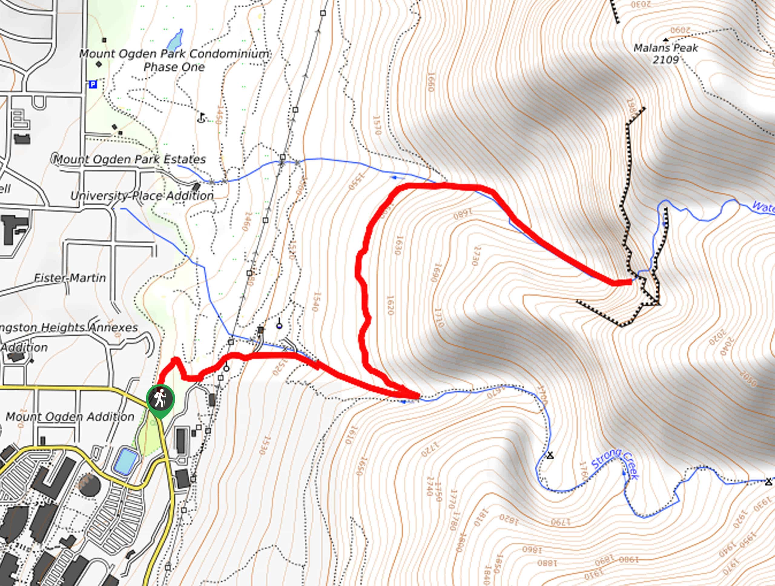
44. Waterfall Canyon Trail via Ogden Park
Difficulty
The Waterfall Canyon Trail via Ogden Park is a gorgeous route east of Salt Lake… Read More
45. The Bonneville Shoreline Trail: Ben Lomond Section
Difficulty
The Bonneville Shoreline Trail: Ben Lomond Section is a gorgeous hike in the Uinta-Wasatch-Cache National… Read More
46. Battle Creek Falls Trail
Difficulty
The Battle Creek Falls Trail is a stunning hiking and mountain biking trail just outside… Read More
47. Ogden Canyon Overlook Trail
Difficulty
The Ogden Canyon Overlook Trail is a popular, moderately challenging hiking trail just outside of… Read More
48. Avenue Twin Peaks Trail
Difficulty
The Avenue Twin Peaks Trail is a popular hike on the edge of Salt Lake… Read More
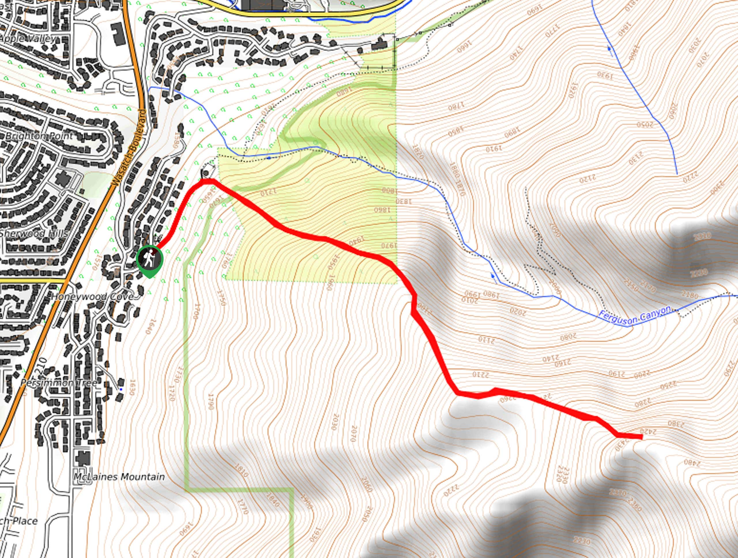
49. Ferguson Canyon Trail to Upper Meadow
Difficulty
The Ferguson Canyon to Upper Meadow Trail is a steep and consistent climb up to… Read More
50. Mount Wolverine via Brighton Lakes Trail
Difficulty
The Mount Wolverine via Brighton Lakes Trail is a challenging route for experienced hikers. This… Read More
51. Gobblers Knob via Butler Fork Trail
Difficulty
Gobblers Knob via Butler Fork is a challenging route for experienced hikers. This trail is… Read More
52. Bear Canyon Bridge via The Bonneville Shoreline Trail
Difficulty
The hike to Bear Canyon Suspension Bridge via the Bonneville Shoreline Trail is a great,… Read More
53. Albion Meadows Trail
Difficulty
The Albion Meadows Trail is a beautiful, family-friendly hike. This trail is well-known for its… Read More
54. Bell Canyon Lower Falls via Boulders Trailhead
Difficulty
The Bell Canyon Lower Falls Trail is a fantastic hike just outside of Sandy, Utah.… Read More
55. Morris Reservoir and Terrace Trail Loop
Difficulty
The Morris Reservoir and Terrace Trail Loop is a fantastic hike just north of downtown… Read More
56. Willow Heights Overview Trail
Difficulty
The Willow Heights Overview Trail is a beautiful, moderately challenging hike through the Uinta-Wasatch-Cache National… Read More
57. Brighton Lakes Loop
Difficulty
The Brighton Lakes Loop is a fantastic tour of the pristine alpine lakes in the… Read More
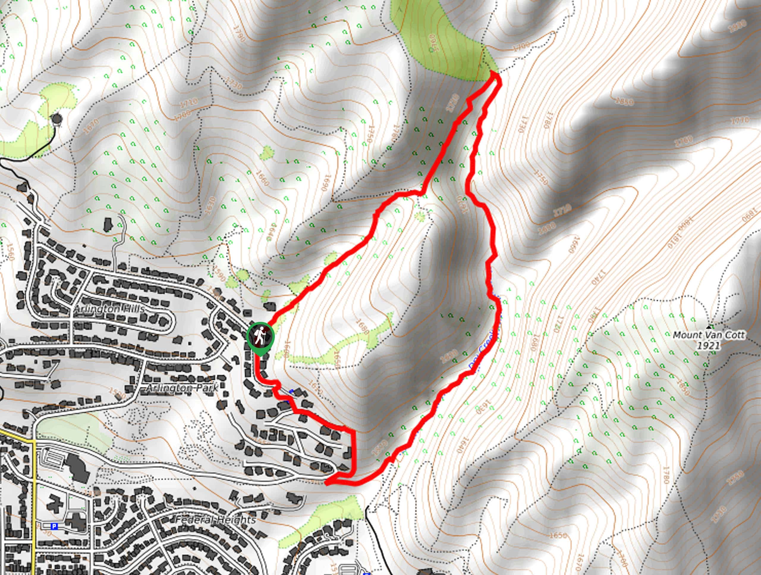
58. Mount Van Cott Trail
Difficulty
The Mount Van Cott Trail is a beautiful, moderately challenging hike just north of the… Read More
59. The Twin Lakes Trail
Difficulty
The Twin Lakes Trail is an absolutely gorgeous out-and-back hike in the Uinta-Wasatch-Cache National Forest.… Read More
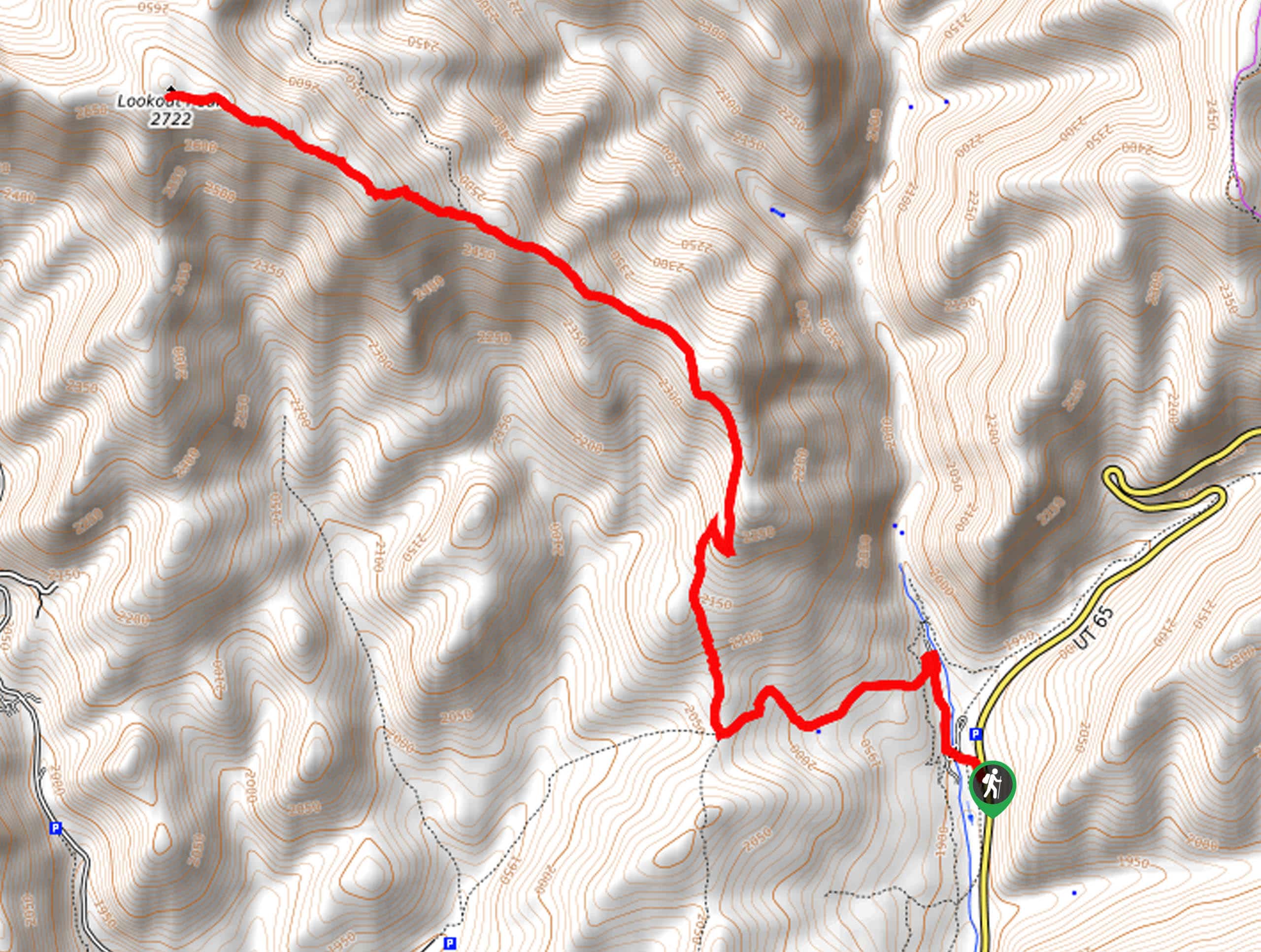
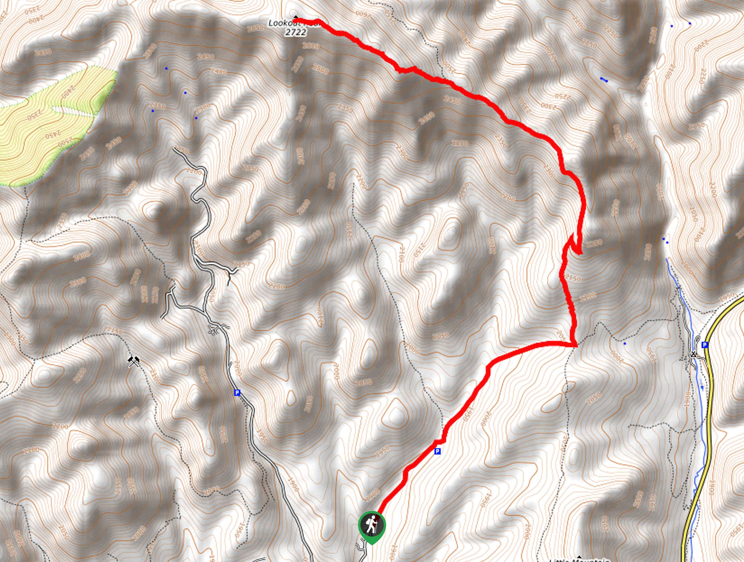
60. Lookout Peak
Difficulty
Lookout Peak is a gorgeous, challenging hike in the Uinta-Wasatch-Cache National Forest. This trail is… Read More
61. The Mormon Pioneer Trail
Difficulty
The Mormon Pioneer Trail is a well-maintained route in the Uinta-Wasatch-Cache National forest between Salt… Read More
62. Desolation Lake and Dog Lake Loop
Difficulty
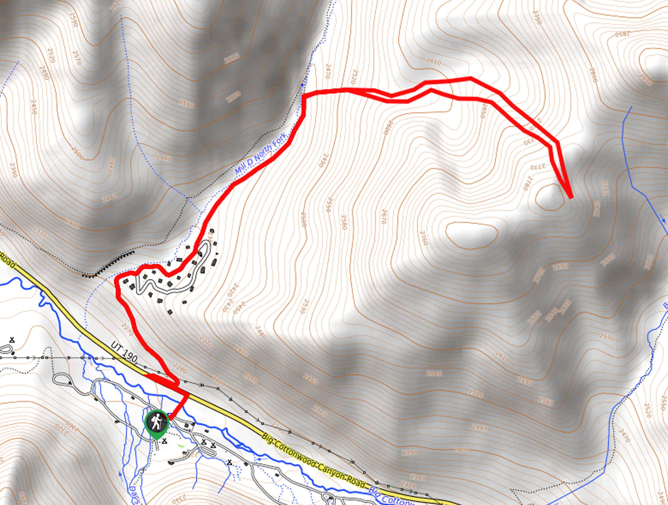
The Desolation Lake and Dog Lake Loop is a gorgeous hike in the Mill Creek… Read More
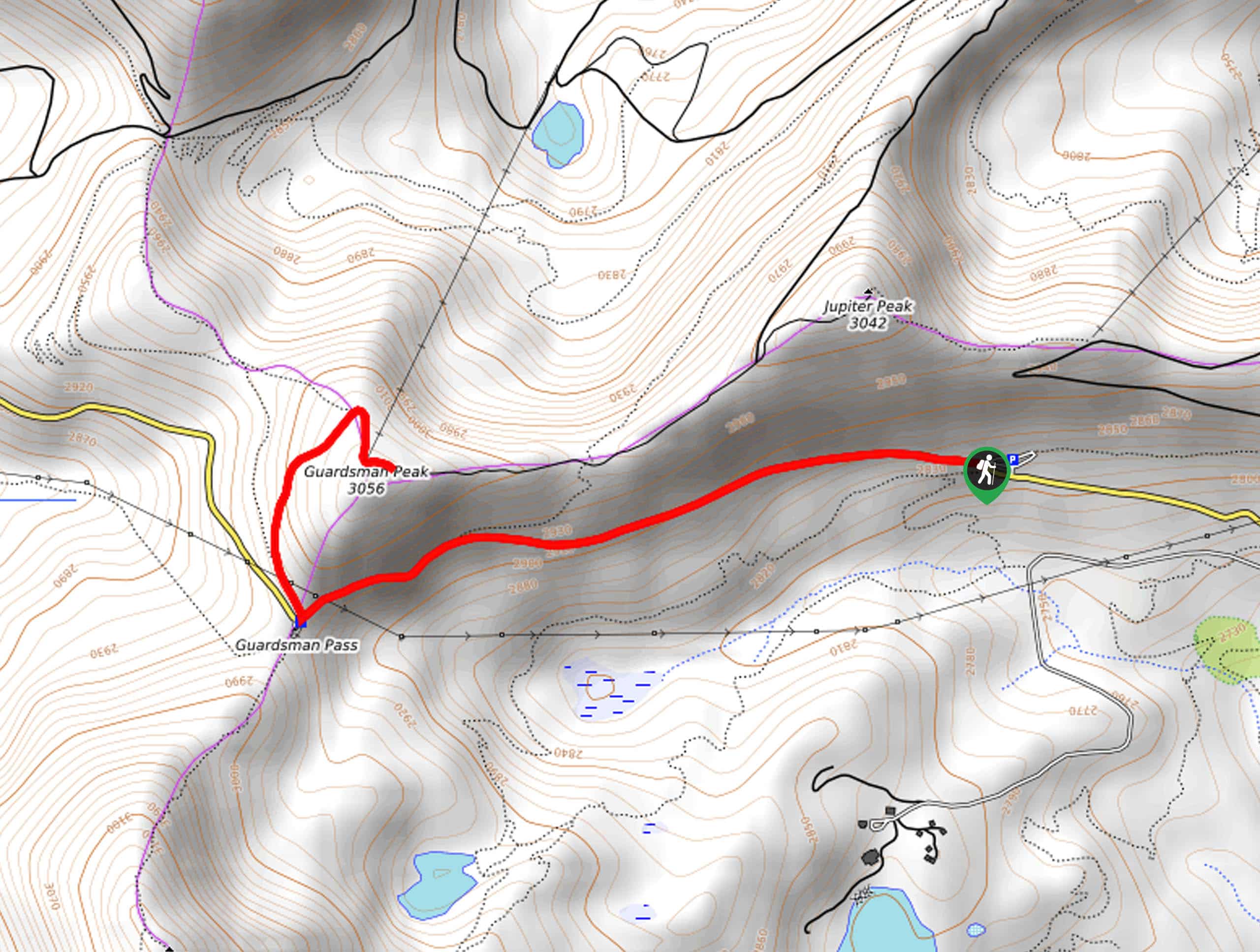
63. Jupiter Peak and Shadow Lake Loop
Difficulty
The Jupiter Peak and Shadow Lake Loop is a gorgeous route through the Uinta-Wasatch-Cache National… Read More
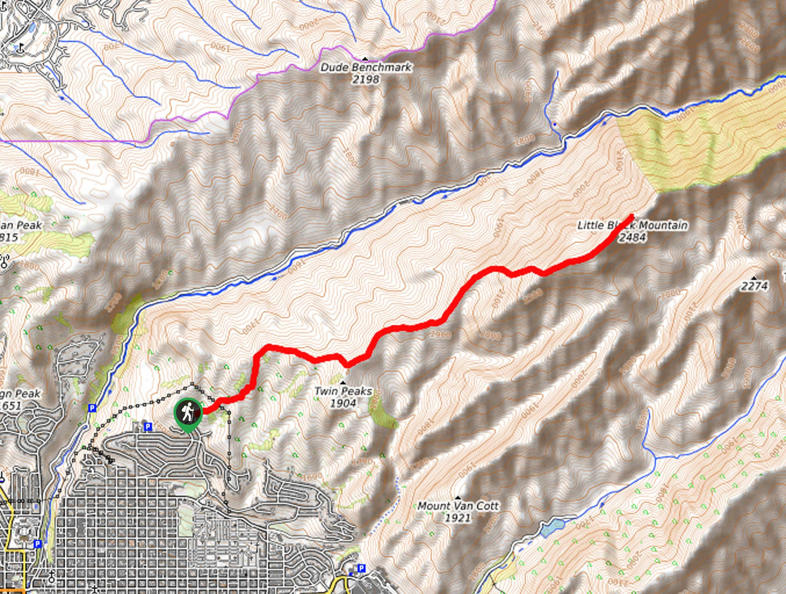
64. Black Mountain Trail
Difficulty
The Black Mountain Trail is a fantastic route for experienced hikers. This trail is not… Read More
65. Lower Hell Canyon
Difficulty
Neither Hell, nor a canyon, the Lower Hell Canyon Trail is a beautiful hike up… Read More
66. Big Beacon (Mount Wire) Trail
Difficulty
The Mount Wire Trail is a fantastic, moderately challenging hike just east of the University… Read More
67. Olympus Hills Park
Difficulty
The Olympus Hills Park Walk is a great little outing for the whole family. This… Read More
68. Burch Hollow Trail
Difficulty
The Burch Hollow Trail is a beautiful hike through the Uinta-Wasatch-Cache National Forest. This trail… Read More
69. Mount Raymond via Alexander Basin Trail
Difficulty
Mount Raymond via the Alexander Basin Trail is a challenging route for experienced hikers. This… Read More
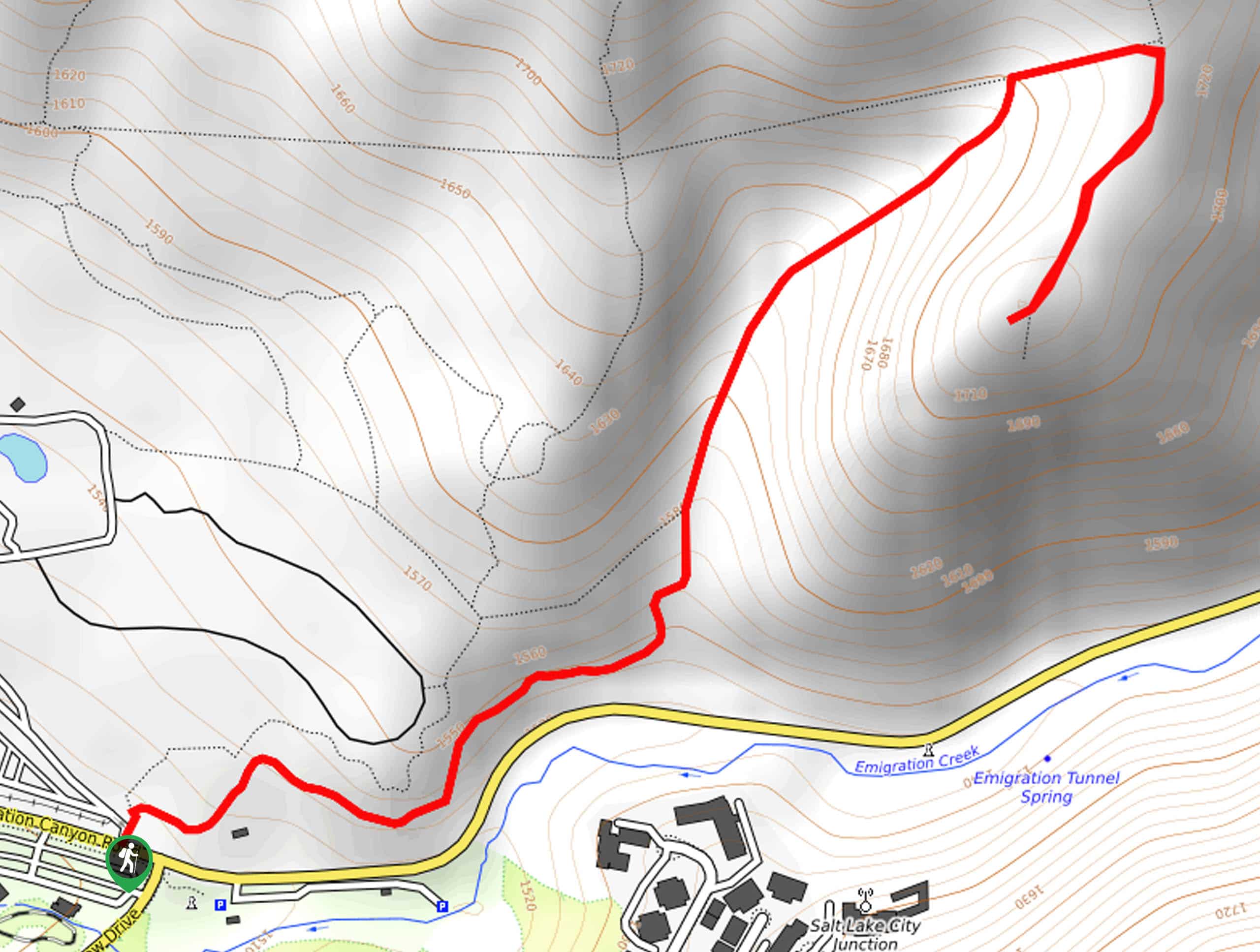
70. Emigration Canyon Miners Trail
Difficulty
The Emigration Canyon Miners Trail is a lovely trail in the Red-Butte Wilderness area. This… Read More
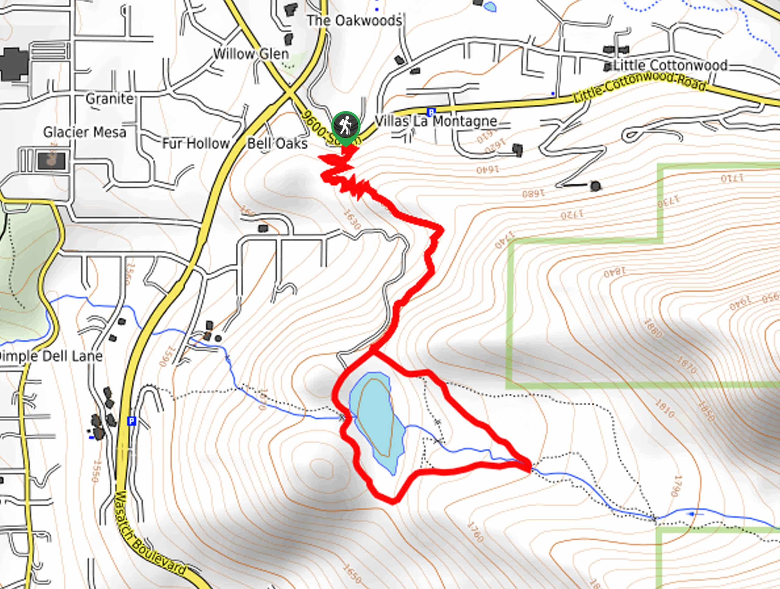
71. Lower Bell Canyon Reservoir via Larry’s Trail
Difficulty
Lower Bell Canyon Reservoir via Larry’s Trail is a gorgeous hike just outside of Sandy,… Read More
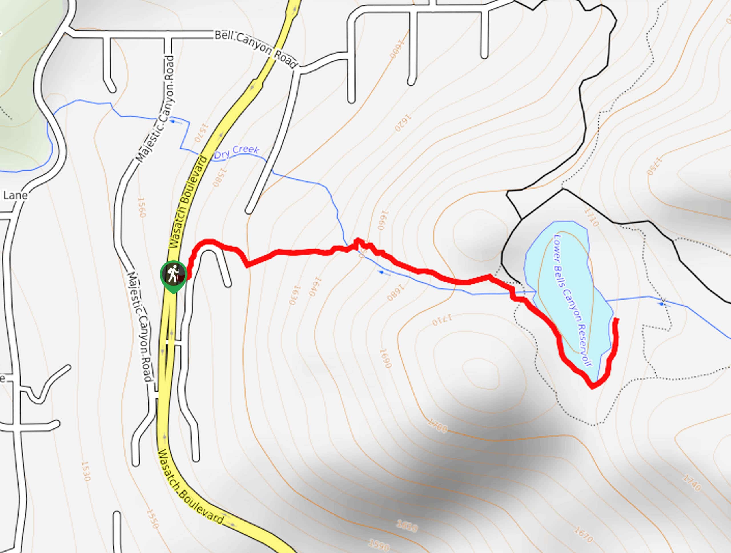
72. Lower Bell Canyon Reservoir via Boulders Trailhead
Difficulty
The hike to Lower Bell Canyon Reservoir via the Boulders Trail is a great route… Read More
73. Bonneville Shoreline Trail: Layton Ridge to Fernwood Recreation Area
Difficulty
The hike from Layton Ridge to the Fernwood Recreation Area follows a beautiful section of… Read More
74. Bells Canyon Trail to Ridgeline
Difficulty
The Bells Canyon Trail to Ridgeline is a gorgeous, rugged route just outside of Sandy,… Read More
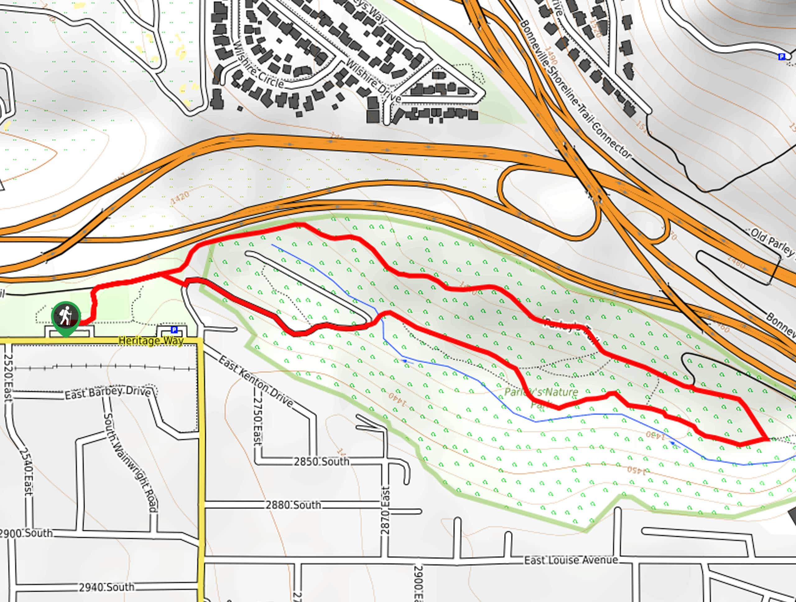
75. Parley’s Historic Nature Park Trail
Difficulty
The Parley’s Historic Nature Park Trail is a popular hiking, running, and dog-walking route in… Read More
76. The Aqueduct Trail
Difficulty
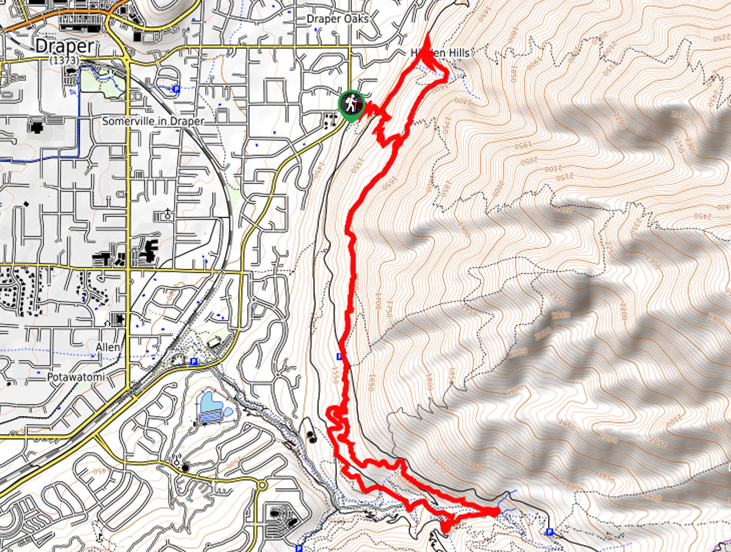
The Aqueduct Trail is a beautiful, family-friendly hike on the eastern edge of Draper, Utah.… Read More
77. Parley’s Trail
Difficulty
Parley’s Trail is an east-west, multi-use path that connects the Bonneville Shoreline Trail with the… Read More
78. Honeycomb Canyon and Lake Solitude Loop
Difficulty
The Honeycomb Canyon and Lake Solitude Loop is a gorgeous hike near Brighton, Utah. This… Read More
79. Parley’s Canyon Overlook and Jack’s Mailbox Loop
Difficulty
Parley’s Canyon Overlook and Jack’s Mountain Loop is a gorgeous but challenging hike in Salt… Read More
80. Willow Creek Trail
Difficulty
The Willow Creek Trail is a lovely route that is fun for the whole family.… Read More
81. White Pine Canyon Trail
Difficulty
The White Pine Canyon Trail is a beautiful route through the forest just outside of… Read More
82. The Z Trail to Bonneville Shoreline Trail
Difficulty
The Z Trail to the Bonneville Shoreline Trail is a gorgeous route located just outside… Read More
83. South Willow Lake via Stansbury Crest Trail
Difficulty
South Willow Lake via the Stansbury Crest Trail is a gorgeous hike through the Deseret… Read More
84. City Creek Park to Memory Grove
Difficulty
The City Creek to Memory Grove Trail is a beautiful, well-maintained pathway in Salt Lake… Read More
85. Bonneville Shoreline Trail: Olympus Cove to Hughes Canyon
Difficulty
The Bonneville Shoreline Trail: Olympus Cove to Hughes Canyon section is a gorgeous route in… Read More
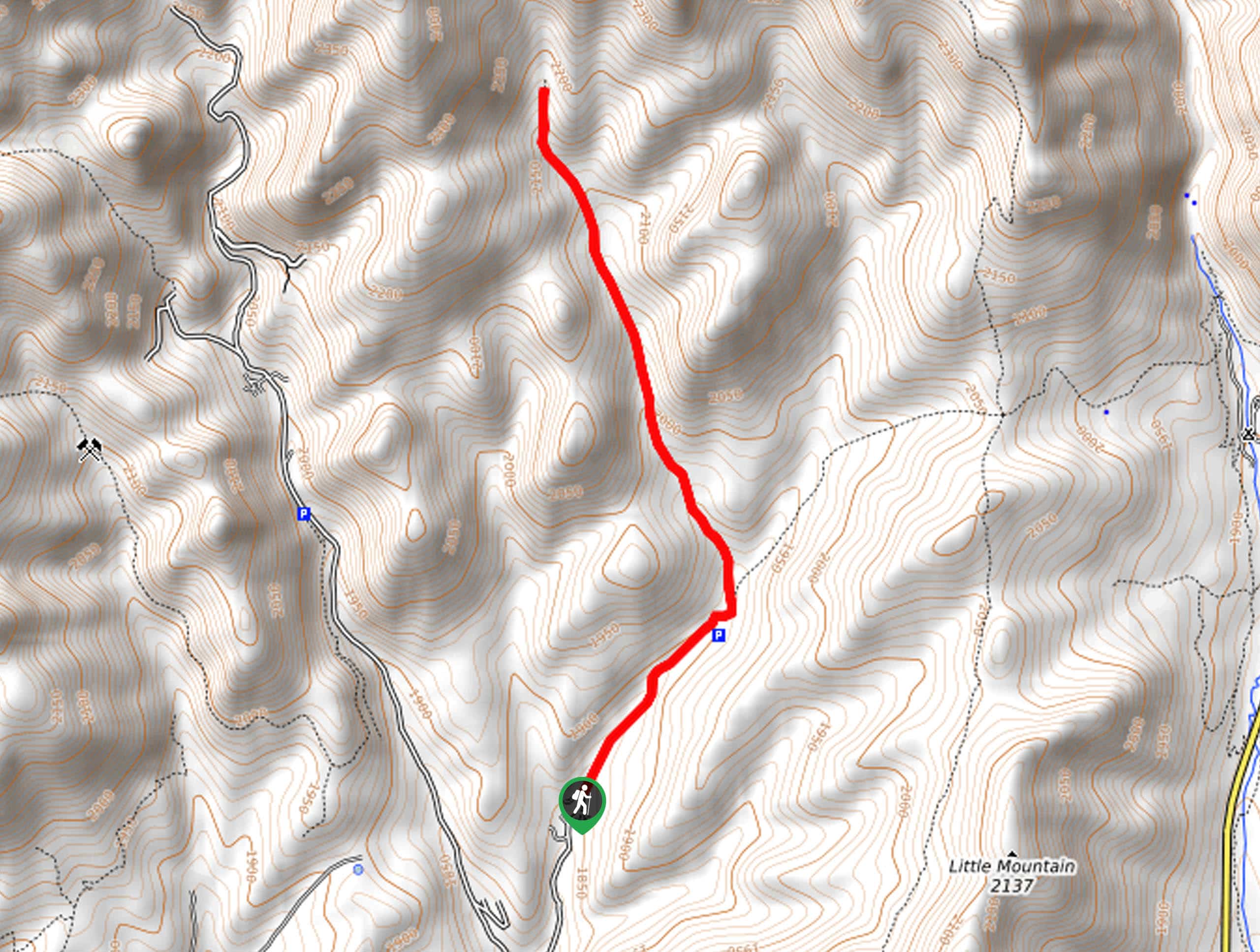
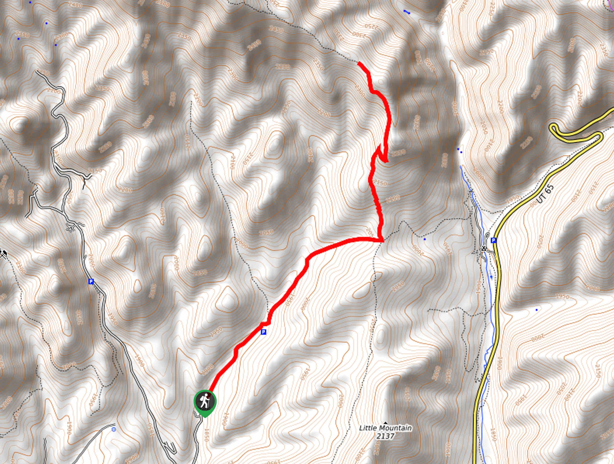
86. The Little Mountain Trail
Difficulty
The Little Mountain Trail is a gorgeous hiking route in the Emigration Canyon Wilderness Area.… Read More
87. Salt Lake Overlook via the Desolation Trail
Difficulty
The Salt Lake Overlook via the Desolation Trail is a moderately challenging route in the… Read More

88. Rattlesnake Loop
Difficulty
The Rattlesnake Loop is a beautiful hiking circuit in the Uinta-Wasatch-Cache National Forest. Located east… Read More
89. Mill A Basin Trail
Difficulty
The Mill A Basin Trail is a beautiful hike in the Uinta-Wasatch-Cache National Forest just… Read More
90. 10420 Peak
Difficulty
The 10420 Peak Trail is a moderately challenging route just east of Brighton Resort, Utah.… Read More
91. Broads Fork Trail
Difficulty
The Broads Fork Trail is a beautiful and challenging hike in the Twin Peaks Wilderness… Read More
92. Moss Ledge Waterfall Trail
Difficulty
The Moss Ledge Waterfall Trail is a beautiful destination in the Uinta-Wasatch-Cache National Forest east… Read More
93. Bonneville Shoreline Trail Loop
Difficulty
The Bonneville Shoreline Trail Loop is an easy hike along the University of Utah Campus… Read More

94. Church Creek to Pipeline Overlook
Difficulty
The Church Creek to Pipeline Overlook Trail is a gorgeous route in the Uinta-Wasatch-Cache National… Read More
95. The Honeycomb Cliffs Trail
Difficulty
The Honeycomb Cliffs trail is a beautiful route in the Uinta-Wasatch-Cache National Forest. This moderately… Read More
96. The Mineral Fork Trail
Difficulty
The Mineral Fork Trail is a beautiful and challenging hike in the Uinta-Wasatch-Cache National Forest,… Read More
97. Bonneville Shoreline Trail: Mount Ogden Section
Difficulty
The Bonneville Shoreline Trail: Mount Ogden Section is a gorgeous hike through the Uinta-Wasatch-Cache National… Read More
98. Bonneville Shoreline Trail: Y Mountain to Springville
Difficulty
The Bonneville Shoreline Trail: Y Mountain to Springville is a long, beautiful hike outside Provo,… Read More
99. Sunset Peak via Brighton Lakes Trail
Difficulty
Sunset Peak via the Brighton Lakes trail is a popular hiking route with stunning views… Read More
100. Snake Creek Pass and Clayton Peak
Difficulty
The Snake Creek and Clayton Peak Trail is a gorgeous hike in the Brighton Resort… Read More
101. Killyon Canyon to Lookout Peak
Difficulty
The Killyon Canyon to Lookout Peak Trail is a beautiful hike through the forest landscape… Read More
102. Killyon Canyon Left Fork
Difficulty
The Killyon Canyon Left Fork Trail is a gorgeous hike through the Uinta-Wasatch-Cache National Forest… Read More

103. Thayne Canyon Trail
Difficulty
The Thayne Canyon Trail is a challenging route in the Mount Olympus Wilderness Area east… Read More
104. Thayne Canyon Loop
Difficulty
The Thayne Canyon Hiking Loop is a beautiful little trail just east of Salt Lake… Read More
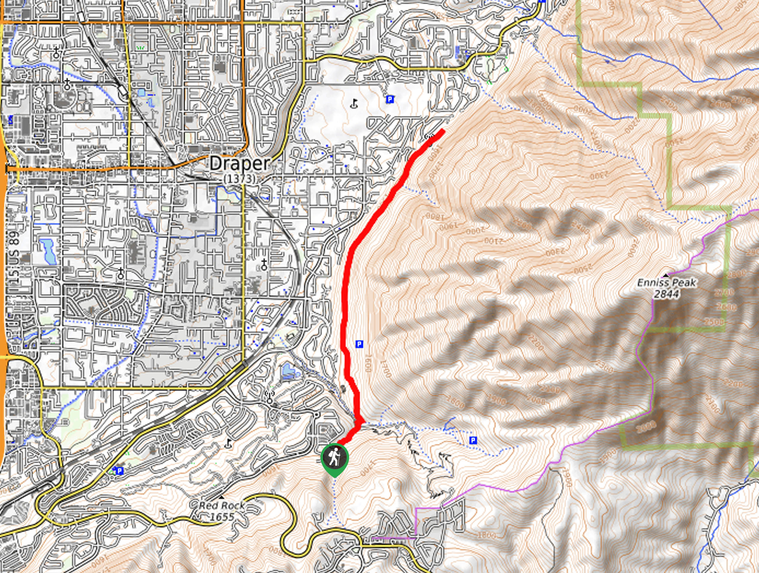
105. The Bonneville Shoreline Trail: Draper Section
Difficulty
The Draper Section of the Bonneville Shoreline Trail is a beautiful, relatively flat hiking route… Read More
106. Porter Fork Trail
Difficulty
The Porter Fork Trail is a beautiful hike through the Uinta-Wasatch-Cache National Forest east of… Read More
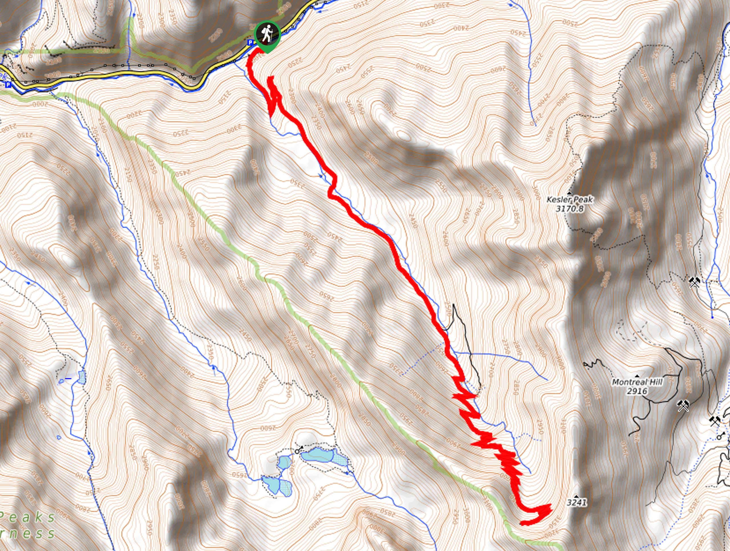
107. Kessler Peak Trail
Difficulty
The Kessler Peak Trail is a challenging hike in the Uinta-Wasatch-Cache National Forest east of… Read More
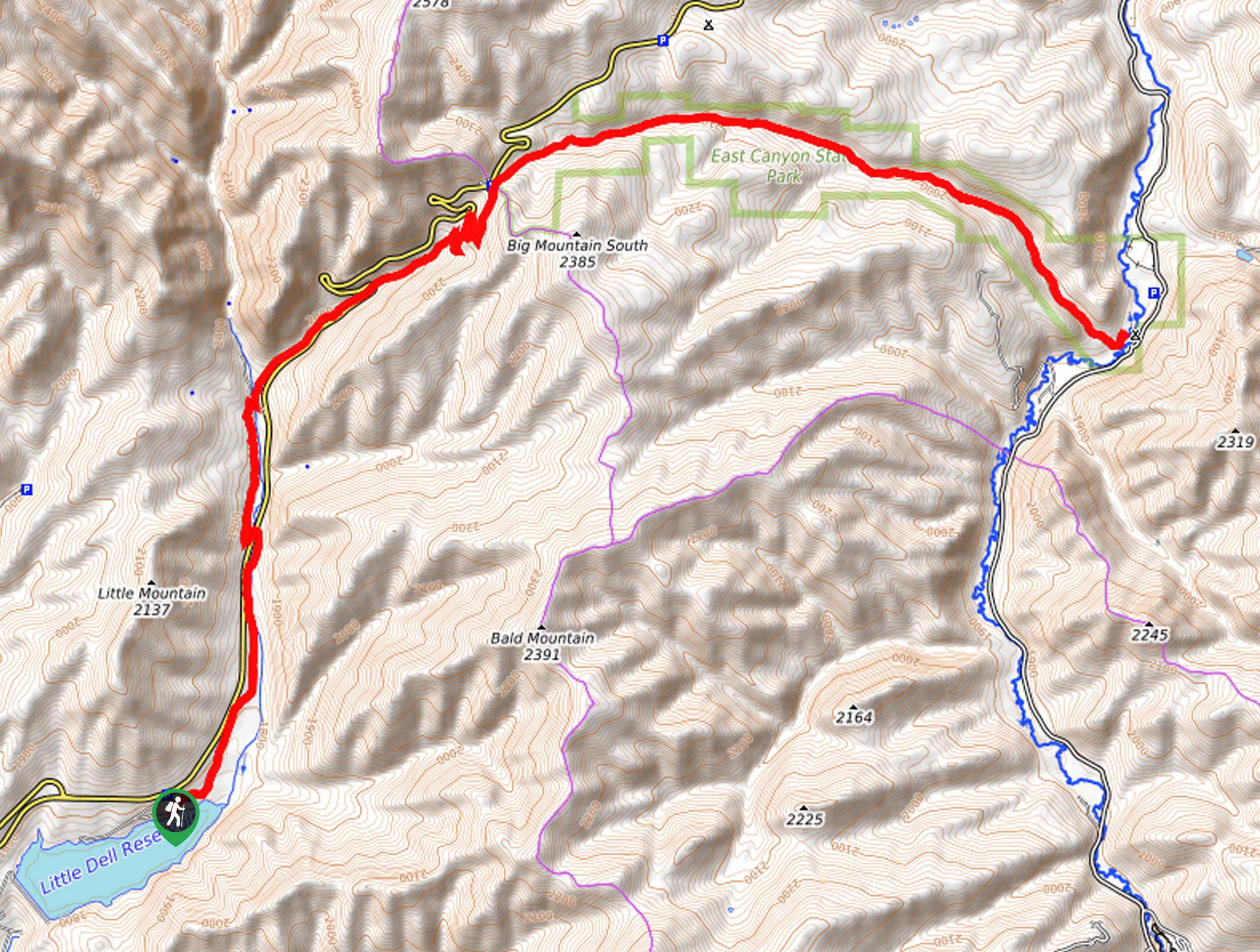
108. Big Mountain Pass in Little Dell Recreation Area
Difficulty
The Big Mountain Pass Trail is a gorgeous route in the Little Dell Recreation Area… Read More
109. Shadow Lake Trail
Difficulty
The Shadow Lake Trail is a gorgeous route east of Salt Lake City, Utah. This… Read More
110. Parley’s Lane Switchback Trail
Difficulty
Parley’s Lane Switchback Trail is a lovely hiking route in Park City, Utah. This trail… Read More
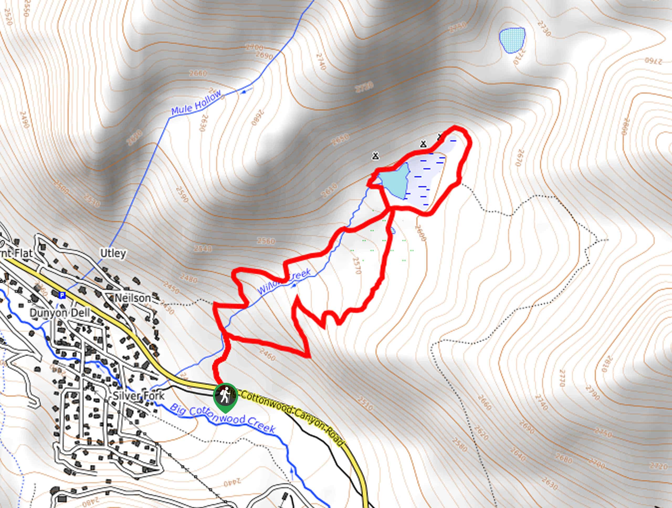
111. Silver Fork Trail
Difficulty
The Silver Fork Trail is a gorgeous hiking route east of Salt Lake City. This… Read More
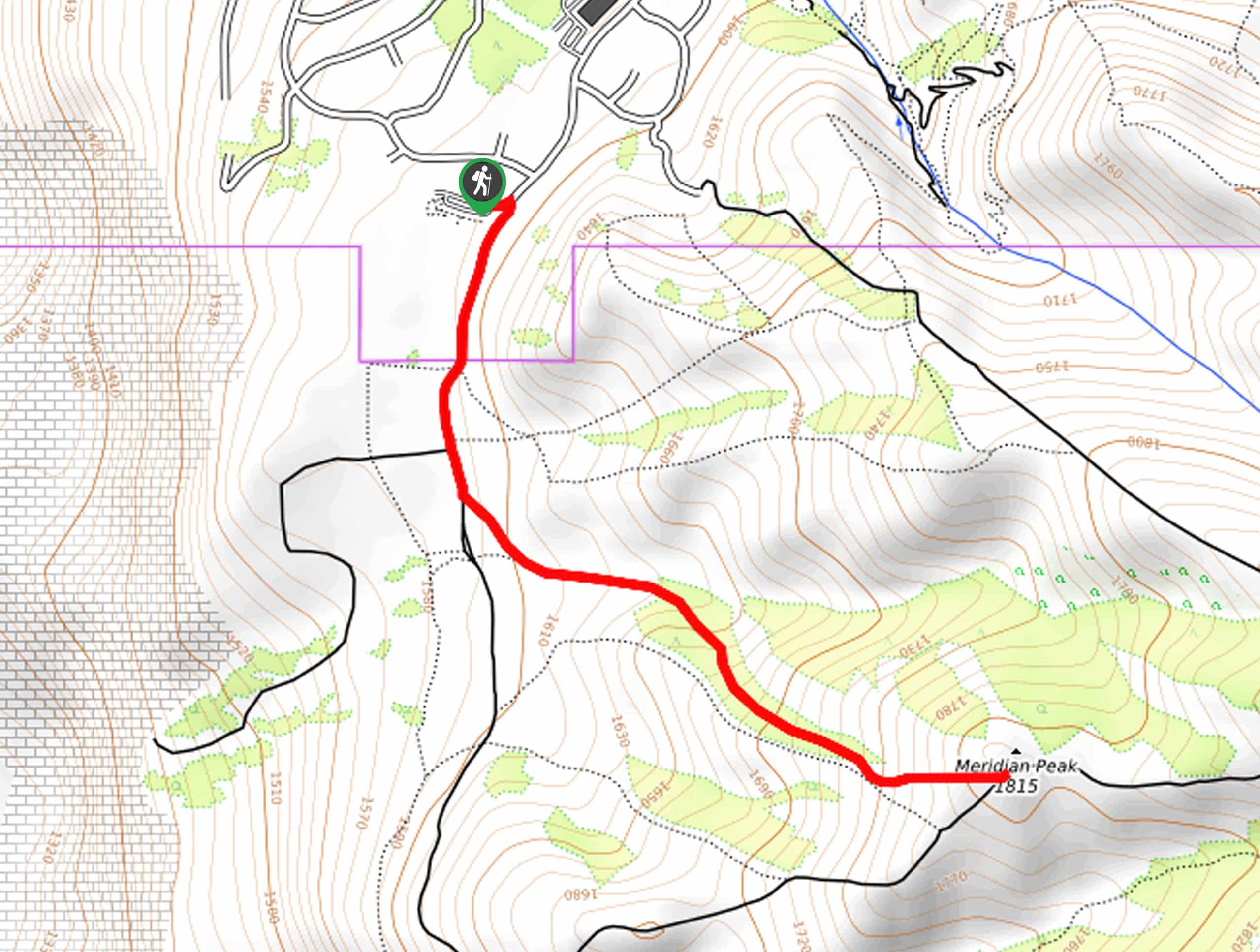
112. Meridian Peak Trail
Difficulty
The Meridian Peak Trail is a short and sweet summit hike north of Salt Lake… Read More
113. Bonneville Shoreline Trail: University of Utah to Emigration Canyon Road
Difficulty
The hike from the University of Utah to Emigration Canyon Road via the Bonneville Shoreline… Read More
114. Toledo Bowl via Cardiff Pass Trail
Difficulty
The Toledo Bowl via Cardiff Pass trail is a beautiful little hike through the Uinta-Wasatch-Cache… Read More
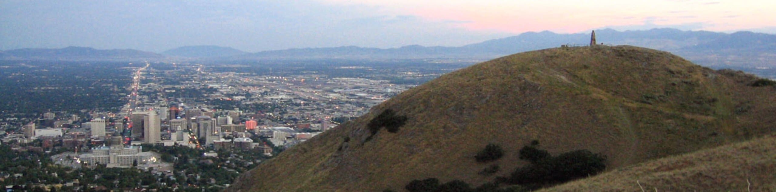
115. Ensign Peak via Hell Canyon Trail
Difficulty
The Ensign Peak via Hell Canyon Trail is a popular hiking route in Salt Lake… Read More
116. Albion Meadows, Sugarloaf Pass, and Collins Road Loop
Difficulty
The Albion Meadows, Sugarloaf Pass, and Collins Road Loop is the track used by the… Read More
117. Bonneville Shoreline Trail: Fernwood Rec Area to East Mountain Wilderness Park
Difficulty
The hike along the Bonneville Shoreline Trail from the Fernwood Recreation Site to East Mountain… Read More
118. White Pine Hollow Trail
Difficulty
The White Pine Hollow Trail is an adventurous route for experienced hikers. This trail includes… Read More
119. Morris Reservoir and Valleyview via the Bonneville Shoreline Trail
Difficulty
The Bonneville Shoreline Trail: Morris Reservoir and Valleyview is a beautiful hike just north of… Read More
120. Jordan River Parkway Trail: Murray Section
Difficulty
A hike along the Jordan River Parkway Trail: Murray Section is a lovely way to… Read More
121. The Great Western Trail Loop
Difficulty
The Great Western Trail Loop is a beautiful hike in the Uinta-Wasatch-Cache National Forest. This… Read More
122. The Great Western Trail to Lookout Peak
Difficulty
The Great Western Trail to The Lookout Peak Trail is a great hike east of… Read More
123. The Bonneville Shoreline Trail: Canyon Entrance Park to Green Canyon
Difficulty
The Bonneville Shoreline Trail from Entrance Canyon Park to Green Canyon is a lovely little… Read More
124. The Bonneville Shoreline Trail: East Orem Section
Difficulty
The Bonneville Shoreline Trail: East Orem Section is a beautiful hike in the Mount Timpanogos… Read More
125. Bonneville Shoreline Trail: Hidden Valley Highlands to Draper
Difficulty
The Bonneville Shoreline Trail from the Hidden Valley Highlands to Draper is a beautiful, well-maintained… Read More
126. The Bonneville Shoreline Trail via Coyote Hollow Trailhead
Difficulty
The Bonneville Shoreline Trail from Coyote Hollow is a gorgeous route on the eastern edge… Read More
127. The Bonneville Shoreline Trail Double Loop
Difficulty
The Bonneville Shoreline Trail Double Loop is a beautiful hike in Salt Lake City. This… Read More
128. Meridian Peak via Ensign Peak Trailhead
Difficulty
Meridian Peak via the Ensign Peak Trailhead is a gorgeous hike in Salt Lake City,… Read More
129. Limekiln to Dry Creek Loop
Difficulty
The Limekiln to Dry Creek Loop is a beautiful hike with gorgeous forest views just… Read More
130. The Deer Path Trail
Difficulty
The Deer Path Trail is a beautiful but rugged hiking trail in the Uinta-Wasatch-Cache National… Read More
131. Desolation Ridge Trail
Difficulty
The Desolation Ridge Trail is a challenging route east of Salt Lake City. This trail… Read More
132. Little Water Peak Loop
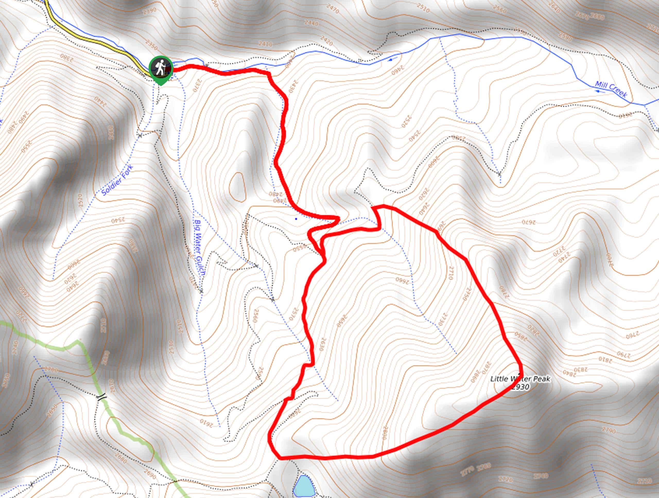
Difficulty
Little Water Peak is a challenging 5.0mi hike in the beautiful Uinta-Wasatch-Cache National… Read More
133. Pioneer Fork Trail
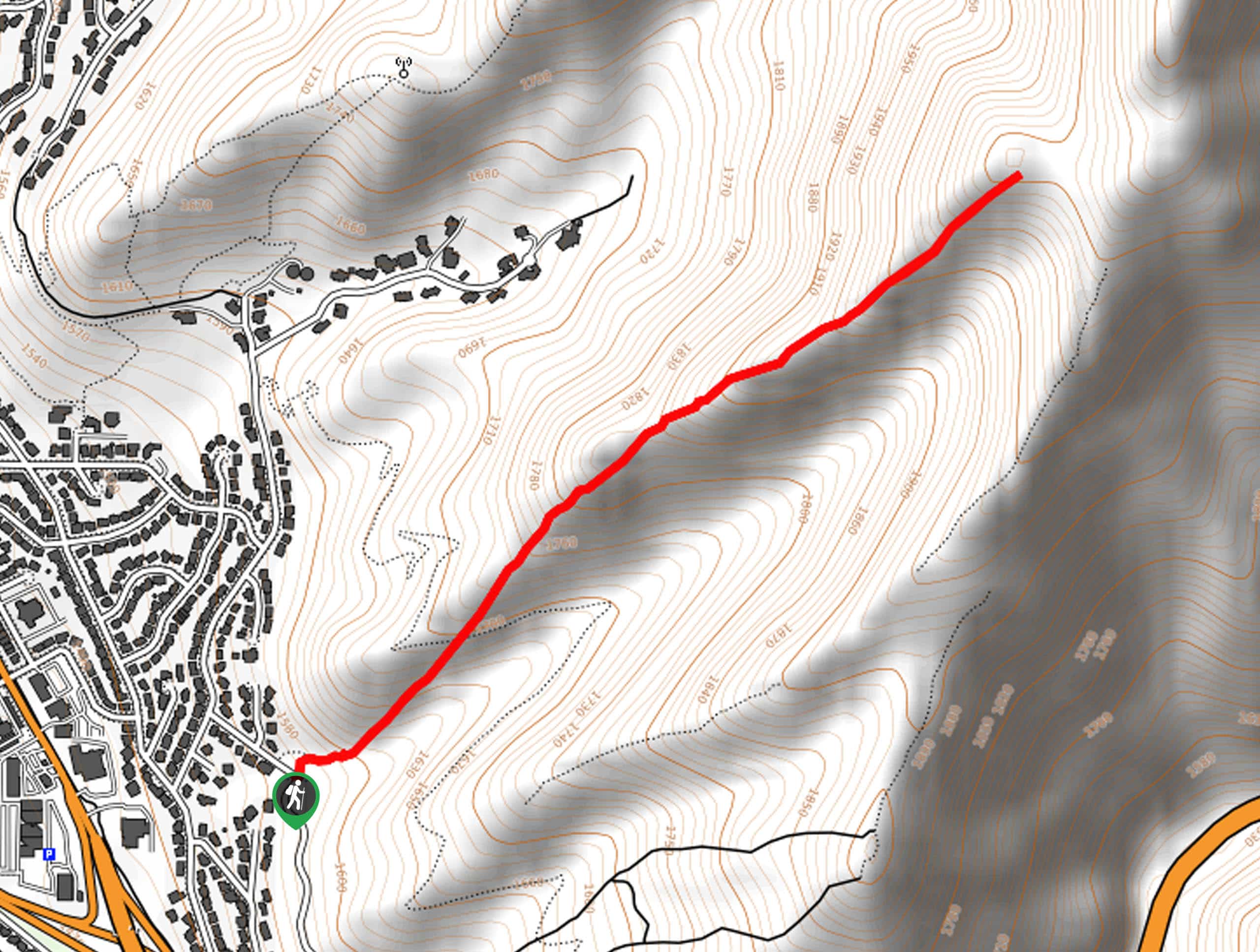
Difficulty
The Pioneer Fork Trail is a short, low-traffic hike in Salt Lake City, Utah. This… Read More
134. Brighton Peaks Loop
Difficulty
The Brighton Peaks Loop is a challenging hike for experienced adventurers. This ambitious route tours… Read More
135. Big Cottonwood Canyon Trail
Difficulty
The Big Cottonwood Canyon Trail is a well-maintained path in Salt Lake City, Utah. This… Read More
136. City Creek to Valley View Ridge Trail
Difficulty
The City Creek to Valley View Ridge Trail is a fantastic route in City Creek… Read More
137. Beartrap Fork and Desolation Lake Trail
Difficulty
The Beartrap Fork and Desolation Lake Trail is a fantastic route in the Uinta-Wasatch-Cache National… Read More
138. Crestwood Gulch Loop
Difficulty
The Crestwood Gulch Loop is a beautiful trail in the Uinta-Wasatch-Cache National Forest east of… Read More
139. Tri-County Peak
Difficulty
The Tri-County Peak Trail is a lovely, moderately-challenging hike near Park City, Utah. This trail… Read More
140. Houndstooth Trail
Difficulty
The Houndstooth Trail is a challenging hike in the Twin Peaks Wilderness Area. This route… Read More
141. Greens Basin Trail
Difficulty
The Greens Basin Trail is a beautiful hike in the Uinta-Wasatch-Cache National Forest. This trail… Read More
142. Millvue Peak Trail
Difficulty
The Millvue Peak Trail is a beautiful hike in the Uinta-Wasatch-Cache National Forest. This trail… Read More
143. Killyons Ridgeline
Difficulty
Killyons Ridgeline Trail is a gorgeous route in the Uinta-Wasatch-Cache National Forest. This trail is… Read More
144. The Hump
Difficulty
The Hump is a fantastic hike in Salt Lake City, Utah. This trail is moderately… Read More

145. Little Mountain Ridge Trail
Difficulty
The Little Mountain Ridge Trail is a beautiful hike on the outskirts of Salt Lake… Read More
146. Scotts Pass via the Great Western Trail
Difficulty
Scotts Pass via the Great Western Trail is a gorgeous route east of Salt Lake… Read More
147. Mount Raymond via Bowman Fork Trail
Difficulty
The hike to the top of Mount Raymond via the Bowman Fork is a challenging… Read More
148. Knowlton’s Knob via The Miner’s Trail
Difficulty
Knowlton’s Knob via the Miner’s Trail is a gorgeous hike east of Salt Lake City.… Read More

149. City Creek Canyon Road
Difficulty
The City Creek Canyon Road is a popular trail just north of downtown Salt Lake… Read More

150. Solitude to Beaver Pond Trail
Difficulty
The Solitude to Beaver Ponds Trail is a beautiful hike through the Uinta-Wasatch-Cache National Forest.… Read More

151. Willow Hollow, Ridge, and Pine Hollow Trail
Difficulty
The Willow Hollow and Pine Hollow Trail is a beautiful route in the Uinta-Wasatch-Cache National… Read More
Are we missing your favourite hike?
Tell us! If you've got photos, a GPS track and know the hike, we'd love to share your favourite hike with the rest of the 10Adventures community.