
Houndstooth Trail
View Photos
Houndstooth Trail
Difficulty Rating:
The Houndstooth Trail is a challenging hike in the Twin Peaks Wilderness Area. This route is rugged with rocky terrain and scrambly sections. If you are up for an adventurous day and a serious workout, this trail is the one for you.
Getting there
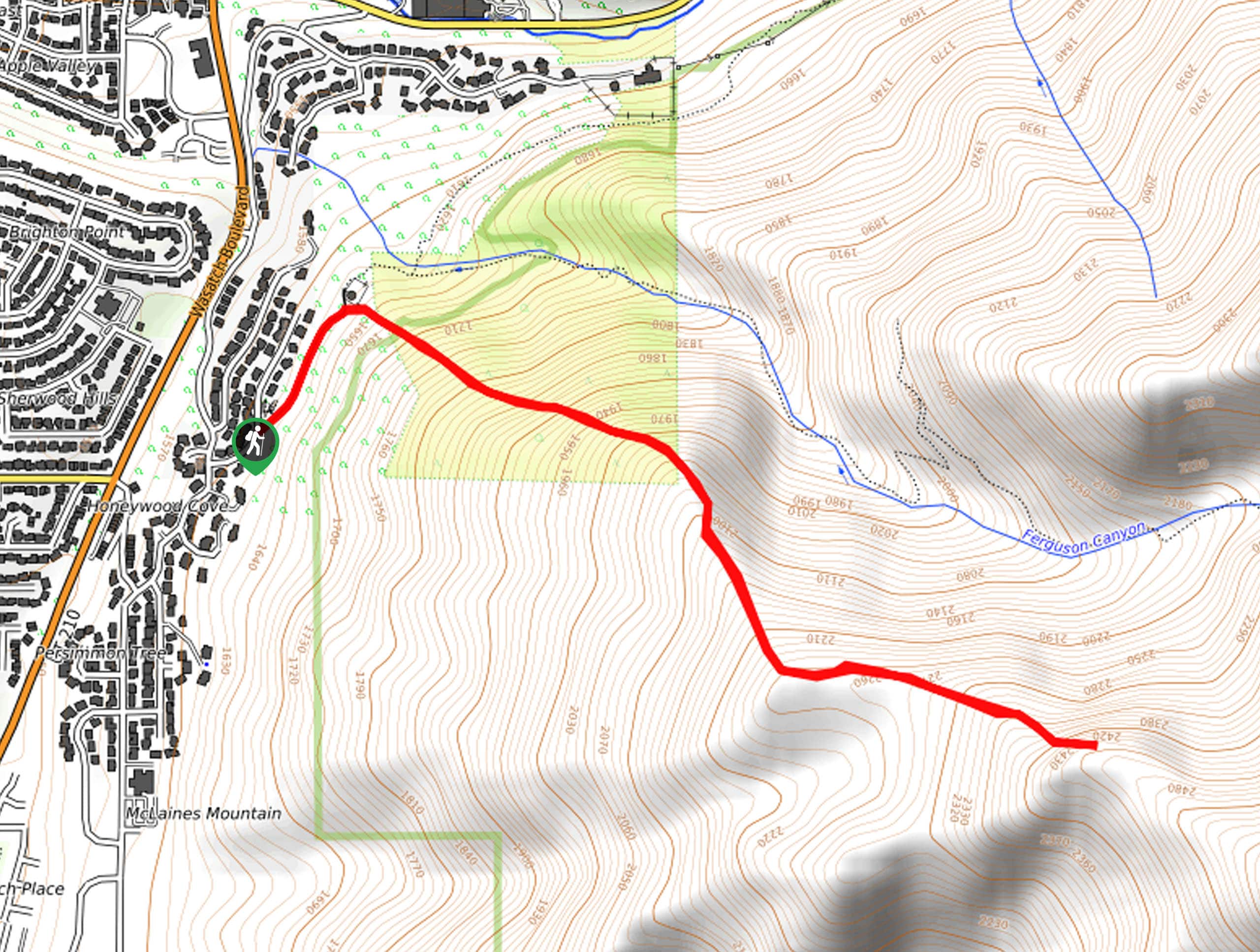
The Houndstooth Trail begins on the east side of Timberline drive on the eastern edge of Cottonwood Heights, Utah.

About
| Backcountry Campground | No |
| When to do | May to September |
| Pets allowed | No |
| Family friendly | No |
| Route Signage | Average |
| Crowd Levels | Low |
| Route Type | Out and back |
Houndstooth Trail
Elevation Graph
Weather
Houndstooth Trail Description
The Houndstooth Trail is a challenging route for experienced adventurers. This trail is tough, with a steep and rocky scramble to the top. As if the physical challenge isn’t enough, this trail is also home to a large population of rattlesnakes, so be sure to keep your eyes peeled and your ears perked. Most of this route follows an overgrown and rugged trail, so hikers should be experienced in route finding. The final push to the top is very exposed and scrambly, so this is not the route for you if you are uncomfortable with heights. However, if you are up for a true adventure and willing to work for your views, The Houndstooth Trail will test your spirit and reward your effort.
From the trailhead on Timberline Drive, follow Ferguson Canyon Trail northeast for 0.2mi before splitting off and following the primitive trail southeast to the top of Houndstooth.
At the top, take a well-deserved rest and enjoy the incredible views before turning back and carefully following your footsteps back to the trailhead where you began.
Similar hikes to the Houndstooth Trail hike

Willow Hollow, Ridge, and Pine Hollow Trail
The Willow Hollow and Pine Hollow Trail is a beautiful route in the Uinta-Wasatch-Cache National Forest. This trail is an…

Solitude to Beaver Pond Trail
The Solitude to Beaver Ponds Trail is a beautiful hike through the Uinta-Wasatch-Cache National Forest. This trail is lush and…

City Creek Canyon Road
The City Creek Canyon Road is a popular trail just north of downtown Salt Lake City, Utah. This path is…
Comments