
Tri-County Peak
View PhotosTri-County Peak
Difficulty Rating:
The Tri-County Peak Trail is a lovely, moderately-challenging hike near Park City, Utah. This trail is a consistent climb to a small summit point with lovely forest views. Dogs are permitted on this route but please respect on-leash/off-leash area signage.
Getting there
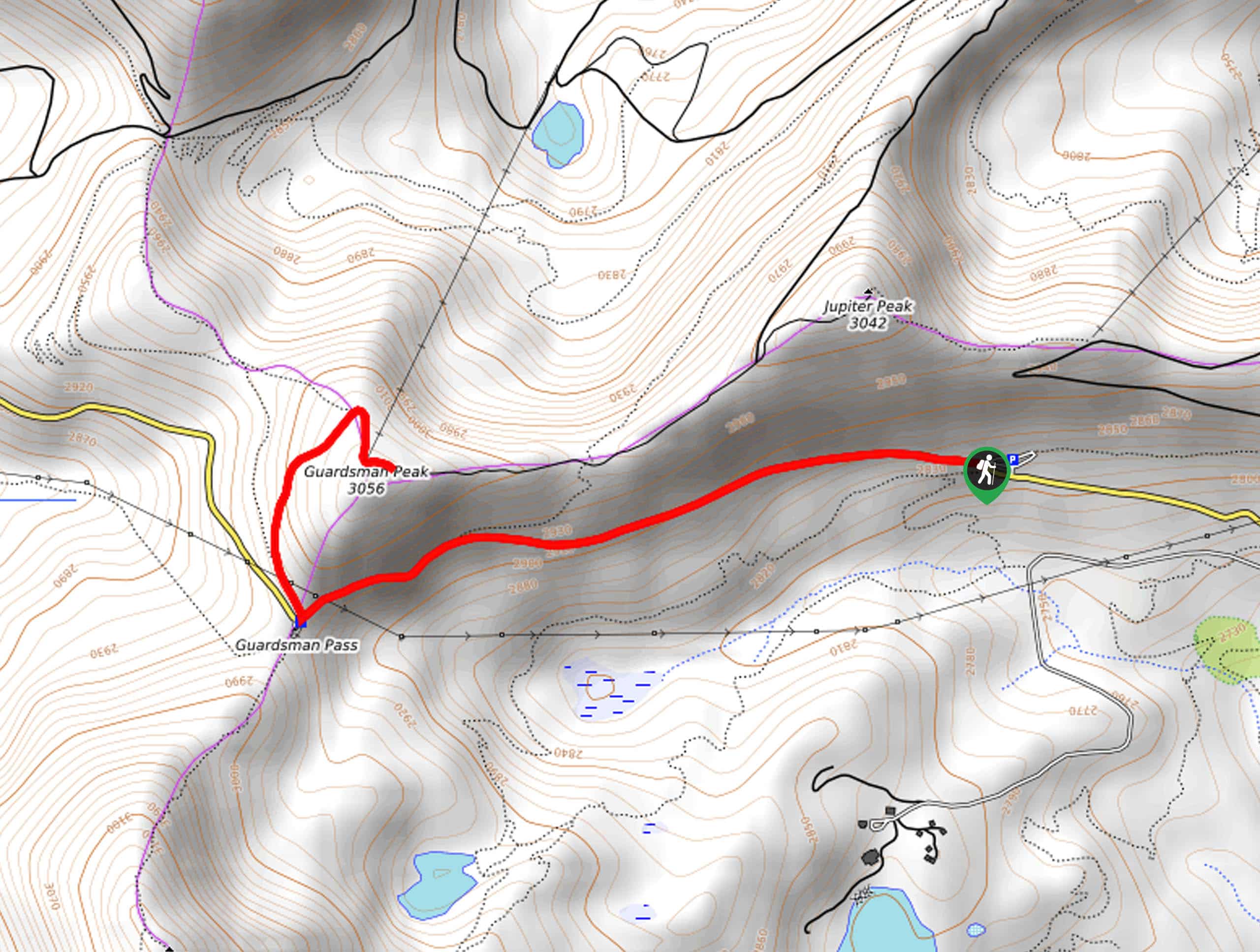
This hike begins at the Bloods Lake Trailhead on Highway 190 east of Salt Lake City.

About
| Backcountry Campground | No |
| When to do | May to October |
| Pets allowed | Yes |
| Family friendly | Older Children only |
| Route Signage | Average |
| Crowd Levels | High |
| Route Type | Out and back |
Tri-County Peak
Elevation Graph
Weather
Tri-County Peak Description
The Tri-County Peak Trail is a beautiful hike in the Uinta-Wasatch-Cache National forest west of Park City, Utah. This trail is moderately challenging with a consistent incline, so we recommend this hike for families with older children. Be sure to bring lots of water and a camera as the consistent climb will lead you to a wonderful summit viewpoint overlooking the Utah wilderness.
From the Bloods Lake Trailhead, follow highway 190 west, then turn right to head north at Guardsman Pass. After a few hundred yards, you will reach a split in the trail, take the path on the right and continue north for 0.3mi to another divide. Finally, take the right-hand path once again to hike the final stretch up to the top of Tri-County Peak.
At the top, take a rest and enjoy the summit views before turning around and following your footsteps back to the trailhead.
If you are looking for a longer adventure, this hike can be combined with the Shadow Lake Loop, although please note that dogs are not permitted at Shadow Lake.
Similar hikes to the Tri-County Peak hike

Willow Hollow, Ridge, and Pine Hollow Trail
The Willow Hollow and Pine Hollow Trail is a beautiful route in the Uinta-Wasatch-Cache National Forest. This trail is an…

Solitude to Beaver Pond Trail
The Solitude to Beaver Ponds Trail is a beautiful hike through the Uinta-Wasatch-Cache National Forest. This trail is lush and…

City Creek Canyon Road
The City Creek Canyon Road is a popular trail just north of downtown Salt Lake City, Utah. This path is…
Comments