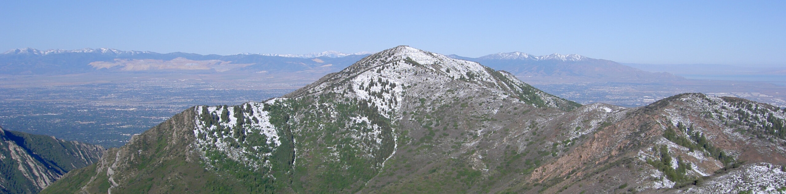
Grandeur Peak East Trail from Church Fork
View Photos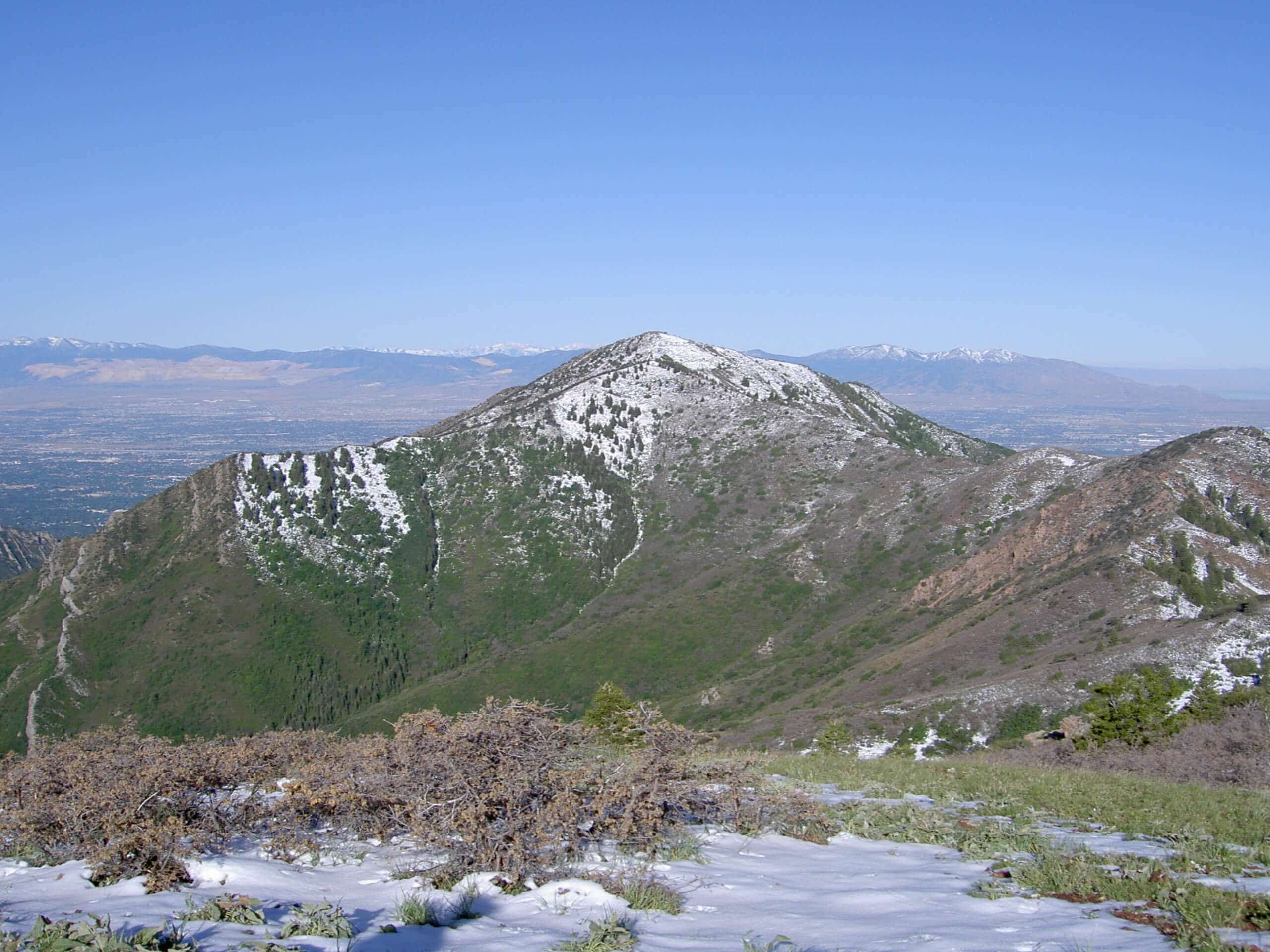
Grandeur Peak East Trail from Church Fork
Difficulty Rating:
The Grandeur Peak East Trail is a fantastic route for experienced hikers. This trail is a steep, rocky route up to a summit point with incredible views. Start this hike early in the morning to catch sunrise at the peak if you are feeling ambitious and are looking for an especially spectacular experience.
Getting there
This trail begins at the Church Fork Picnic Area on the north side of Mill Creek Canyon Road, east of Salt Lake City.

About
| Backcountry Campground | No |
| When to do | Year-round |
| Pets allowed | Yes - Off leash |
| Family friendly | No |
| Route Signage | Average |
| Crowd Levels | High |
| Route Type | Out and back |
Grandeur Peak East Trail from Church Fork
Elevation Graph
Weather
Grandeur Peak East Trail from Church Fork Description
The Grandeur Peak East Trail is a beautiful, challenging route for experienced hikers. In the summer, this trail really heats up in the afternoon sun. Start early in the day to complete the hike before the trail becomes unbearably hot. If you are hiking this route in the winter, traction devices such as microspikes are essential as the trail becomes very icy and treacherous. Hiking poles can be a great help along this route at any time of year to aid with your ascent along the steep and rocky sections and provide stability and support on the way back down.
No matter what season you hike in, you will want to bring along the camera. The views along this trail are absolutely stunning, not to mention the incredible vistas you earn from the summit. The hike up may leave your muscles burning but we promise that the effort is worth it.
From the trailhead at the Church Fork Picnic Area, follow the path north. Just beyond the picnic area, the trail will be intersected by the Pipeline Trail, just stay on the path straight ahead at this intersection. From the intersection, continue up the trail as it follows Church Fork for 0.7mi then begin your climb up the switchbacks heading west. As you make your way up the switchbacks, the Mill Crest trail will merge with the Grandeur Peak Trail from the north. Continue ahead for 0.7mi from this junction to the summit of Grandeur Peak.
Take a well deserved rest atop Grandeur Peak and enjoy the incredible views of the valley below and Salt Lake City beyond. When you’re ready to head home, simply follow the same route back down to the Church Fork Picnic Area where you began.
Frequently Asked Questions
How long is the Grandeur Peak Trail?
The hike to the top of Grandeur Peak East Trail via Church Fork is 5.9mi long.
Are dogs allowed on Grandeur Peak?
Dogs are allowed on the Grandeur Peak East Trail but please keep in mind that this is a strenuous hike with almost no shade and may not be appropriate for all dogs. If you do bring your dog, make sure you have enough water for yourself and your pup.
Insider Hints
This trail can be hiked year round, however traction devices such as microspikes are essential for winter travel
In the summer, start early in the day to beat the heat
This summit can also be reached via the Grandeur Peak West Face Trail or done as a loop (Grandeur Peak Loop)
Similar hikes to the Grandeur Peak East Trail from Church Fork hike

Willow Hollow, Ridge, and Pine Hollow Trail
The Willow Hollow and Pine Hollow Trail is a beautiful route in the Uinta-Wasatch-Cache National Forest. This trail is an…

Solitude to Beaver Pond Trail
The Solitude to Beaver Ponds Trail is a beautiful hike through the Uinta-Wasatch-Cache National Forest. This trail is lush and…

City Creek Canyon Road
The City Creek Canyon Road is a popular trail just north of downtown Salt Lake City, Utah. This path is…
Comments