
Limekiln to Dry Creek Loop
View Photos
Limekiln to Dry Creek Loop
Difficulty Rating:
The Limekiln to Dry Creek Loop is a beautiful hike with gorgeous forest views just outside of Salt Lake City, Utah. This trail is short but moderately challenging with a steep ascent. The Limekiln to Dry Creek Loop is an appropriate challenge for families with older children.
Getting there
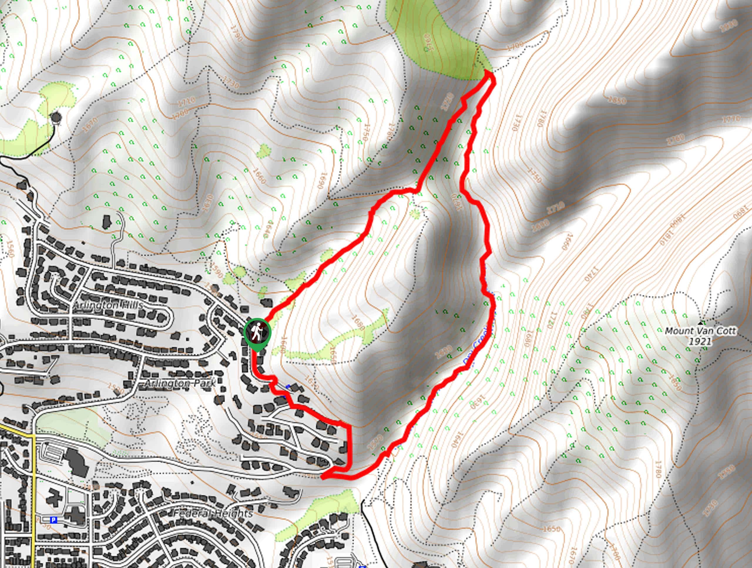
This hike begins on the east side of Tomahawk Drive in Salt Lake City, Utah.

About
| Backcountry Campground | No |
| When to do | Year-round |
| Pets allowed | Yes - On Leash |
| Family friendly | Older Children only |
| Route Signage | Average |
| Crowd Levels | Moderate |
| Route Type | Circuit |
Limekiln to Dry Creek Loop
Elevation Graph
Weather
Limekiln to Dry Creek Loop Description
The Limekiln to Dry Creek Loop is a short and sweet trail in Salt Lake City. This trail may be short, but it is moderately challenging with steep inclines. Hikers should arrive prepared with proper hiking footwear. We recommend bringing along a set of hiking poles to aid your ascents and provide some extra support on the descents. This trail is a beautiful walk through the forest at all times of the year. Located just north of the University of Utah Campus, the Limekiln to Dry Creek Loop is a great spot to go for a study break to clear your head.
To hike this loop, begin on the east side of Tomahawk Drive in Salt Lake City. From the trailhead, follow the Limekiln Gulch Trail northeast. Stay right at the first divide, and go straight at the intersection of trails shortly after. About 0.9mi into your hike, the trail will split into three; take the path on your right-hand side to loop back southwest along the Bonneville Shoreline Trail: Dry Creek Section. Follow the Bonneville Shoreline Trail for one mile, then take your first right to follow Tomahawk Drive back to the trailhead where you began.
If you are looking for more to explore in the area, check out the Mount Van Cott Trail nearby.
Similar hikes to the Limekiln to Dry Creek Loop hike

Willow Hollow, Ridge, and Pine Hollow Trail
The Willow Hollow and Pine Hollow Trail is a beautiful route in the Uinta-Wasatch-Cache National Forest. This trail is an…

Solitude to Beaver Pond Trail
The Solitude to Beaver Ponds Trail is a beautiful hike through the Uinta-Wasatch-Cache National Forest. This trail is lush and…

City Creek Canyon Road
The City Creek Canyon Road is a popular trail just north of downtown Salt Lake City, Utah. This path is…
Comments