Lake Blanche Trail
View Photos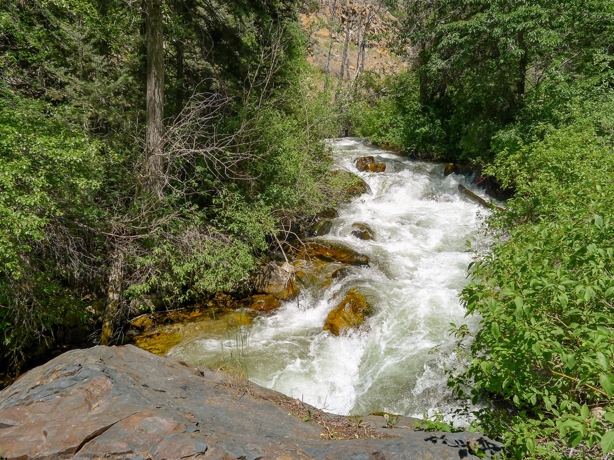
Lake Blanche Trail
Difficulty Rating:
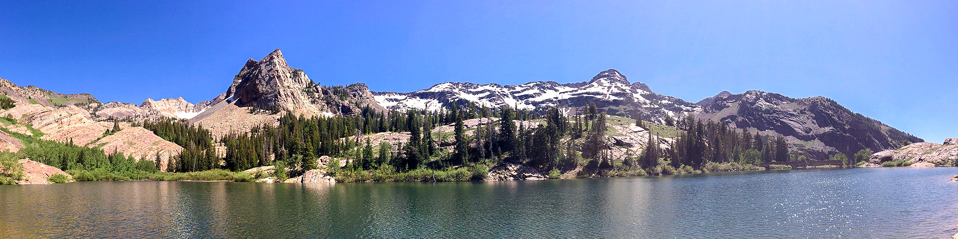
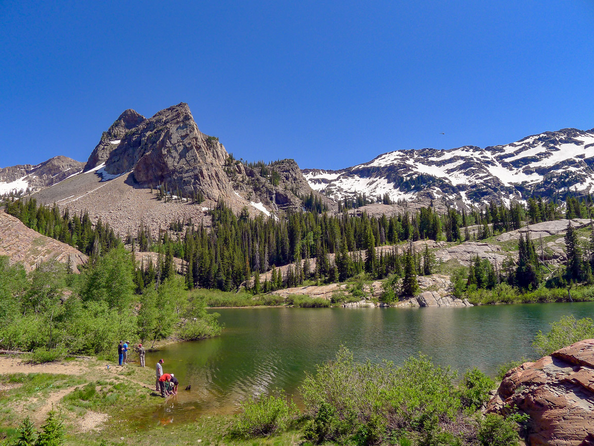
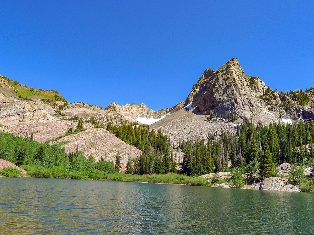
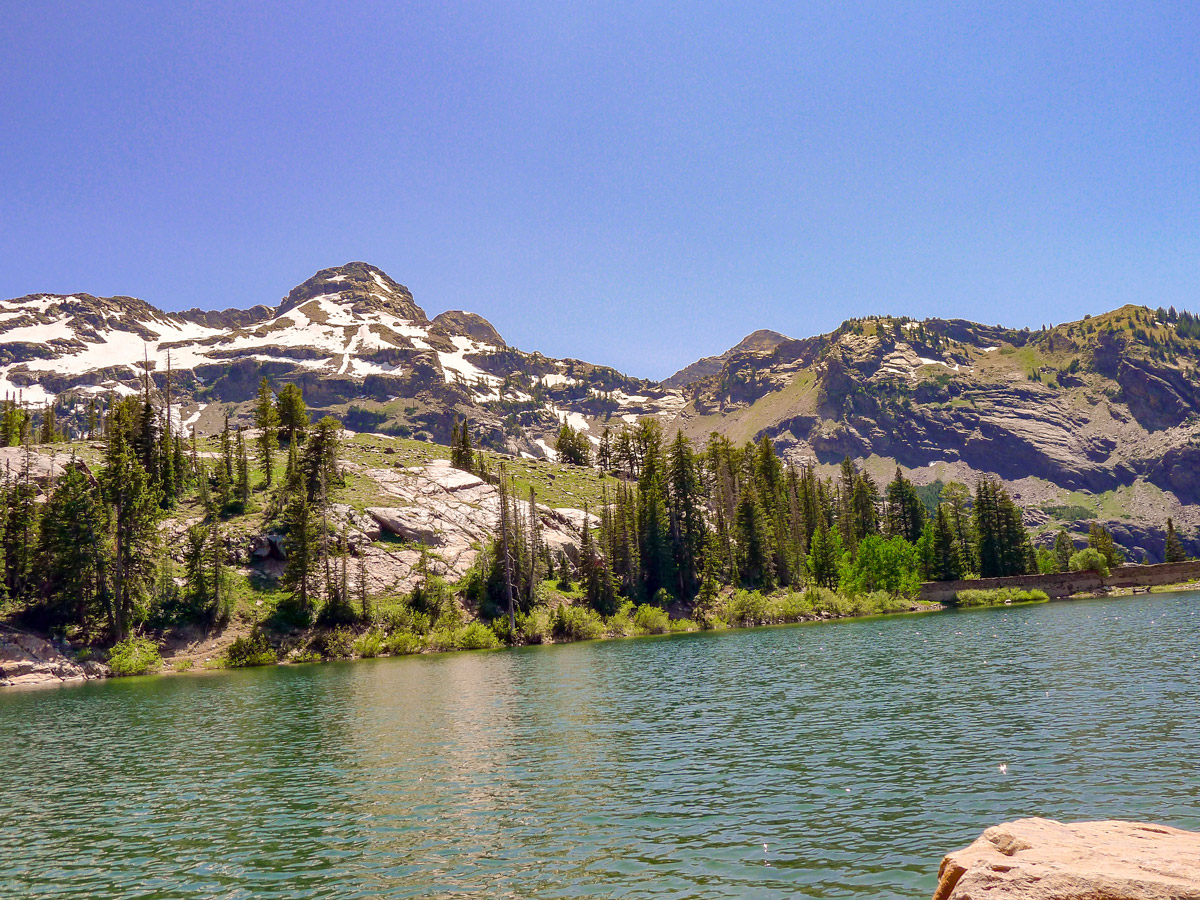
The popular hike up to Lake Blanche is a hotspot for the hikers of Salt Lake City, and for good reason. The stunning alpine lake sits nestled between beautiful, rocky mountains, creating an amazing visual that makes an epic reward for your efforts along the tiring trail.
Getting there
To get to the trailhead of Lake Balance hike, drive up Big Cottonwood Canyon Road for 6.0mi. Look out for a tight switchback in the road and find the Broadsfork Trailhead at the apex of the first turn. The small parking area fills up super fast, and many people end up parking along the narrow road.

About
| When to do | Late spring through early fall |
| Backcountry Campsites | Popular camping at the lake |
| Toilets | At trailhead |
| Family friendly | No |
| Route Signage | Average |
| Crowd Levels | Moderate |
| Route Type | Out and back |
Lake Blanche Trail
Elevation Graph
Weather
Lake Blanche Trail Description
Beginning just past the washrooms, head up the paved walkway and follow the river, where you will soonreach a sign with arrows for the Lake Blanche Trail. You will immediately start to climb up a steep grade that follows along the river, where you will soon pass over the water and find a rest bench. If you need a rest here, you will most likely not make it all the way up to the lake!
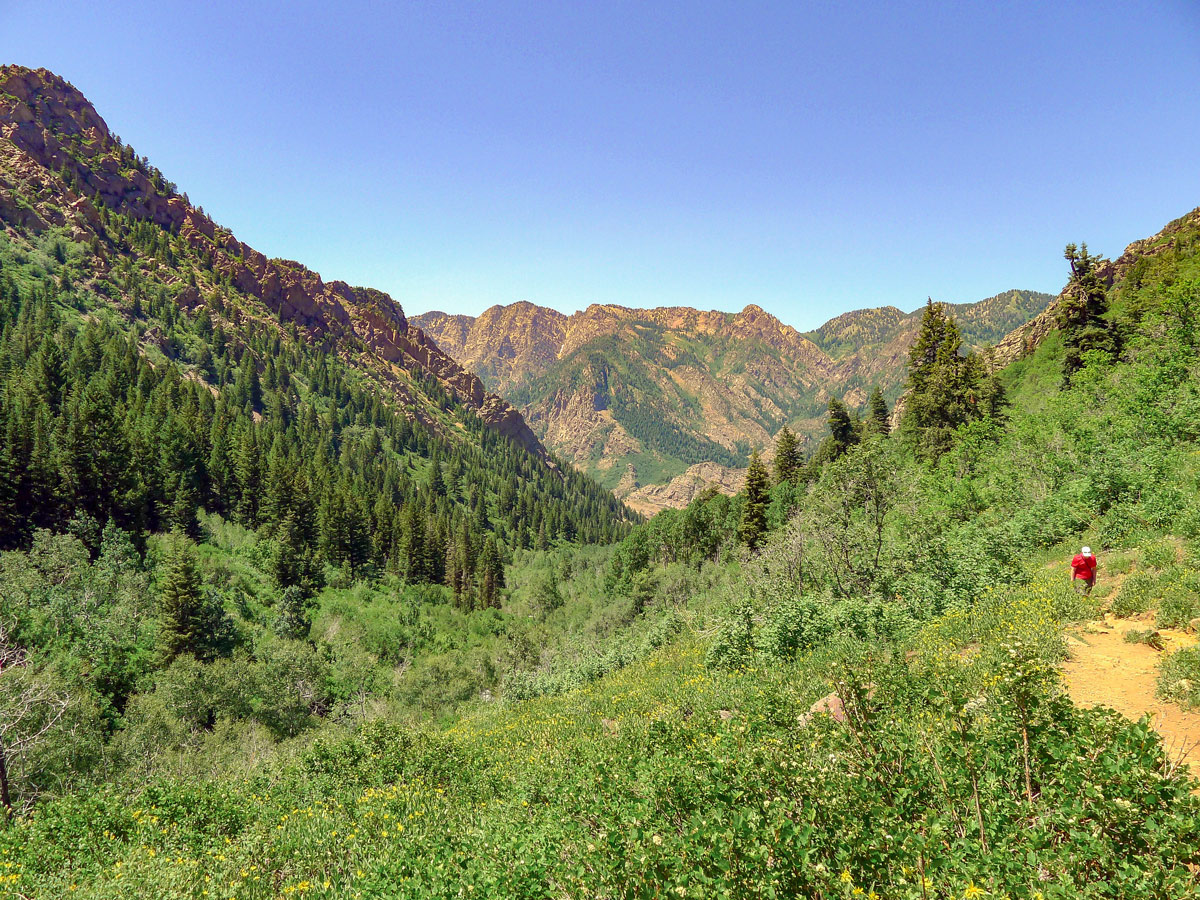
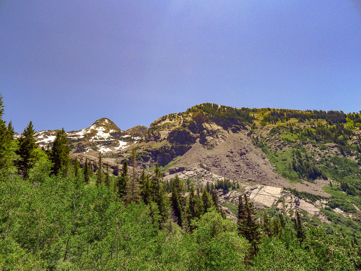
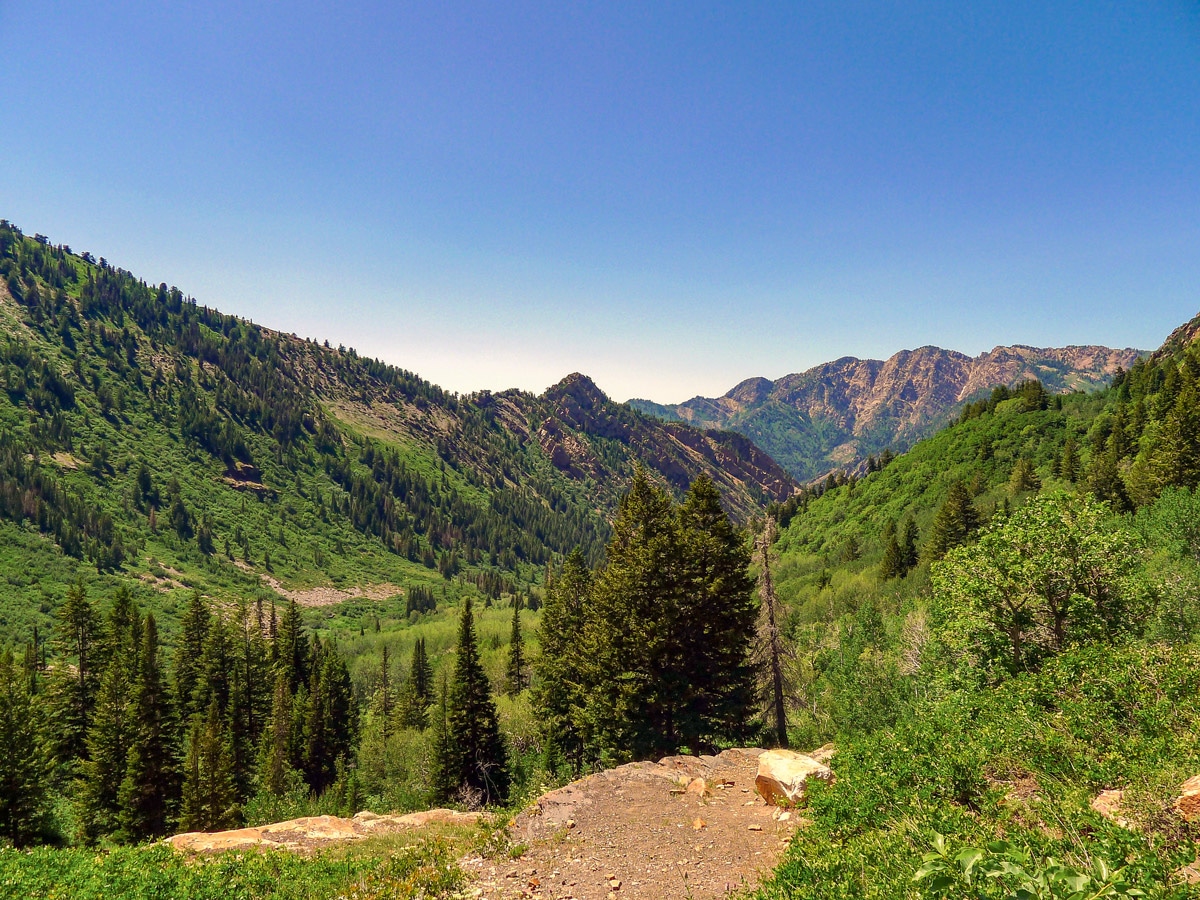
The trail continues, relentlessly gaining elevation, before leading you out of the dense trees and away from the loud river. Looking back, you get stunning views of the opposite side of Big Cottonwood Canyon, including glimpses of Mt. Raymond-another hike on this website.
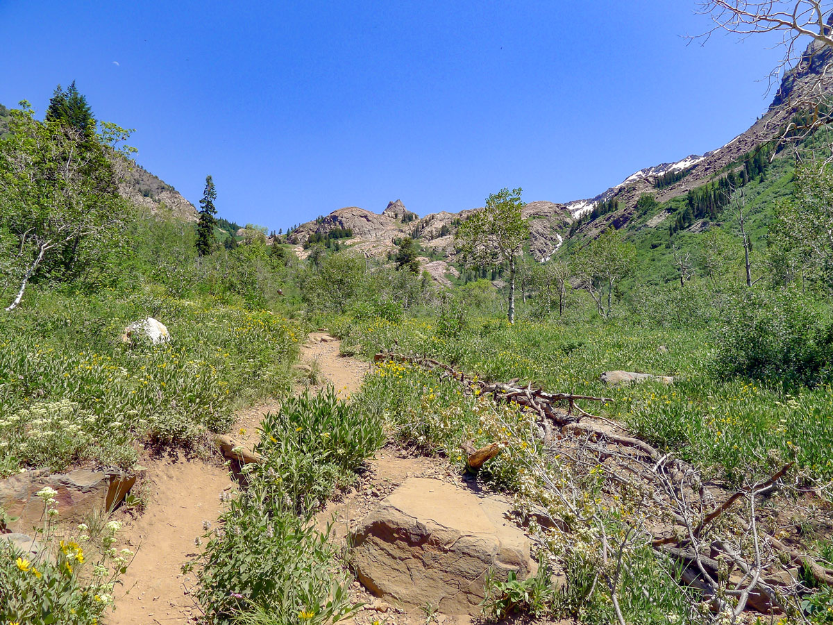
The trail passes through thick cottonwood forests as it keeps ascending, switchbacking occasionally as your quads burn. Finally, the rocky ridge below the lake will come into view and you will know the prize is near.
You will soon crest the ridge and find the gorgeous lake expanding below you. Dromedary Peak to the right and Sundial Peak to the left fill all the space above the lake. Relax on the gently sloping rocks beside the lake to soak in the view and some sun.
You return the way you came.
Frequently asked questions about Lake Blanche
Can you swim in Lake Blanche Utah?
Unfortunately, swimming – along with campfires and dogs – are prohibited at Lake Blanche.
How many miles is Lake Blanche?
This out-and-back trail to Lake Blanche is 6.8mi long.
Can you fish in Utah’s Lake Blanche?
Lake Blanche is an excellent place for fishing, as it is home to a number of species including brown, cutthroat, rainbow, and brook trout.
Insider Hints
Lake Blanche is a popular, easy one-night backpacking trip, or a perfect picnicking lake!
Many fishermen bring their rods up to fish the lake in the spring.
No swimming is allowed since Lake Blanche is part of the Salt Lake City watershed.

Similar hikes to the Lake Blanche Trail hike

Willow Hollow, Ridge, and Pine Hollow Trail
The Willow Hollow and Pine Hollow Trail is a beautiful route in the Uinta-Wasatch-Cache National Forest. This trail is an…

Solitude to Beaver Pond Trail
The Solitude to Beaver Ponds Trail is a beautiful hike through the Uinta-Wasatch-Cache National Forest. This trail is lush and…

City Creek Canyon Road
The City Creek Canyon Road is a popular trail just north of downtown Salt Lake City, Utah. This path is…
ShantiLewis 4 years ago
We went here during summer last year and we enjoyed a lot but beware of snakes when hiking!
Stevie M 4 years ago
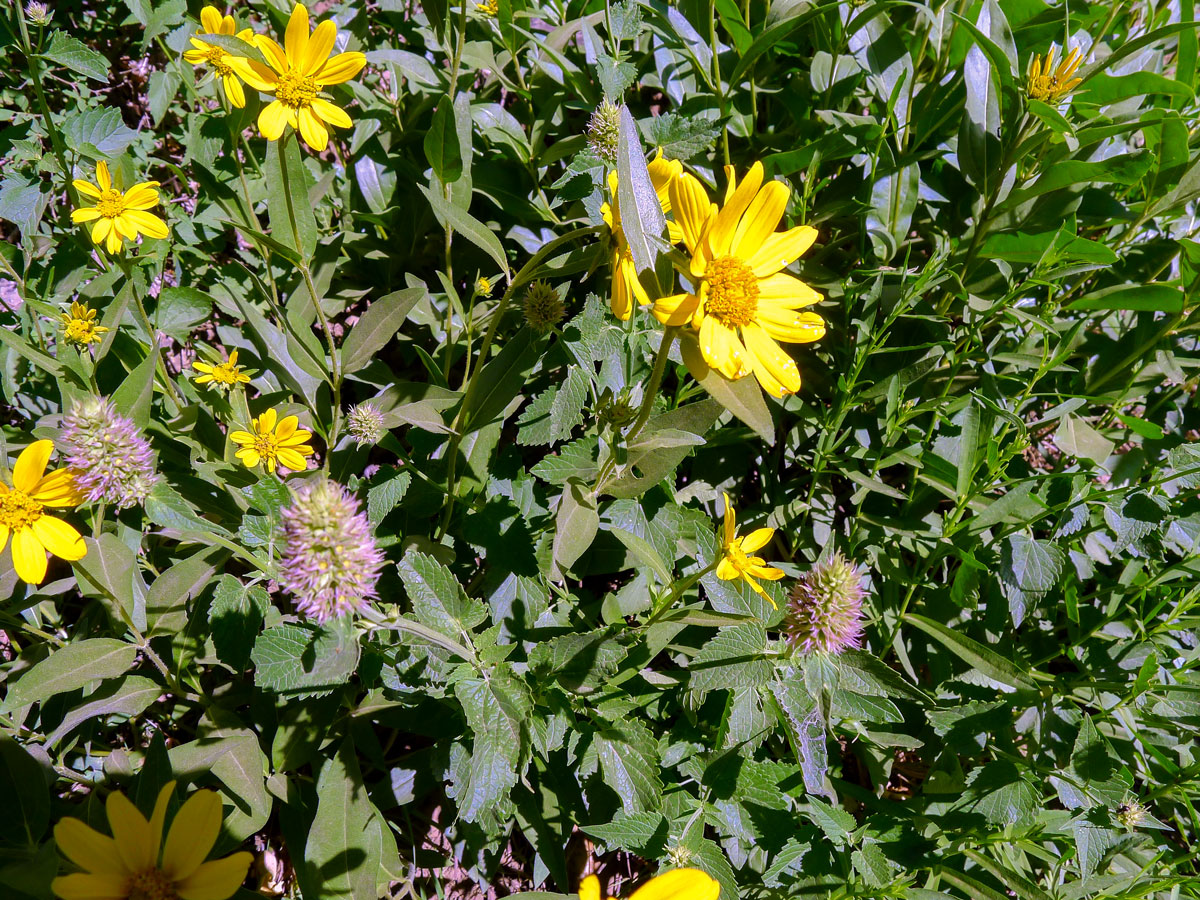
Fantastic hike! Middle length hike with pretty good elevation gain. The lake is beautiful and the views and flowers along the hike were awesome
Yuli H. 4 years ago
It's a beautiful hiking destination consisting of rocky and rugged terrain. The views were magnificent.
Isaiah L. 4 years ago
Lake Blanche is simply mesmerizing. I've seen many lakes in my life before, but I just find this one too gorgeous.
Mariah D. 4 years ago
It was a challenging hike from the beginning until the end. I really felt the abdominal stretch on the way up.
Mitch Reinwick 4 years ago
It was an unbelievable hike that offers great views throughout the journey.
Adriana K. 4 years ago
The views of the Lake were stunning! The atmosphere and surroundings were pleasant!
April O. 4 years ago
I appreciate how they preserve the beauty of the area! They don't allow swimming in the lake.
Melinda J. 4 years ago
Remarkable hike. It's not that easy, but I was really impressed by the views of Mt. Raymond while looking back. It's worth looking forward to because the views from the summit were another story.
marjflores 4 years ago
Such a rewarding view after the strenuous hike.