Red Pine Lake & Pfeifferhorn Ridge hike
View Photos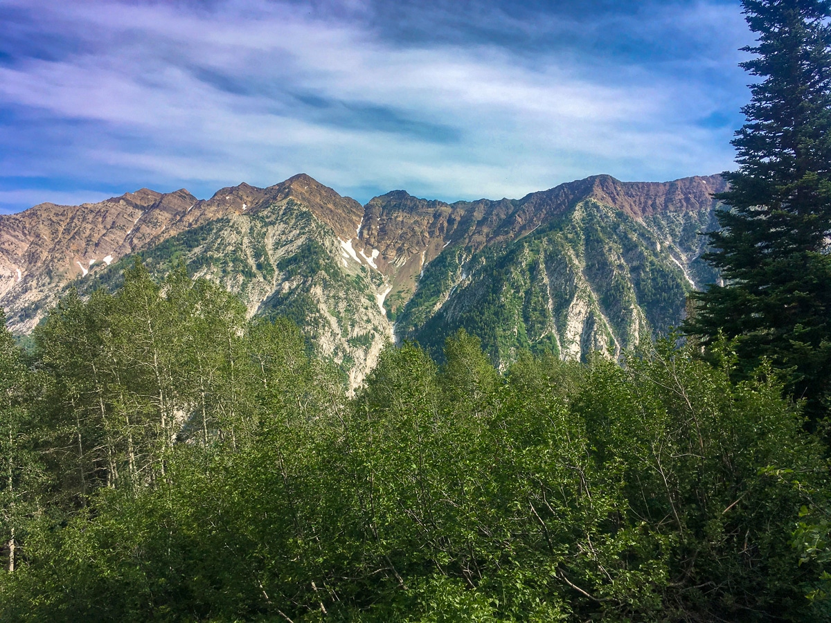
Red Pine Lake & Pfeifferhorn Ridge hike
Difficulty Rating:
The beautiful hike up to Red Pine Lake can easily be extended to grant truly 360-degree views. Hiking past the lake and onto Pfeifferhorn Ridge involves some rock hopping and scrambling and you will need to use your hands, but for confident, experienced hikers the panoramic scenery is worth the trek.
Getting there
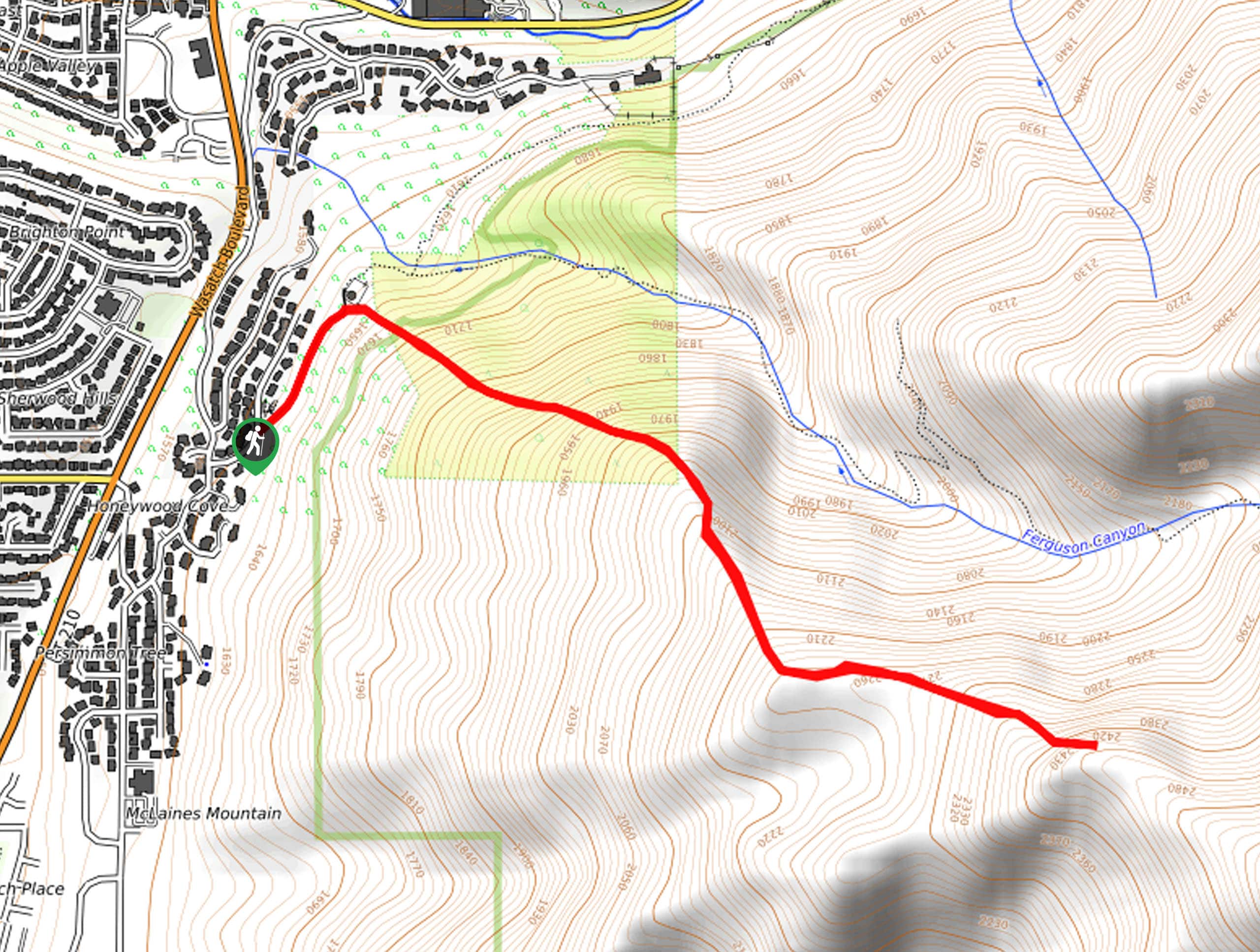
Head up Little Cottonwood Canyon Road for just under 11.0mi. After passing Tanners Flat Campground, look out for a poorly marked turnout on your right. This is the White Pine Trailhead. The parking lot fills quickly, so get here early to guarantee a spot. If you start passing ski lifts, you have gone too far.

About
| When to do | July to September |
| Backcountry Campsites | At Lakes |
| Toilets | At trailhead |
| Family friendly | No |
| Route Signage | Poor |
| Crowd Levels | Low |
| Route Type | Out and back |
Red Pine Lake & Pfeifferhorn Ridge
Elevation Graph
Weather
Route Description for Red Pine Lake & Pfeifferhorn Ridge
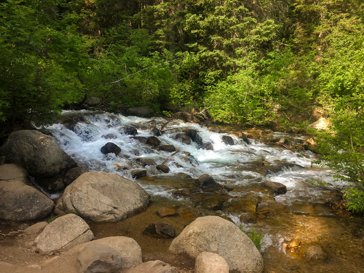
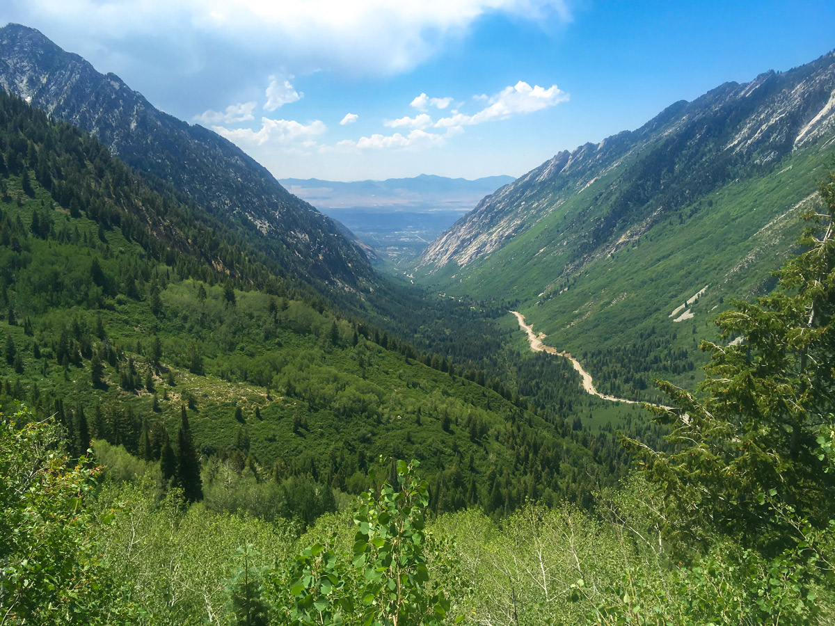
Beginning from the trailhead, start up the trail toward Red Pine and White Pine Lakes. The first 1.0mi or so of the trail is on an old jeep trail and is extremely well graded. You will soon arrive at a large trail junction with a sign, where you will continue to the right toward Red Pine Lake. This single-track trail follows the river for a short way before crossing over it.
After crossing over the river, you will begin to climb. As you climb, the trail veers to the right, and as you gain elevation the canyon drops out below you. You will rejoin the river again as you enter Red Pine Fork.
After approximately half the elevation gain you will pop out onto the higher plateau of Red Pine Fork. From here, the trail will soon lead up to the lake.
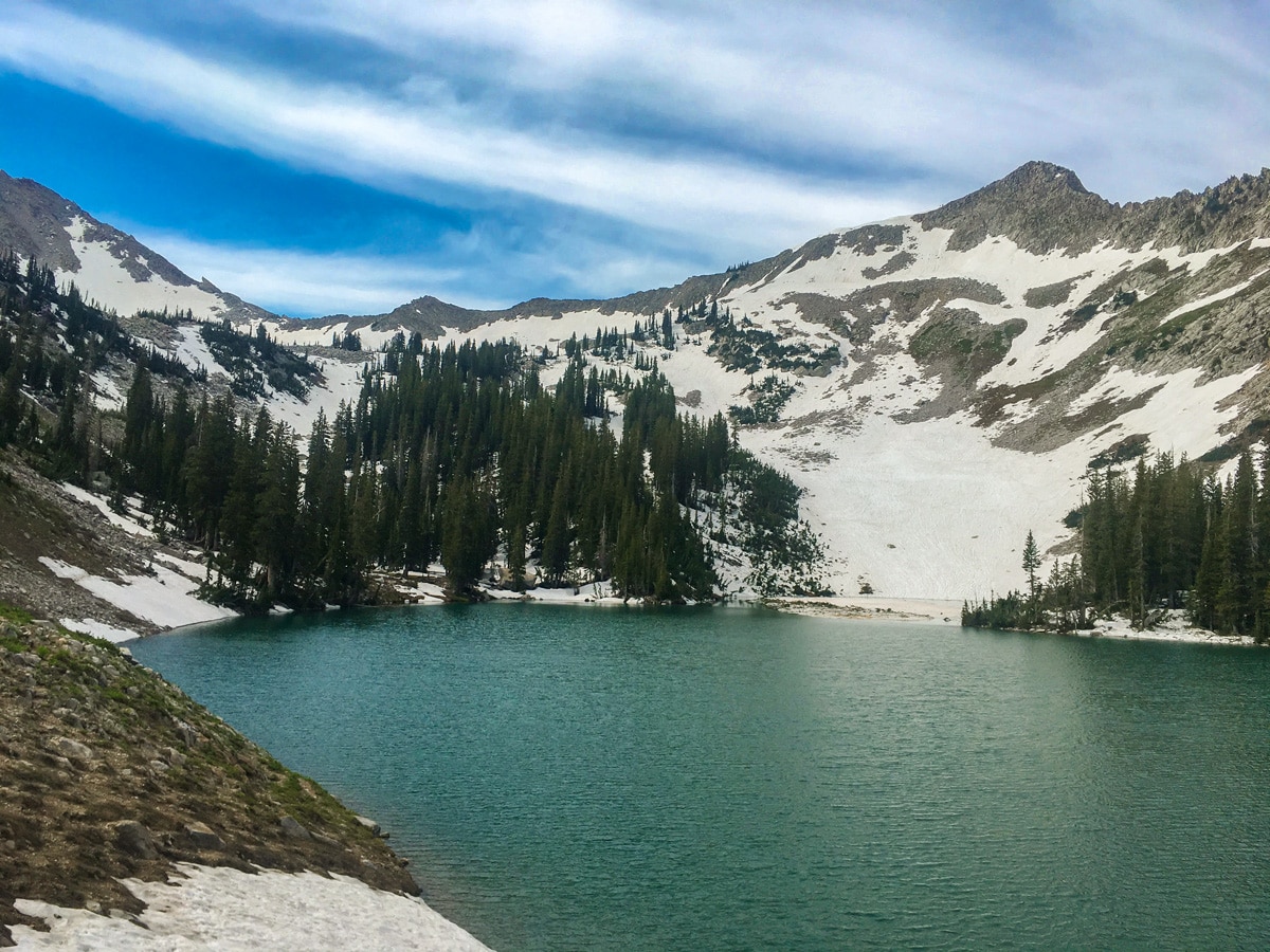
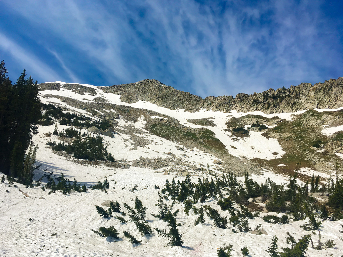
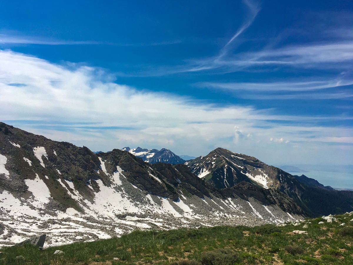
This quintessential alpine lake is a true stunner. Many people just do the hike up to here (a grade 3 hike) and are perfectly content. There are fantastic views up to Thunder Mountain and White Baldy, as well as one of the subsidiary peaks of Pfeifferhorn.
For those who want to continue to the ridge, make sure you are comfortable with using your hands, steep trails and rock hopping, all with a bit of exposure. To continue, follow the trail along the left (east) side of the lake, then cross over the stream feeding the lake beside the extremely large, bus-sized boulder. From here, you have to follow a very loose trail, which makes it way above Red Pine Lake. The trail is at times very difficult to follow, and if there is any late season snow it will linger in this bowl.
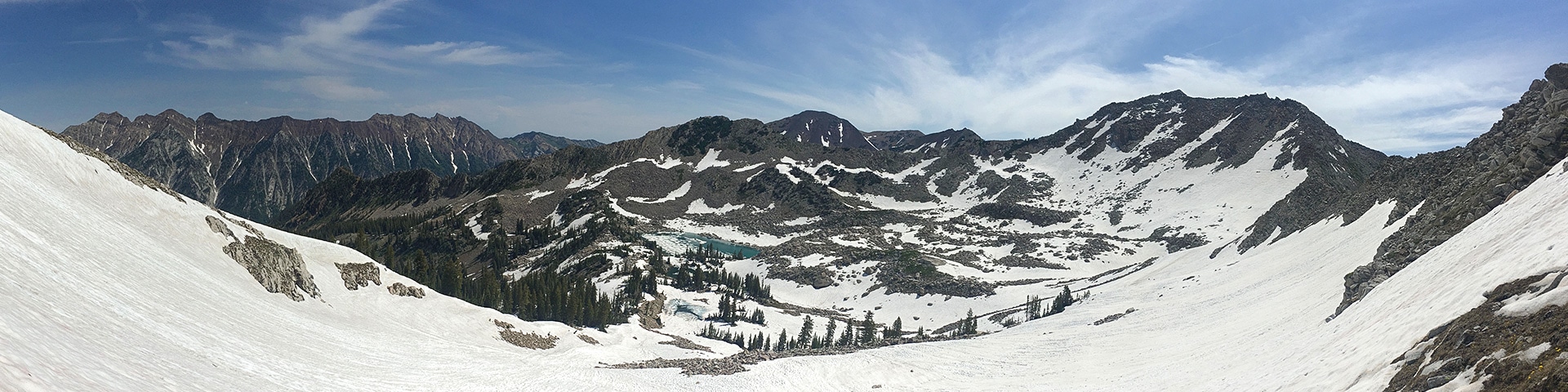
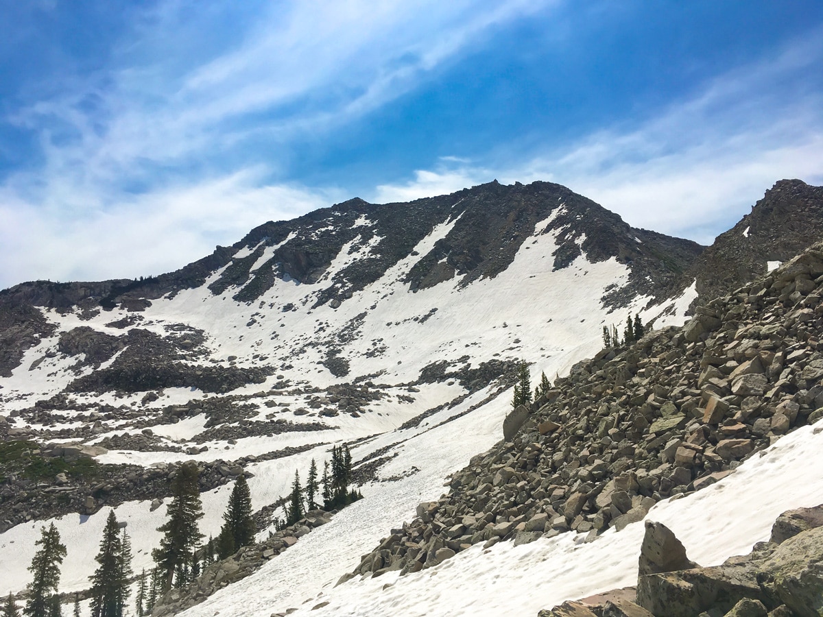
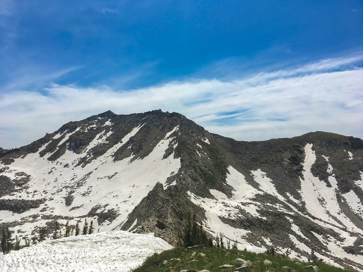
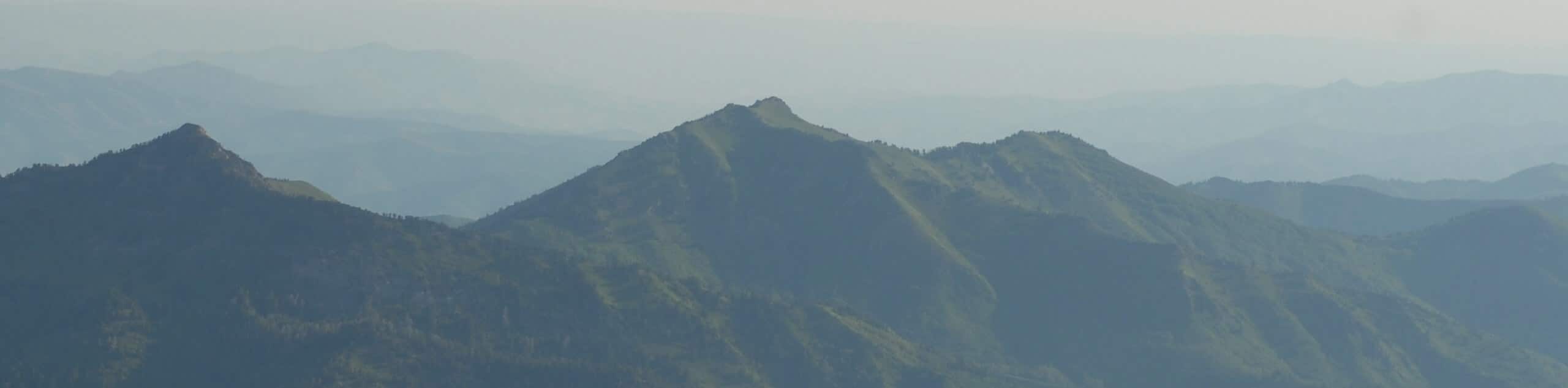
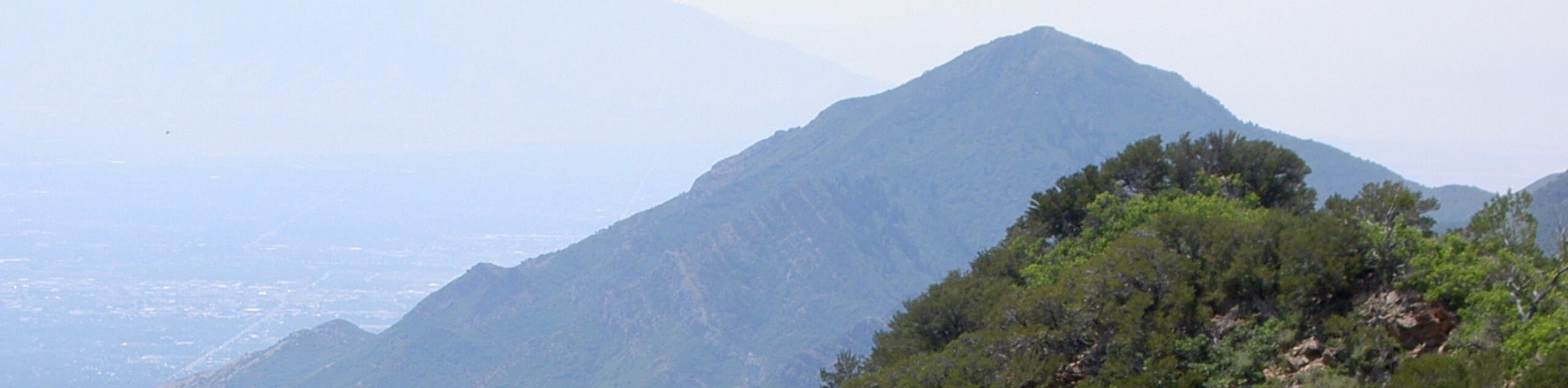
Aim for the rocky slopes above the bowl, far to the right of White Baldy. You will mostly likely have to forge you own way, looking for the best slope up the loose sand and talus. Finally, you will crest the ridge and see a view that will leave you in awe.
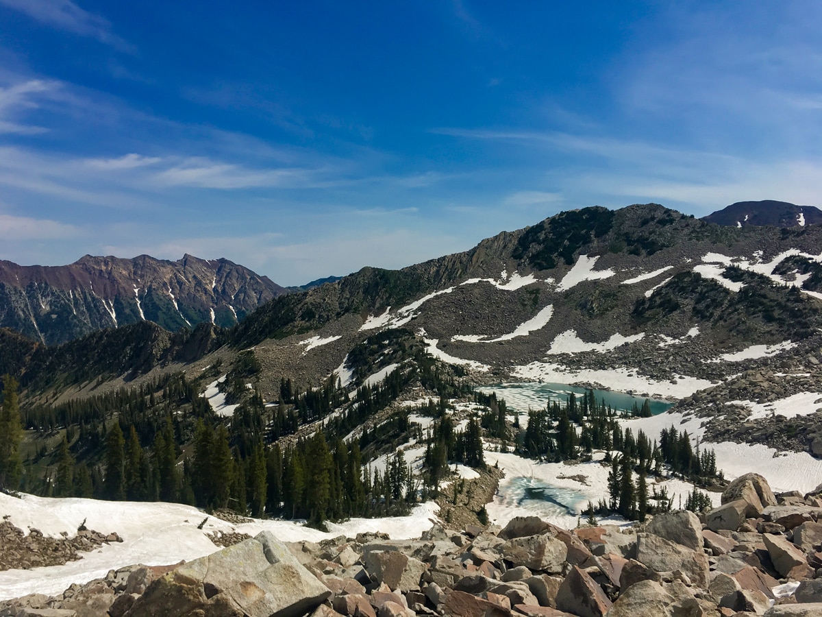
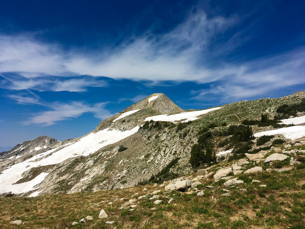
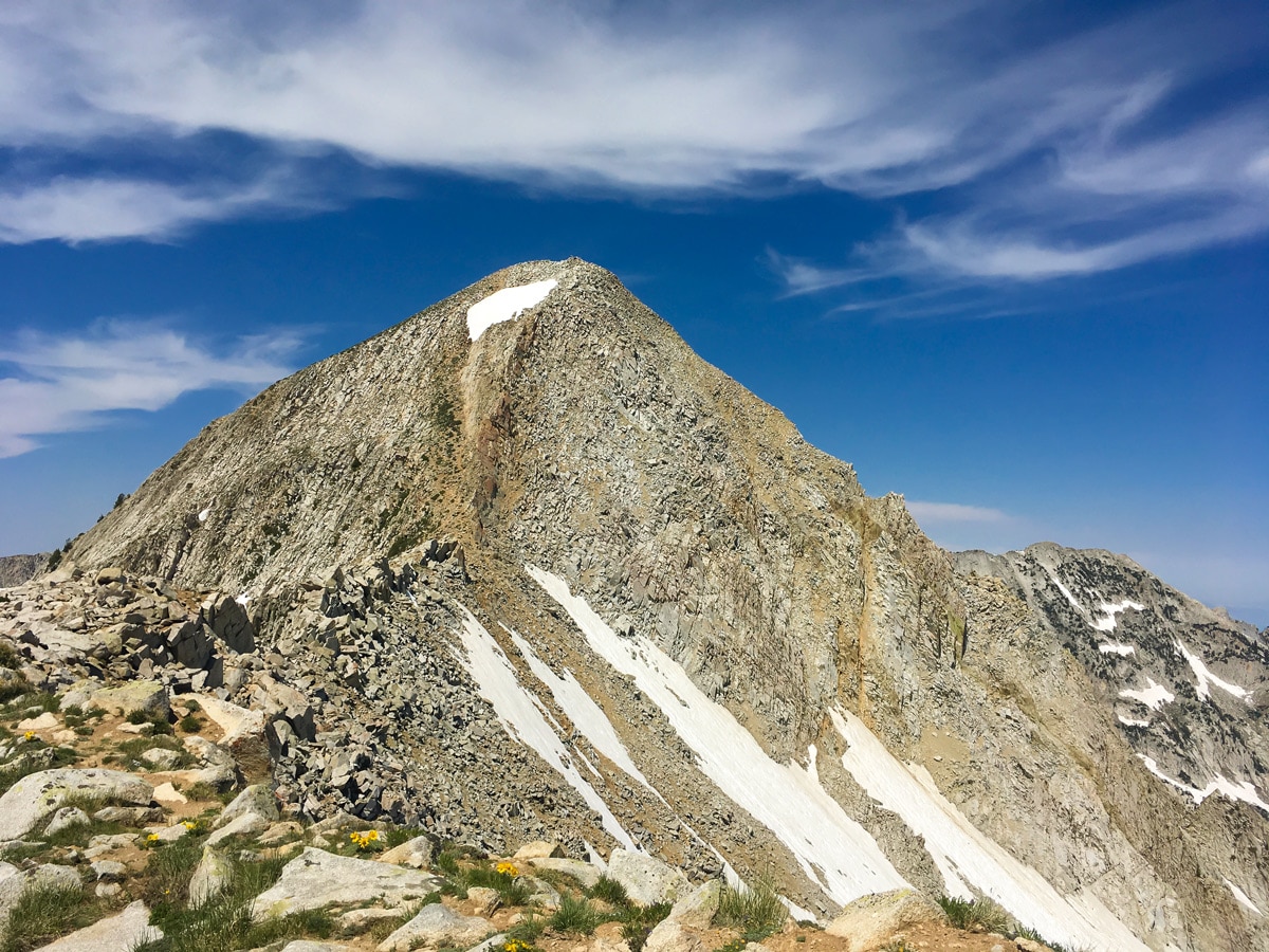
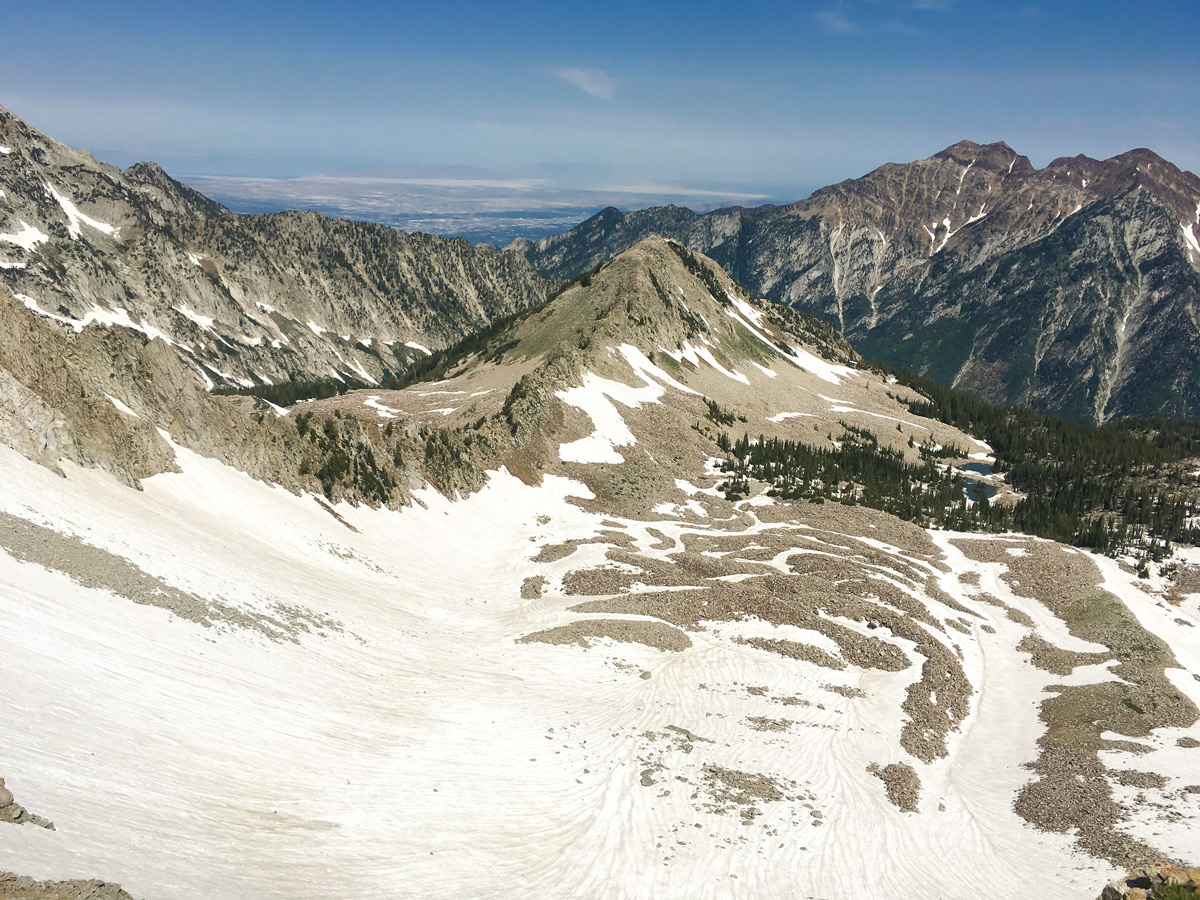
Follow the trail along the ridgeline towards the Pfeifferhorn, stopping at the subsidiary peak. The climb up to the real Pfeifferhorn summit involves some exposed scrambling, so most people turn back here, only experienced scramblers should continue on. The views from this vantage point are unbelievable! To the south, your view will be filled with the incredible massif of Box Elder — another hike on this list. To the north, the Twin Peaks fill the horizon.
After thoroughly enjoying the panoramic views, return the way you came. Take extreme care in descending the steep talus of the ridge.
Insider Hints
The wind can really pick up on the ridge. Bring a windbreaker or jacket so you can enjoy the scenery for as long as possible.
If there is still a lot of snow in the bowl we suggest giving it a miss. Hikers experienced with snow travel will use an ice axe for stability traversing the bowl.
This hike is rated at grade 5 due to the difficulties finding a route to get onto the ridge and the challenge of the hike.

Similar hikes to the Red Pine Lake & Pfeifferhorn Ridge hike
Mount Raymond via Bowman Fork Trail
The hike to the top of Mount Raymond via the Bowman Fork is a challenging route for experienced hikers. This…
Millvue Peak Trail
The Millvue Peak Trail is a beautiful hike in the Uinta-Wasatch-Cache National Forest. This trail is steep and challenging but…
Houndstooth Trail
The Houndstooth Trail is a challenging hike in the Twin Peaks Wilderness Area. This route is rugged with rocky terrain…
Yuli H. 4 years ago
Great hike! The snowy surroundings bring me back to my younger days.
Mariah D. 4 years ago
It was a long and rigorous hike to the top. Wearing some microspikes would be great. There are some rewarding views along the way.
Jarvie P. 4 years ago
It takes great effort and good stamina to complete this hike. You can benefit a lot from using a hiking pole and microspikes. Be careful of slippery portions.
Mitch Reinwick 4 years ago
Cool area. The 360-degree view was wicked! Well worth the effort. Highly recommended.
Annie Smith 5 years ago
Pfeifferhorn Ridge was a bit tricky to get up to, but definitely worth finding the route.
RocKing 5 years ago
Lake Pfeifferhorn hike was amazing. Has everything you want from an adventure - hiking, scrambling, great views. Wonderful!
Otis 5 years ago
A nice run away from the crowds. When we did the hike it was quite windy. The hike is hard and long, but very rewarding. The only downside is that the trail could use some marking and improvements