Mt. Raymond hike
View Photos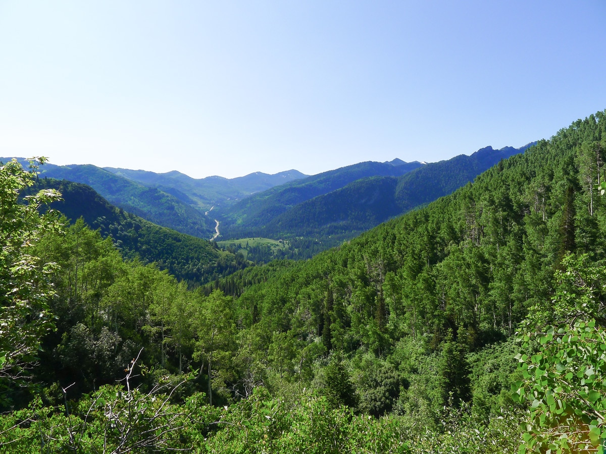
Mt. Raymond hike
Difficulty Rating:
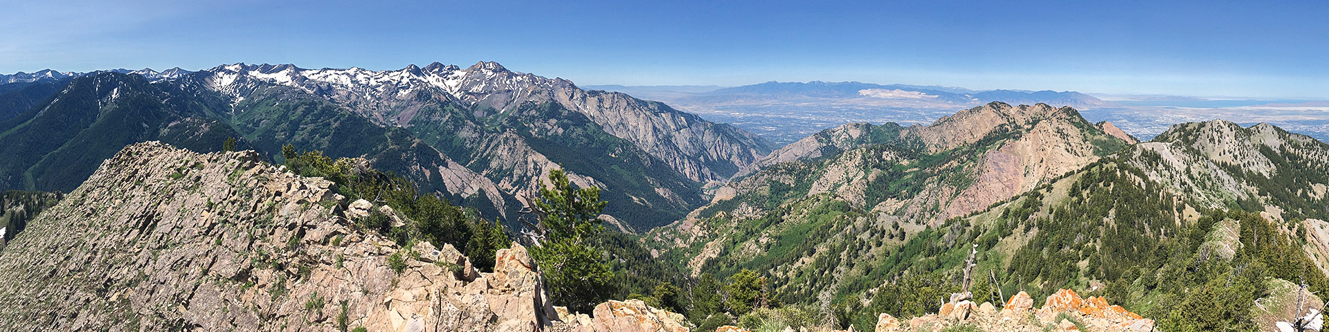
Hiking Mt. Raymond is an incredible trek granting incredible views into the heart of the Wasatch, as well as west to Salt Lake City. Due to the somewhat larger elevation gain of the walk, there are also typically fewer people on the trail; it is not uncommon to have the summit to yourself.
Getting there
From Salt Lake City, head up Big Cottonwood Canyon Road for just over 10.0mi. Just past the 10.0mi marker there will be a small turnoff on the left. Pullout here and find the trailhead. If you pass the Jordon Pines Campground, you have gone too far, go back 0.5mi to find where to park.

About
| When to do | Late spring through early fall |
| Backcountry Campsites | Many spots available in National Forest Wildernes |
| Toilets | None |
| Family friendly | No |
| Route Signage | Average |
| Crowd Levels | Low to Moderate |
| Route Type | Out and back |
Mt. Raymond
Elevation Graph
Weather
Route Description for Mt. Raymond
Begin up the shaded trail opposite Pine Lodge. Almost immediately, you will start the climb. Follow the river for the first short way. You will soon reach a junction where you will turn left. You will continue following a river as the grade of the trail steepens.
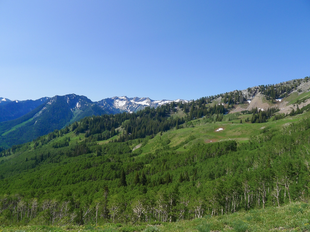
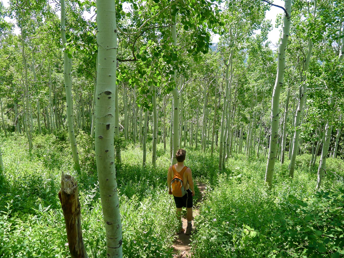
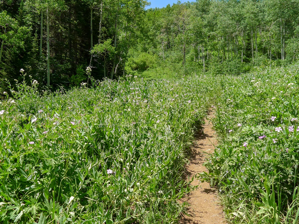
Just as you start to switchback, you will enter a stunning cottonwood forest. Additionally, throughout the entire climb, you will pass through many beautiful meadows, which are home to wildflowers in the springtime.
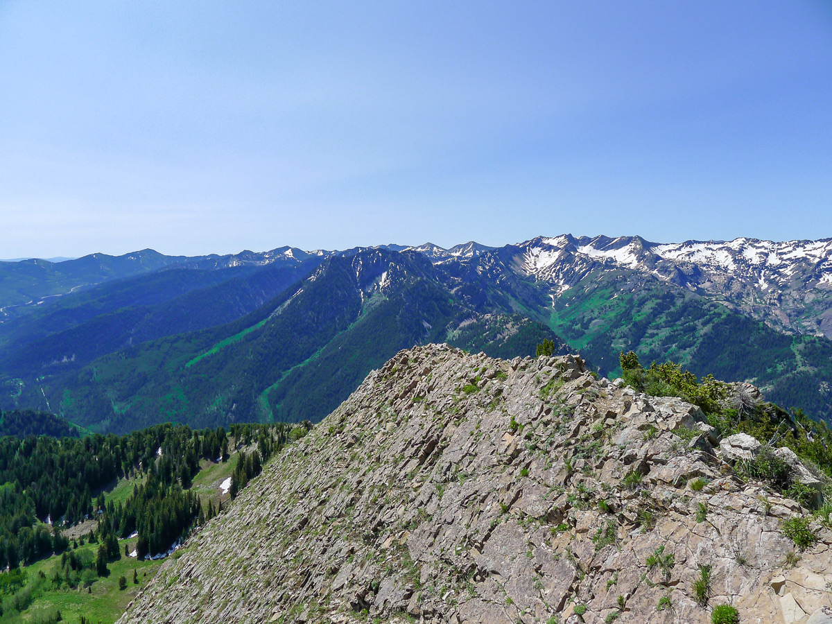
You will cross over the river and begin to switchback. You will pass through several other junctions; however, they are all signed and very obvious. Looking back, you will be able to see the way you came as well as the steep sides of Big Cottonwood Canyon.
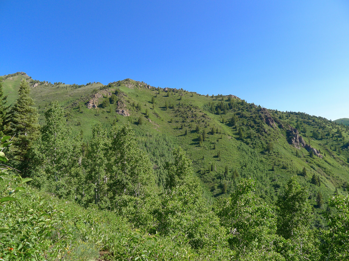
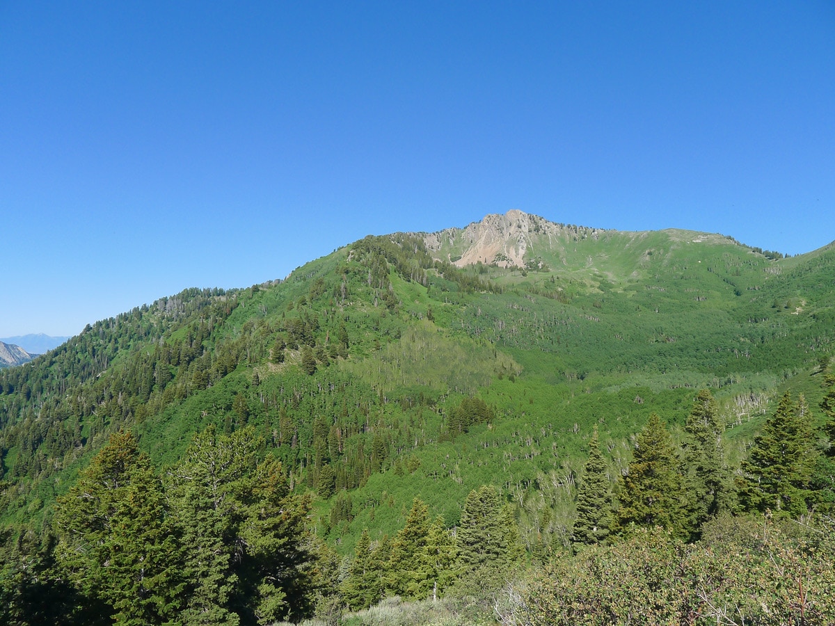
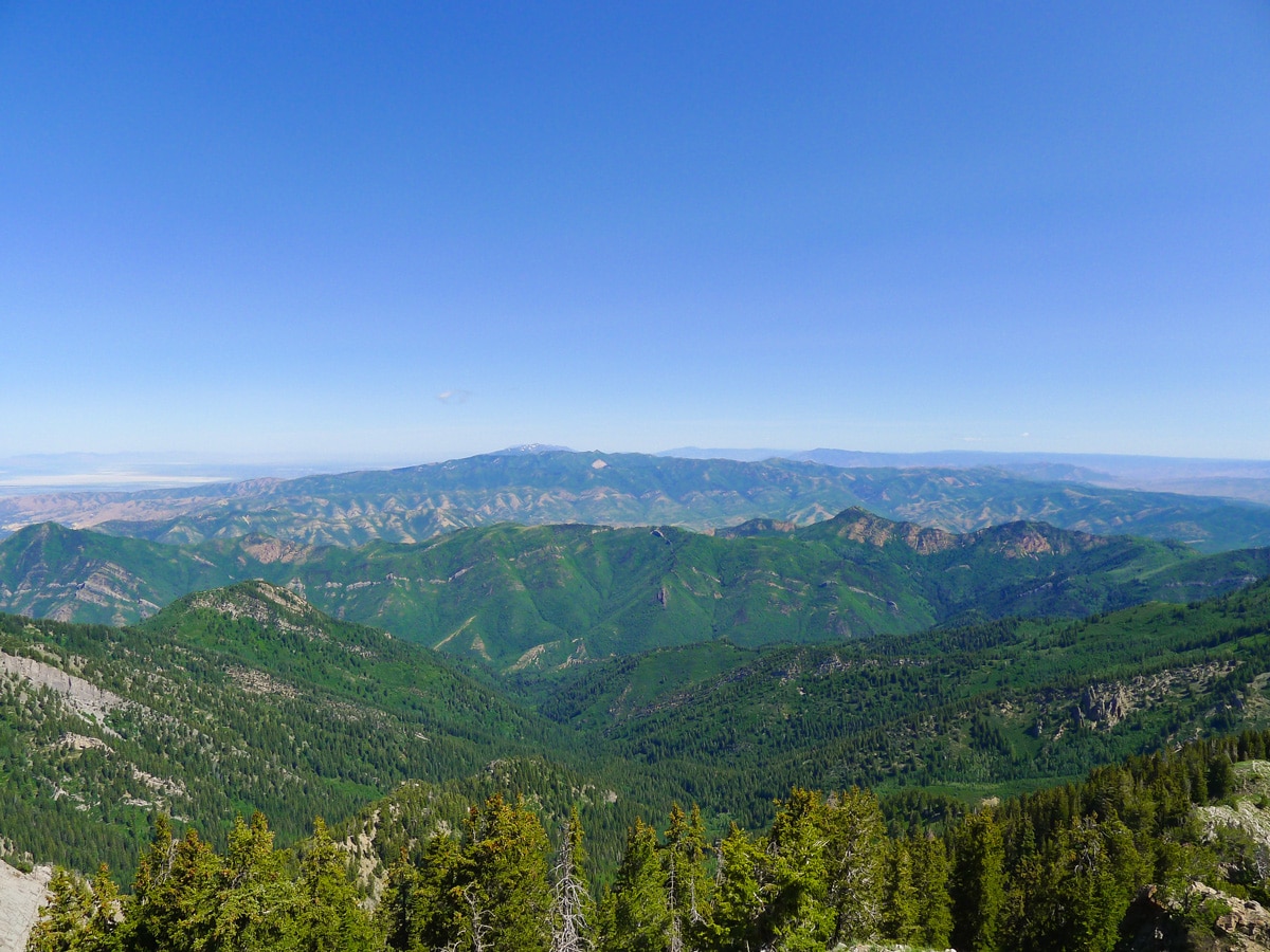
Just before you enter the barren bowl right below rocky Mt Raymond, you will come across an unmarked Y junction. Turn right here and continue to climb, shortly exiting the trees. The trail continues almost directly to Bakers Pass. Here you will get the beginning of your great views, looking back across Big Cottonwood Canyon toward the Dromedary Peak massif.
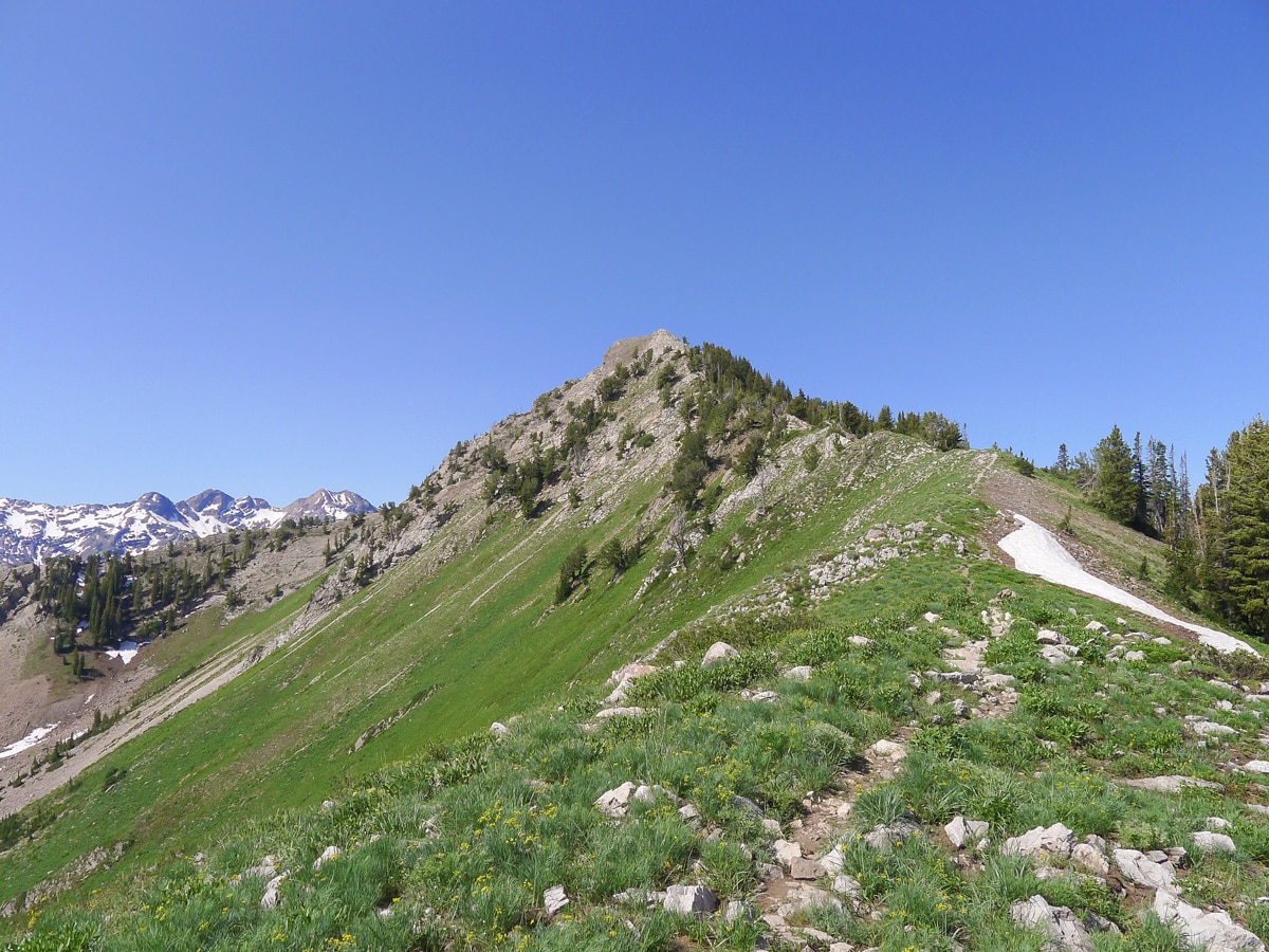
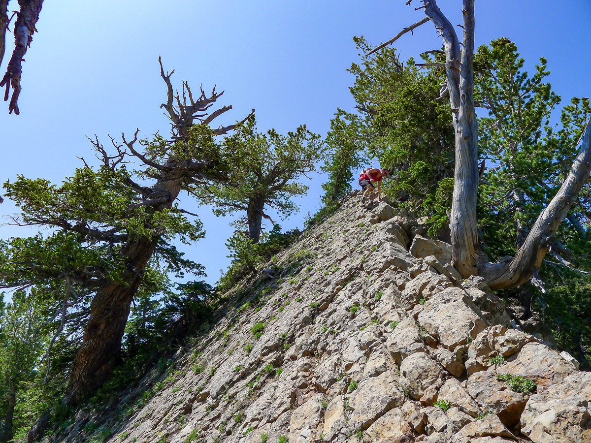
Follow the ridgeline to the left along the narrow and at times hard-to-follow trail. It is steep at first, and then it mellows out for a bit. You will soon find yourself at a rocky section. Some very mild scrambling is required here, but the rocky slab is at a very low angle and not exposed at all. Make your away along the ridgeline proper, most of the time following a trail, all the way up to the summit.
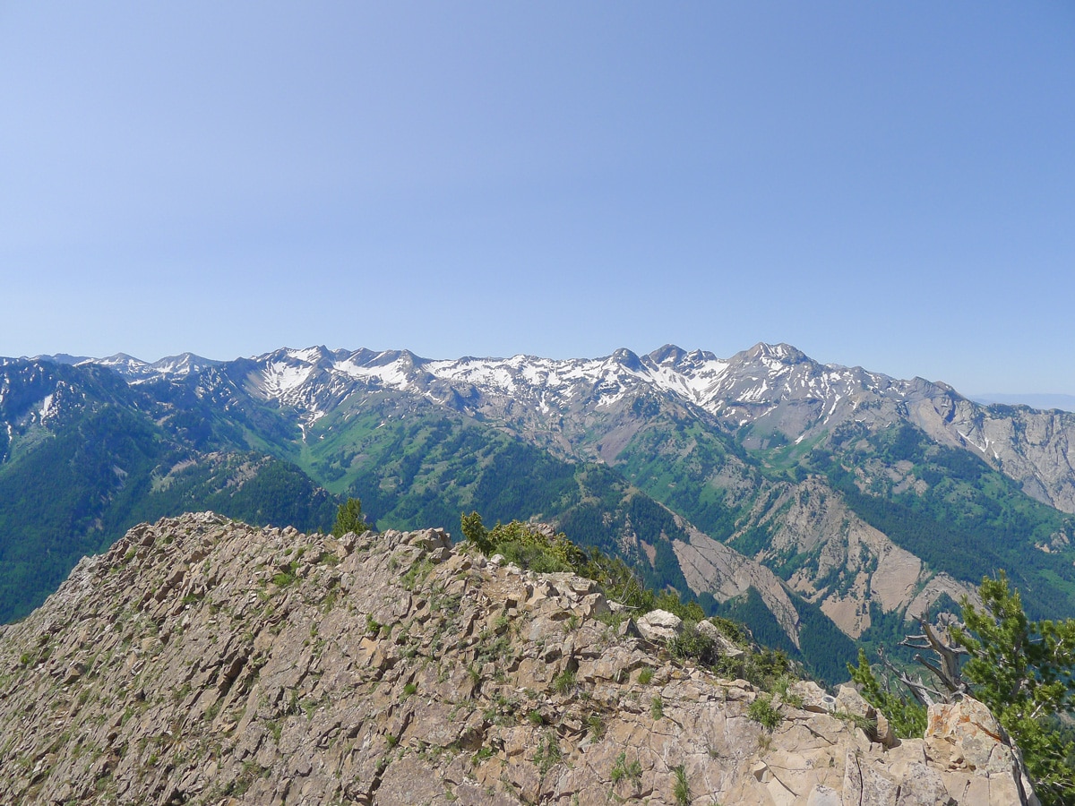
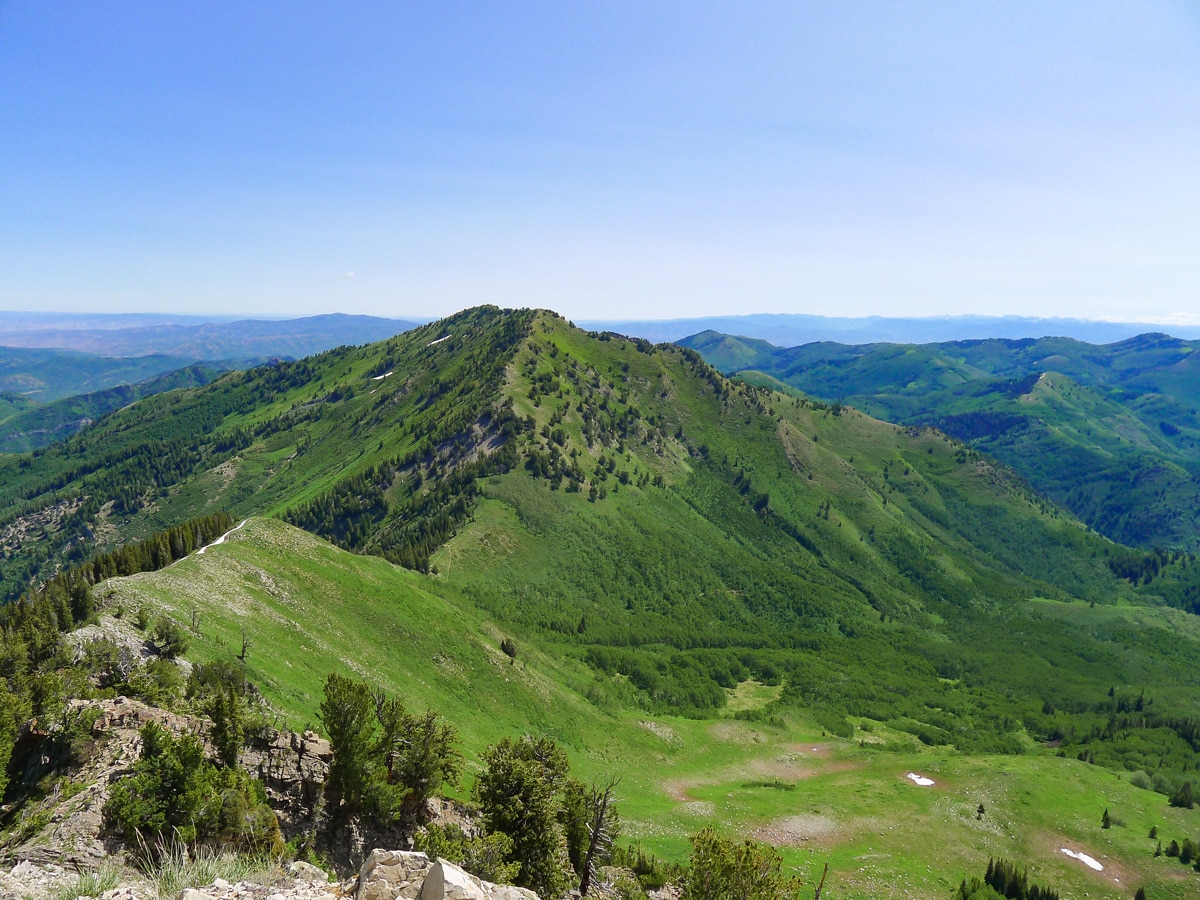
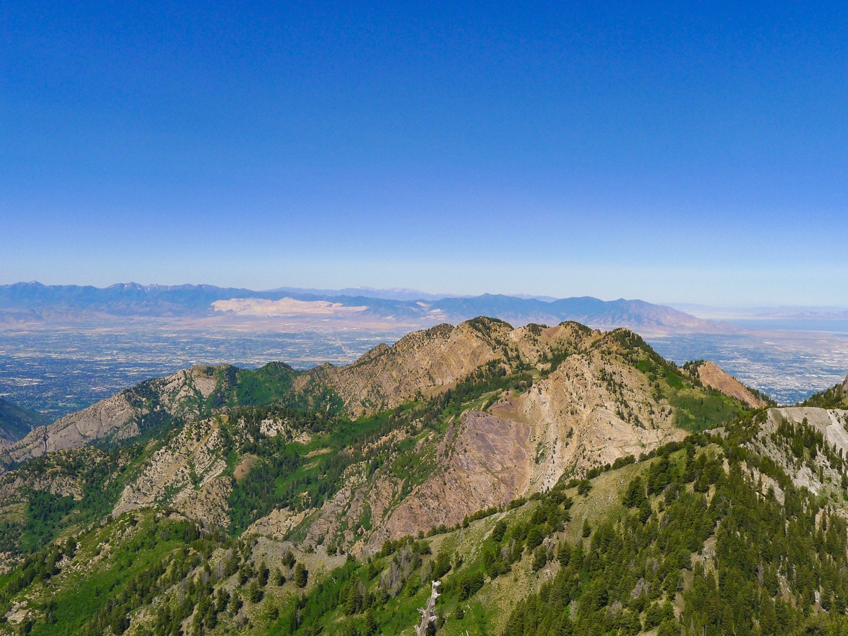
From the summit, you are given unbelievable views in all directions. Looking south across the canyons, you will see the mountains in the heart of the Wasatch, including Dromedary Peak. Looking more to the east, you will see the extension of Big Cottonwood Canyon all the way up to the two ski resorts. To the north will be the impressive rolling foothills of the Wasatch, and to the west is Salt Lake.
Take your time enjoying the summit before packing up and returning the way you came.
Insider Hints
A foam sit pad is definitely worth it, as the summit is very rocky.
Do this hike early as the final ascend is completely in the sun.
This is also a popular sunset hike, but make sure you have a headlamp in case you stay out too late and come back in the dark!

Similar hikes to the Mt. Raymond hike

Willow Hollow, Ridge, and Pine Hollow Trail
The Willow Hollow and Pine Hollow Trail is a beautiful route in the Uinta-Wasatch-Cache National Forest. This trail is an…

Solitude to Beaver Pond Trail
The Solitude to Beaver Ponds Trail is a beautiful hike through the Uinta-Wasatch-Cache National Forest. This trail is lush and…

City Creek Canyon Road
The City Creek Canyon Road is a popular trail just north of downtown Salt Lake City, Utah. This path is…
ArnoldM 4 years ago
Highly recommend but try and stick with the spring & fall times to go.
ShantiLewis 4 years ago
We went here last autumn, and the scenery was breathtaking with all those lively colors.
leo_Martini 4 years ago
Mt. Raymond is a precious gem!
marjflores 4 years ago
The summit is rocky so wear proper footwear to avoid swollen foot.
brandonlong 4 years ago
It's so peaceful here beacause there's nobody else around.
Joe Bart 4 years ago
Great hike. Superb views. Pretty challenging and exhausting, but overall enjoyed it.
Yuli H. 4 years ago
Great hike with some consistent challenges. It's not that easy, maybe that's why many don't dare to do it. There were very few people on the trail. I had the summit to myself for 20 minutes or so.
Jarvie P. 4 years ago
It was such a beautiful hike! There were breathtaking meadows and cotton forest along the way. Every step was worth it.
Mitch Reinwick 4 years ago
I genuinely had a wonderful time trekking Mt. Raymond. It's a great hike with lots of scenic views and photo spots.
Adriana K. 4 years ago
Views spectacular all the way. I would highly recommend this hike for anyone interested in hiking.