Sunset Peak hike
View Photos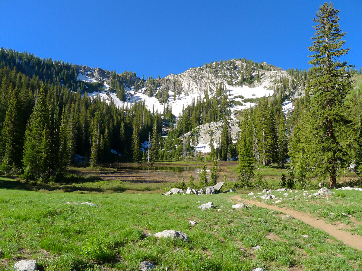
Sunset Peak hike
Difficulty Rating:
If you are all about lakes, hiking up past Dog Lake, Lake Mary, Lake Martha and Lake Catherine are sure to please. The extra climb up to Sunset Peak blows the lakes out of the water and makes this a spectacular walk!
Getting there
From Salt Lake City take Big Cottonwood Road (UT-190) until you reach the Brighton Ski Hill. Continue along the one-way road to the south side where you will find a large parking area and the Majestic ski lift.

About
| When to do | Late spring and summer |
| Backcountry Campsites | at Lakes |
| Toilets | At trailhead |
| Family friendly | No |
| Route Signage | Average |
| Crowd Levels | Moderate |
| Route Type | Out and back |
Sunset Peak
Elevation Graph
Weather
Route Description for Sunset Peak
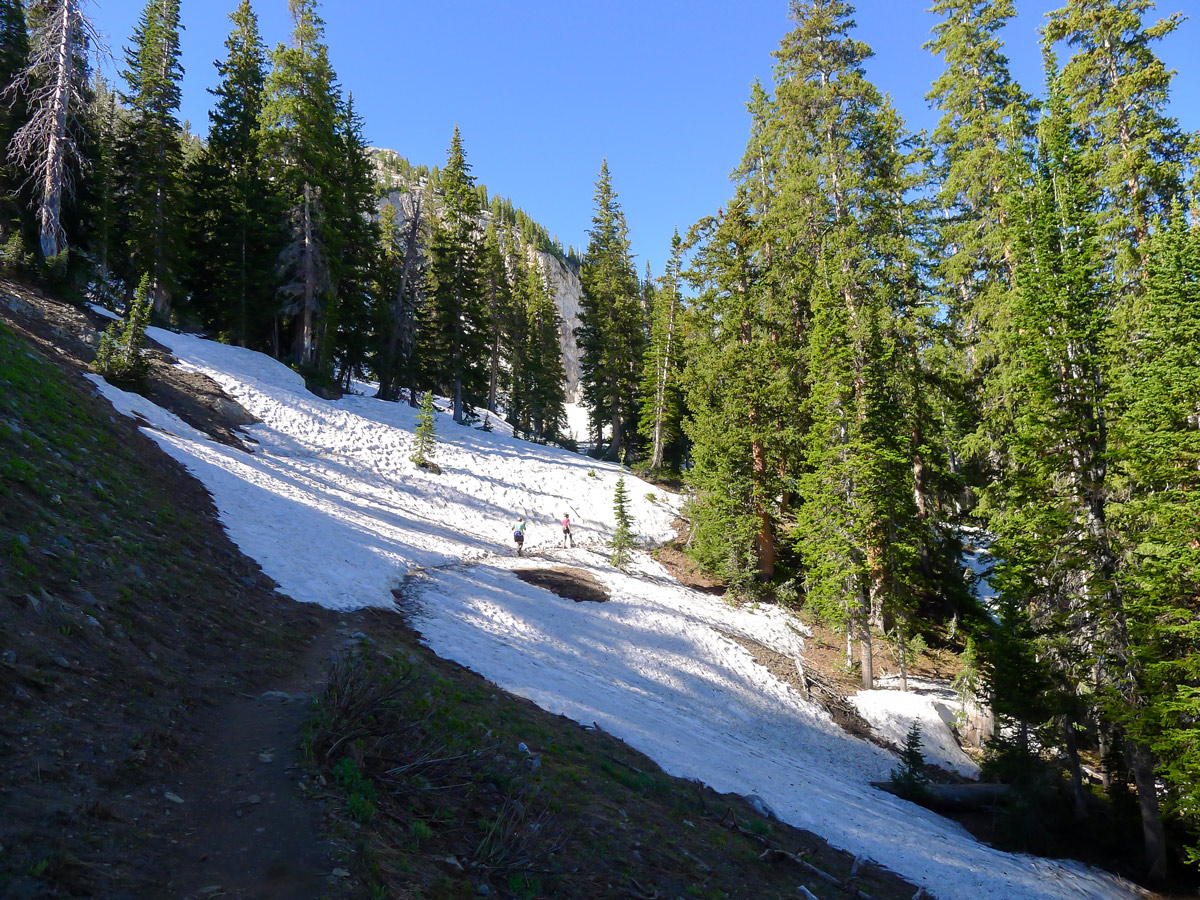
The trail begins by heading uphill following the path of the Majestic ski lift. This short ascent is the price you will have to pay for the insanely gorgeous hiking throughout the rest of the hike!
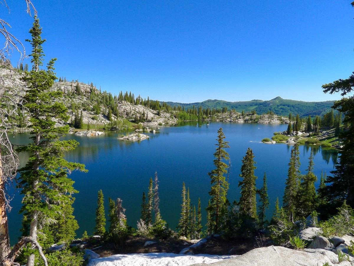
After a little climbing, you will reach a junction with signs for Dog Lake. If you want to take a break, Dog Lake is a good place to do it, however, the lake itself isn’t that impressive. Continue climbing along the main trail to Lake Mary. Most people stop here and for good reason!
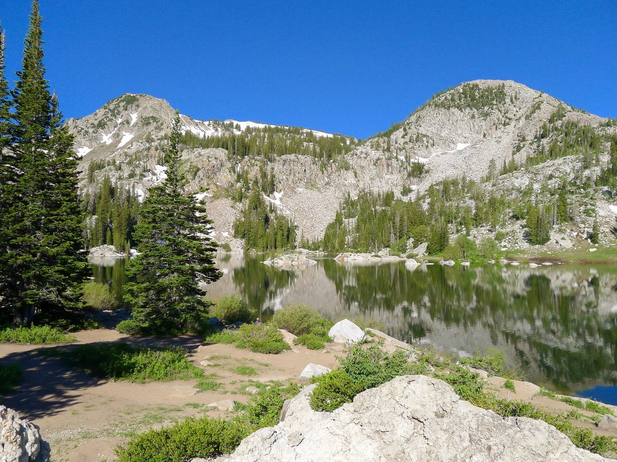
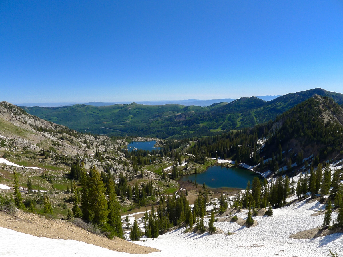
Grand cliffs surround Lake Mary with Mount Millicent and Mount Tuscarora helping to create a beautiful scene. A short way above Lake Mary is Lake Martha, which holds similar views but draws fewer people.
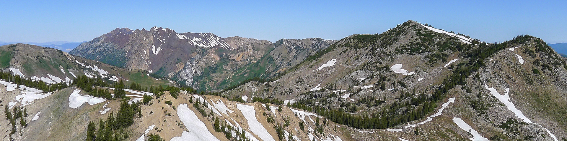
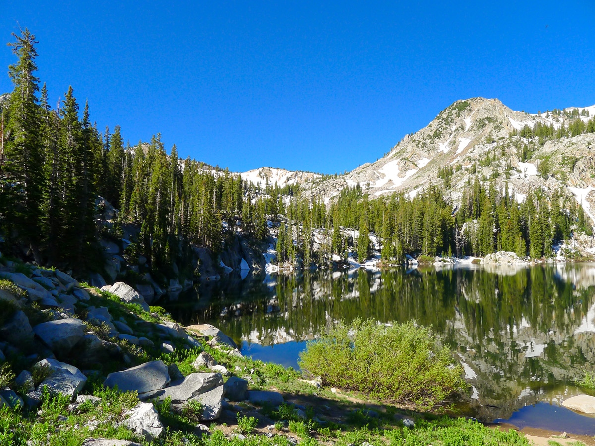
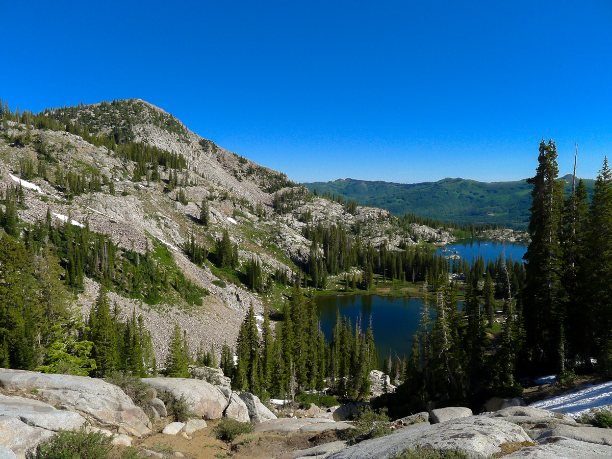
Continuing along the trail, the crowds will thin slightly. The trail becomes slightly hard to follow as many people have made their own trails. You will veer left to gain a ridge, and then turn right to climb up to Lake Catherine. This lake is situated in a stunning alpine bowl, lined by Mount Tuscarora, Pioneer Peak and in the middle, your final objective, Sunset Peak.
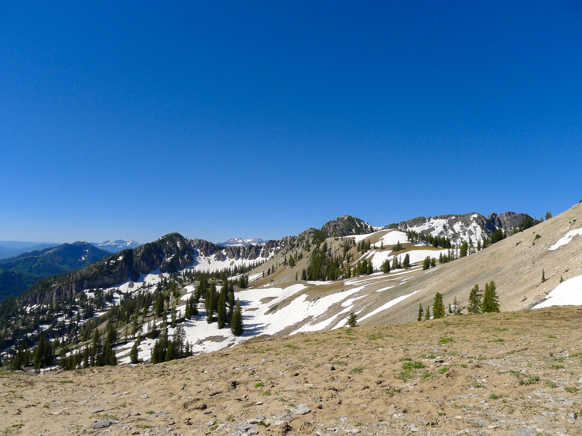
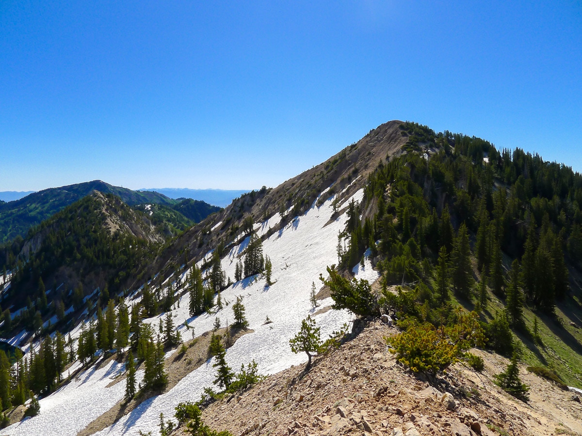
Follow the trail straight up to Catherine Pass. From here, turn left towards Sunset Pass. Follow this ridgeline around to the other pass, and then follow the loose trail up the ridge to Sunset Peak.
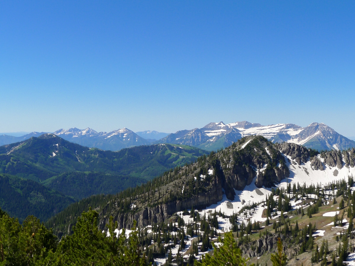
From this summit, you will be granted unbelievable views into both Little and Big Cottonwood Canyons. There are way too many mountains to name, but highlights include Twin Peaks, Box Elder, Mount Timpanogos and Box Elder Peak.
Return the route you ascended.
Insider Hints
Start early will give you a good chance of having the summit all to yourself, a real treat.
For a long hike, you can continue along the ridgeline all the way to Clayton Peak. This would be a long day, but a truly gorgeous hike.

Similar hikes to the Sunset Peak hike

Willow Hollow, Ridge, and Pine Hollow Trail
The Willow Hollow and Pine Hollow Trail is a beautiful route in the Uinta-Wasatch-Cache National Forest. This trail is an…

Solitude to Beaver Pond Trail
The Solitude to Beaver Ponds Trail is a beautiful hike through the Uinta-Wasatch-Cache National Forest. This trail is lush and…

City Creek Canyon Road
The City Creek Canyon Road is a popular trail just north of downtown Salt Lake City, Utah. This path is…
ArnoldM 4 years ago
We loved every moment hiking here.
ShantiLewis 4 years ago
Exquisite scenery of nature!
leo_Martini 4 years ago
Sunset Peak is just absolutely stunning!
Stevie M 4 years ago
The most amazing views at sunset especially with 360° spectacular views.
Gabriel10 4 years ago
The weather was awful when I visited but the views were still nice.
brandonlong 4 years ago
It was windy when we visited, and the sky was gray and dull, but the views were still fantastic.
Joe Bart 4 years ago
It's a nice hike that does not require tremendous effort. Really had a fantastic time exploring the area.
Melinda J. 4 years ago
It was an amusing hike. Trail was pretty decent. There were some easy climbs towards Dog and mary Lake.
Yuli H. 5 years ago
This hike is packed with great views of numerous lakes. There were some mild ascends, enough just to stretch your legs.
Isaiah L. 5 years ago
Beautiful views at the top. Not many people on the trail at all.