Clayton Peak hike
View Photos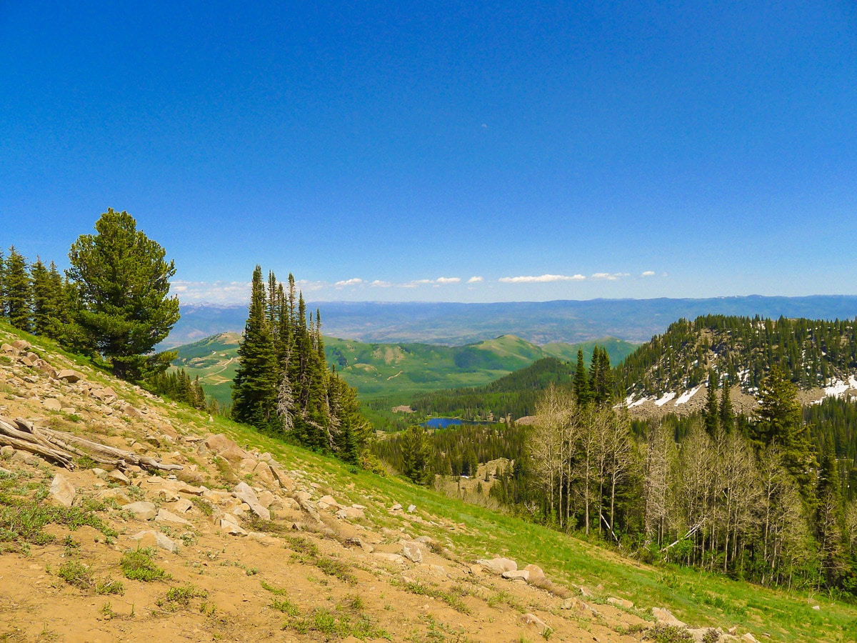
Clayton Peak hike
Difficulty Rating:
The steep hike up to Clayton Peak yields unbelievably stunning views. One of the easier summits to walk in the area, it’s surprising very few people make the trek!
Getting there
From Salt Lake City, take Big Cottonwood Road (UT-190) east for just under 19.0mi. Just before entering the roundabout for the Brighton Ski Hill, you will take a sharp left turn to continue along UT-190. This part of the road is extremely narrow, so take care! Park in the small parking area of Guardsman Pass.

About
| When to do | July through September |
| Backcountry Campsites | None |
| Toilets | None |
| Family friendly | No |
| Route Signage | Poor |
| Crowd Levels | Low |
| Route Type | Out and back |
Clayton Peak
Elevation Graph
Weather
Route Description for Clayton Peak
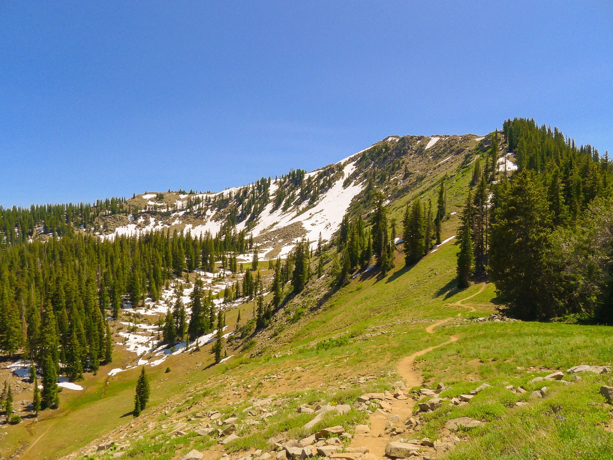
The hike begins on the same side of the road as the small parking lot. Climb the loosely defined trail beginning at the south end of the parking lot. Initially the trial goes nearly straight up the steep slope, but later it begins to switchback. You will crest the ridge after approximately half of the elevation gain. You will be directly below-and to the right of-one of Clayton’s subsidiary peaks.
The trail winds around this summit then descends to the shoulder between it and Clayton. From here your route is clearly visible. As you descend, you will see the top of one of Brighton’s chairlifts, sitting still for the summer months.
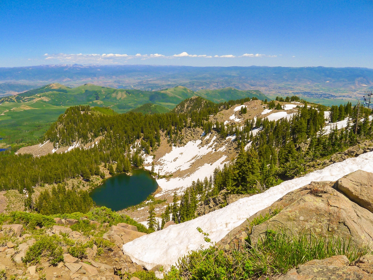
At the bottom of the saddle, a trail on your left will lead down to Lackawaxen Lake. Keep straight here to follow along the ridge. The trail will die out as you enter a talus field. Do some mild rock hopping here to find the trail again closer to the summit.
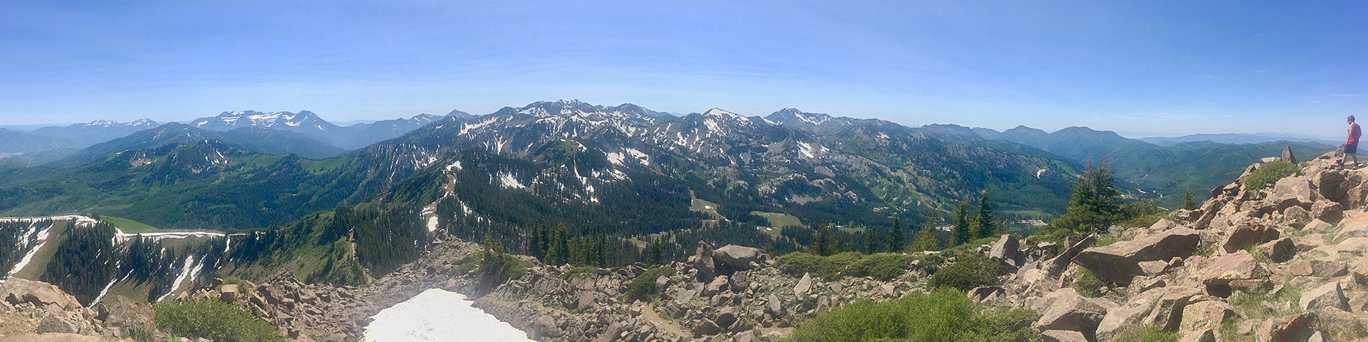
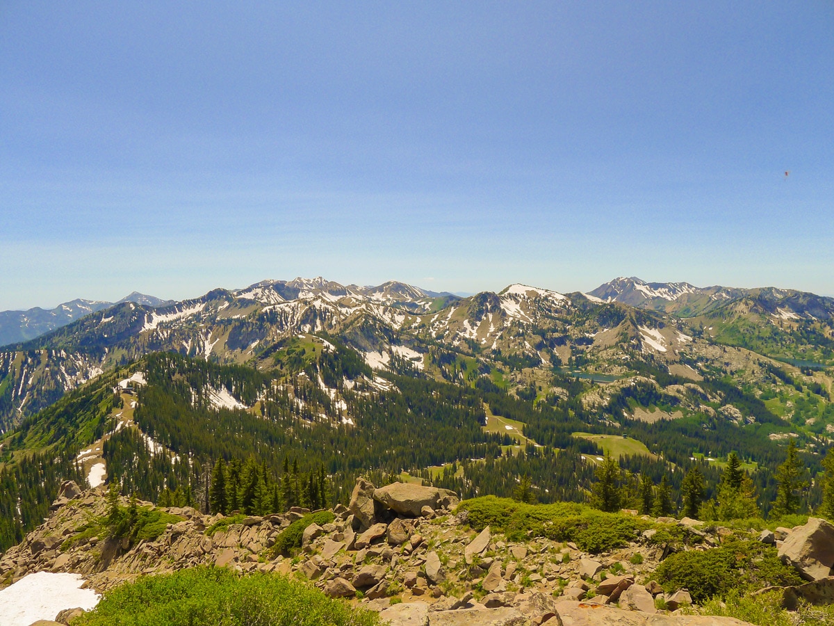
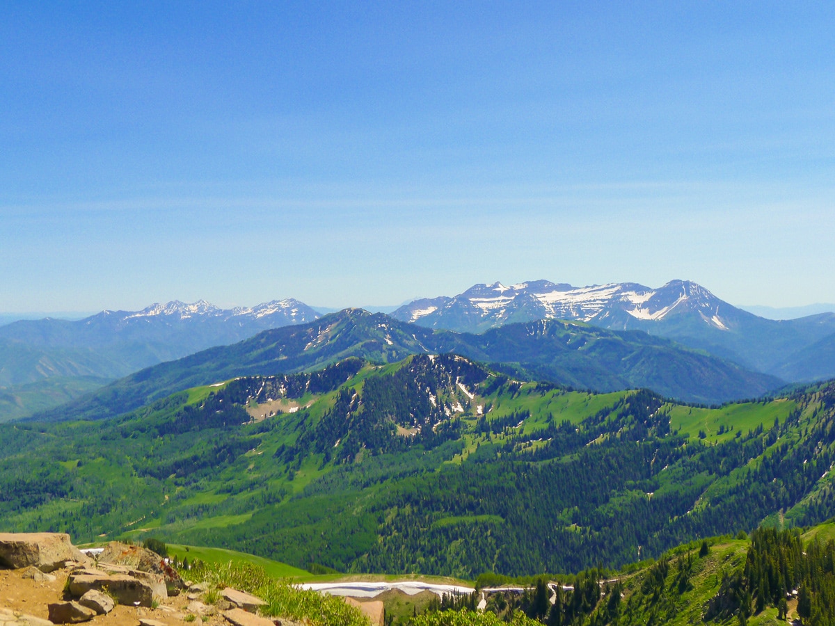
Finally, you will crest the summit ridge to gain the best views of the hike! Looking west you will see the core mountains of the Wasatch, including Sunset Peak along the main massif above Brighton, and Raymond Peak across at the base of the canyon. Those two peaks are other fantastic hikes you’ll find on 10Hikes!
To the east, you will see the foothills of the Wasatch Mountains, and the Uintas in the far distance. To the south, Mount Timpanogos will poke its head out and Box Elder will be visible to its right. There are far too many mountains visible from this perch to name! You will also most likely have this summit to yourself as few people make it this far.
Return the way you came, taking care on the steep and-at times-rocky path.
Insider Hints
This hike is the perfect length to spend some serious time enjoying the summit with a relaxing break.
We recommend bringing foam sit pads or small chairs to enjoy the fantastic view from the summit in comfort!

Similar hikes to the Clayton Peak hike

Willow Hollow, Ridge, and Pine Hollow Trail
The Willow Hollow and Pine Hollow Trail is a beautiful route in the Uinta-Wasatch-Cache National Forest. This trail is an…

Solitude to Beaver Pond Trail
The Solitude to Beaver Ponds Trail is a beautiful hike through the Uinta-Wasatch-Cache National Forest. This trail is lush and…

City Creek Canyon Road
The City Creek Canyon Road is a popular trail just north of downtown Salt Lake City, Utah. This path is…
Stevie M 4 years ago
There are numerous areas of loose gravel and dust. Views are spectacular - numerous lakes below on both sides of the trail.
Adriana K. 4 years ago
Enjoyed the scenery. Definitely good for beginners as there are open spaces.
brandonlong 4 years ago
The snow-peaked mountains and aspen forest were remarkable!
Willy G. 4 years ago
Easy way up and down. Fantastic short hike! Highly recommended.
Washington H. 4 years ago
It's a wonderful trail! The views were spectacular, and would definitely do this again!
April O. 4 years ago
A pleasant hike! I've always wanted to genuinely connect with nature.
Gabriel10 4 years ago
It was a little boring in the beginning, but the further I go the better views I saw.
Joe Bart 5 years ago
The weather was teriffic. Had a wonderful day hiking. The views were pretty cool.
Jarvie P. 5 years ago
The summit ridge offers the best views. This is pretty challenging, but It's not Mt. Everest either. Just bring plenty of water.
Melinda J. 5 years ago
Beautiful hike that gives amazing view at the top. It was a bit dull in the beginning, and there was a loosely defined trail. But it gets better as you get closer to the top. Love it!