The Bonneville Shoreline Trail: Draper Section
View Photos
The Bonneville Shoreline Trail: Draper Section
Difficulty Rating:
The Draper Section of the Bonneville Shoreline Trail is a beautiful, relatively flat hiking route outside of Draper, Utah. This section of trail is family-friendly and a great hike for older kids. Unfortunately, dogs are not permitted on this route.
Getting there
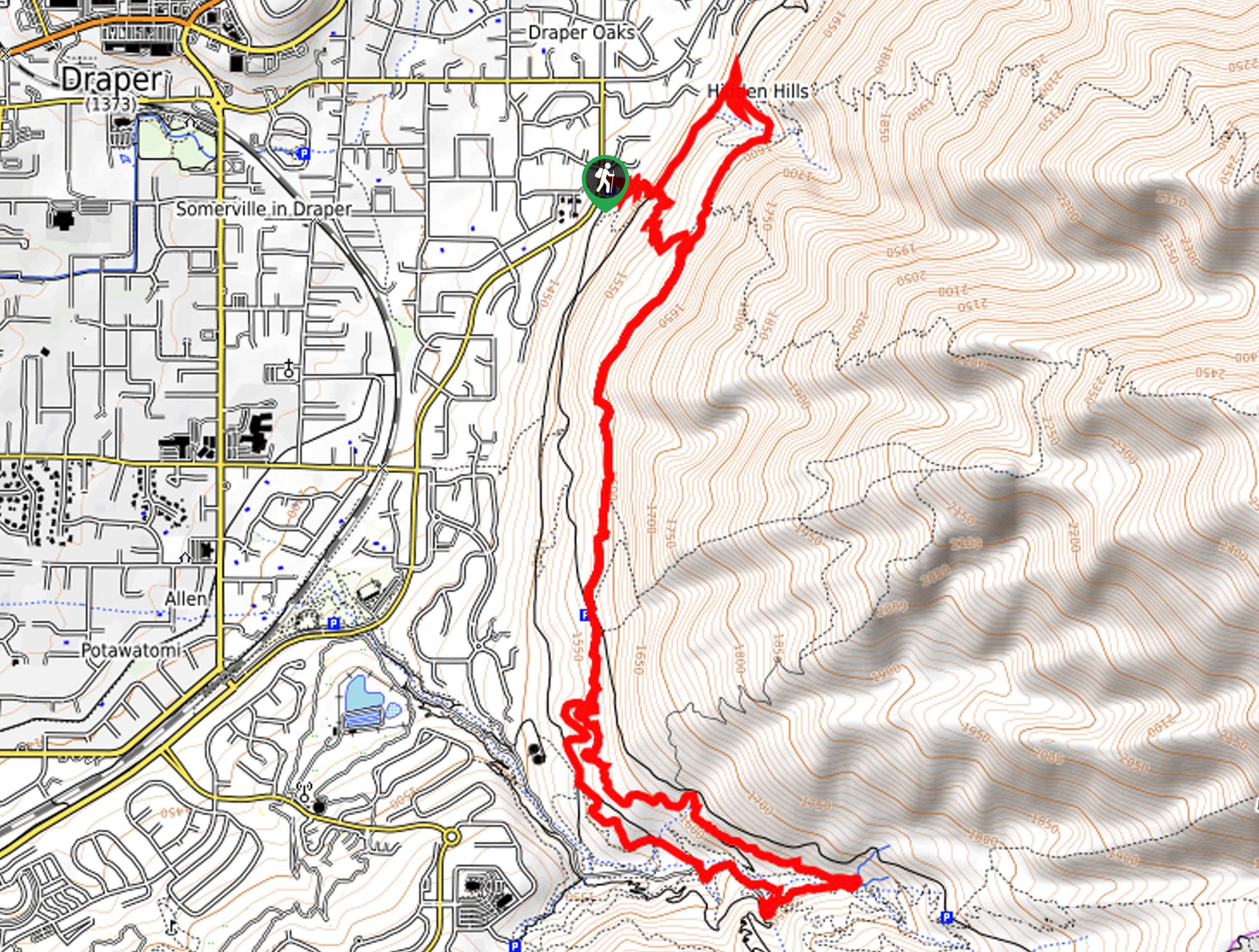
This hike begins at the Orson Smith Trailhead on the east side of Highland drive on the eastern edge of Draper, Utah.

About
| Backcountry Campground | No |
| When to do | Year-round |
| Pets allowed | No |
| Family friendly | Older Children only |
| Route Signage | Average |
| Crowd Levels | Moderate |
| Route Type | Lollipop |
The Bonneville Shoreline Trail: Draper Section
Elevation Graph
Weather
The Bonneville Shoreline Trail: Draper Section Description
The Bonneville Shoreline Trail: Draper Section is a gorgeous route on the eastern edge of Draper, Utah. This trail is shared by hikers and mountain bikers. When hiking, be sure to keep your eyes and ears open and allow bikes to pass you by. There is limited shade along this trail, so be sure to layer on the sunscreen, wear a sunhat, and bring lots of water, especially if you are hiking in the summer. Although dogs are not permitted on this trail, the Bonneville Shoreline Trail: Draper Section makes for a wonderful family hike and a great way to spend the day enjoying nature just outside of town.
The Bonneville Shoreline Trail: Draper Section begins at the Orson Smith Trailhead on the east side of Highland Drive. From the trailhead, follow the path east, across the Aqueduct Trail to the Bonneville Shoreline Trail. Follow the Bonneville Shoreline Trail south for 3.3mi, then take a loop along the Rattler, Ghost Falls, and Gas Line Trails before rejoining the Bonneville Shoreline Trail and returning to the trailhead.
If you are looking for a similar but dog-friendly trail in the area, check out the Aqueduct Trail nearby.
Similar hikes to the The Bonneville Shoreline Trail: Draper Section hike

Willow Hollow, Ridge, and Pine Hollow Trail
The Willow Hollow and Pine Hollow Trail is a beautiful route in the Uinta-Wasatch-Cache National Forest. This trail is an…

Solitude to Beaver Pond Trail
The Solitude to Beaver Ponds Trail is a beautiful hike through the Uinta-Wasatch-Cache National Forest. This trail is lush and…

City Creek Canyon Road
The City Creek Canyon Road is a popular trail just north of downtown Salt Lake City, Utah. This path is…
Comments