
Cecret Lake Trail
View Photos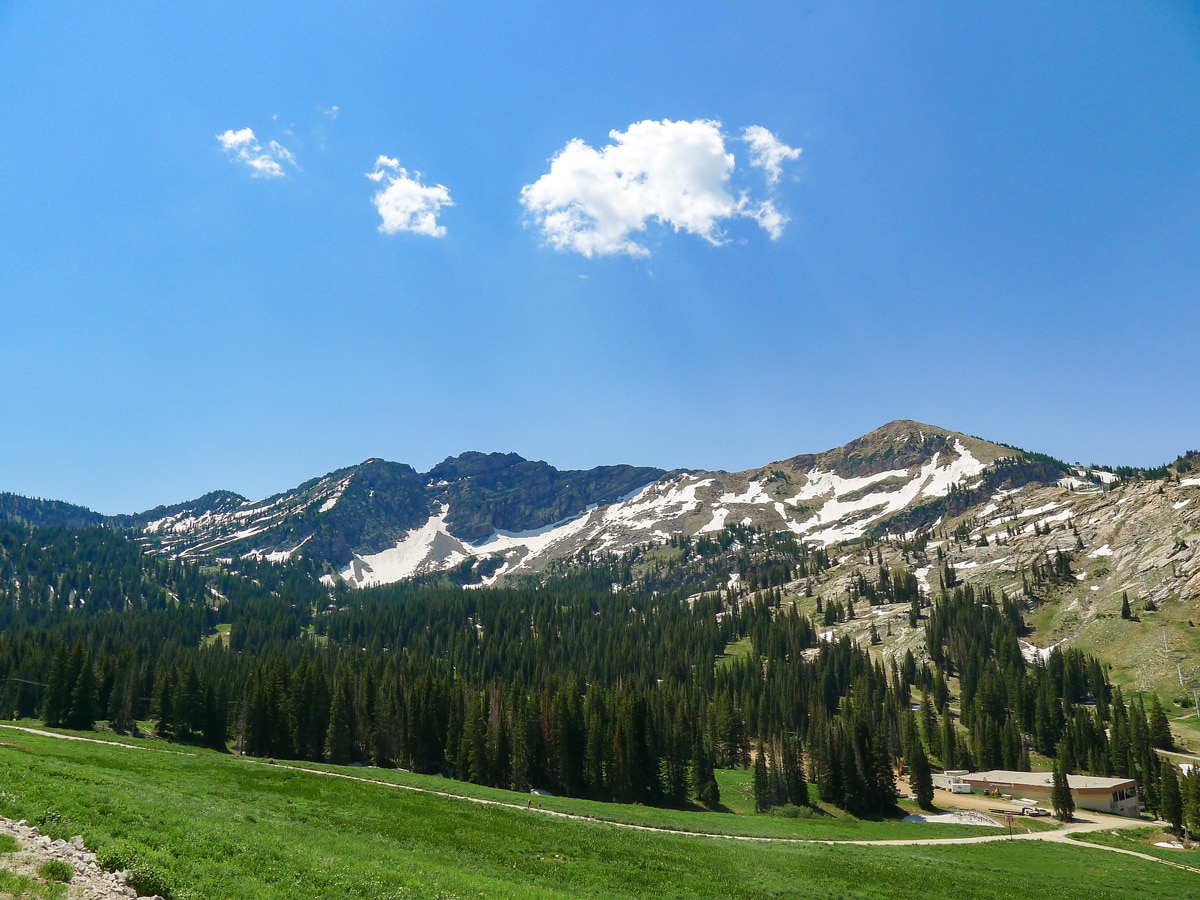
Cecret Lake Trail
Difficulty Rating:
Using the access road for Alta ski lift maintenance, you are swept to high elevation without having to do much in the way of hard work. Starting in high alpine meadows, the short Cecret Lake Trail goes to a stunning alpine lake. A great reward for relatively little effort!
Getting there
To get to the start of the Cecret Lake Trail, go up Little Cottonwood Canyon Road (UT-210) towards Alta Ski Resort until the pavement ends. Continue up the obvious dirt road (Albion Basin Road, passable by sedans) till it ends at the Albion Basin Campground. Right before the gates of the campground is the small parking area, which fills very quickly. If you cannot park here, drive back the way you came for 0.5mi; park at the Catherine Pass trailhead. The trail begins just to the right of the gate of the Albion Basin Campground parking area.

About
| When to do | Late Spring through fall |
| Backcountry Campsites | In National Forest Wilderness |
| Toilets | At trailhead |
| Family friendly | Yes |
| Route Signage | Average |
| Crowd Levels | High |
| Route Type | Out and back |
Cecret Lake Trail
Elevation Graph
Weather
Cecret Lake Trail Description
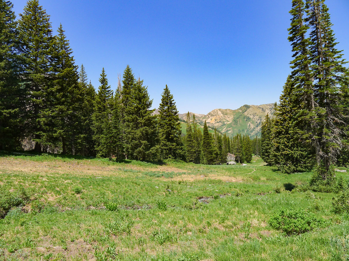
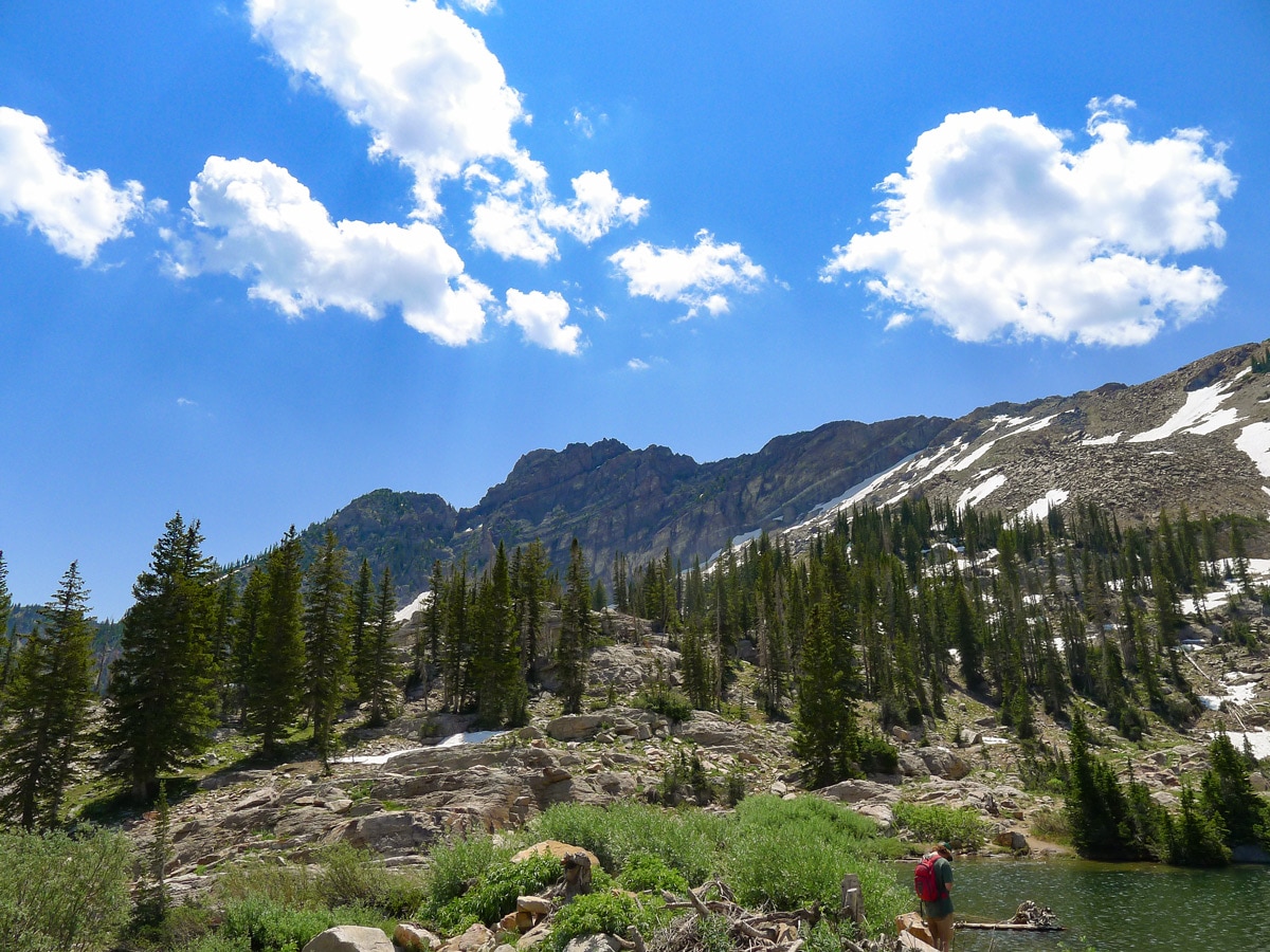
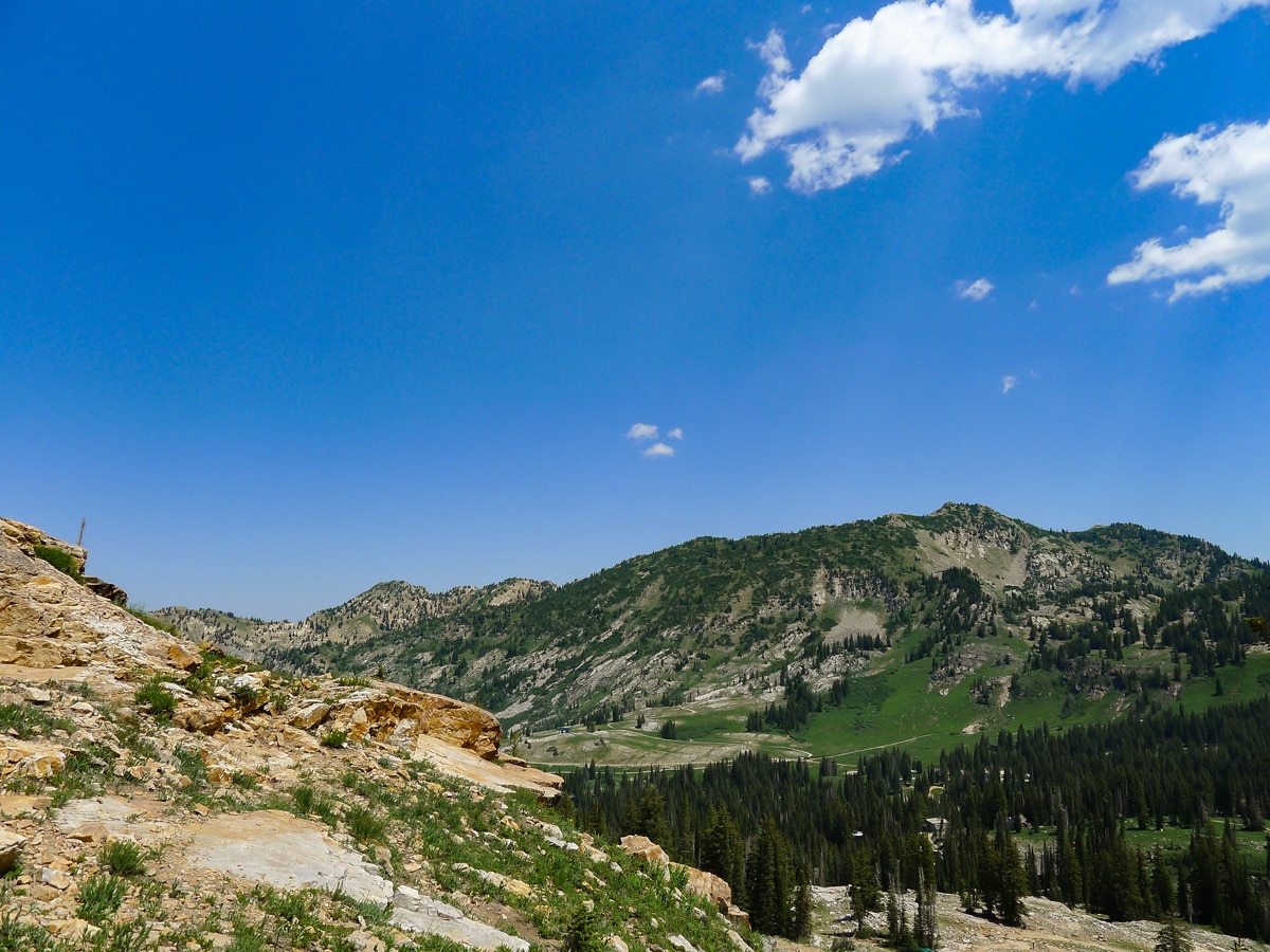
Start along the Cecret Lake Trail and cross over a small creek, making your way along the narrow single track until it begins to widen. Soon you will merge onto a wide jeep road, which you will follow for most of the trail. There are a few spots along the road where it looks like a trail diverges, but continue along the jeep track until you reach a signed junction. You will pass over several streams as you traverse the stunning alpine meadows.
As you make your way along the trail, you will pass several signs explaining the geology and biology of the region. Additionally, wildflowers will blanket the lush meadows if you go in the spring, creating a vibrant atmosphere filled with natural beauty. You will soon come across a junction where you will follow signs left toward Cecret Lake.
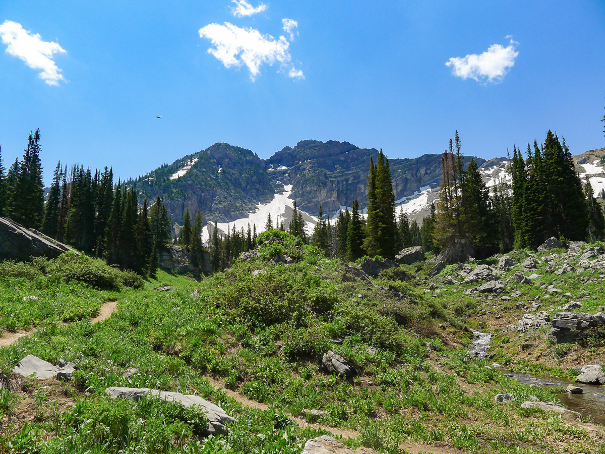
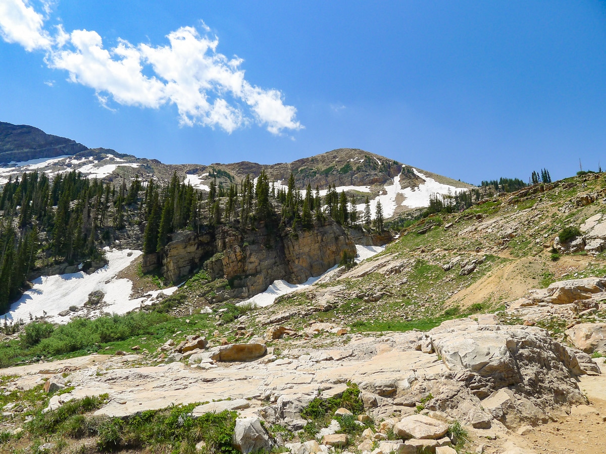
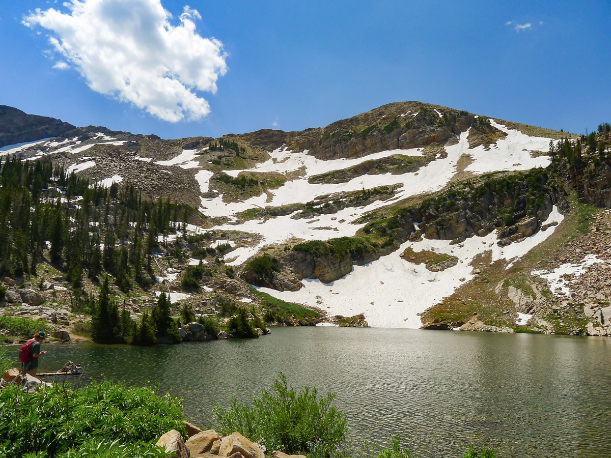
After this junction, you will hike up a series of switchbacks along the steepest part of the trail, before finally cresting the ridge. The lake is located right below Sugarloaf Mountain to the south, and the subsidiary peaks of Mount Baldy to the southwest. The view up here is nothing short of stunning.
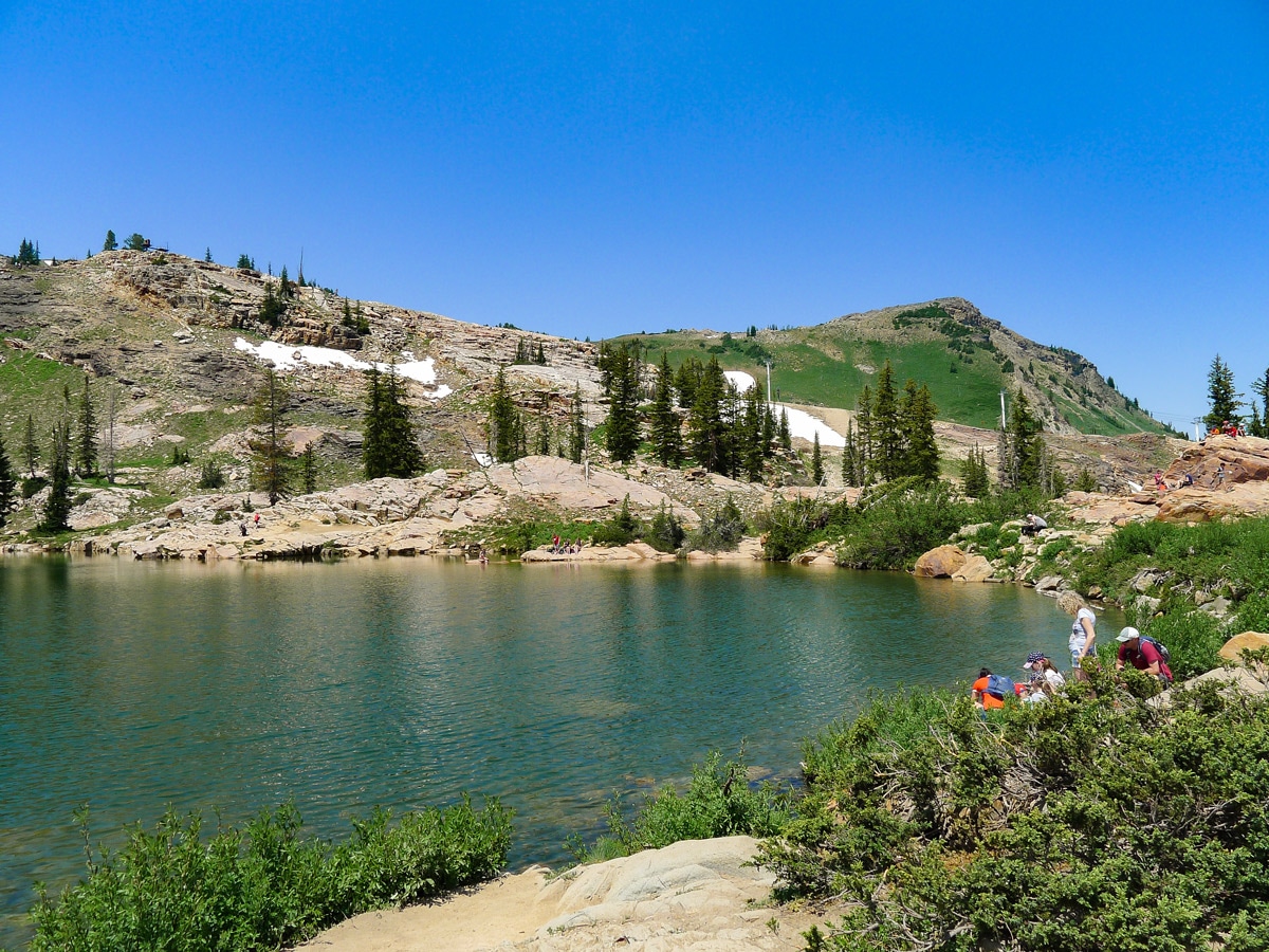
Swimming is not allowed in the lake since it is part of the Salt Lake watershed. After resting on the smooth rocks lining the lake, return the way you came.
Trail highlights
Cecret Lake
Located in Albion Basin within the limits of the town of Alta, Cecret Lake is a small but beautifully scenic alpine lake that is part of the Wasatch National Forest.
Accessible by hiking trail during the summer months, the area surrounding Cecret Lake features several ski resorts that also make it a popular destination in the winter, when the area is blanketed in snow. When the high volumes of snow in the area melt during the summer, they provide the Utah area with clean drinking water, making Cecret Lake an integral part of the surrounding watershed.
Insider Hints
A perfect alpine picnic spot!
In the spring, the streams that cross the path tend to run quite high. Bring poles to help with the crossings if you are unsure on your feet.

Similar hikes to the Cecret Lake Trail hike
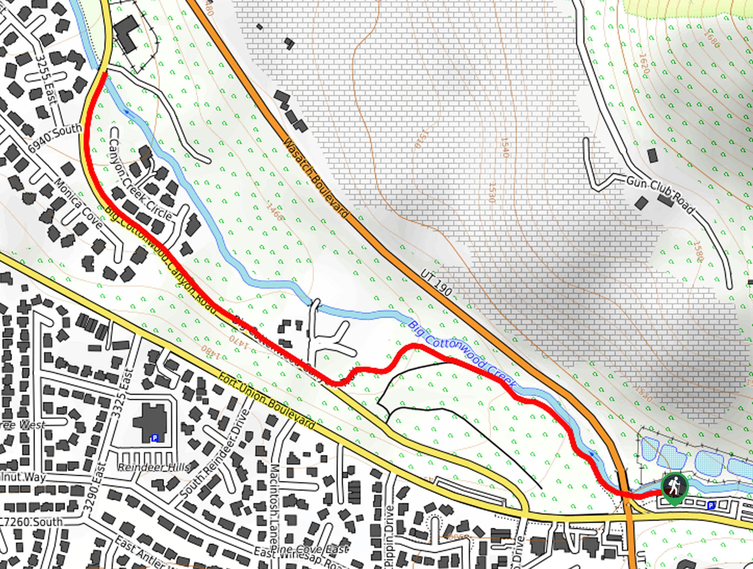
Big Cottonwood Canyon Trail
The Big Cottonwood Canyon Trail is a well-maintained path in Salt Lake City, Utah. This is a multi-use trail popular…
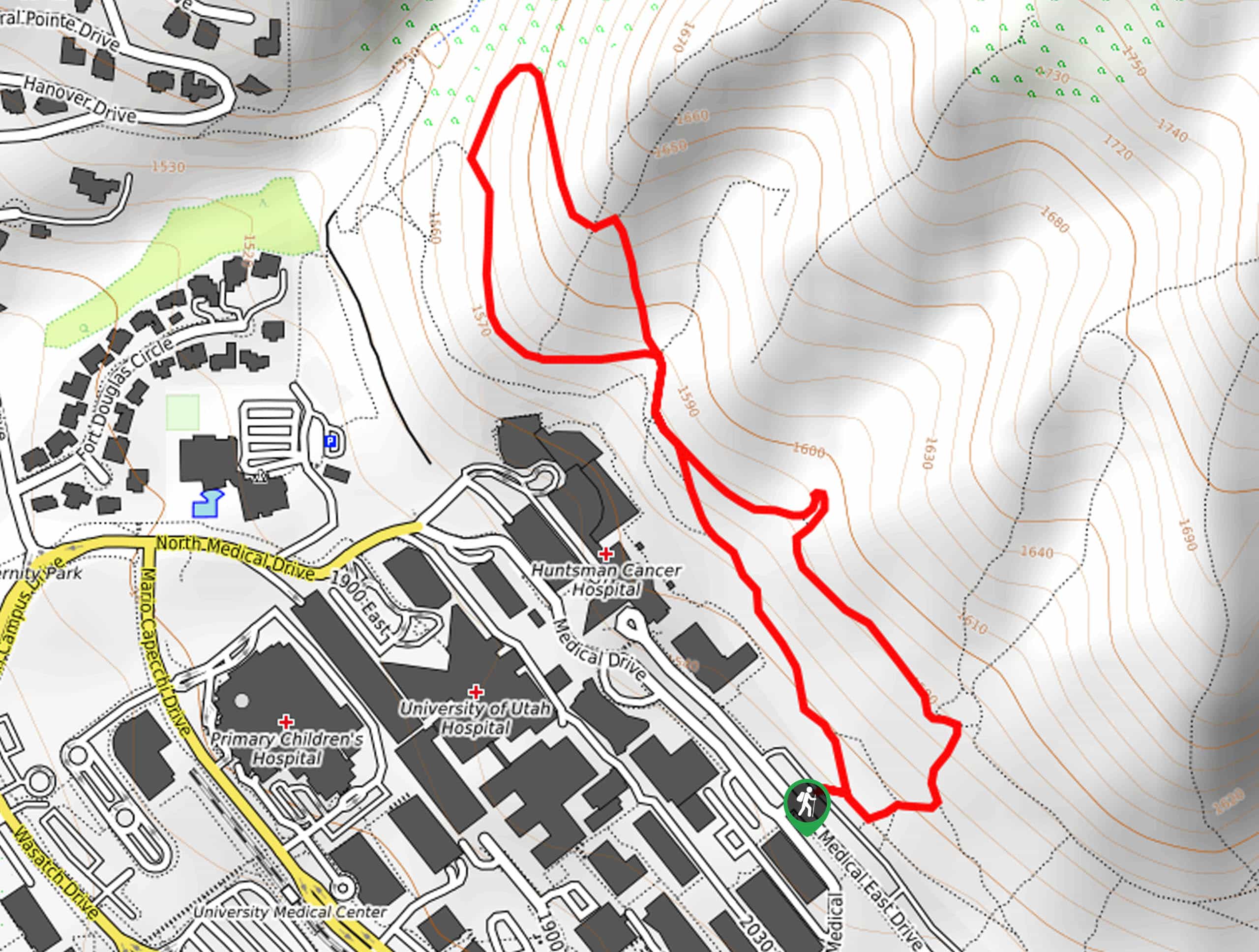
The Bonneville Shoreline Trail Double Loop
The Bonneville Shoreline Trail Double Loop is a beautiful hike in Salt Lake City. This trail, which borders the University…
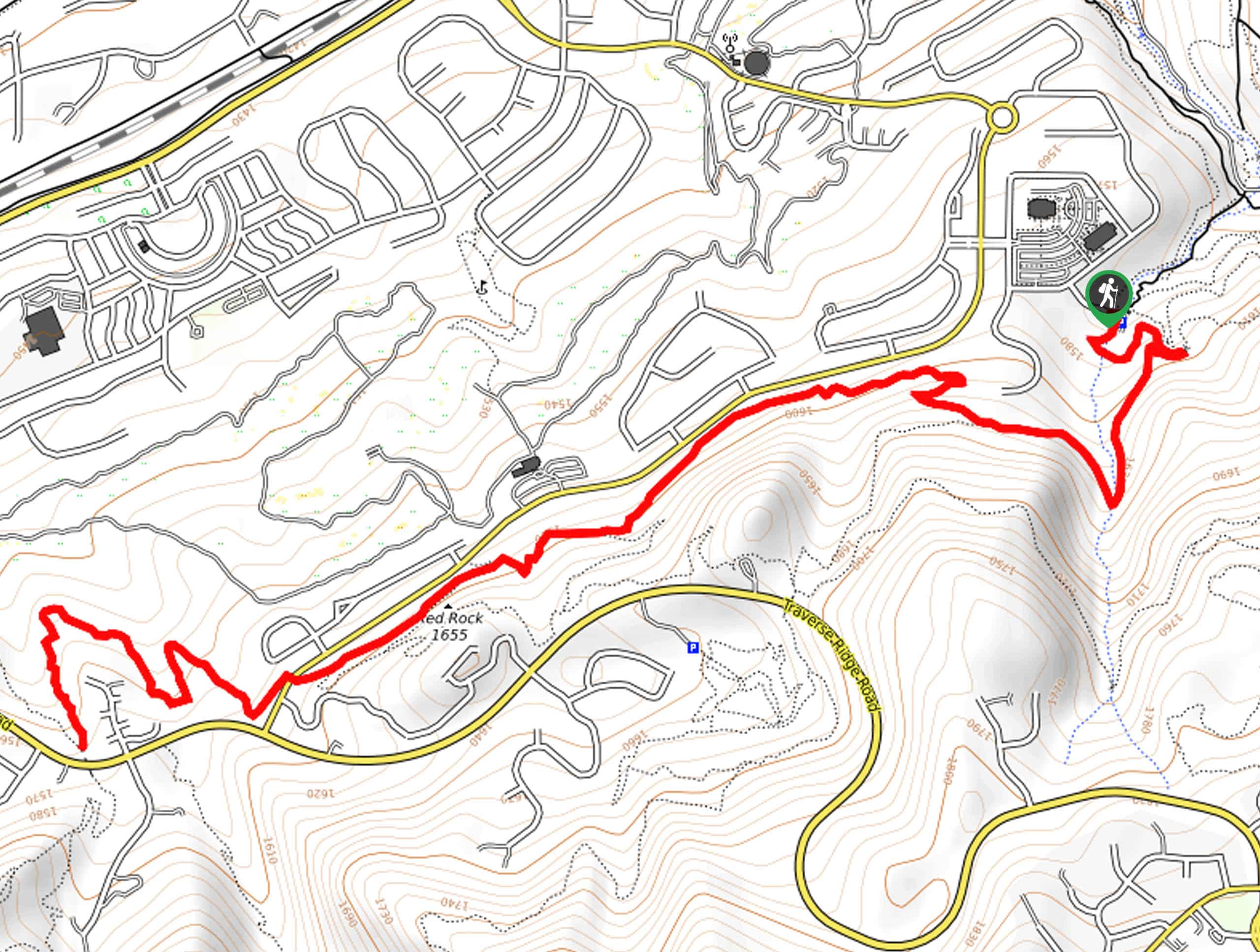
The Bonneville Shoreline Trail via Coyote Hollow Trailhead
The Bonneville Shoreline Trail from Coyote Hollow is a gorgeous route on the eastern edge of Draper, Utah. This section…
ArnoldM 4 years ago
Spectacular views! Stop at all the lookout points along the way and walk the trails.
April O. 4 years ago
We had a nice peaceful picnic here.
marjflores 4 years ago
Short climb with amazing scenery!
benhilton 4 years ago
The alpine meadows and lake views were fantastic.
Willy G. 4 years ago
Cool hike. Fantastic trail. Definitely doable and great for kids.
Washington H. 4 years ago
I would agree that it is an easy trail. It's very short, we didn't notice time has already passed.
Jane L. 4 years ago
This is a great rewarding hike considering the technical difficulty and surroundings.
Zuzu T. 5 years ago
It was so easy! I am so pleased.
Tim_101 5 years ago
came here with my daughter as she wanted a great selfie ^^
Naomi W 5 years ago
Easy walk. Wonderful nature and plenty of nice spots to chill!