hikes in Seattle
Seattle Hikes
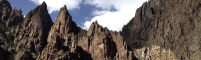
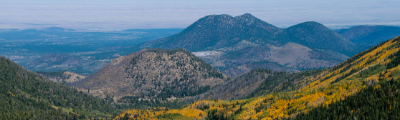
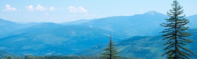
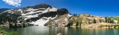
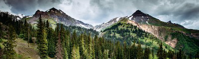
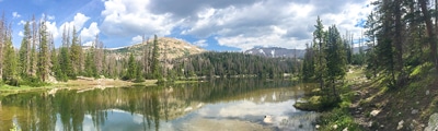
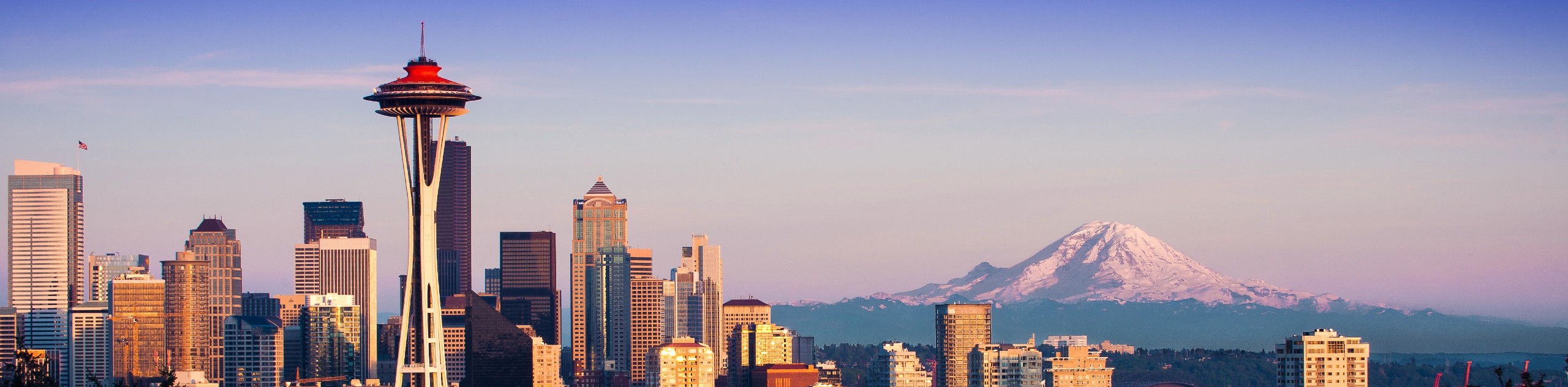
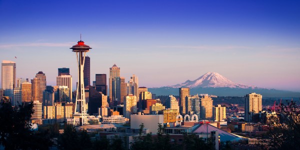
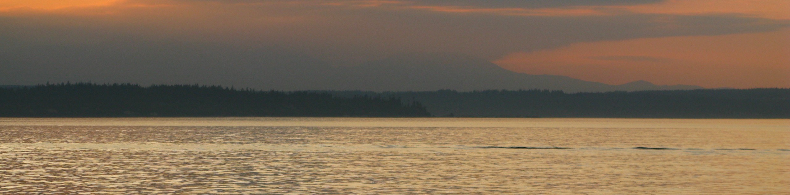
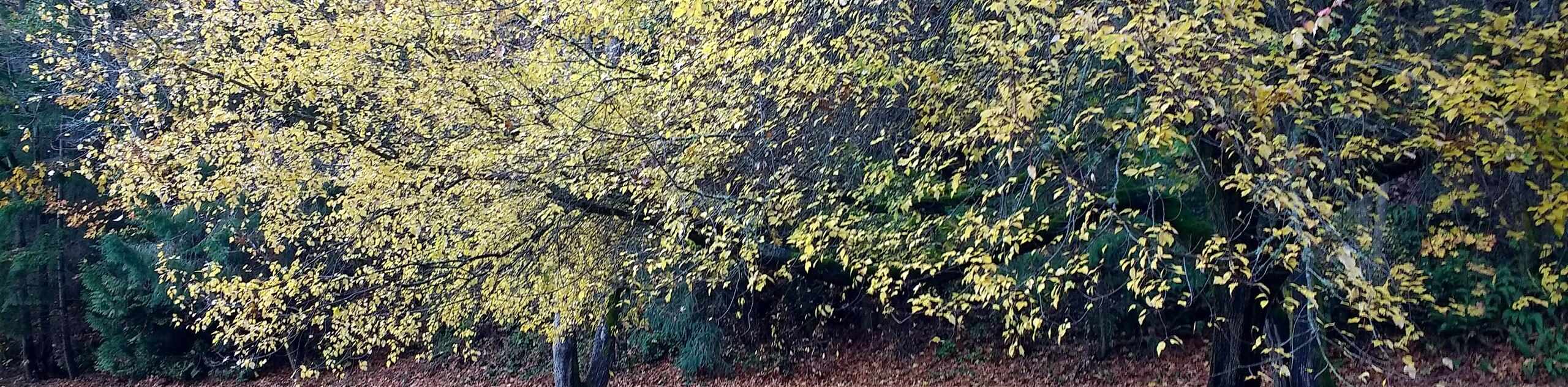
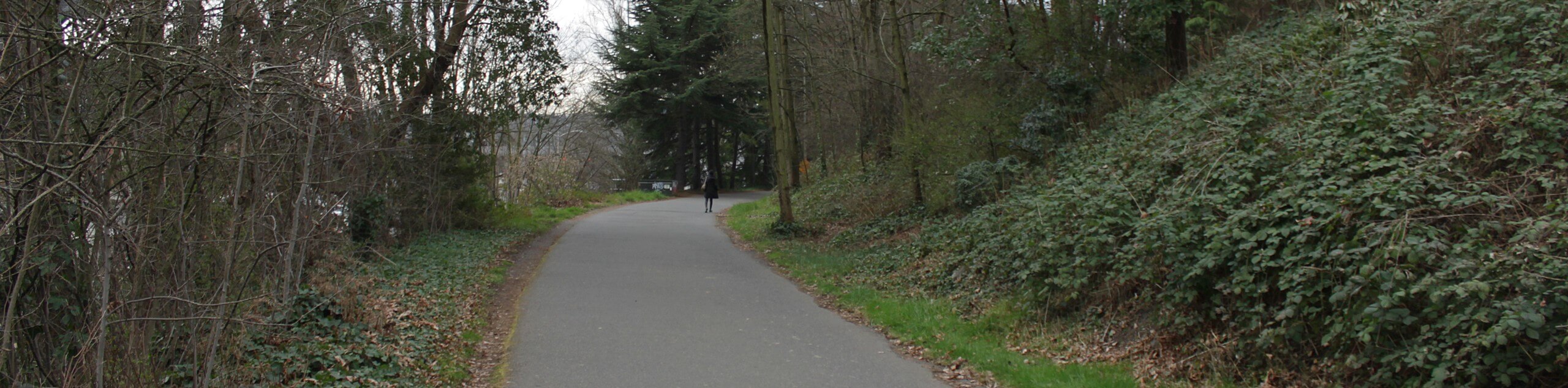
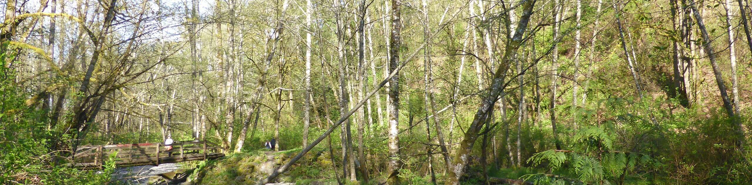
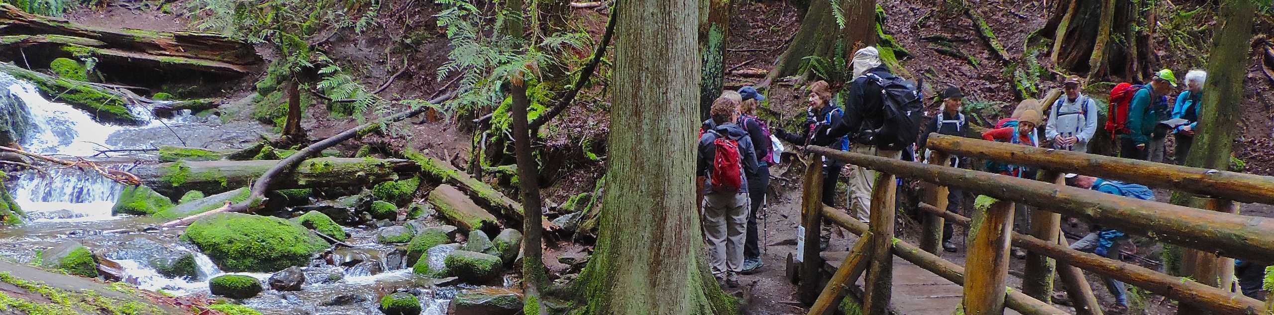
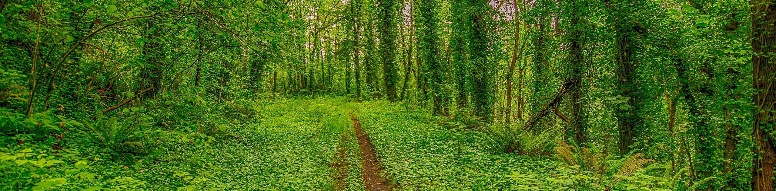
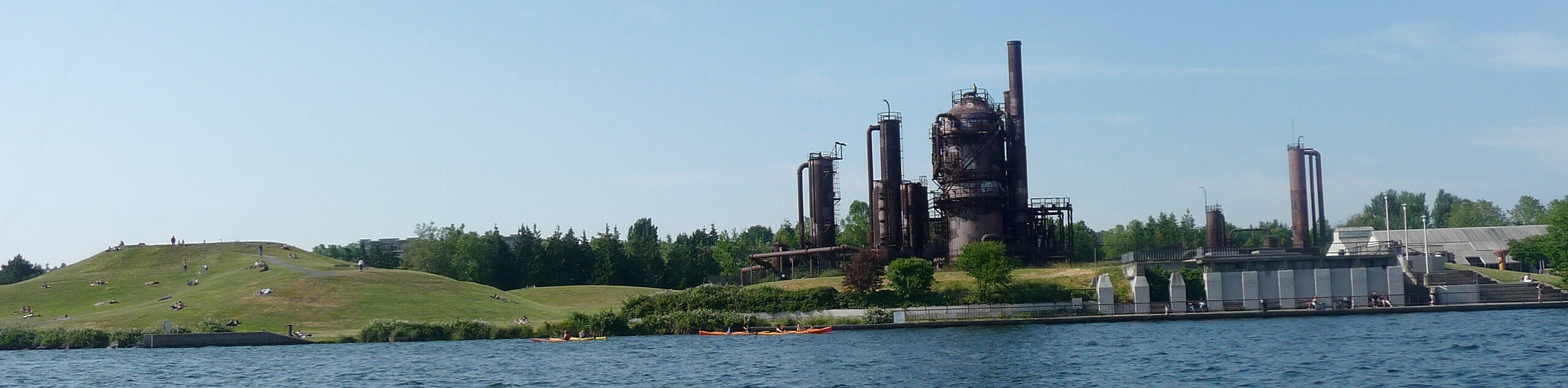
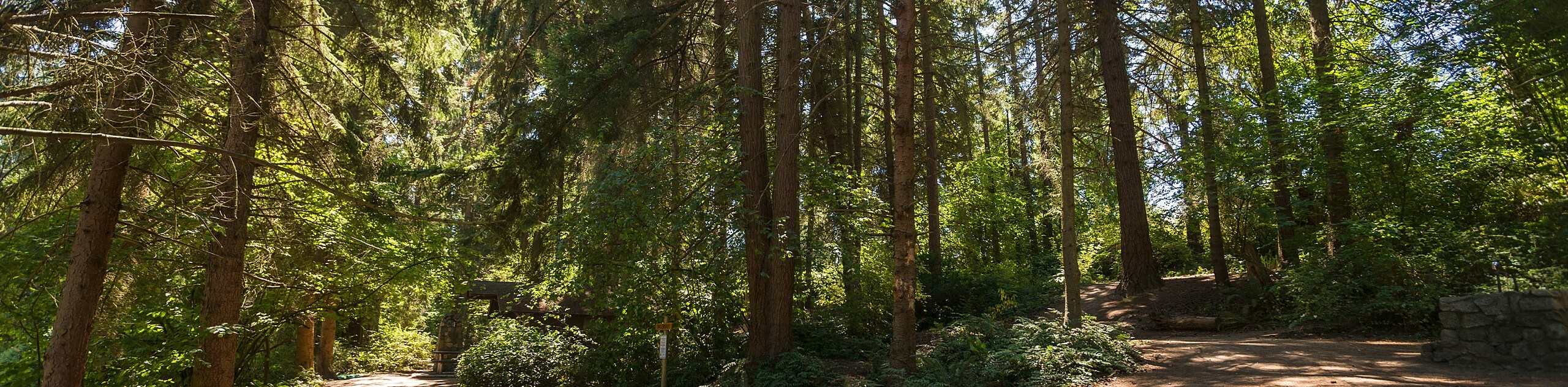
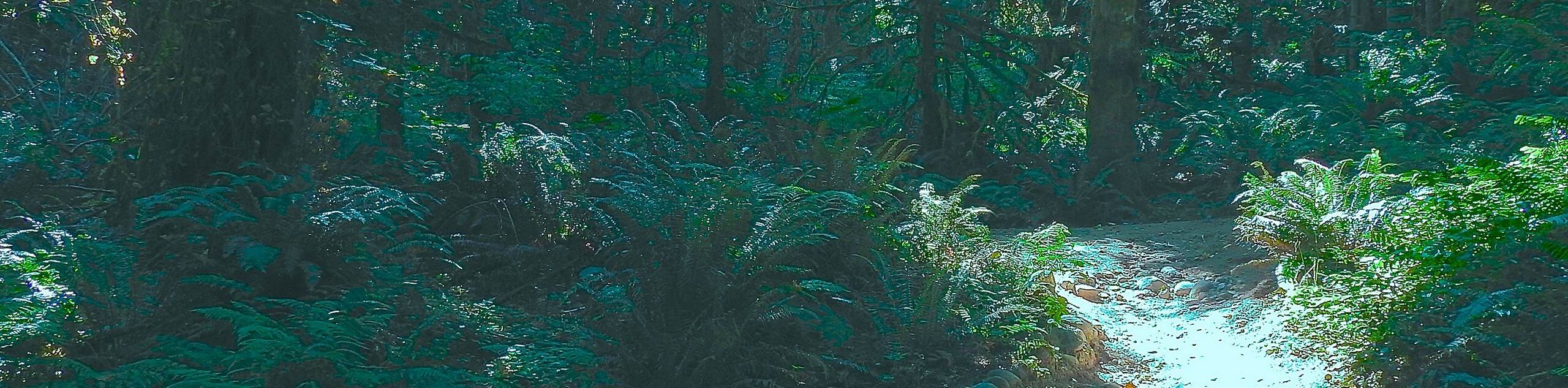
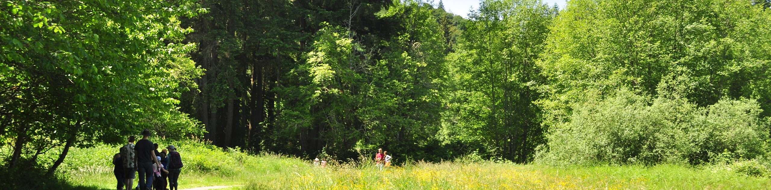
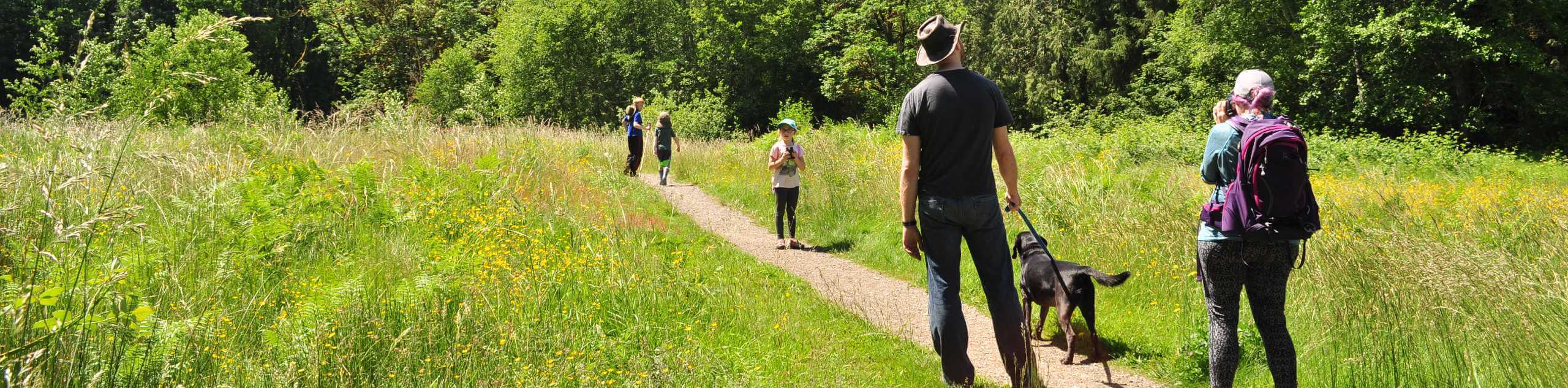
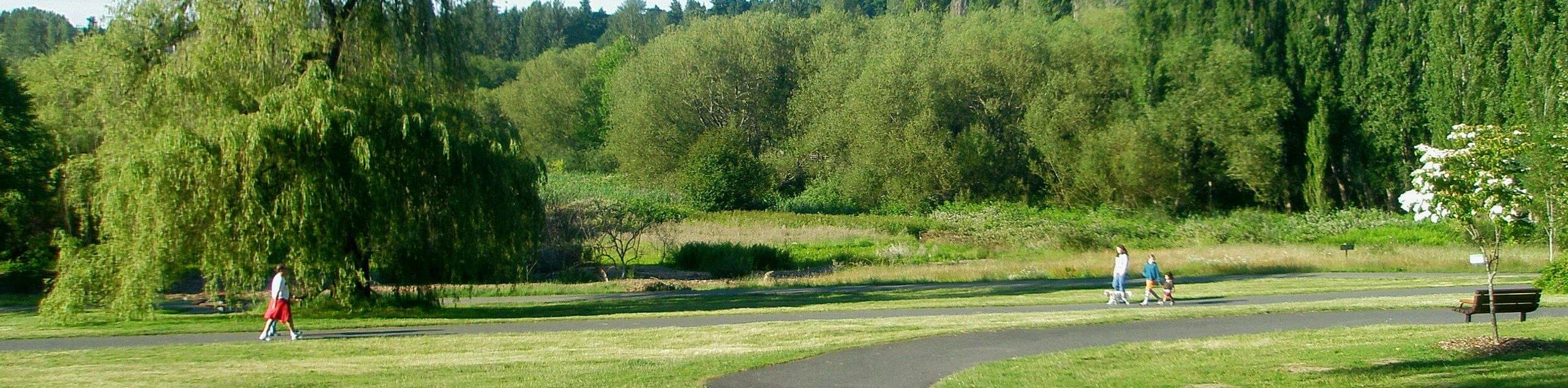
Seattle hikes are a great past time, as they offer the chance to enjoy the breathtaking landscapes of the surrounding area. However, in Seattle you don’t have to get out of the city to get outside! There are nearly 500 parks in the Seattle Parks and Recreation System, offering over 120.0mi of trails right within the city limits. Pair that with the miles upon miles of stunning coastline accessible in the city and you’ve got a metropolis fit for plenty of walking. If you do want to venture a little further, there are plenty of Seattle hikes located just outside of the city that provide a different (but just as wonderful) experience, trailing through old-growth forests and leading you up mountains with stellar viewpoints over the city below. Hikers in and around Seattle are spoiled for choice.
Seattle hikes within the city often cater to all crowds, covering flatter terrain with lower difficulty levels. Don’t think these city walks are a snooze, though! With carefully manicured gardens and wild urban forests alike, you’ll feel far without actually leaving the city. Those venturing further out can bag summits and challenge their skill levels with ease of access guaranteed by few urban centers. Whether you’re casual or committed, Seattle hikes will certainly deliver an amazing experience!
20 Amazing Hikes in and around Seattle
With so many parks and trails within reach, choosing a Seattle hikes can be a bit daunting. No worries, we’ve put together a comprehensive guide to some of our favorite Seattle hikes to help kickstart your adventures.
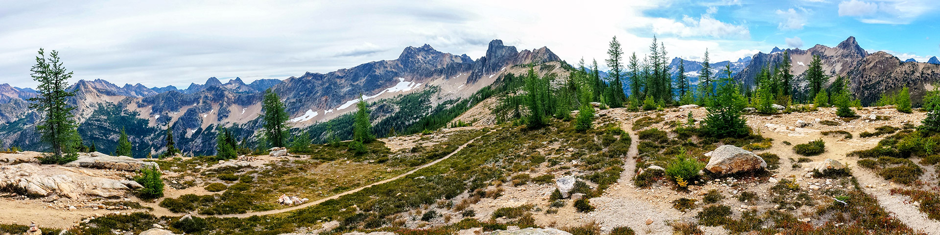
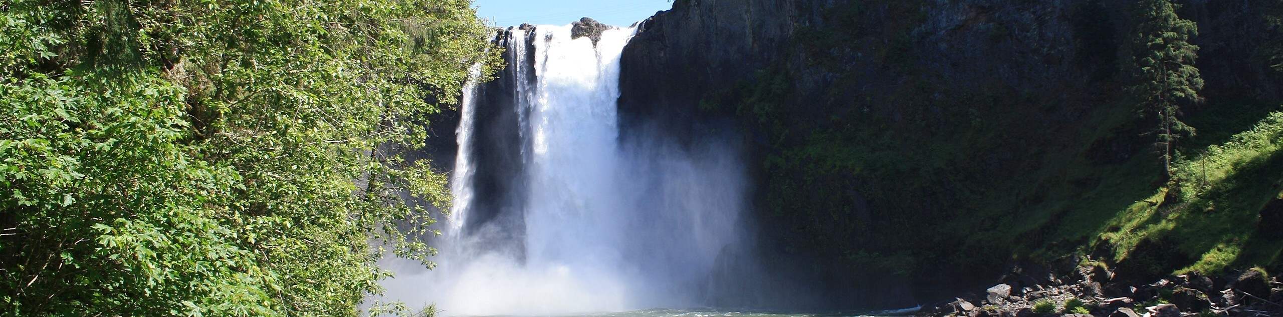
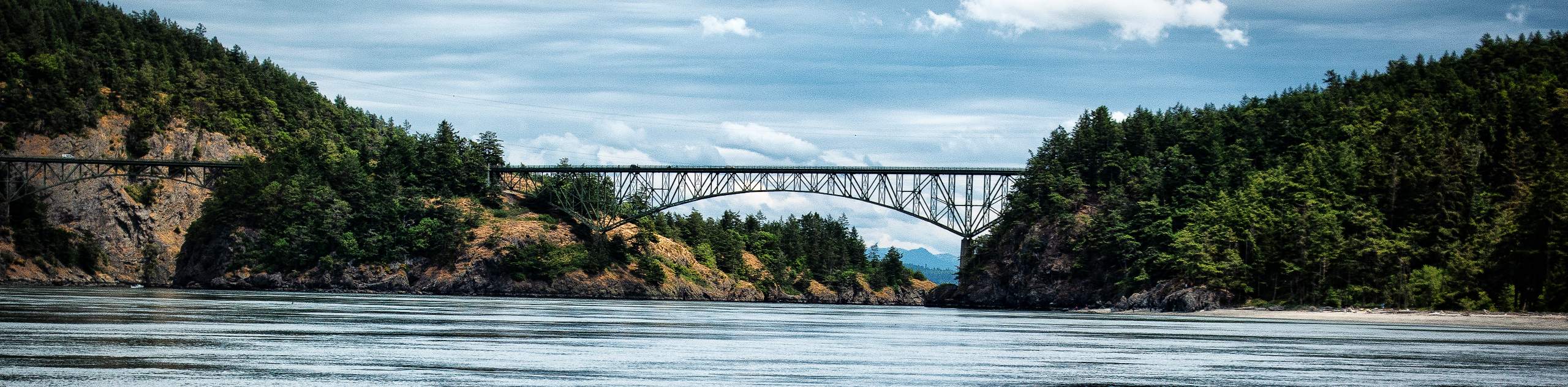
There is a trail for every hiker in Seattle. There are family-friendly trails, ADA-accessible trails, and more challenging hikes on offer, so you’ll be able to pick the right one no matter what you’re seeking. Frequent your top picks on nice mornings or make a list of hikes to try if you’re just visiting. Check out state icons like Snoqualmie Falls and the Deception Pass Bridge or try quirky adventures like the Maple Valley Gnome Trail. The options are nearly endless, so you better choose a Seattle hike that suits your style and get out on the trail!
- Snoqualmie Falls Trail - The Snoqualmie Falls Trail takes you to see one of the most iconic waterfalls in Washington, a familiar sight for Twin Peaks fans. A visit to Snoqualmie is a worthwhile stop for any hiker in the area, and it’s one that allows you to discover the region’s ecosystem and Native American culture as you go.
- Deception Pass Bridge - Walking the Deception Pass Bridge and the nearby Beach Trail are a perfect way to spend an afternoon near Seattle. Kids love the bridge that spans over Deception Pass, and the history of the area can be appreciated at the monument on Pass Island.
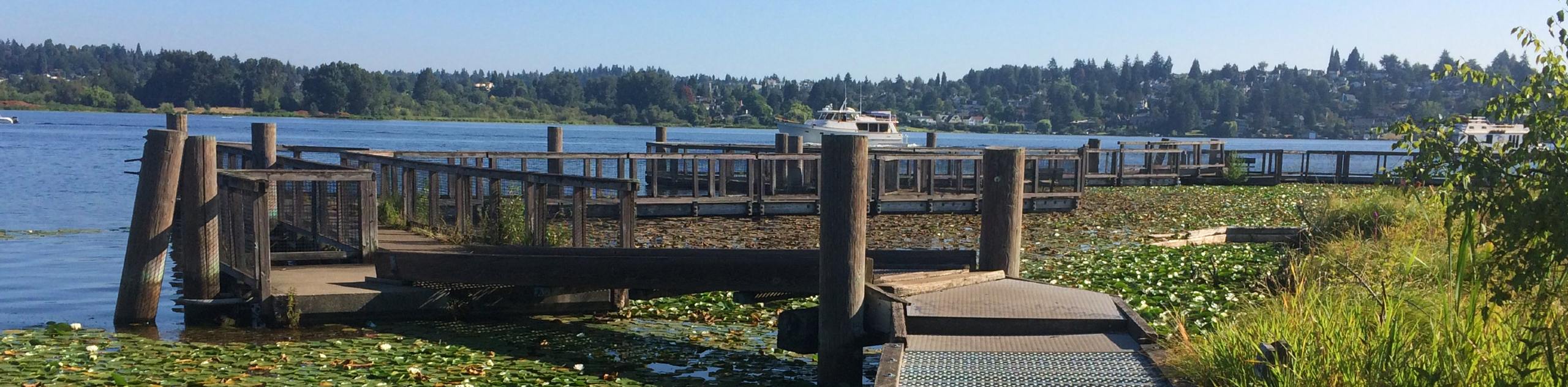
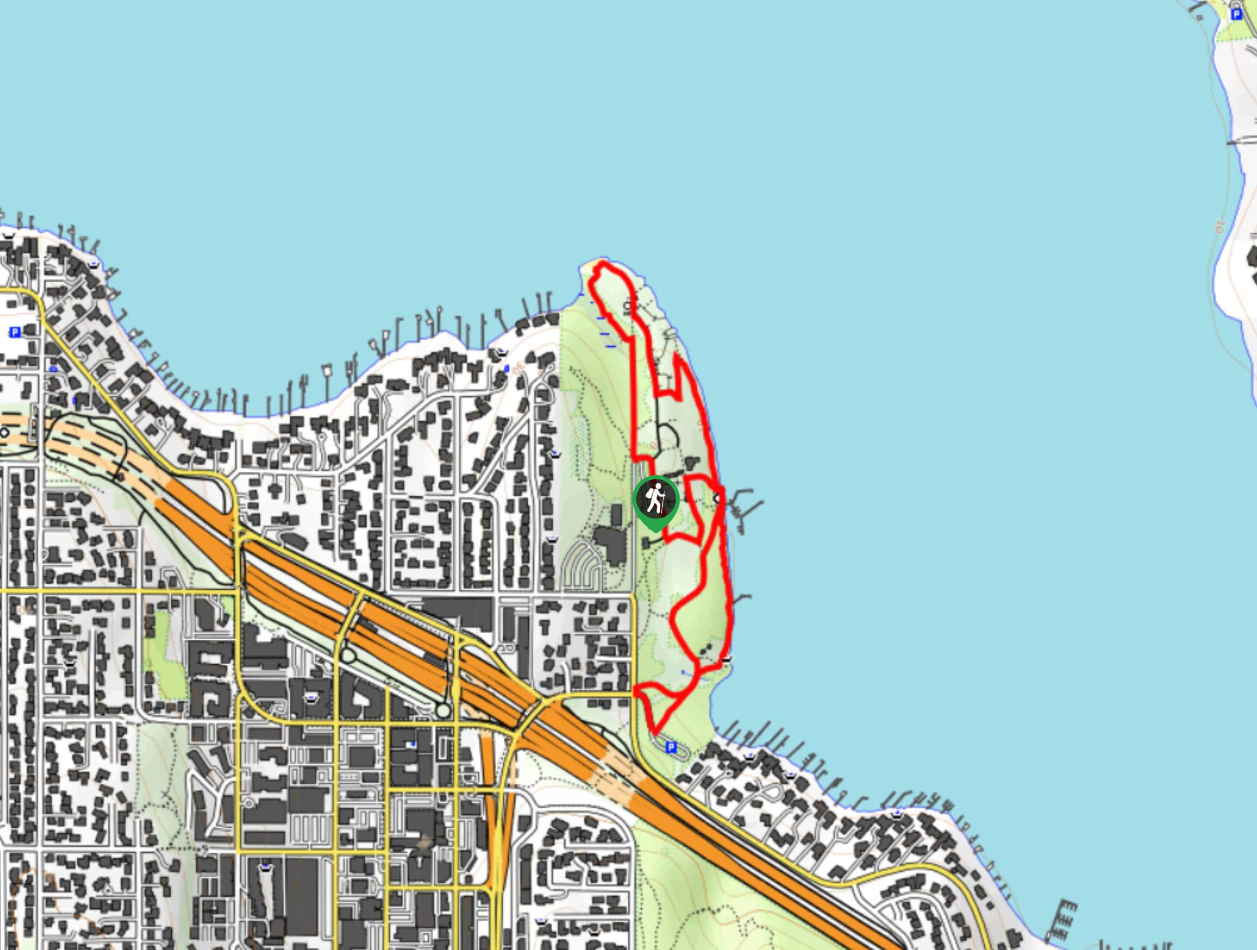
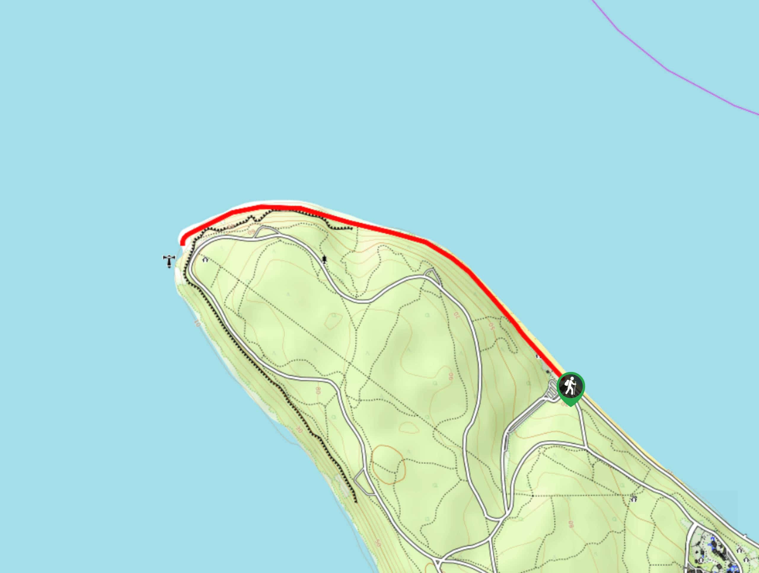
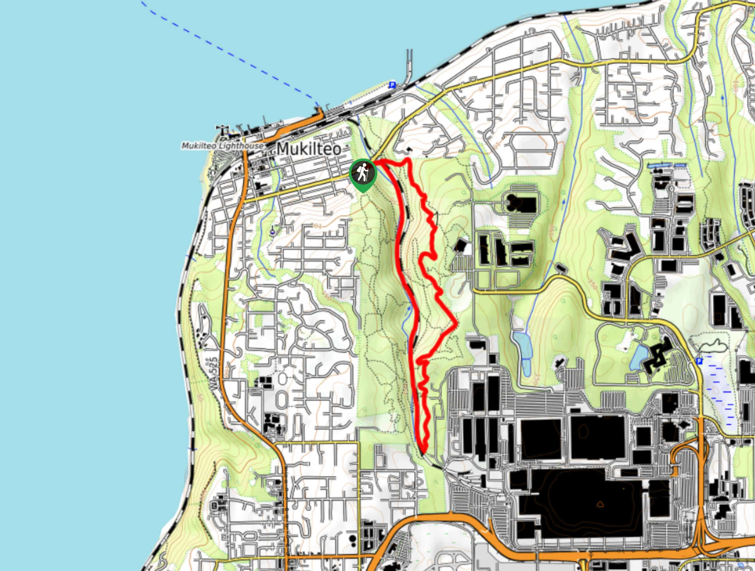
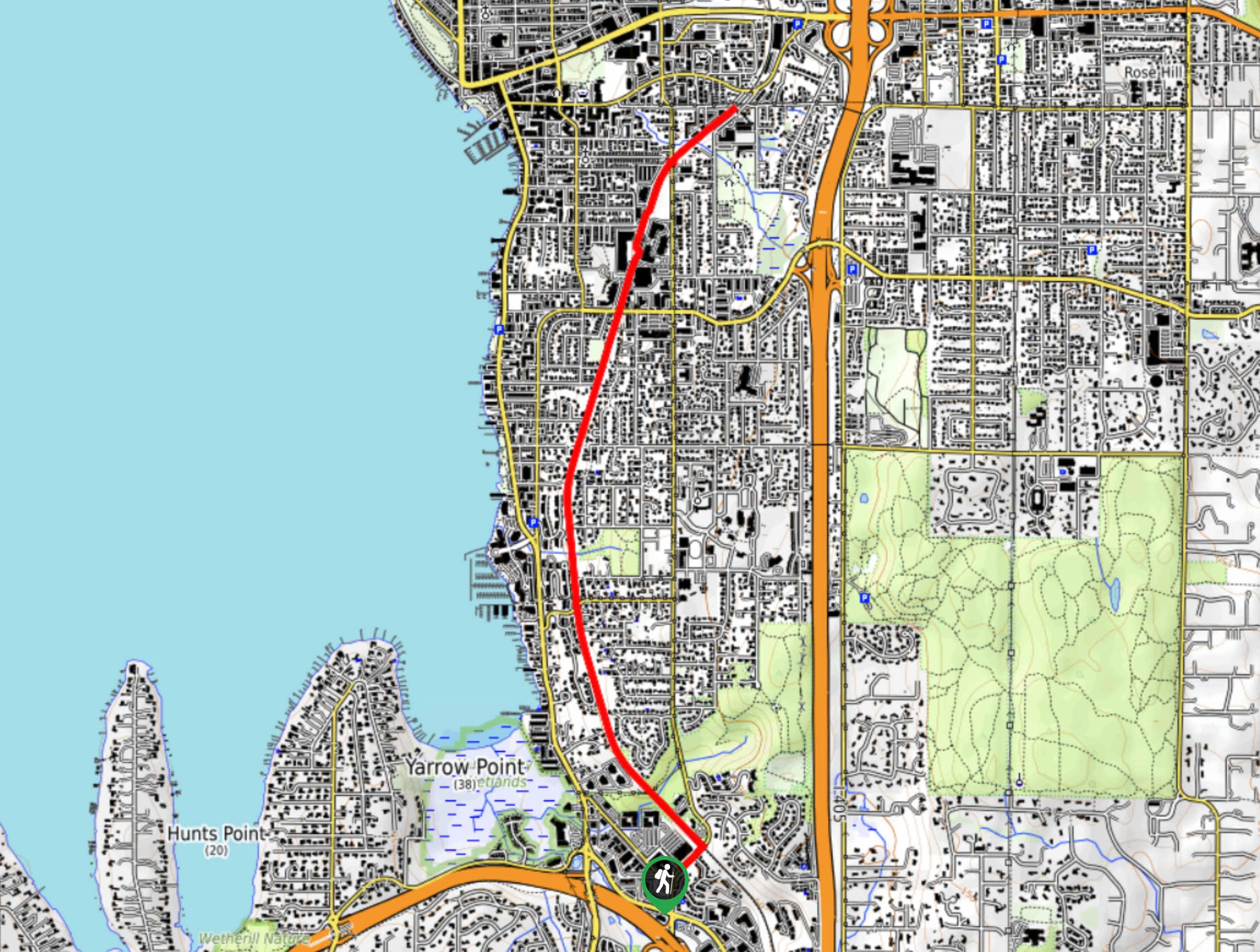
- Discovery Park and Lighthouse Loop - The Discovery Park and Lighthouse Loop Trail is part of a designated National Recreation Trail that takes you through gorgeous forests and meadows. It’s a go-to for local runners and walkers, especially the portion of the trail that extends out to the beach where the West Point lighthouse is.
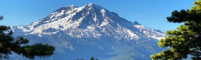
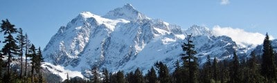
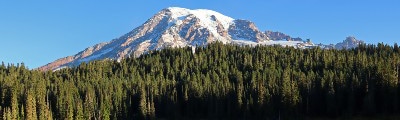
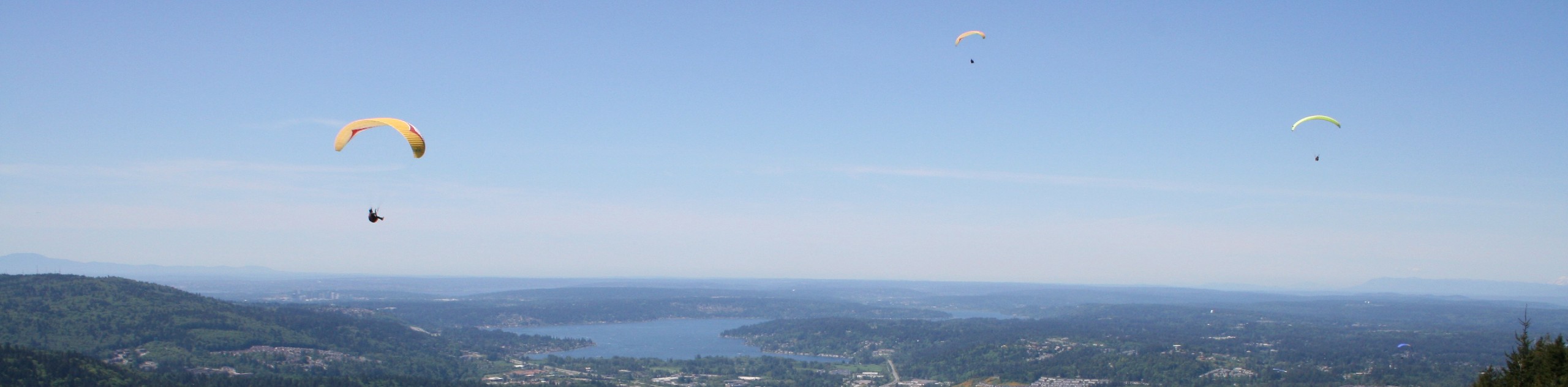
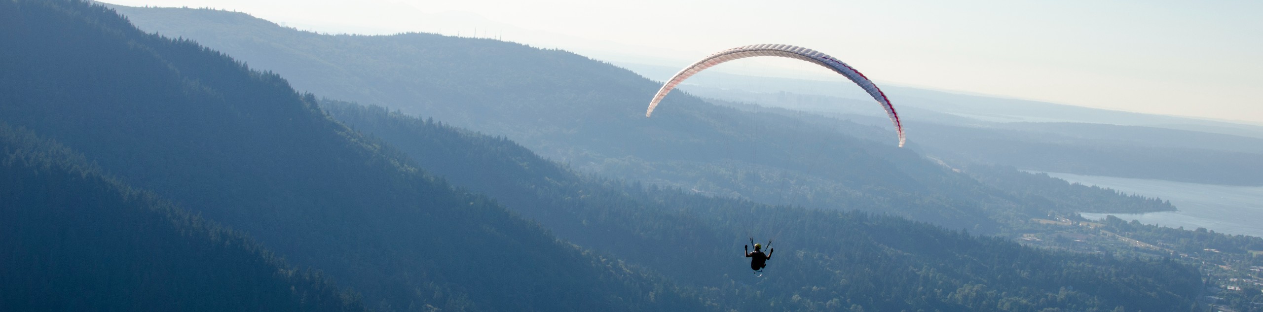
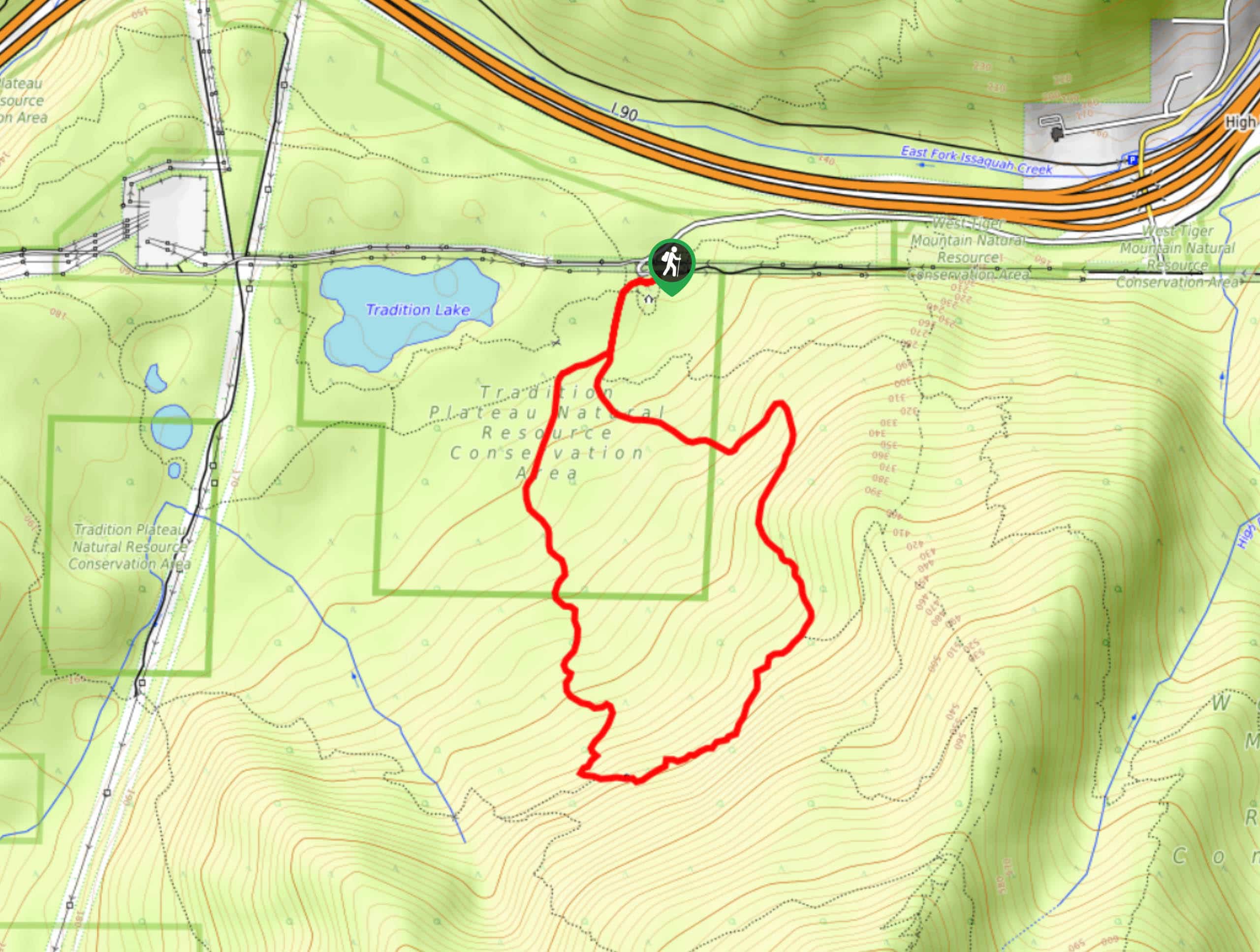
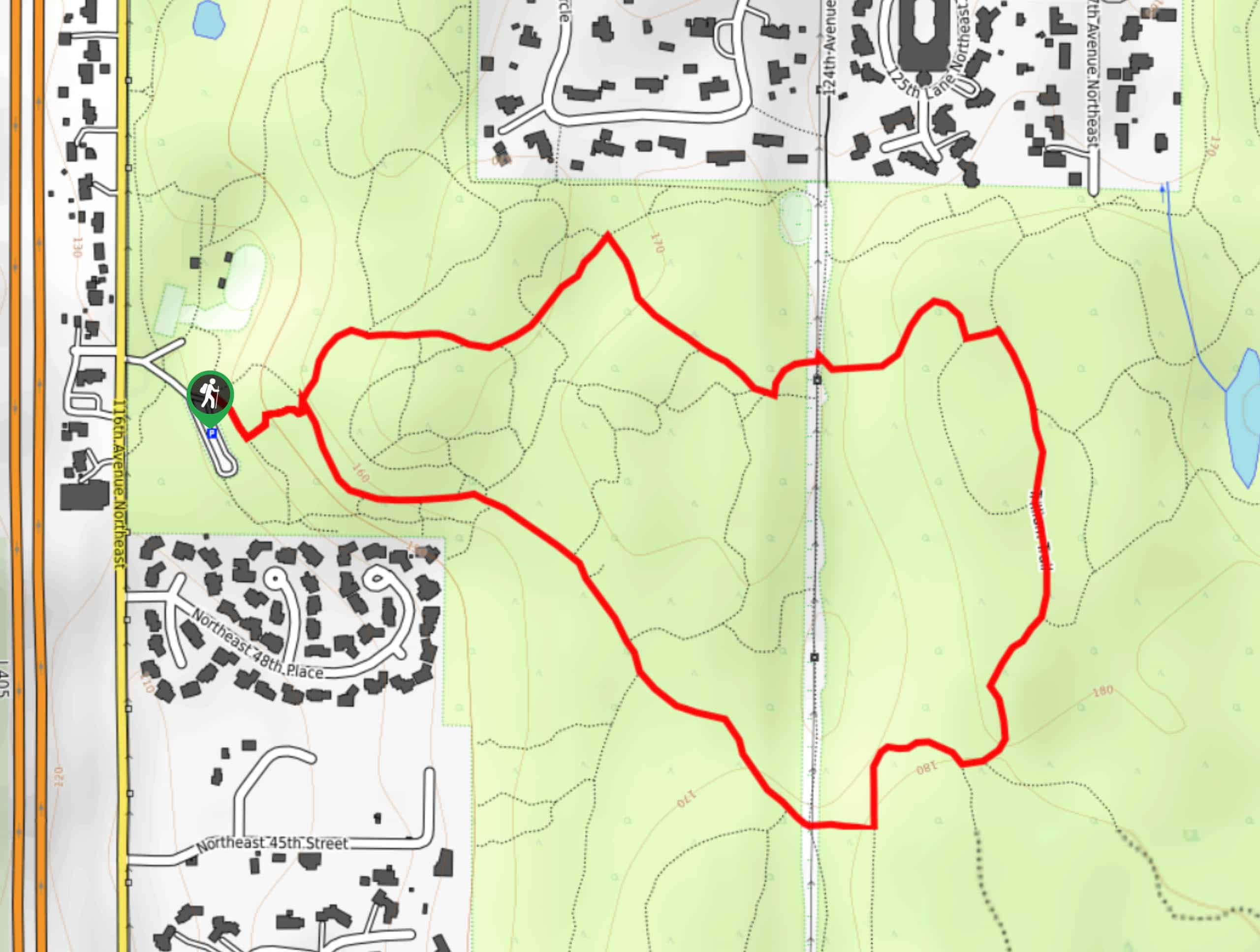
- Poo-Poo Point Trail - Poo-Poo Point is a frequently visited destination on the shoulder of West Tiger Mountain. The point has fabulous views of Mount Rainier and is easy enough for beginner hikers to get to. On a clear day, it’s the ideal overlook across the forest to Rainier.
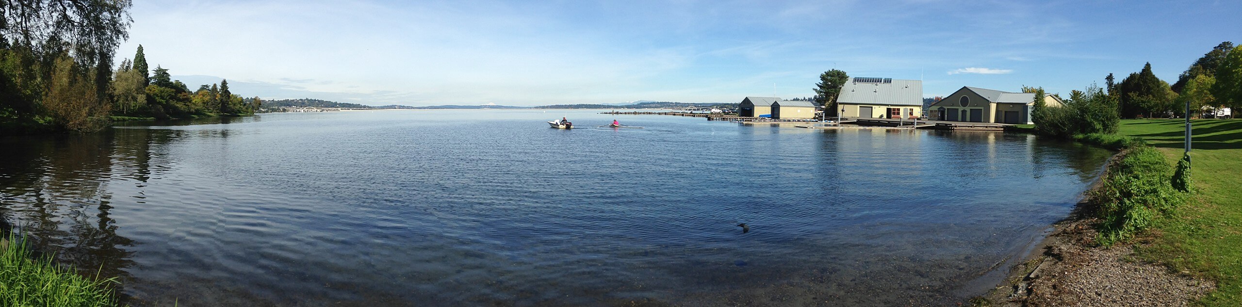
- Seward Park Loop Trail - The Seward Park Loop Trail is a short and sweet route that loops around the perimeter of Seward Park on Bailey Peninsula. This simple route is frequented by walkers, runners, bikers, people with dogs, and families. It’s a quick escape from the city and it offers diverse flora and fauna despite its proximity to the city and humble size.
- Carkeek Park via Pipers Creek Trail - Carkeek Park via Pipers Creek Trail is a perfect way for hikers of all skill levels to get some fresh air. The forest offers a nice sense of tranquillity even on busier days. After you hike through the trees, you’ll be treated to views of Puget Sound.
- East Tiger Mountain Summit - The East Tiger Mountain summit is a popular pick with hikers and mountain bikers and one of two frequently trafficked trails in the Tiger Mountain area. This trail takes you to two viewpoints, the lower of which has a few picnic tables you can use.
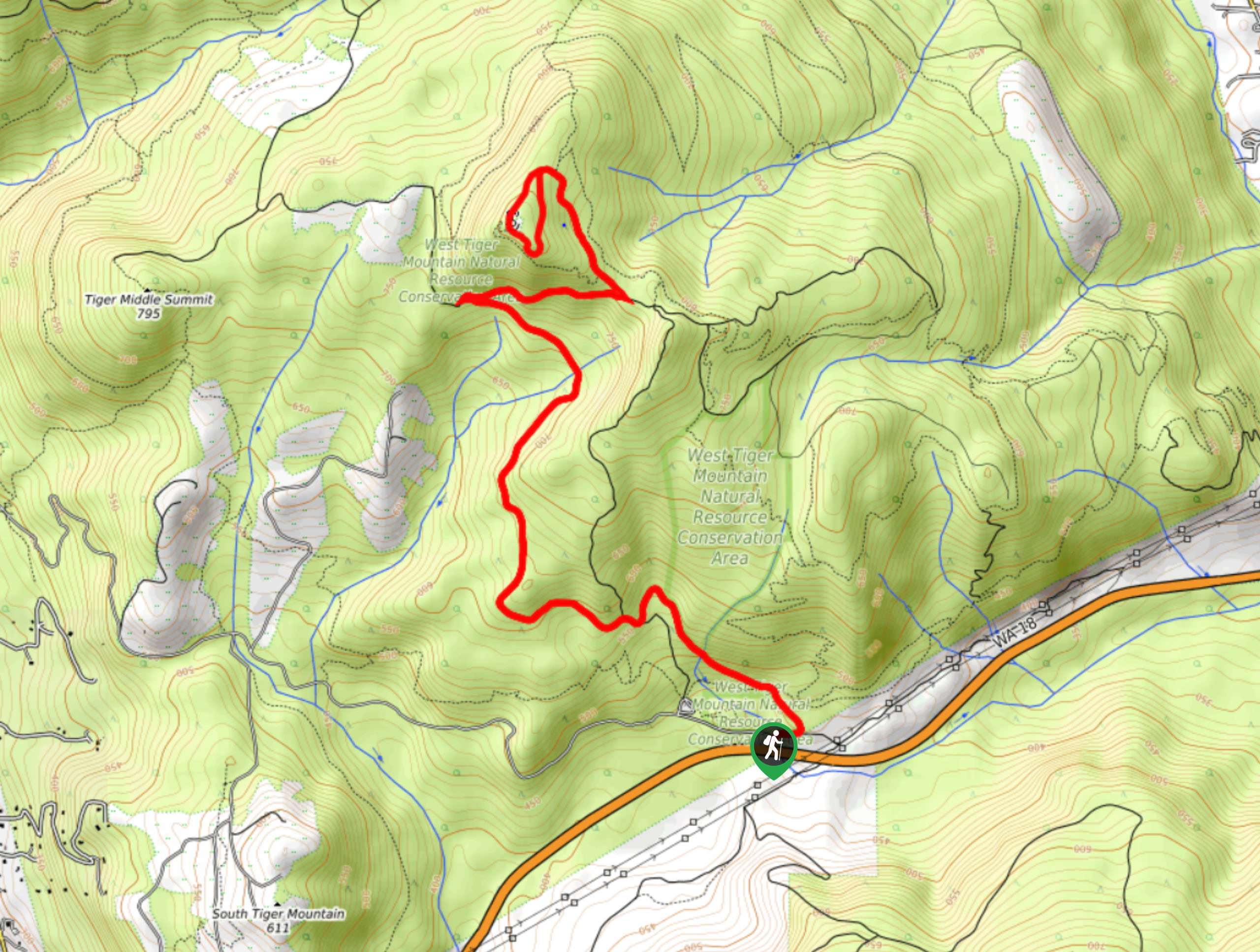
- West Tiger Mountain Summit - West Tiger Mountain via West Tiger #3 the go-to hike in the Tiger Mountain area. It’s harder and steeper than East Tiger, but despite the challenges, it’s a very scenic and enjoyable trip. Travel a forested trail to a summit with even better views than the east side.
- Warren G. Magnuson Park Loop - Warren G. Magnuson Park is one of the most visited recreational areas in the Seattle area. The loop walk around the park is the ideal trail for those wanting to get acquainted with the park for the first time, and it’s easy enough for nearly anyone to enjoy.
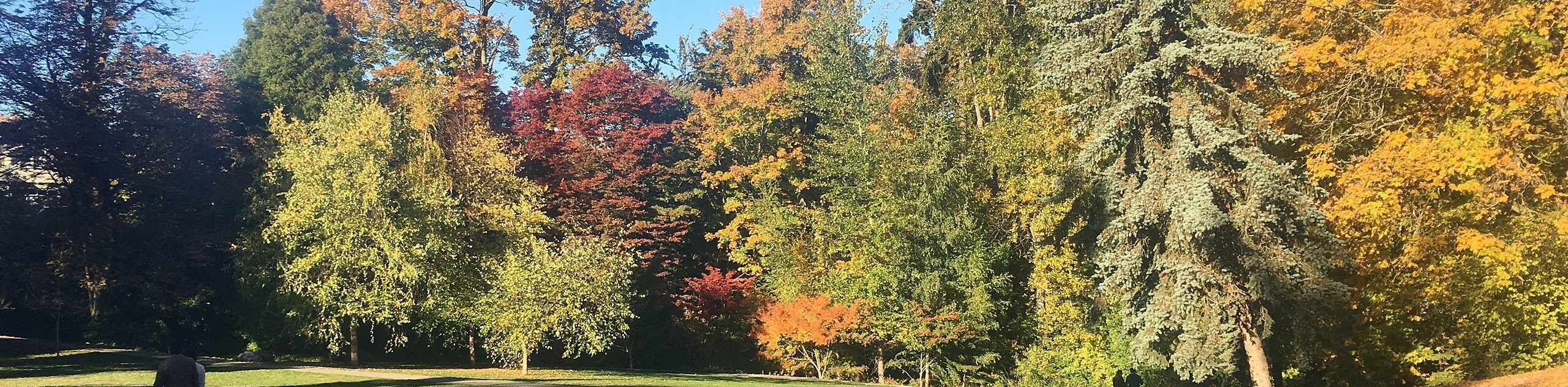
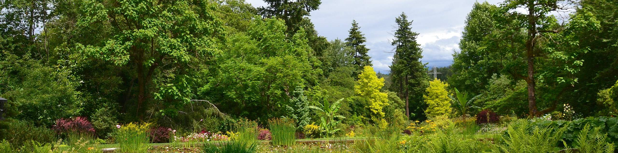
- Washington Park Arboretum Trail - The Washington Park Arboretum is a wonderful park bursting with trees and flowers. It’s packed with magnolias, oaks, maples, and countless flowers. The highlight of the arboretum and one of the best parts of the trail is the stunning Azalea Way. There are also meadows, a Japanese Garden, greenhouses, and groves of trees to wander through.
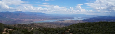
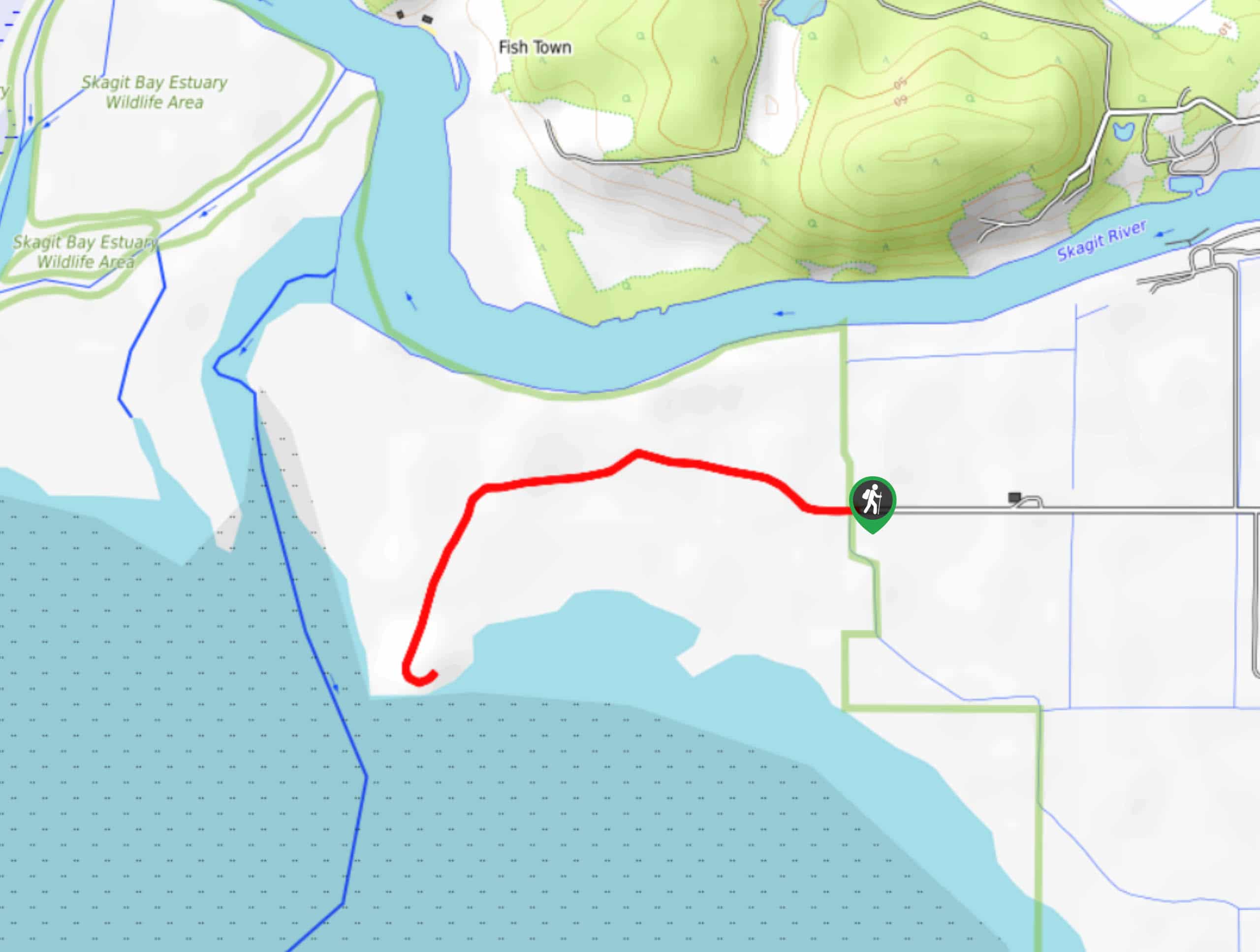
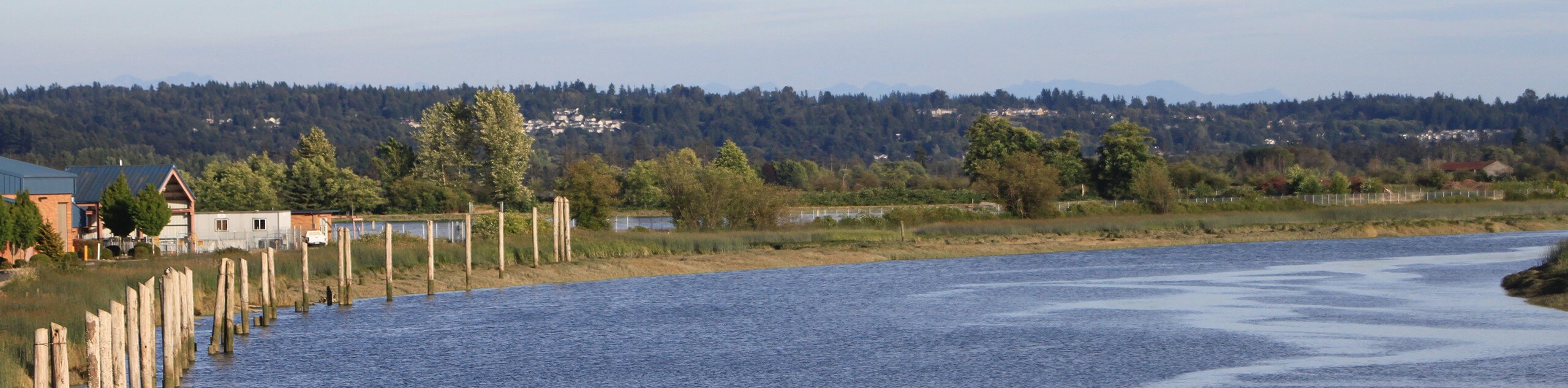
- Nisqually Estuary Boardwalk - The Billy Frank Jr. Nisqually National Wildlife Refuge, formerly known as the Nisqually National Wildlife Refuge, is an important estuary that provides a haven to countless bird and animal species. Walkers on the boardwalk trail can make use of the viewing platforms to look for herons, harbor seals, salmon, otters, and more.
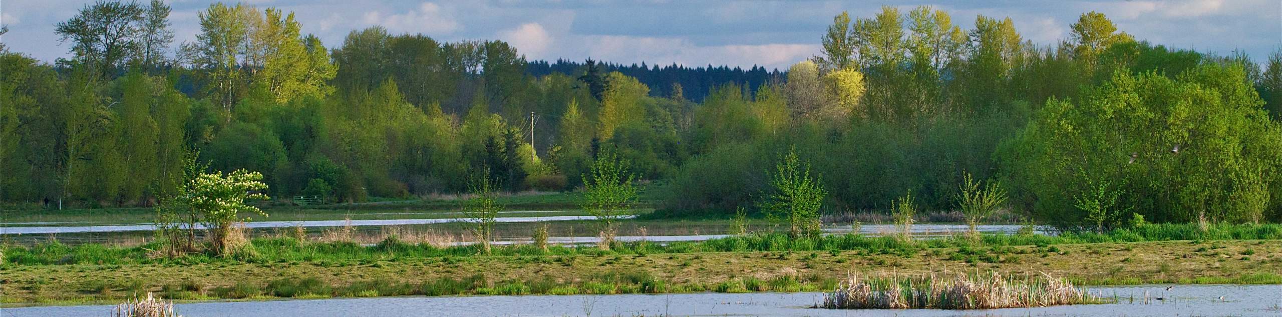
- Cranberry Lake - The Cranberry Lake hike in Cama Beach State Park takes you from the shoreline to the lake on a very straightforward route. It’s a hike suitable for all skill levels, and in the springtime, the trail is lined with beautiful wildflowers. This route is also a good choice for birdwatchers.
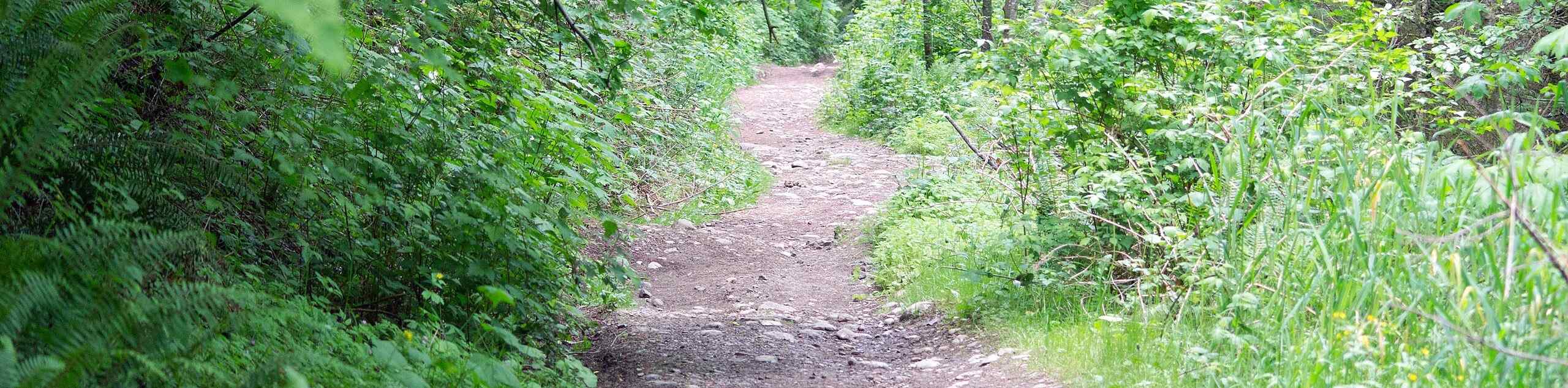
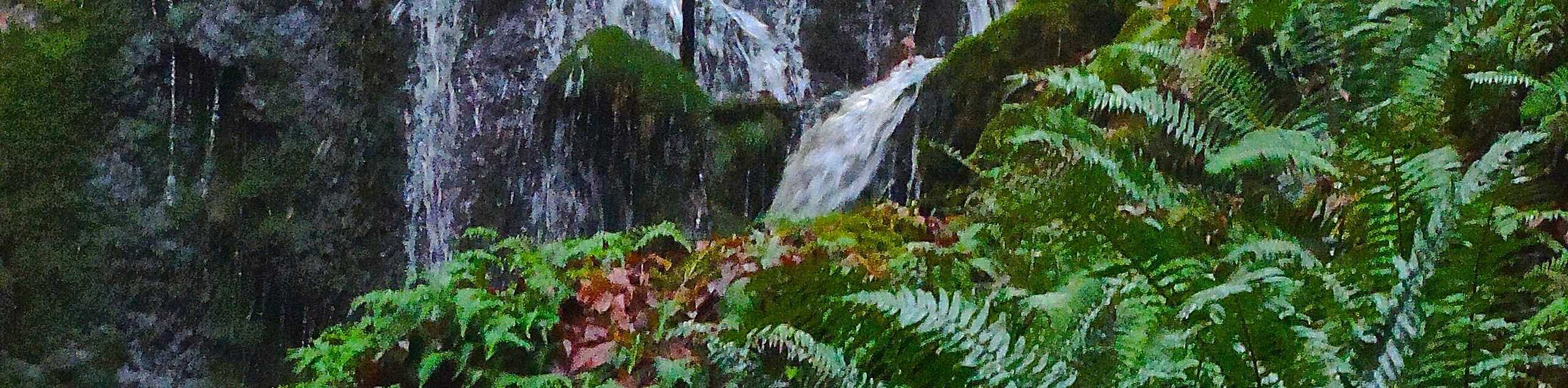
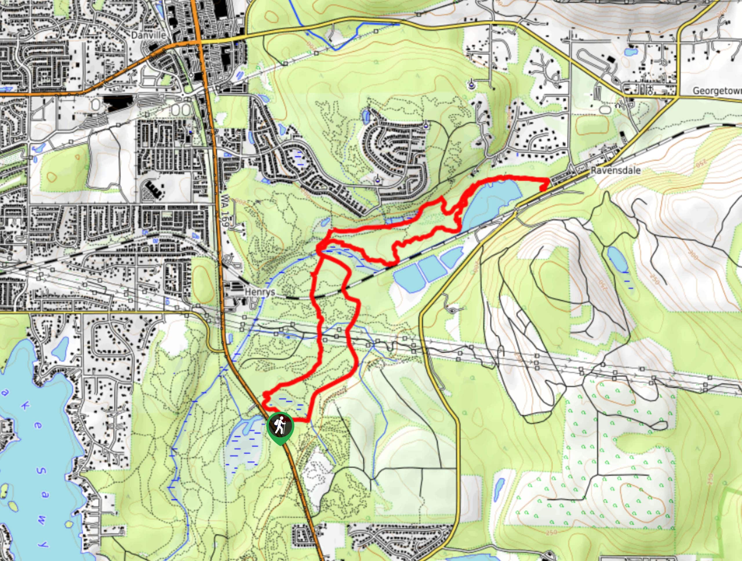
- Cherry Creek Falls Trail - Cherry Creek Falls Trail is an easy hike that shows off the Marckworth Forest. This trail is suitable for all skill levels and good for hikers with dogs. The trail leads you through the forest to two waterfalls tucked into the mossy trees. This trail is also a good choice for birdwatchers and runners.
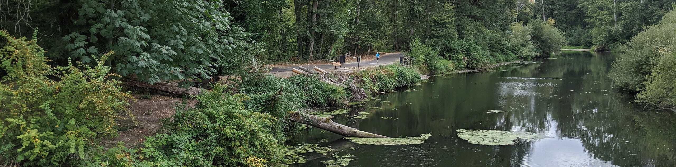
- Burke-Gilman Trail - Burke-Gilman Trail is a multi-use pathway in Seattle popular with walkers, runners, and bikers. This long route can be done in whole or in part, but the entire 20.0mi are paved, making it stroller-friendly. This trail is a great way to get some exercise and enjoy the outdoors in Seattle.
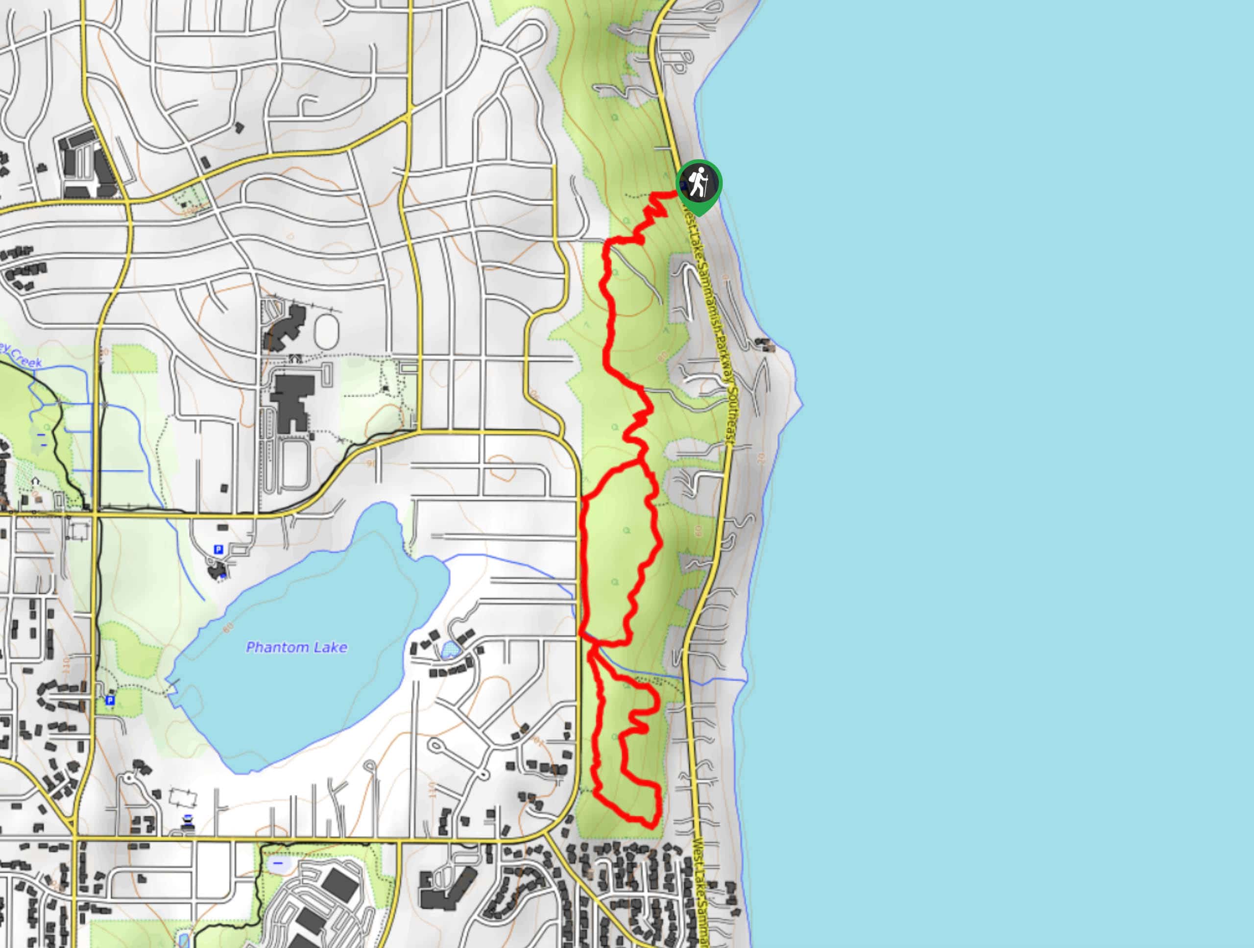
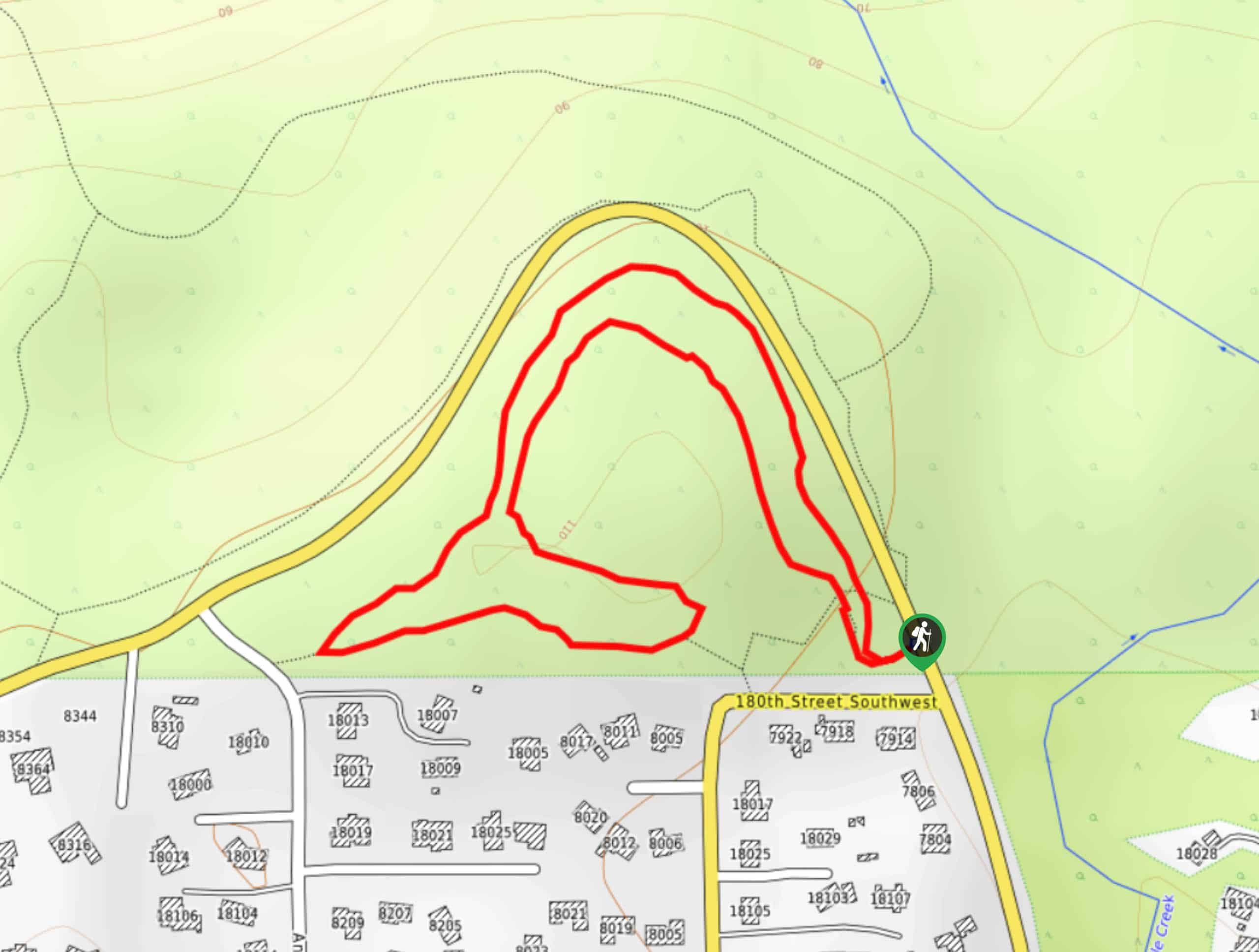
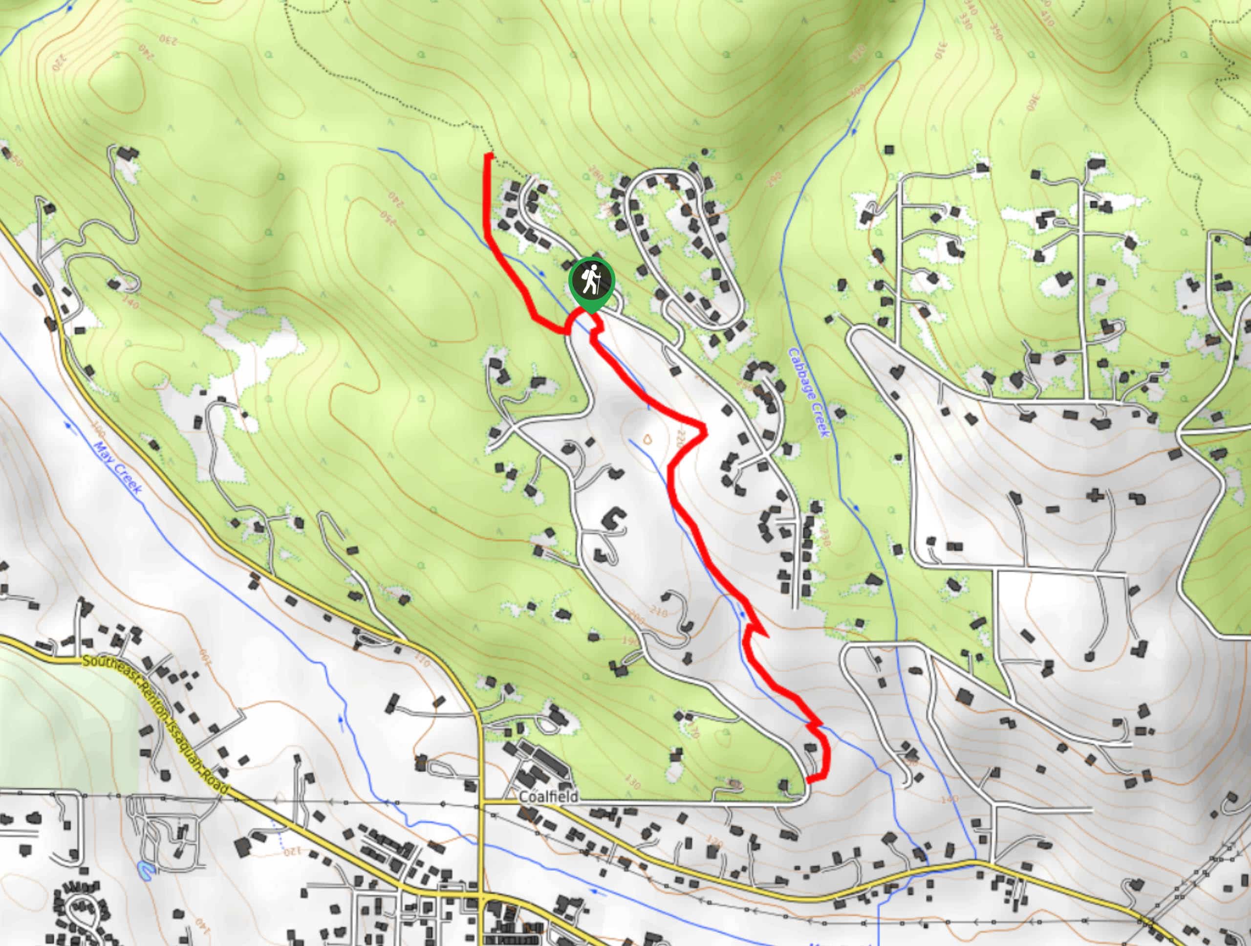
- Cougar Mountain Indian Trail - The Cougar Mountain Indian Trail is one of the most-used trails on Cougar Mountain. It’s an ideal trip for those wanting classic hiking scenery without the work that’s usually required to earn them. Very close to Renton and Issaquah and easily reachable from Seattle, the cute waterfalls on this trail make for a great half-day adventure.
- Cedar River Trail - The Cedar River Trail is a 18.0mi point-to-point pathway that connects Renton and Landsburg. This path is used for walking, biking, and running. You can either bike the whole path or walk/run a portion of it, both offering a nice opportunity to enjoy the fresh air and the riverside.
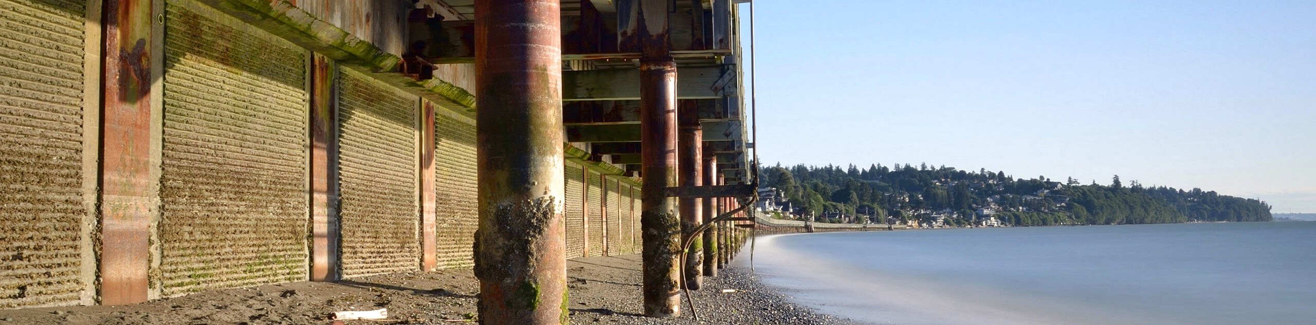
- Seahurst Park Loop Trail - The Seahurst Park Loop Trail is a beautiful easy hike south of Seattle. While this trail is short, there are others in the park that allow you to customize your trip. This loop begins and ends along the coast and travels into a deep green forest with converging creeks.
- Swan Creek Park Trail - Swan Creek Trail a heavily trafficked trail near Tacoma that passes through Swan Creek Park, a pretty park with a variety of trails. Enjoy community gardens and babbling streams on a route easy enough for young kids.
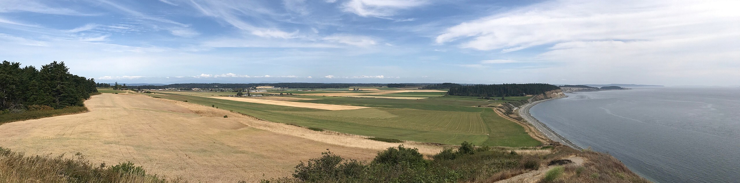
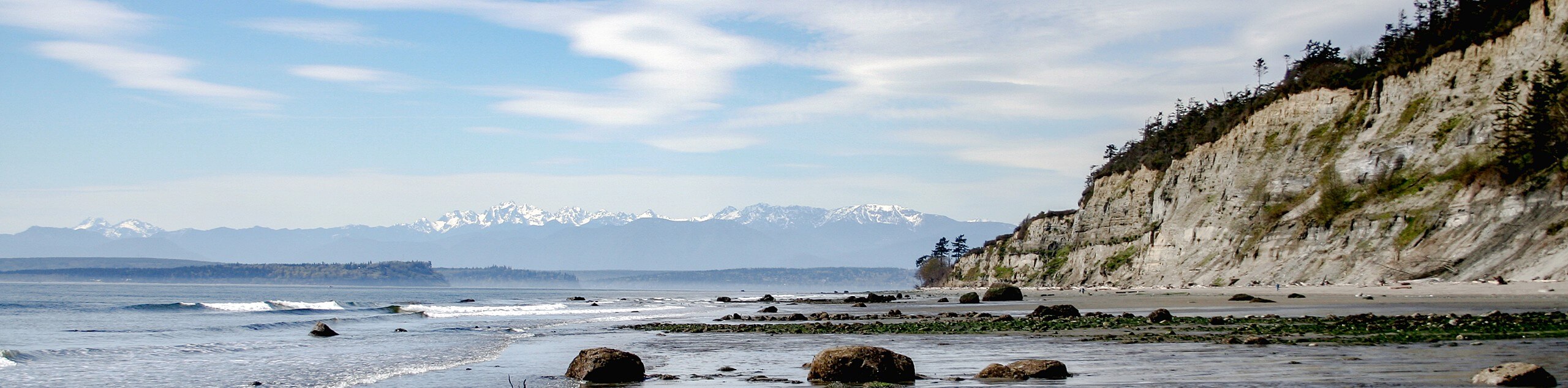
- Ebey’s Landing Trail - Ebey's Landing is a stellar loop trail on Whidbey Island that provides incredible views from atop a high bluff over Puget Sound. Gaze over the water, keep an eye out for wildlife and birds, or spend some time observing the nearby working farms. Ebey’s Landing is especially nice at sunset!
- Flaming Geyser State Park - Flaming Geyser State Park Loop is a good choice for families with small children and those wanting a quick outing. The park itself boasts geyers and interesting natural history, and this loop is a good way to stretch your legs before or after exploring it.
Scroll down to see the full list of hiking trails in and around Seattle.
When is the Best Time to Hike in Seattle?
Seattle experiences warm, mild summers and cool winters with lots of precipitation. While you should be prepared for rain any time of the year, visiting in the summer months of July and August tend to give the warmest, driest weather. Consider summer visits for beach and lake walks so you have the option of a refreshing dip afterwards.
While the summer months offer the best weather, they do also bring the heaviest crowds. If you’re okay with occasionally cooler or wetter conditions, visiting in June or mid-September can give you more privacy on the trails while still offering suitable hiking weather.
Visitors in the winter can generally still enjoy all of the city parks and most of the trails near the city since the Seattle area receives relatively infrequent snow. You’ll want to be dressed for rain, though!
Other Outdoor Activities in and Around Seattle
Hiking and walking are some of the top ways to explore the Seattle area, but they’re definitely not the only way to spend your time here. Adventurers on two wheels can take advantage of the many biker-friendly paths in and around the city, both for road bikes and mountain bikes.
Campers can find sites not far from the city, and skiers and snowboarders can enjoy nearby Stevens Pass, Crystal Mountain, Mount Baker, or Summit at Snoqualmie.
How to Plan a Trip to Seattle
A trip to Seattle is a worthwhile adventure, but you’ll want to put enough time and energy into planning to make sure your trip runs smoothly. Most of the trails in the vicinity of the city are permitless, but you’ll want to double-check your itinerary to see if a Discover Pass is needed for any out of city hikes. If you plan on camping, make sure you plan out your campsites beforehand and check which ones are walk-up and which require advance booking.
We recommend booking your hotels early, especially in the summertime, since Seattle sees plenty of tourists and certain accommodations will book out in advance.
Seattle Adventure Tours
Not so excited about hashing out the details of your itinerary? Letting the pros plan your adventure near Seattle takes the stress out of your trip, letting you focus on your experiences. Check out some incredible adventure tours in the Pacific Northwest.
Frequently Asked Questions About Seattle
Is Seattle safe?
Seattle is one of the safest of the larger cities in the United States. It does not experience a high level of violent or petty crime. That being said, exercise the same caution you would while visiting any other large city.
Is Seattle expensive?
Unfortunately, Seattle is an expensive city in many ways. The cost of living here is, on average, about 50% higher than the national average. Expect food, transportation, and accommodations to be a bit more costly than what you’d find in most other cities in the United States.
Is it cold in Seattle?
The temperature in Seattle typically varies from around 37°F to a pleasant 79°F. While you normally won’t experience extreme cold or extreme heat here, you should prepare for plenty of precipitation.
What do I need to see in Seattle?
First-time visitors to the city often visit Pike Place Market, the various movie and TV shooting locations around the city, the Gum Wall, the Space Needle, the aquarium, the Fremont Troll, the original Starbucks, and the plethora of excellent restaurants.
What can I do outdoors in Seattle?
The Emerald City has a thriving outdoors culture centered around hiking, kayaking, climbing and boulders, and cycling. You’ll fit right in if you’re seeking out any of these activities.
Do you need a car in Seattle?
We recommend either driving your own car, renting a car, or booking a tour that includes transportation. There are some public transportation options in the city but they are largely focused on the city itself and only select trailheads are accessible by bus.
Explore other great hiking regions in Washington State:
Or check out other amazing hiking regions in the United States.
Read MoreThe best hikes in Seattle
01. Snoqualmie Falls Trail
Difficulty
Snoqualmie Falls Trail takes you along an easy 1.4mi route to see one… Read More
02. Deception Pass Bridge and Beach Trail
Difficulty
Deception Pass Bridge and the nearby Beach Trail are a great way to spend an… Read More
03. Discovery Park and Lighthouse Loop Trail
Difficulty
Discovery Park and Lighthouse Loop Trail is a 4.4mi hike in the Seattle-Tacoma… Read More
04. Chirico Trail to Poo-Poo Point
Difficulty
Poo-Poo Point is a popular destination on the shoulder of West Tiger Mountain. The point… Read More
05. Poo-Poo Point Trail
Difficulty
Poo-Poo Point is a heavily frequented destination on the shoulder of West Tiger Mountain. The… Read More
06. Seward Park Loop Trail
Difficulty
The Seward Park Loop Trail is a short route that loops the perimeter of Seward… Read More
07. Carkeek Park via Pipers Creek Trail
Difficulty
Carkeek Park via Pipers Creek Trail is a 3.2mi moderately trafficked loop trail… Read More
08. East Tiger Mountain Summit Hike
Difficulty
East Tiger Mountain Summit is a 7.7mi out and back hike in Tiger… Read More
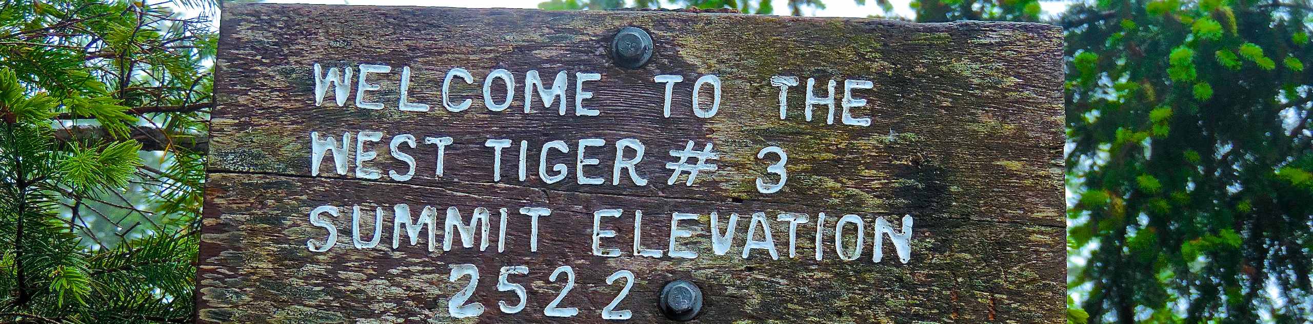
09. West Tiger #3 Trail
Difficulty
West Tiger Mountain via West Tiger #3 is an 5.5mi out and back… Read More
10. Warren G. Magnuson Park Loop
Difficulty
Warren G. Magnuson Park is a frequently visited recreational area near Seattle. The Warren G.… Read More
Yes, there are more than 10
Seattle is so beautiful that we can not give you only 10 hikes. So here is a list of bonus hikes in Seattle that you should take a look at as well
11. Washington Park Arboretum Trail
Difficulty
The Washington Park Arboretum is a stunning park filled to the brim with trees and… Read More
12. Nisqually Estuary Boardwalk Hike
Difficulty
The Billy Frank Jr. Nisqually National Wildlife Refuge, formerly known as the Nisqually National Wildlife… Read More
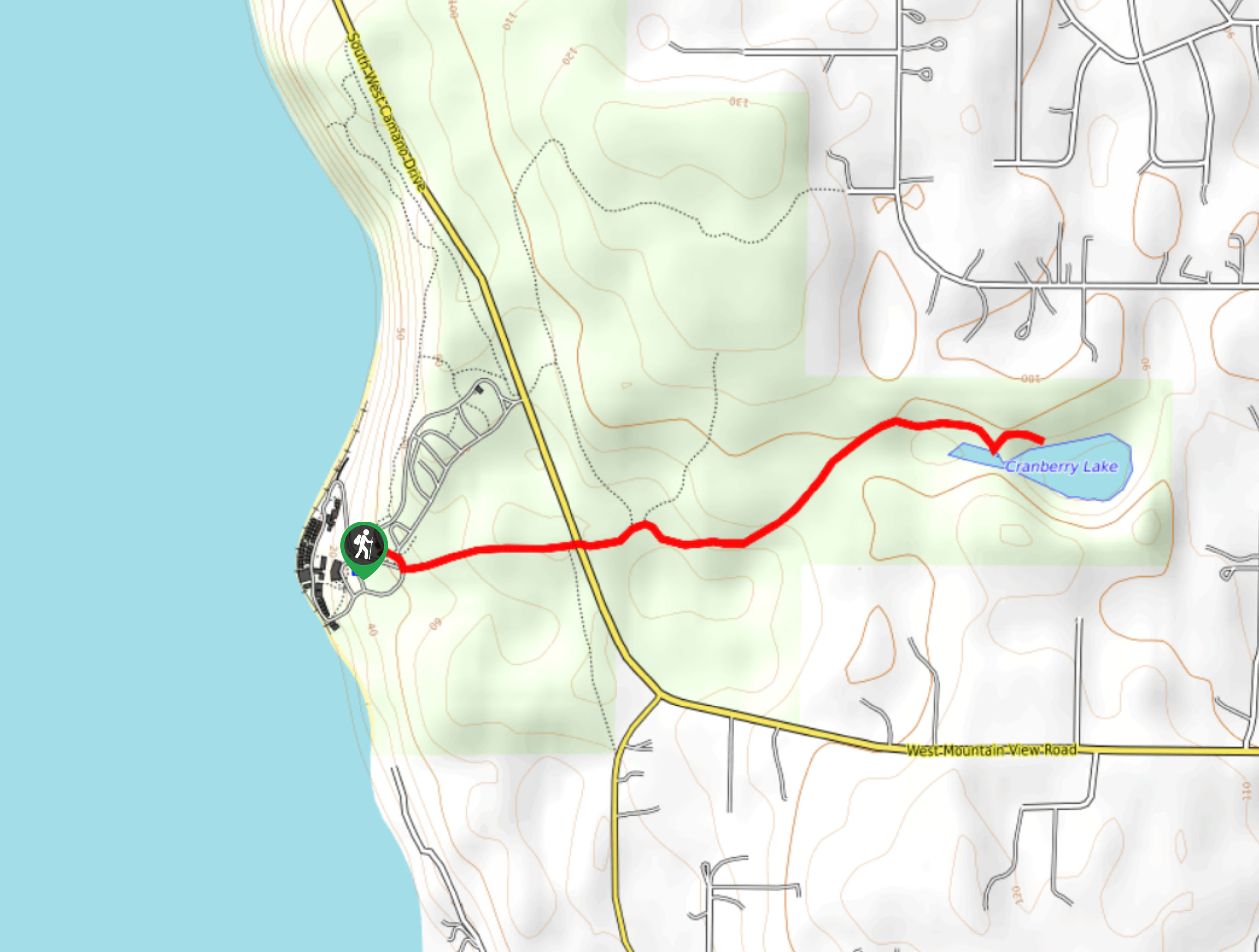
13. Cranberry Lake Hike
Difficulty
The Cranberry Lake hike is a 2.1mi easy trail that sees light traffic.… Read More
14. Cherry Creek Falls Trail
Difficulty
Cherry Creek Falls Trail is a 5.0mi easy hike in the Marckworth Forest.… Read More
15. Burke-Gilman Trail
Difficulty
Burke-Gilman Trail is a well-known multi-use pathway in Seattle popular with walkers, runners, and bikers.… Read More
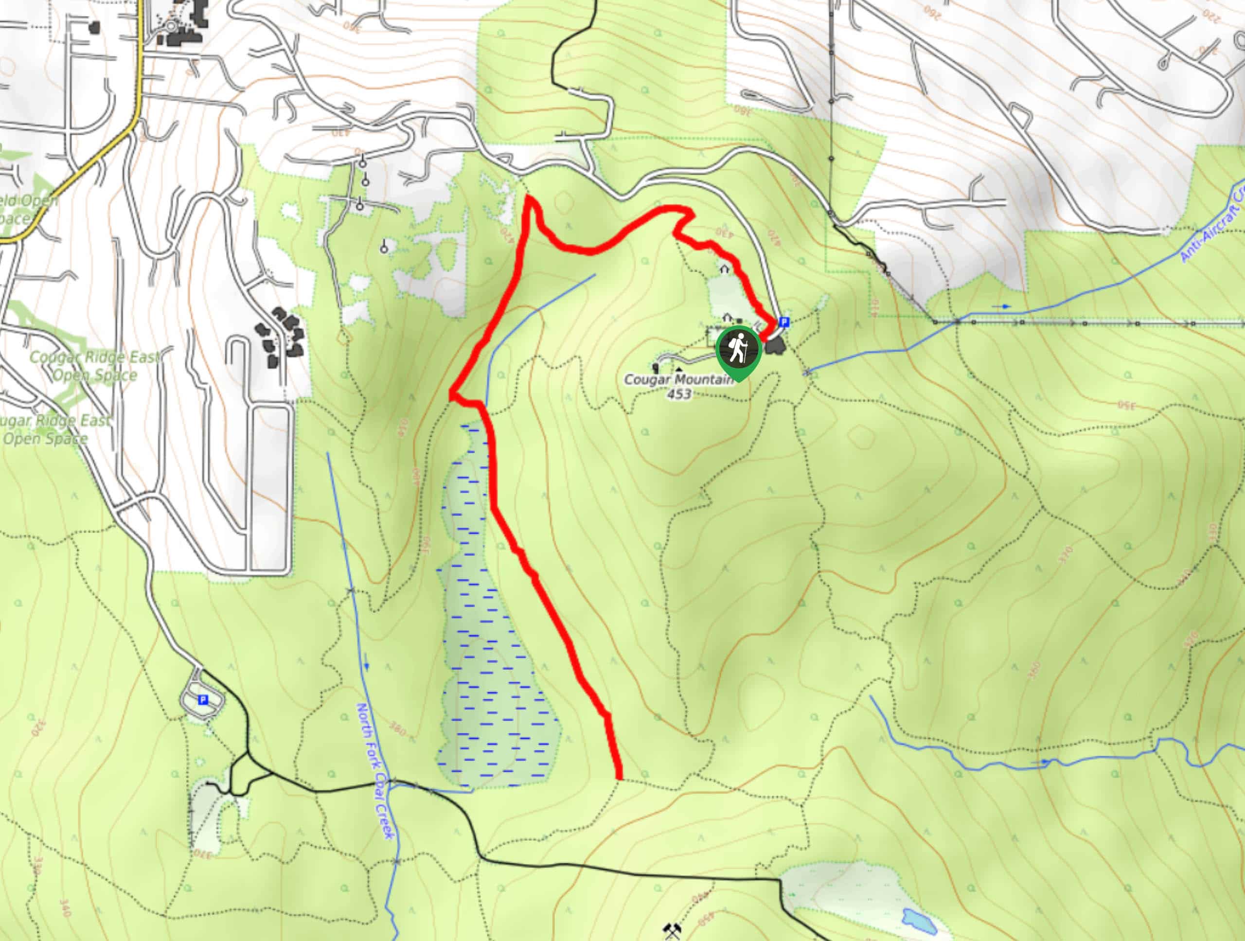
16. Cougar Mountain Indian Trail
Difficulty
The Cougar Mountain Indian Trail is one of the most-used trails on Cougar Mountain. This… Read More
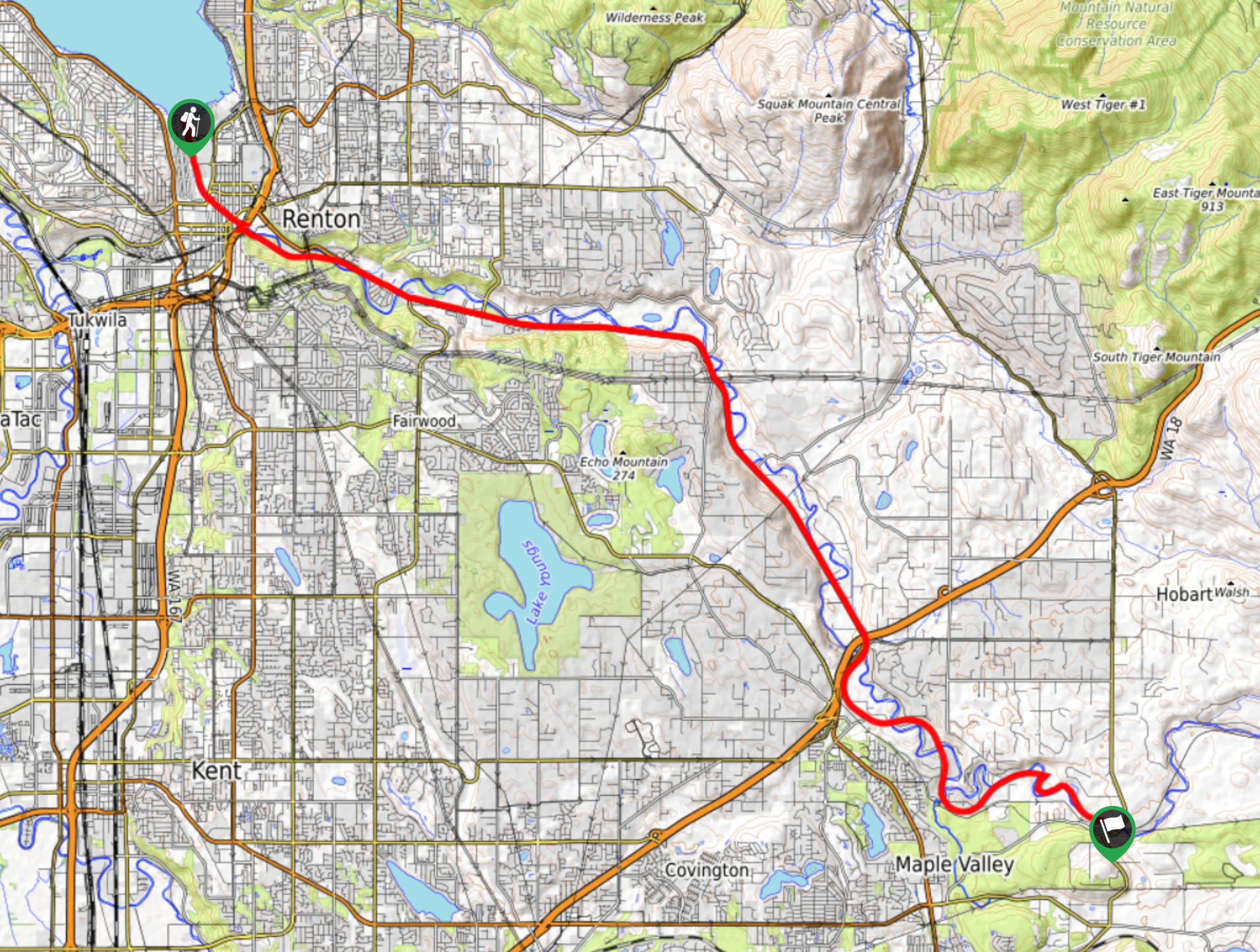
17. Cedar River Trail
Difficulty
The Cedar River Trail is a 18.0mi point-to-point pathway that stretches between Renton… Read More
18. Seahurst Park Loop Trail
Difficulty
The Seahurst Park Loop Trail is a gorgeous easy hike south of Seattle that is… Read More
19. Swan Creek Park Trail
Difficulty
Swan Creek Trail is an 5.3mi heavily trafficked lollipop hike near Tacoma. This… Read More
20. Ebey’s Landing Trail
Difficulty
Ebey's Landing Loop is a popular 5.2mi loop trail on Whidbey Island that… Read More
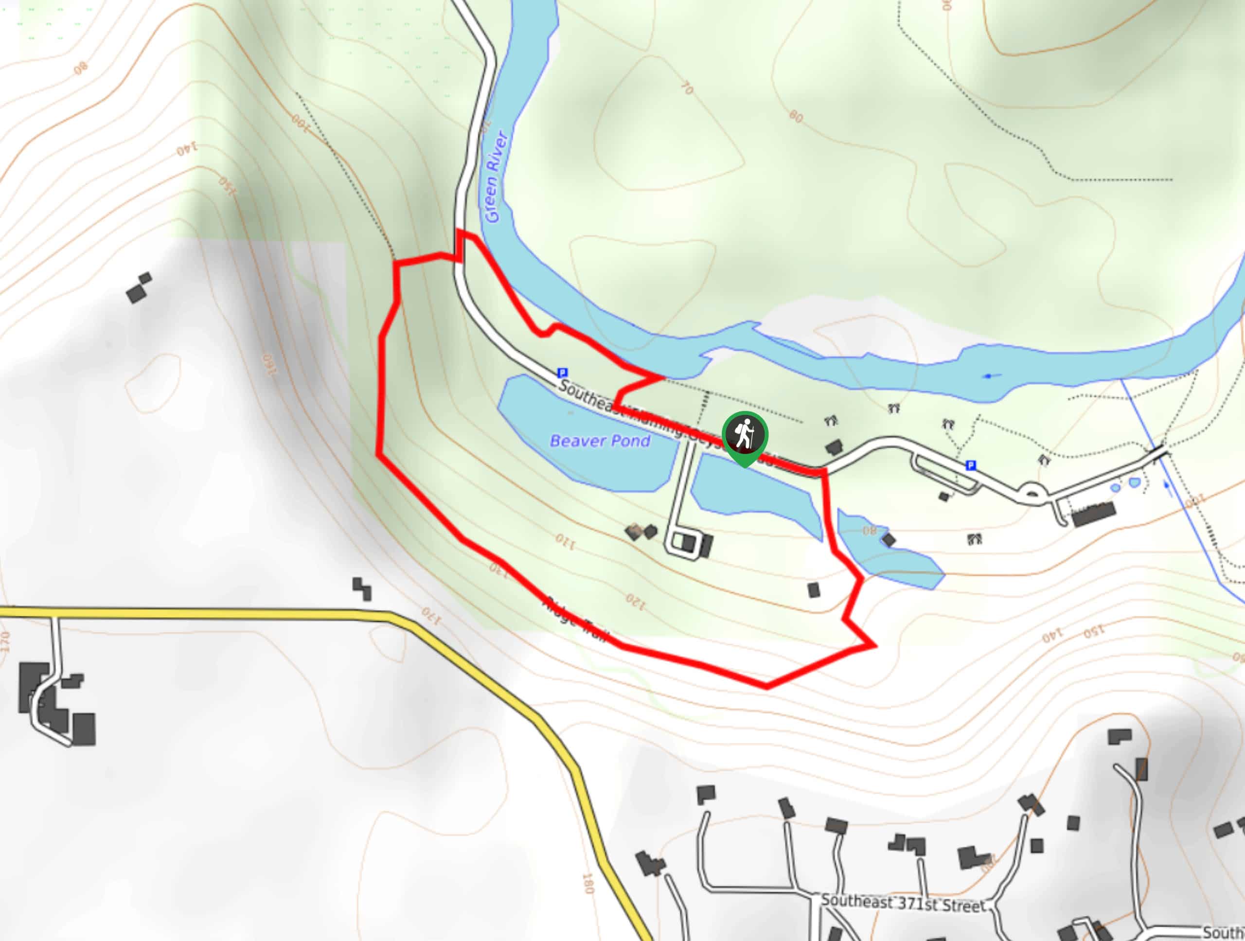
21. Flaming Geyser State Park Loop
Difficulty
Flaming Geyser State Park Loop is a 1.0mi easy nature walk in the… Read More
22. Meadowdale Beach Park Hike
Difficulty
Meadowdale Beach Park is a wonderful destination for the whole family, offering an ecologically diverse… Read More
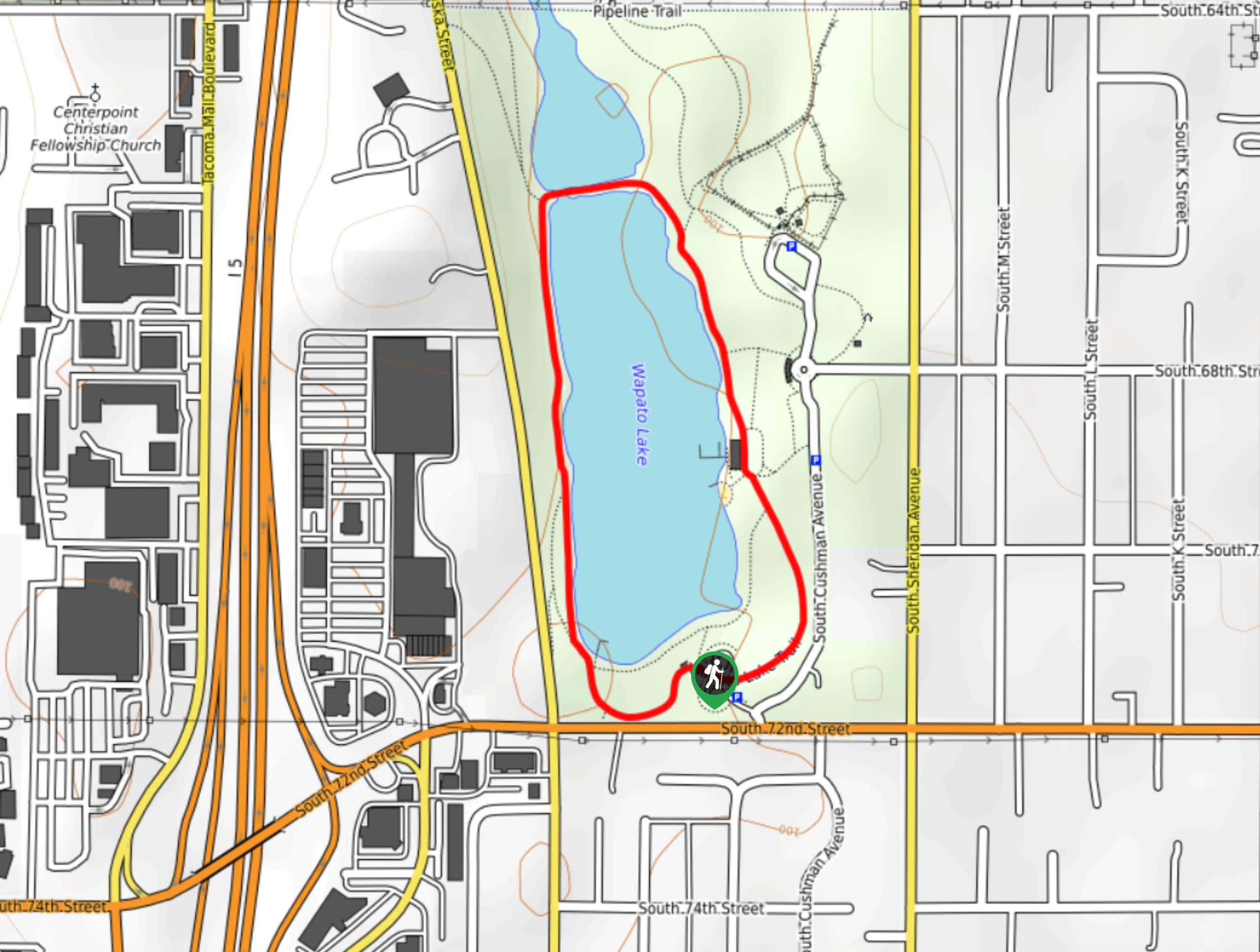
23. Wapato Lake Trail
Difficulty
Wapato Lake Trail is a 1.0mi easy hike in Wapato Lake Park that… Read More
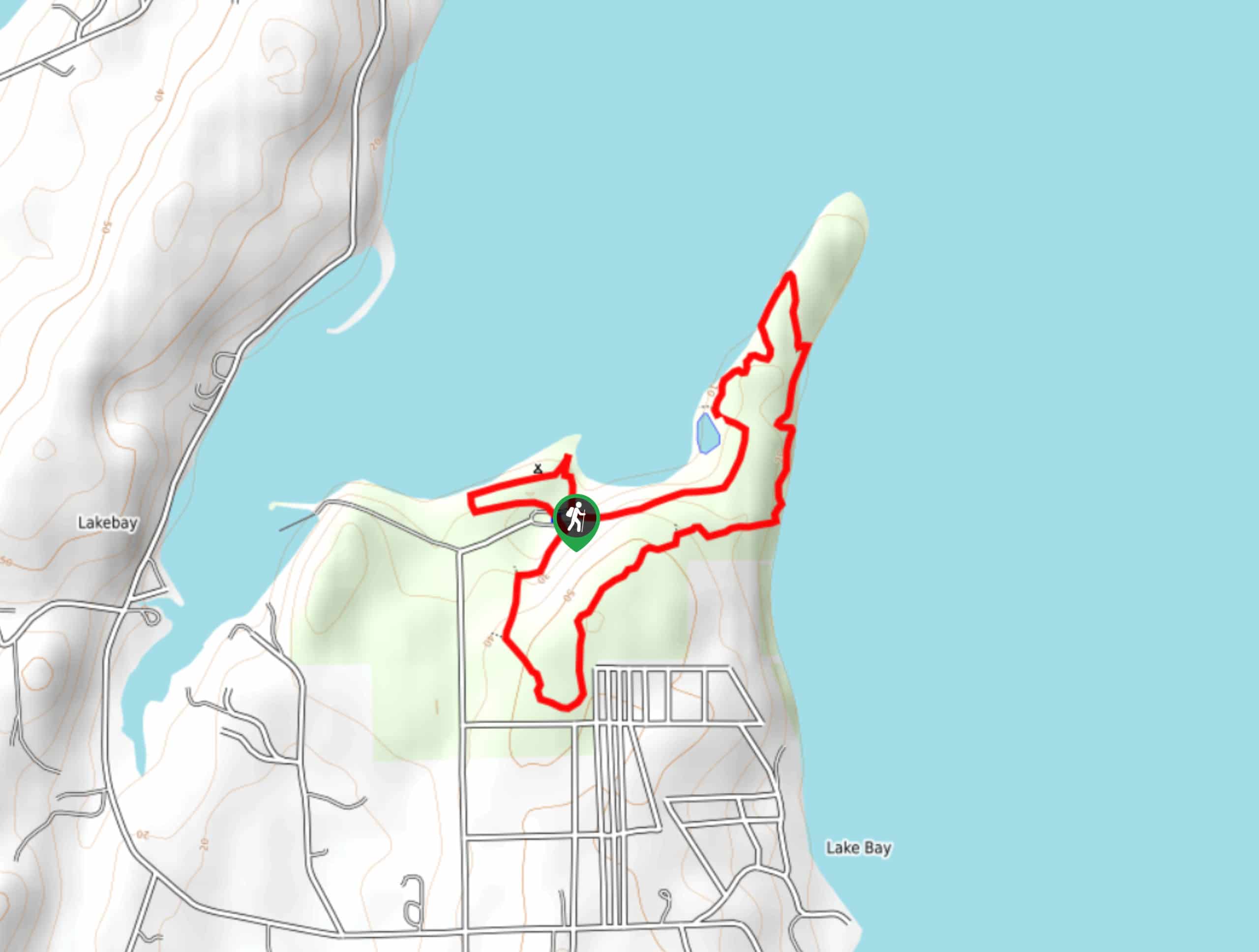
24. Penrose Point State Park Trail
Difficulty
Penrose Point State Park Trail is a 2.3mi easy hike that loops around… Read More
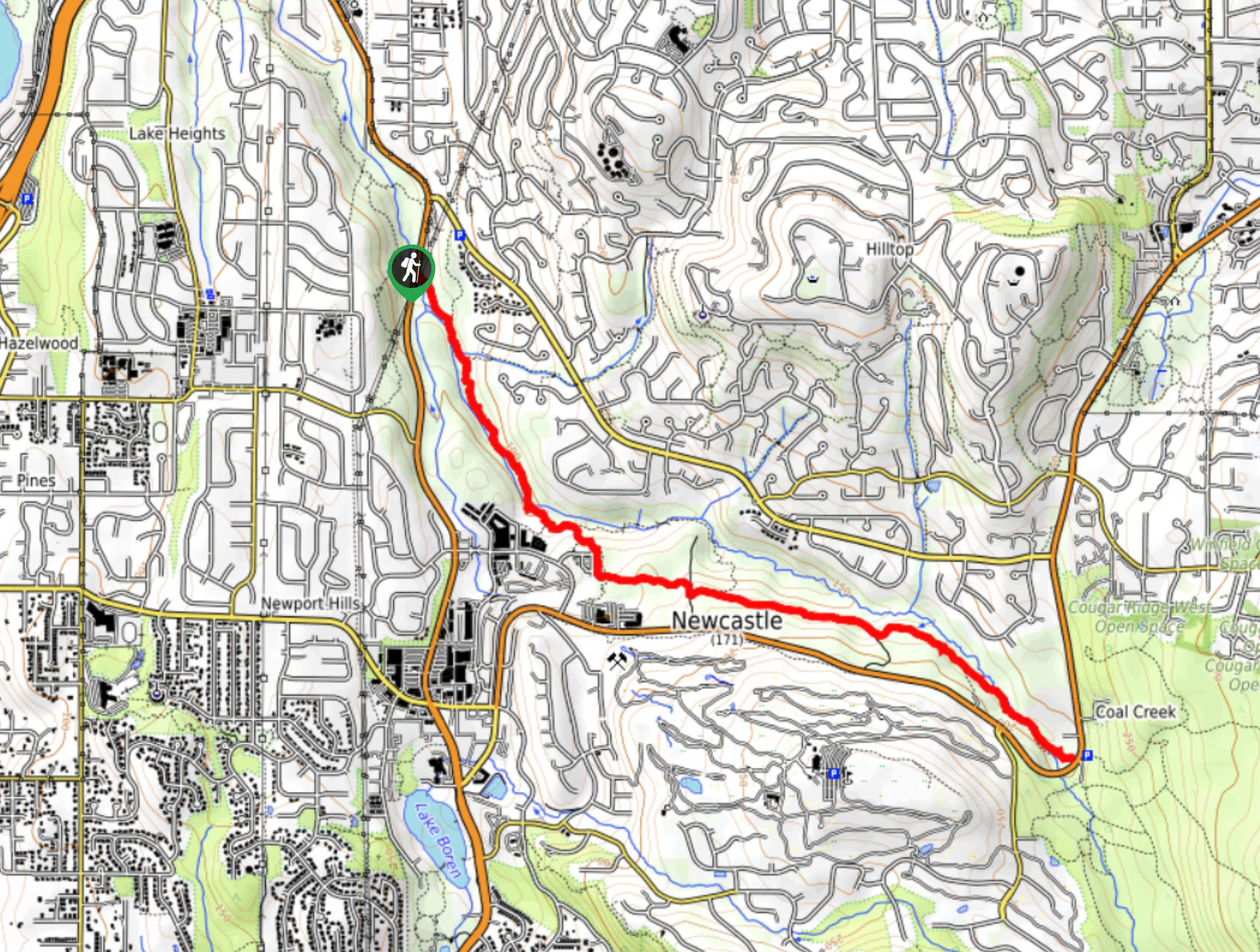
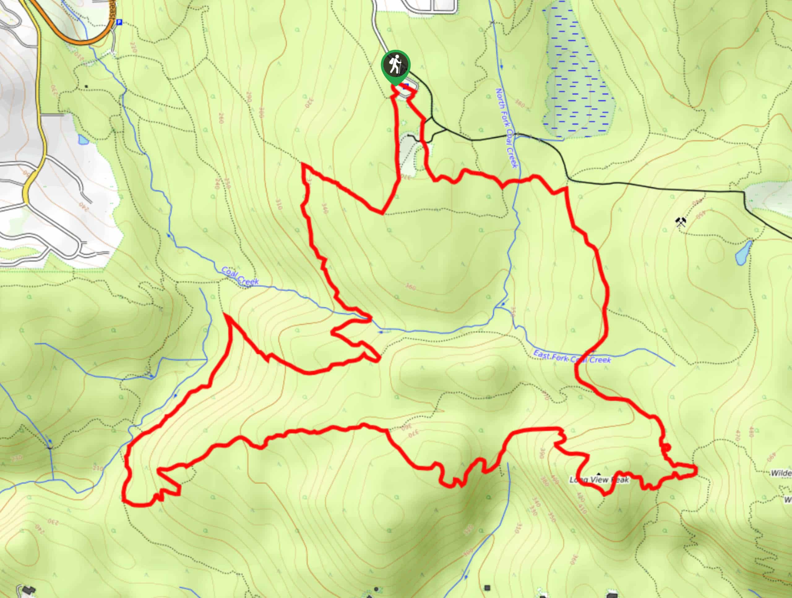
25. Coal Creek Trail
Difficulty
Coal Creek Trail is an 5.3mi easy hiking trail in the Coal Creek… Read More
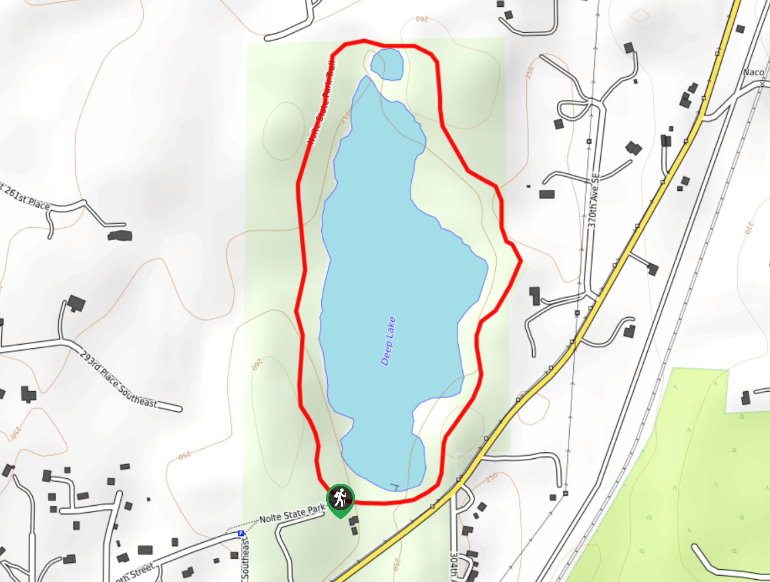
26. Nolte State Park Deep Lake Loop Trail
Difficulty
The loop trail around Deep Lake in Nolte State Park is a quick and easy… Read More
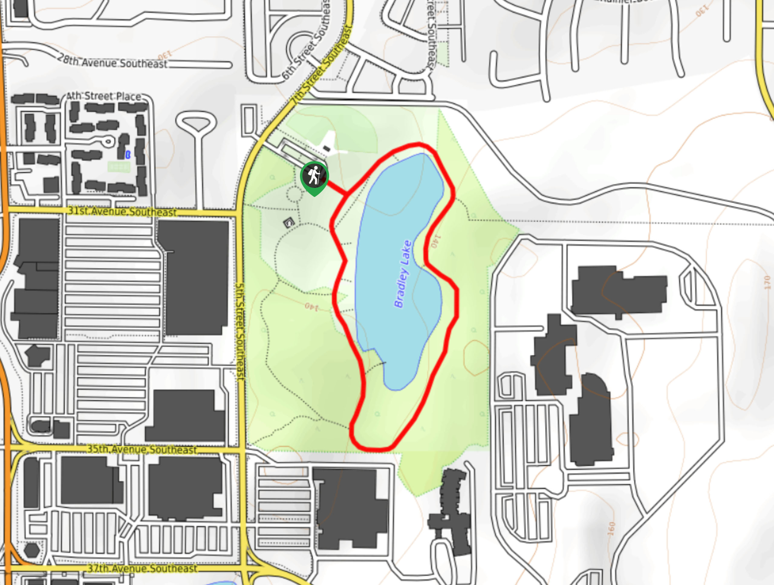
27. Bradley Lake Loop Trail
Difficulty
The loop trail around Bradley Lake in Bradley Lake Park is a quick and easy… Read More
28. Paradise Valley Conservation Area Trail
Difficulty
The Paradise Valley Conservation Area Trail is a 4.6mi easy hike on a… Read More
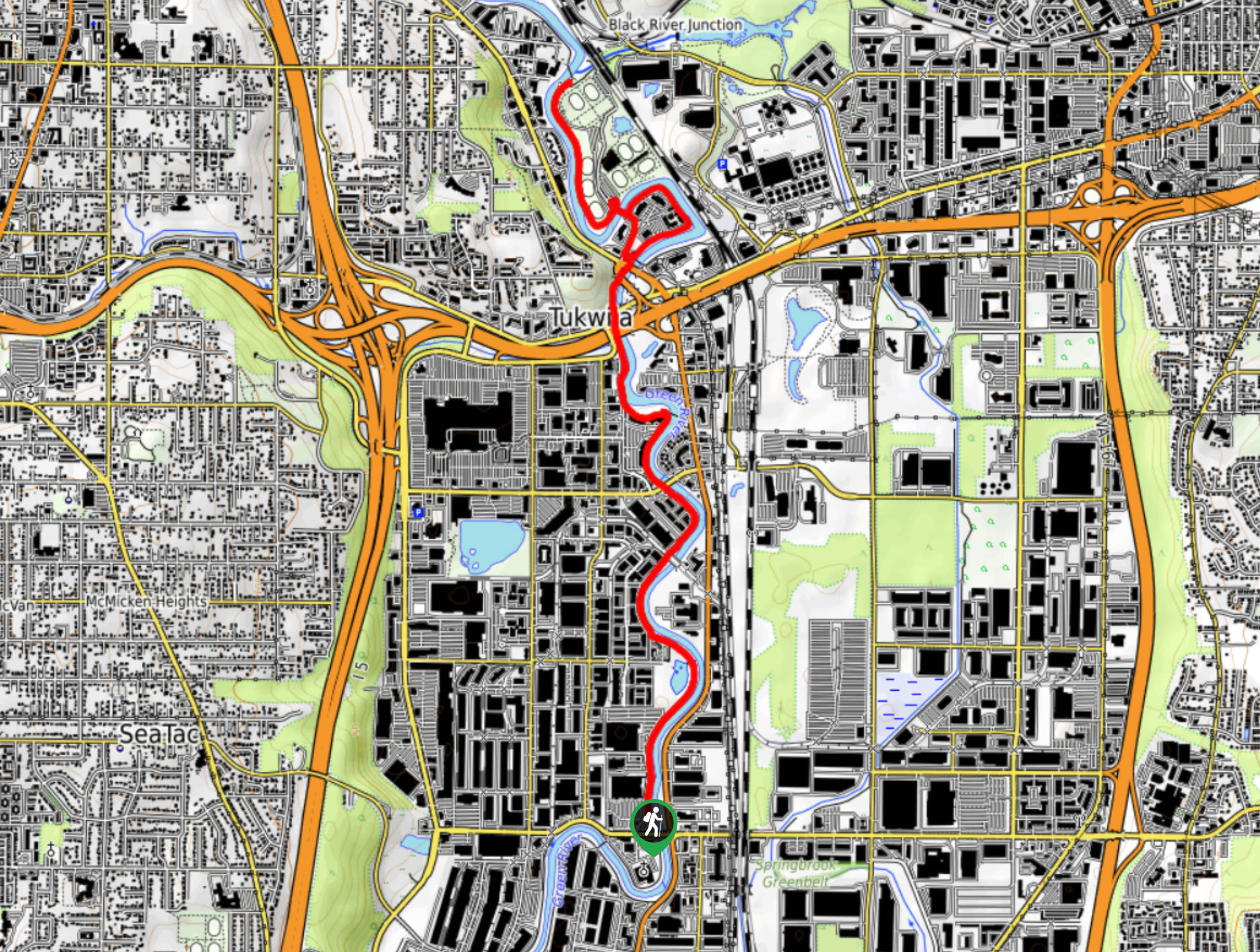
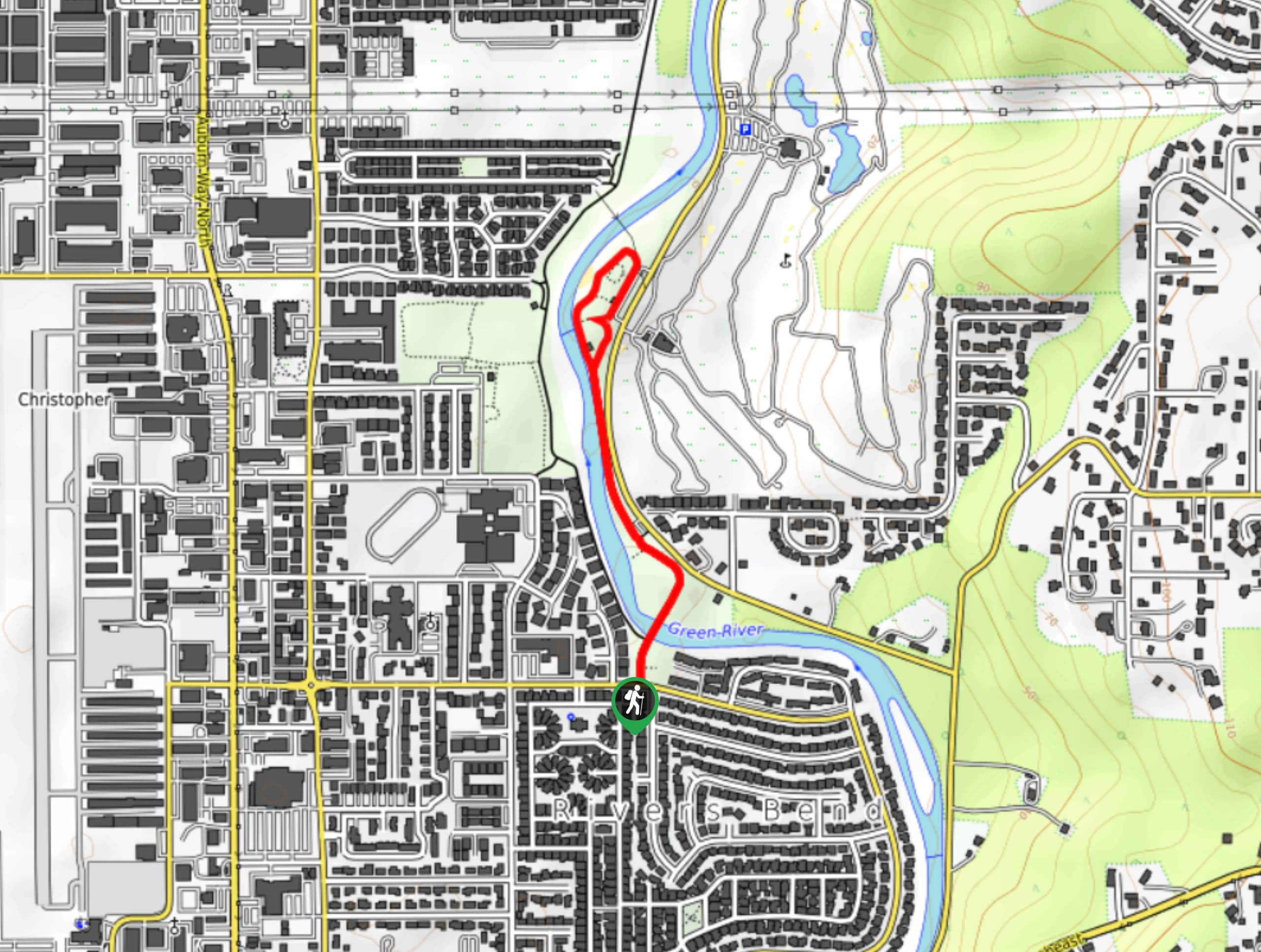
29. Green River Trail Tukwila Section
Difficulty
The Tukwila section of the Green River Trail is a 6.2mi stretch of… Read More
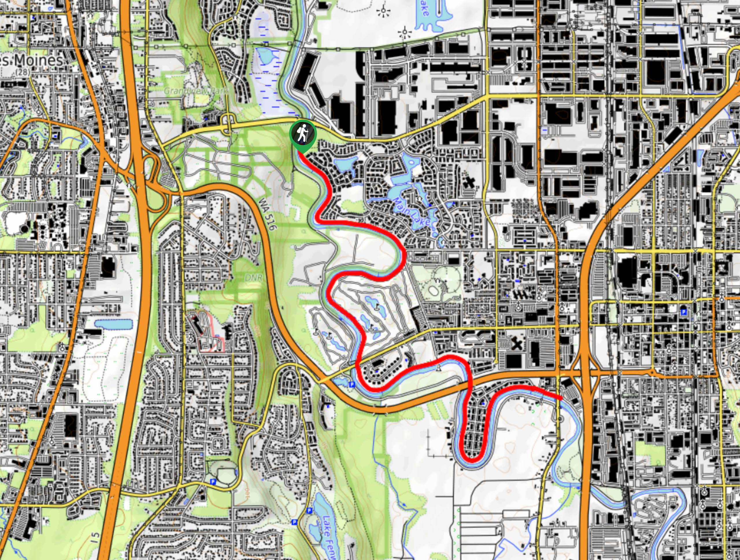
30. Green River Trail
Difficulty
The Green River Trail is a 7.5mi multi-use trail used by walkers, runners,… Read More
31. Coal Creek Falls via Nike Horse Trail
Difficulty
The hike to Coal Creek Falls on the Nike Horse Trail is an easy-moderate adventure.… Read More
32. Coal Creek Falls via Cave Hole Trail
Difficulty
The hike to Coal Creek Falls on the Cave Hole Trail is an enjoyable moderate… Read More
33. Kopachuck State Park Lower Loop Trail
Difficulty
The Kopachuck State Park Lower Loop Trail is a very quick, simple walk in the… Read More
34. Franklin Ghost Town Trail
Difficulty
Franklin Falls Trail is a 2.0mi heavily trafficked out and back trail that… Read More
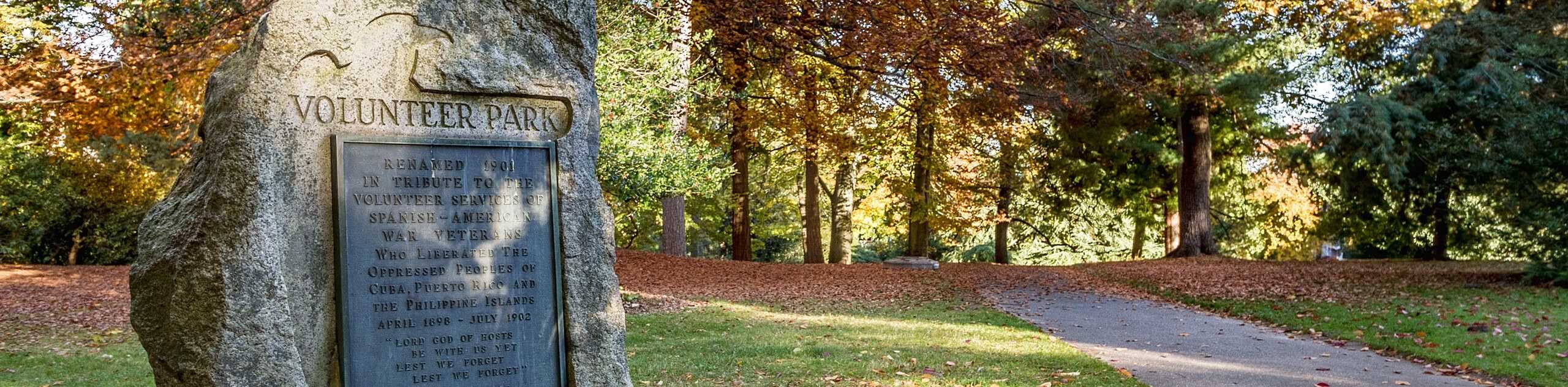
35. Volunteer Park Loop
Difficulty
The volunteer Park Loop is a 1.1mi walk through a very well-maintained park… Read More
36. Lincoln Park Trail
Difficulty
Lincoln Park in West Seattle boasts so much to enjoy. This multi-use park has this… Read More
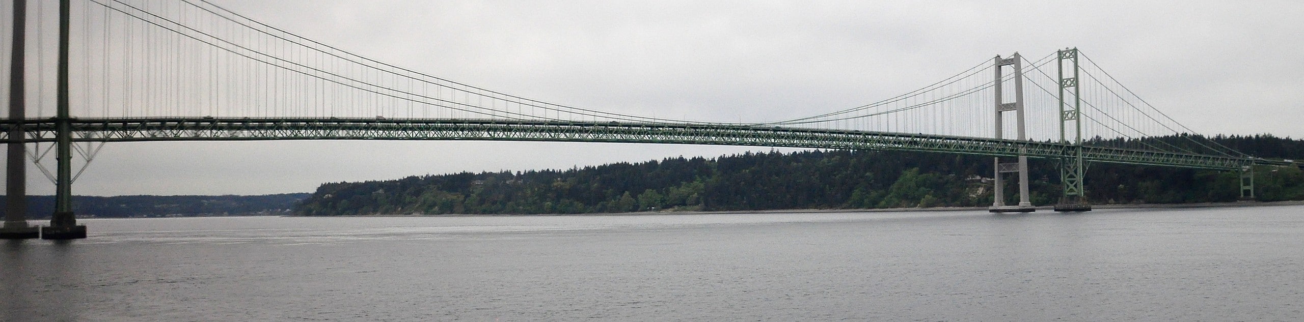
37. Tacoma Narrows Bridge Walk
Difficulty
The walk across the Tacoma Narrows Bridge gets better every time. This 3.4mi… Read More
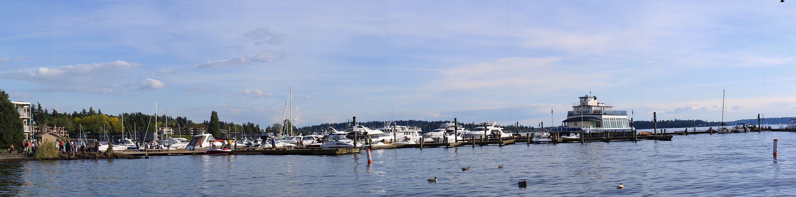
38. Luther Burbank Park Loop
Difficulty
Luther Burbank Park is a multi-use park on the northern end of Mercer Island that… Read More
39. Lake Union Loop
Difficulty
The Lake Union Loop is a heavily trafficked 6.4mi loop in Seattle that… Read More
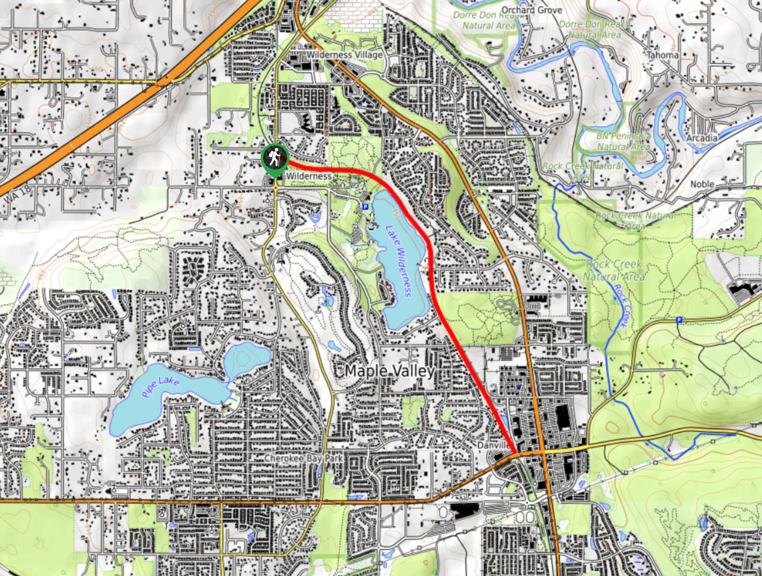
40. Lake Wilderness Trail
Difficulty
The Lake Wilderness Trail is a 4.0mi moderately trafficked out and back trail… Read More
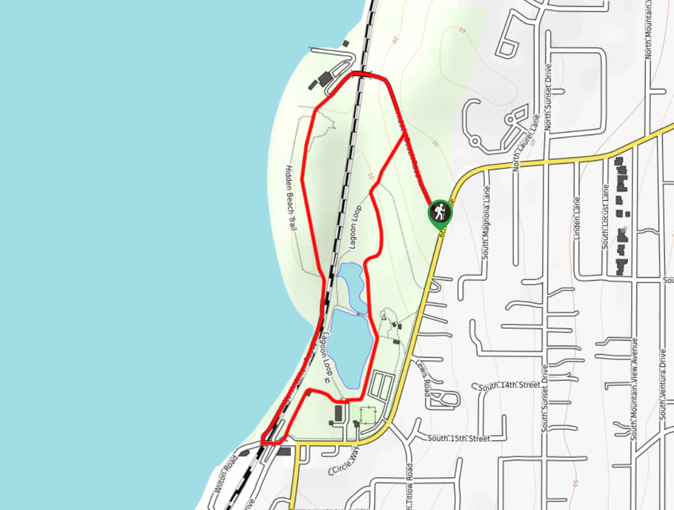
41. Titlow Park Loop
Difficulty
The Titlow Park Loop is a 1.6mi loop trail that takes you from… Read More
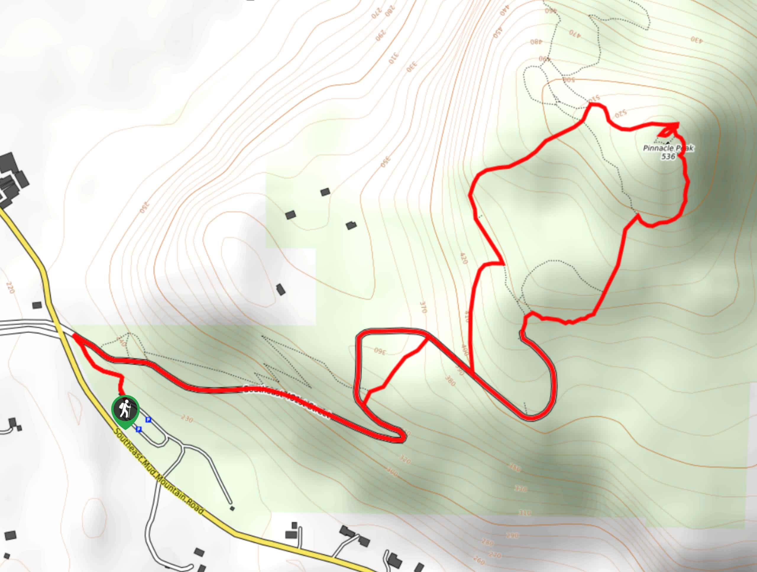
42. Pinnacle Peak Loop Trail
Difficulty
The Pinnacle Peak Loop Trail is a 3.0mi hike in Pinnacle Peak Park… Read More
43. Myrtle Edwards Park to Elliot Bay Park Walk
Difficulty
The walk from Myrtle Edwards Park to Elliot Bay Park on this smooth, straightforward route.… Read More
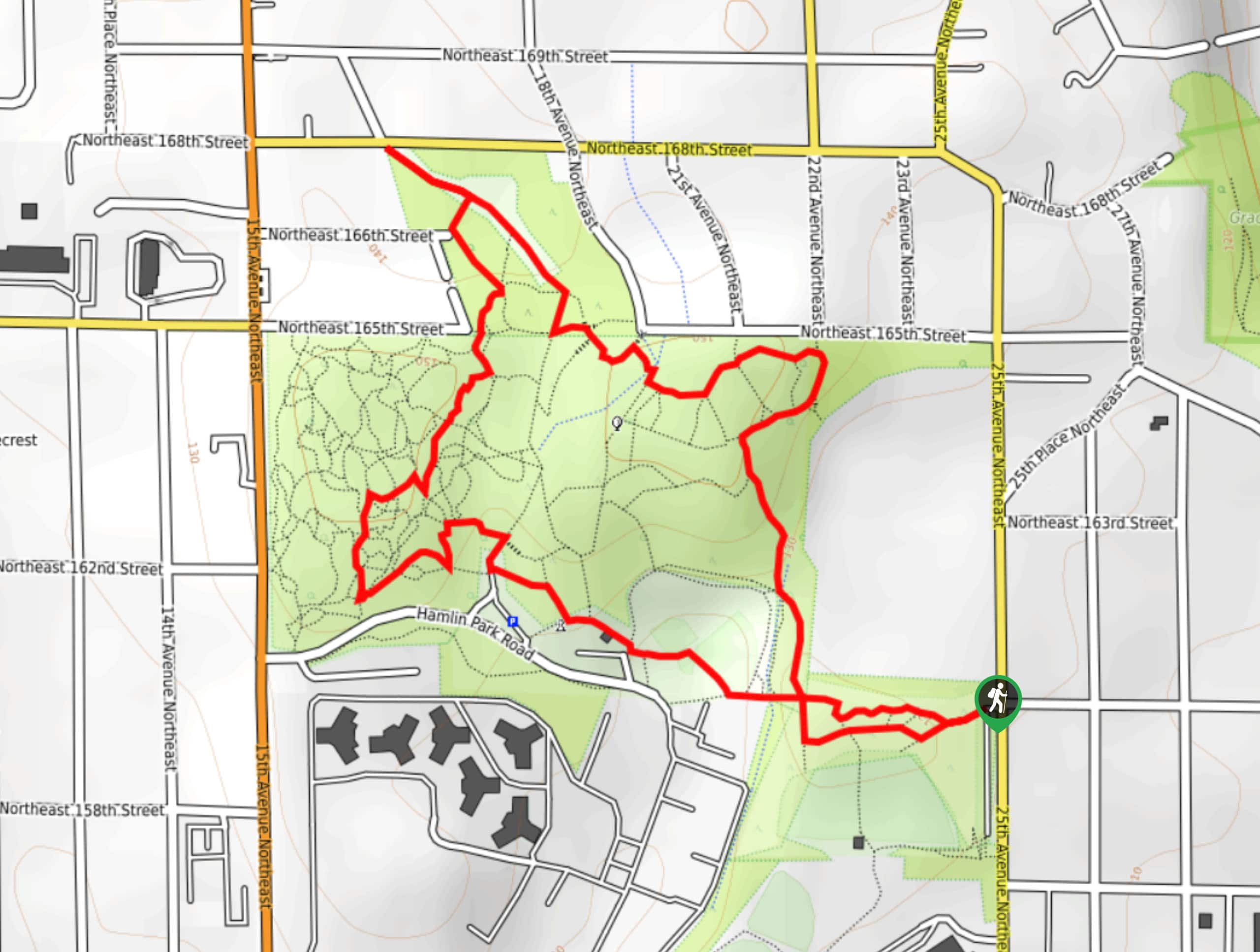
44. Hamlin Park Loop
Difficulty
The Hamlin Park Loop is a 2.0mi trail that follows the perimeter of… Read More
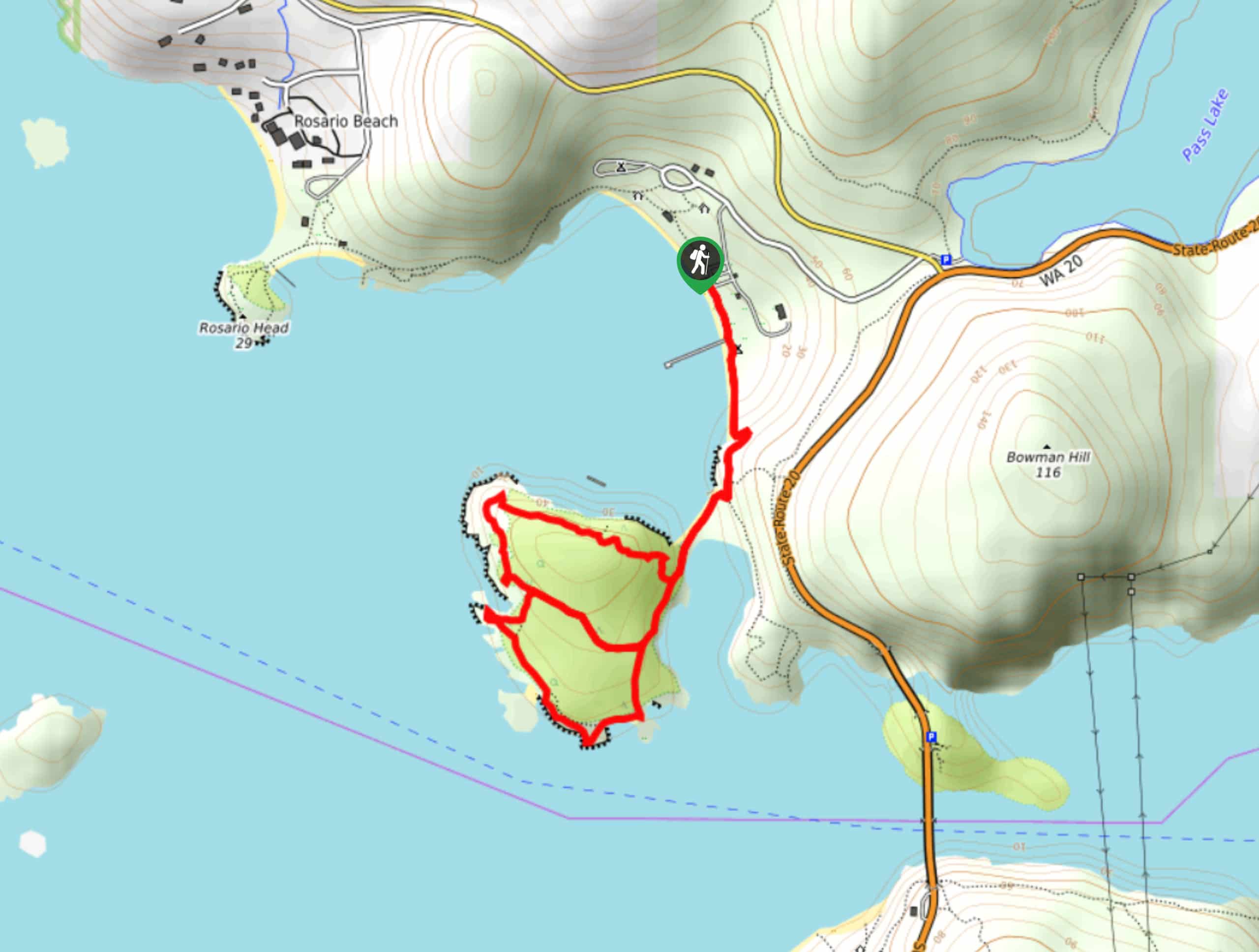
45. Lighthouse Point via Rosario Beach Trail
Difficulty
Lighthouse Point via Rosario Beach Trail is a 2.4mi heavily trafficked out and… Read More
46. Juanita Beach Loop
Difficulty
The Juanita Beach Loop is a half-mile loop walk that takes you over the water… Read More
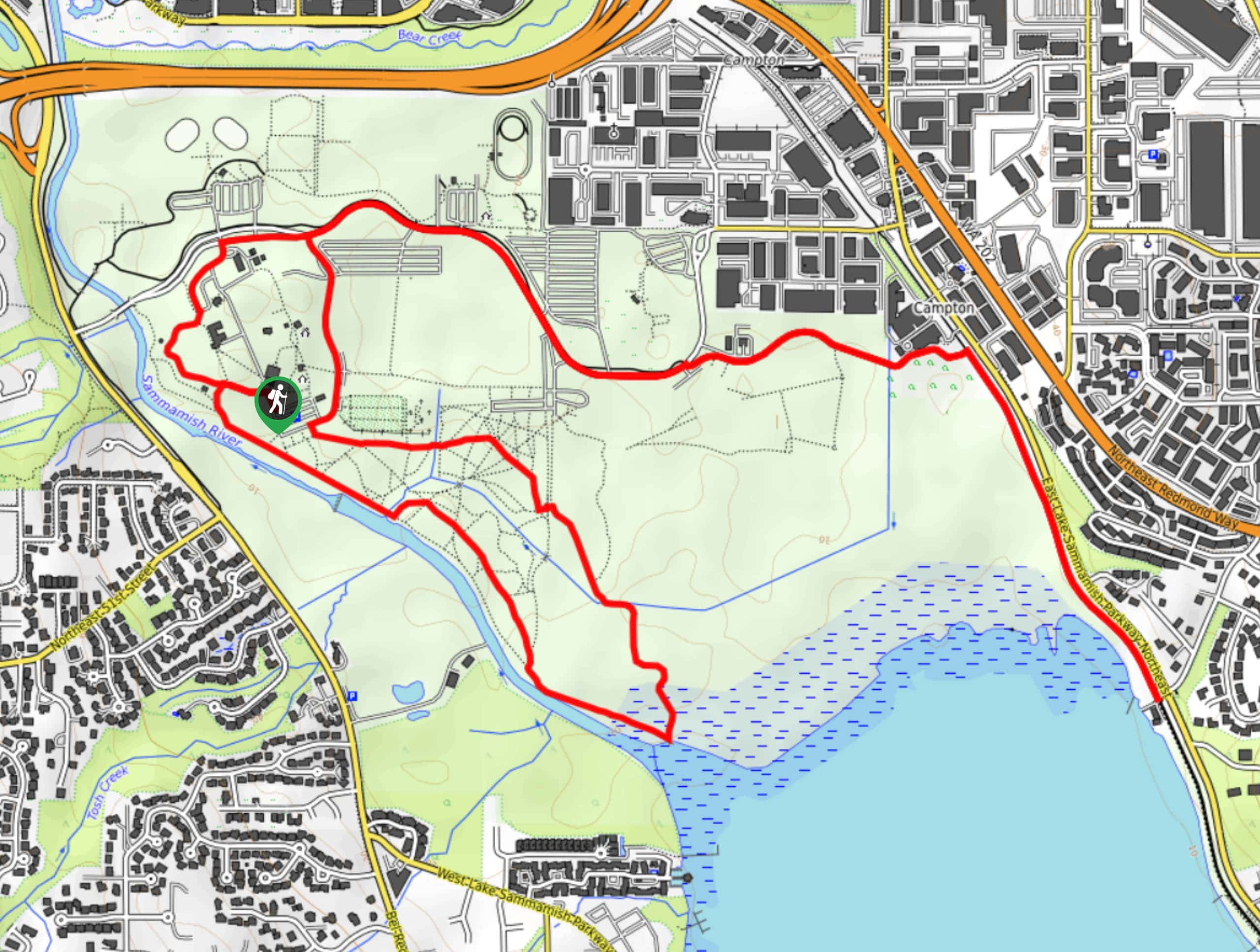
47. Sammamish River Trail
Difficulty
The Sammamish River Trail is a 9.5mi point-to-point trail that runs from Remond… Read More
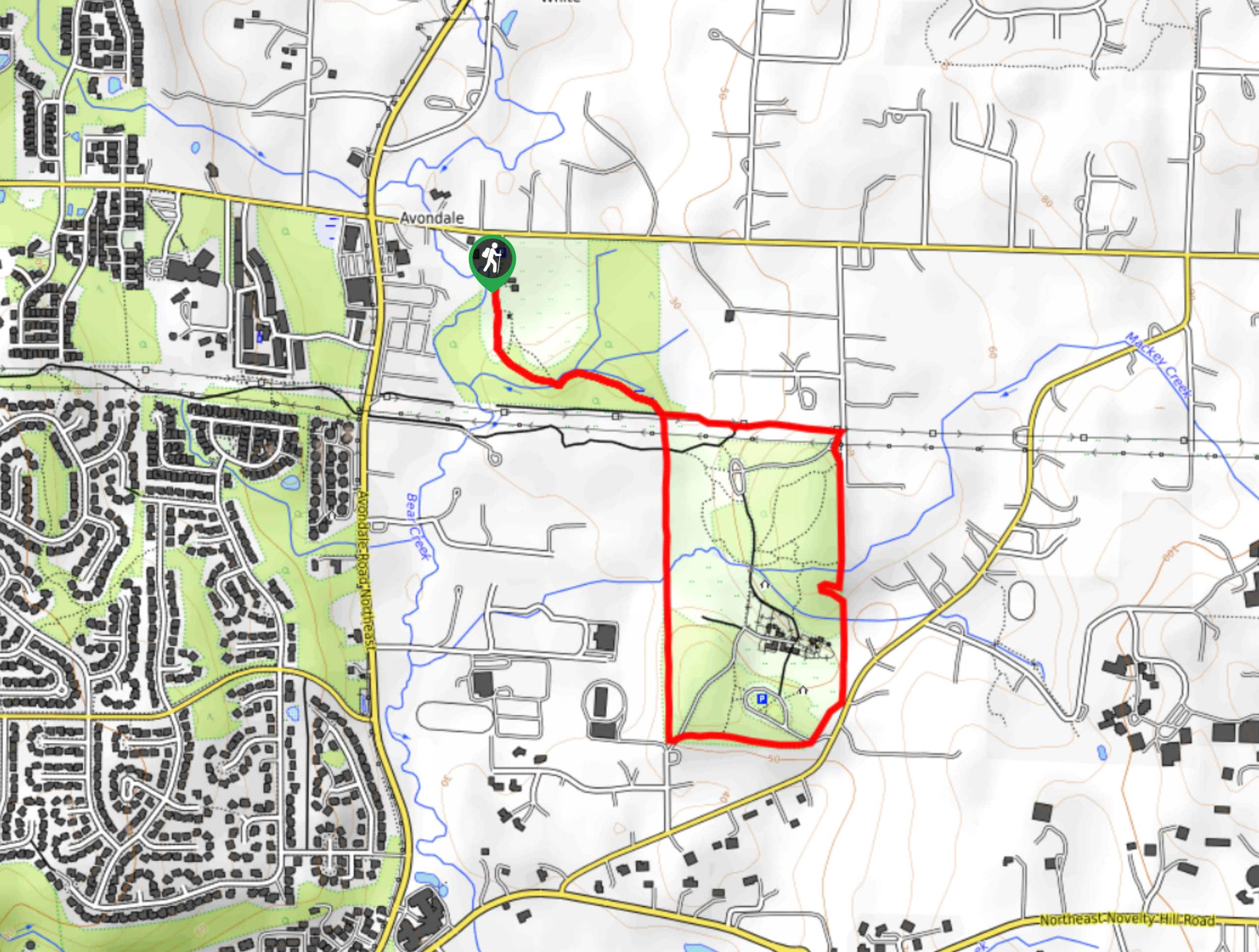
48. Maple Valley Gnome Trail
Difficulty
The Maple Valley Gnome Trail is true to its name, having countless gnomes of all… Read More
49. Ravenna Park Loop Trail
Difficulty
The Ravenna Park Loop Trail is a perfect way to forget you’re in Seattle for… Read More

50. Wright Park Loop
Difficulty
Wright Park is a 27-acre park boasting over 600 trees. Explore this oasis in the… Read More
51. Redondo Beach Boardwalk
Difficulty
Redondo Beach in Washington has a lovely boardwalk that offers you the opportunity to enjoy… Read More
52. Soos Creek Trail
Difficulty
Soos Creek Trail is an 11.5mi out and back trail that runs from… Read More
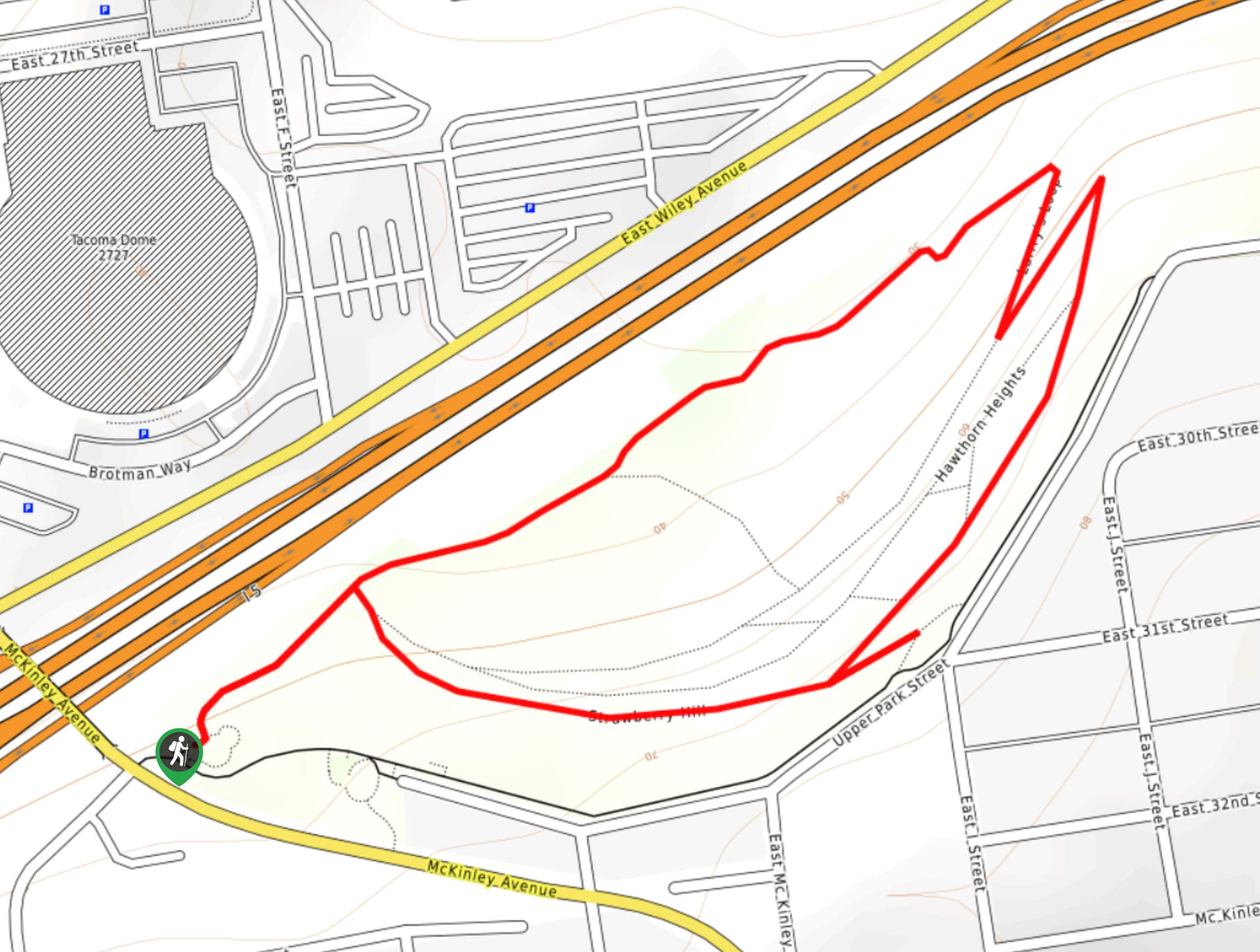
53. McKinley Park Loop
Difficulty
The McKinley Park Loop is a 1.2mi moderately trafficked hike in an urban… Read More
54. Kirkland Waterfront Trail
Difficulty
The Kirkland Waterfront Trail is a 1.2mi out and back walk that takes… Read More
55. Camp Long Loop Trail
Difficulty
The Camp Long Loop is a 1.2mi trail through a wooded park in… Read More
56. Cable Line Trail to West Tiger #3
Difficulty
Cable Line Trail to West Tiger #3 is a 3.0mi out and back… Read More
57. Cable Line Loop to West Tiger #3
Difficulty
Cable Line Loop to West Tiger #3 is an 5.1mi loop hike in… Read More
58. McCollum Park Forest Loop
Difficulty
The McCollum Park Forest Loop is a great nature walk near Everett that is suitable… Read More
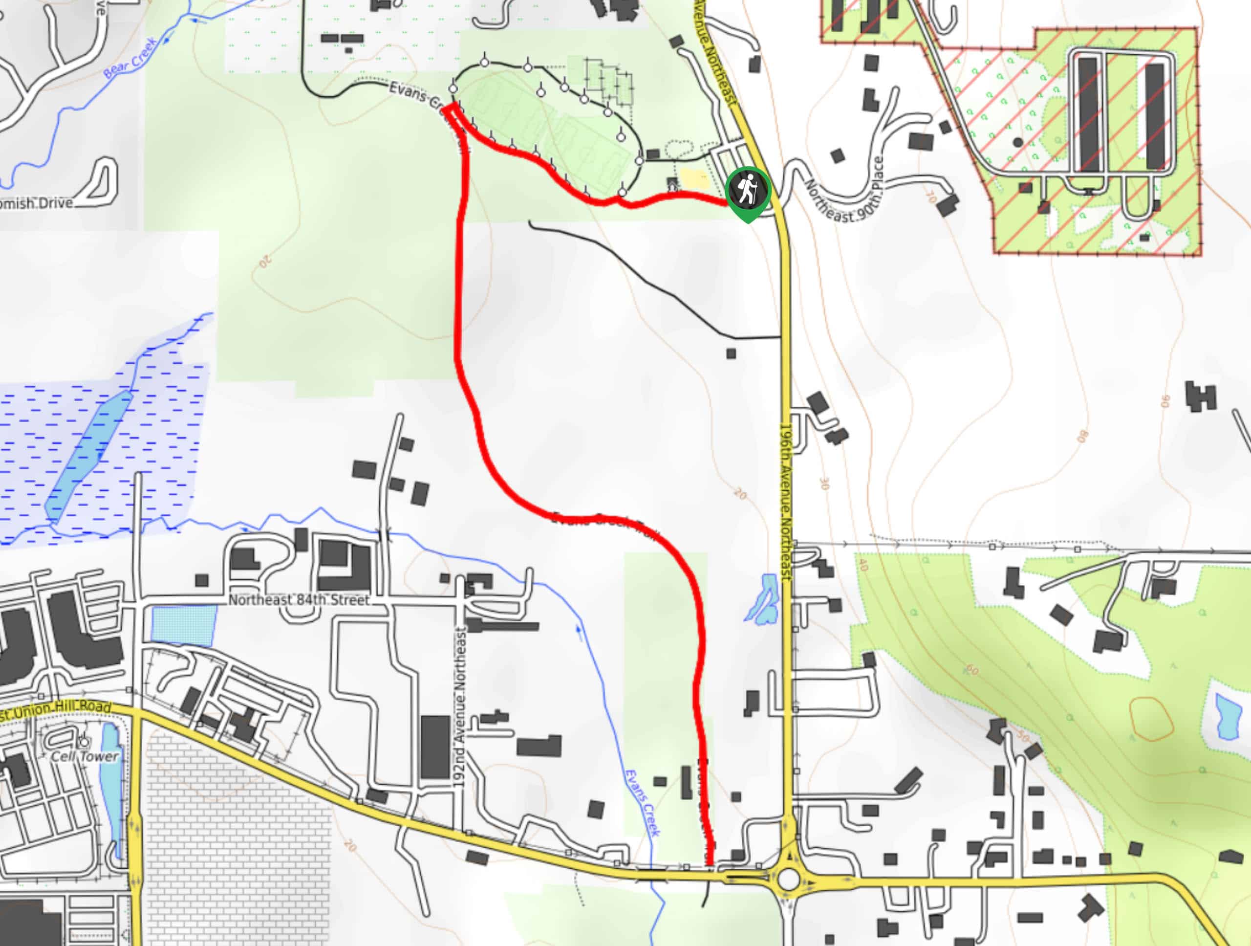
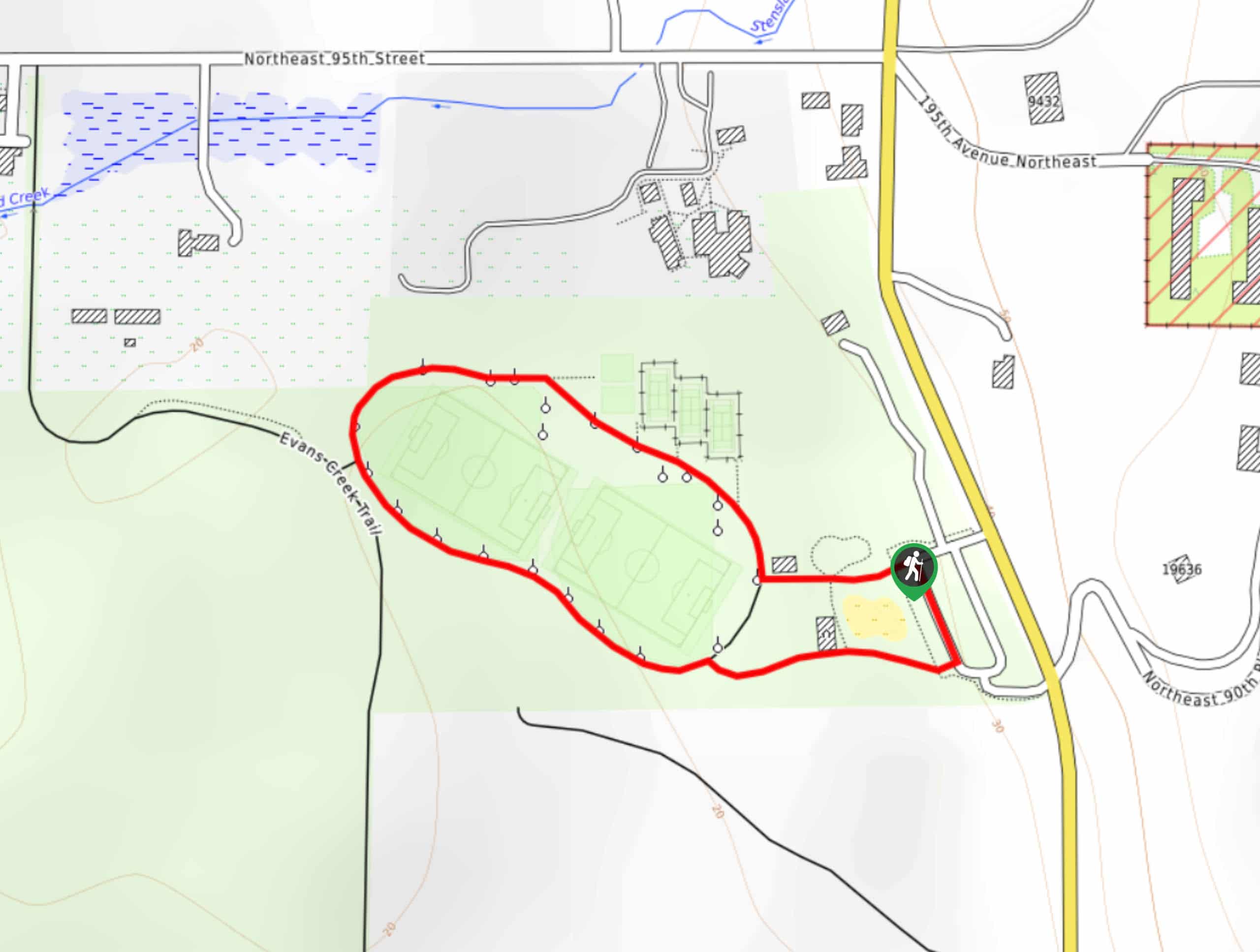
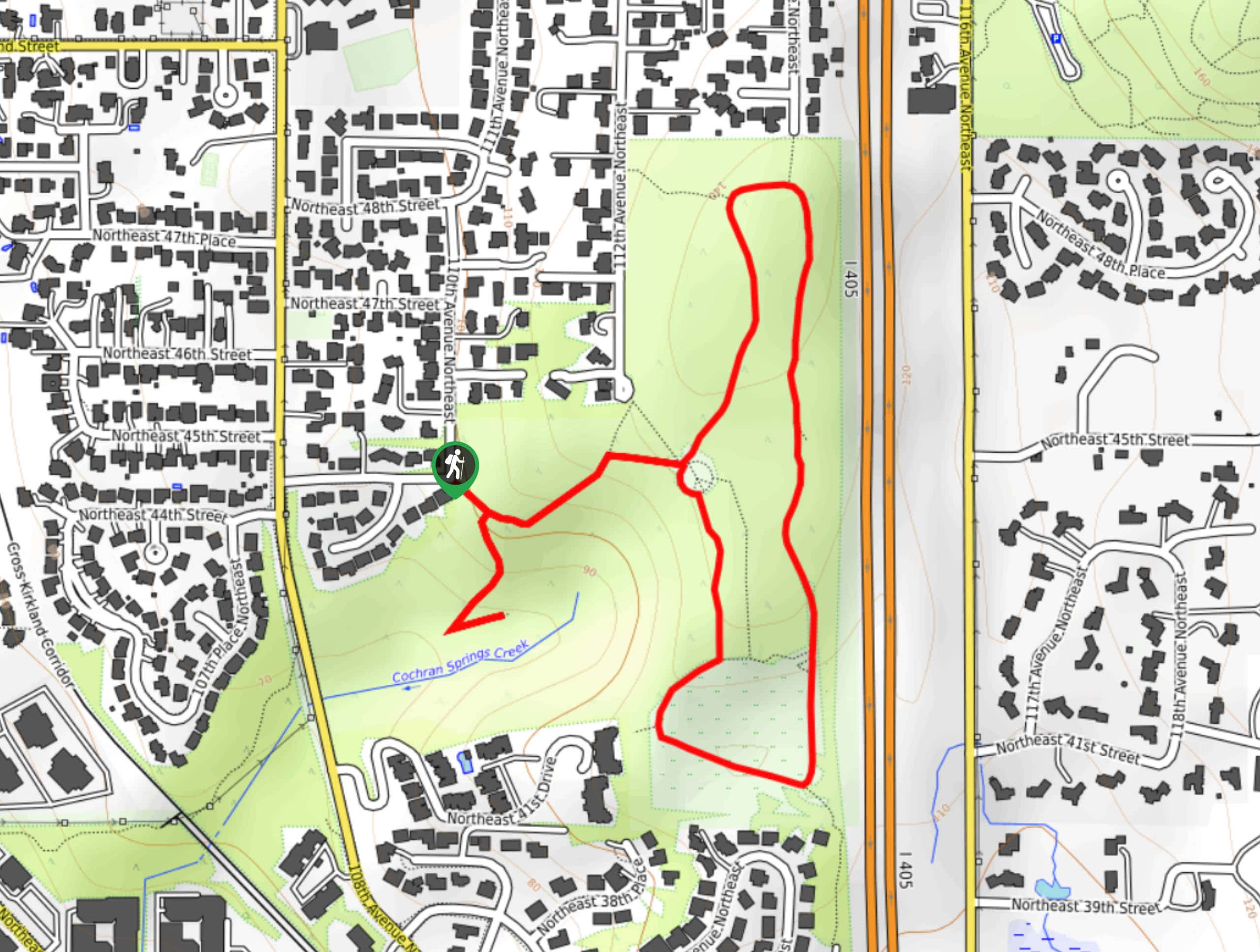
59. Evans Creek Preserve Trail
Difficulty
The Evans Creek Preserve Trail is a 1.7mi easy walk that is suitable… Read More
60. Evans Creek Preserve from Sahalee Way
Difficulty
The Evans Creek Preserve Trail is a 2.4mi easy walk that is suitable… Read More
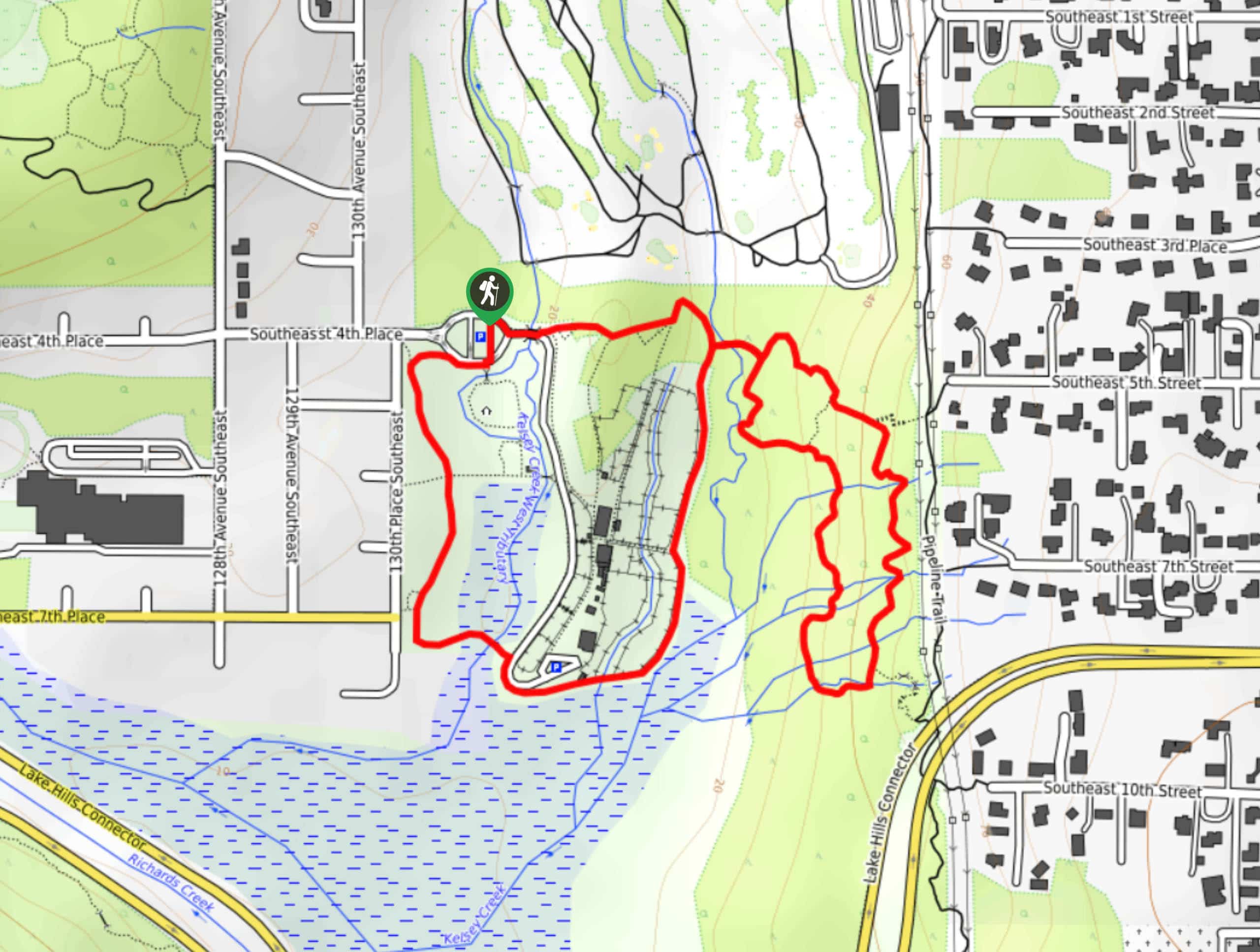
61. Kelsey Creek Farm Trail
Difficulty
The Kelsey Creek Farm Trail is a 1.6mi loop walk through the grounds… Read More
62. Evans Creek Trail
Difficulty
Evans Creek Trail is a 2.0mi trip through old farmland that offers access… Read More
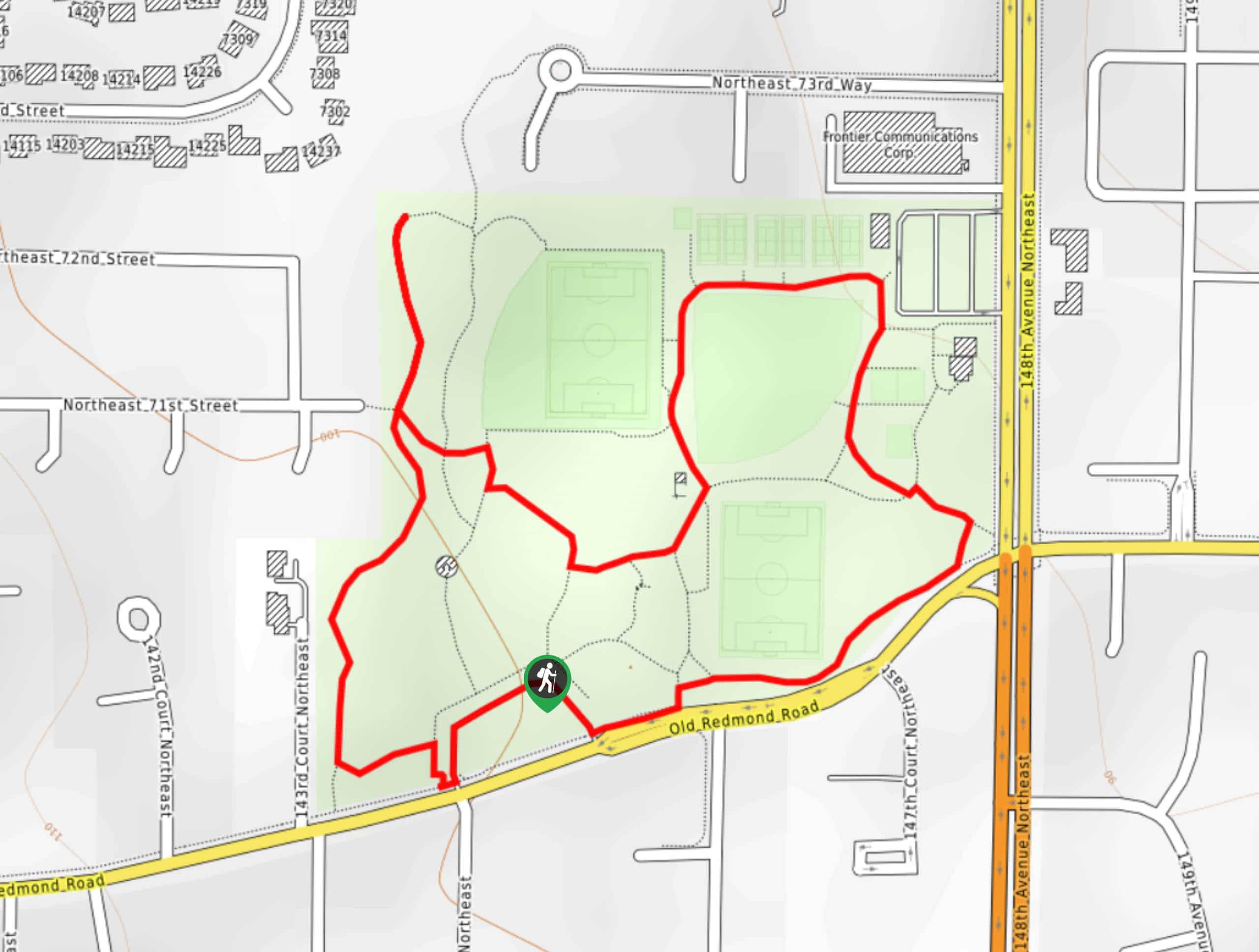
63. Grass Lawn Park Walk
Difficulty
The Grass Lawn Park Walk is a simple, short stroll through the fields at Grass… Read More
64. Juanita Bay Park Trail
Difficulty
A popular spot for birdwatchers, walkers, and joggers, Juanita Bay Park Trail is a picturesque… Read More
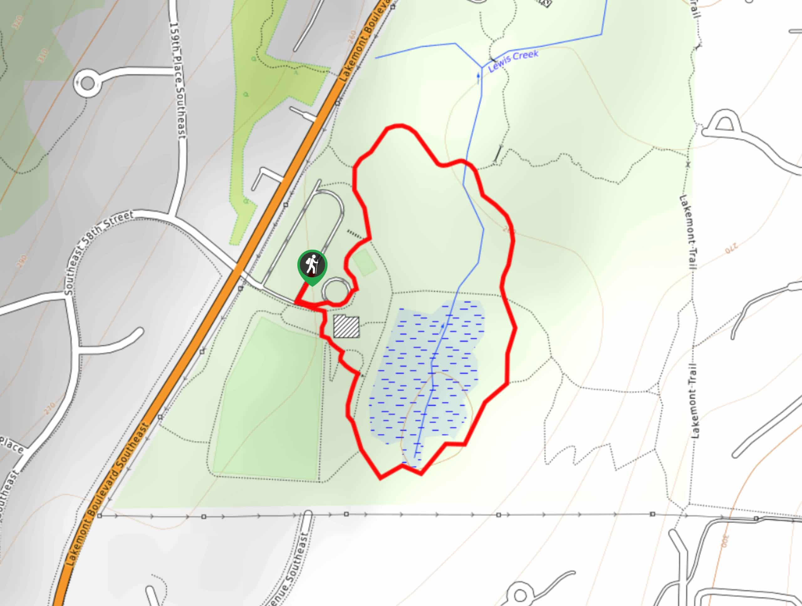
65. Lewis Creek Park Loop
Difficulty
The Lewis Creek Park Loop is a quick walk suitable for the whole family. This… Read More
66. Farrel-McWhirter Park and Juel Park Trail
Difficulty
The Farrel-McWhirter Park and Juel Park Trail is an easy 2.1mi walk through… Read More
67. Dykstra Park and Isaac Evans Park Trail
Difficulty
The Dykstra Park and Isaac Evans Park Trail is a 1.2mi easy walk… Read More
68. Owen Beach Trail
Difficulty
Owen Beach Trail is a 2.1mi heavily trafficked trail that leads you along… Read More
69. Craft Island Trail from Rawlins Road
Difficulty
Craft Island Trail from Rawlins Road is a 1.8mi hike near Mount Vernon… Read More
70. Talus Rocks Loop
Difficulty
The Talus Rocks Loop Trail is an easy-moderate 2.4mi hike that sees heavy… Read More
71. Perrigo Park Loop Trail
Difficulty
The Perrigo Park Loop Trail is a very quick and easy stroll, totalling 0.5mi Read More
72. Marymoor Park Trail
Difficulty
The Marymoor Park Trail is a 6.4mi route that is considered easy. We… Read More
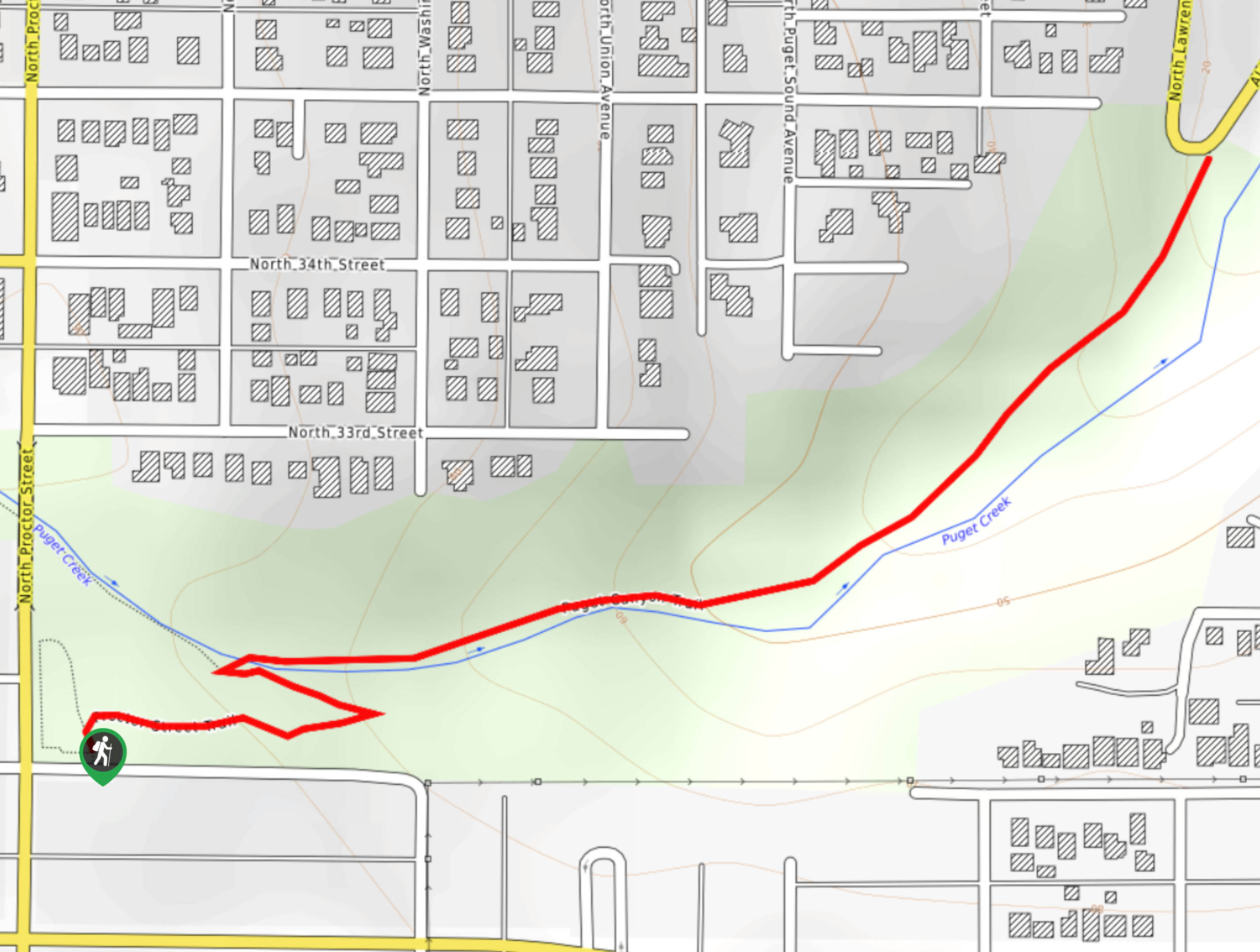
73. Puget Park Trail
Difficulty
Take a hike through a forested canyon on the Puget Park Trail. This 1.2mi Read More
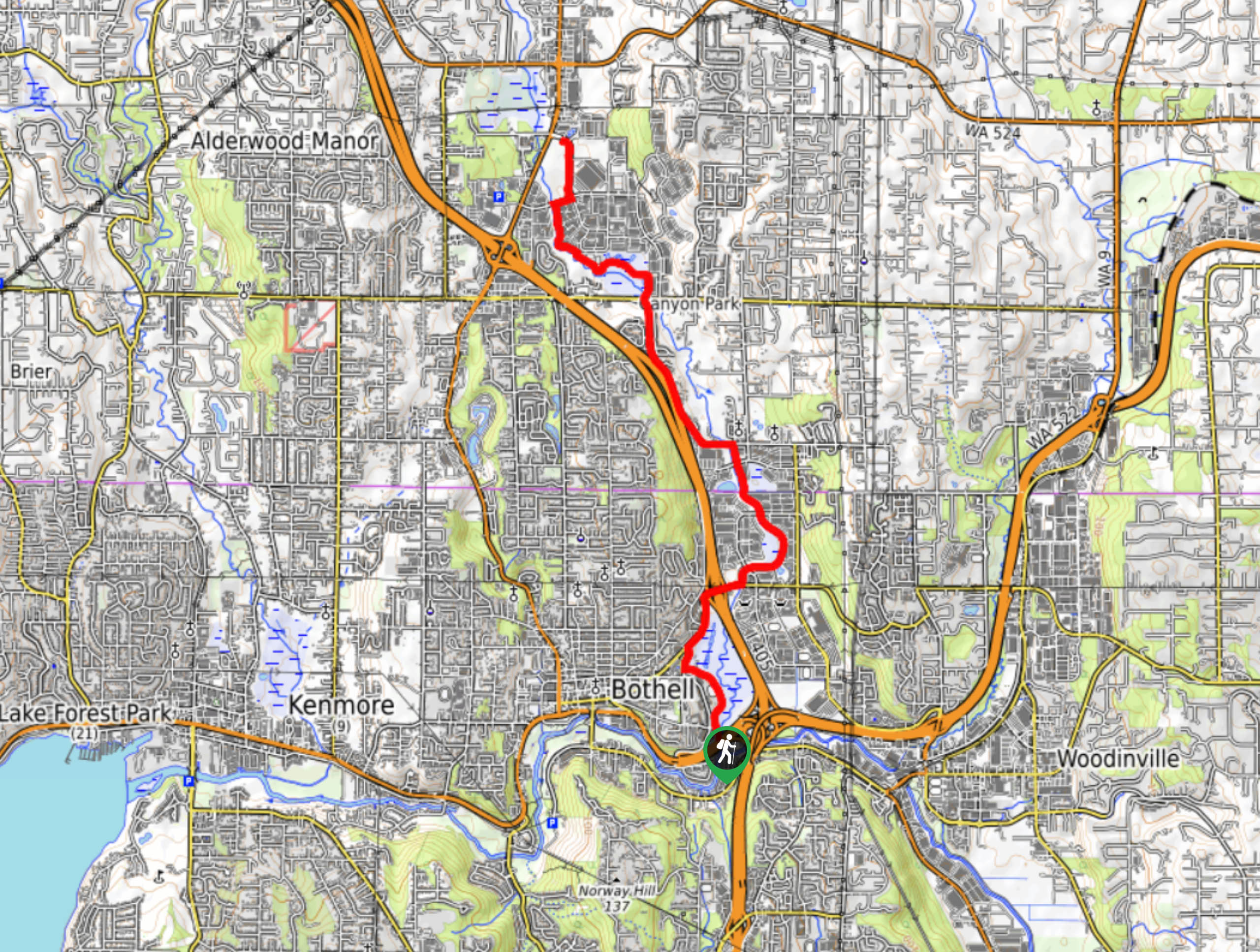
74. Bothell Landing Trail
Difficulty
The Bothell Landing Trail is a well-maintained 4.0mi multi-use pathway perfect for walking,… Read More
75. Watershed Park Trail
Difficulty
The Watershed Park Trail is a scenic wooded trail in Kirkland that makes for a… Read More
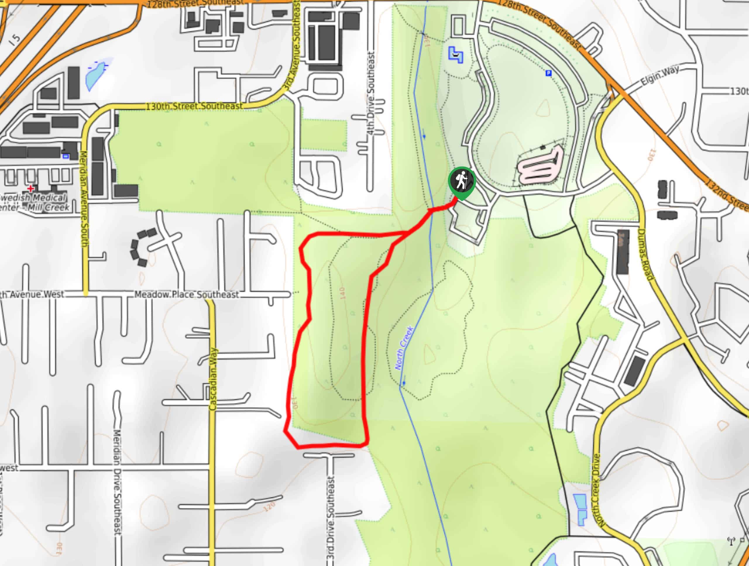
76. North Creek Trail: U of WA Bothell to Thrasher’s Corner
Difficulty
This section of the North Creek Trail goes from the University of WA Bothell to… Read More
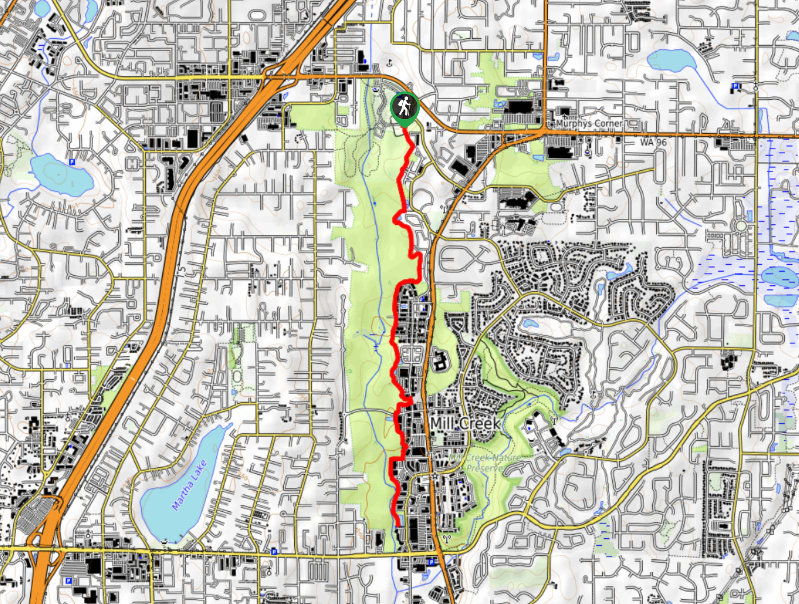
77. North Creek Trail: McCollum Pioneer Park to Mill Creek
Difficulty
This section of the North Creek Trail goes from McCollum Pioneer Park down North Creek… Read More
78. Useless Bay Hike
Difficulty
Useless Bay is a beach walk suitable for all levels thanks to its flatness. This… Read More
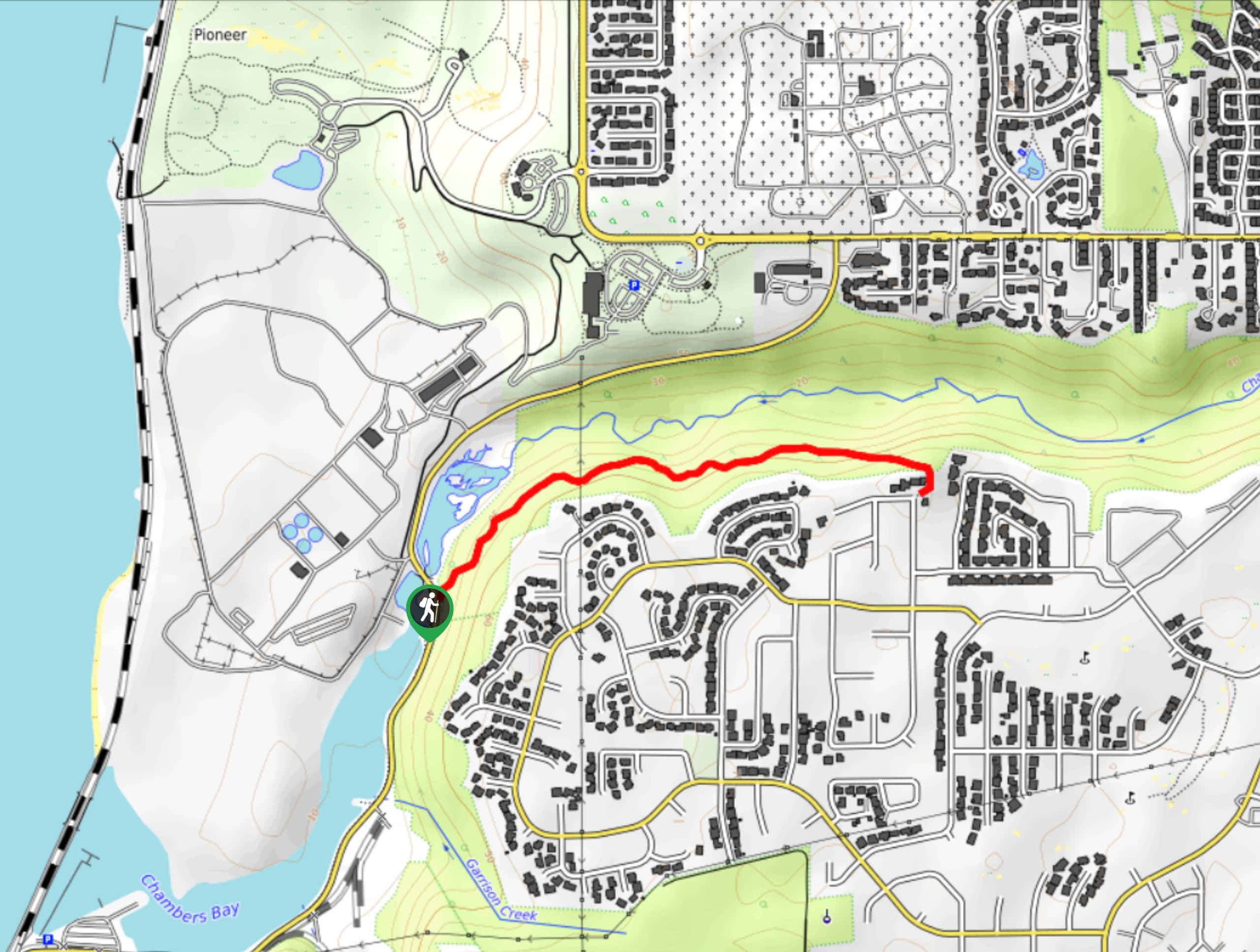
79. Chambers Creek Trail
Difficulty
Chambers Creek Trail is a 1.7mi out and back trail in Tacoma that… Read More
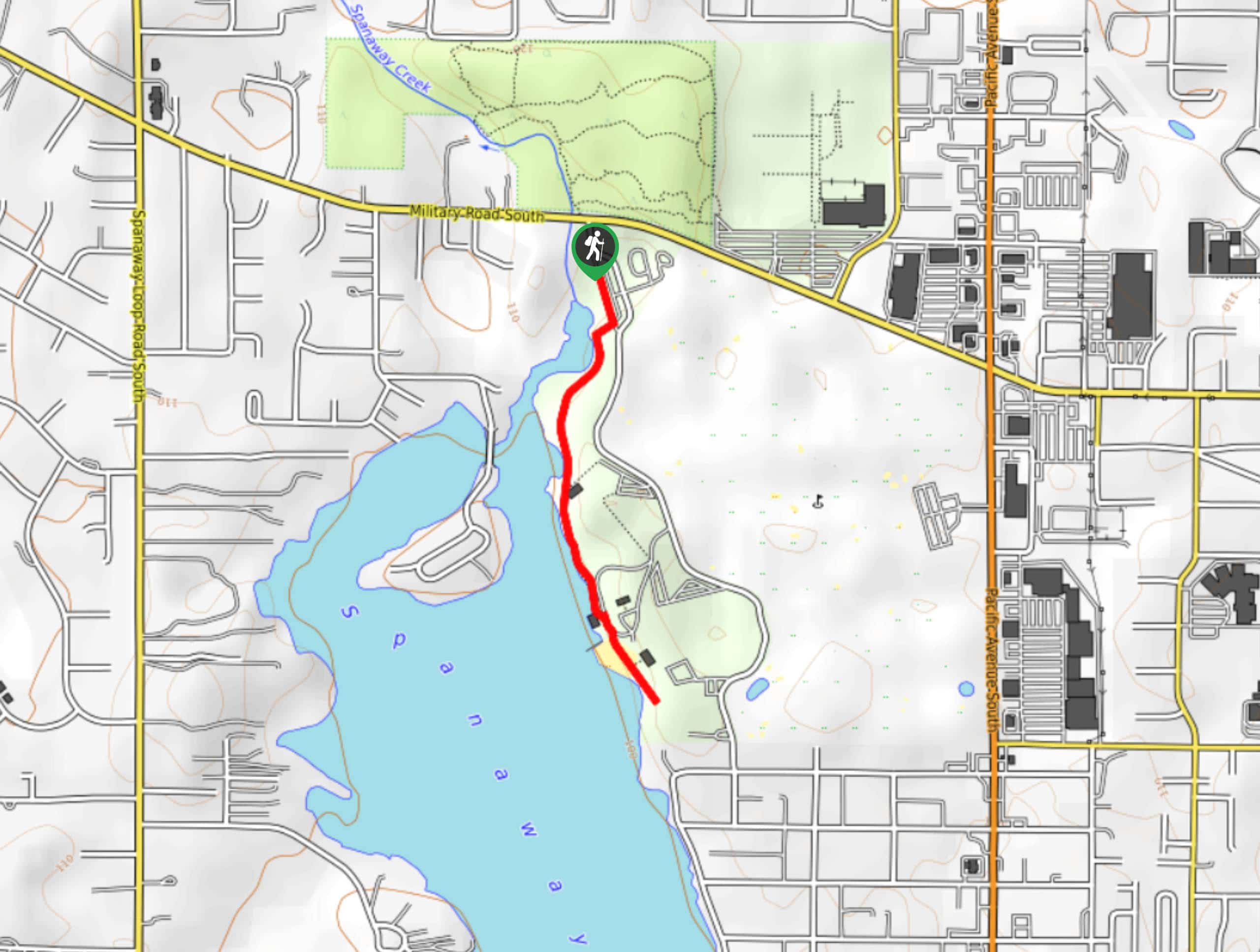
80. Spanaway Lake Trail
Difficulty
Spanaway Lake Trail is a 1.5mi route that runs between the Lake Spanaway… Read More
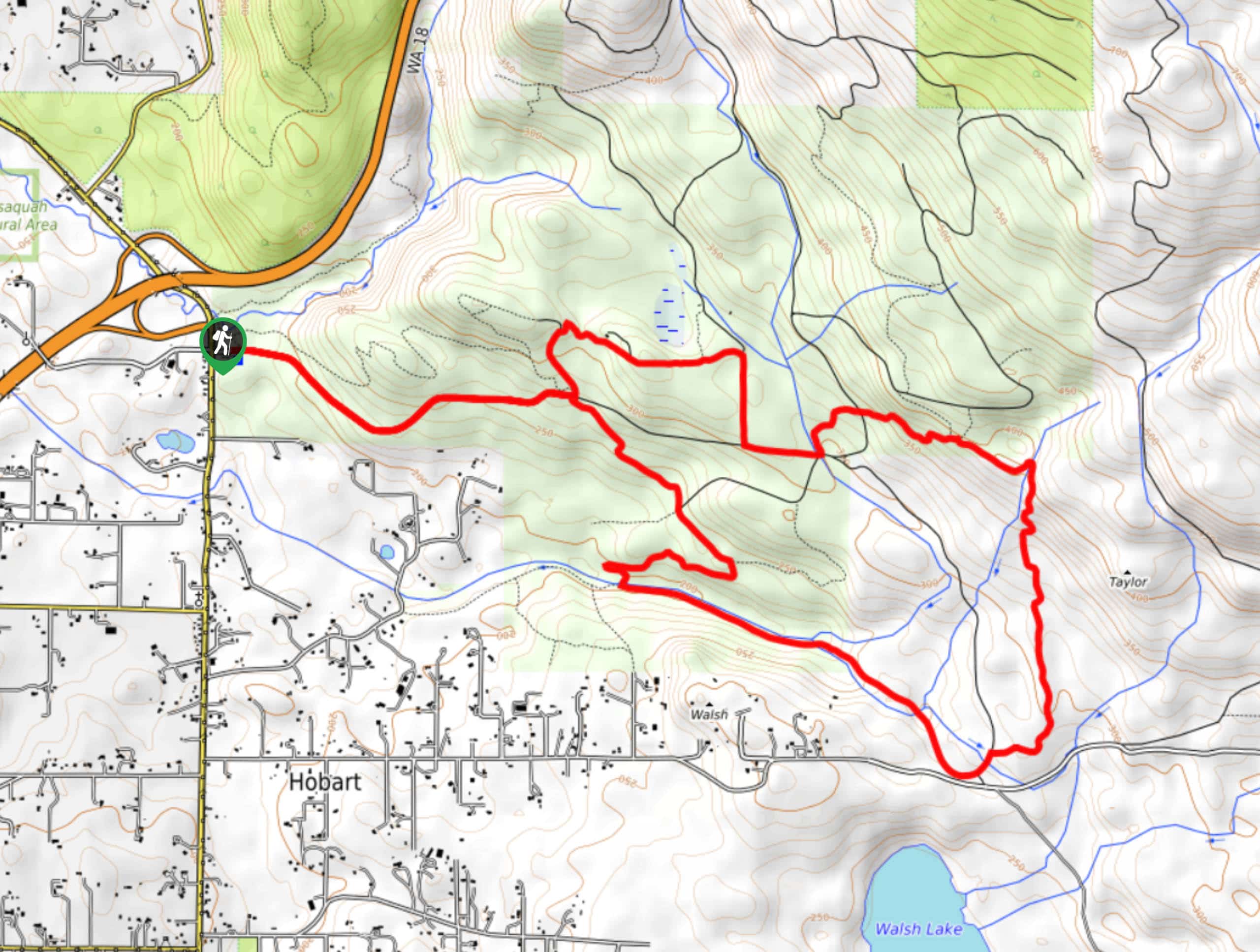
81. Taylor Mountain Loop
Difficulty
The Taylor Mountain Loop is 8.9mi long and considered moderate. This trail is… Read More
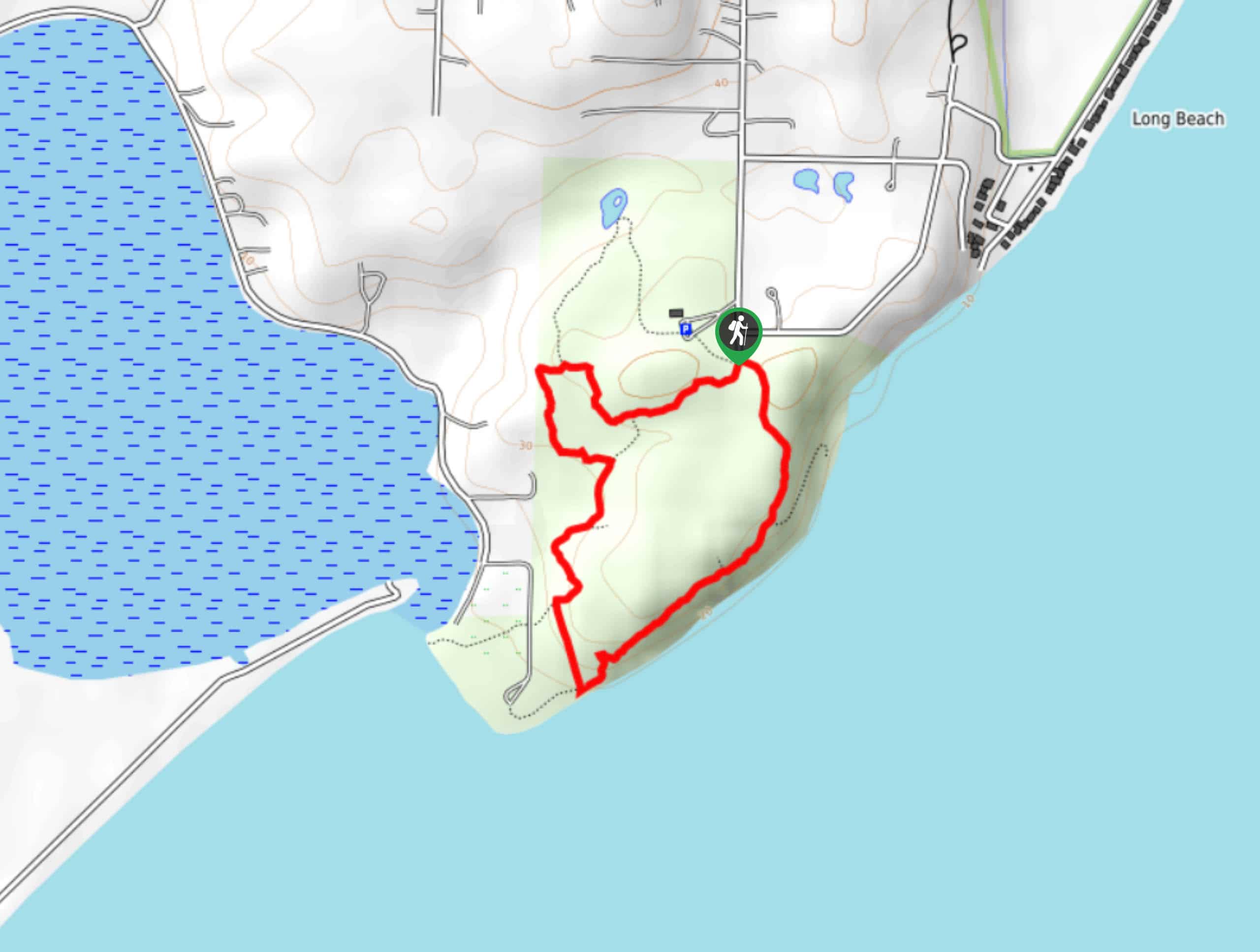
82. Holly and Bluff Loop
Difficulty
The Holly and Bluff Loop is a 1.5mi trail near Long Beach. This… Read More
83. Sword Fern and Highline Trail
Difficulty
Sword Fern and Highline Trail is a super quick and extremely easy loop trail in… Read More
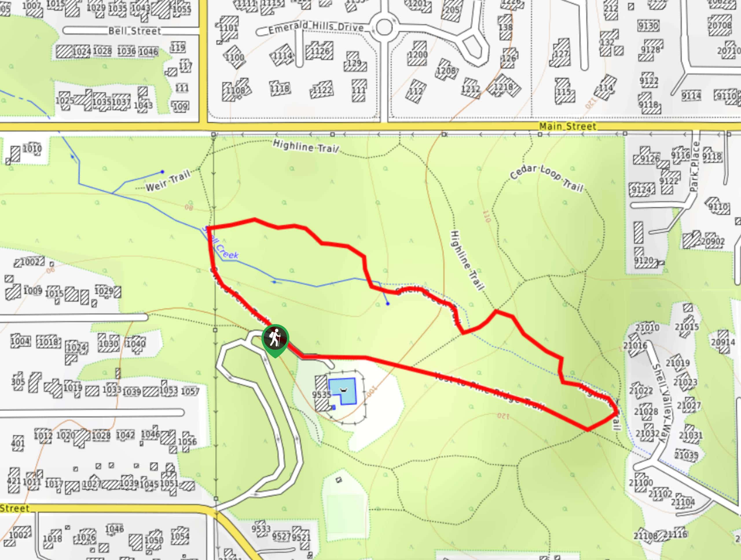
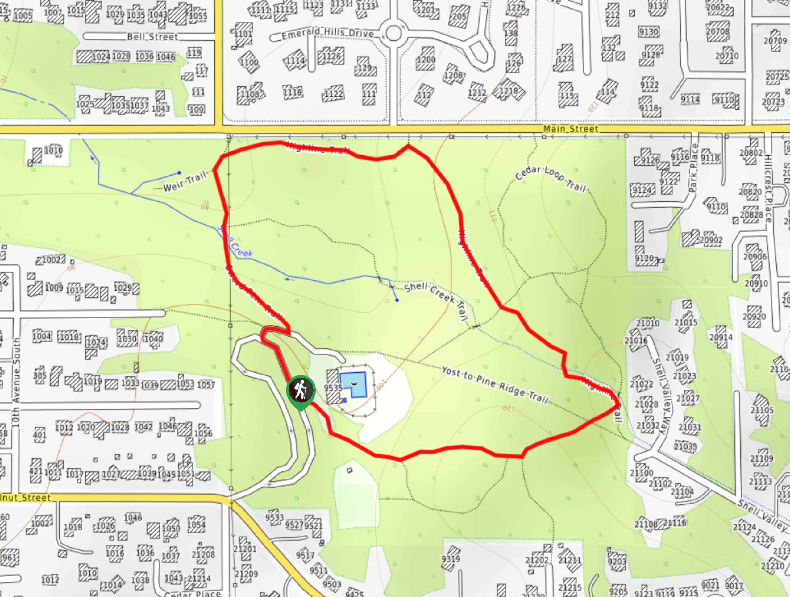
84. Sword Fern, Shell Creek, and Yost to Pine Ridge Loop
Difficulty
The Sword Fern, Shell Creek, and Yost to Pine Ridge Loop is a very short… Read More
85. Birds Nest and Lookout Beach Hike
Difficulty
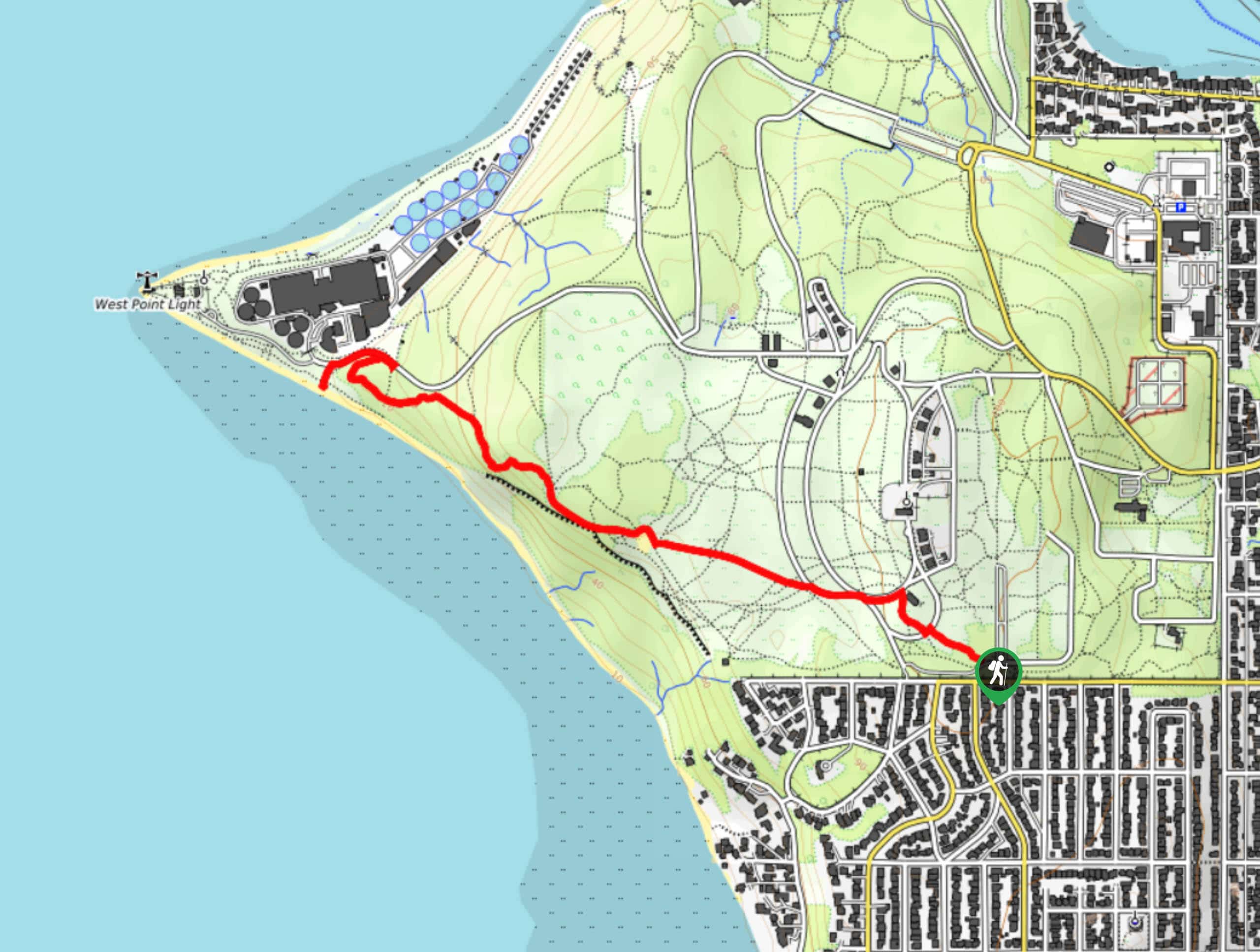
The Birds Nest and Lookout Beach hike is a moderately trafficked easy hike in Discovery… Read More
86. Discovery Park Loop via Emerson Entrance
Difficulty
The Discovery Park Loop via Emerson Entrance hike is a 2.8mi trail in… Read More
87. South Beach Trail
Difficulty
The South Beach Trail is a 1.5mi trail in the Seattle-Tacoma area that… Read More
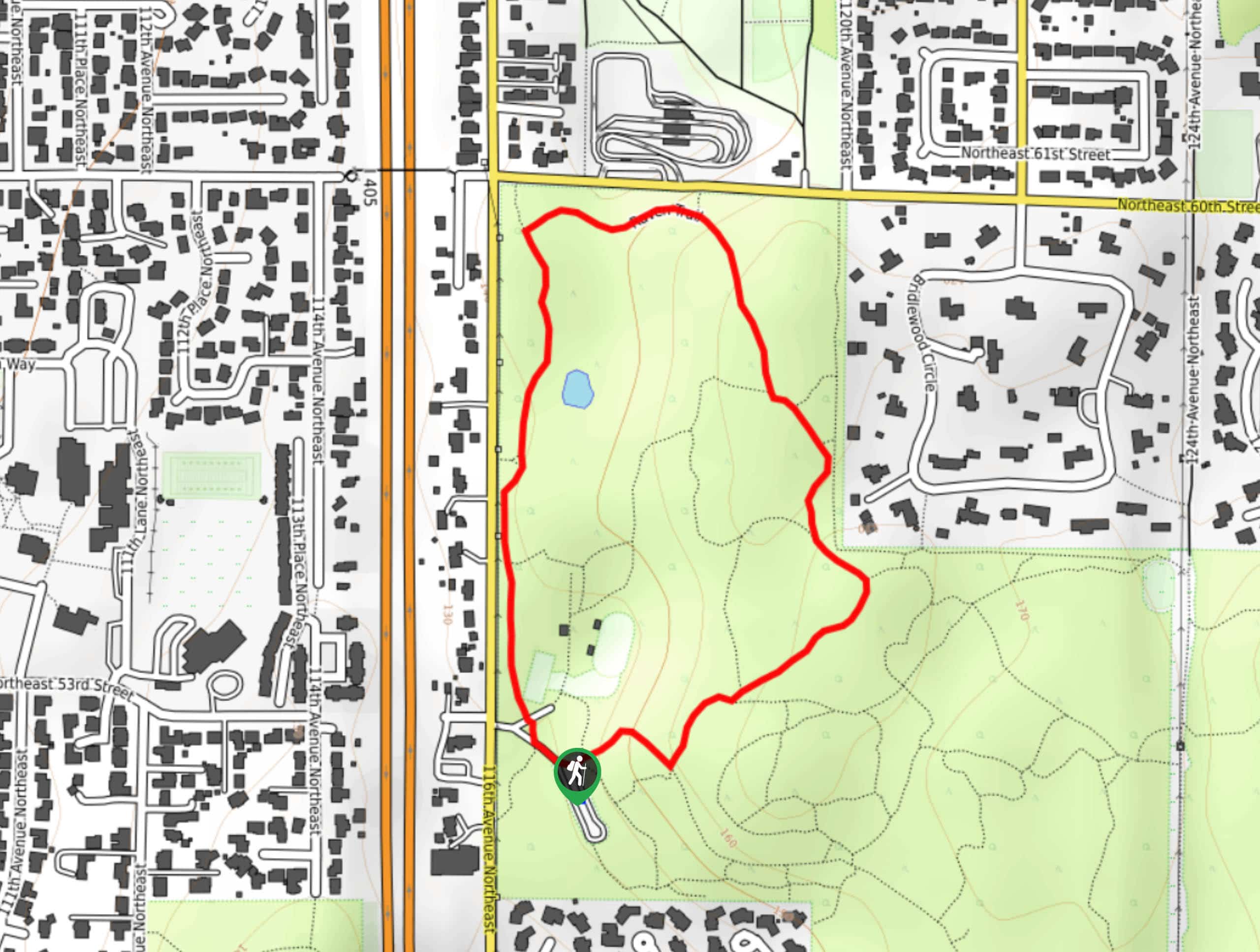
88. Raven Trail
Difficulty
The Raven Trail is a 1.1mi loop in Bridle Trails State Park. This… Read More
89. Discovery Park Extended Loop Trail
Difficulty
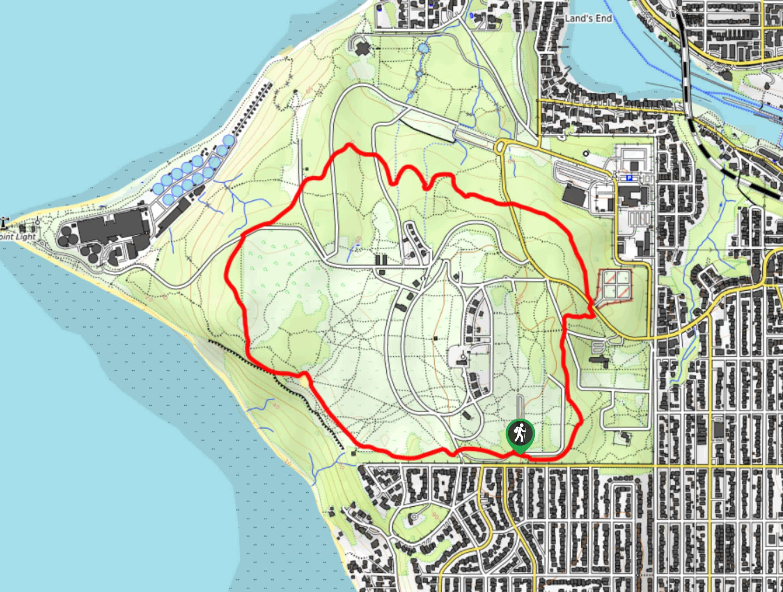
The Discovery Park Extended Loop Trail is a 4.3mi hike in the Seattle-Tacoma… Read More
90. Coyote Loop Trail
Difficulty
The Coyote Loop Trail is a 3.6mi route in Bridle Trails State Park.… Read More
91. Sky Country and Military Road Trail
Difficulty
The Sky Country and Military Road Trail is a 1.2mi easy hike in… Read More
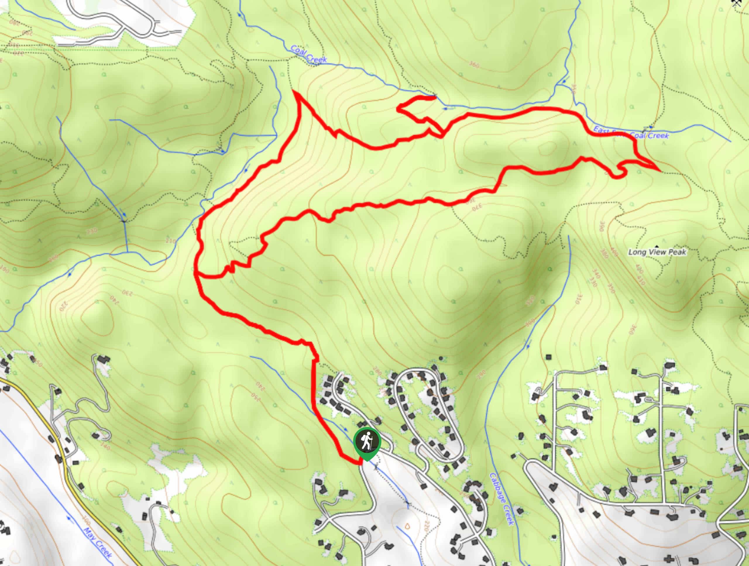
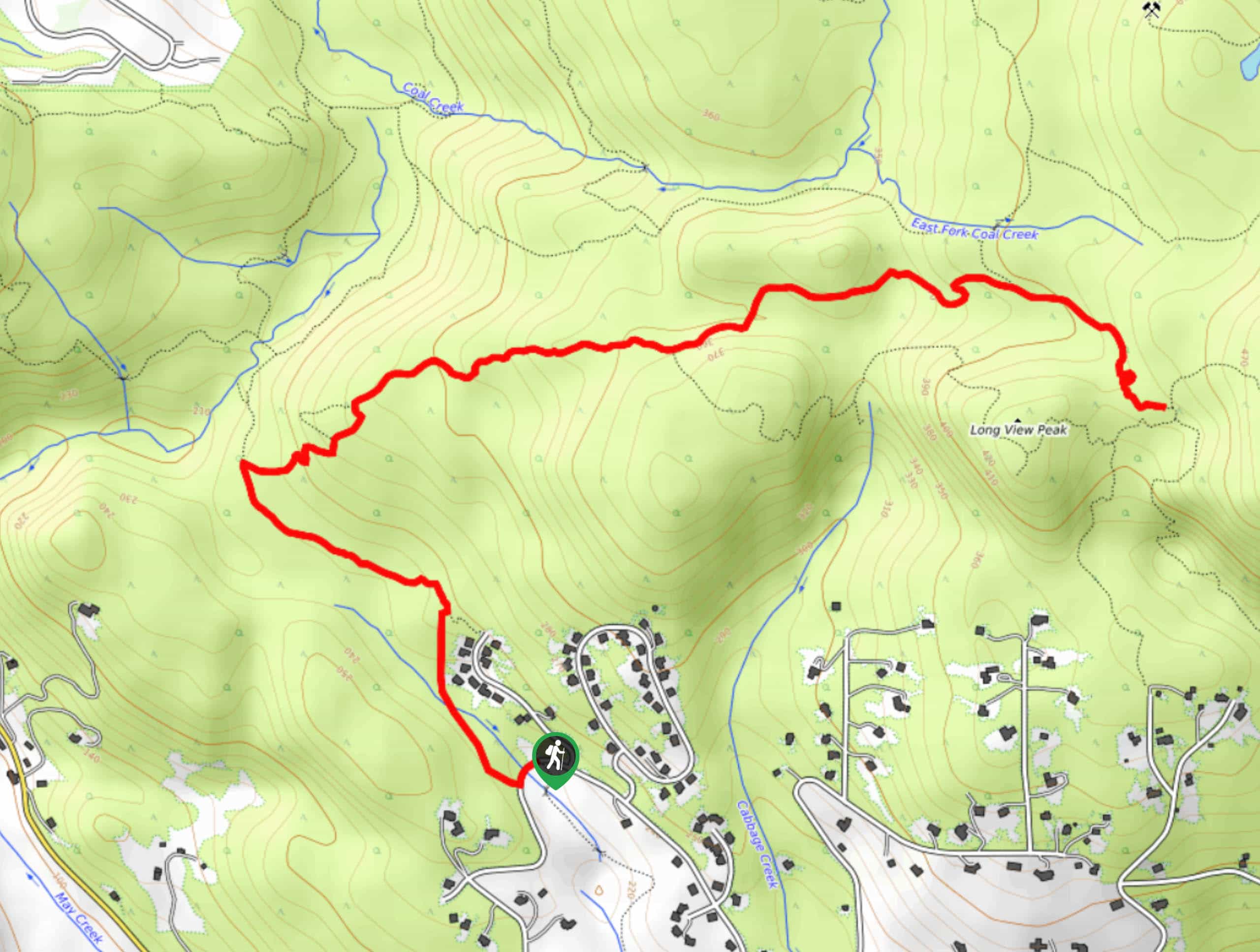
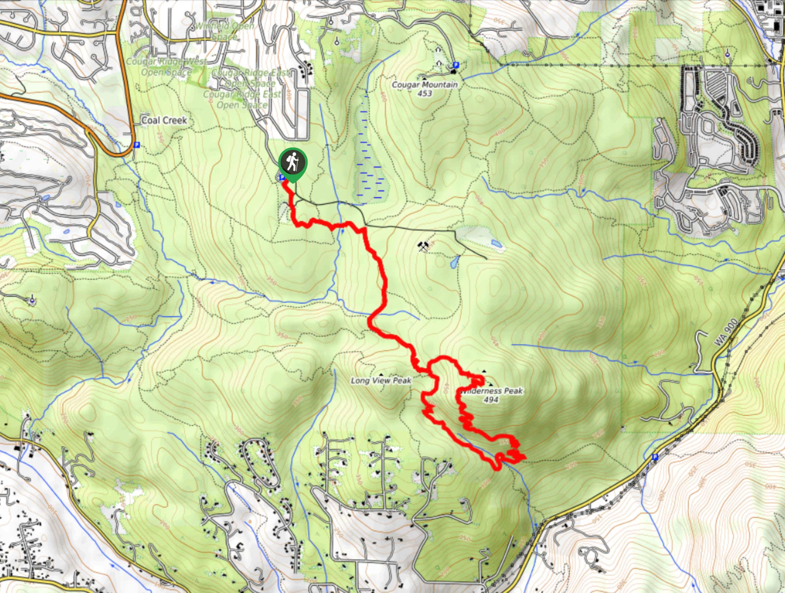
92. Longview Peak and Far Country Lookout Loop
Difficulty
The Longview Peak and Far Country Lookout Loop is a 6.5mi hike in… Read More
93. Klondike Swamp Trail
Difficulty
There are so many ways to explore Cougar Mountain, and the Klondike Swamp Trail is… Read More
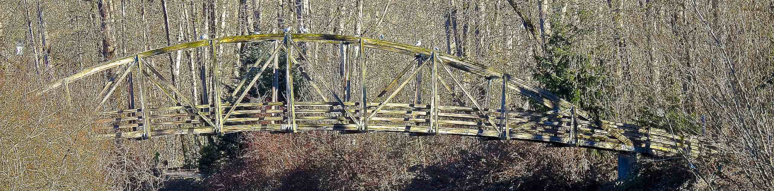
94. Talus Bridge Trail
Difficulty
The Talus Bridge Trail is a quick little hike through Cougar Mountain Regional Wildland Park.… Read More
95. Indian, Shy Bear, and Quarry Loop
Difficulty
The Indian, Shy Bear, and Quarry Loop is a 5.6mi moderately difficult hike… Read More
96. Shy Bear Trail
Difficulty
The Shy Bear Trail is one of the most-used trails on the south side of… Read More
97. Flaming Geyser River Trail
Difficulty
Flaming Geyser River Trail is a 2.3mi easy hike in the park that… Read More

98. Stevensonville Loop
Difficulty
The Stevensonville Loop is a 6.6mi moderate hike in Green River Natural Area.… Read More
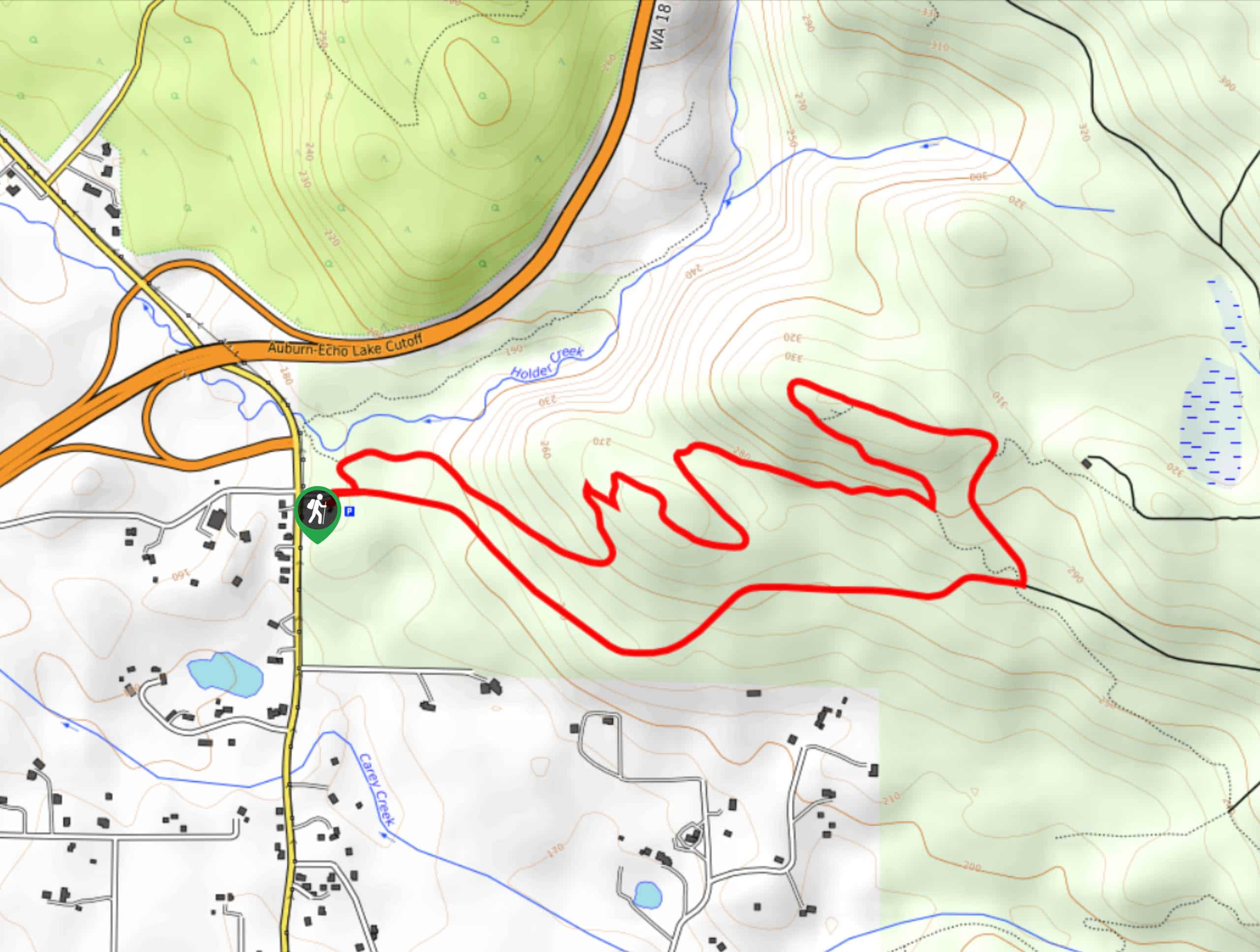
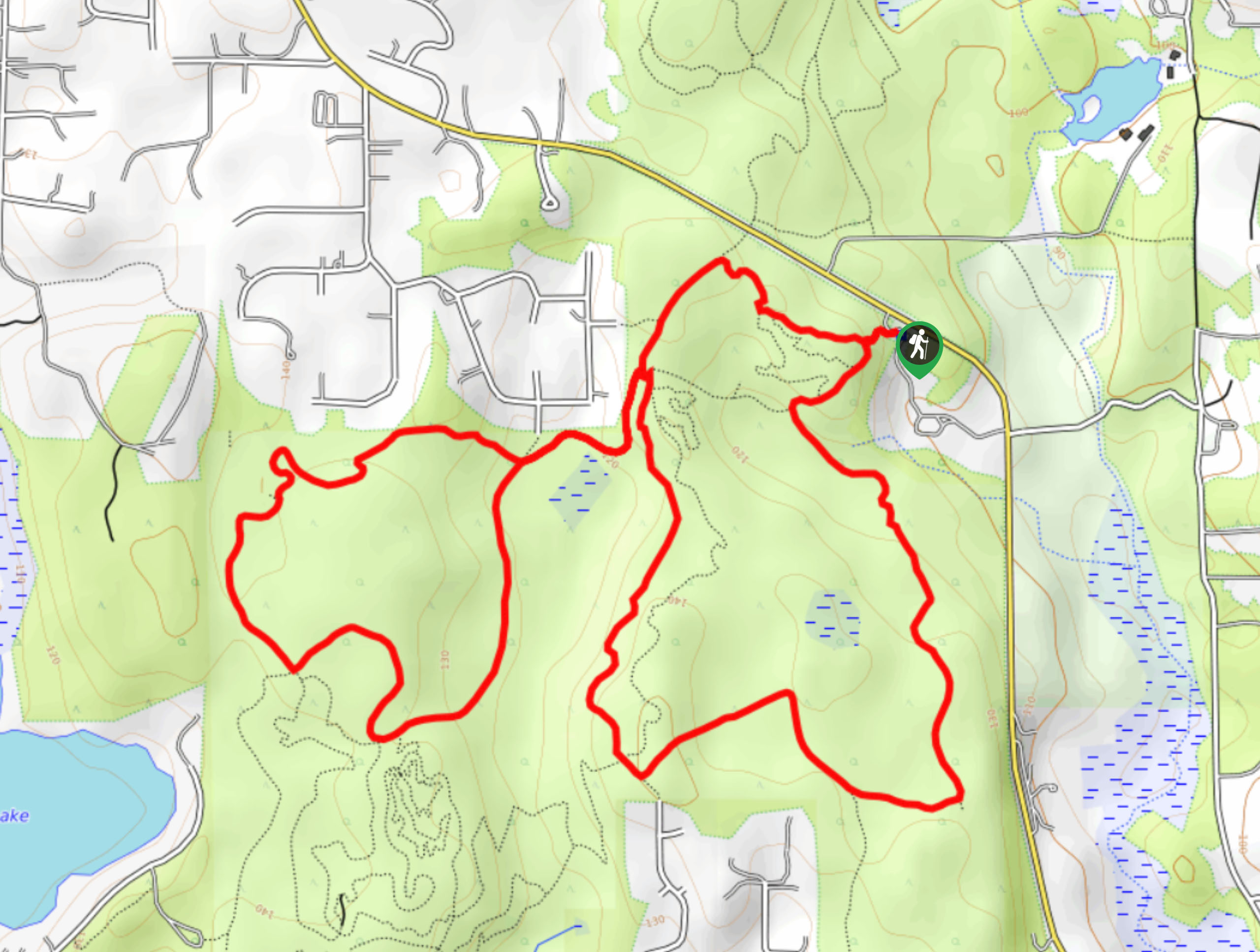
99. Holder Ridge Trail
Difficulty
The Holder Ridge Trail is a 3.8-mile moderately trafficked loop trail in Taylor Mountain Forest.… Read More
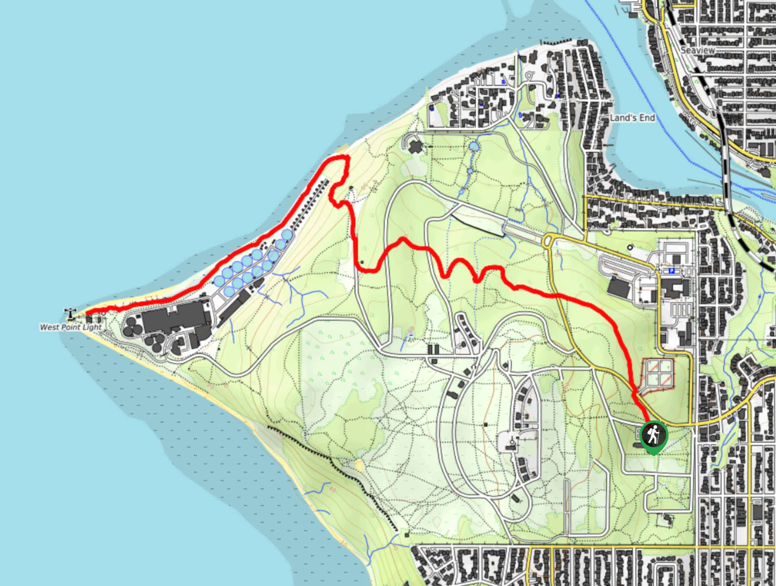
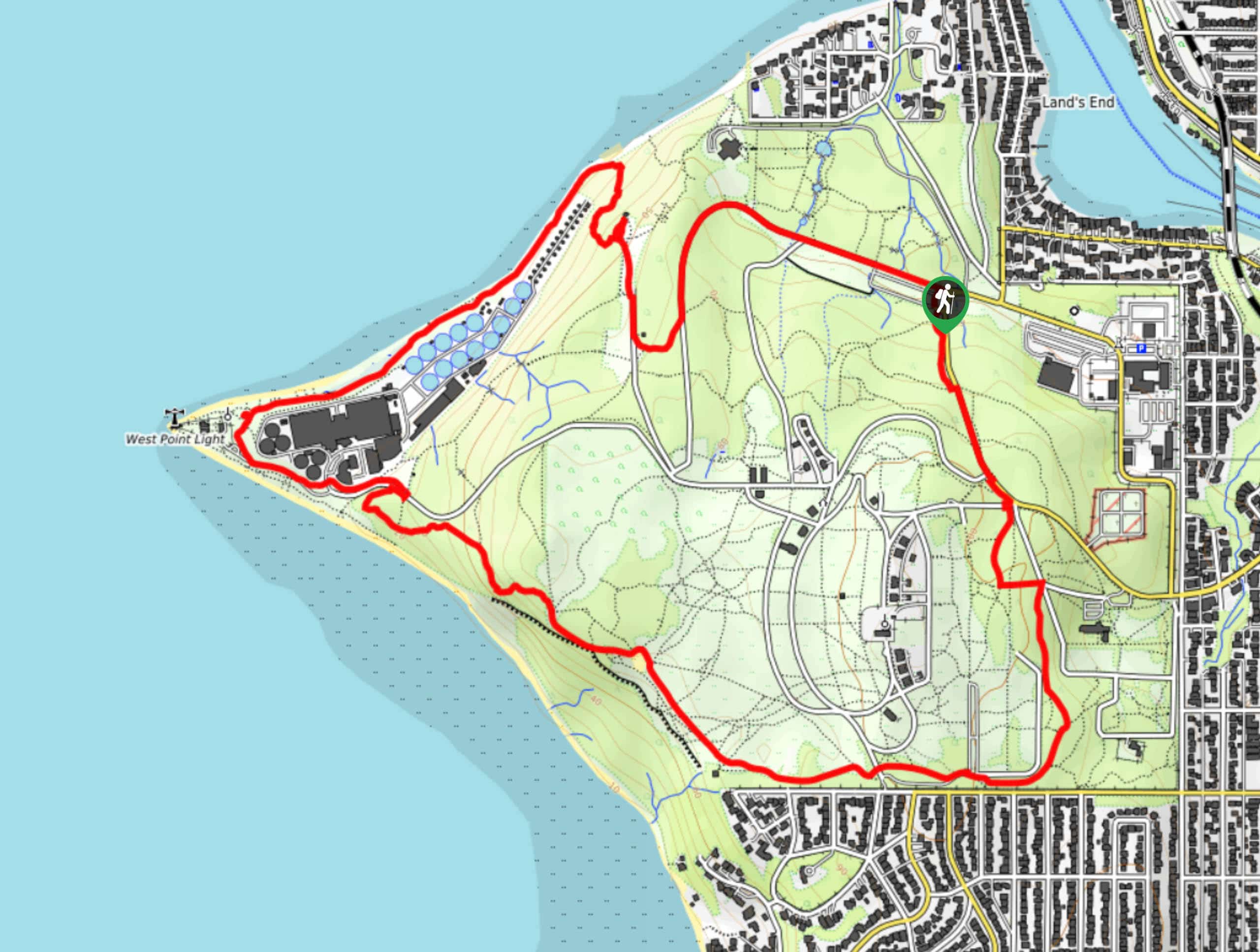
100. West Point Lighthouse Hike
Difficulty
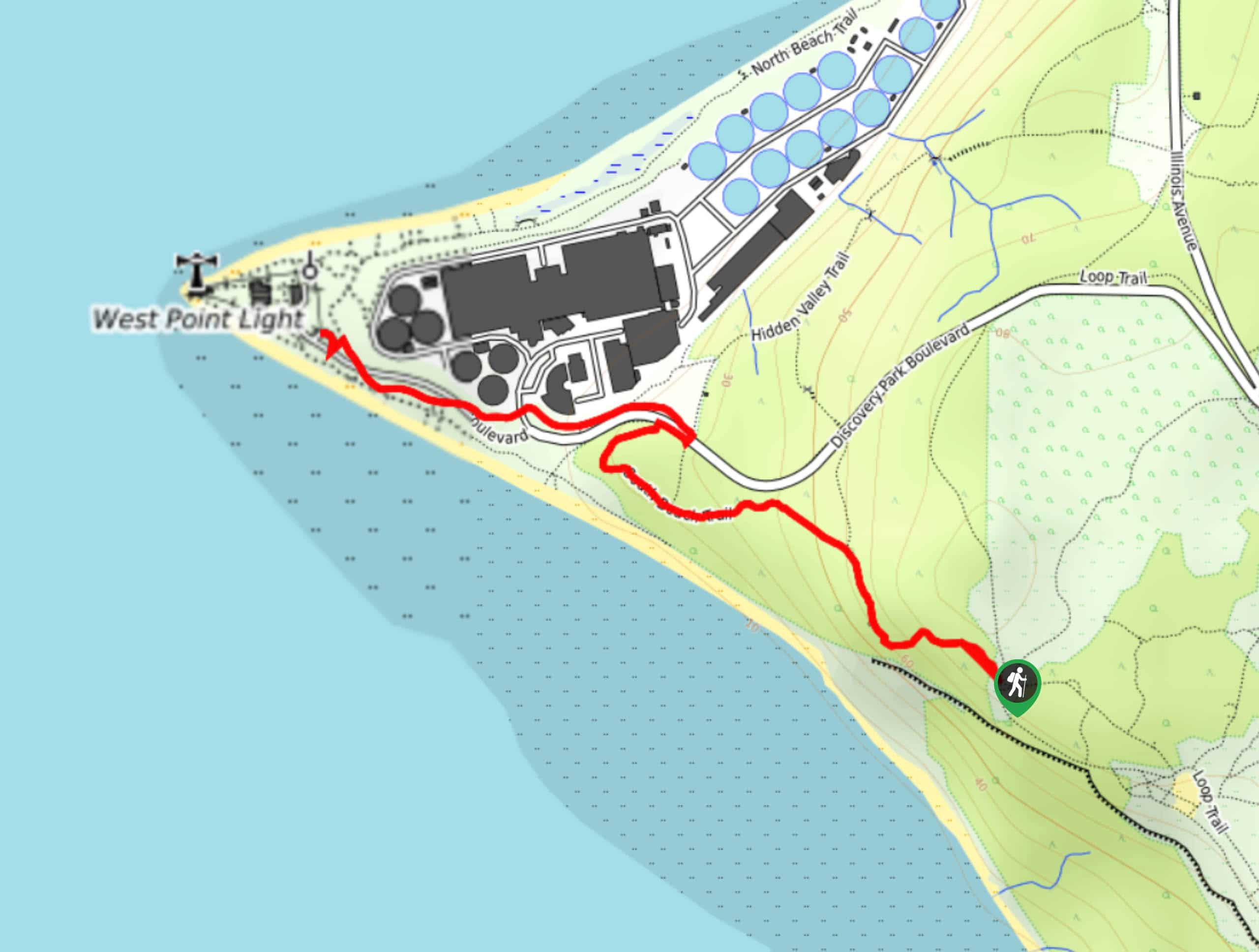
The West Point Lighthouse hike is in Discovery Park, Seattle’s most popular park. This hike… Read More
101. Japanese Gulch Loop
Difficulty
Japanese Gulch Loop is a unique hike. This loop is 4.1mi long and… Read More
102. Weowna Park Loop
Difficulty
The Weowna Park Loop is an underrated hike and a favorite among locals. This 3.4mi Read More
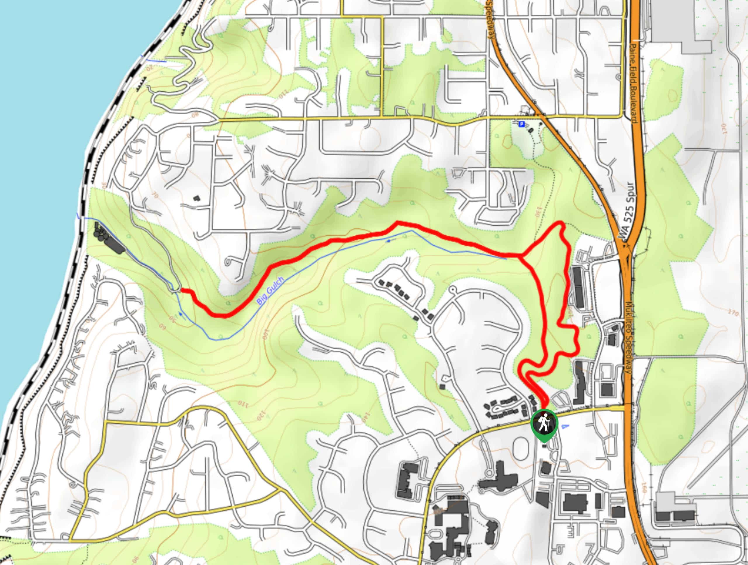
103. Big Gulch Trail
Difficulty
The Big Gulch Trail is a hiking path in the North Gulch Open Space that… Read More
104. Sky Country Trail
Difficulty
The Sky Country is a 6.0mi hike in Cougar Mountain Regional Wildland Park.… Read More
105. Trillium Trail
Difficulty
The Trillium Trail is a 1.8mi heavily trafficked route in Bridle Trails State… Read More
106. Ebey Slough Trail
Difficulty
The Ebey Slough Trail is a short, simple, sweet walk along the water. This is… Read More
107. Southwest County Olympic Short Trail
Difficulty
The Southwest County Olympic Short Trail is a-you guessed it-short walk. This trail is easy… Read More
108. Licorice Fern Trail
Difficulty
The Licorice Fern Trail is a 2.6mi easy hike in Cougar Mountain Regional… Read More
109. Cross Kirkland Corridor Trail
Difficulty
The Cross Kirkland Corridor Trail is a multi-use path that runs through Kirkland north-south. This… Read More
110. Far Country Falls via Licorice Fern Trail
Difficulty
Far Country Falls via Licorice Fern Trail is a 4.8mi moderate hike in… Read More

111. Lowell Riverfront Trail
Difficulty
The Lowell Riverfront Trail is a 3.0mi route alongside the Snohomish River in… Read More
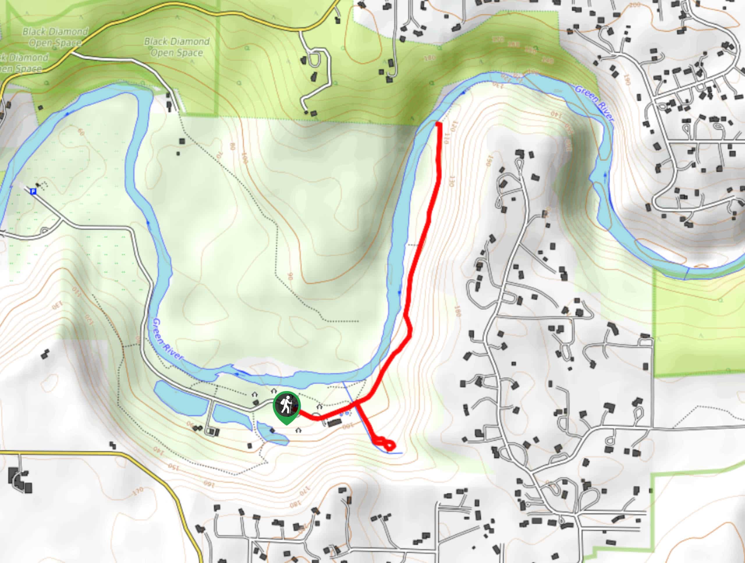
112. Black Diamond Coal Mine Trail
Difficulty
The Black Diamond Coal Mine Trail is a 6.7mi moderate trail that is… Read More

113. Iverson Spit Preserve Loop
Difficulty
The Iverson Spit Preserve Loop is a 1.2mi loop hike right on the… Read More

114. Sky Country to Harvey Manning Loop
Difficulty
The Sky Country to Harvey Manning Loop is a 4.2mi loop trail in… Read More

115. Explorer Falls Hike
Difficulty
The Explorer Falls hike is a 5.3mi moderate hike near Sultan, Washington. This… Read More
Are we missing your favourite hike?
Tell us! If you've got photos, a GPS track and know the hike, we'd love to share your favourite hike with the rest of the 10Adventures community.