Carkeek Park via Pipers Creek Trail
View Photos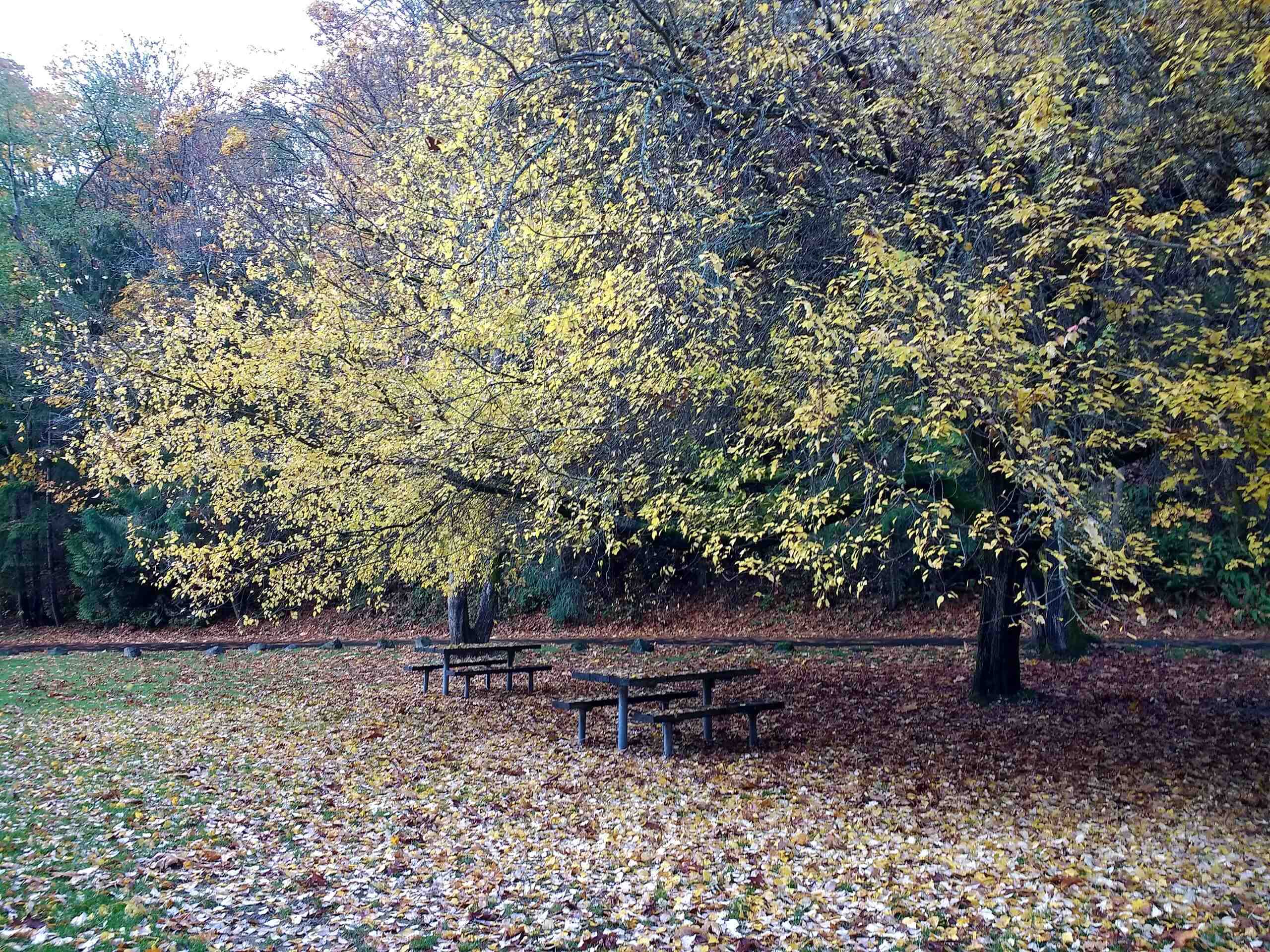
Carkeek Park via Pipers Creek Trail
Difficulty Rating:
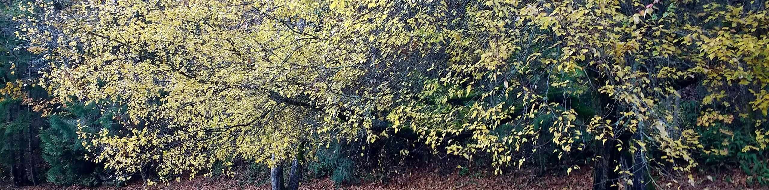
Carkeek Park via Pipers Creek Trail is a 3.2mi moderately trafficked loop trail near Seattle. This hike is easy for most adventurers and is used for running, dog walking, and hiking. This trail sees moderate traffic, but the forest offers a nice sense of tranquillity even on busier days. The forest gives way to views of Puget Sound as you reach the midway point of the loop. This route follows Pipers Creek Trail, but there are plenty of intersecting routes should you wish to modify your hike.
Note that the trail system is not well-marked and some users report having difficulty finding their way around. A downloaded GPS map is recommended to mitigate this challenge.
Getting there
The trailhead for the Carkeek Park via Pipers Creek Trail hike is at the end of 6th Ave NW off NW 100th Pl.

About
| Backcountry Campground | No |
| When to do | Year-round |
| Pets allowed | Yes - On Leash |
| Family friendly | Yes |
| Route Signage | Poor |
| Crowd Levels | Moderate |
| Route Type | Loop |
Carkeek Park via Pipers Creek Trail
Elevation Graph
Weather
Carkeek Park via Pipers Creek Trail Description
Carkeek Park is a recreational area in northwest Seattle comprising Pipers Creek and the area surrounding it. With hills, streams, a beach, forest, and shoreline, it’s a pretty area to spend part of your day in. This park is used often by hikers, dog walkers, and runners. This park sees a touch less traffic than other parks in the metro area, making it a good choice for those seeking a bit more solitude.
The Carkeek Park via Pipers Creek Trail hike is an easy 3.2mi loop that starts from the south entrance to the park and loops along the outermost trail. The route begins in the forest and then stretches along the shore, offering great views of Puget Sound.
The trails in Carkeek Park are not very well-marked and there are many junctions. Some hikers report having difficulty finding their way. We recommend downloading a GPS track of the route or snapping a screenshot of the park map to help you stay on track.
This trail is undulating with few completely flat stretches. Additionally, some park entrances have only a few parking spots. Arrive early if you want to park as close as possible.
Begin from the south entrance to the park off 6th Ave NW. There’s an information board here with paper maps. Grab one if you don’t have a downloaded route. Your hike starts with a couple of brief switchbacks to descend down to the creek. You’ll hike downstream, admiring the steep canyon walls where impressive trees have grown.
There is an orchard along the trail, and then you’ll cross a creek. Ignore the eyesore that is the sewage pumping station and take a right up the 12th Avenue Hillclimb Trail. Next, go left along the North Traverse route. This will lead you to Grand Fir Trail, which you’ll follow to a viewpoint over the park.
From here, take the trail on your far right, which is North Bluff Trail. You’ll hike near the shoreline, looking out over Puget Sound. Stay on the trail closest to the shore until you reach the recreational area with picnic tables, playgrounds, and a fire ring. This is a nice spot to rest a while if you need, looking out over the water, using the restrooms, eating your lunch, or just otherwise taking a break.
Your route continues to hug the shore before slowly pulling away. Turning left at South Ridge Trail, you’ll hike back inland, staying straight on this path as side trails intersect. The trail winds north to rejoin your initial access route, where you’ll turn right and hike back to where you began.
Trail Highlights
Carkeek Park
Carkeek Park is a 216-acre park in the Broadview neighbourhood of Seattle. This park is used for hiking, running, recreation, and education. It contains Piper Orchard and Piper Creek. Families can enjoy the playgrounds and picnic areas, and hikers and runners can use the network of trails. There is a sand beach in the park on Puget Sound. The park was established in its current location in the late 1920s after the original planned site of Carkeek Park was displaced by a naval air station. The park has since been expanded several times through land donations.
Frequently Asked Questions
When is Carkeek Park open?
Carkeek Park is open from 6 AM until 10 PM.
Are there bathrooms at Carkeek Park?
Yes, there are bathrooms in several locations in the park.
Can you swim at Carkeek Park?
Yes, there is a sand beach that can be used for sunning and swimming. Be prepared- Puget Sound is very cold!
Insider Hints
You can take transit to this hike. The #28 bus from downtown stops near the south entrance to the park.
No pass or permit is required for this hike.
No dogs are allowed on the beach at Carkeek Park. There is a $500 fine for violating this. Additionally, keep dogs on leash at all times in accordance with park rules.
Similar hikes to the Carkeek Park via Pipers Creek Trail hike

Explorer Falls Hike
The Explorer Falls hike is a 5.3mi moderate hike near Sultan, Washington. This trail takes you to a…

Sky Country to Harvey Manning Loop
The Sky Country to Harvey Manning Loop is a 4.2mi loop trail in the northern part of Cougar…

Iverson Spit Preserve Loop
The Iverson Spit Preserve Loop is a 1.2mi loop hike right on the beach, coursing through a beaver…
Comments