

Sky Country to Harvey Manning Loop
View Photos
Sky Country to Harvey Manning Loop
Difficulty Rating:
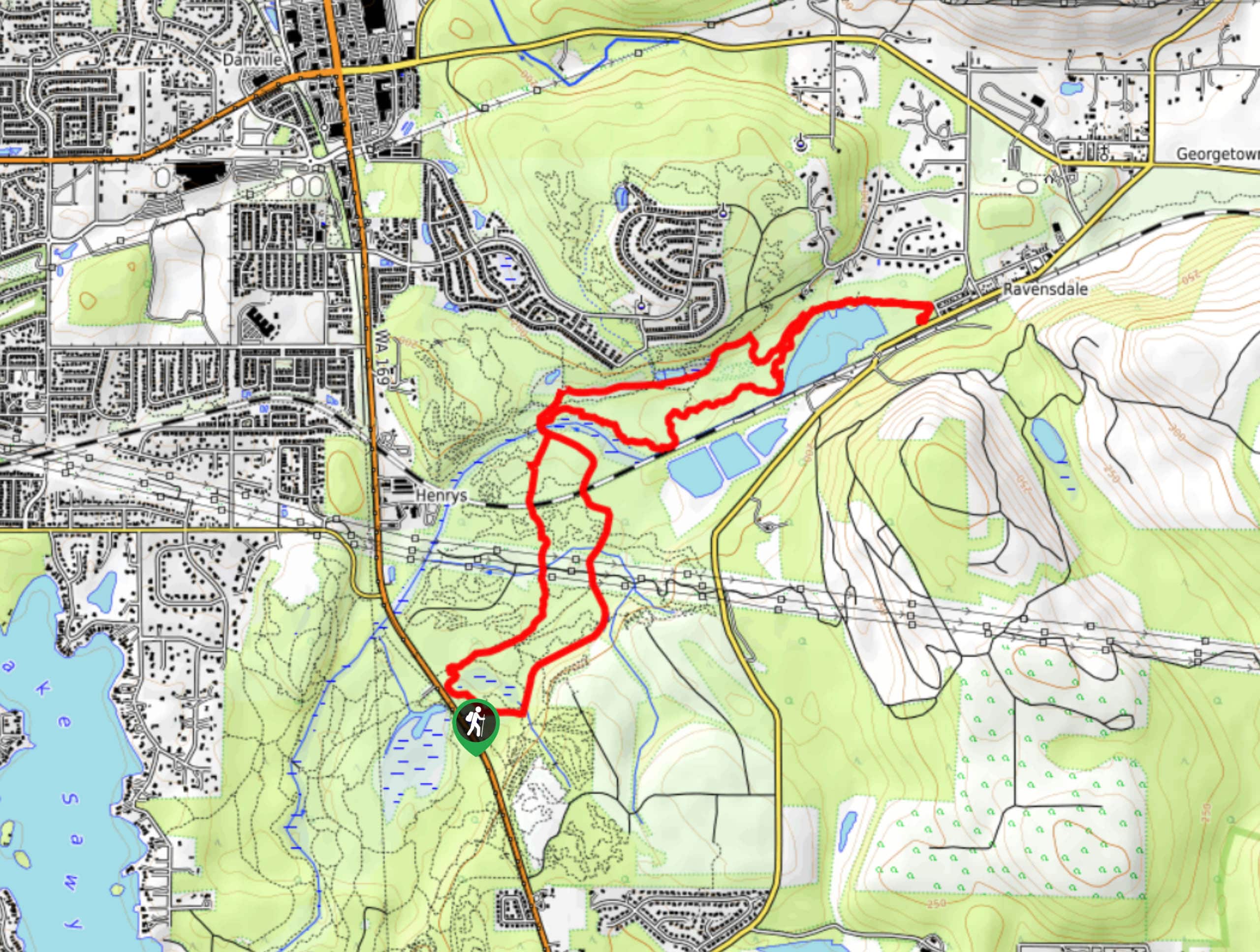
The Sky Country to Harvey Manning Loop is a 4.2mi loop trail in the northern part of Cougar Mountain Regional Wildland Park that is rated as easy. This hike can be done year-round and my most skill levels, with some modest incline gain being the only consideration. Enjoy the quietness of nature on this lightly trafficked route.
Getting there
The trailhead for the Sky Country to Harvey Manning Loop is off the main parking area on 166th Way SE.

About
| Backcountry Campground | No |
| When to do | Year-round |
| Pets allowed | Yes - On Leash |
| Family friendly | Yes |
| Route Signage | Average |
| Crowd Levels | Low |
| Route Type | Loop |
Sky Country to Harvey Manning Loop
Elevation Graph
Weather
Sky Country to Harvey Manning Loop Description
The Sky Country to Harvey Manning Loop is an easy-moderate hike in northern Cougar Mountain Wildland that features a verdant forest. It’s a nice way to get outside and doesn’t tend to get very busy at all. The little creeks and hidden waterfalls of the park are best in late spring, so we recommend visiting early in the season.
Begin from the parking area. Take either the middle or right trail, as they are both part of the loop. You’ll hike either trail to where they converge to form Bypass Trail. Cross the creek and then the trail splits again. There is no better way to go as the elevation gain and descent are similar whether you’ve traveled clockwise or counterclockwise. The turnaround point of the loop is at the Million Dollar Viewpoint.
Similar hikes to the Sky Country to Harvey Manning Loop hike

Explorer Falls Hike
The Explorer Falls hike is a 5.3mi moderate hike near Sultan, Washington. This trail takes you to a…

Iverson Spit Preserve Loop
The Iverson Spit Preserve Loop is a 1.2mi loop hike right on the beach, coursing through a beaver…
Black Diamond Coal Mine Trail
The Black Diamond Coal Mine Trail is a 6.7mi moderate trail that is mostly used by mountain bikers.…
Comments