
Southwest County Olympic Short Trail
View Photos
Southwest County Olympic Short Trail
Difficulty Rating:
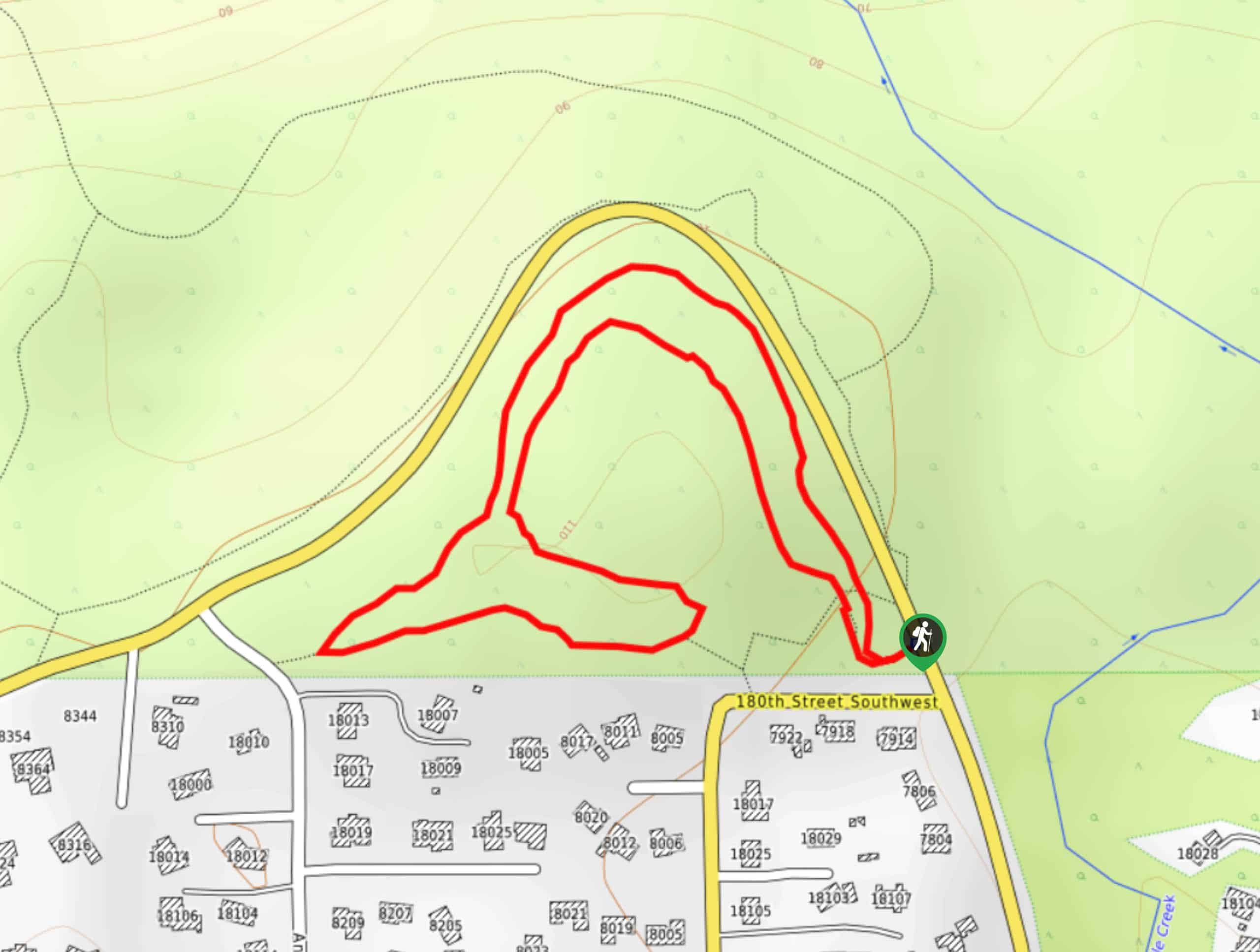
The Southwest County Olympic Short Trail is a-you guessed it-short walk. This trail is easy and less than a mile long, with mostly flat footing. It’s so quick that you can loop it a few times for a longer trip, or just do it once to get the kids or dogs outside. The trail isn’t very well-marked, so consider downloading a GPS track ahead of time. Expect moderate traffic.
Getting there
The trailhead for the Southwest County Olympic Short Trail is off Olympic View Drive.

About
| Backcountry Campground | No |
| When to do | March-October |
| Pets allowed | Yes - On Leash |
| Family friendly | Yes |
| Route Signage | Poor |
| Crowd Levels | Moderate |
| Route Type | Loop |
Southwest County Olympic Short Trail
Elevation Graph
Weather
Southwest County Olympic Short Trail Description
On the hunt for a short and sweet walk that gets you into nature but doesn’t take much time? Try the Southwest County Olympic Short Trail. This loop is less than a mile long and mostly flat. Bring the family and get some steps in, perhaps doing a few laps if you want more time on the trail.
Begin from the trailhead. You’ll stay to the right and then go through the junction, making sure to keep straight. Stay on the trail as it travels next to the road. Where it sharply turns, follow it back towards the trailhead. You’ll want to stay to the left at the junction midway through the return trip, then it’s smooth sailing back to the trailhead.
Similar hikes to the Southwest County Olympic Short Trail hike

Sky Country to Harvey Manning Loop
The Sky Country to Harvey Manning Loop is a 4.2mi loop trail in the northern part of Cougar…

Iverson Spit Preserve Loop
The Iverson Spit Preserve Loop is a 1.2mi loop hike right on the beach, coursing through a beaver…

Lowell Riverfront Trail
The Lowell Riverfront Trail is a 3.0mi route alongside the Snohomish River in Everett. This trail is heavily…
Comments