
Licorice Fern Trail
View Photos
Licorice Fern Trail
Difficulty Rating:
The Licorice Fern Trail is a 2.6mi easy hike in Cougar Mountain Regional Wildland Park that sees moderate traffic. This is one of the most secluded trails in the park, and it lets you dive into the lush ferns and beautiful trees that make Cougar Mountain so popular. There are some hilly sections on this trail.
Getting there
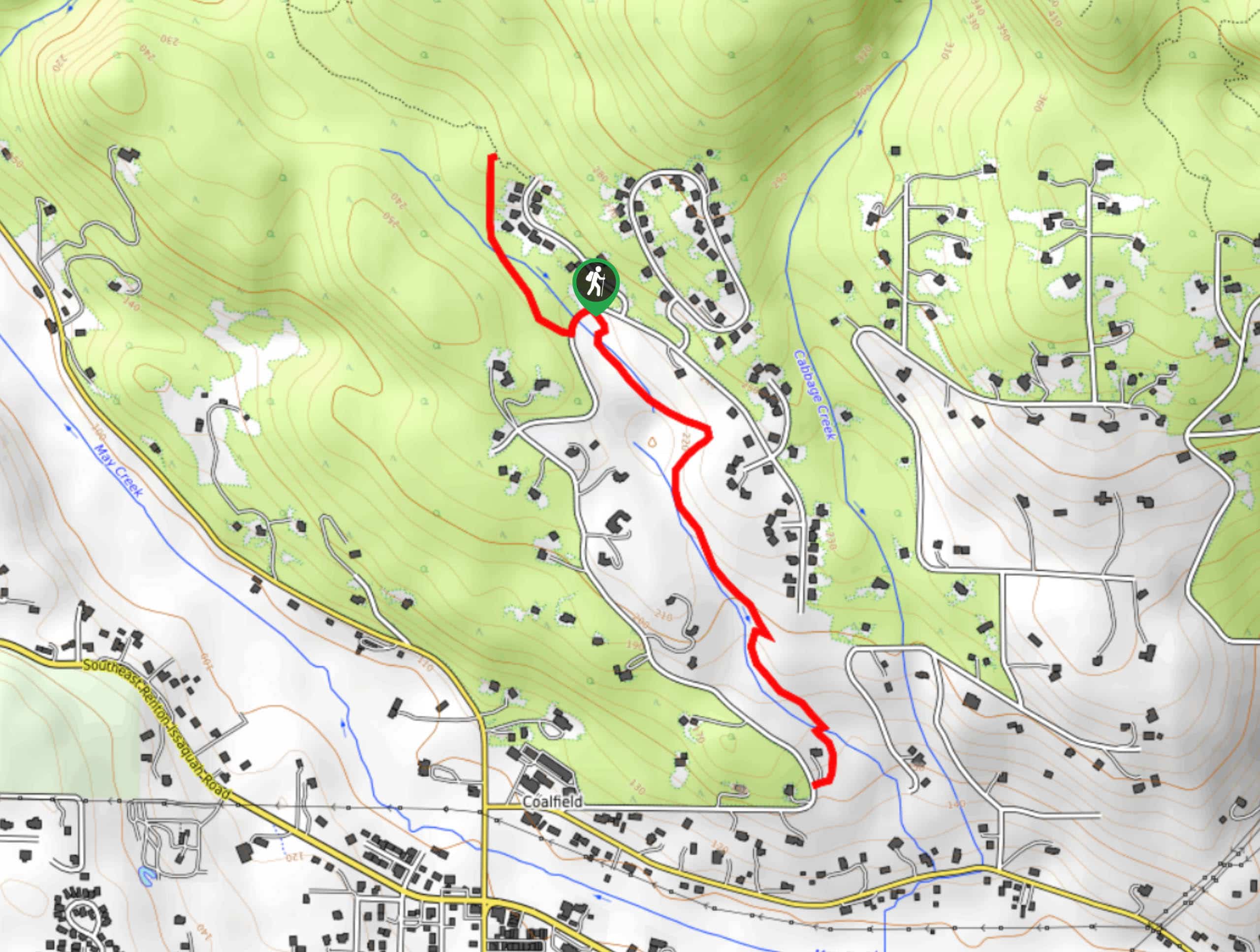
The trailhead for the Licorice Fern Trail is off SE Licorice Way.

About
| Backcountry Campground | No |
| When to do | March-October |
| Pets allowed | Yes - On Leash |
| Family friendly | Yes |
| Route Signage | Average |
| Crowd Levels | Moderate |
| Route Type | Out and back |
Licorice Fern Trail
Elevation Graph
Weather
Licorice Fern Trail Description
The Licorice Fern Trail is an easy hike with just enough undulation to keep things interesting. Lined by ferns and trees, it’s a wonderful way to get into the forest without needing to share the trail with many other people. There are lots of other hikes that can be reached via Licorice Fern Trail, so feel free to keep exploring beyond the bounds of this route.
The trail stretches a bit north of the trailhead and about twice as far south. It roughly follows a creek southward and climbs into the trees northward. There is additional trail access where the route ends at 169th Ave SE, but there is no public parking here.
Similar hikes to the Licorice Fern Trail hike

Explorer Falls Hike
The Explorer Falls hike is a 5.3mi moderate hike near Sultan, Washington. This trail takes you to a…

Sky Country to Harvey Manning Loop
The Sky Country to Harvey Manning Loop is a 4.2mi loop trail in the northern part of Cougar…

Iverson Spit Preserve Loop
The Iverson Spit Preserve Loop is a 1.2mi loop hike right on the beach, coursing through a beaver…
Comments