
Cross Kirkland Corridor Trail
View Photos
Cross Kirkland Corridor Trail
Difficulty Rating:
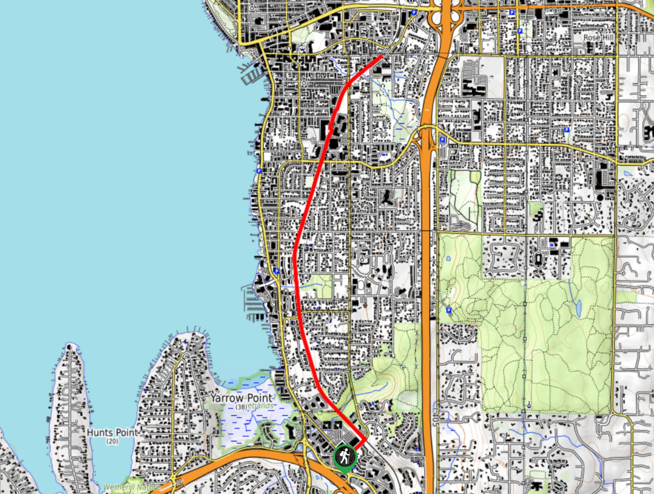
The Cross Kirkland Corridor Trail is a multi-use path that runs through Kirkland north-south. This section of the trail begins near Kirkland Crossing, goes to the rotary house, and returns 5.0mi later. It’s a flat gravel trail suitable for walkers, runners, and capable bikes and strollers. Enjoy nice views and access to Houghton Beach Park. Expect moderate traffic.
Getting there
The trailhead for the Cross Kirkland Corridor Trail is near Kirkland Crossing at the corner of NE 37th Ct and 108th Ave NE.

About
| Backcountry Campground | No |
| When to do | Year-round |
| Pets allowed | Yes - On Leash |
| Family friendly | Yes |
| Route Signage | Average |
| Crowd Levels | Moderate |
| Route Type | Out and back |
Cross Kirkland Corridor Trail
Elevation Graph
Weather
Cross Kirkland Corridor Trail Trail Description
Use the Cross Kirkland Corridor Trail to get from one end of Kirkland to the other, exploring various parts of the city and getting a diverse range of views as you go. This trail is multi-use, seeing walkers, runners, and bikers. Enjoy proximity to Houghton Beach Park on this stretch should you want a break by the water.
Begin at the trailhead. Walk north on the street and take a left onto the corridor trail. You will follow this same trail the entire way, taking no turns. This section of the corridor ends near the rotary house, where you can turn around and retrace your steps. However, should you want to go further, the trail continues past this point.
Similar hikes to the Cross Kirkland Corridor Trail hike

Sky Country to Harvey Manning Loop
The Sky Country to Harvey Manning Loop is a 4.2mi loop trail in the northern part of Cougar…

Iverson Spit Preserve Loop
The Iverson Spit Preserve Loop is a 1.2mi loop hike right on the beach, coursing through a beaver…

Lowell Riverfront Trail
The Lowell Riverfront Trail is a 3.0mi route alongside the Snohomish River in Everett. This trail is heavily…
Comments