Far Country Falls via Licorice Fern Trail
View Photos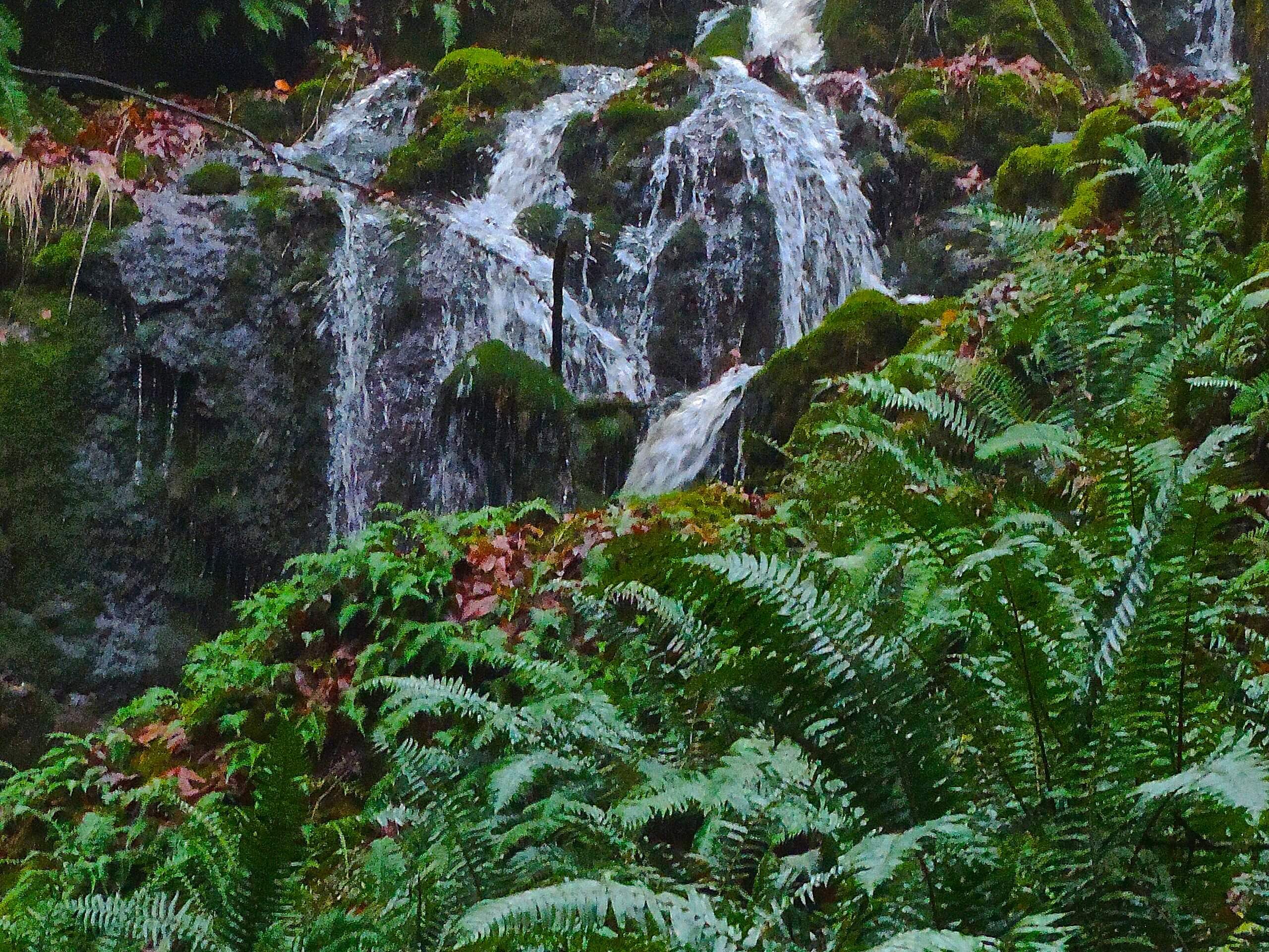
Far Country Falls via Licorice Fern Trail
Difficulty Rating:
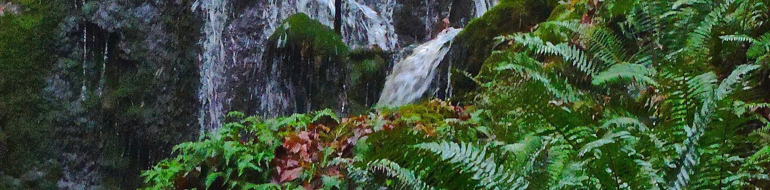
Far Country Falls via Licorice Fern Trail is a 4.8mi moderate hike in Cougar Mountain Regional Wildland Park that sees moderate traffic. Besides the nice waterfall viewpoint, this hike lets you dive into the lush ferns and beautiful trees that make Cougar Mountain so popular. Do this hike in the spring or after heavy rains to ensure the waterfall is flowing.
Getting there
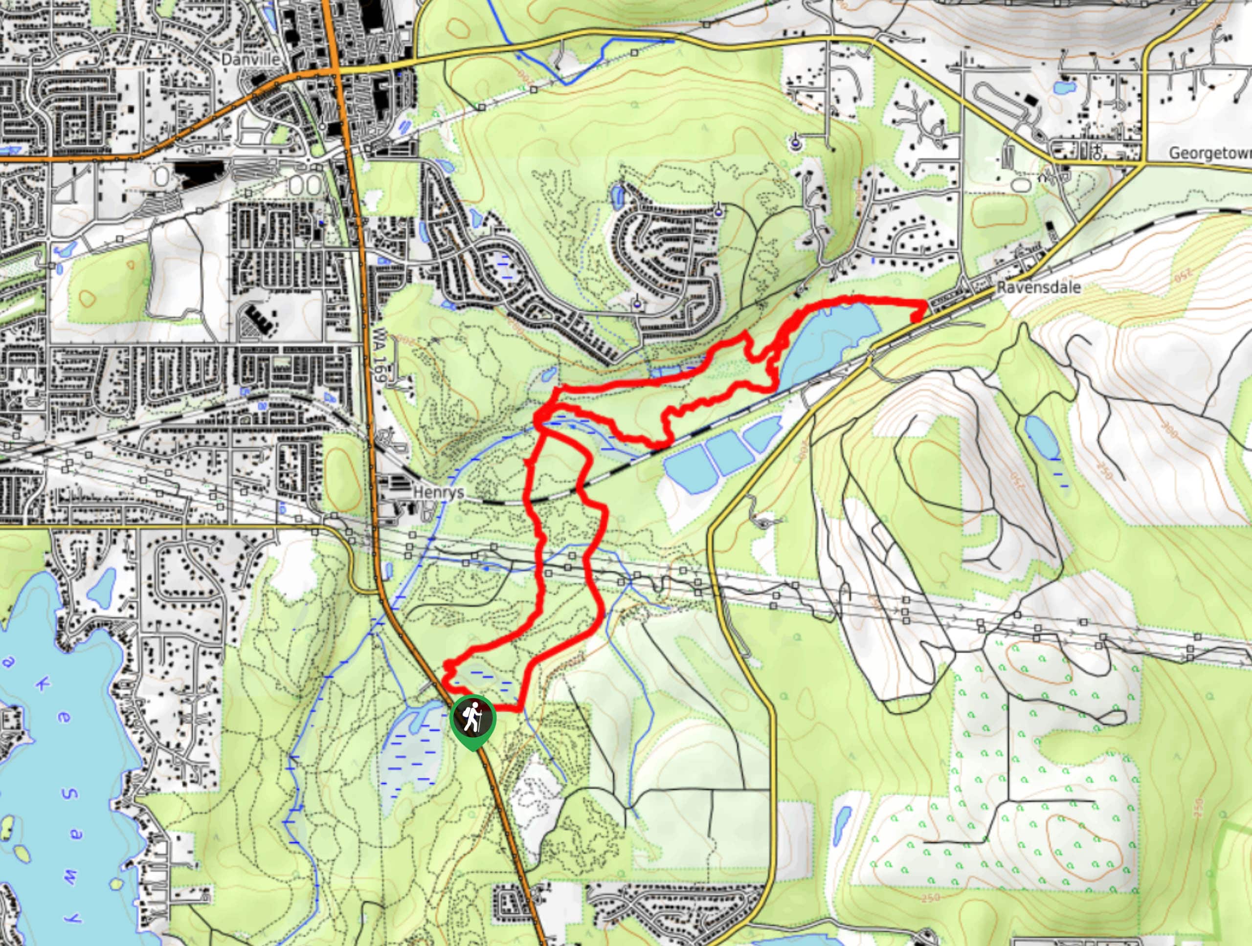
The trailhead for the Licorice Fern Trail is off SE Licorice Way.

About
| Backcountry Campground | No |
| When to do | April-September |
| Pets allowed | Yes - On Leash |
| Family friendly | Yes |
| Route Signage | Average |
| Crowd Levels | Low to Moderate |
| Route Type | Out and back |
Far Country Falls via Licorice Fern Trail
Elevation Graph
Weather
Far Country Falls via Licorice Fern Trail Description
Far Country Falls via Licorice Fern Trail is a moderate hike that features the forest and, of course, a waterfall. We recommend doing this hike in the spring or early summer as the falls tend to dry up as it gets warmer and drier. There are lots of other hikes that can be reached via Licorice Fern Trail, so feel free to keep exploring beyond the bounds of this route.
The route begins at 169th Ave SE, but there is no public parking here. If you need to park, start from SE Licorice Way, where there is parking. Take the trail up along the creek and into the trees. Where the trail splits, you can go right for a short jaunt up to the Far Country Viewpoint or left for the falls viewpoint. When you’re ready, retrace your steps back to the trailhead.
Similar hikes to the Far Country Falls via Licorice Fern Trail hike

Explorer Falls Hike
The Explorer Falls hike is a 5.3mi moderate hike near Sultan, Washington. This trail takes you to a…

Sky Country to Harvey Manning Loop
The Sky Country to Harvey Manning Loop is a 4.2mi loop trail in the northern part of Cougar…
Black Diamond Coal Mine Trail
The Black Diamond Coal Mine Trail is a 6.7mi moderate trail that is mostly used by mountain bikers.…
Comments