
Sky Country Trail
View Photos
Sky Country Trail
Difficulty Rating:
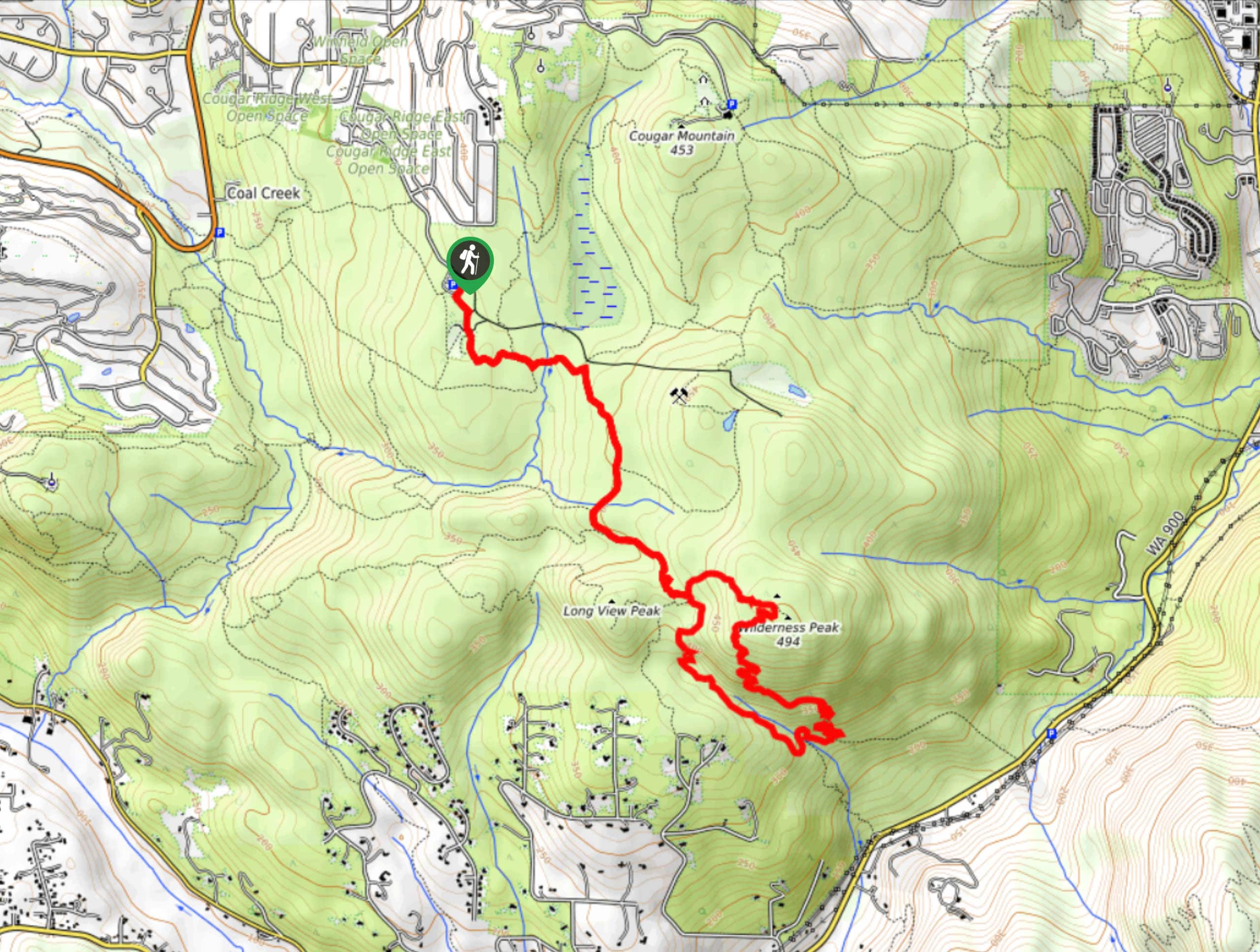
The Sky Country is a 6.0mi hike in Cougar Mountain Regional Wildland Park. This trail is dotted with signs detailing the plant species on the trail. You’ll climb up Wilderness Peak on this trail, so be prepared for a moderate elevation gain and a bit more effort than some of the other trails in the park.
Getting there
The trailhead for the Sky Country Trail is off the main parking area on 166th Way SE.

About
| Backcountry Campground | No |
| When to do | Year-round |
| Pets allowed | Yes - On Leash |
| Family friendly | Yes |
| Route Signage | Average |
| Crowd Levels | Low |
| Route Type | Loop |
Sky Country Trail
Elevation Graph
Weather
Sky Country Trail Description
The Sky Country Trail is a moderate hike through a wooded area and up Wilderness Peak that makes for a lovely day in nature. It doesn’t get very busy despite its waterfall and views. Try visiting when the fall colors are at their best.
Begin from the parking area. Take the trail in the middle and go straight through a convoluted junction onto Old Man’s Trail. Stay on this trail as it merges to become Cave Hole Trail, then take a left onto Bypass Trail. Cross the creek and stay right through two junctions. Now on Shy Bear Trail, keep left at Shy Bear Pass to ascend Wilderness Peak. Descend the peak and return to the trail to retrace your steps.
Similar hikes to the Sky Country Trail hike

Explorer Falls Hike
The Explorer Falls hike is a 5.3mi moderate hike near Sultan, Washington. This trail takes you to a…

Sky Country to Harvey Manning Loop
The Sky Country to Harvey Manning Loop is a 4.2mi loop trail in the northern part of Cougar…
Black Diamond Coal Mine Trail
The Black Diamond Coal Mine Trail is a 6.7mi moderate trail that is mostly used by mountain bikers.…
Comments