
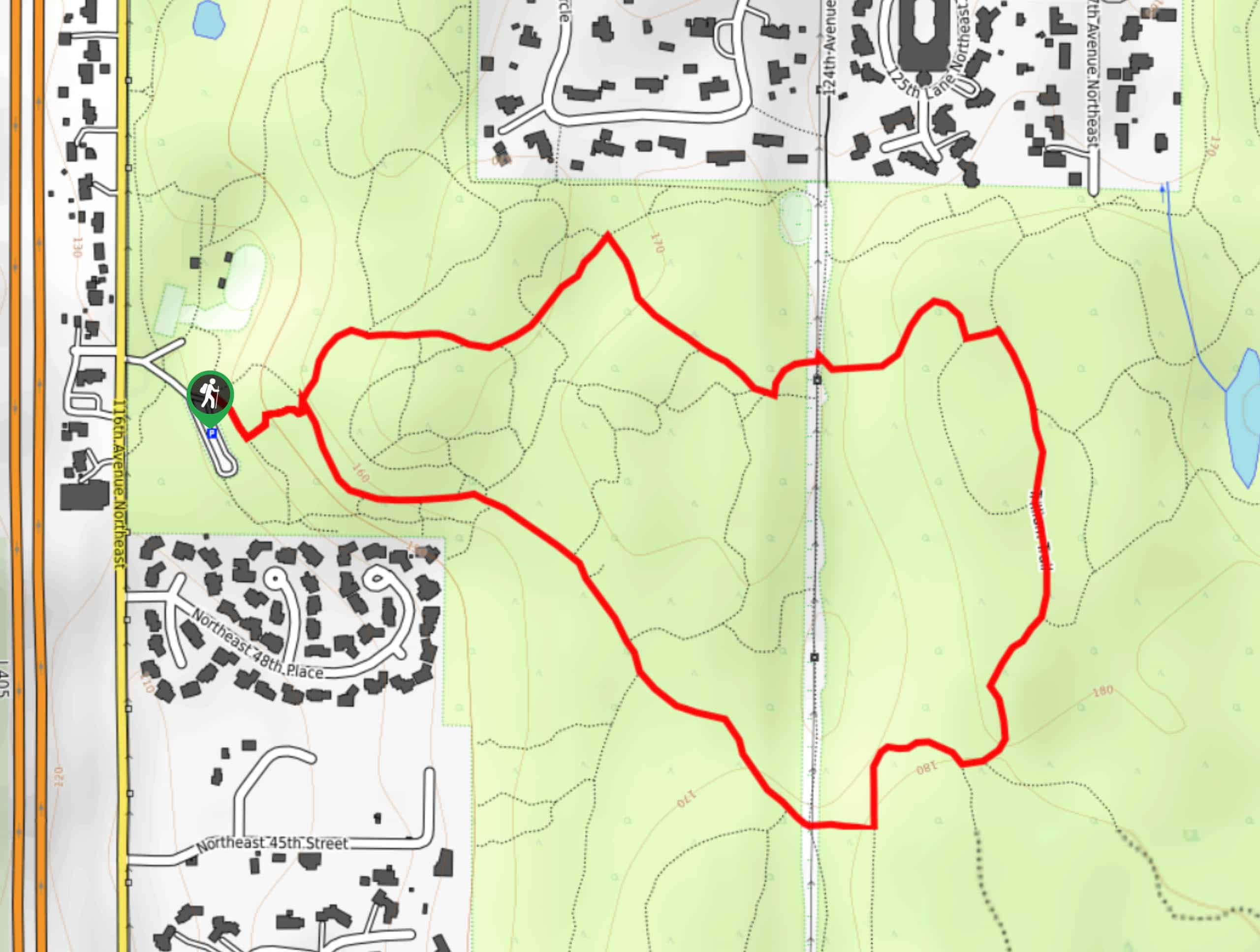
Trillium Trail
View Photos
Trillium Trail
Difficulty Rating:
The Trillium Trail is a 1.8mi heavily trafficked route in Bridle Trails State Park. This easy hike is frequented by horseback riders, as are the other trails in the park. While it’s popular with foot traffic as well, remember to announce yourself as you approach behind horses and ask the riders how to pass safely if you’re unsure. The trail is mostly level but the ground isn’t stroller friendly.
Getting there
The trailhead for the Trillium Trail is off the parking loop on the west side of the park.

About
| Backcountry Campground | No |
| When to do | April-October |
| Pets allowed | Yes - On Leash |
| Family friendly | Yes |
| Route Signage | Good |
| Crowd Levels | High |
| Route Type | Loop |
Trillium Trail
Elevation Graph
Weather
Trillium Trail Description
The Trillium Trail is a gorgeous hike that makes use of a horseback riding park. The loop is easy and mostly flat and the scenery is vibrant green. This trail is heavily trafficked by equestrians, so remember the basics of hiking near horses: don’t come up fast from behind, allow horses the right of way, and announce yourself beforehand to the rider whether coming from in front or behind. If you’re unsure of how to pass a horse, just ask the rider. Remember to keep dogs on leash on this trail.
The loop can be done either clockwise or counterclockwise. Beginning from the trailhead, you’ll follow the flower signage. The loop trails through the middle of the park, passing through cool, shaded forest the entire way. If you’re interested in exploring this forest more, the Raven Trail is a nice option too.
Similar hikes to the Trillium Trail hike

Sky Country to Harvey Manning Loop
The Sky Country to Harvey Manning Loop is a 4.2mi loop trail in the northern part of Cougar…

Iverson Spit Preserve Loop
The Iverson Spit Preserve Loop is a 1.2mi loop hike right on the beach, coursing through a beaver…

Lowell Riverfront Trail
The Lowell Riverfront Trail is a 3.0mi route alongside the Snohomish River in Everett. This trail is heavily…
Comments